Mount Teide Summit Trail - Touching the Roof of Spain
The Mount Teide Summit Trail is a world-class alpine challenge that leads hikers to the highest point in Spain and all the islands of the Atlantic. Rising to a staggering 3,715 metres above sea level, Pico del Teide is the centrepiece of the Teide National Park, a UNESCO World Heritage site located on the island of Tenerife. This is not merely a walk; it is a vertical pilgrimage through a prehistoric volcanic landscape that feels more like the surface of Mars than a Mediterranean island. The trail traverses the massive Las Cañadas caldera, ascending through fields of obsidian, pumice, and ancient lava flows before reaching the sulphuric vents of the summit crater. From the peak, the "Sea of Clouds" often stretches to the horizon, offering views of the neighbouring islands of Gran Canaria, La Gomera, La Palma, and El Hierro. This journey demands physical stamina, careful planning, and a deep respect for the high-altitude environment, rewarding those who reach the top with a perspective of the world that few ever experience.
- Distance: 8.3 km (one-way to summit via Montaña Blanca)
- Elevation Gain: 1,200 metres
- Duration: 5–7 hours (ascent only)
- Difficulty: Challenging (due to altitude and steep gradients)
- Highest Point: 3,715 metres (Pico del Teide)
- Trailhead: Montaña Blanca (2,350 metres)
- Permit: Required for the final 163 metres (Telesforo Bravo trail)
Overview
Mount Teide is a stratovolcano of immense proportions, ranking as the third-tallest volcanic structure in the world when measured from its base on the ocean floor. The summit trail, primarily following Trail 7 (Montaña Blanca) and Trail 10 (Telesforo Bravo), offers a condensed masterclass in volcanology and high-altitude ecology. The experience is defined by its dramatic transitions: from the ochre-coloured pumice plains of the lower slopes to the jagged, black "malpaís" (badlands) of the upper reaches, and finally to the steaming, pale yellow vents of the summit crater where the smell of sulphur serves as a constant reminder of the mountain's volcanic vigour.
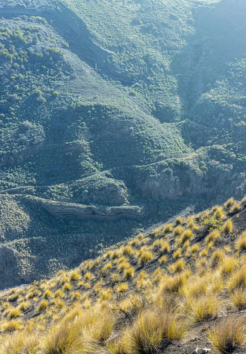
The climb is physically demanding, not necessarily because of technical difficulty—the path is well-marked and generally stable—but because of the rapid gain in altitude. Starting at 2,350 metres, hikers quickly enter the "thin air" zone where oxygen levels are significantly lower than at sea level. This makes every step feel twice as heavy and requires a slow, rhythmic pace. The landscape is stark and largely devoid of shade, exposed to the intense high-altitude sun and the unpredictable winds that whip across the Atlantic. However, the lack of vegetation allows for unobstructed views of the caldera walls—a 17-kilometre wide rim that marks the remains of an even larger ancient volcano.
For many, the highlight of the trek is the "Sea of Clouds" (Mar de Nubes). This meteorological phenomenon occurs when trade winds push clouds against the northern slopes of the island, creating a white, fluffy carpet that sits between 800 and 2,000 metres. Standing at the summit, you are literally above the weather, looking down upon a celestial landscape while the sun shines brilliantly in a deep indigo sky. Whether you choose to hike the entire way from the base or use the cable car to assist with the ascent, the final push to the crater rim is an unforgettable encounter with the raw power of the Earth.
History and Cultural Context
To the Guanches, the aboriginal inhabitants of Tenerife, Mount Teide was a sacred and terrifying place. They called it "Echeyde," which in their mythology was the home of Guayota, a powerful and malevolent deity. Legend tells that Guayota kidnapped Magec (the god of the sun) and imprisoned him inside the mountain, plunging the world into darkness. The Guanches prayed to their supreme god, Achamán, who defeated Guayota, rescued the sun, and sealed the opening of the volcano with the demon still inside. To this day, the occasional rumblings and sulphuric breath of the volcano are seen by some as the stirrings of the trapped Guayota.
European interest in Teide grew during the Age of Discovery. The mountain served as a vital navigational landmark for sailors venturing into the Atlantic, its snow-capped peak visible from hundreds of kilometres away. In the 18th and 19th centuries, Teide became a magnet for European scientists and explorers. Alexander von Humboldt, the famed Prussian polymath, climbed the mountain in 1799. His observations on the "zonation" of plants—how different species thrive at specific altitudes—were largely inspired by his ascent of Teide and laid the groundwork for the modern science of biogeography. He was struck by the transition from the lush laurel forests of the coast to the barren volcanic wastes of the summit.
The trail you walk today follows in the footsteps of these early explorers and the local "neveros" (ice-gatherers). Before the advent of modern refrigeration, local men would climb to the "Cueva del Hielo" (Ice Cave) near the summit to harvest ice, which was then transported by mule to the coastal towns for use in hospitals and for preserving food. In 1954, the area was declared a National Park, and in 2007, it received UNESCO World Heritage status, recognising its global importance as a geological site and its unique role in the history of scientific exploration.
Want more background? Read extended notes on history and cultural context → Learn more
Seasonal Highlights and Weather Reality
The weather on Mount Teide is a study in extremes. While the coastal resorts of Tenerife may enjoy a "permanent spring" of 20–25°C, the summit can be gripped by sub-zero temperatures and gale-force winds at any time of year. Understanding the seasonal nuances is critical for a safe and successful summit attempt.
Spring (April to June): This is arguably the best time to hike. The weather is generally stable, and the park comes alive with the blooming of the Teide Bugloss (Tajinaste Rojo), a spectacular plant that grows up to three metres tall and produces vibrant red flowers. Temperatures at the trailhead are pleasant, though the summit remains cold. Snow patches may still linger in shaded areas, but the trails are usually clear.
Summer (July to September): Summer brings intense heat and extremely high UV levels. While the altitude provides some relief from the sweltering coastal temperatures, the lack of shade on the trail can lead to heat exhaustion. Hikers must start at dawn to avoid the midday sun. This is also the season of the "Calima," a weather event where dust from the Sahara Desert is blown over the islands, reducing visibility and making the air dry and heavy.
Autumn (October to November): Another excellent window for hiking. The summer heat has dissipated, and the winter storms have not yet arrived. The air is often exceptionally clear, providing the best views of the neighbouring islands. However, the days are shorter, and the temperature drop after sunset is rapid and severe.
Winter (December to March): Winter transforms Teide into a true alpine environment. Snow is common, and the trails can become covered in ice, requiring crampons and ice axes. The TF-21 access road is frequently closed due to snow or ice, and the cable car rarely operates in high winds. Only experienced winter hikers with appropriate gear should attempt the summit during these months. Hypothermia is a genuine risk if you are not properly equipped for the freezing winds that scour the peak.
Recommended Itinerary
Mount Teide Summit Route (Montaña Blanca Trail)
Stage 1: Montaña Blanca Trailhead to the "Huevos del Teide"
- Distance: 4.5 km
- Elevation Gain: 370 metres
- Time: 1.5–2 hours
- Start at the small parking area on the TF-21 road (2,350 metres)
- The trail begins as a wide, gentle gravel track winding through pumice fields
- Pass the "Huevos del Teide" (Teide's Eggs)—massive black obsidian boulders formed by accretion as lava rolled down the slopes
- The gradient is steady but manageable, allowing for acclimatisation to the increasing altitude
- Views of the Montaña Blanca dome, a pale yellow volcanic structure that contrasts with the darker lava flows
Stage 2: The Steep Ascent to Altavista Refuge
- Distance: 2.5 km
- Elevation Gain: 540 metres
- Time: 1.5–2.5 hours
- The path narrows and the gradient increases significantly as you leave the gravel track
- Tight zig-zags (switchbacks) climb the steep flank of the volcano
- The terrain becomes rockier, consisting of loose volcanic scree and larger basalt blocks
- Arrive at the Altavista Refuge (3,260 metres), the highest accommodation in Spain
- This is the most physically demanding section of the lower trail; frequent breaks are necessary to manage breathing
Stage 3: Altavista to La Rambleta (Cable Car Station)
- Distance: 1 km
- Elevation Gain: 290 metres
- Time: 45–60 minutes
- The trail continues to climb through the "Malpaís de la Corona," a field of jagged, black lava
- The path is well-constructed but requires careful footwork on the uneven volcanic rock
- Pass the "Cueva del Hielo" (Ice Cave), where ice remains frozen year-round
- Arrive at La Rambleta (3,555 metres), the upper terminus of the Teide Cable Car
- Here, the air is noticeably thinner, and the smell of sulphur from the summit becomes apparent
Stage 4: The Summit Push (Telesforo Bravo Trail)
- Distance: 0.3 km (650 metres of walking)
- Elevation Gain: 163 metres
- Time: 30–45 minutes
- Access is restricted; you must present your permit and ID to the park ranger at the gate
- The trail (Trail 10) is a steep, paved path that winds up the final cone (the "Pilón")
- Fumaroles (steam vents) line the path, emitting hot gases and yellow sulphur crystals
- Reach the crater rim and the highest point (3,715 metres)
- The summit area is small and can be windy; the views are 360-degree panoramas of the Canary archipelago
Important Notes:
- The descent can be made via the same route or by taking the cable car down (check operating times)
- If hiking down, allow 3–4 hours to return to the Montaña Blanca trailhead
- Total round-trip time for the full hike is typically 8–10 hours
- Ensure you have a confirmed permit for the Stage 4 section well in advance
Planning and Bookings
Book Your Trip
Everything you need to plan your journey
Accommodation
Find places to stay near Tenerife
Flights
Search flights to Tenerife
Essential Preparation
The most critical aspect of planning a Teide summit hike is securing the necessary permit for the final 163 metres of the climb. Without this permit, you will be stopped at the La Rambleta checkpoint (3,555 metres) and will not be allowed to reach the actual peak. Permits are free but are limited to a small number of people per day to protect the fragile crater environment. They often sell out two to three months in advance, especially for the peak seasons of spring and autumn.
Physical preparation is equally important. While the trail is not technically difficult, the altitude is a major factor. If possible, spend a few days at intermediate altitudes (such as the town of Vilaflor at 1,400 metres) before attempting the summit. Ensure you are in good cardiovascular health, as the thin air places significant strain on the heart and lungs. Logistics-wise, Tenerife is well-served by two international airports. Most hikers base themselves in the south (Los Cristianos/Costa Adeje) or the north (Puerto de la Cruz), both of which are approximately 60–90 minutes' drive from the National Park.
Trail Accommodation
Accommodation options within the National Park are limited, and staying overnight is the best way to experience the sunrise from the summit.
Altavista Refuge (Refugio de Altavista): Located at 3,260 metres, this is the only accommodation on the trail itself.
- Facilities: Bunk rooms, shared toilets, a basic kitchen with a microwave and kettle (no stoves), and a small common area.
- Requirements: Bookings must be made months in advance via the official Volcano Teide website.
- Note: As of recent updates, the refuge has had periods of closure or restricted service; always check the current status before planning. If staying overnight, you are permitted to summit before 9:00 AM without a separate daytime permit.
- What's NOT provided: Food, showers, or towels. You must bring all your own supplies.
Parador de Las Cañadas del Teide: A high-end hotel located within the caldera, about 5 kilometres from the trailhead.
- Facilities: Full hotel services, restaurant, and swimming pool.
- Ideal for: Hikers who want a comfortable base at 2,150 metres to help with acclimatisation.
Camping: Wild camping is strictly prohibited throughout the Teide National Park to protect the unique volcanic soil and endemic flora.
Required Gear
- Hiking boots: Sturdy, high-cut boots with good grip are essential for the loose volcanic scree and jagged lava rocks.
- Layered clothing: A moisture-wicking base layer, a warm fleece or down mid-layer, and a windproof/waterproof outer shell. Temperatures at the summit can be 15–20°C colder than at the trailhead.
- Sun protection: High-altitude UV is intense. Bring a wide-brimmed hat, high-SPF sunscreen, and Category 3 or 4 sunglasses.
- Head torch: Essential if you are starting before dawn or staying at the refuge for a sunrise summit.
- Backpack: A 20–30 litre daypack with a rain cover.
- Navigation: A physical map of the National Park trails or a reliable offline GPS app (mobile signal is intermittent).
- Emergency whistle and basic first aid kit: Including blister plasters and ibuprofen for altitude-induced headaches.
What to Bring
- Water: Minimum 3–4 litres per person. There are no water sources on the trail, and the dry volcanic air leads to rapid dehydration.
- High-energy food: Trail mix, energy bars, chocolate, and sandwiches. Digestion slows down at altitude, so opt for easily digestible carbohydrates.
- Electrolytes: Powder or tablets to add to your water to help maintain hydration levels.
- Identification: You must carry the original passport or ID card that matches the name on your summit permit.
- Cash: Small denominations for the vending machines at the cable car station or refuge (though these are often out of order).
- Trash bags: To carry out all your waste, including organic matter like fruit peels.
Permits
The permit system for the Telesforo Bravo trail (Trail 10) is strictly enforced by the Teide National Park authorities. The permit is free of charge and can only be obtained through the official National Parks website (Central de Reservas Online). Because of the high demand and limited daily quota, you should attempt to book as soon as your travel dates are confirmed.
Booking Process:
- Visit the official booking portal and select "Teide National Park."
- Choose the "Pico del Teide Access Permit" option.
- Select your date and one of the four available time slots: 09:00–11:00, 11:00–13:00, 13:00–15:00, or 15:00–17:00.
- Enter the full name and passport/ID number for every member of your group. These details cannot be changed later.
- Print the confirmation or save the PDF on your phone.
Important Regulations:
- The permit is only valid for the specific time slot selected. If you arrive late, the rangers may refuse entry.
- You must show your ID/Passport at the checkpoint. A photo of the ID is usually not sufficient; the physical document is required.
- If the cable car is closed due to wind or weather, the permit is automatically cancelled. It does not give you the right to access the summit on a different day.
- If you stay overnight at the Altavista Refuge, you can access the summit before 9:00 AM without a permit, provided you leave the summit area by 9:00 AM when the rangers arrive.
If permits are sold out: You can still hike to La Rambleta (3,555 metres) without a permit. The views from there are still spectacular, though you won't be able to stand on the very highest point. Alternatively, booking a guided tour with an official company sometimes includes a permit, as they have a separate allocation.
Other Activities in the Area
Teide National Park offers a wealth of experiences beyond the summit hike:
- Stargazing: Tenerife is one of the best places in the world for astronomy due to its high altitude and low light pollution. The Teide Observatory is located nearby, and many companies offer evening tours with professional telescopes.
- Roques de García: A series of spectacular rock formations located near the Parador. The most famous is "Roque Cinchado," which featured on the old Spanish 1,000-peseta note. A 3.5 km loop trail circles these formations.
- Teide Cable Car (Teleférico): For those who cannot hike the full distance, the cable car whisks passengers from 2,356 metres to 3,555 metres in just 8 minutes. It offers incredible views of the caldera.
- Pico Viejo: The second-highest peak in Tenerife (3,135 metres). The trail to its massive 800-metre wide crater is less crowded than the Teide summit and offers a different perspective on the volcanic complex.
- Vilaflor: The highest village in Tenerife, famous for its traditional architecture, local wines, and the "Paisaje Lunar" (Lunar Landscape) hiking trail.
Safety and Conditions
Altitude Sickness (Acute Mountain Sickness): This is the primary safety concern on Teide. Symptoms include headache, nausea, dizziness, and extreme fatigue. Because the ascent is rapid, the body has little time to adapt. If you experience severe symptoms, the only cure is to descend immediately. Do not "push through" severe altitude sickness, as it can progress to dangerous levels.
Weather Volatility: The weather can change in minutes. A clear morning can turn into a whiteout with freezing winds. Always check the official AEMET (Spanish Meteorological Agency) mountain forecast for Teide before starting. If the cable car is closed due to wind, it is a strong signal that conditions on the summit are hazardous.
Volcanic Terrain: The rock is sharp and abrasive. A fall on obsidian or basalt can cause deep cuts. Stay on the marked trails to avoid loose ground and to protect the fragile volcanic structures. The "Malpaís" sections are particularly uneven and can lead to ankle sprains if you are not focused.
Dehydration and UV: The air at 3,000+ metres is extremely dry. You will lose significant moisture through breathing alone. Drink water regularly, even if you don't feel thirsty. Apply sunscreen every two hours, as the thinner atmosphere provides less protection against burning.
Emergency Contacts: The general emergency number in Spain is 112. Be aware that mountain rescue on Teide is a complex operation and can take significant time. Always inform someone of your planned route and expected return time.
Side Trips and Points of Interest
The "Huevos del Teide": These "Eggs of Teide" are found along the Montaña Blanca trail. They are giant accretionary lava balls, some the size of a small house. They formed when fragments of solidified lava rolled down a still-liquid flow, gathering more material like a giant snowball. They are unique geological features and provide excellent photographic opportunities against the backdrop of the summit.
Cueva del Hielo (Ice Cave): Located at 3,350 metres, this natural lava tube contains ice that remains frozen throughout the year, even in the height of summer. While entry into the cave is often restricted for safety reasons, the entrance is a fascinating stop. It was historically used by "neveros" to supply the island with ice.
Mirador de la Fortaleza: A short side trail from the cable car station leads to this viewpoint. It offers the best views of the northern side of Tenerife, including the Orotava Valley and the Anaga mountain range in the distance. It is a flatter, easier walk than the summit push.
Mirador de Pico Viejo: Another trail from La Rambleta leads west towards the Pico Viejo crater. This path offers a stunning view down into the multicoloured crater of Teide's younger sibling and across the western coastline of the island. It is particularly beautiful at sunset.
Leave No Trace
Teide National Park is a fragile ecosystem with many endemic species that exist nowhere else on Earth, such as the Teide Violet (Viola cheiranthifolia), which grows in the volcanic scree at high altitudes. Your actions have a direct impact on the preservation of this unique environment.
Guidelines for Responsible Hiking:
- Stay on the Path: Walking off-trail crushes delicate plants and disturbs the volcanic soil, which can take centuries to recover. The "pumice" slopes are particularly sensitive to erosion.
- No Rock Stacking: Building "cairns" or stacking rocks is prohibited. It disturbs the habitat of small insects and lizards and creates visual pollution in a natural landscape.
- Pack It Out: There are no bins on the trail. Carry all your rubbish, including biodegradable items like banana skins, back to the trailhead. Organic waste does not decompose quickly in the dry, cold alpine environment and can attract invasive species.
- Respect the Silence: Avoid loud music or shouting. The silence of the high mountains is part of the wilderness experience for everyone.
- Do Not Take Rocks: It is illegal to remove volcanic rocks or minerals from the National Park. Leave the obsidian and pumice where you found it for others to enjoy.