Mount Tabor Pilgrimage - The Mount of Transfiguration
Rising with a distinctive, symmetrical dome-like profile from the flat expanse of the Jezreel Valley, Mount Tabor (Har Tavor) is one of Israel's most recognisable and spiritually significant landmarks. Standing at 575 metres above sea level—and nearly 450 metres above the surrounding plain—this limestone monolith has served as a strategic military stronghold, a tribal boundary, and a site of profound religious revelation for millennia. The Mount Tabor Pilgrimage trail is a challenging 5.5 km circuit that ascends the steep northern flank of the mountain, offering hikers a physical journey that mirrors the spiritual ascent described in biblical texts. Known primarily to the Christian world as the traditional site of the Transfiguration of Jesus, the mountain also holds deep importance in Jewish history as the gathering point for the tribes of Israel under the prophetess Deborah.
The trail begins in the Bedouin village of Shibli, winding through dense Mediterranean scrubland consisting of scrub oak, terebinth, and carob trees. As the path climbs, the canopy thins, revealing breathtaking 360-degree panoramas of the Lower Galilee, the Gilboa Mountains, and the distant peaks of Mount Hermon on a clear day. This is not merely a hike; it is a transition through layers of history, from the ruins of Crusader and Ayyubid fortifications to the magnificent 20th-century Basilica of the Transfiguration that crowns the summit. Whether approached as a religious pilgrimage or a demanding nature trek, the ascent of Mount Tabor provides a concentrated experience of the Holy Land’s unique blend of natural beauty and ancient heritage.
- Distance: 5.5 km loop
- Elevation Gain: 375 metres
- Duration: 3–4 hours
- Difficulty: Challenging (steep gradients and rocky terrain)
- Best Time: March to May (peak wildflower season) or October to November
- Closest City: Afula (15 km) or Nazareth (10 km)
- Trailhead: Shibli Village (parking available near the visitor centre)
- Access: Open year-round; modest dress required for summit religious sites
Overview
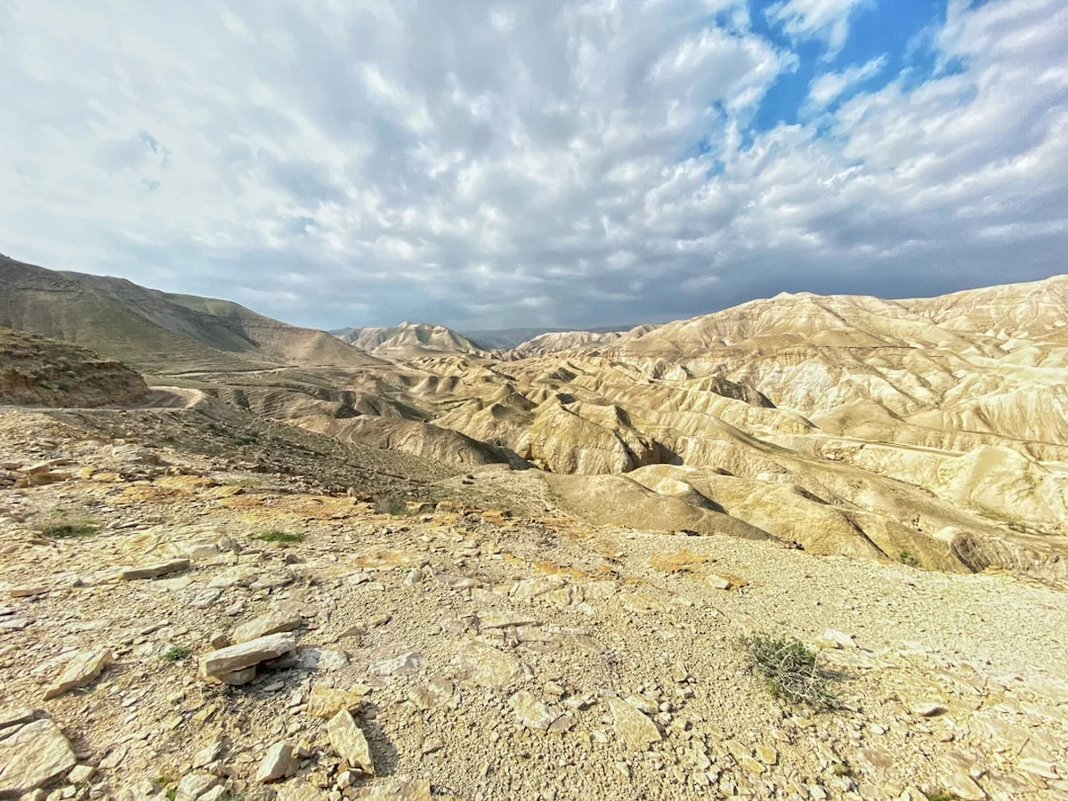
Mount Tabor is often described as a "monadnock"—an isolated hill that stands above the surrounding area due to its resistance to erosion. This geological isolation has made it a natural focal point for every civilisation that has crossed the Jezreel Valley. The pilgrimage trail is designed to take walkers away from the winding asphalt road used by tourist taxis, instead placing them on the ancient "Snake Path" and the Israel National Trail sections that scale the mountain's slopes. The terrain is characterised by rugged limestone outcrops and a surprisingly lush forest cover, a result of extensive reforestation efforts and the mountain's ability to trap moisture from the Mediterranean winds.
The experience of the trail is defined by its verticality. Unlike many Galilee hikes that meander through valleys (wadis), the Mount Tabor Pilgrimage is a relentless upward push. The reward for this exertion is a shifting perspective of the Jezreel Valley, often referred to as the "Breadbasket of Israel." From the trail, the valley appears as a vast patchwork of emerald, gold, and brown fields, punctuated by the white clusters of kibbutzim and moshavim. To the east, the Jordan Valley and the mountains of Gilead in Jordan form a hazy blue backdrop, while to the west, the Nazareth Range rises in a series of limestone ridges.
Upon reaching the summit plateau, the atmosphere changes from the ruggedness of the wild slope to the manicured serenity of the religious complexes. The summit is divided between the Franciscan (Catholic) and Greek Orthodox territories. The Basilica of the Transfiguration, designed by the famed architect Antonio Barluzzi, is a masterpiece of modern religious architecture, built upon the foundations of 4th-century Byzantine and 12th-century Crusader churches. Walking the perimeter of the summit allows visitors to see the massive stones of the Ayyubid fortress walls, built by Al-Adil I in the early 13th century to defend against the Crusaders. This juxtaposition of military might and spiritual peace is the defining characteristic of Mount Tabor.
History and Cultural Context
The history of Mount Tabor is a microcosm of the history of the Levant. In the Hebrew Bible, the mountain appears in the Book of Judges as the site where Deborah the Prophetess commanded Barak to gather 10,000 men from the tribes of Naphtali and Zebulun. From this high vantage point, the Israelite forces charged down into the valley to defeat Sisera and his 900 iron chariots, a victory celebrated in the "Song of Deborah," one of the oldest passages in the Bible. The mountain’s height and isolation made it a natural "High Place" for ancient Canaanite worship before it was integrated into Israelite religious life.
In the New Testament, although not mentioned by name, Mount Tabor is the traditional location of the Transfiguration (Matthew 17, Mark 9, Luke 9). According to tradition, Jesus took Peter, James, and John up a "high mountain" where he was transfigured before them, his face shining like the sun and his clothes becoming white as light. The appearance of Moses and Elijah alongside Jesus on the summit solidified the mountain's status as a bridge between the Law, the Prophets, and the Gospel. By the 4th century, Queen Helena, mother of Constantine the Great, had identified Tabor as the site, leading to the construction of the first Byzantine churches.
The medieval period saw Mount Tabor transformed into a massive fortress. During the Crusades, the mountain changed hands multiple times. The Benedictines established a monastery here, which was later fortified by the Knights Hospitaller. In 1212, the Ayyubid Sultan Al-Adil I built a formidable fortress encompassing the entire summit to block the Crusader route from Acre to the Sea of Galilee. The remains of these massive walls and the "Gate of the Wind" (Bab el-Hawa) are still visible today. In 1799, the plain below the mountain was the site of the Battle of Mount Tabor, where Napoleon Bonaparte’s vastly outnumbered French forces defeated an Ottoman army. Today, the mountain is a site of peaceful coexistence, with the Bedouin village of Shibli-Umm al-Ghanam at its base and monks and friars maintaining the summit’s holy sites.
Want more background? Read extended notes on history and cultural context → Learn more
Seasonal Highlights and Weather Reality
The climate of the Lower Galilee is Mediterranean, meaning the Mount Tabor Pilgrimage experience varies dramatically with the seasons. Understanding these shifts is crucial for both safety and aesthetic enjoyment.
Spring (March to May): This is undoubtedly the "Golden Age" for hiking Mount Tabor. Following the winter rains, the mountain is transformed into a vibrant botanical garden. The slopes are covered in a carpet of wildflowers, including the iconic red anemone (Anemone coronaria), purple cyclamen, and various species of wild orchids. The air is crisp, and the visibility is often at its peak, allowing for views that stretch to the Mediterranean Sea. Temperatures are typically a comfortable 18°C to 25°C, making the steep ascent manageable.
Summer (June to August): Hiking Mount Tabor in the height of summer is a test of endurance. Temperatures in the Jezreel Valley frequently exceed 35°C, and the humidity can be high. The trail offers some shade under the oak trees, but the rocky sections radiate heat. If you must hike in summer, an "Alpine Start" (before 6:00 AM) is essential to finish the ascent before the midday sun. The landscape turns a tawny gold, and the lushness of spring fades into a rugged, sun-baked beauty.
Autumn (September to November): As the heat breaks, autumn offers a second window for comfortable hiking. The first rains (the "Yoreh") usually arrive in October, washing the dust from the trees and bringing a fresh scent to the mountain. This is also a prime time for birdwatching, as Mount Tabor sits on one of the world's most important migratory flyways. Thousands of storks, pelicans, and birds of prey can be seen soaring on the thermals created by the mountain's steep slopes.
Winter (December to February): Winter brings rain and occasionally heavy fog that can shroud the summit for days. While the trail can become slippery and muddy, hiking during a break in the clouds is a magical experience. The mountain feels isolated and ancient, and the waterfalls in the nearby wadis begin to flow. Snow is extremely rare but has been known to dust the summit once every few years, creating a scene of extraordinary beauty.
Recommended Itinerary
Mount Tabor Pilgrimage Circuit
Stage 1: Shibli Trailhead to the Mid-Slope Junction
- Distance: 1.5 km
- Elevation gain: 150 metres
- Time: 45–60 minutes
- Start at the designated parking area at the top of Shibli village
- Follow the Green-marked trail (which overlaps with the Israel National Trail)
- The path begins with a steady climb through a mix of pine and indigenous oak forest
- Pass through the "Lower Gate" area where the gradient begins to sharpen
- Look for the ancient stone-cut steps that appear in sections of the trail
- This stage is the best place to spot the Galilee Iris in early spring
Stage 2: The "Snake Path" Ascent to the Summit Gate
- Distance: 1.2 km
- Elevation gain: 200 metres
- Time: 60–75 minutes
- The trail becomes significantly steeper and more technical
- Navigate a series of tight switchbacks (the "Snake Path") over limestone scree
- The forest thins, offering the first expansive views of the Jezreel Valley to the south
- Pass beneath the massive ruins of the Ayyubid-era defensive walls
- Reach the "Gate of the Wind" (Bab el-Hawa), the historic Crusader/Ayyubid entrance to the summit plateau
- This is the most physically demanding section of the hike
Stage 3: The Summit Plateau and Religious Complexes
- Distance: 1.5 km (exploring the summit)
- Elevation: Minimal (mostly flat)
- Time: 1–1.5 hours
- Walk the "Circumference Path" that rings the summit for 360-degree views
- Visit the Franciscan Basilica of the Transfiguration (check opening hours: usually 08:00–12:00 and 14:00–17:00)
- Explore the Greek Orthodox Monastery of Elias (St. Elijah) on the northern side of the plateau
- Observe the archaeological remains of the Byzantine and Crusader churches integrated into the modern structures
- Find a quiet spot in the gardens for reflection or a snack (ensure all rubbish is packed out)
- Note: Modest dress (shoulders and knees covered) is mandatory for entry into the churches
Stage 4: Descent via the Northern Slope to Shibli
- Distance: 1.3 km
- Elevation: 350 metres descent
- Time: 45 minutes
- Follow the Black-marked trail for a different perspective on the descent
- This path is steeper and more direct than the ascent, requiring careful footwork on loose stones
- The northern slope is more shaded and remains green longer into the summer
- Rejoin the Green trail near the base to return to the Shibli parking area
- Finish the day with a visit to the Shibli Visitor Centre to learn about Bedouin culture and the mountain's history
Important Notes:
- The trail is well-marked with the standard Israeli trail blazing system (two stripes of white with a coloured stripe in the middle)
- The summit is a holy site; maintain a quiet and respectful demeanour
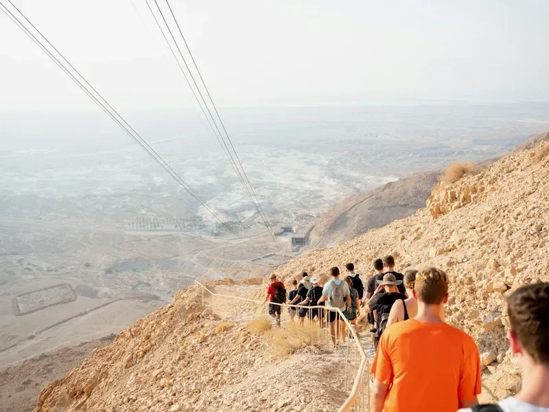
- Taxis (shuttles) operate from the base to the summit for those unable to hike, but the trail offers a far superior experience
- Water is available at the summit, but carry at least 2 litres for the ascent
- The trail can be slippery after rain; trekking poles are highly recommended for the descent
Planning and Bookings
Book Your Trip
Everything you need to plan your journey
Accommodation
Find places to stay near Afula
Flights
Search flights to Afula
Essential Preparation
Mount Tabor is a challenging day hike that requires a moderate to high level of fitness due to the steepness of the ascent. While the distance is short (5.5 km), the 375-metre climb is concentrated over a small area. Hikers should be comfortable with uneven rocky terrain and steep gradients. No formal bookings are required to hike the mountain, as it is part of a public nature reserve, but coordination is needed if you plan to visit the religious sites at the summit.
The closest major town is Afula, which has full services including supermarkets, pharmacies, and outdoor gear shops. However, Nazareth is the more common base for travellers, offering a wide range of accommodation from historic guesthouses to modern hotels. To reach the trailhead, you can take a public bus from Afula or Nazareth to the village of Shibli, though a private car or taxi is more convenient for reaching the upper parking area where the trail begins.
Trail Accommodation
This is a day hike requiring no overnight accommodation on the mountain itself. Camping is strictly prohibited within the Mount Tabor Nature Reserve and on the summit plateau to protect the archaeological sites and the sanctity of the religious complexes.
Nearby Options:
- Shibli Village: Several local families offer Bedouin-style "Zimmer" (guesthouse) accommodation, providing an authentic cultural experience and immediate access to the trailhead.
- Nazareth: Located 20 minutes away, Nazareth offers the largest concentration of accommodation, including the famous Fauzi Azar Inn and various pilgrim hostels.
- Kibbutz En Dor: Located at the foot of the mountain, this kibbutz sometimes offers rural lodging options.
- Mount Precipe (Nazareth): For those on the "Jesus Trail," there are designated campsites in the surrounding forest areas, but these are several kilometres from Tabor.
Required Gear
- Hiking boots: Essential. The limestone on Mount Tabor is sharp and can be slippery. Ankle support is highly recommended for the "Snake Path" section.
- Trekking poles: Highly recommended for the steep descent to save your knees and provide stability on loose scree.
- Modest clothing: You will not be allowed into the Basilica or the Monastery in shorts or sleeveless tops. Carry a lightweight sarong or zip-off trousers to cover up at the summit.
- Sun protection: A wide-brimmed hat, high-SPF sunscreen, and sunglasses. Even in winter, the Mediterranean sun is intense.
- Small daypack: 15–25 litres is sufficient for water, snacks, and extra layers.
- Navigation: A physical map of the Lower Galilee or an offline GPS app (like Israel Hiking Map or AllTrails). The trail is well-marked, but it is easy to take a wrong turn in the forest.
What to Bring
- Water: Minimum 2 litres per person in winter/spring; 3–4 litres in summer. There is a water fountain at the summit, but do not rely on it as your primary source.
- Food: High-energy snacks (dates, nuts, energy bars) and a light lunch. There is a small cafeteria at the summit, but its opening hours are inconsistent.
- Electrolytes: Especially important during the summer months to prevent dehydration and heat exhaustion.
- First aid kit: Include blister plasters, antiseptic wipes, and any personal medications.
- Mobile phone and power bank: Signal is generally good on the mountain, but the steep terrain can drain batteries if using GPS.
- Cash: Small change for the cafeteria or for donations at the religious sites.
Permits
No permits or entry fees are required to hike the Mount Tabor Pilgrimage trail or to enter the Mount Tabor Nature Reserve. The mountain is open to the public 24 hours a day, though hiking at night is not recommended due to the technical nature of the path and the presence of wild boar.
Religious Site Access:
- Basilica of the Transfiguration (Franciscan): Entry is free. Opening hours are generally 08:00–12:00 and 14:00–17:00 daily. It may be closed to tourists during special masses or feast days (the Feast of the Transfiguration is August 6th).
- Greek Orthodox Monastery: Entry is more restricted and depends on the resident monks. Modest dress is strictly enforced here.
- Group Visits: Large organised groups (over 20 people) planning to hold a private service at the summit should contact the Franciscan Pilgrims' Office in Jerusalem in advance.
Transport Logistics:
- Shuttle Taxis: If you choose not to hike down, or if a member of your party cannot hike up, private shuttle vans operate from the Shibli village entrance to the summit. The cost is approximately 25–35 NIS per person.
- Private Cars: You can drive to the summit via a narrow, winding road with 22 hairpin turns. However, during peak holiday periods (Easter, Sukkot), the road may be closed to private vehicles to prevent gridlock, leaving the shuttles as the only motorised option.
Other Activities in the Area
The Lower Galilee is a compact region, making it easy to combine the Mount Tabor hike with other significant sites:
- The Jesus Trail: A 65 km hiking route from Nazareth to Capernaum. Mount Tabor is a popular side-trip or alternative segment for those walking this historic path.
- Nazareth Old City: Explore the Basilica of the Annunciation, the largest church in the Middle East, and the vibrant Nazareth Market (Shuk).
- Zippori National Park: Located 15 minutes away, this archaeological site features world-class Roman and Byzantine mosaics, including the "Mona Lisa of the Galilee."
- Nain: A small village at the foot of the nearby Hill of Moreh, traditional site of the raising of the widow's son.
- Kfar Kama: A nearby Circassian village offering a unique cultural experience, including a museum dedicated to the history of this North Caucasian Muslim community in Israel.
- Wine Tasting: The Tabor Winery, located in nearby Kfar Tabor, offers tours and tastings of some of Israel's most respected Galilee wines.
Safety and Conditions
Pre-Departure Checks:
- Check the Israel Meteorological Service (IMS) forecast for the "Lower Galilee" region. Pay close attention to "Heat Load" warnings.
- Ensure you have the "Red Alert" app or similar on your phone for security updates, though the Galilee is generally very stable.
- Inform someone of your planned route and expected return time.
Heat and Hydration: The single greatest danger on Mount Tabor is heatstroke. The ascent is south-facing in parts and can become a "heat trap." Drink water proactively—do not wait until you are thirsty. If you feel dizzy, nauseous, or stop sweating, find shade immediately and stop your ascent.
Terrain Hazards: The "Snake Path" consists of loose limestone. It is very easy to slip, especially on the descent. Take short steps and keep your weight over your feet. During the winter, the rocks can develop a thin layer of moss or algae that becomes incredibly slick when wet.
Wildlife: Mount Tabor is home to wild boar, golden jackals, and various snakes (including the Palestinian Viper). While vipers are shy and usually flee from the sound of footsteps, be careful when placing your hands on rocky ledges or stepping over fallen logs. Wild boar are common in the Shibli area; they are generally harmless but should be given a wide berth, especially if they have young.
Emergency Contacts:
- Police: 100
- Ambulance (Magen David Adom): 101
- Fire Brigade: 102
- The trail is within range of Israeli mobile networks, but in deep crevices on the northern slope, signal may be intermittent.
Side Trips and Points of Interest
The Gate of the Wind (Bab el-Hawa): This massive stone archway is the primary entrance to the summit plateau. Built by the Ayyubids in 1212, it was designed to be a "bent entrance"—a common medieval defensive feature that forced attackers to turn at a right angle, exposing their unshielded side to defenders. The view through the archway, framing the Basilica in the distance, is one of the most photographed spots on the mountain.
The Circumference Path: Most pilgrims head straight for the churches, but the 1.5 km path that circles the entire summit is a highlight for nature lovers. It offers views that the central complex cannot—looking north toward the Horns of Hattin (site of Saladin’s decisive victory over the Crusaders) and the snow-capped peak of Mount Hermon in the winter.
The Crusader Moat: On the southern side of the summit, you can still see the remains of the deep dry moat carved into the bedrock by the Crusaders. It illustrates the incredible labour expended to turn this mountain into an impregnable fortress.
Shibli Heritage Centre: Located at the base of the mountain, this centre provides excellent context on the Bedouin tribes of the Galilee, their transition from nomadic to settled life, and their long-standing role as guardians of the mountain.
Leave No Trace
Mount Tabor is both a protected Nature Reserve and a site of extreme religious sensitivity. Thousands of people visit every week, and the cumulative impact can be devastating if the Leave No Trace principles are not followed strictly.
Your responsibility as a walker:
- Pack it in, pack it out: There are no rubbish bins on the trail. Carry all your waste, including fruit peels and nut shells, back down to the village.
- Respect the silence: Many people come to Mount Tabor for prayer and meditation. Avoid shouting or playing music on the trail or at the summit.
- Stay on the marked path: The slopes of Tabor are home to rare geophytes (bulb plants). Stepping off the trail crushes these bulbs and compacts the soil, preventing regrowth.
- No fires: The Mediterranean scrubland is highly flammable. Fires are strictly prohibited at all times.
- Do not disturb the archaeology: The mountain is covered in ancient stones. Do not move them to build cairns or "souvenirs."
- Modesty is respect: Even if you are not religious, wearing modest clothing at the summit is a way of respecting the local culture and the millions for whom this is a sacred space.