Mount Somers Track
The Mount Somers Track is a rewarding day walk located in the Canterbury region of New Zealand's South Island. Offering a diverse range of landscapes, from lush native bush to open tussock slopes and dramatic rocky outcrops, it provides a fantastic opportunity to experience the natural beauty of the Canterbury foothills. The track culminates in panoramic views from the summit of Mount Somers, a prominent peak in the area, making it a popular choice for hikers seeking a challenging yet accessible adventure. This track is well-maintained and suitable for those with a moderate level of fitness, providing a memorable outdoor experience within relatively easy reach of Christchurch.
- Distance: 22.4 km return
- Duration: 6–8 hours
- Season: October to April (best weather)
- Elevation gain: 800 m
- Difficulty: Moderate to Hard
- Closest City: Christchurch (~2 hours drive)
- Trailhead Access: Sharplin Falls Car Park
- Permits: Not required
Overview
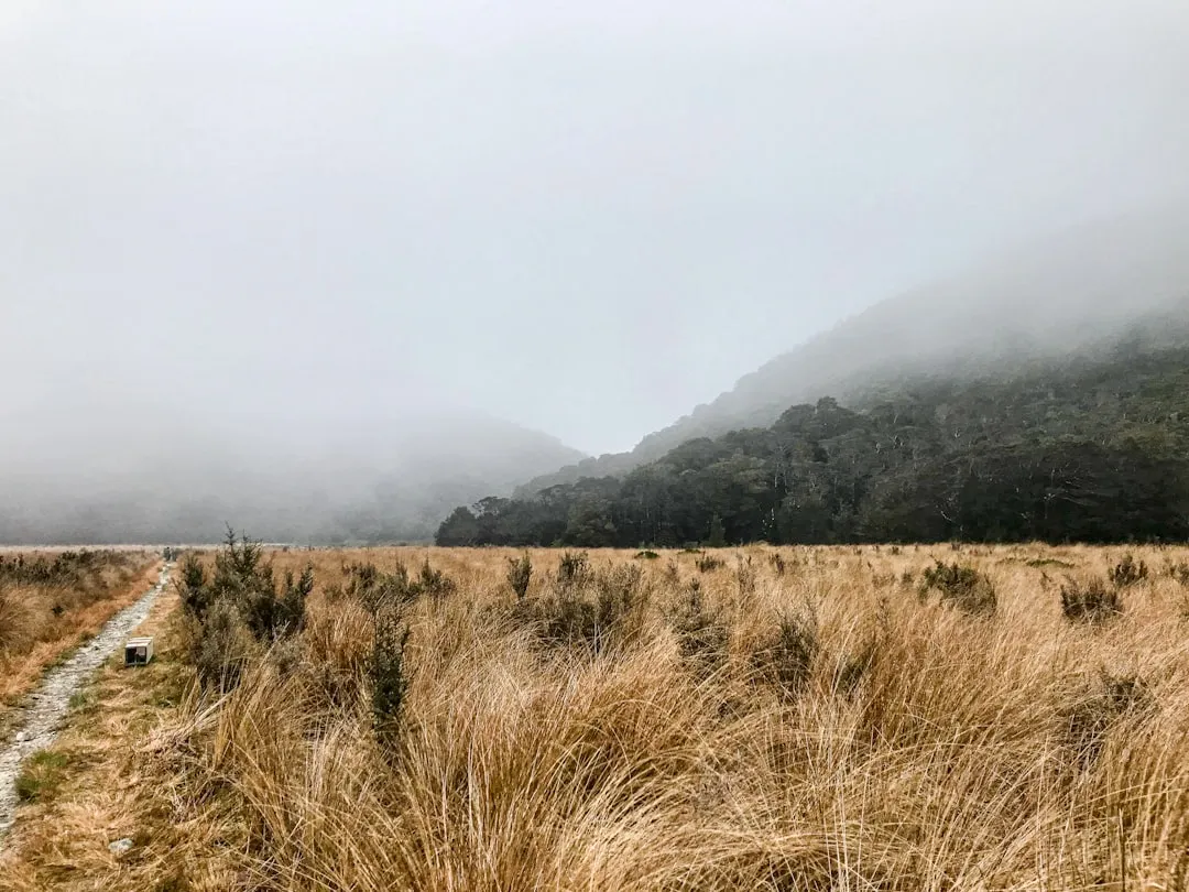
The Mount Somers Track is a classic Canterbury day hike that offers a substantial challenge and spectacular rewards. The journey begins with a gentle ascent through native beech forest, where the air is cool and the sounds of birdsong fill the canopy. As the track climbs, the forest gradually gives way to open tussock grasslands, offering increasingly expansive views of the surrounding countryside. The terrain becomes steeper and more rugged as you approach the summit ridge, with sections of scree and rocky paths requiring careful footing.
The summit of Mount Somers, at 1,687 metres, provides a breathtaking 360-degree panorama. On a clear day, you can see across the Canterbury Plains to the Pacific Ocean, and inland towards the Southern Alps. The descent follows a similar route, allowing for a different perspective on the landscapes you traversed on the way up. The track is well-marked, but its length and significant elevation gain mean it is a full-day commitment and requires a good level of fitness and preparation.
The track is divided into two main sections: the ascent to the summit and the descent. While many hikers opt for the out-and-back route to the summit, there is also a longer loop option that incorporates the Woolshed Creek track, offering a more varied experience for those with more time and energy. The Woolshed Creek section passes through a historic woolshed and offers different geological features, including interesting rock formations.
History and Cultural Context
The Mount Somers area has a rich history, deeply intertwined with Māori settlement and early European exploration and farming. For Māori, the Canterbury Plains and the foothills of the Southern Alps were important seasonal hunting and gathering grounds. While specific historical accounts of Māori use of Mount Somers itself are less detailed than for some other prominent peaks, the broader region was traversed and utilised by iwi such as Ngāi Tahu.
European settlement in the mid-19th century saw the land around Mount Somers rapidly transformed into sheep farming country. The prominent peak became a landmark for early settlers and surveyors. The track itself has evolved from old farm tracks and surveyor routes. The presence of the historic Woolshed Creek woolshed, which can be incorporated into a longer loop of the track, is a tangible reminder of the area's pastoral heritage. This woolshed, though now in disrepair, stands as a testament to the hard work and ingenuity of the early farmers who worked this challenging terrain.
The establishment of tracks and the promotion of Mount Somers as a recreational destination are more recent developments, driven by the Department of Conservation and local hiking enthusiasts. The aim has been to provide safe access to this magnificent landscape while preserving its natural and historical values. The track's current form reflects a balance between providing a challenging hiking experience and maintaining the wild character of the Canterbury foothills.
Seasonal Highlights and Weather Reality
The Mount Somers Track is best enjoyed during the warmer months, from October to April. During this period, the weather is generally more stable, and the risk of snow and ice on the upper reaches of the track is significantly reduced.
Spring (October–November): This is a beautiful time to hike as the tussock lands begin to turn green, and wildflowers start to bloom. The weather can be variable, with occasional late frosts or snow showers possible at higher elevations. Days are getting longer, offering ample time for the hike.
Summer (December–February): The warmest months offer the most reliable weather for hiking. However, summer can also bring hot temperatures, especially on the exposed tussock slopes. It is crucial to carry plenty of water and sun protection. Sandflies can also be present, particularly in shaded or damp areas.
Autumn (March–April): Autumn is often considered one of the best times to hike Mount Somers. The weather is typically settled and crisp, with clear skies and cooler temperatures. The tussock turns golden hues, creating a stunning visual spectacle. The risk of snow is low, and sandfly activity is usually reduced.
Winter (May–September): While technically possible to hike in winter, it is strongly discouraged for casual day hikers. The upper sections of the track can be covered in snow and ice, making it treacherous and requiring specialised winter mountaineering equipment and experience. Weather conditions can change rapidly, with blizzards and extreme cold posing significant risks. The Sharplin Falls car park may also be inaccessible due to snow.
Weather Considerations: Regardless of the season, the weather in the Canterbury foothills can change rapidly. Always check the forecast before you go, and be prepared for wind, rain, and temperature drops, even on a seemingly clear day. The summit of Mount Somers is exposed, and conditions can be significantly different from those at the trailhead.
Recommended Itinerary
Mount Somers Track - Summit Day Walk
Early Morning: Departure from Christchurch
- Depart Christchurch, driving west on State Highway 73.
- Continue on SH73 towards Springfield, then turn south onto the Inland Scenic Route 72 (SH72).
- Follow SH72 for approximately 40 km, passing through towns like Windwhistle and Staveley.
- Turn right onto Hoods Road, then left onto Ashworths Road.
- Follow Ashworths Road until you reach the Sharplin Falls Car Park, the trailhead for the Mount Somers Track.
- Total driving time: approximately 2 hours.
Morning: Ascent through Native Forest
- Begin your hike from the Sharplin Falls Car Park.
- The initial section of the track winds through beautiful native beech forest.
- Follow the well-marked path, enjoying the shade and the sounds of the forest.
- The gradient is moderate, allowing for a good warm-up.
- You will pass the turn-off for Sharplin Falls (a short, worthwhile detour if time permits).
- Continue climbing, with occasional glimpses of the surrounding farmland through breaks in the trees.
Midday: Transition to Tussock Slopes and Summit Push
- The forest begins to thin, and you emerge onto open tussock-covered slopes.
- The views start to open up significantly, offering vistas across the Canterbury Plains.
- The track becomes steeper and more exposed to the elements.
- Continue following the marked route, which may involve some rocky sections and scree.
- Take breaks to rehydrate and enjoy the expanding scenery.
- The summit ridge is now within reach, but the final ascent requires sustained effort.
Afternoon: Summit and Descent
- Reach the summit of Mount Somers (1,687 m).
- Spend time enjoying the 360-degree panoramic views.
- Have lunch and take photographs.
- Begin your descent, retracing your steps back down the mountain.
- Be mindful of your footing on the steeper sections, especially on the scree.
- Continue through the tussock lands and back into the native forest.
Late Afternoon: Return to Trailhead
- Arrive back at the Sharplin Falls Car Park.
- Total hiking time: 6–8 hours, depending on fitness and time spent at the summit.
- Drive back to Christchurch.
Alternative Loop Option (Woolshed Creek):
- For a longer and more varied hike, consider the loop that includes the Woolshed Creek track. This adds approximately 5-7 km and 2-3 hours to the total journey.
- The Woolshed Creek section passes by the historic woolshed and offers different geological features.
- This loop is generally considered more challenging due to its length and varied terrain.
Planning and Bookings
Book Your Trip
Everything you need to plan your journey
Accommodation
Find places to stay near Christchurch
Flights
Search flights to Christchurch
Essential Preparation
The Mount Somers Track is a significant day hike that requires careful planning. Given its length and elevation gain, a good level of physical fitness is essential. Ensure you are comfortable walking for 6-8 hours with a pack, and have experience with uneven terrain and steep ascents/descents. The closest major city is Christchurch, which offers all necessary amenities for stocking up on supplies, hiring gear, and finding accommodation before and after your hike. The drive from Christchurch to the trailhead at Sharplin Falls Car Park takes approximately 2 hours. It is advisable to start your hike early in the morning to allow ample time to complete the walk before dusk, especially during shorter daylight hours.
Trail Accommodation
This is a day hike requiring no overnight accommodation. The Mount Somers Track is designed to be completed within a single day. There are no huts, lodges, or campsites along the main summit track. Hikers are expected to start and finish their journey on the same day. If you wish to extend your visit to the area, there are various accommodation options available in nearby towns such as Methven or Geraldine, or back in Christchurch.
Required Gear
- Sturdy hiking boots: Waterproof and with good ankle support are essential for navigating the varied and often uneven terrain.
- Backpack: A comfortable day pack (20-30 litres) to carry essentials.
- Waterproof jacket and overtrousers: Weather can change quickly in the mountains; be prepared for rain and wind.
- Warm layers: Including a fleece or wool mid-layer and a hat and gloves, even in summer, as temperatures can drop significantly at higher altitudes.
- Sun protection: Sunscreen (SPF 30+), sunglasses, and a wide-brimmed hat are crucial due to the exposed nature of the upper track.
- Navigation: While the track is generally well-marked, a map and compass or GPS device are recommended, especially if considering the loop track or in case of poor visibility. An offline map on your phone is also useful.
- First-aid kit: Including blister treatment, pain relievers, and any personal medications.
- Head torch: With spare batteries, in case your hike takes longer than expected.
What to Bring
- Food: Plenty of high-energy snacks and a substantial packed lunch. Consider items like sandwiches, fruit, nuts, energy bars, and trail mix.
- Water: At least 2-3 litres of water per person. There are no reliable water sources on the upper sections of the track, and any water found lower down should be treated. A water filter or purification tablets are recommended if you plan to refill.
- Toiletries: Hand sanitiser, toilet paper (pack out used paper), and any personal hygiene items.
- Insect repellent: Sandflies can be present, especially during warmer months.
- Trekking poles: Highly recommended for the steep ascents and descents, as they can help reduce strain on your knees and improve stability.
- Mobile phone: For emergency use, though reception can be patchy. Consider a personal locator beacon (PLB) for added safety.
Permits
No permits are required to hike the Mount Somers Track. Access to the trailhead at Sharplin Falls Car Park is free, and there are no booking requirements for day use. However, it is always advisable to check the Department of Conservation (DOC) website for any alerts or track closures that may be in effect due to weather conditions, maintenance, or other unforeseen circumstances. While no permits are needed, responsible use of the track and adherence to Leave No Trace principles are expected.
Other Activities in the Area
The region surrounding Mount Somers offers several other attractions and activities for visitors:
- Sharplin Falls: A short, easy detour from the main track, offering a pleasant walk to a picturesque waterfall. This is a good option for a shorter outing or a relaxing break.
- Staveley Campgrounds: Located a short drive from the trailhead, these campgrounds offer basic facilities for those wishing to stay overnight in the area.
- Lake Coleridge: A scenic lake approximately 30-40 minutes drive from the Mount Somers trailhead, offering opportunities for fishing, kayaking, and picnicking.
- Methven and Mt Hutt: Further afield, the town of Methven is a hub for adventure activities, including skiing and snowboarding at Mt Hutt during winter, and mountain biking and hiking in summer.
- Geraldine: A charming rural town with artisan shops, cafes, and a local museum, offering a glimpse into the region's heritage.
- Canterbury Plains exploration: Enjoy scenic drives through the agricultural heartland of the Canterbury Plains, stopping at local markets or farm gates.
Safety and Conditions
Weather: The most critical safety consideration for Mount Somers is the unpredictable mountain weather. Always check the MetService forecast for the Canterbury foothills and alpine regions before you depart. Be prepared for rapid changes, including strong winds, rain, fog, and even snow at higher elevations, regardless of the season. If the forecast is poor, postpone your hike.
Fitness: This is a strenuous day hike with significant elevation gain. Ensure you have a good level of cardiovascular fitness and are accustomed to walking on uneven and steep terrain. Undertaking this hike without adequate fitness can lead to exhaustion, injury, and potential distress.
Navigation: While the main summit track is generally well-marked, the terrain can be disorienting in poor visibility. Carry a map and compass and know how to use them, or use a reliable GPS device or offline map app. The Woolshed Creek loop track is less frequently used and may require more careful navigation.
Water: Carry sufficient water for the entire hike (2-3 litres per person). There are no reliable water sources on the upper, exposed sections of the track. Any water found lower down should be treated before consumption.
Footwear: Sturdy, broken-in hiking boots with good ankle support are essential to prevent injuries on the rocky and uneven surfaces.
Communication: Mobile phone reception can be unreliable in the area. Consider carrying a personal locator beacon (PLB) for emergencies, especially if hiking alone or in adverse weather conditions.
Sandflies: These biting insects can be prevalent, particularly during warmer months and in shaded, damp areas. Carry effective insect repellent and consider wearing long sleeves and trousers.
Emergency: In case of an emergency, call 111 (New Zealand emergency services). Provide your location, the nature of the emergency, and your current condition.
Side Trips and Points of Interest
Sharplin Falls: Located just a short distance from the main trailhead, Sharplin Falls is a beautiful, easily accessible waterfall. A well-maintained track leads to the falls, making it a perfect short detour for a refreshing break or a pleasant addition for those seeking a less strenuous experience. The falls are particularly impressive after rainfall.
Woolshed Creek Track (Loop Option): For hikers looking for a longer and more varied day out, the Woolshed Creek track offers an alternative route that can be combined with the summit track to form a loop. This section passes by the historic Woolshed Creek woolshed, a relic of the area's pastoral past. The landscape along this route is different, featuring interesting rock formations and a more remote feel. It adds significant distance and elevation change, so it is only recommended for experienced and fit hikers.
Summit Views: The primary point of interest is, of course, the summit of Mount Somers itself. At 1,687 metres, it offers unparalleled 360-degree views. On a clear day, you can see the vast Canterbury Plains stretching out to the east, the Southern Alps forming a dramatic backdrop to the west, and the winding rivers and farmland below. It's an ideal spot for a picnic lunch and to appreciate the scale of the landscape.
Geological Features: As you ascend, particularly on the more exposed sections and the Woolshed Creek track, you will encounter interesting geological formations. The volcanic origins of the area are evident in the rock types and the varied terrain, offering a visual lesson in the region's geological history.
Leave No Trace
The Mount Somers Track traverses a beautiful and ecologically sensitive area. Practising Leave No Trace principles is crucial to preserving its natural beauty and ensuring it remains a pristine environment for future visitors.
- Plan Ahead and Prepare: Know the conditions, check the weather, and be prepared for the demands of the hike.
- Travel and Camp on Durable Surfaces: Stick to the marked track at all times. Avoid cutting corners on switchbacks, as this causes erosion.
- Dispose of Waste Properly: Pack out everything you pack in, including all food scraps, wrappers, and any other litter. Use the toilets provided at the trailhead, or if necessary, dig a cathole at least 10 metres away from water sources and the track, and bury human waste. Pack out used toilet paper.
- Leave What You Find: Do not remove plants, rocks, or any other natural objects. Take only photographs and memories.
- Minimise Campfire Impacts: Campfires are not permitted on this day hike.
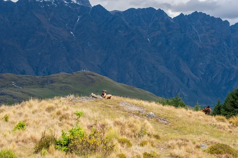
- Respect Wildlife: Observe wildlife from a distance and never feed them. Feeding wildlife can harm their health and alter their natural behaviours.
- Be Considerate of Other Visitors: Keep noise levels down and yield to other hikers on the track.
By following these principles, you help protect the natural heritage of Mount Somers for everyone to enjoy.