
Mount Ossa Circuit - Tasmania's Highest Peak
The Mount Ossa Circuit is a challenging multi-day trek in the heart of Tasmania's Central Highlands, offering a true wilderness experience and the chance to summit the state's highest peak. This circuit, typically undertaken over two to three days, traverses a landscape of dramatic alpine scenery, including rugged mountains, pristine glacial lakes, and vast, windswept plateaus. It is a route for experienced hikers seeking solitude and a significant physical challenge, rewarding them with unparalleled views and a profound connection to the wild Tasmanian wilderness. The circuit is renowned for its demanding terrain, unpredictable weather, and the sheer majesty of its alpine environment.
- Distance: 25.0 km
- Elevation Gain: 1200 m
- Duration: 2-3 days
- Difficulty: Challenging
- Best Time: November to April
- Closest City: Launceston
- Trailhead Access: Nearest airport: Launceston (LST). Drive ~2.5 hours to Lake St Clair. Car recommended. Road conditions generally good, check for updates. Parking available at Lake St Clair visitor centre. Park entry permit required. Cradle Mountain-Lake St Clair National Park pass needed.
- Coordinates: -41.8417, 146.0147
Overview
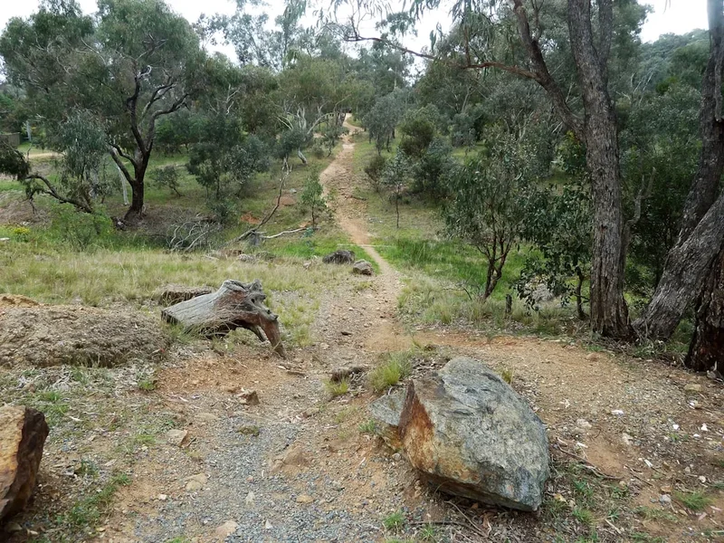
The Mount Ossa Circuit is a demanding but immensely rewarding trek that takes you to the roof of Tasmania. Starting from the shores of Lake St Clair, the circuit winds its way through diverse alpine terrain, culminating in the ascent of Mount Ossa, which stands at 1617 metres. The trail is not a clearly defined, well-trodden path in many sections, requiring strong navigation skills and a good sense of direction. It is a route that demands respect for the alpine environment, with weather capable of changing dramatically and rapidly.
The journey typically begins with a walk along the shores of Lake St Clair, Tasmania's deepest lake, before heading inland towards the rugged peaks. The ascent to Mount Ossa is steep and often involves scrambling over scree and rock. The summit offers breathtaking 360-degree views across the vast wilderness of the Cradle Mountain-Lake St Clair National Park, including views of Cradle Mountain itself, Barn Bluff, and the central plateau. The descent often follows a different route, allowing for a varied experience of the park's alpine landscapes, including alpine meadows, rocky outcrops, and potentially snowfields even in early summer.
This circuit is best suited for those with a high level of fitness, experience in alpine environments, and proficiency in navigation using map and compass. It is a true test of endurance and self-reliance, offering a profound sense of accomplishment upon completion. The remoteness and ruggedness of the terrain ensure that walkers are likely to experience a true sense of solitude, making it an ideal choice for those seeking an escape into the wild.
History and Cultural Context
The Central Highlands of Tasmania, including the area around Mount Ossa, have a long and complex history. For millennia, Aboriginal Tasmanians, particularly the Paredarerme people, traversed these highlands, utilising the rich resources of the alpine and subalpine environments. These journeys were often seasonal, following traditional pathways and utilising the abundant flora and fauna for sustenance and tools. The rugged terrain and harsh climate would have presented significant challenges, highlighting the resilience and adaptability of the original inhabitants.
European exploration and settlement in the region began in the 19th century, driven by pastoralism, mining, and later, tourism. The establishment of the Cradle Mountain-Lake St Clair National Park in the mid-20th century was a crucial step in preserving this unique wilderness. Mount Ossa, as the state's highest peak, has long been a significant landmark for explorers and mountaineers. Early ascents would have been arduous expeditions, requiring considerable courage and determination, often undertaken by surveyors, geologists, and adventurous individuals seeking to chart and conquer the highest points of the island.
The development of walking tracks and huts in the broader region, while not as extensive or formalised as on some other famous Australian walks, has facilitated access for hikers. However, the Mount Ossa Circuit itself remains a route that largely relies on off-track navigation and a deep understanding of the alpine environment. The area continues to be a place of immense natural and cultural significance, a testament to the enduring power of Tasmania's wild landscapes.
Seasonal Highlights and Weather Reality
The Mount Ossa Circuit is a true alpine experience, and its accessibility and conditions are heavily dictated by the seasons. The best time to undertake this challenging trek is during the warmer months, from November to April. During this period, the days are longer, and the weather is generally more stable, although still highly unpredictable.
Summer (December to February): This is the most popular time for hiking in the region. Snowmelt usually means water is readily available, and the alpine wildflowers can be in bloom. However, summer can also bring thunderstorms, high winds, and sudden drops in temperature. Sandflies can also be prevalent, especially near water sources.
Autumn (March to April): The autumn colours in the Tasmanian highlands can be spectacular, with golden hues transforming the landscape. The weather can be crisp and clear, offering excellent visibility. However, temperatures begin to drop significantly, and the possibility of early snowfalls increases, particularly at higher elevations. Days are shorter, requiring careful planning of hiking times.
Spring (November): Early spring can still see significant snow cover on Mount Ossa and surrounding peaks, making navigation and travel difficult and potentially dangerous. While wildflowers may begin to appear, conditions can be highly variable, with a higher chance of snow, ice, and strong winds. It is essential to check conditions thoroughly before setting out.
Winter (May to October): This period is generally unsuitable for the Mount Ossa Circuit for all but the most experienced winter mountaineers. Heavy snow, ice, extreme cold, and short daylight hours make the trek exceptionally dangerous. Avalanche risk is also a significant concern. Access to the trailhead may also be affected by snow.
Weather: It cannot be overstated that the weather in Tasmania's alpine regions is notoriously fickle. Conditions can change from clear and sunny to blizzard-like within a matter of hours. High winds, heavy rain, sleet, and snow are common, even in summer. Walkers must be prepared for all conditions and carry appropriate gear for survival in extreme weather.
Recommended Itinerary
2-Day Mount Ossa Circuit Itinerary
Day 1: Lake St Clair to Pelion Hut (or similar high camp)
- Distance: Approximately 15-18 km
- Elevation gain: Variable, significant ascent towards Pelion Plains
- Time: 6-8 hours
- Start at Lake St Clair Visitor Centre
- Follow the Overland Track south for a section, passing through temperate rainforest and open woodland
- Ascend towards Pelion Plains, a vast alpine plateau
- Potential camping locations include near Pelion Hut (if available and booked) or established high camps in the vicinity. Note: Pelion Hut is part of the Overland Track and requires separate booking. Alternative is to find a suitable, established campsite away from water sources and sensitive vegetation.
- This day focuses on gaining elevation and positioning yourself for the summit attempt.
Day 2: Summit Mount Ossa and Return to Lake St Clair
- Distance: Approximately 7-10 km (return from camp to summit and back to trailhead)
- Elevation gain: Approximately 600-700 m ascent to summit, then descent
- Time: 6-9 hours (including summit time)
- Early start from camp to maximise daylight and potentially favourable morning weather
- Navigate towards the base of Mount Ossa. The route becomes less defined here, requiring careful map and compass work.
- Ascend Mount Ossa via the most direct and safest route, which often involves scrambling over scree and rock.
- Enjoy panoramic views from the summit (1617 m).
- Descend carefully, retracing your steps or following an alternative route if planned and well-researched.
- Continue descent back towards Lake St Clair, potentially via a different section of the Overland Track or a connecting route.
- Arrive back at Lake St Clair Visitor Centre.
3-Day Mount Ossa Circuit Itinerary (More Relaxed Pace)
Day 1: Lake St Clair to Pelion Hut (or similar high camp)
- Distance: Approximately 15-18 km
- Elevation gain: Variable, significant ascent towards Pelion Plains
- Time: 6-8 hours
- As per Day 1 of the 2-day itinerary. This allows for a more leisurely start and acclimatisation.
Day 2: Day trip to Mount Ossa Summit from Pelion Plains
- Distance: Approximately 7-10 km (return from camp to summit and back to camp)
- Elevation gain: Approximately 600-700 m ascent to summit, then descent
- Time: 6-9 hours
- Leave your main pack at your campsite and carry a smaller day pack with essentials.
- Navigate towards the base of Mount Ossa.
- Ascend Mount Ossa, enjoying the summit views.
- Descend back to your campsite at Pelion Plains.
- This allows for a full day of summiting without the pressure of carrying a heavy pack and then hiking further.
Day 3: Pelion Hut (or camp) to Lake St Clair
- Distance: Approximately 15-18 km
- Elevation gain: Mostly descent
- Time: 5-7 hours
- Pack up camp and begin the descent back towards Lake St Clair.
- Follow the Overland Track or a connecting route, enjoying the changing scenery as you lose elevation.
- Arrive back at Lake St Clair Visitor Centre.
Important Notes:
- This circuit is not a marked track in its entirety. Navigation skills are paramount.
- Weather can change rapidly; always be prepared for alpine conditions.
- Water sources can be scarce in drier periods; carry sufficient water or a reliable treatment method.
- Accommodation at Pelion Hut requires booking through Parks Tasmania as part of the Overland Track. If not booked, or if seeking a more remote experience, established campsites in the vicinity of Pelion Plains are an alternative, adhering to Leave No Trace principles.
- This itinerary is a suggestion; actual routes and timings will depend on individual fitness, weather, and chosen campsites.
Planning and Bookings
Book Your Trip
Everything you need to plan your journey
Accommodation
Find places to stay near Launceston
Flights
Search flights to Launceston
Essential Preparation
The Mount Ossa Circuit is a serious undertaking that requires meticulous planning and preparation. Given its challenging nature and the remoteness of the terrain, a high level of fitness is non-negotiable. You should be comfortable hiking for extended periods with a heavy pack over uneven and steep ground. Familiarity with map and compass navigation is essential, as large sections of the route are not marked and can be difficult to follow, especially in poor visibility.
The closest major town with comprehensive services is Launceston, approximately 2.5 hours' drive from the Lake St Clair trailhead. Launceston offers a full range of accommodation, outdoor gear shops, supermarkets, and transport options. It is advisable to spend at least one night in Launceston before heading to the trailhead to finalise gear, purchase supplies, and check weather forecasts. Ensure your vehicle is in good condition for the drive, as services are limited once you leave the main towns.
It is crucial to inform someone of your detailed itinerary, expected return time, and emergency contact details. This is a fundamental safety precaution for any remote wilderness trip.
Trail Accommodation
The Mount Ossa Circuit does not have a continuous chain of designated huts like some more developed tracks. The primary accommodation option for those undertaking the circuit is camping. However, there is a key hut that walkers may utilise or pass by:
Pelion Hut: This is a basic hut located on Pelion Plains, a popular stopover point for those walking the Overland Track. It is a serviced hut with bunks, a fireplace, and a rainwater tank. However, it is essential to understand that Pelion Hut is part of the Overland Track system and requires advance booking through Parks Tasmania, especially during the peak season (October to May). If you intend to use Pelion Hut, booking is mandatory.
Camping: Outside of Pelion Hut, the circuit involves camping in designated or suitable wild camping locations. Walkers must adhere strictly to Leave No Trace principles, camping at least 100 metres from water sources and established tracks, and ensuring minimal impact on the environment. There are no formal campsites with facilities along the majority of the circuit route. You will need to be entirely self-sufficient for camping.
What's NOT provided:
- No cooking facilities at campsites.
- No toilets at campsites (except at Pelion Hut).
- No rubbish disposal.
- No electricity or charging facilities.
- No bedding or mattresses at Pelion Hut (you must bring your own sleeping bag and mat).
Seasonal Availability: Pelion Hut is generally accessible year-round, but booking is required during the peak season. Camping is possible year-round, but winter conditions make it extremely hazardous and generally not recommended.
Costs: Hut fees for Pelion Hut are part of the Overland Track booking system and are typically around AUD $60-80 per person per night during the peak season. Camping fees may also apply in certain areas, and it is essential to check with Parks Tasmania. A National Parks Pass is also required for entry into the Cradle Mountain-Lake St Clair National Park.
Required Gear
- Sturdy Hiking Boots: Waterproof, well-broken-in boots with good ankle support are essential for navigating rough terrain and scree.
- Backpack: A robust pack of 60-75 litres capacity, with a comfortable harness and hip belt, is needed to carry all your gear and food. A waterproof pack liner or cover is highly recommended.
- Tent: A high-quality, four-season tent capable of withstanding strong winds and heavy rain is crucial. Ensure it is lightweight and easy to pitch in challenging conditions.
- Sleeping Bag: A warm sleeping bag rated to at least -5°C to 0°C is necessary, as alpine temperatures can drop significantly, even in summer.
- Sleeping Mat: For insulation and comfort.
- Waterproof Jacket and Trousers: Made from breathable, waterproof material (e.g., Gore-Tex). Essential for protection against rain and wind.
- Warm Layers: Including thermal base layers (merino wool is ideal), fleece mid-layers, and a warm insulated jacket (down or synthetic).
- Navigation Tools: Topographic map of the area, a reliable compass, and a GPS device or smartphone with offline mapping capabilities. Knowledge of how to use them is paramount.
- Head Torch: With spare batteries. Essential for early starts, late finishes, and camp chores.
- First-Aid Kit: Comprehensive kit including blister treatment, pain relievers, bandages, antiseptic wipes, and any personal medications.
- Sun Protection: High SPF sunscreen, sunglasses, and a wide-brimmed hat. The sun can be intense at altitude, even on cloudy days.
- Insect Repellent: Particularly effective against sandflies.
What to Bring
- Food: Lightweight, high-energy, non-perishable food for the duration of your trip (2-3 days). This includes breakfast, lunch, dinner, and plenty of snacks. Plan for an extra day's worth of food in case of delays.
- Water Treatment: A water filter, purification tablets, or a UV steriliser. While water is generally plentiful, it should always be treated.
- Cooking Gear: Lightweight camping stove, fuel, cooking pot, mug, bowl, and utensils.
- Toiletries: Biodegradable soap, toothbrush, toothpaste, toilet paper, hand sanitiser, and a small trowel for burying human waste if not using a hut toilet.
- Repair Kit: Duct tape, cordage, safety pins, and a multi-tool for gear repairs.
- Emergency Shelter: A lightweight emergency bivvy bag or space blanket.
- Whistle: For signalling in emergencies.
- Personal Locator Beacon (PLB) or Satellite Messenger: Highly recommended for remote areas with no mobile reception.
- Trekking Poles: Can significantly reduce strain on knees during descents and aid balance on uneven terrain.
- Camera: To capture the stunning scenery.
- Book or journal: For downtime at camp.
Permits
Entry into the Cradle Mountain-Lake St Clair National Park requires a Parks Pass. These can be purchased online from the Parks Tasmania website or at various visitor centres and outlets. For multi-day hikes, an annual pass is often the most economical option.
Hut Bookings: If you plan to stay at Pelion Hut, booking is mandatory during the peak season (1 October to 31 May). Bookings can be made through the Parks Tasmania website. It is advisable to book well in advance, especially if you are planning to hike during school holidays or public holidays, as availability can be limited.
Camping: While there are no formal campsites along the Mount Ossa Circuit outside of Pelion Plains, campers must adhere to strict Leave No Trace principles. This includes camping at least 100 metres from water sources and tracks, and ensuring all waste is packed out. In some areas, specific camping restrictions may apply, so it is always best to check with Parks Tasmania prior to your trip.
Park Entry Fees:
- Day Entry Pass: AUD $16.50 per vehicle (valid for 24 hours)
- Annual Pass: AUD $132 per vehicle (valid for 12 months)
Hut Fees (Pelion Hut):
- Peak Season (1 October - 31 May): AUD $60-80 per person per night (subject to change)
- Off-Season (1 June - 30 September): Free, but conditions are extreme and not recommended for this circuit.
It is essential to check the Parks Tasmania website for the most up-to-date information on fees, booking procedures, and any specific regulations pertaining to the Cradle Mountain-Lake St Clair National Park.
Other Activities in the Area
The Lake St Clair region and the broader Cradle Mountain-Lake St Clair National Park offer a wealth of activities for those looking to extend their stay or explore beyond the Mount Ossa Circuit:
- Overland Track: The world-renowned Overland Track is a 65 km multi-day hike that passes through the heart of the park. While the Mount Ossa Circuit is a challenging detour, walking sections of the Overland Track offers a different perspective on the park's diverse landscapes.
- Cradle Mountain Summit: A popular day hike or overnight trip, the summit of Cradle Mountain offers iconic views and a challenging climb.
- Dove Lake Circuit: A relatively easy and scenic walk around Dove Lake, offering stunning views of Cradle Mountain.
- Tasmanian Wilderness Cruises: Explore the dramatic coastal scenery of the west coast from the water, with opportunities to spot seals, seabirds, and other marine life.
- Wildlife Spotting: The park is home to a variety of native Tasmanian wildlife, including wombats, wallabies, echidnas, and the elusive platypus. Early mornings and late evenings are often the best times for sightings.
- Scenic Drives: The drive to Cradle Mountain and around the Lake St Clair area offers spectacular vistas and opportunities to stop at various lookouts and points of interest.
- St Clair Visitor Centre: Learn more about the park's natural and cultural history, geology, and flora and fauna at the informative visitor centre.
Safety and Conditions
Pre-Trip Planning:
- Check Weather Forecasts: Always check the Bureau of Meteorology (BOM) and Parks Tasmania for the latest weather forecasts and any severe weather warnings for the Central Highlands and Cradle Mountain-Lake St Clair National Park. Be prepared for rapid changes.
- Inform Someone: Leave a detailed itinerary with a reliable contact person, including your planned route, expected return date and time, and emergency contact numbers.
- Park Alerts: Visit the Parks Tasmania website for any track closures, fire bans, or other alerts relevant to the park.
- Vehicle Check: Ensure your vehicle is in good mechanical condition, especially tyres, as you will be travelling on unsealed roads.
On the Trail:
- Navigation: This is a challenging route with sections that are not clearly marked. Proficiency in map and compass navigation is essential. Do not rely solely on GPS devices, as batteries can fail and reception can be poor.
- Weather Preparedness: Be prepared for all conditions. Hypothermia is a significant risk, even in summer. Carry adequate warm clothing, waterproofs, and a reliable shelter.
- Water: While water is generally available from streams and lakes, it must be treated before drinking. Carry a water filter or purification tablets.
- Fitness: Ensure you are physically fit enough for the demands of the trek. Pace yourself and take regular breaks.
- Communication: Mobile phone reception is virtually non-existent in most parts of the park. Consider carrying a Personal Locator Beacon (PLB) or satellite messenger for emergencies.
- Wildlife: Be aware of native wildlife. Do not feed animals, and store food securely to prevent them from accessing it.
- Respect the Environment: Adhere to Leave No Trace principles at all times.
Emergency Procedures: In case of an emergency, stay calm. If you have a PLB or satellite messenger, activate it. If not, and if safe to do so, attempt to reach a location with mobile reception or seek assistance from other walkers. Know the emergency contact numbers for Parks Tasmania and local emergency services.
Side Trips and Points of Interest
Mount Ossa Summit: The primary objective of the circuit, the summit of Mount Ossa (1617 m) offers unparalleled panoramic views of the Tasmanian wilderness. On a clear day, you can see for vast distances, taking in iconic peaks like Cradle Mountain, Barn Bluff, and the central plateau. The ascent involves scrambling over scree and rock, making it a rewarding challenge.
Pelion Plains: This expansive alpine plateau is a significant feature of the circuit. It is a relatively flat and open area, often dotted with tarns and unique alpine vegetation. It provides a stark contrast to the surrounding rugged peaks and offers a sense of immense space and solitude.
Lake St Clair: As the deepest lake in Australia, Lake St Clair is a beautiful and serene starting and finishing point for the trek. The surrounding temperate rainforest and the clear waters of the lake are a welcome sight after days in the alpine environment.
Tasmanian Flora and Fauna: Keep an eye out for the unique plant life of the alpine regions, including hardy alpine shrubs, cushion plants, and wildflowers in season. The area is also home to a variety of native animals, such as wombats, wallabies, echidnas, and various bird species. If you are lucky, you might even spot a platypus in the lakes and rivers.
Views of Surrounding Peaks: Throughout the circuit, particularly on the ascent and descent of Mount Ossa, you will be treated to spectacular views of other prominent peaks within the Cradle Mountain-Lake St Clair National Park. These include Barn Bluff, Cradle Mountain, and the imposing peaks of the Du Cane Range.
Leave No Trace
The Mount Ossa Circuit traverses a pristine and fragile alpine environment. Adhering to the principles of Leave No Trace is paramount to preserving this wilderness for future generations. As a walker on this circuit, you have a responsibility to minimise your impact:
- Plan Ahead and Prepare: Research the route, understand the conditions, and pack appropriately. Inform someone of your plans.
- Travel and Camp on Durable Surfaces: Stick to established tracks where they exist. When camping, choose sites that are already impacted or are naturally resistant to damage, such as rock, gravel, dry grass, or snow. Avoid camping on fragile alpine vegetation.
- Dispose of Waste Properly: Pack out everything you pack in, including all food scraps, wrappers, and toilet paper. Use designated toilets where available (e.g., at Pelion Hut). If no toilet is available, dig a cathole at least 100 metres from water, trails, and campsites, and bury human waste.
- Leave What You Find: Do not remove or disturb natural objects such as rocks, plants, or cultural artefacts.
- Minimise Campfire Impacts: Campfires are generally discouraged in alpine environments due to the fragile vegetation and the risk of wildfires. Use a lightweight stove for cooking. If a campfire is absolutely necessary and permitted, use existing fire rings and keep fires small. Ensure fires are completely extinguished.
- Respect Wildlife: Observe wildlife from a distance. Never feed animals, as this can disrupt their natural behaviours and diets. Store food securely to prevent animals from accessing it.
- Be Considerate of Other Visitors: Keep noise levels down, especially in camping areas. Yield to other walkers on narrow sections of track.
By following these principles, you help to ensure that the Mount Ossa Circuit remains a wild and beautiful place for everyone to enjoy.