Mount Giluwe Ascent - Papua New Guinea's Volcanic Giant
The Mount Giluwe Ascent is a challenging expedition to the summit of one of Papua New Guinea's highest and most accessible volcanoes. Located in the Southern Highlands Province, Mount Giluwe is a dormant stratovolcano that offers a unique trekking experience through diverse ecosystems, from montane rainforests to alpine grasslands and volcanic scree. This trek is not for the faint-hearted; it demands good physical fitness, resilience to unpredictable weather, and a willingness to embrace remote wilderness. The journey to the summit, often completed over two to three days, provides a profound connection with the raw, untamed beauty of the New Guinean highlands and offers breathtaking panoramic views for those who reach its highest points.
- Distance: 33.0 km (round trip)
- Elevation Gain: 2500 m
- Duration: 2-3 days
- Difficulty: Challenging
- Best Time: May to September (dry season)
- Closest City: Mount Hagen
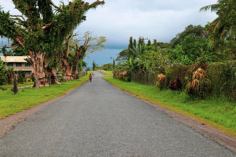
- Trailhead Access: Fly to Mount Hagen Airport (HGU). Hire a local 4x4 or arrange transport through a tour operator to reach the base of Mt. Giluwe (approx. 3-4 hours drive). Road conditions can be challenging, especially during the rainy season. Secure necessary climbing permits and hire local guides in Mount Hagen before heading to the mountain. Limited parking available at the trailhead.
- Coordinates: -6.0333, 143.8833
Overview
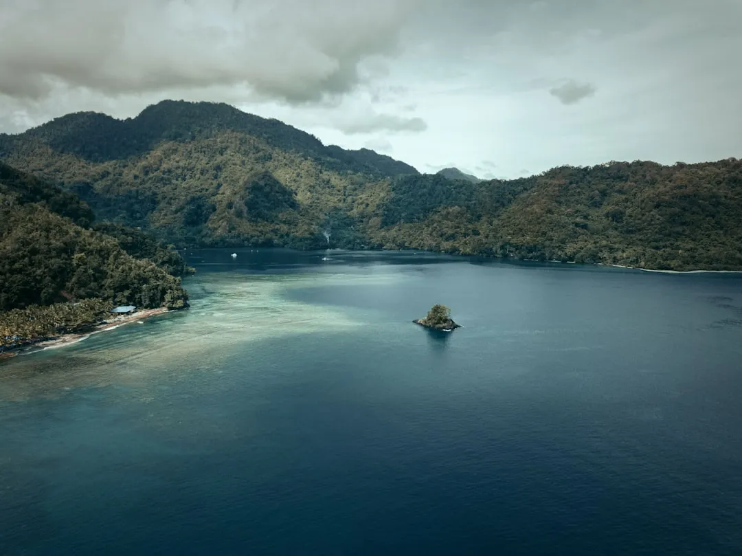
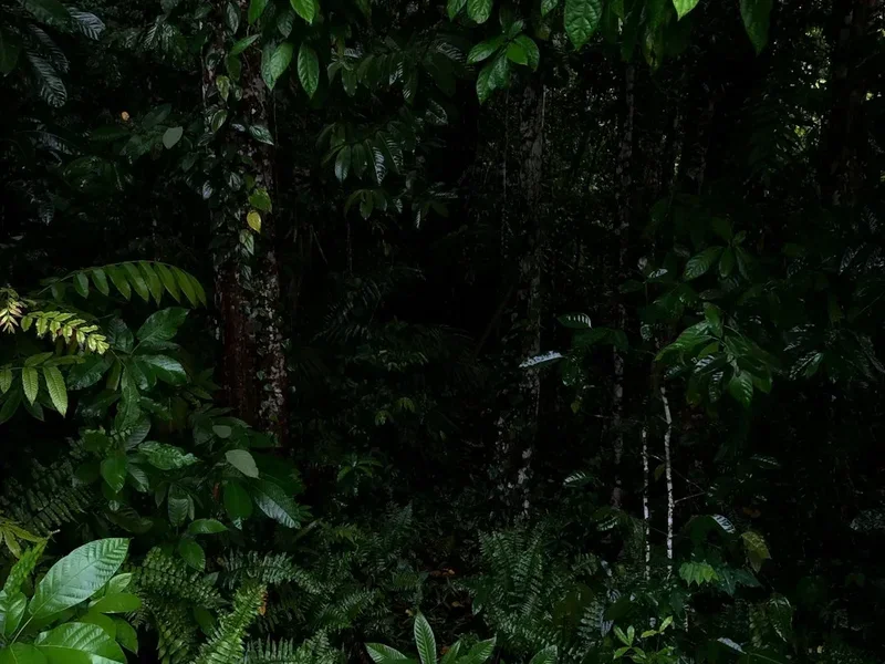
Mount Giluwe, standing at 4,367 metres (4,366 m), is the fifth-highest mountain in Papua New Guinea and the highest volcano in Oceania. Its ascent is a journey through a series of distinct ecological zones, each presenting its own challenges and rewards. The lower slopes are cloaked in dense, humid montane rainforest, teeming with unique flora and fauna. As you gain altitude, the forest gradually gives way to mossy cloud forests, where ancient trees are draped in epiphytes and the air becomes cooler and more humid. Above the treeline, the landscape transforms into open alpine grasslands, often shrouded in mist, with hardy shrubs and tussock grasses clinging to the volcanic soil. The final push to the summit involves navigating rocky scree slopes and volcanic ridges, often in challenging weather conditions.
The weather on Mount Giluwe is notoriously unpredictable. While the dry season (May to September) offers the best chance of clear skies, rain, fog, and strong winds can occur at any time, significantly impacting visibility and making the ascent more arduous. Temperatures can drop close to freezing at higher altitudes, especially at night. The remoteness of the region means that self-sufficiency is paramount; there are no established huts or facilities along the route, and all necessary supplies must be carried. Local guides are essential, not only for navigation and safety but also for cultural insights and logistical support.
The summit of Mount Giluwe is not a single point but rather a complex of three peaks, with the highest being the westernmost. Reaching any of the summits offers a profound sense of accomplishment and a chance to witness spectacular, albeit often fleeting, views of the surrounding highlands. The journey is as much about experiencing the rugged beauty of the landscape and the resilience of its ecosystems as it is about reaching the physical summit.
History and Cultural Context
Mount Giluwe has a long and significant history for the indigenous peoples of the Southern Highlands Province. For centuries, local communities have lived in the shadow of this imposing volcano, incorporating it into their cultural beliefs and traditional practices. The mountain is considered a sacred place by many, and its slopes have been traversed by local people for hunting, gathering, and spiritual purposes. The exact historical use of the higher slopes for settlement or extensive travel is less documented, likely due to the challenging terrain and harsh climate.
The geological history of Mount Giluwe is one of volcanic activity. It is a dormant stratovolcano, part of the Bismarck Volcanic Arc, which has been active for hundreds of thousands of years. The last significant eruption is estimated to have occurred around 15,000 years ago. The volcanic landscape has shaped the local environment, creating fertile soils in the lower valleys that support agriculture, while the higher altitudes present a stark, alpine environment.
European exploration and documentation of Mount Giluwe began in the early to mid-20th century. Geologists and explorers were drawn to its imposing presence and its status as one of the highest peaks in Papua New Guinea. However, due to its remote location and challenging access, it remained relatively unvisited by international trekkers for many years. In recent decades, with improved (though still basic) infrastructure and the growth of adventure tourism in Papua New Guinea, Mount Giluwe has become an increasingly popular destination for experienced hikers seeking a unique challenge in a remote and culturally rich environment. The establishment of local guiding services has made the ascent more accessible, while still preserving the authentic, rugged nature of the expedition.
Seasonal Highlights and Weather Reality
The best time to attempt the Mount Giluwe ascent is during the dry season, which typically runs from May to September. This period offers the highest probability of clearer skies, reduced rainfall, and more stable weather conditions, making the trek safer and more enjoyable. Even during the dry season, however, the weather can change rapidly, and visitors should be prepared for rain, fog, and strong winds at any time.
Dry Season (May to September): This is the prime trekking window. Days are generally cooler and drier, with less humidity. Visibility at higher altitudes is often better, increasing the chances of summit views. However, nights can be cold, with temperatures potentially dropping below freezing, especially near the summit. Frost and even light snow are possible at the highest elevations.
Wet Season (October to April): This period is characterised by heavy rainfall, high humidity, and frequent fog. The trails can become extremely muddy, slippery, and difficult to navigate. Rivers and streams can swell, posing a significant hazard. Landslides are also more common during this time. While trekking is still possible, it is significantly more challenging and dangerous, and the chances of reaching the summit with good visibility are greatly reduced. Many tour operators and guides recommend avoiding this period for summit attempts.
Temperature: Temperatures vary significantly with altitude. At the trailhead (around 2,500-2,800 metres), daytime temperatures might range from 10-18°C. As you ascend, temperatures will drop, potentially reaching 0-5°C at higher camps and near the summit, with wind chill making it feel colder. Nights will be significantly colder than daytime temperatures.
Wind: Wind is a constant factor, especially at higher altitudes and on exposed ridges. Strong winds can make walking difficult and increase the risk of hypothermia. Always be prepared for windy conditions, even on seemingly calm days.
Recommended Itinerary
2-Day Mount Giluwe Ascent Itinerary
Day 1: Mount Hagen to Base Camp (approx. 2,500-2,800 m)
- Morning: Depart Mount Hagen after breakfast.
- Drive: Approximately 3-4 hours to the trailhead near the base of Mount Giluwe. The road can be rough and may require a 4x4 vehicle.
- Trek Start: Begin trekking from the trailhead.
- Distance: 8-10 km
- Elevation Gain: 500-700 m
- Time: 4-6 hours
- Terrain: Starts in montane rainforest, gradually ascending through dense vegetation.
- Camp: Set up camp at a designated or suitable wild camping spot at the base camp elevation. This is typically in a sheltered area within the forest or at the edge of the treeline.
- Evening: Prepare dinner, acclimatise to the altitude, and rest for the next day's push.
Day 2: Base Camp to Summit (4,367 m) and Return to Trailhead
- Early Morning: Wake up before dawn for an early start.
- Trek to Summit: Ascend through alpine grasslands and over volcanic scree.
- Distance: 12-14 km (round trip from base camp)
- Elevation Gain: 1500-1800 m (to summit)
- Time: 8-10 hours (round trip to summit and back to base camp)
- Terrain: Open alpine terrain, rocky scree, potentially muddy sections, exposed ridges.
- Summit: Reach the summit plateau and explore the various peaks. Enjoy the panoramic views if weather permits.
- Descent: Descend back to base camp.
- Afternoon: Pack up camp and descend back to the trailhead.
- Drive: Transfer back to Mount Hagen.
3-Day Mount Giluwe Ascent Itinerary (Recommended for better acclimatisation)
Day 1: Mount Hagen to Mid-Altitude Camp (approx. 3,000-3,200 m)
- Morning: Depart Mount Hagen after breakfast.
- Drive: Approximately 3-4 hours to the trailhead.
- Trek Start: Begin trekking from the trailhead.
- Distance: 6-8 km
- Elevation Gain: 500-700 m
- Time: 3-5 hours
- Terrain: Montane rainforest, transitioning to mossy cloud forest.
- Camp: Set up camp at a suitable wild camping spot at mid-altitude. This allows for better acclimatisation.
- Evening: Relax and prepare for the higher altitude push.
Day 2: Mid-Altitude Camp to Summit (4,367 m) and Return to Mid-Altitude Camp
- Early Morning: Wake up before dawn.
- Trek to Summit: Ascend through alpine grasslands and over volcanic scree.
- Distance: 10-12 km (round trip from mid-altitude camp)
- Elevation Gain: 1100-1300 m (to summit)
- Time: 7-9 hours (round trip to summit and back to camp)
- Terrain: Open alpine terrain, rocky scree, potentially muddy sections, exposed ridges.
- Summit: Reach the summit plateau.
- Descent: Descend back to the mid-altitude camp.
- Evening: Rest and recover at camp.
Day 3: Mid-Altitude Camp to Trailhead and Return to Mount Hagen
- Morning: Pack up camp after breakfast.
- Trek: Descend through the cloud forest and montane rainforest back to the trailhead.
- Distance: 6-8 km
- Elevation Loss: 500-700 m
- Time: 3-4 hours
- Drive: Transfer back to Mount Hagen.
Important Notes:
- This is a challenging trek requiring good physical fitness and acclimatisation.
- All accommodation is wild camping; you must carry all camping gear and food.
- Local guides and porters are highly recommended for safety, navigation, and cultural experience.
- Weather is highly variable; be prepared for all conditions.
- Water sources are generally available but should be treated.
- Permits and local arrangements must be made in Mount Hagen before departure.
Planning and Bookings
Book Your Trip
Everything you need to plan your journey
Accommodation
Find places to stay near Mount Hagen
Flights
Search flights to Mount Hagen
Essential Preparation
Planning a trek to Mount Giluwe requires careful consideration of logistics, safety, and cultural protocols. The closest major town and transport hub is Mount Hagen. It is crucial to arrange your transport to and from the trailhead, as well as secure local guides and porters, well in advance. Mount Hagen offers basic accommodation, supplies, and banking facilities. It is advisable to spend at least one night here before heading to the mountain to finalise arrangements and purchase any last-minute items. Hiring experienced local guides is not just recommended but often mandatory for navigating the terrain and understanding local customs. They will assist with permit acquisition, arrange transport, and provide invaluable knowledge of the mountain and its environment. Ensure you have adequate travel insurance that covers high-altitude trekking and potential medical evacuation.
Trail Accommodation
This is a wild camping trek. There are no established huts, lodges, or campsites along the Mount Giluwe route. Trekkers must be entirely self-sufficient and carry all necessary camping equipment, including tents, sleeping bags, and cooking gear. Designated camping spots are typically found at the base of the mountain (around 2,500-2,800 metres) and at a mid-altitude camp (around 3,000-3,200 metres) if opting for a 3-day itinerary. These spots are usually natural clearings or sheltered areas within the forest or at the edge of the treeline. Wild camping requires adherence to Leave No Trace principles, ensuring minimal impact on the environment.
Facilities Provided: None. You are in a remote wilderness area.
What's NOT Provided: All shelter, sleeping arrangements, cooking facilities, food, water treatment, and waste disposal must be provided by the trekker.
Seasonal Availability: Camping is possible year-round, but the dry season (May-September) is strongly recommended for safety and comfort.
Costs: No direct costs for camping spots, but associated costs include guide fees, porter fees, and transport, which are part of the overall trek package.
Required Gear
- Sturdy, waterproof hiking boots: Broken-in, with good ankle support.
- Waterproof and windproof outer layers: A high-quality jacket and trousers are essential due to unpredictable weather.
- Warm layers: Fleece or down jacket, thermal base layers (merino wool or synthetic), warm hat, and gloves. Temperatures can drop significantly at altitude.
- Sleeping bag: Rated for sub-zero temperatures (e.g., -5°C to -10°C comfort rating) due to cold nights.
- Tent: A robust, waterproof, and wind-resistant 3-season tent.
- Backpack: A comfortable 60-75 litre pack with a rain cover.
- Trekking poles: Highly recommended for stability on steep ascents and descents, especially on scree.
- Headlamp: With spare batteries, for early morning starts and navigating in the dark.
- First-aid kit: Comprehensive kit including blister treatment, pain relievers, antiseptic wipes, bandages, and any personal medications.
- Navigation tools: Map of the area, compass, and GPS device or smartphone with offline maps. Local guides will have these, but it's good practice to have your own.
- Sun protection: High SPF sunscreen, sunglasses, and a wide-brimmed hat. The sun can be intense at altitude, even on cloudy days.
What to Bring
- Food: Sufficient high-energy, lightweight food for the duration of the trek (2-3 days). This includes breakfast, lunch, dinner, and plenty of snacks. Consider freeze-dried meals for convenience.
- Water bottles or hydration reservoir: Capacity for at least 2-3 litres.
- Water purification method: Filter, purification tablets, or UV steriliser.
- Cooking equipment: Lightweight stove, fuel, pot, utensils, mug, and lighter/matches.
- Toiletries: Biodegradable soap, toothbrush, toothpaste, toilet paper, hand sanitiser, and any personal hygiene items. Pack out all used toilet paper.
- Insect repellent: Especially for the lower forest sections.
- Camera and spare batteries/power bank: To capture the stunning scenery.
- Duct tape and repair kit: For minor gear repairs.
- Personal identification and copies of permits.
- Cash: For local guides, porters, and any purchases in Mount Hagen.
- Small towel: Quick-drying.
Permits
Before embarking on the Mount Giluwe ascent, it is essential to secure the necessary permits and permissions. These typically involve a combination of national park entry fees and local community permits. Arrangements are usually made in Mount Hagen through your tour operator or directly with local village elders or authorities. It is advisable to confirm the exact permit requirements and associated costs with your guide or tour organiser well in advance of your trip.
National Park Entry: While Mount Giluwe is not within a formally gazetted national park in the same way as some other protected areas in PNG, there may be fees associated with accessing the general region or specific areas designated for trekking. Your guide will be aware of these requirements.
Local Community Permits: The land surrounding Mount Giluwe is often customary land belonging to local communities. It is a cultural and often legal requirement to obtain permission from these communities to traverse their land and camp. This usually involves a fee paid directly to the community or through your guide. Respecting local customs and traditions is paramount when dealing with community permits.
Guide and Porter Arrangements: While not strictly permits, hiring local guides and porters is a critical part of the planning process. They are essential for navigation, safety, and cultural liaison. Their fees are a significant component of the trek cost. Ensure you agree on clear terms regarding their services, duration, and payment before commencing the trek.
Booking Strategy:
- Contact reputable tour operators specialising in Papua New Guinea treks well in advance (at least 3-6 months).
- Discuss your desired itinerary (2 or 3 days) and fitness level.
- Confirm all inclusions: guides, porters, transport, food, camping equipment, and permit fees.
- Be prepared for a degree of flexibility, as weather and local conditions can influence the exact schedule.
- Finalise all arrangements and payments in Mount Hagen before departing for the mountain.
Other Activities in the Area
While Mount Giluwe is the primary draw for visitors to this region, the Southern Highlands Province and the broader Mount Hagen area offer other points of interest for those with extra time:
- Cultural Villages: Experience the rich cultural heritage of Papua New Guinea by visiting traditional villages. This can offer insights into local customs, traditions, and daily life. Arrangements for such visits should be made through your guide or tour operator to ensure respectful and authentic interactions.
- Local Markets: Mount Hagen hosts vibrant local markets where you can see a diverse array of fresh produce, handicrafts, and local goods. It's a great place to observe local life and perhaps purchase souvenirs.
- Ramu River and Ramu Valley: For the truly adventurous, exploring the Ramu River basin offers a glimpse into more remote and less-visited parts of Papua New Guinea, though this requires significant logistical planning and is typically undertaken by experienced expedition organisers.
- Other Highland Peaks: Papua New Guinea boasts numerous other high peaks, including Mount Wilhelm (the country's highest), Mount Bosavi, and Mount Karimui. These offer different trekking challenges and unique landscapes for those interested in further mountaineering adventures.
- Birdwatching: The montane forests of the Southern Highlands are home to a spectacular array of birdlife, including numerous endemic species and birds of paradise. Guided birdwatching tours can be arranged.
Safety and Conditions
Pre-Departure Checks:
- Weather: Always check the latest weather forecasts for the Mount Hagen region and the specific mountain forecast if available. Be prepared for rapid changes, especially at higher altitudes.
- Road Conditions: The road to the trailhead can be treacherous, particularly during the wet season. Ensure your transport is suitable (4x4 recommended) and that your driver is experienced with local conditions.
- Guide Briefing: Have a thorough briefing with your local guide about the route, potential hazards, emergency procedures, and communication methods.
- Health: Consult your doctor about necessary vaccinations and malaria prophylaxis for Papua New Guinea. Ensure you are adequately fit for high-altitude trekking.
Altitude Sickness (Acute Mountain Sickness - AMS): Mount Giluwe's summit is over 4,300 metres. AMS can affect anyone, regardless of fitness. Symptoms include headache, nausea, dizziness, and fatigue. The best prevention is gradual ascent and acclimatisation. A 3-day itinerary is strongly recommended over a 2-day one. If symptoms develop, do not ascend further; descend if they worsen. Your guide will monitor you for signs of AMS.
Terrain Hazards: The trek involves steep ascents and descents, loose scree, muddy sections, and potentially slippery rocks. Trekking poles are invaluable for stability. Be mindful of your footing at all times.
Weather Extremes: Expect rain, fog, strong winds, and cold temperatures, even in the dry season. Hypothermia is a real risk at higher altitudes. Ensure you have adequate warm and waterproof clothing. Visibility can drop to near zero in fog, making navigation extremely difficult.
Remoteness and Evacuation: Mount Giluwe is a remote location. In case of a serious emergency, evacuation can be difficult and time-consuming. Ensure your travel insurance covers emergency medical evacuation from remote areas. Your guide will have a plan for communication and emergency response.
Wildlife: While large dangerous animals are not a primary concern on the upper slopes, be aware of your surroundings in the forest sections. Respect all wildlife and do not attempt to feed or approach animals.
Cultural Sensitivity: Always be respectful of local customs and traditions. Ask permission before taking photographs of people. Your guide will advise on appropriate behaviour.
Side Trips and Points of Interest
Summit Plateau Exploration: Mount Giluwe's summit is not a single point but a complex of three peaks. The highest is the westernmost peak. Upon reaching the summit plateau, take time to explore the different volcanic cones and craters. The views from various points can differ, and each offers a unique perspective on the surrounding highlands.
Crater Lakes: Depending on recent rainfall and conditions, small crater lakes may be visible on the summit plateau. These ephemeral bodies of water add to the stark, volcanic beauty of the high-altitude environment.
Unique Flora and Fauna: As you ascend, observe the transition in vegetation from dense rainforest to mossy cloud forest and finally to alpine grasslands. Keep an eye out for unique plant species adapted to the high altitude and volcanic soil. While wildlife sightings are less common at higher elevations, the lower forest sections are rich in birdlife, including various endemic species.
Panoramic Views (Weather Permitting): If you are fortunate enough to reach the summit on a clear day, the panoramic views of the surrounding Southern Highlands Province are spectacular. You can often see other volcanic peaks, vast river valleys, and the patchwork of agricultural land in the distance. These views are a significant reward for the challenging ascent.
Volcanic Features: Observe the various volcanic features along the route, including lava flows, ash deposits, and the distinctive shape of the stratovolcano. Understanding the geological history of the mountain adds another layer of appreciation to the trek.
Leave No Trace
The Mount Giluwe ascent traverses a fragile alpine and montane environment. Adhering to Leave No Trace principles is crucial to minimise your impact and preserve the natural beauty of this unique volcanic landscape for future generations. As this is a wild camping trek, your responsibility is even greater.
Plan Ahead and Prepare: Research the trek thoroughly, understand the conditions, and prepare adequately. This includes having the right gear, sufficient food, and making all necessary arrangements for guides and permits.
Travel and Camp on Durable Surfaces: Stick to established paths where they exist. When camping, choose established sites or durable surfaces like rock or dry grass. Avoid camping on fragile vegetation. Set up camp at least 70 metres away from water sources.
Dispose of Waste Properly: Pack it in, pack it out. This includes all food scraps, wrappers, toilet paper, and any other refuse. Use designated toilet facilities if available, or dig catholes at least 15-20 cm deep and 70 metres away from water, camp, and trails. Pack out all used toilet paper.
Leave What You Find: Do not remove any natural objects, plants, or rocks. Avoid carving or marking trees or rocks. Respect cultural heritage sites.
Minimise Campfire Impacts: Campfires are generally not recommended or permitted on high-altitude treks due to the fragile environment and limited fuel. Use a lightweight stove for cooking.
Respect Wildlife: Observe wildlife from a distance. Never feed animals, as it can disrupt their natural behaviours and diets. Store food securely to prevent attracting animals.
Be Considerate of Other Visitors: Keep noise levels down, especially in the early morning and late evening. Yield to others on the trail. Your actions reflect on all trekkers.