Mount Fuji Climb - The Sacred Ascent of Japan
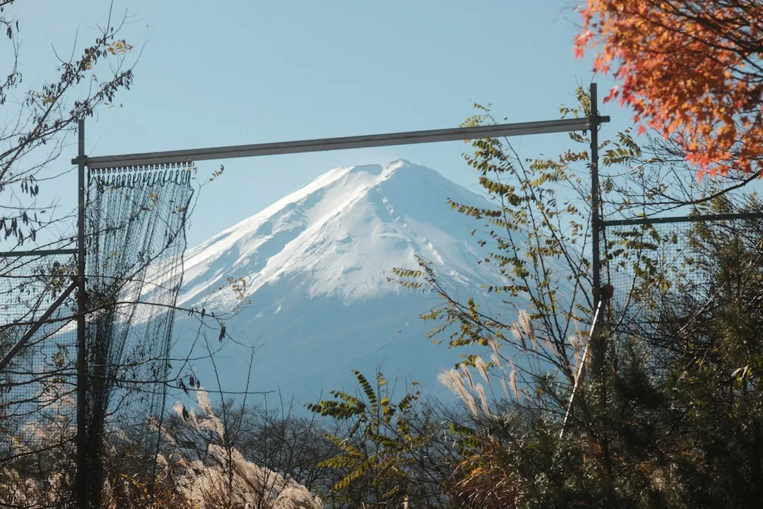
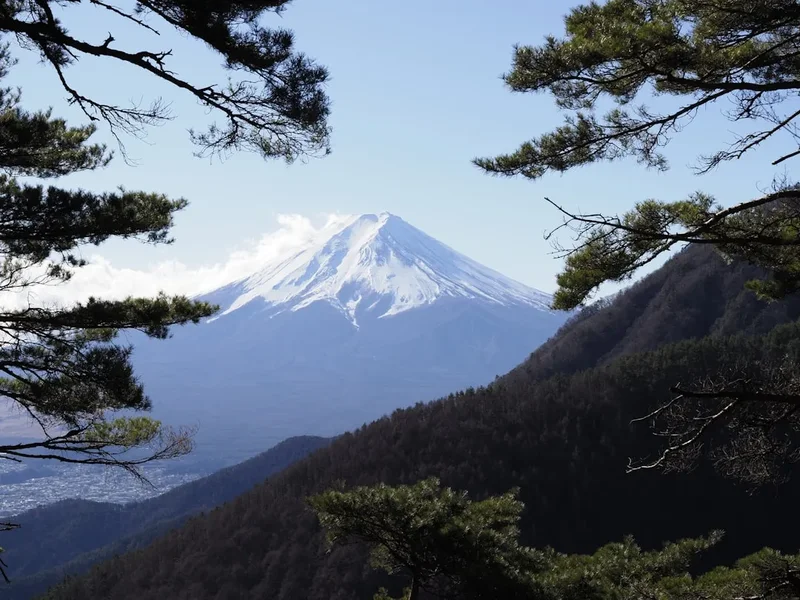
Mount Fuji, or Fujisan, is not merely a mountain; it is the singular, iconic silhouette that defines the Japanese landscape and spirit. Rising to a height of 3,776 metres, this perfectly symmetrical stratovolcano is the highest peak in Japan and a UNESCO World Heritage site recognised for its cultural rather than just its physical significance. The climb is a pilgrimage of endurance, drawing hundreds of thousands of hikers each year who seek to witness the "Goraiko"—the arrival of light—from the summit at dawn. Spanning approximately 15 kilometres round-trip via the popular Yoshida Trail, the journey takes climbers through distinct ecological zones, from the lush subalpine forests of the lower slopes to the stark, volcanic scoria and basalt of the upper reaches. This is a challenging high-altitude trek that demands physical preparation, respect for the mountain's volatile weather, and an appreciation for the deep spiritual history that permeates every rocky switchback.
- Distance: 15.0 km (round trip via Yoshida Trail)
- Elevation Gain: 1,300 m
- Duration: 8–12 hours
- Difficulty: Challenging
- Best Time: July to early September (official climbing season)
- Highest Point: 3,776 m (Summit)
- Trailhead: Fuji-Subaru Line 5th Station (2,305 m)
- Closest City: Fujiyoshida
Overview
The experience of climbing Mount Fuji is a masterclass in contrast. It begins at the bustling 5th Station, a hub of tourism and commerce, and ascends into a realm of thin air, silence, and raw volcanic power. While there are four main routes to the summit—Yoshida, Fujinomiya, Subashiri, and Gotemba—the Yoshida Trail is the most frequented, offering the best infrastructure and the most spectacular views of the sunrise. The terrain is characterised by long, winding zig-zags on volcanic gravel (scoria) that can be taxing on the calves during the ascent and punishing on the knees during the descent. As you climb higher, the vegetation thins, replaced by a landscape of deep reds and burnt oranges, a testament to the mountain's fiery geological past.
Climbing Fuji is often described as a test of mental fortitude as much as physical strength. The air becomes noticeably thinner above 3,000 metres, and the temperature can drop to near freezing even in the height of summer. Most climbers choose to break the journey into two days, staying at one of the many mountain huts (yamagoya) located between the 7th and 8th stations. This allows for acclimatisation and a midnight start to reach the summit in time for the sunrise. Standing above a sea of clouds (unkai) as the sun breaks the horizon is a transformative experience, casting a long, triangular shadow of the mountain across the landscape of Shizuoka and Yamanashi prefectures.
Despite its popularity, Mount Fuji remains a serious alpine environment. The weather is notoriously fickle; clear skies can transform into torrential rain and high winds within minutes. The "bullet climbing" phenomenon—attempting to summit and descend in a single night without sleep—is strongly discouraged by local authorities due to the high risk of altitude sickness and exhaustion. For those who prepare correctly, the climb is a rewarding journey that connects the hiker to centuries of Japanese tradition and the sheer, humbling scale of one of the world's most beautiful volcanoes.
Wakahi Guide
Detailed route notes, maps, logistics & tips for the Mount Fuji Climb (PDF).
History and Cultural Context
Mount Fuji has been a sacred site for centuries, serving as a focal point for Shinto and Buddhist practices. To the ancient Japanese, the mountain was the dwelling place of deities, most notably Konohanasakuya-hime, the goddess of flowering trees and volcanoes. For much of history, the mountain was considered too sacred for common people to climb; the first recorded ascent was by an anonymous monk in 663 AD. It wasn't until the Edo period (1603–1867) that "Fujiko" climbing societies became popular, allowing commoners to undertake the pilgrimage as a form of spiritual purification. These early pilgrims wore white robes and straw sandals, chanting "Rokkon Shojo" (purification of the six senses) as they ascended.
Geologically, Mount Fuji is a relatively young volcano, having reached its current form over the last 100,000 years through three distinct phases: Komitake Fuji, Ko-Fuji (Old Fuji), and the current Shin-Fuji (New Fuji). Its last major eruption occurred in 1707, known as the Hoei Eruption, which created a massive new crater on its southeastern flank and rained ash as far away as Tokyo (then Edo). This volcanic activity has shaped not only the landscape but also the cultural psyche of Japan, representing both destructive power and eternal beauty.
In 2013, Mount Fuji was inscribed as a UNESCO World Heritage site under the title "Fujisan, sacred place and source of artistic inspiration." This designation recognises the mountain's profound influence on Japanese art, most famously in the ukiyo-e woodblock prints of Katsushika Hokusai and Utagawa Hiroshige. Today, the mountain remains a symbol of national identity. While the straw sandals have been replaced by modern hiking boots, the sense of reverence remains. Every year, the "Yama-biraki" (mountain opening) ceremony in early July marks the start of the season, continuing a tradition of ritual and respect that has endured for over a millennium.
Want more background? Read extended notes on history and cultural context → Learn more
Seasonal Highlights and Weather Reality
The official climbing season for Mount Fuji is strictly limited to the summer months, typically from early July to early September. During this window, the mountain huts are operational, public transport to the 5th stations is frequent, and the trails are officially managed by local authorities. This is the only time when it is considered safe for recreational hikers to attempt the summit. The weather during this period is generally stable, but "stable" is a relative term at 3,776 metres. Daytime temperatures at the 5th station might be a pleasant 20°C, while the summit can hover near 0°C even in August.
July offers the excitement of the season opening, though the "Tsuyu" (rainy season) can often linger into the first two weeks of the month, bringing mist and damp conditions. August is the peak month, coinciding with the Obon holiday, when the trails can become extremely crowded. For those seeking a quieter experience, late August or the first week of September provides a slightly more tranquil atmosphere, though the risk of typhoons increases during this time. Typhoons can cause the mountain to be closed entirely, with all transport halted and hikers ordered to stay in huts or descend immediately.
Outside the official season (mid-September to June), Mount Fuji is a different beast entirely. The huts close, the water sources are shut off, and the mountain becomes a playground for expert mountaineers only. Winter on Fuji is notoriously dangerous due to the "blue ice" that forms on the upper slopes—hard, slick ice that makes a slip potentially fatal. High winds are constant, often exceeding 100 kilometres per hour. Attempting the mountain in the off-season without professional-grade alpine equipment, extensive winter experience, and a filed climbing plan is a life-threatening endeavour and is strongly discouraged by the Japanese government.
Recommended Itinerary
Standard 2-Day Yoshida Trail Itinerary
Day 1: 5th Station to 8th Station
- Distance: 6 km
- Elevation gain: 800 m
- Time: 4–5 hours
- Start at the Fuji-Subaru Line 5th Station (2,305 m) around midday to allow for altitude acclimatisation.
- The trail begins with a relatively flat, wide path through high-altitude shrubs before beginning the first set of zig-zags.
- Pass the 6th Station (Safety Guidance Centre), where you must show your entry permit or pay the entry fee.
- The climb from the 7th to the 8th station becomes steeper and rockier, requiring occasional use of hands for balance on volcanic basalt steps.
- Arrive at your pre-booked mountain hut (e.g., Taishokan or Gansomuro) by 5:00 PM.
- Eat a simple "curry rice" dinner, prepare your gear for the morning, and attempt to sleep early.
Day 2: 8th Station to Summit and Descent
- Distance: 9 km (total for the day)
- Elevation: 500 m gain to summit, 1,300 m descent
- Time: 6–8 hours
- Wake up between 1:00 AM and 2:00 AM to begin the final push for the summit.
- The trail is often crowded at this hour; maintain a steady, slow pace to manage oxygen intake.
- Pass through the white Torii gates of the 9th station as the sky begins to lighten.
- Reach the summit (3,710 m - 3,776 m) before dawn to secure a spot for the "Goraiko" (sunrise).
- Optional: Spend 90 minutes walking the "Ohachi-meguri" (crater rim circuit) to reach the absolute highest point, Kengamine.
- Begin the descent via the dedicated descent trail—a long, repetitive series of switchbacks on loose volcanic gravel.
- The descent is notoriously hard on the knees; use trekking poles and take frequent breaks.
- Return to the 5th Station by late morning or midday for transport back to Fujiyoshida or Tokyo.
Important Notes:
- The descent trail is separate from the ascent trail on the Yoshida route; ensure you follow the yellow signs for "Yoshida/Subashiri" to avoid ending up on the wrong side of the mountain.
- Mountain huts must be booked months in advance; they do not accept walk-ins during the peak season.
- The summit area has a post office where you can send postcards with a unique Mount Fuji postmark.
- Always carry a headlamp with extra batteries for the night ascent.
Planning and Bookings
Book Your Trip
Everything you need to plan your journey
Accommodation
Find places to stay near Fujiyoshida
Flights
Search flights to Fujiyoshida
Essential Preparation
Preparation for Mount Fuji begins with physical conditioning. While the trail is technically straightforward (no ropes or technical climbing required), the sustained incline and high altitude make it a significant physical challenge. Focus on cardiovascular fitness and leg strength in the months leading up to your trip. Equally important is logistical coordination. You must decide which of the four trails to take; the Yoshida Trail (Yamanashi Prefecture) is the most popular due to its accessibility from Tokyo, while the Fujinomiya Trail (Shizuoka Prefecture) is the shortest but steepest.
Fujiyoshida and Kawaguchiko serve as the primary base towns for the Yoshida Trail. These areas offer a wide range of accommodation, from traditional ryokans to modern hotels. It is highly recommended to spend at least one night at the base (approx. 800–1,000 m) or a few hours at the 5th station (2,305 m) before starting your climb to help your body adjust to the decreasing oxygen levels. Transport from Tokyo is efficient, with direct "Fuji Excursion" trains from Shinjuku or highway buses that run directly to the 5th station during the climbing season.
Trail Accommodation
Accommodation on Mount Fuji consists of mountain huts (yamagoya). These are basic, functional shelters designed for short stays, not luxury. They are essential for a safe, two-day climb and must be booked well in advance through official online portals or by phone.
Hut Facilities:
- Sleeping arrangements: Typically shared bunk spaces or "capsule" style berths with sleeping bags or blankets provided. Space is extremely tight.
- Meals: Most huts offer a "two meals" package (simple dinner like curry rice and a cold breakfast pack for the trail).
- Toilets: Eco-toilets are available but usually require a small fee (200–300 yen) for non-guests.
- Small shop: Selling water, snacks, oxygen canisters, and branded mountain gear.
- No showers or baths: Water is a precious commodity transported up the mountain.
- No private rooms: Expect a communal, noisy environment.
What Huts Don't Provide:
- Drinking water for free: You must purchase bottled water or bring your own.
- Charging stations: Electricity is limited; bring a portable power bank.
- Quiet: With hundreds of people moving at different times, earplugs are essential.
- Waste disposal: You must carry all your rubbish back down the mountain.
Booking Requirements:
- Bookings usually open in April or May for the upcoming season.
- Costs range from 8,000 to 12,000 yen per night, depending on the day of the week and meal options.
- New for 2024/2025: A mandatory booking system for the Yoshida Trail to manage daily hiker limits.
Required Gear
- Hiking boots: Sturdy, waterproof boots with good ankle support are vital for the rocky terrain.
- Layered clothing: A moisture-wicking base layer, an insulating mid-layer (fleece or down), and a breathable outer shell.
- Rain gear: High-quality waterproof jacket and trousers. Ponchos are often useless in the high winds of Fuji.
- Headlamp: Essential for the night climb to the summit. Bring spare batteries.
- Trekking poles: Highly recommended for the descent to save your knees on the loose scoria.
- Backpack: A 20–30 litre pack with a rain cover.
- Sun protection: Sunglasses, high-SPF sunscreen, and a wide-brimmed hat (the UV radiation is intense at high altitudes).
- Gloves: To protect hands on rocky sections and for warmth at the summit.
What to Bring
- Cash: Small denominations (100-yen coins) for toilets and larger notes for hut payments and snacks. Credit cards are rarely accepted.
- Water: At least 2 litres to start. You can buy more at huts, but it becomes increasingly expensive as you ascend.
- High-energy snacks: Trail mix, energy bars, chocolate, and electrolyte powder.
- Portable oxygen (optional): Small canisters are sold at the 5th station and huts for those feeling the effects of altitude.
- Personal first aid: Blister pads, ibuprofen (for altitude headaches), and any personal medications.
- Plastic bags: To carry out all your rubbish.
- Earplugs and eye mask: For attempting to sleep in the crowded mountain huts.
- Toilet paper/Wet wipes: While toilets have paper, it is good to have your own (biodegradable).
Permits
In recent years, the management of Mount Fuji has undergone significant changes to combat over-tourism and ensure hiker safety. As of 2024, new regulations have been implemented specifically for the Yoshida Trail, which is the most popular route. These changes include a daily cap on the number of hikers and a mandatory entry fee.
The New Yoshida Trail System:
- Daily Limit: A maximum of 4,000 hikers are permitted to start the climb from the Yoshida 5th Station each day.
- Mandatory Fee: A 2,000 yen per person entry fee is now required to pass the 5th station gate. This is in addition to the optional 1,000 yen "Fuji-san Conservation Donation."
- Gate Closure: The entry gate at the 5th station closes from 4:00 PM to 3:00 AM to prevent "bullet climbing" (ascending without a hut reservation). Only those with a confirmed mountain hut booking are allowed to pass during these hours.
How to Secure Your Spot:
- Online Reservation: It is highly recommended to reserve your climbing slot and pay the entry fee in advance through the official Yamanashi Prefecture climbing website.
- QR Code: Upon successful reservation, you will receive a QR code that must be scanned at the 5th station gate.
- On-site Payment: If the daily limit of 4,000 has not been reached, you can pay at the gate, but this is risky during peak weekends and holidays.
Other Trails (Fujinomiya, Subashiri, Gotemba): As of the current season, these trails do not have the same 2,000 yen mandatory fee or 4,000-person cap, but they still encourage the 1,000 yen conservation donation. However, hikers should check for updated regulations as Shizuoka Prefecture may implement similar measures in the future.
Other Activities in the Area
The Fuji Five Lakes (Fujigoko) region at the base of the mountain offers a wealth of activities for those looking to relax after their climb or for those who prefer to view the mountain from a distance:
- Lake Kawaguchiko: The most accessible of the five lakes, offering stunning "Reverse Fuji" views on calm mornings. Visit the Itchiku Kubota Art Museum or take the Mt. Fuji Panoramic Ropeway for bird's-eye views.
- Chureito Pagoda: Located in Arakurayama Sengen Park, this is the site of the famous photograph featuring a five-story pagoda with Mount Fuji in the background. It is particularly beautiful during cherry blossom season.
- Fuji-Q Highland: For adrenaline seekers, this amusement park at the foot of the mountain features some of the world's steepest and fastest roller coasters, all with views of the volcano.
- Oshino Hakkai: A set of eight ponds fed by snowmelt from Mount Fuji. The water is incredibly clear, and the traditional thatched-roof buildings provide a glimpse into old Japan.
- Gotemba Premium Outlets: One of Japan's largest shopping malls, offering international brands with a backdrop of the mountain.
- Onsen (Hot Springs): There is no better way to soothe sore muscles than a soak in a local onsen. Many baths in the Kawaguchiko and Hakone areas offer views of Mount Fuji while you soak.
Safety and Conditions
Altitude Sickness (AMS): This is the most common health issue on Mount Fuji. Symptoms include headache, nausea, dizziness, and fatigue. To prevent AMS: ascend slowly, stay hydrated, avoid alcohol, and spend time acclimatising at the 5th station. If symptoms become severe, the only cure is to descend immediately. Do not "push through" severe altitude sickness.
Weather Hazards: The weather on Fuji can change with terrifying speed. Lightning is a significant risk on the exposed upper slopes; if you hear thunder or see dark clouds approaching, seek shelter in a hut immediately. High winds can make walking difficult and significantly increase the risk of hypothermia. Always check the "Fuji Mountain Forecast" before starting your climb.
Falling Rocks: The volcanic terrain is unstable. Rocks can be dislodged by other hikers or by wind. While the trails are generally well-maintained, wearing a climbing helmet is becoming increasingly common and is recommended by safety officials, especially on the steeper sections of the Yoshida and Fujinomiya trails.
The Descent: More injuries occur during the descent than the ascent. The loose gravel (scoria) is slippery, and the repetitive motion is taxing on joints. Take small steps, use poles, and ensure your boots are tied tightly to prevent your toes from hitting the front of your shoes.
Emergency Services: There are first aid centres at the 5th, 7th, and 8th stations during the official season, staffed by doctors and nurses. In a serious emergency, dial 110 (police) or 119 (ambulance/fire). Note that mountain rescues are difficult and expensive; ensure your travel insurance covers high-altitude trekking.
Side Trips and Points of Interest
Ohachi-meguri (Crater Rim Walk): Once you reach the summit, the journey isn't quite over. A circular trail follows the edge of the massive central crater. This 90-minute walk takes you to Kengamine, the absolute highest point in Japan (3,776 m), marked by a stone pillar. The walk offers views into the 500-metre wide crater and panoramic vistas of the Japanese Alps and the Pacific Ocean.
Kusushi Shrine and Okumiya: There are two main Shinto shrines at the summit where you can receive a special "Goshuin" (temple stamp) in your pilgrimage book. You can also have your wooden hiking stick branded with a hot iron stamp, a traditional way to mark your progress up the mountain.
Hoei Crater: For those taking the Fujinomiya or Gotemba trails, a short detour leads to the Hoei Crater, the site of the last major eruption in 1707. The scale of the crater is immense, and the surrounding landscape feels more like the surface of Mars than Earth.
The Shadow of Fuji (Kage-Fuji): If you are at the summit at sunrise on a clear day, look to the west. You may see the perfect triangular shadow of the mountain cast for kilometres across the clouds or the landscape below. It is a fleeting, ethereal sight that many consider the highlight of the climb.
Leave No Trace
Mount Fuji is a sacred site and a fragile ecosystem. With millions of visitors, the environmental impact is significant. It is the responsibility of every hiker to minimise their footprint and preserve the mountain for future generations.
The Fuji Code of Conduct:
- Carry out all trash: There are no rubbish bins on the mountain. Everything you bring up—including fruit peels, cigarette butts, and used oxygen canisters—must go back down with you.
- Stay on the trail: Short-cutting switchbacks causes erosion and destroys the limited high-altitude vegetation. The volcanic soil is very loose and easily damaged.
- Do not take rocks: It is illegal to remove any lava rocks or plants from the mountain, as it is part of a National Park.
- Use toilets properly: Always use the provided eco-toilets at the huts. Human waste is a major management challenge on the mountain; never "go" in the wild.
- Respect the silence: Many people are climbing for spiritual reasons or are trying to sleep in huts. Avoid loud music or shouting.
- No graffiti: Do not scratch names into rocks or hut walls. This is considered a desecration of a sacred site.
By following these principles, you honour the centuries of pilgrims who walked these paths before you and ensure that "Fujisan" remains a symbol of purity and beauty.