Mount Fansipan Climb - The Roof of Indochina
Mount Fansipan, or Phan Xi Pang in Vietnamese, stands as the highest peak in the Indochinese Peninsula, reaching a formidable height of 3,143 metres above sea level. Located in the Lao Cai Province of Northwest Vietnam, it is the crowning jewel of the Hoang Lien Son mountain range—a rugged, eastern extension of the Himalayas. This is not merely a mountain; it is a symbol of Vietnamese resilience and a sanctuary of biodiversity. The climb is a challenging 19.2-kilometre return journey that takes trekkers through a vertical world of temperate rainforests, ancient bamboo thickets, and sharp alpine ridges. While a modern cable car now whisks tourists to the summit in minutes, the traditional trekking route remains the only way to truly experience the mountain's raw power, shifting microclimates, and the profound silence of the high-altitude wilderness. For those who choose the path of most resistance, the reward is a deep connection with a landscape that feels ancient, mystical, and utterly untamed.
- Distance: 19.2 km return (via Tram Ton Pass route)
- Duration: 2 days / 1 night (3-day options available for slower pacing)
- Season: October to April (dry season; peak clarity in November and February)
- Accommodation: Basic mountain huts at 2,200 m and 2,800 m
- Highest point: 3,143 m (Summit of Mount Fansipan)
- Elevation Gain: Approximately 1,600 m total ascent
- Difficulty: Challenging (requires high cardiovascular fitness and sure-footedness)
- Requirement: Mandatory licensed guide and national park permits
Overview
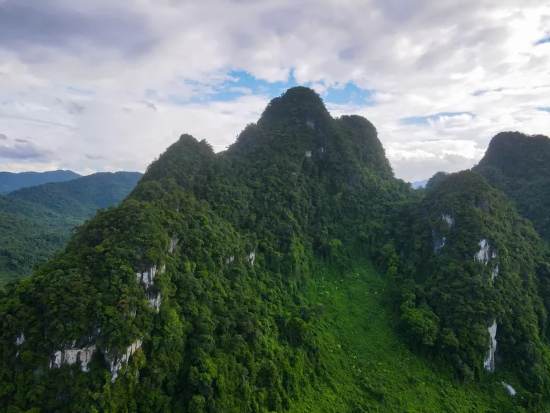
Mount Fansipan is often referred to as the "Roof of Indochina," a title that reflects its status as the highest point in Vietnam, Laos, and Cambodia. The mountain is part of the Hoang Lien Son National Park, a protected area of approximately 30,000 hectares that serves as one of Vietnam's most important ecological hotspots. The trek is a masterclass in altitudinal zonation. Starting at the Tram Ton Pass (2,100 m), the trail initially winds through lush, humid sub-tropical forests where giant ferns and moss-covered hardwoods dominate the canopy. As elevation increases, the landscape transforms into a temperate zone characterised by ancient rhododendrons—some over 200 years old—which erupt in vibrant shades of red, pink, and white during the spring months. Above 2,500 metres, the forest thins into dense "dwarf bamboo" forests, where the wind begins to howl and the air thins, providing the first real taste of high-alpine conditions.
The terrain is notoriously demanding. Unlike many Western alpine trails that utilise gentle switchbacks, the path up Fansipan is direct and visceral. It involves navigating tangled root systems, scrambling over slick rock faces, and ascending steep, metal ladders installed in the most vertical sections. The weather is a defining character of the experience. The mountain creates its own microclimate; it is common to start a trek in the sweltering heat of the valley, climb through a layer of thick, "pea-soup" fog, and emerge above the clouds into a world of brilliant sunshine and endless blue horizons. This "sea of clouds" (bien may) is the holy grail for Vietnamese trekkers, where the lower peaks of the Hoang Lien Son range appear as islands in a white, frothing ocean.
While the summit has been developed with a large complex of Buddhist temples, statues, and a funicular station, the trek itself remains a wilderness experience. The contrast between the quiet, arduous climb and the sudden architectural grandeur of the summit is jarring but spectacular. Standing at the 3,143-metre marker, looking out over the border towards China and down into the Muong Hoa Valley, provides a sense of scale that is unmatched in Southeast Asia. This is a journey that tests physical limits and rewards the spirit with some of the most dramatic mountain scenery in the region.
History and Cultural Context
The history of Mount Fansipan is deeply intertwined with the local ethnic minority groups, primarily the Hmong, Dao, and Tay people, who have lived in the shadow of the Hoang Lien Son range for centuries. To the local Hmong, the mountain is known as "Hua Xi Pan," which translates to "the giant tottering rock." For generations, the mountain was a place of myth and mystery, believed to be the dwelling place of powerful spirits. Local hunters and herbalists were the only ones to venture into its higher reaches, searching for rare medicinal plants and cardamom, which still grows wild in the damp, shaded gullies of the lower slopes.
European interest in the mountain began during the French colonial era. In 1905, French surveyors officially measured the peak and named it Fansipan, though the origin of the name remains a subject of debate—some believe it is a corruption of the Hmong name, while others suggest it relates to a local geographical term. During the early 20th century, Sapa (then Chapa) was established as a hill station for French officials seeking to escape the heat of the plains. The French built several paths and small shelters on the mountain, though many of these were reclaimed by the jungle during the subsequent decades of conflict. It wasn't until the late 1990s and early 2000s, as Vietnam opened up to international tourism, that the mountain became a popular destination for adventure seekers.
In 2016, the landscape of Fansipan changed forever with the completion of the Fansipan Legend cable car system. This Guinness World Record-holding feat of engineering made the summit accessible to thousands of people daily. However, for the local communities, the mountain remains a source of pride and livelihood. Many of the guides and porters who lead treks today are Hmong men from nearby villages like Cat Cat and Sin Chai. Their knowledge of the terrain, weather patterns, and local flora is an essential part of the trekking experience, providing a cultural bridge between the modern hiker and the ancient traditions of the Hoang Lien Son.
Want more background? Read extended notes on history and cultural context → Learn more
Seasonal Highlights and Weather Reality
The weather on Mount Fansipan is notoriously unpredictable and can change from brilliant sunshine to a torrential downpour in a matter of minutes. The trekking season is generally defined by the dry season, which runs from October to April. During this window, the humidity is lower, and the chances of clear views from the summit are significantly higher.
Autumn (October to November): This is arguably the best time to climb. The summer rains have subsided, leaving the landscape lush and green, but the air is crisp and clear. This season offers the highest probability of witnessing the "sea of clouds" phenomenon. Temperatures at the summit can drop to near freezing at night, so warm layers are essential.
Winter (December to February): The coldest months on the mountain. Temperatures at the 2,800-metre base camp frequently drop below zero, and frost is common. In rare instances, snow falls on the summit, transforming the tropical landscape into a surreal winter wonderland. While the skies are often clear, the wind chill can be extreme, requiring high-quality thermal gear.
Spring (March to April): This is the season of the rhododendrons. The mountain slopes are painted with bursts of colour as the ancient trees bloom. However, this period also sees the arrival of the "crachin"—a fine, persistent drizzle that can make the trail extremely slippery and obscure views for days at a time.
Summer (May to September): The monsoon season. Trekking during this time is generally discouraged. Heavy rains make the steep trails dangerous and prone to landslides. Leeches are highly active in the lower forests, and the summit is frequently shrouded in thick cloud and thunderstorms. If you choose to climb in summer, be prepared for wet gear and limited visibility.
Recommended Itinerary
2-Day Fansipan Summit Itinerary (Tram Ton Route)
Day 1: Sapa to Base Camp (2,800 m)
- Distance: 7.5 km
- Elevation gain: 700 m
- Time: 5–6 hours
- Morning transfer from Sapa town to Tram Ton Pass (2,100 m), the highest road pass in Vietnam.
- Begin the trek through temperate forest, following a relatively gentle gradient for the first two kilometres.
- Cross several small streams and navigate the first sections of exposed tree roots.
- Stop for a picnic lunch at the 2,200-metre camp, a small clearing used by porters.
- The afternoon involves a steeper ascent as the trail enters the bamboo forest zone.
- Arrive at the 2,800-metre base camp in the late afternoon.
- Settle into the basic mountain hut, enjoy a hot meal prepared by the guides, and witness the sunset over the Lai Chau valley.
- Early sleep is essential as the summit push begins before dawn.
Day 2: Base Camp to Summit and Descent
- Distance: 11.7 km (total for the day)
- Elevation: 343 m gain to summit, 1,043 m descent to trailhead
- Time: 7–9 hours
- Pre-dawn start (usually 4:00 AM) to reach the summit for sunrise.
- The trail from base camp to the summit is the most technical, involving steep rock scrambles and metal ladders.
- Reach the summit of Mount Fansipan (3,143 m) as the first light hits the Hoang Lien Son range.
- Explore the summit complex, including the Great Buddha Statue and the various pagodas.
- After enjoying the views, begin the long descent back to the 2,800-metre camp for breakfast.
- Continue the descent all the way back to Tram Ton Pass. The downhill journey is taxing on the knees and requires careful foot placement on slippery sections.
- Transfer back to Sapa for a well-earned hot shower and celebratory dinner.
- Note: Many trekkers choose to take the cable car down from the summit to save their knees, though this must be organised in advance or paid for at the station.
Important Notes:
- The itinerary is subject to change based on weather conditions and group fitness.
- A 3-day itinerary is recommended for those who want a more relaxed pace, staying one night at the 2,200 m camp and one night at the 2,800 m camp.
- Water is available at the camps but must be treated or boiled.
- The descent is often considered harder than the ascent due to the impact on joints.
Planning and Bookings
Book Your Trip
Everything you need to plan your journey
Accommodation
Find places to stay near Sapa
Flights
Search flights to Sapa
Essential Preparation
Climbing Mount Fansipan requires more than just physical fitness; it requires careful logistical coordination. Since 2017, the Hoang Lien Son National Park authorities have mandated that all trekkers must be accompanied by a licensed guide. This is for safety reasons, as the trail is poorly marked in sections and the weather can turn dangerous quickly. Most trekkers book a package through an agency in Sapa or Hanoi, which includes the guide, permits, transport, and meals.
Physical preparation should focus on cardiovascular endurance and leg strength. The trail involves thousands of "natural steps" (roots and rocks), so training on stairs or steep hills is highly recommended. Sapa serves as the base for all Fansipan expeditions. It is a vibrant town with a wide range of accommodation, from luxury hotels to ethnic homestays. It is advisable to arrive in Sapa at least one day before your trek to acclimatise to the 1,600-metre altitude of the town and to meet your guide for a final gear check.
Trail Accommodation
Accommodation on the mountain is extremely basic and should be viewed as a shelter rather than a lodge. There are two main overnight locations: the 2,200-metre camp and the 2,800-metre base camp.
Hut Facilities:
- Sleeping arrangements: Large, communal wooden platforms. You will sleep side-by-side with other trekkers.
- Bedding: Thin sleeping mats and heavy sleeping bags are usually provided by the trekking company.
- Toilets: Very basic squat toilets located in a separate outhouse. There are no flushing facilities.
- Kitchen: A small sheltered area where guides cook over gas rings or wood fires.
- Water: Piped mountain water is available for washing, but it is not potable without treatment.
- Electricity: There is generally no electricity or charging facilities at the camps. Some huts may have a small solar light for the evening.
What Huts Don't Provide:
- Private rooms or partitions.
- Showers or hot water for washing.
- Towels or toiletries.
- Heating (the huts can be extremely cold at night).
- WiFi or mobile signal (signal is intermittent and weak).
Required Gear
- Trekking boots: Must have deep tread and good ankle support. The trail is often muddy and slippery.
- Waterproof jacket: A high-quality hardshell (Gore-Tex or similar) is non-negotiable. Even in the dry season, mist and drizzle are common.
- Down jacket: Essential for the evenings at base camp and the sunrise summit push, where temperatures can be sub-zero.
- Trekking poles: Highly recommended to reduce the impact on knees during the steep descent.
- Head torch: Essential for the pre-dawn summit climb and navigating the hut at night. Bring spare batteries.
- Backpack: A 30-40L pack is sufficient if your porter is carrying your sleeping bag and food. Ensure it has a waterproof cover.
- Thermal base layers: Merino wool or synthetic layers to wick sweat and provide warmth at night.
What to Bring
- Water treatment: Purification tablets or a filter (e.g., Sawyer Squeeze) to treat mountain water.
- Personal first aid: Blister pads (Compeed), ibuprofen, rehydration salts, and any personal medications.
- High-energy snacks: Trail mix, energy bars, and chocolate. While meals are provided, you will need extra calories during the climb.
- Toiletries: Biodegradable wet wipes (your "mountain shower"), toothbrush, and small tube of toothpaste.
- Sun protection: High-SPF sunscreen, lip balm with SPF, and sunglasses. The UV radiation is intense at 3,000 metres.
- Dry bags: To keep your clothes and electronics dry inside your backpack.
- Power bank: To keep your phone or camera charged for summit photos.
- Small change: Vietnamese Dong (VND) for buying a celebratory drink or snack at the summit station.
Permits
Access to Mount Fansipan is strictly regulated by the Hoang Lien Son National Park authorities. You cannot simply show up at the trailhead and begin walking. The permit system is designed to manage the number of trekkers on the mountain and ensure that everyone is accounted for by a licensed professional.
Permit Requirements:
- National Park Entrance Fee: This is a daily fee that contributes to the maintenance of the trails and the protection of the forest.
- Trekking Permit: A specific document issued by the park office in Sapa. This requires your passport details.
- Licensed Guide: Your permit is only valid if you are accompanied by a guide registered with the Lao Cai Tourism Department.
- Overnight Permit: If you are staying at the 2,800 m or 2,200 m camps, a separate overnight authorisation is required.
How to Obtain Permits:
The most efficient way to handle permits is to book through a reputable trekking agency in Sapa. They will collect your passport information and handle all the paperwork at the National Park office. If you are an independent traveller, you can attempt to visit the National Park headquarters in Sapa town yourself, but you will still be required to hire a guide through them. It is recommended to arrange this at least 48 hours in advance, especially during the peak months of October and November.
Costs:
The cost of permits is usually bundled into the price of a guided trek. A standard 2-day, 1-night guided trek typically costs between US$100 and US$180 per person, depending on the group size and the level of service (e.g., whether porters are included). This price generally covers all permits, transport to the trailhead, five meals, and basic accommodation.
Other Activities in the Area
Sapa and the surrounding Hoang Lien Son range offer a wealth of experiences beyond the Fansipan climb. Consider adding these to your itinerary:
- Muong Hoa Valley Trekking: A more cultural experience, walking through the iconic rice terraces and visiting the villages of the Black Hmong and Red Dao people. This is much less physically demanding than Fansipan.
- Cat Cat Village: A short walk from Sapa town, this village offers a glimpse into Hmong traditional crafts, though it is quite commercialised. The nearby waterfall is worth a visit.
- Silver Waterfall (Thac Bac): Located near the Tram Ton Pass, this 200-metre-high waterfall is easily accessible from the road and is particularly impressive after rain.
- Love Waterfall (Thac Tinh Yeu): A beautiful 1.5-kilometre walk through the forest leads to this secluded waterfall, which is steeped in local legend.
- Sapa Market: Visit on a Sunday to see ethnic minority groups from across the region gather to trade goods, livestock, and traditional textiles.
- O Quy Ho Pass: One of the four great mountain passes of Northwest Vietnam. Rent a motorbike or hire a driver to experience the hairpin turns and incredible views into the Lai Chau valley.
Safety and Conditions
Pre-Departure Checks:
- Check the local weather forecast specifically for Sapa and the Hoang Lien Son range. Note that town weather is often much milder than mountain weather.
- Ensure your trekking agency has registered your climb with the park authorities.
- Inform your hotel in Sapa of your expected return time.
- Check your gear: Ensure your head torch is working and your waterproofs are still effective.
Altitude Sickness: While 3,143 metres is not high enough to cause severe High Altitude Cerebral Oedema (HACE) for most people, many trekkers still experience mild symptoms of Acute Mountain Sickness (AMS). Symptoms include headache, nausea, and dizziness. The best prevention is to stay hydrated, avoid alcohol, and maintain a steady, slow pace. If symptoms become severe, the only cure is to descend immediately.
Terrain Hazards: The trail is notoriously steep and can be very slippery. The "staircase" sections made of tree roots are particularly treacherous when wet. Always maintain three points of contact on steep scrambles. The metal ladders installed on the final summit push are sturdy but can be intimidating for those with a fear of heights. Take your time and ensure your footing is secure before moving.
Hypothermia: This is a genuine risk on Fansipan, even in the tropics. The combination of sweat-soaked clothes, high winds, and dropping temperatures can lead to rapid cooling of the body core. Always change into dry clothes as soon as you reach the camp and keep your waterproof shell accessible at all times.
Emergency Evacuation: There is no helicopter rescue service in the Hoang Lien Son National Park. In the event of a serious injury, you will have to be carried down the mountain by porters to the nearest road access. Ensure your travel insurance specifically covers trekking up to 3,200 metres.
Side Trips and Points of Interest
The Great Buddha Statue: Located at 3,000 metres, this is the highest bronze Buddha statue in Vietnam. Standing 21 metres tall, it is a masterpiece of Vietnamese Buddhist architecture. The statue is composed of thousands of small bronze plates and sits atop a complex of carved stone reliefs. In the morning mist, it appears to float above the clouds.
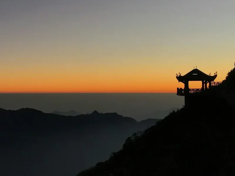
Bich Van Thien Tu Pagoda: This beautiful temple complex near the summit is built in the architectural style of the Tran Dynasty. It features intricate wood carvings, stone courtyards, and sweeping tiled roofs. It is a peaceful place to reflect on your journey before the final push to the peak.
The 9-Storey Waterfall: A hidden gem on the Tram Ton route, this series of small cascades over dark rock is a perfect spot for a rest. The sound of the water provides a soothing backdrop to the dense forest environment.
The Summit Marker: The iconic stainless steel pyramid marking 3,143 m is the ultimate photo opportunity. There are actually several markers on the summit plateau, including the original stone marker and the newer, more modern versions. On a clear day, you can see the mountains of Yunnan, China, to the north.
Leave No Trace
The Hoang Lien Son National Park is a fragile ecosystem under significant pressure from tourism. As a trekker, it is your responsibility to minimise your impact on this unique environment. The park is home to many endangered species, including the Black Crested Gibbon and various rare orchids, which rely on an undisturbed habitat.
Your responsibility as a walker:
- Pack out all trash: This includes organic waste like banana peels and eggshells, which decompose slowly at high altitudes and can disrupt local wildlife diets.
- Stay on the trail: The "dwarf bamboo" and alpine mosses are easily damaged by trampling. Creating new paths leads to soil erosion, especially during the monsoon.
- Respect the water: Do not use soap or detergents in the mountain streams. Even biodegradable soap can harm aquatic life in small alpine pools.
- No fires: Use only the designated cooking areas in the huts. Wildfires are a significant threat to the dry bamboo forests in winter.
- Respect local culture: Ask permission before taking photos of your guides or porters. Be mindful that the mountain is a sacred site for many local people.
- Do not pick plants: It is illegal to remove any flora from the National Park, including the famous rhododendron blooms.
By following these principles, you help ensure that the "Roof of Indochina" remains a pristine wilderness for the next generation of adventurers.