
Mount Elbert Summit Trail
Mount Elbert, the highest peak in the Rocky Mountains and the state of Colorado, stands as a majestic sentinel at 4,399 metres (4,399 m). This challenging day hike offers an unparalleled opportunity to stand on the roof of the Rockies, surrounded by a breathtaking panorama of alpine wilderness. The trail is a testament to the raw beauty and formidable scale of the Colorado Front Range, a journey that tests endurance and rewards with views that stretch to the horizon. While the ascent is demanding, the well-maintained paths and the sheer grandeur of the landscape make it a sought-after objective for experienced hikers and mountaineers seeking a true high-altitude adventure.
- Distance: 14.5 km (round trip)
- Elevation Gain: 1,430 m
- Duration: 5–8 hours
- Difficulty: Challenging
- Season: July to September (summer months), dry conditions
- Closest City: Leadville
- Trailhead Access: Nearest airport: Denver International (DIA). Drive ~2.5 hours to Leadville, then south on US-24. Turn onto CO-300/Halfmoon Creek Rd (unpaved). High clearance vehicle recommended. Parking is limited; arrive early. No permits needed for day hiking. Trailhead GPS: 39.1178, -106.4453
Overview
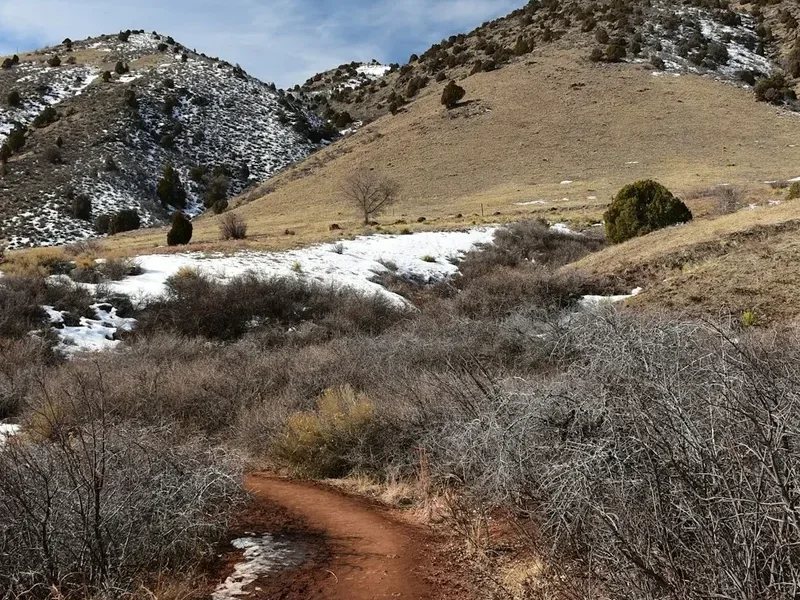
The Mount Elbert Summit Trail is a classic Colorado fourteener experience, offering a direct and rewarding ascent to the highest point in the Rocky Mountains. This is not a technical climb, but rather a strenuous hike that demands significant physical fitness and acclimatisation to altitude. The trail begins in the subalpine forest, gradually transitioning through alpine meadows dotted with wildflowers in summer, before emerging onto the barren, windswept slopes of the upper mountain. The path is generally well-defined, though rocky and steep in sections, particularly as you approach the summit ridge.
The journey is a study in changing ecosystems. Initially, you'll walk through dense stands of Engelmann spruce and subalpine fir, the air cool and shaded. As you gain elevation, the trees become more stunted and gnarled, eventually giving way to the treeline, a dramatic boundary where life clings precariously to existence. Above the treeline, the landscape transforms into a vast expanse of tundra, characterised by low-lying vegetation, scree fields, and exposed rock. The final push to the summit involves navigating a series of switchbacks and a broad, rocky ridge, with the summit plateau offering expansive 360-degree views.
The summit itself is a broad, relatively flat area marked by a cairn and a summit register. From this vantage point, you can see numerous other fourteeners, including Mount Massive to the north, La Plata Peak to the south, and the Collegiate Peaks further south. The sheer scale of the Rocky Mountains unfolds before you, a sea of peaks stretching as far as the eye can see. The descent, while often faster, requires careful footing due to loose rock and the potential for fatigue.
This hike is best undertaken during the summer months when snow has melted from the higher elevations and the weather is generally more stable. However, mountain weather is notoriously unpredictable, and afternoon thunderstorms are a common occurrence. Starting early is crucial to avoid both crowds and the risk of lightning strikes.
History and Cultural Context
The Mount Elbert massif, like much of the Colorado Rockies, has a rich history intertwined with indigenous peoples, early explorers, and the relentless pursuit of mineral wealth. For millennia, the Ute people, the original inhabitants of this region, traversed these mountains, utilising the abundant resources for hunting and sustenance. The towering peaks likely held spiritual significance, serving as natural landmarks and places of reverence.
European exploration of the area began in earnest in the mid-19th century, driven by the discovery of gold and silver. The nearby town of Leadville, established in 1877, quickly became one of the wealthiest cities in the United States, a boomtown fuelled by the rich ore veins found in the surrounding mountains. Prospectors and miners ventured into the high country, charting routes and establishing claims, often naming geographical features after themselves or their discoveries.
Mount Elbert itself was named in honour of Chief Elbert, a prominent leader of the Ute tribe. The naming reflects a period when early surveyors and geologists were documenting the vast western territories, often incorporating indigenous names into their maps. The peak's designation as the highest point in Colorado and the Rockies solidified its status as a significant landmark.
In the late 19th and early 20th centuries, as the mining boom subsided, the focus shifted towards recreation and conservation. The establishment of national forests and parks, including the San Isabel National Forest which encompasses Mount Elbert, aimed to preserve the natural beauty and ecological integrity of these wild spaces. Hiking and mountaineering gradually gained popularity, transforming the mountains from a source of mineral wealth into a destination for adventure and natural appreciation. Today, Mount Elbert is a popular destination for hikers and climbers, a symbol of Colorado's majestic alpine landscape and a testament to its enduring natural heritage.
Seasonal Highlights and Weather Reality
The optimal season for hiking Mount Elbert is during the summer months, typically from July through September. During this period, the snow has largely melted from the trails, making them accessible and safer for hiking. The alpine meadows burst into bloom with a vibrant array of wildflowers, adding a splash of colour to the rugged landscape.
Summer (July–September): This is the prime hiking season. Days are generally longer, and temperatures at the trailhead are pleasant. However, it is crucial to be aware of the significant risk of afternoon thunderstorms. These storms can develop rapidly, bringing lightning, heavy rain, hail, and strong winds. Starting your hike very early in the morning (e.g., by 6:00 AM) is essential to be off the summit and descending before the typical afternoon storm cycle begins.
Late Spring (June): While some early hikers may attempt Elbert in June, snow can linger at higher elevations, particularly on north-facing slopes and in shaded gullies. Trails may be difficult to follow, and avalanche risk, though diminishing, can still be a concern in certain areas. It is advisable to check recent trail conditions and snow reports before attempting a hike in June.
Autumn (October): The autumn months can offer crisp, clear days with fewer crowds and beautiful fall colours in the lower elevations. However, the weather becomes increasingly unpredictable. Snowfall can occur at any time, and temperatures will drop significantly, especially at higher altitudes. The window for safe hiking narrows considerably in October.
Winter (November–May): Mount Elbert is a serious winter mountaineering objective during these months. The trails are completely snow-covered, and avalanche danger is high. Ascending Elbert in winter requires advanced mountaineering skills, including ice axe and crampon proficiency, avalanche awareness, and navigation expertise. It is not recommended for casual hikers.
Weather Considerations: Regardless of the season, always be prepared for rapidly changing weather conditions. Temperatures can fluctuate dramatically with elevation and time of day. Hypothermia is a risk even in summer if you get wet and cold. Always carry appropriate layers, including waterproof and windproof outer shells.
Recommended Itinerary
Mount Elbert Summit Day Hike Itinerary
Early Morning (5:00 AM - 6:00 AM): Trailhead Arrival and Start
- Arrive at the Mount Elbert Trailhead (Halfmoon Creek Road)
- Ensure vehicle is suitable for unpaved, potentially rough road conditions (high clearance recommended)
- Final gear check: water, snacks, layers, rain gear, navigation tools
- Begin ascent on the well-marked trail
- Initial section passes through dense subalpine forest
Morning (6:00 AM - 9:00 AM): Forest and Treeline Ascent
- Continue climbing through Engelmann spruce and subalpine fir
- The trail gradually gains elevation with moderate switchbacks
- Pass the treeline (approximately 3,500 metres)
- The landscape opens up to alpine tundra and rocky terrain
- Views begin to open up, offering glimpses of surrounding peaks
Midday (9:00 AM - 12:00 PM): Summit Push
- Navigate the steeper, rockier sections of the upper mountain
- The trail becomes more exposed, with potential for strong winds
- Follow the main trail towards the summit ridge
- Reach the summit plateau
- Spend time enjoying the panoramic views and taking photographs
- Sign the summit register
Afternoon (12:00 PM - 3:00 PM): Descent and Return
- Begin the descent, taking care on loose scree and rocky sections
- Maintain focus on footing to prevent slips and falls
- Continue descending through the alpine tundra and back into the treeline
- Return to the trailhead
Important Notes:
- Start as early as possible to avoid afternoon thunderstorms and crowds.
- Acclimatise to altitude if possible by spending a day or two in Leadville (elevation ~3,000 m) before hiking.
- Carry at least 2-3 litres of water per person.
- Pack high-energy snacks and a lunch.
- Be prepared for all types of weather, including sun, wind, rain, and potentially hail or snow.
- Know your limits and turn back if weather conditions deteriorate or you experience symptoms of altitude sickness.
Planning and Bookings
Book Your Trip
Everything you need to plan your journey
Accommodation
Find places to stay near Leadville
Flights
Search flights to Leadville
Essential Preparation
Mount Elbert is a challenging day hike that requires careful planning and preparation. The primary considerations are altitude, weather, and physical fitness. Given its status as the highest peak in Colorado, acclimatisation is paramount. Spending at least one to two nights in Leadville (elevation approximately 3,000 metres) or a similar high-altitude location before attempting the summit is highly recommended. This allows your body to adjust to the lower oxygen levels, significantly reducing the risk of altitude sickness.
The trailhead is accessed via Halfmoon Creek Road, which is an unpaved, gravel road. While passable for most vehicles in good weather, it can be rough and rocky, especially in sections. A high-clearance vehicle is strongly recommended, and a 4WD vehicle may be beneficial in wet conditions or if the road is particularly rutted. Parking at the trailhead is limited, so arriving early, especially on weekends and during peak season, is essential. There are no facilities at the trailhead, so ensure you have all necessary supplies before departing.
Trail Accommodation
This is a day hike requiring no overnight accommodation.
Required Gear
- Sturdy Hiking Boots: Waterproof, broken-in hiking boots with good ankle support are essential for navigating the rocky and uneven terrain.
- Backpack: A comfortable daypack (20-35 litres) to carry essentials.
- Navigation: A map of the Mount Elbert trails, a compass, and a GPS device or smartphone with offline maps downloaded. Mobile phone service is unreliable at best.
- Headlamp or Flashlight: With extra batteries, in case of an early start or delayed descent.
- Sun Protection: High SPF sunscreen, sunglasses, and a wide-brimmed hat are crucial due to the intense sun at high altitudes.
- First-Aid Kit: Comprehensive kit including blister treatment, pain relievers, bandages, antiseptic wipes, and any personal medications.
- Waterproof and Windproof Outerwear: A high-quality rain jacket and rain pants are non-negotiable. Weather can change rapidly, and hypothermia is a risk.
- Warm Layers: Include a fleece jacket or insulated vest, and a warm hat and gloves, even in summer. Temperatures at the summit can be near freezing.
- Trekking Poles: Highly recommended for stability and reducing strain on knees during the ascent and descent.
What to Bring
- Water: Carry at least 2-3 litres of water per person. Hydration is critical at altitude. Consider a hydration reservoir or multiple water bottles.
- Food: High-energy snacks such as trail mix, energy bars, nuts, dried fruit, and jerky. Pack a substantial lunch.
- Water Treatment: While the trail has water sources, it is always advisable to carry a water filter or purification tablets as a backup.
- Toiletries: Biodegradable toilet paper, hand sanitiser, and a small trowel for digging catholes if away from designated areas (though the trail is well-used).
- Emergency Shelter: A lightweight emergency bivy sack or space blanket.
- Insect Repellent: While less of an issue at higher altitudes, it can be useful at the trailhead.
- Camera: To capture the spectacular views.
- Identification and Emergency Contact Information: Keep this readily accessible.
Permits
For day hiking on Mount Elbert, no specific permits are required. The trails are located within the San Isabel National Forest, and general access is permitted. However, it is always advisable to check for any temporary closures or restrictions that may be in place due to fire danger, trail maintenance, or other unforeseen circumstances.
While no permits are needed for day use, it is important to be aware of regulations regarding camping. Overnight camping is generally restricted to designated areas or dispersed camping sites that meet specific criteria, and often requires a permit. Since Mount Elbert is primarily a day hike destination, most visitors do not encounter these regulations. However, if you plan to backpack in the surrounding wilderness areas, researching and obtaining the necessary permits well in advance is crucial.
Key Points Regarding Permits:
- Day Hiking: No permit required.
- Overnight Camping: May require permits depending on location and regulations within the San Isabel National Forest. Research specific camping regulations if planning an overnight stay.
- Group Size Limits: Be aware of any group size limitations that may apply, especially for larger parties.
- Fire Restrictions: Always check for current fire restrictions before your trip, as campfires may be prohibited during dry periods.
It is recommended to visit the official website for the San Isabel National Forest or contact their local ranger district for the most up-to-date information on regulations and any potential permit requirements.
Other Activities in the Area
The region surrounding Mount Elbert offers a wealth of outdoor activities for those looking to extend their stay or explore beyond the summit hike:
- Mount Massive Trail: Located to the north of Mount Elbert, Mount Massive is another prominent fourteener offering a challenging hike with stunning views. The trail is generally considered slightly less steep than Elbert's but still requires significant effort.
- La Plata Peak Trail: To the south, La Plata Peak is another popular fourteener, known for its rugged beauty and challenging ascent.
- Collegiate Peaks Wilderness: This vast wilderness area offers numerous opportunities for backpacking, backcountry camping, and exploring a network of trails that connect many of the region's fourteeners and other high peaks.
- Leadville Historic District: Explore the rich mining history of Leadville by visiting its museums, historic buildings, and the National Mining Hall of Fame and Museum.
- Turquoise Lake: A beautiful reservoir located near Leadville, offering opportunities for fishing, boating, kayaking, and scenic drives. Several campgrounds are available around the lake.
- Twin Lakes: These picturesque natural lakes are a popular spot for recreation, including hiking, fishing, and photography. The historic town of Twin Lakes is also worth a visit.
- Colorado Trail: Sections of the famous Colorado Trail pass through this region, offering opportunities for day hikes or longer backpacking trips.
- Scenic Drives: The drive along US-24 through the Arkansas River Valley offers spectacular mountain scenery.
Safety and Conditions
Altitude Sickness: This is the most significant risk for hikers on Mount Elbert. Symptoms can include headache, nausea, dizziness, fatigue, and shortness of breath. If symptoms appear, descend immediately. Acclimatisation is key: spend time at altitude before hiking, stay well-hydrated, and avoid alcohol and strenuous activity on your first day at elevation.
Weather: Mountain weather is unpredictable. Afternoon thunderstorms are common and dangerous. Always start early, monitor the forecast, and be prepared to turn back if conditions deteriorate. Lightning strikes are a serious threat on exposed ridges and summits.
Trail Conditions: The trail is generally well-maintained but can be steep, rocky, and loose, especially on the upper slopes. Wear sturdy footwear and use trekking poles for stability. Snow can linger into July on shaded sections, and ice can form on rocks, making them slippery.
Navigation: While the main trail to the summit is usually clear, it is essential to carry a map and compass and know how to use them. Visibility can drop rapidly in fog or storms, making navigation difficult.
Wildlife: Be aware of your surroundings. While large predators like bears are rare at these altitudes, you may encounter marmots, pikas, and various bird species. Do not feed any wildlife.
Emergency Preparedness: Inform someone of your hiking plans, including your expected return time. Carry a fully charged mobile phone (though service is unreliable) and consider a personal locator beacon (PLB) or satellite messenger for remote areas.
Physical Fitness: Mount Elbert is a strenuous hike. Ensure you are in good physical condition and have experience with long, steep ascents before attempting it. Pace yourself, take breaks, and listen to your body.
Side Trips and Points of Interest
Mount Elbert Summit Cairn and Register: The ultimate point of interest, the summit is marked by a substantial cairn of rocks. Inside, you'll find a summit register where hikers can sign their names, leave messages, and record their ascent. It's a tradition to add your own entry and read those left by others, a shared experience of accomplishment.
Alpine Tundra Ecosystem: As you ascend above the treeline, you enter a fragile alpine tundra environment. This unique ecosystem is characterised by low-growing, hardy plants adapted to harsh conditions, including cushion plants, wildflowers, and lichens. Observing these resilient forms of life is a point of interest in itself.
Panoramic Views: The primary "side trip" is simply taking the time to absorb the incredible 360-degree views from the summit. On a clear day, you can see dozens of other mountain peaks, including Mount Massive, La Plata Peak, and the entire Collegiate Peaks range. The vastness of the Rocky Mountains unfolds before you, offering a profound sense of scale and perspective.
Geological Features: The exposed rock faces and scree slopes offer a glimpse into the geological history of the Rockies. Look for different rock types and formations that tell the story of the mountain's volcanic and glacial past.
The "False Summit": Hikers often encounter what appears to be the summit from a distance, only to realise it is a false summit. This can be a psychological challenge, but pushing on to the true summit is part of the Elbert experience.
Leave No Trace
The Mount Elbert Summit Trail traverses a sensitive alpine environment. Adhering to Leave No Trace principles is crucial to preserving its natural beauty and ecological integrity for future generations. As a high-traffic fourteener, the impact of visitors can be significant if not managed responsibly.
Plan Ahead and Prepare: Research trail conditions, weather forecasts, and any regulations before your trip. Know your capabilities and choose a hike that matches your fitness level. Acclimatise to altitude.
Travel and Camp on Durable Surfaces: Stay on the marked trail at all times. The alpine tundra is fragile and can take decades to recover from off-trail travel. Avoid walking on vegetation, and stick to rocky or well-trodden paths.
Dispose of Waste Properly: Pack out everything you pack in, including all food scraps, wrappers, and any other litter. Use designated toilets where available, or dig catholes at least 60 metres (60 m) from water sources, trails, and campsites. Pack out all toilet paper.
Leave What You Find: Do not remove rocks, plants, or any other natural objects. Take only photographs and memories.
Minimise Campfire Impacts: Campfires are generally not permitted on the Mount Elbert trail due to the high-altitude, fragile environment and fire risk. If camping in designated areas where fires are allowed, use established fire rings and keep fires small.
Respect Wildlife: Observe wildlife from a distance. Never feed animals, as it can harm their health, alter their natural behaviours, and expose them to danger. Store food securely.
Be Considerate of Other Visitors: Yield to uphill hikers. Keep noise levels down and avoid loud music. Respect the solitude and experience of others.