Mount Bandai Ascent
The Mount Bandai Ascent is a rewarding day hike located in the Fukushima Prefecture of Japan, offering stunning panoramic views of the surrounding volcanic landscape and lakes. Known for its accessibility and diverse scenery, the trail winds through forests, past volcanic craters, and culminates at the summit of Mount Bandai, often referred to as the "Wand-waving Mountain" due to its distinctive shape. This hike is suitable for those with moderate fitness and provides a memorable experience of Japan's natural beauty.
- Distance: 12.0 km one-way
- Elevation gain: 850 m
- Duration: 5-7 hours
- Difficulty: Moderate
- Best Time: May to October
- Closest City: Koriyama
- Trailhead Access: Nearest city: Koriyama. From Koriyama Station, take the Bandai Toto bus to Bandaisan eighth station (approx. 1 hour). Check bus schedules. Car: Drive to the trailhead parking lot via Route 115. Parking available. No permits required, but consider registering at the visitor centre.
- Coordinates: 37.5833, 140.0750
Overview
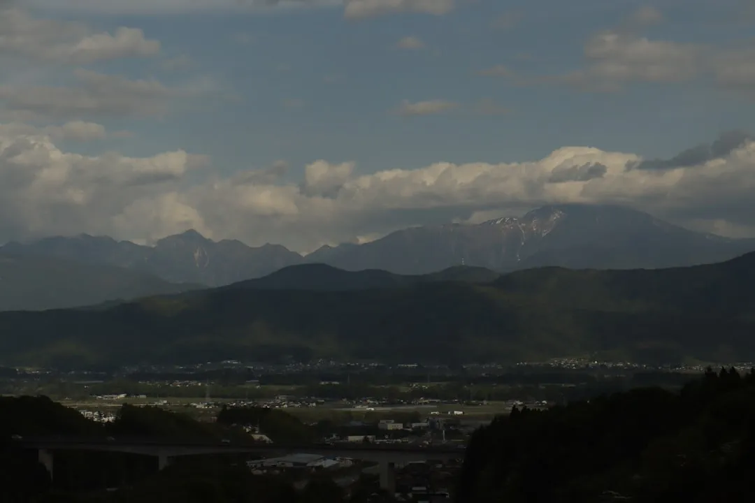
Mount Bandai (1,816 m) is an active stratovolcano that dominates the skyline of the Bandai-Asahi National Park. Its most dramatic geological event occurred in 1888 with the Bandai eruption, which reshaped the mountain and created numerous lakes and craters, including the picturesque Goshikinuma (Five-Coloured Lakes) area. The ascent trail typically starts from the eighth station (Hachigōme) and offers a varied hiking experience.
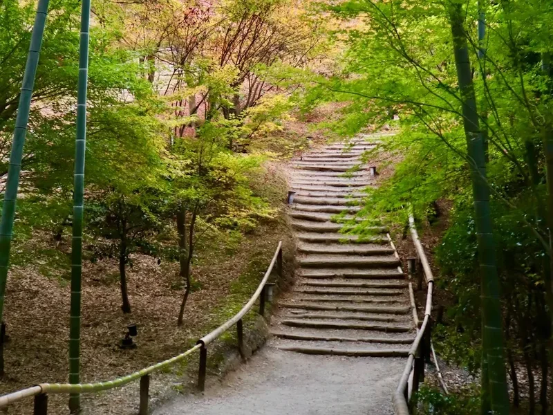
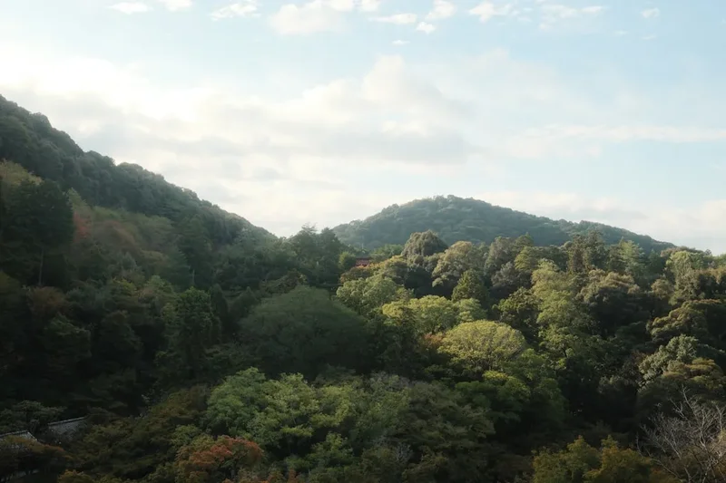
The initial part of the trail is often through dense, verdant forests, providing shade and a sense of immersion in nature. As you gain altitude, the vegetation gradually changes, and you begin to encounter more open, rocky terrain characteristic of volcanic slopes. The path is generally well-maintained but can be steep in sections, requiring a reasonable level of fitness. The summit area offers a dramatic volcanic landscape, with views extending across the Bandai Plateau, Lake Inawashiro, and on clear days, even Mount Fuji in the distance.
The hike is popular during the warmer months, from May to October, when the weather is generally favourable for trekking. Spring can bring lingering snow at higher elevations, while autumn offers spectacular foliage colours. The trail is a popular day hike, allowing visitors to experience the grandeur of a Japanese volcano without the need for overnight accommodation.
History and Cultural Context
Mount Bandai has a long and significant history, deeply intertwined with the local culture and spirituality of the Fukushima region. For centuries, it has been revered as a sacred mountain, a place of pilgrimage and natural wonder. The mountain's distinctive shape, often described as resembling a person waving their hand, has inspired numerous legends and folklore.
The most significant event in Mount Bandai's recent history was the catastrophic eruption on July 15, 1888. This massive eruption, known as the Bandai-san eruption, was one of the most destructive volcanic events in Japan's recorded history. It caused widespread devastation, altering the landscape dramatically. The eruption triggered massive landslides, blocked rivers, and formed over 300 new lakes and ponds, most notably the Goshikinuma lakes. The eruption also claimed the lives of over 400 people and destroyed numerous villages.
Following the eruption, the area was designated as part of the Bandai-Asahi National Park, established in 1950. This designation aimed to protect the unique geological features, diverse ecosystems, and cultural heritage of the region. The trails around Mount Bandai have since been developed to allow visitors to safely explore the volcanic landscape and appreciate its natural beauty, while also learning about its powerful history. The visitor centres and information boards scattered throughout the area provide insights into the geology, ecology, and the human impact of the 1888 eruption.
Seasonal Highlights and Weather Reality
Mount Bandai offers a different experience throughout its hiking season, which typically runs from May to October. Each period presents unique visual spectacles and weather considerations.
Spring (May to early June): This is a time of renewal. Forests begin to turn vibrant green, and wildflowers start to bloom along the lower trails. However, higher elevations may still have snow patches, especially on north-facing slopes. The weather can be unpredictable, with a mix of sunny days and cool, rainy periods. Snowmelt can also make some sections of the trail muddy or slippery.
Summer (mid-June to August): The most popular time for hiking. The forests are lush and full, and the weather is generally warmer, though afternoon thunderstorms are common. The higher temperatures mean that starting early in the morning is advisable to avoid the heat and potential for rain. The summit views are often clearest during this period, but humidity can be high.
Autumn (September to October): This is arguably the most visually stunning season. The deciduous forests surrounding Mount Bandai transform into a breathtaking tapestry of red, orange, and yellow foliage. The air is crisp and cool, making for very pleasant hiking conditions. The Goshikinuma lakes are particularly beautiful against the backdrop of autumn colours. However, as the season progresses into late October, temperatures can drop significantly, and early snow is possible.
Weather Reality: While the hiking season is defined by pleasant conditions, Mount Bandai is a volcano, and its weather can change rapidly. Visitors should always be prepared for rain, wind, and cooler temperatures, especially at higher altitudes. Even in summer, the summit can be significantly colder than the base. Checking the mountain forecast before setting out is crucial.
Recommended Itinerary
Mount Bandai Ascent - Day Hike Itinerary
Early Morning (Approx. 7:00 AM - 8:00 AM): Travel to Trailhead
- Depart from Koriyama City.
- Option 1 (Public Transport): Take the Bandai Toto bus from Koriyama Station towards Bandaisan Hachigōme (Eighth Station). The journey takes approximately 1 hour. Confirm bus schedules in advance as they can be infrequent.
- Option 2 (Car): Drive to the Bandaisan Hachigōme trailhead parking lot via Route 115. Parking is available, and fees may apply.
- Arrive at the Bandaisan Hachigōme trailhead.
Morning (Approx. 8:00 AM - 12:00 PM): Ascent through Forests and Volcanic Terrain
- Begin the hike from the Bandaisan Hachigōme trailhead.
- The initial section of the trail is typically through dense beech and conifer forests.
- Follow the marked path, which may involve some gentle inclines and flatter sections.
- As you ascend, the forest will gradually thin, and the terrain will become more rocky and open, characteristic of volcanic slopes.
- Look for signs indicating the route to the summit (e.g., 山頂 - Sanjō).
- Pass by smaller craters or volcanic features as you gain altitude.
- The path may become steeper and more challenging in sections.
Midday (Approx. 12:00 PM - 1:00 PM): Summit Arrival and Lunch
- Reach the summit of Mount Bandai (1,816 m).
- Take time to enjoy the 360-degree panoramic views.
- On a clear day, you can see Lake Inawashiro, the Goshikinuma lakes, the Bandai Plateau, and potentially Mount Fuji in the far distance.
- Have your packed lunch and rest at the summit. Be aware of wind and cooler temperatures at this altitude.
Afternoon (Approx. 1:00 PM - 4:00 PM): Descent and Return Journey
- Begin the descent back to the Bandaisan Hachigōme trailhead.
- The descent route may follow the same path or a slightly different variation, depending on trail markings.
- Exercise caution on steep or loose sections.
- Continue through the forests and volcanic terrain.
- Arrive back at the Bandaisan Hachigōme trailhead.
Late Afternoon (Approx. 4:00 PM onwards): Travel back to Koriyama
- Option 1 (Public Transport): Catch the Bandai Toto bus back to Koriyama Station. Ensure you are aware of the last bus departure time.
- Option 2 (Car): Drive back to Koriyama City.
Important Notes:
- This is a day hike; no overnight accommodation is required.
- The trail is generally well-marked, but carrying a map or using a GPS device is recommended.
- Weather can change rapidly; always be prepared for rain and cooler temperatures.
- Wear sturdy hiking boots and bring layers of clothing.
- Carry sufficient water and snacks, as facilities on the trail are limited.
- Consider registering your hike at the visitor centre for safety purposes.
Planning and Bookings
Book Your Trip
Everything you need to plan your journey
Accommodation
Find places to stay near Koriyama
Flights
Search flights to Koriyama
Essential Preparation
Mount Bandai is a popular day hike, and while it doesn't require the extensive booking coordination of multi-day treks, proper preparation is key to a safe and enjoyable experience. The closest major city is Koriyama, which serves as the primary gateway for accessing the mountain. Koriyama offers a range of accommodation options, from business hotels to more traditional Japanese inns, and has excellent transport links, including the Shinkansen (bullet train).
Access to the trailhead, typically the Bandaisan Hachigōme (Eighth Station), is achievable via public transport or private vehicle. If using public transport, the Bandai Toto bus service from Koriyama Station is the most convenient option. It's crucial to check the bus schedule in advance, as services can be infrequent, especially outside peak season or on weekends. Driving offers more flexibility, with parking available at the trailhead, though fees may apply. Ensure your vehicle is equipped for mountain roads if necessary.
Before your hike, familiarise yourself with the trail conditions and weather forecast. The Bandai-Asahi National Park Visitor Centre can provide up-to-date information. While no specific permits are required for day hiking on Mount Bandai, registering your intentions at the visitor centre is a good safety practice, especially if hiking alone or in challenging weather conditions.
Trail Accommodation
This is a day hike requiring no overnight accommodation.
Required Gear
- Hiking Boots: Sturdy, waterproof hiking boots with good ankle support are essential for navigating the varied terrain, which includes rocky paths and potentially slippery sections. Ensure they are well broken-in to prevent blisters.
- Waterproof Jacket: A lightweight, breathable waterproof jacket is crucial. Weather on mountains can change quickly, and rain is common, especially during summer afternoons.
- Waterproof Overtrousers: Recommended for protection against rain and wind, especially at higher altitudes.
- Backpack: A daypack (20-30 litres) is sufficient to carry essentials. Ensure it has a comfortable harness and hip belt for stability.
- Head Torch: Essential even for a day hike, in case of unexpected delays or if you start very early or finish late. Carry spare batteries.
- First Aid Kit: A basic kit including plasters, antiseptic wipes, pain relievers, blister treatment, and any personal medications.
- Navigation Tools: A map of the Mount Bandai trails and a compass are recommended. A GPS device or a smartphone with offline maps downloaded can also be very useful.
- Sun Protection: Sunscreen (SPF 30+), sunglasses, and a wide-brimmed hat are important, as sun exposure can be intense at higher altitudes, even on cloudy days.
What to Bring
- Food: Pack enough food for the entire day, including breakfast, lunch, and snacks. Energy bars, fruit, nuts, and sandwiches are good options. There are no food facilities on the trail.
- Water: Carry at least 1.5 to 2 litres of water per person. Water sources may be available on the trail, but it is strongly recommended to treat all water before drinking using a filter or purification tablets.
- Toiletries: Biodegradable soap, toothbrush and toothpaste, hand sanitiser, and toilet paper. Pack out all used toilet paper.
- Warm Layers: Even in summer, the summit can be cold. Bring a fleece or insulating mid-layer, and a warm hat and gloves.
- Insect Repellent: Especially important during summer months to ward off mosquitoes and other biting insects.
- Trekking Poles: Optional, but can be helpful for stability on ascents and descents, particularly on steep or uneven sections.
- Camera: To capture the stunning scenery.
- Small Towel: Useful for wiping sweat or drying off after rain.
Permits

No specific permits are required for day hiking on Mount Bandai. The trails are part of the Bandai-Asahi National Park, and access is generally open to the public. However, it is always advisable to check for any temporary closures or advisories issued by the park authorities, especially following severe weather events or during maintenance periods.
Registration: While not mandatory, it is highly recommended to register your hike at the Bandai-Asahi National Park Visitor Centre located near the trailhead or in the nearby town of Kitashiobara. This allows park rangers to be aware of your plans, which is crucial for safety in case of an emergency. They can also provide valuable information on current trail conditions, weather forecasts, and any specific hazards to be aware of.
Fees: There are no entrance fees for the national park or the hiking trails themselves. However, parking at the Bandaisan Hachigōme trailhead may incur a fee. Information regarding parking charges should be available at the trailhead or the visitor centre.
Best Time to Visit: The official hiking season for Mount Bandai typically runs from May to October. Outside of these months, especially during winter, the mountain can be covered in deep snow, making it accessible only to experienced mountaineers with appropriate winter gear and skills. Spring (May) may still have snow at higher elevations, and autumn (October) can bring early snowfalls.
Other Activities in the Area
The region surrounding Mount Bandai offers a wealth of natural beauty and cultural experiences beyond the summit ascent:
- Goshikinuma Lakes (Five-Coloured Lakes): A network of stunningly coloured volcanic lakes formed by the 1888 eruption. A popular walking trail connects these lakes, offering spectacular views and photographic opportunities. Each lake has a unique hue, ranging from emerald green to deep blue and even turquoise.
- Lake Inawashiro: One of Japan's largest freshwater lakes, located at the foot of Mount Bandai. It offers opportunities for various water sports in summer, scenic drives along its shores, and beautiful views of the mountain.
- Bandai-Asahi National Park Visitor Centre: Located in Kitashiobara, this centre provides excellent information about the park's geology, flora, fauna, and the history of the Bandai eruption. It's a great place to start your exploration of the area.
- Urabandai: This area, located on the northern slopes of Mount Bandai, is known for its numerous lakes, forests, and hot springs. It's a popular destination for outdoor activities like cycling, kayaking, and hiking.
- Fukushima Prefectural Museum of Art: Located in Koriyama, this museum showcases a diverse collection of art, including local crafts and historical artifacts.
- Koriyama City: Explore the city itself, which offers shopping, dining, and cultural attractions. The Koriyama City Museum of History and Folklore provides insights into the region's past.
- Onsen (Hot Springs): Several hot spring resorts are located in the Urabandai area and around Lake Inawashiro, offering a relaxing way to unwind after a day of hiking.
Safety and Conditions
Weather: The most critical safety consideration for Mount Bandai is the unpredictable mountain weather. Always check the MetService mountain forecast for the Bandai region before you depart and be prepared for rapid changes. Conditions can shift from sunny and warm to cold, windy, and rainy within a short period. Hypothermia is a risk, even in summer, at higher altitudes.
Trail Conditions: While the main trail to the summit is generally well-maintained, sections can be steep, rocky, and slippery, especially after rain. Snow can linger on higher parts of the trail well into early summer (May/June). Always wear appropriate footwear and use caution. If you encounter unexpected snow or ice, and you are not equipped for winter conditions, it is safer to turn back.
Volcanic Activity: Mount Bandai is an active volcano. While major eruptions are rare, it's important to be aware of any official advisories or warnings from the Japan Meteorological Agency or local authorities regarding volcanic activity. The visitor centre will have the most current information.
Wildlife: While large dangerous animals are not a significant concern on Mount Bandai, you may encounter smaller wildlife. It's important to maintain a safe distance and never feed wild animals. Be aware of insects, particularly mosquitoes and flies, which can be prevalent during warmer months.
Navigation: Although the main trail is usually well-marked, it is essential to carry a map and compass or a reliable GPS device. Do not rely solely on mobile phone signal, as it can be intermittent in mountainous areas. Inform someone of your hiking plans, including your intended route and estimated return time.
Emergency Contacts: In case of an emergency, dial 110 for police or 119 for fire and ambulance services in Japan. Having the contact details for the Bandai-Asahi National Park Visitor Centre is also advisable.
Side Trips and Points of Interest
While the primary objective is the summit of Mount Bandai, several points of interest and potential side trips enhance the experience:
Summit Crater Rim: Upon reaching the summit plateau, you can often walk along the rim of the main volcanic crater. This offers a closer look at the volcanic geology and dramatic drop-offs. Exercise extreme caution and stay well back from the edge, as the ground can be unstable.
Goshikinuma Lakes Trail: If time and energy permit, consider incorporating a visit to the Goshikinuma Lakes. While not directly on the ascent route, they are a short drive or bus ride from the base area. A dedicated walking trail loops around the most famous lakes (Bishamon-numa, Aone-numa, Midoro-numa, Akudama-numa, and Ao-numa), offering spectacular colours and a different perspective on the volcanic landscape. This can be done as a separate half-day excursion.
Observation Decks/Viewpoints: Along the ascent and descent, there may be designated viewpoints offering specific vistas of Lake Inawashiro or the surrounding mountain ranges. These are excellent spots for rest and photography.
Bandaisan Hachigōme (Eighth Station) Area: The trailhead area itself often has facilities such as restrooms and sometimes small rest stops or information boards detailing the mountain's history and geology. It's a good place to acclimatise before starting your climb.
Leave No Trace
The Mount Bandai area, as part of the Bandai-Asahi National Park, is a precious natural environment that requires careful stewardship. Adhering to Leave No Trace principles ensures that this beautiful landscape remains pristine for future visitors and for the health of its ecosystems.
Plan Ahead and Prepare: Research the trail, weather, and any park regulations before your visit. Pack appropriate gear and sufficient supplies to avoid needing to forage or create waste on the trail.
Travel and Camp on Durable Surfaces: Stick to marked trails. Avoid walking on fragile vegetation, especially around the summit and near water bodies. The volcanic soil and alpine flora are sensitive to trampling.
Dispose of Waste Properly: Pack out everything you pack in. This includes all food scraps, wrappers, and any other litter. Use designated restrooms at the trailhead. If nature calls on the trail, dig a cathole at least 60 metres away from water sources, trails, and campsites, and bury human waste.
Leave What You Find: Do not take rocks, plants, or any other natural objects from the park. Leave them for others to enjoy and for the ecosystem to thrive.
Minimize Campfire Impacts: Campfires are generally not permitted on day hikes and are restricted in national parks. If camping were an option, use established fire rings and keep fires small.
Respect Wildlife: Observe wildlife from a distance. Never feed animals, as this can disrupt their natural behaviours and diets, and can make them dependent on humans or aggressive.
Be Considerate of Other Visitors: Keep noise levels down, yield to other hikers on narrow trails, and be respectful of the natural quiet of the mountain.