
Mount Assiniboine Trail - The Matterhorn of the Canadian Rockies
The Mount Assiniboine Trail is a quintessential Canadian Rockies backpacking experience, a multi-day trek that leads to the iconic Mount Assiniboine Provincial Park, often referred to as the "Matterhorn of the Canadian Rockies" due to its striking pyramidal peak. This trail offers a profound immersion into alpine wilderness, traversing diverse landscapes from dense coniferous forests and subalpine meadows to high alpine passes and turquoise glacial lakes. The journey is a challenging yet immensely rewarding exploration of one of Canada's most spectacular mountain environments, showcasing dramatic peaks, abundant wildlife, and the raw beauty of the Continental Divide.
- Distance: 55.0 km (main route, can be extended with side trips)
- Duration: 3-5 days
- Season: July to September (snow can persist into July at higher elevations)
- Accommodation: Huts and campsites within Assiniboine Provincial Park (reservations essential)
- Highest point: Approximately 2,300 m (at passes like Wonder Pass or Assiniboine Pass)
- Daily walkers: No daily limit for independent hikers, but accommodation capacity is limited
- Direction: Typically accessed from Sunshine Village (Banff National Park) or Mount Shark (Kananaskis Country), allowing for various route combinations.
Overview
The Mount Assiniboine Trail is not a single, rigidly defined path but rather a network of routes converging on the magnificent Mount Assiniboine. The most popular approach is a point-to-point hike, often starting from Sunshine Village near Banff and ending at Mount Shark in Kananaskis Country, or vice versa. This route offers a classic traverse through the heart of the Canadian Rockies, presenting a breathtaking array of scenery that changes with every kilometre.
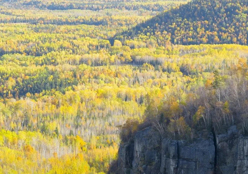
The initial stages often involve hiking through dense forests of lodgepole pine and spruce, gradually giving way to more open subalpine terrain as elevation is gained. Wildflowers carpet the meadows in summer, creating vibrant displays of colour against the dramatic mountain backdrops. As you ascend towards the passes, the landscape transforms into rugged alpine tundra, where hardy vegetation clings to rocky slopes and panoramic views unfold. The highlight, of course, is the first glimpse of Mount Assiniboine itself, a majestic peak that dominates the skyline and inspires awe.
Wildlife is a common sight along the trail. Hikers may encounter elk, deer, marmots, pikas, and a variety of bird species. Bears (both black and grizzly) are also present, making bear safety awareness and preparedness crucial. The trail's elevation means that weather can change rapidly, with sunshine giving way to rain, hail, or even snow within a short period, even in mid-summer. This unpredictability adds to the wild character of the experience.
The trail system around Assiniboine is extensive, allowing for customisable itineraries and numerous side trips to explore glacial lakes, waterfalls, and higher viewpoints. Whether you choose a shorter 3-day trek or a more leisurely 5-day exploration, the Mount Assiniboine Trail promises an unforgettable adventure into the wild heart of the Canadian Rockies.
History and Cultural Context
The lands surrounding Mount Assiniboine have been the traditional territory of Indigenous peoples for millennia, including the Stoney Nakoda and Ktunaxa First Nations. These peoples utilized the area for hunting, gathering, and spiritual practices, possessing deep knowledge of the land, its resources, and its seasonal cycles. The imposing peak of Assiniboine itself likely held significant cultural and spiritual meaning for these early inhabitants.
The modern era of exploration and tourism in the Canadian Rockies began in the late 19th and early 20th centuries. Mount Assiniboine was first summited in 1901 by James Outram, a British mountaineer, who was captivated by its beauty and grandeur. His descriptions and photographs helped to popularise the peak and the surrounding region, attracting other adventurers and climbers.
In the early 20th century, the Canadian Pacific Railway (CPR) played a significant role in promoting tourism in the Rockies. They built a network of lodges and trails, encouraging visitors to explore the wilderness. The establishment of Mount Assiniboine Provincial Park in 1922, initially as a game preserve, was a crucial step in protecting this pristine alpine environment. The park was later expanded and designated as part of a UNESCO World Heritage Site in 1984, recognising its outstanding universal value.
The trails themselves evolved from Indigenous pathways and early mountaineering routes into the well-maintained hiking routes we see today. The construction of huts and campsites by Parks Canada and BC Parks has facilitated access for backpackers, allowing more people to experience the magic of Assiniboine. Despite increased visitor numbers, the park's remoteness and strict regulations help preserve its wild character and ecological integrity.
Seasonal Highlights and Weather Reality
The primary hiking season for the Mount Assiniboine Trail is from July to September. During this period, most of the snow has melted from the main trails and passes, making them accessible and safer for hikers.
July: This is often the best month for wildflowers, with meadows bursting into colour. However, higher passes may still have lingering snow, and early July can still see significant snowpack, especially on north-facing slopes. Weather can be highly variable, with warm, sunny days interspersed with cold, wet periods. Bear activity is generally high.
August: Typically the driest month, offering the highest probability of stable weather. The days are still long, and the scenery is at its peak. Wildflowers may be past their prime in lower elevations but can still be found in alpine areas. This is the busiest month for hikers, and accommodation reservations are essential.
September: The autumn colours begin to emerge, with larches turning golden in the higher elevations, offering a spectacular visual display. The crowds thin out, and the air becomes crisp and cool. However, the risk of early snow increases, and daylight hours shorten. Weather can be unpredictable, with a higher chance of frost and freezing temperatures, especially at night.
Weather Considerations: Regardless of the month, visitors must be prepared for rapidly changing mountain weather. Temperatures can fluctuate significantly, and precipitation can occur in any form (rain, hail, snow). Wind can be a significant factor, especially at higher elevations and exposed passes. Hypothermia is a risk even in summer if hikers are caught unprepared in wet and cold conditions.
Recommended Itinerary
3-Day Mount Assiniboine Traverse (Sunshine Village to Mount Shark)
Day 1: Sunshine Village to Sunshine Meadows / Rock Isle Lake / Citadel Pass Area
- Distance: 10-15 km (depending on chosen campsite/hut)
- Elevation gain: ~400-600 m
- Time: 4-6 hours
- Start at Sunshine Village parking lot (accessible via gondola or shuttle from Banff)
- Hike through Sunshine Meadows, renowned for its alpine wildflowers and stunning vistas
- Option to camp near Rock Isle Lake or continue towards Citadel Pass
- Key waypoints: Sunshine Village, Sunshine Meadows, Rock Isle Lake, Citadel Pass
- This day offers gradual acclimatisation and spectacular views without extreme elevation gain
Day 2: Citadel Pass Area to Assiniboine Lodge / Og Lake / Wonder Pass Area
- Distance: 15-20 km
- Elevation gain: ~500-700 m (including pass ascents/descents)
- Time: 6-8 hours
- Ascend towards Citadel Pass, offering expansive views of the surrounding peaks
- Descend into the Assiniboine area, with the iconic peak coming into full view
- Pass by Og Lake, a picturesque spot with reflections of Assiniboine
- Option to stay at Assiniboine Lodge (requires separate booking and higher cost) or nearby campsites
- Key waypoints: Citadel Pass, Assiniboine Lodge, Og Lake, Wonder Pass
- This is the day where Mount Assiniboine truly dominates the landscape
Day 3: Assiniboine Lodge / Wonder Pass Area to Mount Shark Trailhead
- Distance: 20-25 km
- Elevation loss: ~700-900 m
- Time: 6-8 hours
- Hike out via Wonder Pass or Assiniboine Pass, depending on chosen route and accommodation
- The trail descends through forests and meadows towards the Mount Shark trailhead
- Key waypoints: Wonder Pass (or Assiniboine Pass), Bryant Creek, Mount Shark Trailhead
- This is the longest day, primarily downhill, but still requires good stamina
- Shuttle service or pre-arranged transport is required from Mount Shark to Canmore or other destinations
Alternative Itinerary Notes:
- This is a sample itinerary; routes can be modified based on accommodation availability and personal preference.
- Helicopter access is an option for parts of the route, significantly reducing hiking time and distance, but is expensive.
- The reverse route (Mount Shark to Sunshine Village) is also popular.
- Longer itineraries (4-5 days) allow for more exploration of side trips like Nub Peak, Sunburst Lake, and Marvel Lake.
Planning and Bookings
Book Your Trip
Everything you need to plan your journey
Accommodation
Find places to stay near Canmore
Flights
Search flights to Canmore
Essential Preparation
Planning for Mount Assiniboine requires careful coordination, especially regarding accommodation and transportation. The park is remote, and services are limited. It is crucial to book accommodation well in advance, as capacity is limited and demand is high, particularly during the peak summer months of July and August. Consider your fitness level; while the main trails are well-maintained, there are significant elevation gains and distances involved. Familiarise yourself with bear safety protocols, as this is active bear country. Ensure you have reliable navigation tools, as trails can be less distinct in certain sections or in poor weather. The closest major city with comprehensive services is Canmore, Alberta, which serves as a primary staging point for accessing the trailheads.
Trail Accommodation
Accommodation within Mount Assiniboine Provincial Park is managed by BC Parks and requires advance reservations. Options include backcountry huts and designated campsites.
- Assiniboine Lodge: A historic, privately-run lodge offering comfortable rooms and meals. This is the most expensive option and books up extremely far in advance.
- Huts: Several basic backcountry huts are available, such as the Assiniboine, Magog Lake, and Wonder Pass huts. These offer bunk beds and a common area.
- Campsites: Designated campsites are located near the huts and lodges, providing tent pads and access to shared facilities. Popular camping areas include Magog Lake, Wonder Pass, and Sunshine Meadows.
Booking Requirements: Reservations are mandatory and can be made through the BC Parks reservation system. Bookings typically open in early spring for the summer season and are highly competitive. It is advisable to have flexible dates and be prepared to book immediately upon release.
Facilities Provided: Huts and campsites generally provide basic amenities such as pit toilets, bear-proof food caches or storage lockers, and access to potable water (from streams or designated taps, treatment recommended). Huts have wood stoves for heating and cooking, but you must bring your own fuel. Campsites have tent pads and often a communal cooking shelter.
What's NOT Provided: Huts and campsites do not provide bedding, cooking equipment (pots, pans, utensils), food, or fuel for stoves (unless specified for the lodge). You must bring all your own gear and supplies.
Seasonal Availability: Accommodation is generally available from mid-June to early October, weather permitting. Snow can linger into July, and early snow can close the park in September or October.
Costs: Campsite fees are typically around CAD$15-20 per night per person. Hut fees are higher, often in the CAD$30-50 per night range per person. Assiniboine Lodge rates are significantly higher and include meals.
Required Gear
- Backpacking boots: Sturdy, waterproof, and well broken-in boots are essential for navigating varied terrain and providing ankle support.
- Waterproof and windproof outer layers: A high-quality rain jacket and overtrousers are critical due to the unpredictable mountain weather.
- Warm layers: Insulating mid-layers (fleece or down jacket), thermal base layers (merino wool or synthetic), a warm hat, and gloves are necessary, as temperatures can drop significantly, especially at night and at higher elevations.
- Backpack: A comfortable backpack of 50-70 litre capacity, with a good hip belt and rain cover, is needed to carry all your gear and food.
- Sleeping bag: A 3-season sleeping bag rated to at least -5°C to 0°C is recommended for comfort in the huts and campsites.
- Sleeping pad: For insulation and comfort if camping.
- Navigation tools: A detailed map of the Assiniboine area, a compass, and a GPS device or smartphone with downloaded offline maps are essential.
- Headlamp or flashlight: With extra batteries, as huts and campsites are unlit.
- First-aid kit: Comprehensive kit including blister treatment, pain relievers, antiseptic wipes, bandages, and any personal medications.
- Sun protection: High SPF sunscreen, sunglasses, and a wide-brimmed hat, as the sun can be intense at altitude.
- Insect repellent: Especially important during July and August to ward off mosquitoes and black flies.
What to Bring
- Food: Sufficient non-perishable food for the duration of your trip, including breakfasts, lunches, dinners, and snacks. Plan for high-energy meals.
- Water treatment: A water filter, purification tablets, or a UV steriliser is essential, as all water sources should be treated.
- Cooking equipment: A lightweight backpacking stove, fuel, a pot, cooking utensils, a mug, and a bowl/plate.
- Toiletries: Biodegradable soap, toothbrush, toothpaste, toilet paper, hand sanitiser, and any personal hygiene items.
- Bear spray: Absolutely essential for personal safety. Know how to use it and carry it in an easily accessible location.
- Trekking poles: Highly recommended for stability on ascents and descents, and for reducing strain on knees.
- Camera: To capture the stunning scenery.
- Book or journal: For downtime in the evenings.
- Trash bags: To pack out all your waste.
Permits
Access to Mount Assiniboine Provincial Park requires a backcountry permit, which includes both camping and hut reservations. These permits are managed by BC Parks and are in extremely high demand, especially for the peak season (July and August).
Reservation System:
- Booking Window: Reservations typically open in early spring (often March or April) for the entire summer season (mid-June to early October). The exact date is announced on the BC Parks website.
- How to Book: Bookings are made online through the BC Parks reservation portal. It is highly recommended to create an account and familiarise yourself with the system well in advance of the booking opening date.
- Competition: Due to the park's popularity and limited capacity, reservations for popular dates and locations (like Magog Lake campsites or Assiniboine Hut) can sell out within minutes. Have multiple date options and preferred locations ready.
Permit Costs:
- Camping: Approximately CAD$15-20 per person per night.
- Huts: Approximately CAD$30-50 per person per night.
- Assiniboine Lodge: This is a private lodge with separate booking and pricing, significantly higher than park-managed accommodation.
Park Entry Fees: While there are no specific park entry fees for Mount Assiniboine Provincial Park itself, you will need to pay for parking at Sunshine Village or Mount Shark Trailhead, and potentially shuttle services. If you are entering via Banff National Park (Sunshine Village trailhead), a Parks Canada Discovery Pass is required for your vehicle.
Cancellation Policy: Familiarise yourself with BC Parks' cancellation and refund policy. Cancellations can occur, so persistent checking of the reservation system can sometimes yield last-minute availability.
Other Activities in the Area
Beyond the main hiking routes, Mount Assiniboine Provincial Park offers numerous opportunities for exploration and enjoyment:
- Day Hikes: Numerous shorter hikes branch off the main trails, allowing for exploration without carrying a full pack. Popular options include hikes to Nub Peak, Sunburst Lake, Marvel Lake, and the various viewpoints around Assiniboine Lodge.
- Photography: The iconic views of Mount Assiniboine, its surrounding lakes, and alpine meadows make this a photographer's paradise. Sunrise and sunset offer particularly dramatic lighting.
- Wildlife Viewing: Keep an eye out for elk, deer, bighorn sheep, mountain goats, marmots, pikas, and various bird species. Remember to maintain a safe distance and never feed wildlife.
- Stargazing: With minimal light pollution, the night skies in Assiniboine are spectacular. On clear nights, the Milky Way is often visible in stunning detail.
- Mountaineering: For experienced climbers, Mount Assiniboine itself and other surrounding peaks offer challenging mountaineering objectives. This requires advanced technical skills, equipment, and experience.
- Horseback Riding: Guided horseback riding trips are available from various outfitters, offering a different perspective on the landscape.
Safety and Conditions
Bear Safety: Mount Assiniboine is prime grizzly and black bear habitat. Always carry bear spray and know how to use it. Hike in groups, make noise (talk, sing), and be aware of your surroundings. Store all food and scented items in bear-proof containers or lockers provided at campsites and huts. Never leave food unattended.
Weather: Mountain weather is notoriously unpredictable. Be prepared for rapid changes, including rain, hail, snow, and strong winds, even in summer. Hypothermia is a serious risk. Always carry adequate warm and waterproof clothing, even on sunny days.
Trail Conditions: Trails can be muddy, rocky, and steep. Snow can linger on higher passes well into July. Check current trail conditions with BC Parks or local visitor centres before your trip. Be prepared for stream crossings, which can be challenging after heavy rain.
Navigation: While trails are generally well-marked, it is essential to carry a map and compass and know how to use them. GPS devices or smartphone apps with downloaded offline maps are also highly recommended. Do not rely solely on mobile phone service, as it is unreliable in the park.
Water: Treat all water from streams and lakes before drinking, even if it appears clear. Use a water filter, purification tablets, or boil water.
Communication: Mobile phone service is generally non-existent within the park. Consider carrying a satellite communication device (like a SPOT or inReach) for emergencies.
Fitness: The trails involve significant elevation gain and distance. Ensure you are physically fit and have experience with multi-day backpacking trips before attempting this hike.
Emergency Contact: Inform someone of your hiking plans, including your intended route and expected return date. Provide them with contact information for BC Parks or emergency services.
Side Trips and Points of Interest
Nub Peak: A popular and relatively short side trip from the Assiniboine Lodge area. The trail ascends through alpine meadows to a viewpoint offering spectacular panoramic vistas of Mount Assiniboine, Magog Lake, and the surrounding peaks. It's an excellent spot for sunset or sunrise photography.
Sunburst Lake and Cerulean Lake: These stunning turquoise lakes are located a short distance from the main trail, accessible from the Assiniboine Lodge area. The vibrant colours of the water, set against the dramatic mountain scenery, are breathtaking.
Marvel Lake: A longer day hike or an option for a multi-day itinerary, Marvel Lake is a beautiful glacial lake situated in a remote valley. The trail to Marvel Lake offers a different perspective of the Assiniboine massif and the surrounding wilderness.
Wonder Pass: A key pass on the route, Wonder Pass offers expansive views of the Assiniboine massif and the valleys on either side. It's a dramatic and often windy location, showcasing the raw alpine environment.
Assiniboine Pass: An alternative to Wonder Pass for exiting the park towards Mount Shark, Assiniboine Pass also provides excellent views and a slightly different route through the alpine terrain.
The Citadel: A prominent peak near Citadel Pass, offering challenging scrambling and climbing opportunities for experienced mountaineers. The views from its summit are unparalleled.
Leave No Trace
Mount Assiniboine Provincial Park is a pristine wilderness area, and adhering to Leave No Trace principles is paramount to preserving its natural beauty and ecological integrity for future generations. Visitors are expected to practice these principles diligently.
- Plan Ahead and Prepare: Research the park, understand regulations, book accommodation in advance, and pack appropriate gear.
- Travel and Camp on Durable Surfaces: Stick to designated trails and campsites. Avoid walking on fragile vegetation, especially in meadows and around lakes.
- Dispose of Waste Properly: Pack out everything you pack in, including all food scraps, wrappers, and toilet paper. Use designated toilets or catholes dug at least 70 metres from water sources, trails, and campsites.
- Leave What You Find: Do not remove or disturb natural objects, plants, or cultural artifacts.
- Minimize Campfire Impacts: Campfires are generally prohibited in Mount Assiniboine Provincial Park to protect the fragile environment. Use a lightweight stove for cooking.
- Respect Wildlife: Observe wildlife from a distance. Never feed animals, as it harms their health, alters their natural behaviours, and exposes them to danger. Store food securely.
- Be Considerate of Other Visitors: Respect the solitude of others. Avoid loud noises and keep group sizes manageable.
By following these guidelines, you contribute to the ongoing protection of this extraordinary mountain landscape.