Trilha do Itacolomi - The Stone Sentinel of Ouro Preto
The Trilha do Itacolomi is the definitive trekking experience in the heart of Minas Gerais, leading adventurers to the summit of the iconic Pico do Itacolomi. Rising 1,772 metres above sea level, this majestic rock formation served as a vital navigational landmark for colonial bandeirantes and gold seekers during the 18th century. The journey begins within the protected confines of the Itacolomi State Park, a sprawling sanctuary of Atlantic Forest and high-altitude grasslands (campos de altitude). Hikers traverse a landscape where history and geology collide, moving from lush, shaded valleys to wind-swept ridges that offer some of the most profound panoramic views in Brazil. This is more than a physical ascent; it is a pilgrimage through the heritage of the Iron Quadrangle, demanding endurance while rewarding the spirit with an unparalleled perspective of the UNESCO World Heritage city of Ouro Preto nestled far below.
- Distance: 11.0 km return
- Duration: 5–7 hours
- Season: May–August (Dry season; provides the clearest views and safest trail conditions)
- Huts: No overnight huts on trail; day walk only
- Highest point: Pico do Itacolomi (1,772 m)
- Daily walkers: Restricted by Park capacity (registration required at entrance)
- Direction: Out-and-back route from the Park headquarters
Overview
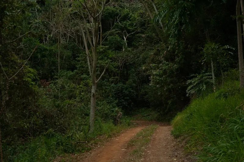
The Trilha do Itacolomi is a masterclass in elevation and ecological transition. Starting from the historic Fazenda do Manso, the trail begins as a wide, well-defined track that lures walkers into a steady rhythm. The initial phase winds through regenerating forest, where the air is heavy with the scent of damp earth and the calls of tropical birdlife. As the gradient sharpens, the dense canopy begins to thin, giving way to the unique "campos rupestres"—stony fields—characterised by hardy shrubs, vibrant orchids, and bromeliads that cling to the quartzite substrate. This shift in flora signals your arrival into the high-country, where the sun becomes more intense and the horizon begins to expand.
The trail's primary challenge lies in its consistent vertical gain. Hikers must ascend approximately 600 metres over the course of the trek, with the final approach to the "filhote" (the smaller rock formation next to the main peak) requiring careful footing over uneven, rocky terrain. The path is a physical dialogue with the mountain; long, lung-burning stretches are punctuated by natural balconies that offer views of the Serra do Caraça in the distance. The final push to the base of the main peak is a dramatic scramble that rewards the persistent with a 360-degree theatre of the Minas Gerais landscape.
What sets this trail apart is its profound sense of isolation despite its proximity to the bustling streets of Ouro Preto. Within an hour of walking, the sounds of the city are replaced by the whistling of the wind through the grass and the occasional screech of a hawk. The scale of the "Pedra Menino" (the smaller peak) against the massive "Pico" creates a silhouette that is unmistakable and hauntingly beautiful. This is a journey that tests your cardiovascular fitness but provides a deep, quiet satisfaction that only comes from standing atop a landmark that has guided human movement for over three centuries.
History and Cultural Context
The name "Itacolomi" is derived from the Tupi language, meaning "stone child" (ita: stone; colomi: child). This refers to the distinct geological feature where a smaller rock appears to be sitting beside the larger peak, appearing like a child at its parent's side. For the indigenous peoples of the region, these peaks held spiritual significance long before European arrival. However, it was during the Brazilian Gold Rush of the 1700s that the peak took on its most famous role. As explorers pushed inland from the coast in search of precious metals, the Pico do Itacolomi served as a "Farol dos Bandeirantes" (Bandeirantes' Lighthouse), a permanent, unmissable beacon that guided them toward the rich deposits of Vila Rica (now Ouro Preto).
The trail itself passes through the historic grounds of the Itacolomi State Park, which was once home to the Fazenda do Manso. This estate played a significant role in the agricultural support of the mining region. Today, the park serves as a vital bridge between the colonial past and environmental preservation. Walking these paths, you are following in the footsteps of poets, rebels of the Inconfidência Mineira, and naturalists like Saint-Hilaire and Spix and Martius, who explored these mountains in the 19th century to document the incredible biodiversity of the Brazilian interior.
Want more background? Read extended notes on history and cultural context → Learn more
Seasonal Highlights and Weather
The climate in the Serra do Espinhaço is defined by two distinct seasons: the wet and the dry. During the peak summer months (December to March), the region experiences heavy tropical rainfall. While the landscape becomes vibrantly green, the trail can become slippery, and the risk of lightning strikes on the exposed ridges makes summiting dangerous. Fog is also a frequent visitor during the wet season, often completely obscuring the very views hikers work so hard to see.
The "Golden Window" for the Trilha do Itacolomi is the dry season, spanning from May to August. During this period, the humidity drops, and the sky takes on a deep, crystalline blue hue. The temperatures are cooler, making the 600-metre climb much more manageable. However, hikers should be prepared for significant temperature swings; while it may be 25°C at the park entrance, the wind chill at the 1,772-metre summit can make it feel significantly colder. Early morning starts in June or July might even see a thin layer of frost on the high-altitude grasses.
Recommended Itinerary

09:00 – 10:30: The Forest Ascent
- Distance: ~3 km
- The trail begins at the Fazenda do Manso, following a steady uphill gradient through pockets of Atlantic Forest.
- Keep an eye out for masked titi monkeys and diverse bird species in the shaded canopy.
10:30 – 12:00: The High Grasslands
- Distance: ~2.5 km
- The canopy disappears as you emerge into the high-altitude grasslands (campos de altitude).
- The Pico do Itacolomi finally comes into full view, appearing as a massive, dark monolith against the sky.
12:00 – 13:00: The Summit Push
- The final section involves a steeper scramble over quartzite rocks to reach the 1,772m peak.
- Find a sheltered spot for lunch while soaking in the 360-degree views of the Iron Quadrangle and Ouro Preto.
Planning and Bookings
Book Your Trip
Everything you need to plan your journey
Accommodation
Find places to stay near Urubici
Flights
Search flights to Urubici
Unlike multi-day treks, the Trilha do Itacolomi does not require months of planning for hut bookings, but logistical preparation is still key. It is highly recommended to stay in Ouro Preto the night before to ensure an early start, as the park usually opens at 08:00 and hikers are discouraged from starting the summit trek after 11:00. Specialized hiking gear is hard to find locally; ensure your boots and technical clothing are sorted before arriving.
Permits
Access is governed by the regulations of the IEF (Instituto Estadual de Florestas). Individual hikers must register at the park entrance gate upon arrival and pay a small entrance fee. For large groups, it is recommended to contact the Park administration at least 7 days in advance. A strict "Leave No Trace" policy is in effect, and pets are not allowed within the State Park to protect local wildlife species.
Other Activities in the Area
- Historic Centre of Ouro Preto: Explore the steep cobblestone streets of this UNESCO World Heritage site.
- Minas de Passagem: Descend into one of the world's largest gold mines open to the public.
- Fazenda do Manso: Visit the historic farmhouse near the park entrance to learn about colonial tea production.
Safety and Conditions
The primary risks on Itacolomi are dehydration, heat exhaustion, and sudden weather shifts. The trail is exceptionally exposed for the final 3 kilometres. If you see dark clouds gathering or hear thunder, abandon the summit attempt immediately. Lightning is a genuine threat on high-altitude ridges. Always ensure you carry at least 2.5 litres of water, as there are no reliable sources on the mountain itself.
Side Trips and Points of Interest
The "Filhote" Base: For many, the base of the smaller peak (the child) is the highlight. The rock formations here are jagged and dramatic, providing a perfect foreground for photos of the main peak. The geology here is fascinating, with ripples in the stone showing where this land was once an ancient seabed millions of years ago.
Leave No Trace
The Itacolomi State Park is a sanctuary for endemic species. The "campos rupestres" are particularly fragile; stay on the marked path as braided trails lead to severe erosion. Carry out all rubbish, including organic waste, and do not pick flowers or collect rocks. Respect the silence to protect nesting birdlife and the experience of other hikers.