Monte Terminillo Ascent
The Monte Terminillo Ascent is a challenging day walk in the Apennine Mountains of central Italy, offering a rewarding climb to the summit of one of the region's most prominent peaks. This route is a favourite for hikers seeking panoramic views and a good physical workout, with a significant elevation gain packed into a relatively short distance. The ascent takes you through varied terrain, from alpine meadows to rocky scree slopes, culminating in a breathtaking vista from the summit. It's a journey that tests endurance and offers a profound connection with the rugged beauty of the Italian mountains.
- Distance: 15.0 km one-way
- Elevation gain: 1600 m
- Duration: 6-8 hours
- Difficulty: Challenging
- Best Time: June–September (summer months)
- Closest City: Rieti
- Trailhead Access: Nearest city: Rieti. Drive from Rieti following signs for Terminillo/Rifugio Angelo Sebastiani. Road is paved but can be narrow and winding. Driving time: ~45 mins. Parking available at Rifugio. GPS: 42.4613, 12.9722. No permits needed.
Overview
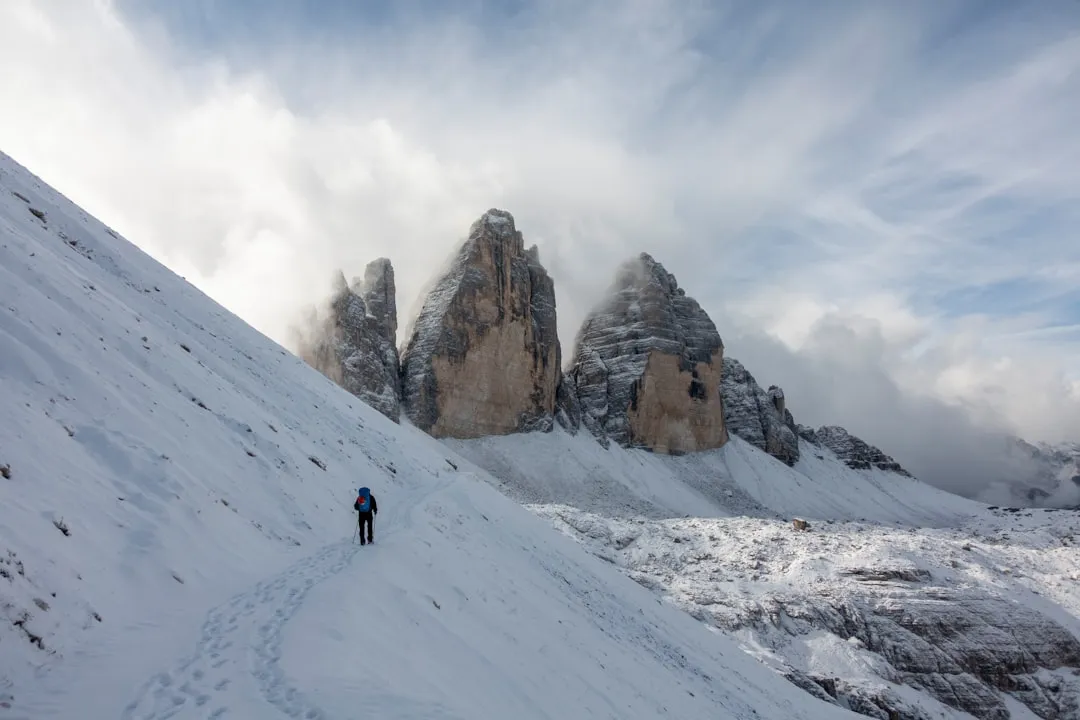
Monte Terminillo, often referred to as the "Giant of Latium," stands as a majestic presence in the heart of the Apennines, its summit reaching 2,217 metres above sea level. The ascent from the vicinity of Rifugio Angelo Sebastiani is a demanding but immensely satisfying day hike. The trail begins with a steady climb, gradually gaining altitude through open alpine pastures dotted with wildflowers during the summer months. As you ascend, the landscape becomes more rugged, transitioning into scree and rocky paths that require careful footing.
The route is characterised by its relentless elevation gain. Over approximately 7.5 kilometres to the summit, you will conquer 1600 metres of ascent. This significant gradient means the hike is a true test of cardiovascular fitness and leg strength. However, the rewards are substantial. From the summit, on a clear day, the views are simply spectacular. You can see across a vast expanse of central Italy, with the Tyrrhenian Sea visible in the distance to the west and the Adriatic Sea to the east on exceptionally clear days. The surrounding Apennine peaks form a dramatic and undulating panorama, offering a sense of immense scale and wild beauty.
The trail is well-marked for the most part, especially the initial sections leading towards the summit ridge. However, the final approach to the peak can involve navigating loose scree, and it's advisable to have good navigation skills or a reliable map and compass. The summit itself is a broad, relatively flat area, often marked by a cross or a small monument, providing an excellent spot to rest, refuel, and soak in the 360-degree views. The descent follows the same path, which can be challenging on the knees due to the steep gradient and loose terrain.
This hike is best undertaken during the summer months when snow has receded from the higher elevations, and the weather is generally more stable. While it is a challenging day walk, the Monte Terminillo Ascent offers an unforgettable experience for those who are well-prepared and eager to explore the high alpine environment of the Apennines.
History and Cultural Context
Monte Terminillo has a long history of human interaction, primarily linked to pastoralism and, more recently, to tourism and winter sports. For centuries, the high pastures of Terminillo were used by shepherds to graze their flocks during the summer months. This transhumance, the seasonal movement of livestock between different pastures, was a cornerstone of the economy in many parts of the Apennines, shaping the landscape and the cultural traditions of the local communities.
The mountain's potential for tourism began to be realised in the early 20th century. The construction of roads leading towards the summit area, particularly the road to Rifugio Angelo Sebastiani, facilitated access for visitors. The establishment of ski resorts in the mid-20th century further cemented Terminillo's role as a destination for recreation. While the ski facilities have seen periods of both popularity and decline, the mountain has retained its appeal for hikers and nature enthusiasts.
The Rifugio Angelo Sebastiani, located at an altitude of 1,850 metres, is a key landmark and starting point for many ascents. Named after a prominent figure in Italian mountaineering, the refuge has served as a base for climbers and hikers for decades, offering a place of rest and sustenance. Its presence signifies the mountain's enduring connection with outdoor pursuits.
The area around Monte Terminillo is also rich in local folklore and traditions. The rugged terrain and the dramatic weather patterns have inspired stories and legends passed down through generations. The mountain is not just a geographical feature but a part of the cultural identity of the surrounding regions, particularly the province of Rieti.
Seasonal Highlights and Weather Reality
The Monte Terminillo Ascent is a summer hike, with the optimal period running from June through September. During these months, the weather is generally more stable, and the snow has typically melted from the higher trails, making the ascent accessible and safe.
Summer (June–September): This is the prime season for hiking Monte Terminillo. The days are long, providing ample daylight for the 6-8 hour round trip. Alpine meadows are in full bloom, offering vibrant displays of wildflowers. The air is crisp and clear, providing excellent visibility for the panoramic views from the summit. However, even in summer, mountain weather can be unpredictable. Afternoon thunderstorms are common, so starting early in the morning is highly recommended to avoid the most intense heat and the risk of storms. Temperatures at the summit can still be cool, especially in the early morning or late afternoon, so layers are essential.
Spring (April–May): While the lower slopes might be accessible, the higher reaches of Monte Terminillo are often still covered in snow during spring. Avalanche risk can persist, and trails may be impassable or require specialised winter mountaineering equipment and skills. It is generally not recommended for casual hikers during this period.
Autumn (October–November): The early part of autumn can still offer good hiking conditions, with cooler temperatures and fewer crowds. The changing colours of the vegetation can be beautiful. However, as the season progresses, snow can begin to fall again, making the higher sections of the trail hazardous. It is crucial to check weather forecasts and trail conditions very carefully if attempting an autumn hike.
Winter (December–March): Monte Terminillo is a popular destination for winter sports, with ski resorts operating on its slopes. However, the hiking trails are typically covered in deep snow and ice, making them suitable only for experienced winter mountaineers with appropriate equipment such as snowshoes, crampons, and ice axes. The risk of avalanches is significant.
Weather Reality: The Apennines are known for their changeable mountain weather. Even on a clear summer morning, conditions can deteriorate rapidly. Be prepared for strong winds, sudden drops in temperature, and the possibility of rain or even snow at higher altitudes. Always check the mountain forecast before setting out and be prepared to turn back if conditions become unsafe.
Recommended Itinerary
Monte Terminillo Ascent - Day Walk
Early Morning (Approx. 7:00 AM): Departure from Rieti
- Drive from Rieti towards Monte Terminillo, following signs for Rifugio Angelo Sebastiani.
- The drive takes approximately 45 minutes and involves navigating a paved, but often narrow and winding, mountain road.
- Enjoy the changing scenery as you gain altitude.
Morning (Approx. 7:45 AM): Arrival at Trailhead & Preparation
- Arrive at the parking area near Rifugio Angelo Sebastiani (GPS: 42.4613, 12.9722).
- Final gear check: ensure boots are tied, water bottles are full, and layers are adjusted.
- Take a moment to appreciate the views from the starting point.
Morning (Approx. 8:00 AM): Commencement of Ascent
- Begin the hike from the vicinity of the rifugio.
- The initial section is a well-trodden path, often a gravel track, leading upwards through alpine meadows.
- Focus on maintaining a steady pace, conserving energy for the significant elevation gain ahead.
- Observe the flora and fauna; wildflowers are abundant in summer.
Late Morning to Midday (Approx. 10:00 AM - 12:00 PM): Ascending the Slopes
- The trail becomes steeper and more rugged.
- You will transition from open meadows to rocky terrain and scree.
- Navigation becomes more important; follow the marked path and cairns.
- Take short breaks to drink water and check your surroundings.
- The views begin to open up, offering glimpses of the valleys below.
Midday (Approx. 12:00 PM - 1:00 PM): Approaching the Summit Ridge
- The gradient remains challenging, but you are nearing the summit ridge.
- The terrain may involve scrambling over larger rocks or navigating loose scree.
- Be mindful of your footing and use your hands for balance if necessary.
- The air will be cooler and the wind stronger at this altitude.
Early Afternoon (Approx. 1:00 PM - 2:00 PM): Summit Arrival
- Reach the summit of Monte Terminillo (2,217 m).
- Take time to celebrate your achievement and enjoy the unparalleled 360-degree panoramic views.
- Identify prominent landmarks in the distance.
- Have your lunch and rehydrate.
- Be aware of the time and the need to begin your descent.
Afternoon (Approx. 2:00 PM - 4:00 PM): Descent Begins
- Start your descent, retracing your steps.
- The descent can be hard on the knees; use trekking poles if you have them.
- Exercise caution on scree and loose sections.
- Enjoy the changing perspective of the landscape as you descend.
Late Afternoon (Approx. 4:00 PM - 5:00 PM): Return to Trailhead
- Arrive back at the parking area near Rifugio Angelo Sebastiani.
- Take time to stretch and recover.
- Consider a brief stop at the rifugio if it is open.
Late Afternoon/Early Evening (Approx. 5:00 PM onwards): Return Journey
- Drive back to Rieti.
- Reflect on a successful and challenging mountain ascent.
Important Notes:
- This is a strenuous day hike requiring good physical fitness.
- Start early to maximise daylight and avoid afternoon weather.
- Carry sufficient water and high-energy food.
- Weather can change rapidly; be prepared for all conditions.
- Trekking poles are highly recommended for both ascent and descent.
- Inform someone of your hiking plans and expected return time.
Planning and Bookings
Book Your Trip
Everything you need to plan your journey
Accommodation
Find places to stay near Rieti
Flights
Search flights to Rieti
Essential Preparation
The Monte Terminillo Ascent is a demanding day hike that requires careful planning and preparation. Given the significant elevation gain and the remote mountain environment, ensuring you are physically prepared and have the correct gear is paramount. The closest major city is Rieti, which serves as the primary logistical hub for accessing the mountain. Rieti offers a range of accommodation options, from budget-friendly guesthouses to more comfortable hotels, as well as supermarkets for stocking up on supplies and outdoor gear shops for any last-minute purchases.
Access to the trailhead is primarily by car. From Rieti, follow the signs for Monte Terminillo and the Rifugio Angelo Sebastiani. The road is paved but can be narrow and winding, especially as you climb higher. Allow approximately 45 minutes for the drive from Rieti to the parking area near the rifugio. There is parking available at the rifugio, but it can become busy during peak season, so arriving early is advisable.
It is crucial to check the weather forecast specifically for the mountain summit in the days leading up to your hike and again on the morning of your ascent. Mountain weather can be highly localised and change rapidly. Be prepared for cooler temperatures, strong winds, and potential precipitation, even during the summer months.
Trail Accommodation
This is a day hike requiring no overnight accommodation.
Required Gear
- Sturdy hiking boots: Waterproof and with good ankle support, well broken-in to prevent blisters.
- Waterproof and windproof jacket: Essential for protection against sudden weather changes, rain, and wind.
- Waterproof overtrousers: To keep your legs dry and protected from wind.
- Warm layers: Including a fleece or insulated jacket, and a base layer made of merino wool or synthetic material.
- Hat and gloves: Even in summer, temperatures at the summit can be cold.
- Backpack: A comfortable daypack (25-35 litres) to carry essentials.
- Trekking poles: Highly recommended for stability and to reduce strain on knees during ascent and descent.
- Navigation tools: A detailed map of the area, a compass, and a GPS device or smartphone with offline maps. Ensure you know how to use them.
- Head torch: With spare batteries, in case of unexpected delays or an early start/late finish.
- First-aid kit: Including blister treatment, pain relievers, antiseptic wipes, bandages, and any personal medications.
- Sun protection: High SPF sunscreen, sunglasses, and a wide-brimmed hat.
What to Bring
- Food: Sufficient high-energy snacks and a packed lunch for the duration of the hike (6-8 hours). Examples include energy bars, nuts, dried fruit, sandwiches.
- Water: At least 2-3 litres of water per person. There are no reliable water sources on the upper sections of the trail, so carry all you need. Water treatment methods (filter or purification tablets) are not typically necessary if carrying sufficient water, but can be a backup.
- Toiletries: Hand sanitiser, toilet paper (and a bag to pack it out), any personal hygiene items.
- Mobile phone: Fully charged, with a power bank if possible. Signal can be intermittent.
- Emergency whistle: For signalling in case of emergency.
- Small repair kit: Including duct tape and safety pins.
- Identification and emergency contact details.
Permits
No specific permits are required to hike the Monte Terminillo Ascent. The trails are generally open to the public, and access is free. However, it is always advisable to check local regulations or any advisories issued by regional park authorities or the Italian Alpine Club (CAI) before your trip, especially if planning to hike outside the main summer season.
While no permits are needed, responsible hiking practices are expected. This includes staying on marked trails, respecting the natural environment, and carrying out all rubbish. The area around Monte Terminillo is a natural park, and its preservation is important.
Important Considerations:
- Seasonality: The most crucial factor is the season. The hike is best undertaken between June and September. Outside these months, snow and ice can make the trail hazardous or impassable without specialised equipment and experience.
- Weather: Always check the mountain weather forecast before you go. Conditions can change rapidly in the mountains, and safety should be the top priority.
- Trail Conditions: While generally well-maintained, trail conditions can vary. Be prepared for rocky terrain and scree, especially on the upper slopes.
- Local Information: If possible, consult with local hiking groups or information centres in Rieti for the most up-to-date information on trail conditions and any potential advisories.
Other Activities in the Area
The region surrounding Monte Terminillo offers a variety of activities for visitors looking to extend their stay or explore beyond the summit hike:
- Skiing and Snowboarding: During the winter months, Monte Terminillo is a popular destination for winter sports, with several ski resorts offering slopes for all levels.
- Exploring Rieti: The nearby city of Rieti has a rich history and offers attractions such as its Romanesque architecture, the historic centre, and the beautiful surrounding countryside.
- Cycling: The mountain roads and surrounding areas are popular with cyclists, offering challenging climbs and scenic routes.
- Nature Walks and Birdwatching: The lower slopes and surrounding valleys provide opportunities for gentler nature walks, with diverse flora and fauna to observe.
- Gastronomy: The region is known for its traditional Italian cuisine. Enjoy local specialities in the trattorias and restaurants in Rieti and the mountain villages.
- Visiting Local Villages: Explore charming nearby villages such as Leonessa, which offers historical sites and a glimpse into traditional mountain life.
Safety and Conditions
Pre-Hike Checks:
- Weather Forecast: Always check the most up-to-date mountain weather forecast for Monte Terminillo. Websites like MeteoAM (Italian Air Force meteorological service) or local Italian weather sites are good resources. Be prepared for rapid changes, including wind, rain, and temperature drops.
- Trail Conditions: While the main trail is generally clear in summer, check for any local advisories regarding trail closures or hazards. The Italian Alpine Club (CAI) often provides information.
- Road Conditions: Ensure the road to Rifugio Angelo Sebastiani is open and clear, especially if travelling in the shoulder seasons.
On the Trail:
- Physical Fitness: This is a challenging hike with significant elevation gain. Ensure you are adequately fit and have recent hiking experience.
- Navigation: The trail is generally well-marked, but it is essential to carry a map, compass, and/or GPS device and know how to use them. Visibility can drop significantly in cloud or fog.
- Altitude: While not extremely high, the altitude can affect some individuals. Ascend gradually and listen to your body.
- Terrain: Be prepared for varied terrain, including rocky paths and loose scree, especially on the upper slopes. Good footwear is crucial.
- Water: Carry more water than you think you will need. There are no reliable water sources on the upper mountain.
- Sun Exposure: The sun can be intense at higher altitudes, even on cooler days. Use sunscreen, wear a hat, and sunglasses.
- Hypothermia: Even in summer, temperatures at the summit can be cold, especially with wind chill. Always carry warm layers and waterproofs.
- Communication: Mobile phone signal can be unreliable. Consider carrying a personal locator beacon (PLB) or satellite messenger for remote areas. Inform someone of your hiking plans, including your intended route and expected return time.
- Emergency Services: In case of emergency, contact the Italian emergency services (Numero Unico di Emergenza: 112).
Specific Hazards:
- Afternoon Thunderstorms: Common in summer. Start your hike early to avoid being caught out on exposed ridges during a storm.
- Loose Scree: Can make descents challenging and increase the risk of slips and falls.
- Wind: The summit ridge can be very exposed to strong winds.
Side Trips and Points of Interest
Rifugio Angelo Sebastiani: Located at 1,850 metres, this mountain refuge is a key landmark and often the starting point for the ascent. While primarily a base for hikers and skiers, it offers a place to rest, refuel, and enjoy the mountain atmosphere. Check its opening hours if you plan to stop there before or after your hike.
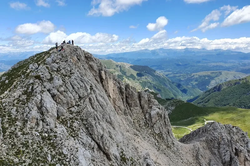
The Summit Cross: At the highest point of Monte Terminillo (2,217 m), a prominent cross stands as a testament to the mountain's significance. It serves as a focal point for hikers and offers a clear marker of your achievement. The area around the cross provides the most expansive panoramic views.
Panoramic Views: The primary "point of interest" on this hike is the breathtaking 360-degree panorama from the summit. On a clear day, you can see an immense swathe of central Italy. Key features visible include:
- The surrounding Apennine mountain ranges, creating a dramatic, undulating landscape.
- The plains and valleys leading towards the Tyrrhenian Sea to the west.
- On exceptionally clear days, the distant outline of the Adriatic Sea to the east.
- The city of Rieti and its surrounding fertile plain.
- The network of roads and smaller villages that dot the landscape below.
Alpine Flora and Fauna: During the summer months, the alpine meadows are rich with wildflowers. Keep an eye out for various species of alpine plants adapted to the harsh conditions. Birdlife may also be present, including birds of prey that soar on the thermals. The transition in vegetation from the lower forested slopes to the high alpine environment is a point of interest in itself.
The Road to Terminillo: The drive itself offers scenic vistas. The winding mountain road provides increasingly impressive views of the surrounding valleys and peaks as you ascend, serving as a prelude to the grander views from the summit.
Leave No Trace

The Monte Terminillo Ascent traverses a beautiful natural environment, and it is crucial for all hikers to practice Leave No Trace principles to preserve its pristine condition for future visitors. The mountain's ecosystem is sensitive, and human impact can have lasting effects.
Your responsibility as a hiker:
- Plan Ahead and Prepare: Understand the trail, weather conditions, and any regulations before you go. Pack appropriately for the conditions and the duration of your hike.
- Travel and Camp on Durable Surfaces: Stick to the marked trails. Avoid cutting switchbacks or walking on fragile vegetation, especially in the alpine meadows where plants are slow to recover. The summit area is rocky, so tread carefully to avoid dislodging loose stones.
- Dispose of Waste Properly: Pack out everything you pack in. This includes all food scraps, wrappers, and any other litter. Do not bury or burn waste. Use designated toilet facilities if available, or follow proper cathole procedures if not, ensuring you are at least 70 metres away from water sources, trails, and campsites.
- Leave What You Find: Do not take rocks, plants, or any other natural objects. Leave them for others to enjoy and for the ecosystem to thrive.
- Minimise Campfire Impacts: Campfires are generally not permitted on day hikes and are not relevant for this route. If camping were permitted, use established fire rings and keep fires small.
- Respect Wildlife: Observe wildlife from a distance. Do not feed animals, as this can disrupt their natural behaviours and diets. Keep pets under control if you bring them.
- Be Considerate of Other Visitors: Keep noise levels down and yield to other hikers, especially on narrow sections of the trail.
By adhering to these principles, you help ensure that the Monte Terminillo Ascent remains a wild and beautiful place for generations to come.