
Monte Rosa Tour - A High-Altitude Odyssey Through the Pennine Alps
The Monte Rosa Tour (Tour de Monte Rosa) is one of Europe's most prestigious and physically demanding long-distance trekking circuits. Spanning approximately 150 kilometres and circumnavigating the massive Monte Rosa massif, this journey takes walkers through the heart of the Pennine Alps, crossing the international border between Switzerland and Italy. Unlike the more famous Tour du Mont Blanc, the Monte Rosa Tour is characterised by its higher average elevation, more rugged terrain, and a profound sense of cultural immersion as it traverses the historic lands of the Walser people. The route offers an unparalleled perspective of the second-highest peak in the Alps and Western Europe, the Dufourspitze (4,634 metres), and provides constant, breathtaking views of a crown of 4,000-metre peaks, including the iconic Matterhorn (Cervino), Liskamm, and the Breithorn.
This is not a journey for the faint-hearted. With a cumulative elevation gain of approximately 10,000 metres, the trail demands high levels of physical fitness, sure-footedness, and a degree of comfort with high-alpine environments. The path weaves through glacial moraines, lush larch forests, ancient stone villages, and over high mountain passes that have served as vital trade routes for centuries. Starting and ending in the world-renowned mountaineering hub of Zermatt, the circuit offers a masterclass in alpine diversity—from the manicured elegance of Swiss valleys to the raw, wild beauty of the Italian Piedmont and Aosta regions. It is a trek that challenges the body while nourishing the soul with some of the most dramatic mountain scenery on Earth.
- Distance: 150.0 km circuit
- Duration: 8–12 days
- Season: July to September (high summer is essential for snow-free passes)
- Accommodation: High-altitude mountain huts (Rifugios and Cabanes) and valley hotels
- Highest point: Theodul Pass (3,301 m)
- Difficulty: Challenging (requires alpine experience and high fitness)
- Direction: Traditionally walked anti-clockwise, though clockwise is possible
Overview
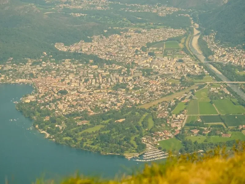
The Monte Rosa Tour is a journey of contrasts and superlatives. While the Tour du Mont Blanc attracts the masses, the Monte Rosa Tour remains a more connoisseur’s choice, offering a quieter, more rugged experience that stays at a higher average altitude. The massif itself is a sprawling complex of peaks and glaciers, and the trail provides a 360-degree perspective of this geological giant. The circuit is traditionally divided into nine or ten stages, each offering a distinct landscape and cultural atmosphere. In Switzerland, the trail is impeccably marked and often follows the dramatic Europaweg, featuring one of the world's longest pedestrian suspension bridges. In Italy, the terrain feels wilder and more ancient, passing through the high-altitude pastures of the Valsesia and Gressoney valleys.
One of the defining features of the Monte Rosa Tour is the crossing of the Theodul Pass. At 3,301 metres, this is the highest point of the trek and involves walking across a glacier. While the section on the glacier is often groomed for summer skiing, it serves as a stark reminder of the high-alpine nature of this route. The transition from the German-speaking Valais region of Switzerland to the Italian-speaking valleys of Aosta and Piedmont is not just linguistic; it is reflected in the architecture, the cuisine, and the very pace of life. The stone-roofed houses of the Walser villages in Alagna and Gressoney stand as testament to a resilient mountain culture that has thrived in these harsh conditions for nearly a millennium.
The physical toll of the trek is significant. Walkers should expect daily elevation gains and losses exceeding 1,000 metres, often on steep, rocky terrain. However, the rewards are commensurate with the effort. Standing at the top of the Passo del Monte Moro and seeing the east face of Monte Rosa—the highest rock wall in the Alps—is an experience that stays with a trekker forever. The infrastructure along the route is excellent, with a network of well-maintained mountain huts providing warm meals and a social atmosphere, though the popularity of the route means that planning and early booking are essential components of a successful journey.
History and Cultural Context
The history of the Monte Rosa Tour is inextricably linked to the Walser people, a Germanic tribe that migrated from the Upper Valais in Switzerland to the high valleys of Italy and Austria between the 12th and 14th centuries. These hardy settlers established communities in some of the most remote and inhospitable parts of the Alps, developing unique architectural styles and a dialect that persists to this day. As you walk through villages like Macugnaga, Alagna Valsesia, and Gressoney-la-Trinité, you are walking through a living museum of Walser heritage. Their traditional wooden and stone houses, designed to withstand heavy snow and facilitate the drying of hay, are a recurring motif of the Italian stages of the trek.
The mountains themselves have a storied place in the history of mountaineering. The first ascent of the Dufourspitze in 1855 by a team led by Charles Hudson marked a significant milestone in the "Golden Age" of Alpinism. Since then, the Monte Rosa massif has been a primary objective for climbers from around the world. The tour route follows many of the same paths used by early explorers, surveyors, and smugglers who navigated these high passes long before they were designated as hiking trails. The Theodul Pass, in particular, has been used since Roman times, with archaeological finds suggesting it was a vital link for trade and military movement across the Alps.
In the modern era, the Monte Rosa Tour was formalised as a trekking circuit to celebrate this shared heritage and the natural beauty of the region. It represents a successful cross-border collaboration between Switzerland and Italy, promoting sustainable tourism while preserving the delicate alpine environment. The trail is not just a physical challenge; it is a journey through the shared history of the Alps, where the boundaries between nations blur in the face of the overwhelming presence of the mountains.
Want more background? Read extended notes on history and cultural context → Learn more
Seasonal Highlights and Weather Reality
The window for completing the full Monte Rosa Tour is relatively narrow, typically extending from early July to mid-September. Outside of this period, the high passes—many of which exceed 2,800 metres—are likely to be blocked by snow, making the route impassable for standard trekkers and requiring advanced mountaineering skills and equipment.
July: This is the month of alpine flowers. The meadows are a riot of colour, and the days are at their longest. However, residual snow patches can still linger on north-facing slopes and high passes like the Augstbordpass or the Colle del Turlo. Trekkers in early July should be prepared for some snow travel and may find trekking poles and micro-spikes useful.
August: This is the peak season. The weather is generally at its most stable, and all huts are fully operational. The downside is that the trail and the huts are at their most crowded. Afternoon thunderstorms are a common occurrence in the Alps during August; these can be violent and develop rapidly, making it essential to reach your destination or a safe shelter by mid-afternoon.
September: Many experienced trekkers consider September the best time for the Monte Rosa Tour. The air is crisper and clearer, providing the best visibility for photography. The crowds begin to thin, and the autumn colours start to touch the larch forests. However, the days are shorter, and the risk of an early-season snowfall increases. By late September, many of the higher mountain huts begin to close for the season.
Weather in the Pennine Alps is notoriously unpredictable. Even in the height of summer, temperatures at the higher passes can drop below freezing, and snow can fall at any time of year. Fog and low cloud can reduce visibility to a few metres, making navigation on the more rugged sections difficult. Trekkers must be prepared for all conditions, from intense high-altitude sun to freezing rain and wind.
Recommended Itinerary
9-Day Monte Rosa Tour Itinerary (Anti-Clockwise)
Day 1: Zermatt to Theodulpass
- Distance: 12 km
- Elevation gain: 1,700 m (or less if using cable cars)
- Time: 5–6 hours
- Depart Zermatt (1,608 m) and climb towards the Matterhorn glacier paradise
- Pass through the hamlet of Zum See and climb steeply towards Trockener Steg
- Cross the lower section of the Theodul Glacier (often on a marked ski piste)
- Arrive at Rifugio Teodulo (3,317 m) on the Italian border
- Spectacular sunset views of the Matterhorn's south face
Day 2: Theodulpass to Resy
- Distance: 16 km
- Elevation loss: 1,300 m
- Time: 5–6 hours
- Descend from the pass into the Aosta Valley of Italy
- Pass the Cime Bianche lakes with their striking turquoise water
- Descend through alpine pastures to the village of Saint-Jacques
- Final short climb to the hamlet of Resy
- Stay at Rifugio Ferraro or Rifugio Guide Frachey
Day 3: Resy to Gressoney-la-Trinité
- Distance: 14 km
- Elevation gain: 700 m, Elevation loss: 850 m
- Time: 5 hours
- Cross the Colle Bettaforca (2,672 m)
- Enjoy views of the Western Monte Rosa peaks (Castor and Pollux)
- Descend into the Gressoney Valley, a stronghold of Walser culture
- Arrive in the picturesque village of Gressoney-la-Trinité
- Explore the traditional architecture and local museums
Day 4: Gressoney-la-Trinité to Alagna Valsesia
- Distance: 15 km
- Elevation gain: 1,100 m, Elevation loss: 1,600 m
- Time: 6–7 hours
- A challenging climb to the Passo dei Salati (2,936 m)
- Traverse high ridges with expansive views into the Piedmont region
- Long descent into Alagna, a world-renowned freeride ski hub and historic Walser village
- Stay in a traditional Walser hotel or the nearby Rifugio Pastore
Day 5: Alagna Valsesia to Macugnaga
- Distance: 20 km
- Elevation gain: 1,500 m, Elevation loss: 1,400 m
- Time: 8–9 hours
- One of the toughest days: crossing the Colle del Turlo (2,738 m)
- The pass is reached via an ancient, stone-paved military road
- Descend into the Val Anzasca towards Macugnaga
- Behold the East Face of Monte Rosa, the highest wall in the Alps
- Stay in the village of Macugnaga (Staffa or Pecetto)
Day 6: Macugnaga to Saas-Fee
- Distance: 18 km
- Elevation gain: 1,600 m, Elevation loss: 1,000 m
- Time: 7–8 hours
- Climb to the Passo del Monte Moro (2,853 m)
- Pass the golden statue of the Madonna delle Nevi
- Cross back into Switzerland and descend towards the Mattmark Reservoir
- Follow the easy lakeside path and then descend into the Saas Valley
- Arrive in the car-free resort of Saas-Fee, surrounded by 4,000 m peaks
Day 7: Saas-Fee to Grächen
- Distance: 18 km
- Elevation gain: 900 m, Elevation loss: 1,000 m
- Time: 6–7 hours
- Follow the "Höhenweg Saas-Fee" high-altitude balcony trail
- Spectacular views across the valley to the Fletschhorn and Weissmies
- Traverse steep slopes and larch forests
- Arrive in the sunny terrace village of Grächen
- Prepare for the final dramatic stages back to Zermatt
Day 8: Grächen to Europahütte
- Distance: 14 km
- Elevation gain: 1,100 m, Elevation loss: 500 m
- Time: 6–7 hours
- Begin the famous Europaweg, often cited as the most beautiful hike in the Alps
- Navigate sections with fixed cables and tunnels (requires a good head for heights)
- Cross the Charles Kuonen Suspension Bridge (494 m long)
- Arrive at the spectacularly situated Europahütte (2,265 m)
- Note: This section is prone to rockfalls; check local status before departing
Day 9: Europahütte to Zermatt
- Distance: 18 km
- Elevation gain: 400 m, Elevation loss: 1,000 m
- Time: 5–6 hours
- Continue along the Europaweg with the Matterhorn coming into constant view
- Pass through the Sunnegga area with its beautiful alpine lakes (Leisee, Stellisee)
- Final descent into Zermatt to complete the circuit
- Celebrate the achievement in one of Zermatt's many historic restaurants
Important Notes:
- The itinerary can be shortened by using cable cars in several locations (Zermatt, Gressoney, Alagna, Saas-Fee).
- The Europaweg (Days 8 and 9) is subject to frequent closures due to geological instability. An alternative valley route is always available.
- Glacier conditions on the Theodul Pass can change; always follow the marked poles.
- Booking huts in advance is mandatory, especially in July and August.
Planning and Bookings
Book Your Trip
Everything you need to plan your journey
Accommodation
Find places to stay near Zermatt
Flights
Search flights to Zermatt
Essential Preparation
The Monte Rosa Tour requires meticulous planning, particularly regarding logistics and physical conditioning. Trekkers should be capable of walking 6–9 hours a day with a loaded pack, often on steep and uneven terrain. Training should focus on cardiovascular endurance and leg strength, ideally including several long day hikes with significant elevation gain in the months leading up to the trip.
Logistically, Zermatt is the most common starting point. As a car-free village, access is via the Matterhorn Gotthard Bahn from Täsch, where large parking facilities are available. Most international travellers fly into Zurich (ZRH) or Geneva (GVA) and take the efficient Swiss rail system to Zermatt via Visp. It is highly recommended to spend at least one or two days in Zermatt or Saas-Fee prior to starting the trek to acclimatise to the altitude, as much of the trail stays above 2,000 metres.
Trail Accommodation
Accommodation on the Monte Rosa Tour is a mix of high-altitude mountain huts (Rifugios in Italy, Cabanes in Switzerland) and valley hotels or guesthouses. The huts offer a unique alpine experience, typically providing dormitory-style sleeping arrangements and communal half-board meals (breakfast and dinner).
Hut Facilities:
- Dormitory bunks with blankets or duvets (silk liners are mandatory for hygiene)
- Communal dining rooms serving hearty multi-course Italian or Swiss mountain fare
- Shared bathroom facilities (showers are often available for a small fee, but water is limited)
- Drying rooms for boots and wet gear
- Charging stations for electronics (though these can be crowded)
- Small selection of snacks, drinks, and packed lunches for purchase
Booking Requirements:
- Huts must be booked months in advance for the peak July–August season.
- Swiss huts can often be booked via the SAC (Swiss Alpine Club) online portal.
- Italian rifugios often require direct email or phone bookings, sometimes with a deposit.
- Costs typically range from CHF 80–110 in Switzerland and €60–85 in Italy for half-board.
Required Gear
- Sturdy trekking boots: High-cut with a stiff sole (Vibram or similar) for rocky terrain and glacier crossing.
- Backpack: 35–45 litres is usually sufficient if staying in huts. Ensure it has a high-quality rain cover.
- Clothing layers: Moisture-wicking base layers, a warm fleece or down mid-layer, and a high-quality waterproof/breathable shell jacket.
- Trekking poles: Highly recommended to reduce impact on knees during the long descents.
- Navigation: Topographic maps (1:25,000 or 1:50,000), a compass, and a GPS device or smartphone with offline maps (e.g., Outdooractive or Gaia GPS).
- Sun protection: High-factor sunscreen, lip balm with SPF, polarised sunglasses (Category 3 or 4), and a wide-brimmed hat.
- Safety gear: A basic first aid kit, an emergency whistle, and a space blanket.
What to Bring
- Silk or lightweight cotton sleeping bag liner (mandatory in all huts).
- Personal toiletries: Biodegradable soap, travel towel, toothbrush, and any necessary medications.
- Water hydration system: At least 2 litres of capacity (bladder or bottles).
- Cash: Both Swiss Francs (CHF) and Euros (€) are necessary, as many remote huts do not accept credit cards or have unreliable connections.
- Earplugs: Essential for a good night's sleep in communal dormitories.
- Headlamp: For navigating huts at night or in case of late arrivals.
- Snacks: Energy bars, nuts, and dried fruit to supplement hut meals.
- Power bank: To ensure your phone/GPS remains charged in remote areas.
Permits
One of the advantages of the Monte Rosa Tour is that no formal permits are required to hike the trail itself. There are no daily quotas for the path, and you are free to cross the border between Switzerland and Italy as part of the Schengen Agreement (though you should always carry a valid passport or national ID card).
However, the "permit" in a practical sense is your hut reservation. Because wild camping is strictly regulated and generally discouraged or prohibited along much of the route (especially in Switzerland and within Italian regional parks), your ability to complete the trek is entirely dependent on securing accommodation. During the peak summer months, the lack of a reservation can effectively stop your journey, as huts are often filled to capacity and may turn away trekkers who arrive without a booking, except in genuine emergency situations.
Key Permit-Related Considerations:
- Fishing Permits: If you intend to fish in any of the alpine lakes or rivers, local permits are required and can usually be purchased in the valley towns.
- Group Permits: Large organised groups (usually 10+ people) may need to notify local tourism offices or hut wardens further in advance.
- Parking: In Täsch (for Zermatt), you will need to pay for long-term parking in one of the multi-storey terminals.
- Cable Cars: While not permits, tickets for the various lifts can be expensive. Consider purchasing a "Peak Pass" or similar regional discount card if you plan to use multiple lifts.
Other Activities in the Area
The regions surrounding Monte Rosa offer a wealth of activities for those looking to extend their stay or take a rest day:
- Gornergrat Railway: Take the historic cogwheel railway from Zermatt to the Gornergrat (3,089 m) for one of the finest panoramic views in the Alps, overlooking the Gorner Glacier and 29 peaks over 4,000 metres.
- Matterhorn Museum (Zermatlantis): Located in Zermatt, this underground museum offers a fascinating look at the history of the village and the dramatic first ascent of the Matterhorn.
- Walser Museums: Visit the dedicated Walser museums in Alagna Valsesia or Gressoney-la-Trinité to see preserved traditional homes and learn about the unique culture and language of the region.
- Saas-Fee Ice Pavilion: Explore the world's largest ice grotto, carved directly into the Fee Glacier, featuring stunning ice sculptures and glaciological displays.
- Thermal Baths: Relax tired muscles in the thermal spas of Champoluc or the luxury wellness centres in Zermatt and Saas-Fee.
- Mountain Biking: Both Zermatt and the Aosta Valley offer world-class mountain bike trails, ranging from flowy alpine singletrack to technical downhill runs.
- Via Ferrata: For those with a head for heights, there are several excellent via ferrata routes in the area, including the Gorge Alpine in Saas-Fee.
Safety and Conditions
Safety on the Monte Rosa Tour is primarily a matter of preparation, respect for the environment, and sound decision-making. The high-altitude nature of the trek introduces risks that are not present on lower-level walks.
Altitude Sickness: Much of the trail lies above 2,000 metres, and the Theodul Pass reaches over 3,300 metres. Mild symptoms of Acute Mountain Sickness (AMS), such as headaches, nausea, and fatigue, are common. The best prevention is gradual acclimatisation, staying hydrated, and avoiding overexertion in the first 48 hours. If symptoms persist or worsen, the only cure is to descend to a lower altitude.
Glacier Crossing: The crossing of the Theodul Glacier is generally safe for trekkers during the summer as it follows a marked and often groomed path used by skiers. However, you must stay between the markers. Venturing off the marked path without glacier equipment (rope, harness, crampons) and the knowledge to use them is extremely dangerous due to hidden crevasses.
Terrain and Exposure: Sections of the Europaweg and the descent from the Passo del Monte Moro involve steep drops and narrow paths. While these are often equipped with fixed cables or steps, they require a good head for heights and steady footing. In wet or icy conditions, these sections can become significantly more hazardous.
Weather Awareness: Alpine weather can change in minutes. Always check the local forecast (MeteoSwiss for Switzerland, Meteo vda for Aosta Valley) before setting out. If a thunderstorm is forecast, start your day as early as possible to be off the high passes by noon. If caught in a storm on a ridge or pass, descend immediately and avoid standing near isolated trees or metal cables.
Emergency Contacts:
- Switzerland: 144 (Medical Emergencies), 1414 (REGA Air Rescue)
- Italy: 112 (General Emergency Number), 118 (Medical/Alpine Rescue)
- Ensure your travel insurance specifically covers "search and rescue" and "high-altitude trekking up to 4,000 metres."
Side Trips and Points of Interest
For those with extra time or energy, several detours and landmarks along the Monte Rosa Tour are well worth the effort:
The Charles Kuonen Suspension Bridge: Located on the Europaweg between Grächen and Zermatt, this is a marvel of modern engineering. Stretching 494 metres across the Grabengufer ravine, it is one of the longest pedestrian suspension bridges in the world. Walking across it provides a thrilling (and slightly swaying) perspective of the valley floor far below.
Schwarzsee: A beautiful alpine lake at the foot of the Matterhorn's Hörnli Ridge. It is a short detour from the main trail on the final day and features a small chapel (Maria zum Schnee) that is a popular spot for reflection and photography.
The Madonna delle Nevi: At the Passo del Monte Moro, a large golden statue of the Virgin Mary stands overlooking the border. It is a powerful symbol for the local mountain communities and offers a spectacular foreground for photos of the Monte Rosa East Face.
Lago di Cime Bianche: These high-altitude lakes on the descent from the Theodul Pass are known for their extraordinary colour, ranging from milky turquoise to deep emerald, caused by glacial flour suspended in the water. They provide a perfect spot for a rest and a picnic in a truly wild setting.
Hörnlihütte: While not strictly on the tour, fit trekkers can take a half-day detour from Zermatt to visit the base camp for Matterhorn climbers. The hut sits at 3,260 metres and offers an intimate look at the climbers preparing for their ascent of the world's most famous mountain.
Leave No Trace
The alpine environment is a fragile ecosystem that is increasingly under pressure from climate change and tourism. As a trekker on the Monte Rosa Tour, you have a responsibility to minimise your impact on this pristine landscape. The principles of Leave No Trace are essential for preserving the trail for future generations.
Key Principles for the Monte Rosa Tour:
- Plan Ahead and Prepare: Proper planning reduces the likelihood of emergencies and ensures you don't have to resort to unsafe or environmentally damaging practices.
- Travel on Durable Surfaces: Stay on the marked trails. Cutting switchbacks causes erosion and destroys fragile alpine vegetation that can take decades to recover.
- Dispose of Waste Properly: Pack out all trash, including organic waste like fruit peels, which decompose very slowly at high altitudes. Use the toilets provided in huts and villages.
- Leave What You Find: Do not pick wildflowers or remove rocks or fossils. Leave cultural and historic artefacts, such as Walser stone tools or ruins, as you found them.
- Respect Wildlife: Observe marmots, chamois, and ibex from a distance. Never feed wildlife, as it disrupts their natural foraging habits and can make them dependent on humans.
- Be Considerate of Others: Keep noise levels down, especially near huts in the evening. Yield to uphill hikers and maintain a friendly, respectful attitude toward fellow trekkers and locals.