
Monte Gennaro Loop: A Roman Escape to the Mountains
The Monte Gennaro Loop is a captivating day walk offering a refreshing escape from the bustling city of Rome, immersing hikers in the natural beauty of the Monti Lucretili Regional Park. This circular route provides a moderate challenge with significant elevation gain, rewarding participants with panoramic vistas of the surrounding Lazio region and, on clear days, a distant glimpse of the Eternal City itself. It's an accessible adventure for those seeking a taste of the Italian Apennines without venturing too far from urban amenities.
- Distance: 14.5 km
- Elevation Gain: 750 m
- Duration: 5–6 hours
- Difficulty: Moderate
- Best Time: May to October
- Closest City: Rome
- Trailhead Access: From Rome, take the A24 highway towards L'Aquila. Exit at Tivoli and follow signs for Marcellina/San Polo dei Cavalieri. Continue to the trailhead near Campo Catino. Driving time is approximately 1 hour. Parking available at Campo Catino.
Overview
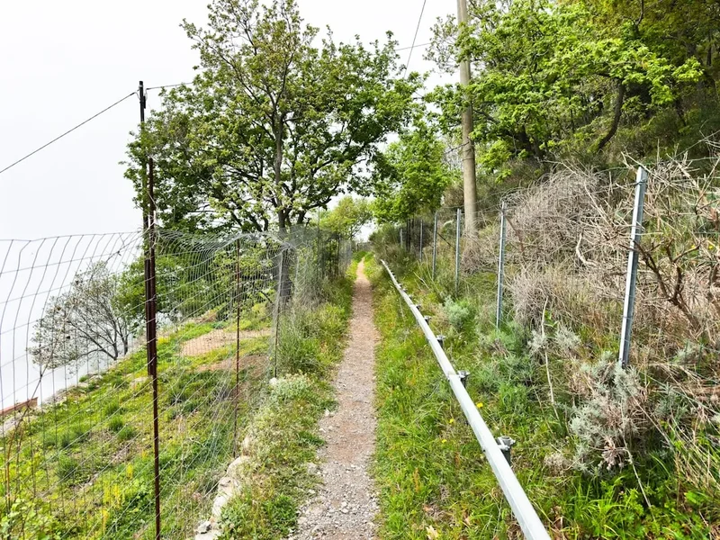
The Monte Gennaro Loop is a well-defined circuit that ascends to the summit of Monte Gennaro, the highest peak in the Monti Lucretili range. The trail begins from the picturesque area of Campo Catino, a high-altitude plateau that serves as a natural starting point for many mountain excursions. The ascent is steady, winding through a mix of beech forests and open meadows, offering a gradual introduction to the mountain's terrain. As you climb, the vegetation changes, and the views begin to open up, providing tantalising glimpses of the landscape below.
The summit of Monte Gennaro, at 1,271 metres, is marked by a prominent cross and offers a breathtaking 360-degree panorama. On a clear day, the views extend across the rolling hills of Lazio, the Tyrrhenian Sea in the distance, and the sprawling metropolis of Rome. The descent follows a different path, often utilising wider tracks and offering a contrasting perspective of the mountainside. This loop design ensures that hikers experience a variety of scenery and terrain throughout their journey, making it a dynamic and engaging day hike.
The trail is generally well-maintained, though some sections can be rocky and uneven, requiring sturdy footwear. The moderate difficulty level makes it suitable for most reasonably fit hikers, but the significant elevation gain means it’s not to be underestimated. The best times to undertake this walk are during the spring and autumn months when the weather is typically pleasant, and the colours of the landscape are at their most vibrant. Summer can be hot, especially on exposed sections, while winter may bring snow and ice, making the trail more challenging and potentially impassable without appropriate winter gear.
History and Cultural Context
The Monti Lucretili, and Monte Gennaro in particular, have a long history of human interaction, dating back to ancient Roman times. The area was likely used for pastoralism and as a source of timber and other natural resources. The strategic position of Monte Gennaro, overlooking the fertile plains and the nascent city of Rome, would have made it a significant vantage point throughout history.
In more recent centuries, the mountains became a popular destination for Romans seeking respite from the summer heat and the urban environment. The trails were developed and maintained by local communities and shepherds, facilitating access to grazing lands and pilgrimage routes. The presence of religious sites, such as chapels and hermitages, scattered throughout the Apennines, speaks to the spiritual significance these mountains have held for centuries. The cross at the summit of Monte Gennaro is a testament to this enduring connection, serving as a beacon and a focal point for pilgrims and hikers alike.
The development of modern hiking trails has made Monte Gennaro more accessible to a wider audience. The loop route, as it is commonly walked today, represents a synthesis of ancient pathways and modern trail design, offering a journey that is both physically engaging and historically resonant. The area is part of the Monti Lucretili Regional Park, established to protect its natural beauty, biodiversity, and cultural heritage, ensuring that these mountains continue to be a cherished natural resource for generations to come.
Seasonal Highlights and Weather Reality
The Monte Gennaro Loop is a walk that can be enjoyed throughout much of the year, but each season offers a distinct experience and presents its own set of considerations.
Spring (May to June): This is an ideal time to hike the loop. The landscape bursts into life with wildflowers carpeting the meadows, and the forests are a vibrant green. The weather is generally mild, with temperatures comfortable for hiking. However, spring can also bring unpredictable rainfall, so carrying waterproofs is always advisable. The higher elevations may still hold patches of snow in early spring.
Summer (July to August): While the loop is accessible in summer, it can be quite hot, especially on the exposed sections of the ascent and descent. Hikers should start early in the morning to avoid the midday sun and carry ample water. The higher altitude does offer some respite from the heat of Rome, but the lack of extensive shade on the upper slopes means it can still be challenging. The views from the summit are often at their clearest during this period.
Autumn (September to October): This is arguably the most beautiful season for the Monte Gennaro Loop. The forests transform into a spectacular display of autumnal colours, with shades of gold, red, and orange painting the landscape. The weather is typically stable and pleasant, with cooler temperatures and clear skies. The reduced crowds compared to summer also make for a more tranquil experience.
Winter (November to April): Hiking Monte Gennaro in winter requires caution and appropriate gear. Snowfall is common at higher elevations, and the trails can become icy and treacherous. While the loop is technically possible for experienced winter hikers with crampons and ice axes, it is generally not recommended for casual day walkers. The views can be stunning on clear winter days, but the risk of severe weather and difficult conditions is significantly higher.
Weather Considerations: The weather in the Monti Lucretili can change rapidly. Even on a clear morning, clouds can roll in, bringing rain or fog, particularly at higher altitudes. It is essential to check the mountain forecast before setting out and to be prepared for a range of conditions, regardless of the season.
Recommended Itinerary
Monte Gennaro Loop: A Day Hike Itinerary
Early Morning (Approx. 8:00 AM): Departure from Rome
- Begin your journey from Rome, heading east on the A24 highway towards L'Aquila.
- The drive takes approximately 1 hour, depending on traffic conditions leaving the city.
- Follow signs for Tivoli and then for Marcellina/San Polo dei Cavalieri.
- Continue on local roads towards Campo Catino, the designated trailhead.
Morning (Approx. 9:00 AM - 9:30 AM): Arrival at Campo Catino and Trailhead Preparation
- Arrive at Campo Catino, a high-altitude plateau with parking facilities.
- Take time to prepare your gear, ensure you have sufficient water and snacks, and check the trail markers.
- Locate the start of the Monte Gennaro Loop trail, typically well-signposted from the parking area.
Morning to Midday (Approx. 9:30 AM - 12:30 PM): Ascent to Monte Gennaro Summit
- Begin the ascent towards Monte Gennaro.
- The initial part of the trail may pass through open meadows or light woodland.
- As you gain elevation, the path will become steeper and more defined, often winding through beech forests.
- Look for trail markers (often red and white stripes) indicating the loop route.
- The trail gradually climbs, offering increasingly expansive views of the surrounding valleys and distant landscapes.
- Approximate distance covered: 6–7 km.
- Approximate elevation gain: 500–600 m.
Midday (Approx. 12:30 PM - 1:30 PM): Summit Experience at Monte Gennaro
- Reach the summit of Monte Gennaro (1,271 m).
- Admire the panoramic views from the summit cross.
- Take a break for lunch and refreshments, enjoying the expansive vistas.
- On clear days, you may see Rome, the Tyrrhenian Sea, and the wider Apennine mountain range.
Afternoon (Approx. 1:30 PM - 4:00 PM): Descent and Loop Completion
- Begin the descent, following the loop trail which takes a different route from the ascent.
- The descent path may be steeper in sections or follow wider tracks.
- Continue to enjoy the changing scenery as you descend through forests and meadows.
- The trail will eventually lead you back towards the Campo Catino area.
- Approximate distance covered: 7–8 km.
- Approximate elevation loss: 750 m.
Late Afternoon (Approx. 4:00 PM onwards): Return to Rome
- Arrive back at the Campo Catino trailhead.
- Pack up your gear and begin the drive back to Rome.
- The return journey will take approximately 1 hour.
Important Notes:
- This is a day hike; no overnight accommodation is required.
- The trail is generally well-marked, but carrying a map or GPS device is recommended.
- Start early to allow ample time and avoid the hottest part of the day in summer.
- Carry sufficient water, as there are no reliable water sources on the upper parts of the trail.
- Wear sturdy hiking boots with good ankle support.
- Be prepared for changing weather conditions, especially at higher altitudes.
Planning and Bookings
Book Your Trip
Everything you need to plan your journey
Accommodation
Find places to stay near Rome
Flights
Search flights to Rome
Essential Preparation
The Monte Gennaro Loop is a day hike, meaning no complex booking coordination for accommodation is required. The primary logistical consideration is transportation from Rome to the trailhead at Campo Catino. Driving is the most convenient method, taking approximately one hour via the A24 highway. Ensure your vehicle is in good condition, as mountain roads can be winding. Parking is available at Campo Catino, though it can become busy on weekends and holidays, so arriving early is advisable. For those without a car, public transport options are limited and time-consuming, often involving multiple bus changes and a significant walk from the nearest stop. Researching these options thoroughly is crucial if not driving. Familiarise yourself with the route using a reliable map or GPS device, as mobile signal can be intermittent in the mountains.
Trail Accommodation
This is a day hike requiring no overnight accommodation.
Required Gear
- Hiking Boots: Sturdy, waterproof hiking boots with good ankle support are essential for navigating the rocky and uneven terrain.
- Backpack: A comfortable daypack (20-30 litres) to carry essentials.
- Waterproof Jacket: A lightweight, breathable waterproof jacket is crucial, as mountain weather can change rapidly.
- Layers of Clothing: Wear moisture-wicking base layers, an insulating mid-layer (fleece or down jacket), and a waterproof outer shell. Avoid cotton.
- Headwear: A sun hat for protection from the sun and a warm hat (beanie) for cooler temperatures or higher altitudes.
- Gloves: Lightweight gloves can be useful, especially in cooler seasons or at the summit.
- Navigation Tools: A physical map of the area, a compass, and/or a GPS device or smartphone with offline maps downloaded.
- First-Aid Kit: A basic kit including plasters, antiseptic wipes, pain relievers, blister treatment, and any personal medications.
- Head Torch: Essential in case of unexpected delays or if starting very early/finishing late.
What to Bring
- Water: Carry at least 1.5–2 litres of water per person. There are no reliable water sources on the trail.
- Food: High-energy snacks such as nuts, dried fruit, energy bars, and sandwiches for lunch.
- Sun Protection: High SPF sunscreen, sunglasses, and lip balm.
- Insect Repellent: Particularly useful during warmer months.
- Trekking Poles: Optional, but can be beneficial for reducing strain on knees during the ascent and descent.
- Camera: To capture the stunning views.
- Mobile Phone: Fully charged, with a power bank if possible.
- Small Towel: For wiping sweat or drying off after unexpected rain.
- Hand Sanitiser: For hygiene.
Permits
No specific permits are required to hike the Monte Gennaro Loop. The trail is located within the Monti Lucretili Regional Park, which is generally open to the public for recreational use. However, it is always advisable to check for any local regulations or temporary restrictions that may be in place, especially during peak seasons or for specific events. The park's official website or local tourist information centres can provide the most up-to-date information. Parking at Campo Catino is generally free, but it is wise to be aware of any signage regarding parking regulations.
Other Activities in the Area
The region surrounding Monte Gennaro offers several other attractions for visitors looking to extend their stay or explore beyond the hiking trail:
- Tivoli: Located a short drive from the trailhead, Tivoli is a historic town famous for its UNESCO World Heritage sites, including Villa d'Este with its magnificent Renaissance gardens and fountains, and Hadrian's Villa, the sprawling archaeological complex of Emperor Hadrian's former residence.
- Monti Lucretili Regional Park: Beyond Monte Gennaro, the park offers numerous other hiking trails, ranging from gentle walks through forests to more challenging ascents of other peaks. Exploring different sections of the park can reveal diverse flora, fauna, and stunning natural landscapes.
- Local Gastronomy: The Lazio region is renowned for its cuisine. After your hike, consider visiting a local trattoria in one of the nearby villages, such as Marcellina or San Polo dei Cavalieri, to sample traditional dishes like pasta alla carbonara, amatriciana, or cacio e pepe, accompanied by local wines.
- Agriturismo Stays: For a more immersive experience, consider staying at an agriturismo (farm stay) in the countryside surrounding Rome. These offer a peaceful retreat and an opportunity to enjoy authentic rural Italian life and cuisine.
- Rome Exploration: As the capital city, Rome offers an endless array of historical sites, museums, art galleries, and culinary experiences. A day trip to Monte Gennaro can be perfectly combined with a longer stay in Rome, providing a balance of urban exploration and natural adventure.
Safety and Conditions
Trail Conditions: The Monte Gennaro Loop is generally well-maintained, but conditions can vary. The path can be rocky, uneven, and steep in places. During and after rainfall, sections may become slippery and muddy. In winter, snow and ice can make the trail hazardous, requiring specialised equipment and experience.
Weather: Mountain weather is notoriously unpredictable. Be prepared for rapid changes, including sudden drops in temperature, strong winds, fog, and rain, even on seemingly clear days. Always check the weather forecast before you go and be ready to turn back if conditions deteriorate.
Navigation: While the trail is marked, it is essential to carry a map and compass or a GPS device with offline maps. Mobile phone signal can be unreliable in the mountains, so do not solely rely on your phone for navigation. Familiarise yourself with the route beforehand.
Water: There are no reliable water sources on the trail, especially on the upper sections. Carry sufficient water for the entire hike (at least 1.5–2 litres per person). Consider bringing a water filter or purification tablets as a backup.
Wildlife: While large dangerous animals are rare in this region, be aware of potential encounters with wild boar or other smaller wildlife. It is best to observe animals from a distance and never feed them.
Emergency Contacts: Know the emergency number for Italy (112). Inform someone of your hiking plans, including your intended route and estimated return time.
Physical Fitness: The hike involves significant elevation gain and a moderate difficulty level. Ensure you are physically prepared for a 5–6 hour hike with a substantial climb. If you have any health concerns, consult your doctor before undertaking the hike.
Sun Protection: Even on cloudy days, UV radiation can be strong at higher altitudes. Use sunscreen, wear a hat, and sunglasses.
Side Trips and Points of Interest
Summit Cross: The most prominent feature at the summit of Monte Gennaro is the large metal cross. This serves as a popular landmark and a focal point for hikers. It offers a tangible sense of achievement upon reaching the peak and provides a clear marker for the highest point.
Panoramic Views: The primary "point of interest" is the breathtaking 360-degree panorama from the summit. On a clear day, the views are extensive, encompassing the rolling hills of the Lazio region, the distant Tyrrhenian Sea, the city of Rome, and the rugged peaks of the Apennine Mountains. This expansive vista is the main reward for the challenging ascent.
Campo Catino Plateau: The starting and ending point of the loop, Campo Catino, is itself a beautiful high-altitude plateau. It is often used as a base for picnics and as a starting point for various mountain excursions. The open meadows and surrounding forests offer a pleasant environment to begin and end your hike.
Forest Sections: The loop passes through varied woodland, including significant stretches of beech forest. These sections offer shade and a different atmosphere compared to the open summit. The changing foliage throughout the seasons adds to the visual appeal of these forest paths.
Shepherd Huts and Ruins: While not always clearly marked or maintained, remnants of old shepherd huts or stone structures can sometimes be spotted along the less-travelled parts of the trail. These offer a glimpse into the historical use of the mountains for pastoral activities.
Leave No Trace
The Monte Gennaro Loop, situated within the Monti Lucretili Regional Park, is a natural environment that deserves respect and careful stewardship. Adhering to Leave No Trace principles ensures that this beautiful area remains pristine for future visitors and for the health of its ecosystems.
Plan Ahead and Prepare: Before your hike, familiarise yourself with the trail, weather conditions, and any park regulations. Pack appropriately for the conditions and carry sufficient food and water to avoid relying on natural resources.
Travel and Camp on Durable Surfaces: Stick to the marked trails. Avoid cutting switchbacks or walking on fragile vegetation, as this can lead to erosion and damage to plant life. Campo Catino offers designated areas for resting and picnicking.
Dispose of Waste Properly: Pack out everything you pack in. This includes all food scraps, wrappers, and any other litter. Use designated bins if available, but be prepared to carry all waste back with you. Use toilet facilities where available, or if not, dig a cathole at least 60 metres away from water sources, trails, and campsites.
Leave What You Find: Resist the temptation to take souvenirs such as rocks, plants, or historical artefacts. Leave the natural and cultural heritage of the area as you found it.
Minimise Campfire Impacts: Campfires are generally not permitted on day hikes and are discouraged in natural areas. If permitted in designated areas, use existing fire rings and keep fires small. Ensure fires are completely extinguished before leaving.
Respect Wildlife: Observe wildlife from a distance. Never feed animals, as this can disrupt their natural behaviours and diets, and can make them dependent on humans or aggressive. Store food securely.
Be Considerate of Other Visitors: Keep noise levels down, yield to other hikers on narrow trails, and be mindful of others' enjoyment of the natural environment. Respect the local culture and traditions.