Monte Fitz Roy Trail - The Crown Jewel of Patagonia
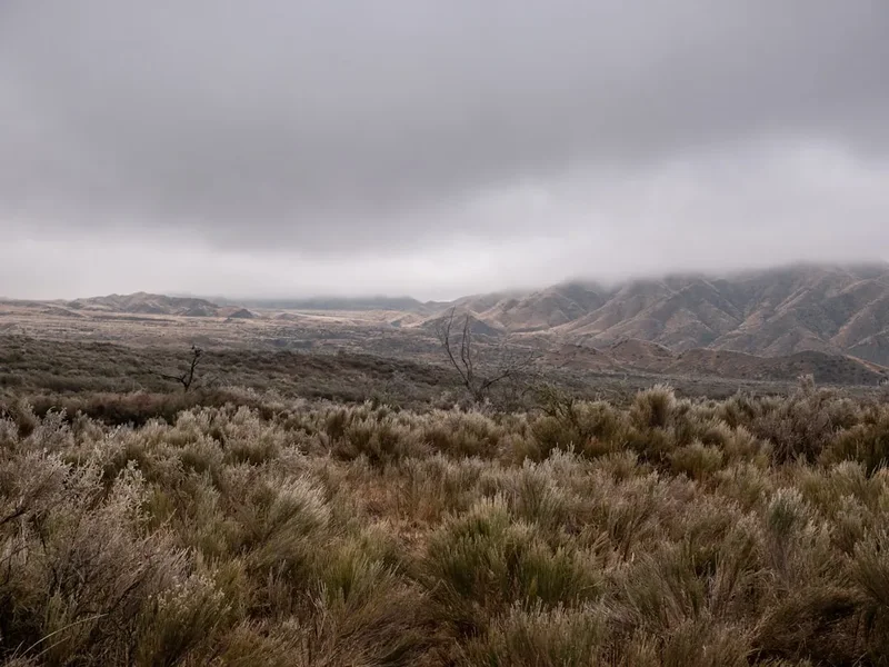
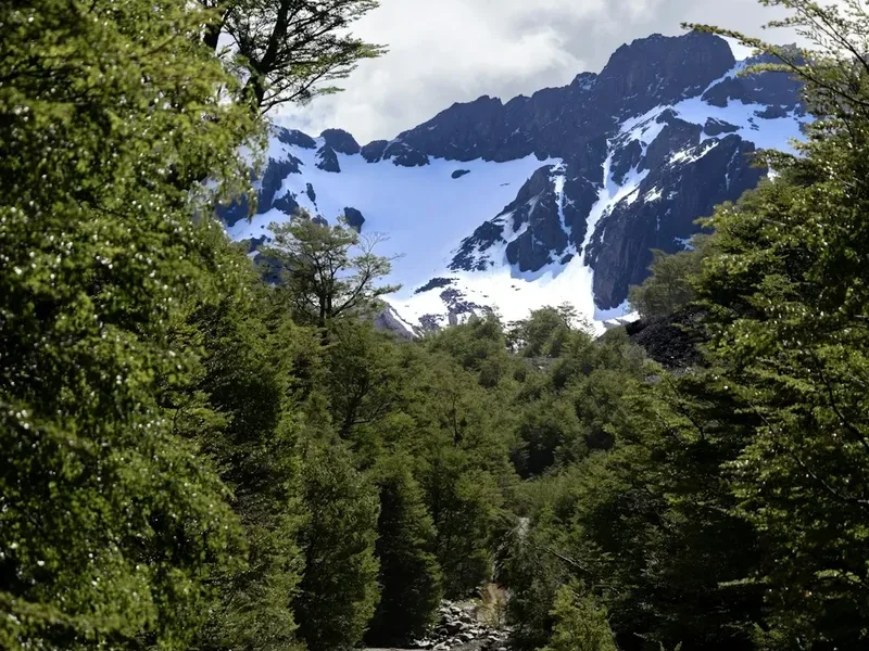
The Monte Fitz Roy Trail, also known as the Laguna de los Tres trek, is arguably the most iconic day hike in South America. Located within the northern sector of Los Glaciares National Park in Argentina, this 21-kilometre return journey leads hikers to the base of the granite monoliths that have inspired generations of explorers, climbers, and photographers. Rising 3,405 metres above sea level, Monte Fitz Roy (or Cerro Chaltén) dominates the skyline with its jagged, vertical spires, flanked by the equally impressive needles of Aguja Poincenot and Cerro Torre. The trail is a masterclass in Patagonian beauty, traversing ancient Lenga forests, crossing glacial streams, and culminating in a steep, challenging ascent to a turquoise alpine lagoon that sits directly beneath the towering granite walls. This is not merely a walk; it is a pilgrimage to the heart of the Andes, offering a raw and visceral encounter with the elements of the southern hemisphere's most dramatic mountain range.
- Distance: 21.0 km return
- Duration: 8–10 hours
- Elevation Gain: 850 m
- Difficulty: Challenging (primarily due to the final ascent)
- Best Time: October to April (Southern Hemisphere spring to autumn)
- Highest Point: Laguna de los Tres (1,170 m)
- Trailhead: El Chaltén (Avenida San Martín or El Pilar)
- Cost: Free (No entry fee for this sector of Los Glaciares National Park)
Overview
The Monte Fitz Roy Trail is the definitive trekking experience in El Chaltén, Argentina’s trekking capital. While the town offers numerous world-class routes, the journey to Laguna de los Tres remains the primary objective for almost every visitor. The trail is characterised by its incredible variety of terrain and the constant, looming presence of the Fitz Roy massif. The first half of the trek is a moderate journey through sub-antarctic forests and open heathlands, providing frequent glimpses of the peaks. However, the final kilometre is a legendary test of endurance, involving a 400-metre vertical gain over a steep, rocky moraine that requires steady footing and mental resolve.
The reward at the summit is unparalleled. Laguna de los Tres, named for the three peaks visible from its shores (Fitz Roy, Poincenot, and Torre), is a glacial lake of startling blue. On a clear day, the reflection of the granite spires in the water creates one of the most photographed vistas on Earth. Beyond the main lagoon, a short scramble to the left reveals the hidden Laguna Sucia, a deep emerald pool fed by hanging glaciers that cling to the vertical walls of the massif. The scale of the landscape is difficult to comprehend until you are standing at the water's edge, feeling the cold katabatic winds blowing off the Southern Patagonian Ice Field.
Unlike many world-class trails that require complex logistics or expensive permits, the Monte Fitz Roy Trail is remarkably accessible. It begins directly from the edge of the El Chaltén village, allowing hikers to walk from their accommodation straight into the wilderness. Despite this accessibility, the trail demands respect. The weather in Patagonia is notoriously fickle, and the "four seasons in one day" cliché is a daily reality here. Hikers must be prepared for intense UV radiation, gale-force winds, and sudden snowfalls, even in the height of summer. This blend of accessibility and raw, untamed wilderness is what makes the Fitz Roy Trail a cornerstone of global trekking culture.
History and Cultural Context
The history of Monte Fitz Roy is a tapestry of indigenous mythology, colonial exploration, and mountaineering legend. To the original inhabitants of the region, the Aonikenk (Tehuelche) people, the mountain was known as "Chaltén." In their language, this translates to "smoking mountain," a reference to the near-constant cap of clouds that clings to the summit, which the Aonikenk believed was smoke from a volcanic vent. The mountain held deep spiritual significance, appearing in various myths as a sacred landmark that anchored the world.
The European name "Fitz Roy" was bestowed in 1877 by the Argentine explorer Francisco Moreno (Perito Moreno). He named it in honour of Robert FitzRoy, the captain of the HMS Beagle, who had surveyed the Patagonian coast in the 1830s alongside Charles Darwin. Interestingly, FitzRoy himself never saw the mountain that now bears his name, as his surveys were primarily maritime. For decades, the peak remained a mystery to the outside world, its vertical granite walls deemed impossible to climb by early mountaineers.
The first successful ascent of Monte Fitz Roy did not occur until 1952, when French climbers Lionel Terray and Guido Magnone reached the summit. This feat remains one of the most significant achievements in the history of alpinism, as the technical difficulty of the granite and the extreme weather conditions make it one of the most challenging peaks in the world. Today, the mountain remains a "holy grail" for elite climbers, while the trail to its base allows recreational hikers to share in the awe that the peak inspires. The town of El Chaltén itself is a relatively recent addition to the map, founded in 1985 during a border dispute between Argentina and Chile. What began as a strategic outpost has evolved into a vibrant hub for outdoor enthusiasts, yet it retains a frontier spirit that honours the explorers and climbers who first put this region on the map.
Want more background? Read extended notes on history and cultural context → Learn more
Seasonal Highlights and Weather Reality
The trekking season in Los Glaciares National Park runs from October to April, coinciding with the Southern Hemisphere's spring, summer, and autumn. Outside of these months, the trail is often buried in deep snow, and the town of El Chaltén enters a period of semi-hibernation with limited services and extreme cold.
Spring (October to November): This is a season of transition. The forests begin to bud, and the birdlife is particularly active. Hikers may encounter snow on the upper sections of the trail, especially on the final ascent to Laguna de los Tres. The weather is highly unpredictable, but the crowds are significantly thinner than in mid-summer. The contrast between the white snowcaps and the emerging greenery makes for exceptional photography.
Summer (December to February): This is the peak season. The days are incredibly long, with daylight lasting until 10:00 PM, providing ample time for the long trek. This is also the windiest time of year; the "Patagonian winds" can reach speeds of over 100 km/h, making the exposed sections of the trail challenging. While the temperatures are mild (averaging 10°C to 18°C), the sun is extremely strong due to the thin ozone layer in the southern latitudes.
Autumn (March to April): Many experienced hikers consider this the best time to visit. The Lenga forests turn brilliant shades of red, orange, and gold, creating a spectacular frame for the granite peaks. The winds typically die down, and the air becomes crisp and clear. However, the days shorten rapidly, and night-time temperatures can drop below freezing. By late April, the first winter storms begin to arrive, signalling the end of the hiking season.
Weather Reality: Regardless of the season, hikers must prepare for the "Patagonian Factor." It is common to start a hike in a t-shirt under a cloudless sky and finish it in a waterproof jacket amidst a sleet storm. The mountains create their own microclimate, and the weather can change in a matter of minutes. Always check the wind speed forecasts, as high winds on the final moraine can be dangerous.
Recommended Itinerary
Monte Fitz Roy Day Hike Route Progression
Waypoint 1: El Chaltén Trailhead to Mirador del Fitz Roy
- Distance: 4 km
- Elevation Gain: 350 m
- Time: 1–1.5 hours
- The trail begins at the northern end of Avenida San Martín.
- A steady, uphill climb through open terrain and small patches of forest.
- Reach the first major viewpoint (Mirador del Fitz Roy) for a panoramic view of the valley and the distant peaks.
- This section is well-maintained but can be dusty in dry conditions.
Waypoint 2: Mirador del Fitz Roy to Laguna Capri / Poincenot Junction
- Distance: 4 km
- Elevation Gain: 50 m (mostly flat)
- Time: 1–1.5 hours
- The trail levels out as it enters the Lenga forest.
- Hikers can choose a slight detour to Laguna Capri (a beautiful lake with Fitz Roy views) or continue on the direct path toward Campamento Poincenot.
- Cross several small wooden bridges over crystal-clear streams.
- The forest provides welcome shade and protection from the wind.
Waypoint 3: Campamento Poincenot to the Base of the Ascent
- Distance: 1.5 km
- Elevation Gain: Minimal
- Time: 30–45 minutes
- Pass through the Poincenot campsite, a popular spot for overnight trekkers.
- Cross the Río Blanco via a sturdy bridge.
- Arrive at the "Río Blanco" ranger station (usually unstaffed), which marks the start of the final, steep climb.
- This is the last place to use a toilet (latrine) before the summit.
Waypoint 4: The Final Ascent to Laguna de los Tres
- Distance: 1 km
- Elevation Gain: 400 m
- Time: 1–1.5 hours
- The most challenging part of the day. The trail turns into a steep, rocky switchback over a glacial moraine.
- The path is narrow and can be crowded; it is customary to give way to those climbing up.
- The terrain is loose rock and scree, requiring careful foot placement.
- As you crest the final ridge, the full scale of Monte Fitz Roy is revealed suddenly and dramatically.
Waypoint 5: Laguna de los Tres and Laguna Sucia Viewpoint
- Distance: 0.5 km (exploration)
- Elevation Gain: Minimal
- Time: 1 hour (suggested rest time)
- Spend time at the shore of Laguna de los Tres.
- Follow the trail to the left (south) for 300 metres to reach the ridge overlooking Laguna Sucia.
- This viewpoint offers a look at the hanging glaciers and the sheer 2,000-metre vertical drop of the granite walls.
- Eat lunch here, but stay sheltered from the wind behind large boulders.
Waypoint 6: The Descent and Return to El Chaltén
- Distance: 10 km
- Elevation Loss: 850 m
- Time: 3.5–4.5 hours
- Retrace your steps down the steep moraine (trekking poles are highly recommended here to save your knees).
- Follow the trail back through the forest.
- Consider taking the alternative path via Laguna Capri if you missed it on the way up.
- The final 3 km descent into El Chaltén offers beautiful views of the Río de las Vueltas valley.
Important Notes:
- Start early (before 8:00 AM) to avoid the largest crowds and to ensure you return before dark.
- The final kilometre is very exposed; if winds are exceeding 60–70 km/h, consider turning back at the base of the ascent.
- Water from the streams in the park is generally considered safe to drink, but use a filter if you have a sensitive stomach.
- There are no rubbish bins on the trail; you must carry everything back to town.
Planning and Bookings
Book Your Trip
Everything you need to plan your journey
Accommodation
Find places to stay near El Chalten
Flights
Search flights to El Chalten
Essential Preparation
The Monte Fitz Roy Trail is a demanding day hike that requires a solid level of cardiovascular fitness. While the first 9 kilometres are relatively manageable, the final 1-kilometre ascent is punishing. Hikers should be comfortable with steep gradients and uneven, rocky terrain. If you have pre-existing knee issues, trekking poles are not just a luxury—they are essential for the descent.
Logistically, El Chaltén is the base for this trek. Most travellers fly into El Calafate (FTE) and take a 3-hour bus journey to El Chaltén. During the peak season (December–February), it is vital to book your bus transfers and accommodation at least several weeks in advance. El Chaltén is a small village, and it frequently reaches full capacity. There is no need to book the trail itself, as it is open to the public and free of charge, but you should check in with the Park Ranger office (Guardaparque) near the entrance of town to get the latest weather updates and trail conditions.
Trail Accommodation
As this is primarily a day hike, most walkers stay in El Chaltén. The village offers a wide range of options, from luxury eco-lodges and boutique hotels to budget-friendly hostels and serviced campsites. Many hostels offer "dormitorio" style beds which are popular with the international trekking community.
For those wishing to see the sunrise at Laguna de los Tres (a spectacular sight when the granite turns bright red), overnight camping is permitted at designated sites:
- Campamento Poincenot: The most popular campsite, located about 2 hours from the summit. It is free, but facilities are basic (pit toilets and a nearby stream for water). No fires are allowed; you must use a camping stove.
- Campamento Laguna Capri: Located about 2 hours from town, offering beautiful lake views. Also free with basic facilities.
- Note: There are no "huts" or "lodges" on the trail itself. If you camp, you must bring all your own gear (tent, sleeping bag, stove). There is no booking system for these campsites; they operate on a first-come, first-served basis.
Required Gear
- Trekking Boots: Sturdy, waterproof boots with good ankle support are mandatory. The final ascent is over loose rock where trainers or sandals are inadequate and potentially dangerous.
- Layered Clothing: Use the "three-layer system." A moisture-wicking base layer (merino wool is best), an insulating mid-layer (fleece or down), and a high-quality waterproof and windproof outer shell.
- Trekking Poles: Highly recommended for the 400m steep descent to protect your joints and provide stability on the scree.
- Head Torch: Essential if you plan to start before dawn for sunrise or if you are a slower hiker who might return as dusk falls.
- Sun Protection: High SPF sunscreen, lip balm with UV protection, and polarised sunglasses. The Patagonian sun is exceptionally harsh.
- Day Pack: A 20–30 litre pack with a rain cover to keep your gear dry during sudden squalls.
What to Bring
- Hydration: At least 2 litres of water capacity. While stream water is generally safe, a portable filter (like a Sawyer Squeeze or LifeStraw) provides peace of mind.
- High-Energy Food: Pack a substantial lunch plus high-calorie snacks (nuts, chocolate, energy bars). You will burn a significant amount of energy on the final climb.
- Personal First Aid: Blister plasters (Compeed), ibuprofen, and any personal medications.
- Navigation: While the trail is well-marked, an offline map (such as Maps.me or AllTrails) is useful for tracking your progress.
- Waste Bags: Small bags to carry out all your rubbish, including organic waste like banana peels or apple cores, which do not decompose quickly in this cold environment.
Permits

One of the most remarkable aspects of the Monte Fitz Roy Trail is that, as of the current season, no permits or entry fees are required for the northern sector of Los Glaciares National Park. Unlike the famous "W" Trek in Chile's Torres del Paine, which requires months of advance planning and significant fees, the trails around El Chaltén remain open and free to all visitors.
Registration: While no permit is needed, it is highly recommended (and sometimes requested by rangers) that you register your plans if you intend to do any remote backcountry trekking or if you are travelling solo. The Park Ranger office at the entrance of El Chaltén provides a voluntary registration service. This is a safety measure so that authorities know where you are in the event of a regional emergency or extreme weather event.
Group Limits: There are currently no strict limits on the number of day hikers allowed on the trail. However, the park authorities monitor trail erosion and may implement restrictions in the future. To help maintain this "free access" status, it is vital that all hikers adhere strictly to the park rules: no fires, no littering, and no straying from the marked paths.
Camping Regulations: If you plan to stay overnight at Campamento Poincenot or Laguna Capri, you do not need to book a spot. However, you must only camp within the designated areas. Wild camping outside of these established sites is strictly prohibited to protect the fragile Andean ecosystem. During peak periods (January), these campsites can become very crowded, so arriving early in the afternoon is advised to secure a flat spot for your tent.
Other Activities in the Area
El Chaltén is a paradise for outdoor lovers, and you should plan to stay at least 4–5 days to experience the variety of the region:
- Laguna Torre Trek: A 18-km return hike that is much flatter than the Fitz Roy trail. It leads to a glacial lake filled with icebergs, with the needle-thin Cerro Torre as the backdrop.
- Loma del Pliegue Tumbado: A challenging ascent to a 1,500-metre summit that offers the best 360-degree view of the entire park, including both the Fitz Roy and Torre massifs simultaneously.
- Huemul Circuit: For experienced trekkers only, this 4-day expedition involves river crossings using zip-lines and offers incredible views of the Southern Patagonian Ice Field.
- Viedma Glacier Navigation: Take a boat tour from Puerto Bahía Túnel to see the massive face of the Viedma Glacier, the largest in Argentina.
- Chorrillo del Salto: An easy 3-km walk from town to a beautiful 20-metre waterfall, perfect for a recovery day.
- Craft Beer and Gastronomy: El Chaltén has a thriving craft beer scene. After a long hike, visit one of the local "cervecerías" to try a Patagonian IPA and a traditional "cordero patagónico" (Patagonian lamb) stew.
Safety and Conditions
Weather Awareness: The primary danger on the Monte Fitz Roy Trail is the weather. Hypothermia is a genuine risk, even in summer, if you get wet and the wind picks up. Always carry a windproof and waterproof outer layer, regardless of how the sky looks when you start. If clouds begin to descend rapidly or the wind becomes so strong that it is difficult to stand, turn back immediately.
The Final Moraine: The last kilometre to Laguna de los Tres is steep and composed of loose rock. Ankle injuries are common here. Take your time, use trekking poles, and be mindful of other hikers. In early spring or late autumn, this section can be covered in ice; if you do not have crampons or micro-spikes, do not attempt the final climb if it is icy.
Water and Health: While the water in the park is famously pure, the increase in tourism has put pressure on the environment. To be safe, take water from fast-flowing streams rather than stagnant pools, and use a purification method if you are unsure. Giardia is rare but not unheard of.
Emergency Services: There is no mobile phone reception on the trail. In the event of an injury, you must rely on other hikers to carry a message to the nearest ranger station (Río Blanco) or back to town. The El Chaltén volunteer rescue team is highly skilled, but a rescue can take many hours to coordinate. Carrying a satellite communication device (like a Garmin inReach) is recommended for solo hikers.
Wildlife: You may encounter the endangered Huemul (South Andean Deer). If you see one, keep a distance of at least 20 metres and do not feed it. Pumas are present in the park but are extremely elusive and rarely seen by hikers. If you do encounter a puma, do not run; stand your ground, make yourself look large, and shout.
Side Trips and Points of Interest
Laguna Sucia: Often overlooked by hikers who are exhausted after reaching Laguna de los Tres. From the main lagoon, look to your left (south) and follow a faint trail over the rocky ridge for about 5–10 minutes. You will be rewarded with a view down into Laguna Sucia. The water is a deeper, more intense emerald colour, and you can see the glaciers "hanging" off the cliffs above, often calving small chunks of ice into the water with a thunderous crack.
Piedras Blancas Glacier: If you take the "El Pilar" trailhead (a common alternative start point), you will pass a spectacular viewpoint for the Piedras Blancas Glacier. This is a hanging glacier that spills down the side of the mountains in a series of icefalls. It is much more active than the glaciers at Laguna de los Tres, and you can often hear the ice shifting and cracking.
Mirador del Fitz Roy: Located about 4 km from town, this is the perfect spot for those who don't want to do the full 21-km trek. It offers a classic "postcard" view of the mountain. Many people hike to this point for sunrise and then return to town for breakfast.
Laguna Capri: A beautiful lake surrounded by forest. It is a slightly more sheltered spot than the higher viewpoints and is a great place to sit and watch the light change on the granite peaks. The reflection of Fitz Roy in the still waters of the lake during the early morning is world-class.
Leave No Trace
Los Glaciares National Park is a fragile environment that faces increasing pressure from global tourism. To preserve the beauty of the Monte Fitz Roy Trail, all visitors must adhere to the seven principles of Leave No Trace:
- Plan Ahead and Prepare: Know the weather, have the right gear, and don't overextend yourself.
- Travel and Camp on Durable Surfaces: Stay on the marked trails. The alpine tundra and mosses take decades to grow and can be destroyed by a single footstep.
- Dispose of Waste Properly: Pack it in, pack it out. This includes "biodegradable" waste like fruit peels, which do not break down in the cold climate and can attract invasive species.
- Leave What You Find: Do not take rocks, plants, or any other natural objects. Leave the landscape as you found it for others to enjoy.
- Minimise Campfire Impacts: Fires are strictly prohibited throughout the park. Use a lightweight stove for cooking.
- Respect Wildlife: Observe animals from a distance. Never feed birds or foxes, as this habituates them to humans and can lead to their death.
- Be Considerate of Other Visitors: Keep noise levels down. Let the sounds of nature prevail. Yield to uphill hikers on the steep sections of the trail.
By following these guidelines, you ensure that the "smoking mountain" remains as pristine for the next generation as it was for the Aonikenk people centuries ago.