
Monte Amiata Circuit
The Monte Amiata Circuit is a captivating day walk nestled in the heart of Tuscany, Italy, offering a blend of natural beauty, historical intrigue, and panoramic vistas. This circular route circumnavigates the ancient volcanic massif of Monte Amiata, traversing diverse landscapes from dense chestnut forests to open meadows and rocky outcrops. It provides a moderate challenge suitable for most walkers, rewarding them with breathtaking views across the Tuscan countryside, including glimpses of the Apennine Mountains and the Tyrrhenian Sea on clear days. The circuit is steeped in local history, with remnants of past mining activities and ancient settlements dotting the landscape, offering a rich cultural experience alongside the physical exertion.
- Distance: 25.0 km
- Elevation Gain: 800 m
- Duration: 6-8 hours
- Difficulty: Moderate
- Best Time: May to October
- Closest City: Siena
- Trailhead Access: Nearest city: Siena. From Siena, drive south on SS2/SR2 for ~90km to Abbadia San Salvatore, then follow signs to Prato delle Macinaie. Car recommended. Parking available at Prato delle Macinaie. No permits required. Road conditions generally good. GPS: 42.8833, 11.6167
Overview
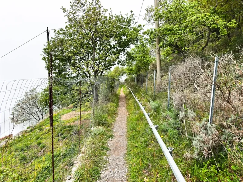
The Monte Amiata Circuit is a journey through a landscape shaped by both volcanic forces and human endeavour. The walk begins at Prato delle Macinaie, a popular starting point and picnic area, and immediately immerses you in the cool, shaded embrace of ancient chestnut forests. These woods, characteristic of Monte Amiata's lower slopes, are particularly beautiful in autumn when the leaves turn golden, but offer welcome shade during the warmer months of May to October. As the trail ascends, the forest canopy gradually thins, revealing open meadows and rocky terrain that hint at the mountain's volcanic origins.
The circuit is designed to offer a comprehensive experience of Monte Amiata's diverse ecosystems and historical layers. You'll encounter remnants of the area's mining past, particularly mercury extraction, which once defined the local economy. Signs of this industrial heritage can be seen in old mine shafts, abandoned buildings, and the distinctive reddish soil in some areas. The trail also passes through areas of significant natural beauty, with opportunities to observe local flora and fauna. The moderate elevation gain of 800 metres is spread across the 25 km route, making it a manageable, albeit sustained, effort for those with a reasonable level of fitness.
The highest point of the circuit offers expansive 360-degree views. On a clear day, the panorama stretches across the rolling hills of Tuscany, dotted with vineyards and olive groves, towards the distant peaks of the Apennines. To the west, the shimmering expanse of the Tyrrhenian Sea can sometimes be glimpsed. The descent often follows different paths, showcasing further varied terrain and offering new perspectives on the mountain and its surroundings. The circuit is well-marked, though carrying a map and compass or GPS device is always advisable for any extended hike.
History and Cultural Context
Monte Amiata has a rich and complex history, deeply intertwined with its geological formation and natural resources. The mountain, an extinct volcano, has been inhabited since prehistoric times. Archaeological evidence suggests settlements dating back to the Etruscan period, who were drawn to the area's mineral wealth and strategic location.
The most significant historical chapter for Monte Amiata, however, is its role as a major centre for mercury mining. From the 19th century until the late 20th century, the mountain was a hive of industrial activity, with numerous mines extracting cinnabar, the primary ore of mercury. Towns like Abbadia San Salvatore and Santa Fiora owe much of their development and character to this industry. The mining operations left an indelible mark on the landscape, with abandoned mine entrances, processing plants, and the distinctive red-tinged earth visible in many areas. The Monte Amiata Circuit passes through some of these historically significant zones, offering a tangible connection to this industrial past.
Beyond mining, Monte Amiata has also been a centre for agriculture and forestry. The extensive chestnut forests have provided a vital food source and building material for centuries. The local communities have developed unique traditions and a strong sense of identity tied to the mountain. The circuit allows walkers to appreciate this heritage, passing through ancient woodlands and offering glimpses into the rural life that continues to thrive in the shadow of the volcano.
Seasonal Highlights and Weather Reality
The Monte Amiata Circuit is best enjoyed during the spring and autumn months, from May to October. During this period, the weather is generally mild and pleasant, ideal for hiking.
Spring (May-June): This is a particularly beautiful time to walk the circuit. The landscape bursts into vibrant life, with wildflowers carpeting the meadows and the forests displaying fresh, verdant foliage. Temperatures are typically cool and comfortable, ranging from 10°C to 20°C. The air is often crisp, and the views are usually clear.
Summer (July-August): While the circuit can be walked in summer, it can be considerably warmer, with temperatures sometimes exceeding 30°C, especially at lower elevations and in open areas. The chestnut forests offer welcome shade, but exposed sections can be challenging. It is advisable to start early in the morning to avoid the midday heat and ensure you carry ample water.
Autumn (September-October): This is arguably the most spectacular season for the Monte Amiata Circuit. The chestnut forests transform into a breathtaking spectacle of red, gold, and orange hues. The weather remains pleasant, with cooler temperatures and clear skies often prevailing. This is also the season for chestnut harvesting, and you might encounter locals gathering this traditional food source.
Winter (November-April): While the circuit can technically be walked in winter, it is not recommended for casual hikers. Monte Amiata can experience significant snowfall, particularly at higher elevations, making the trails difficult to navigate and potentially dangerous. Temperatures can drop below freezing. If attempting in winter, appropriate winter hiking gear, navigation skills, and knowledge of avalanche risks are essential.
Weather Considerations: While generally predictable during the recommended seasons, mountain weather can change rapidly. Always check the local forecast before setting out. Be prepared for cooler temperatures at higher elevations and potential rain showers, even on otherwise sunny days.
Recommended Itinerary
Monte Amiata Circuit - Day Walk Itinerary
Early Morning (Approx. 8:00 AM): Start at Prato delle Macinaie
- Begin your hike from the well-marked trailhead at Prato delle Macinaie.
- This area offers ample parking and picnic facilities, making it a convenient starting point.
- Take a moment to orient yourself and prepare your gear.
Morning (Approx. 8:30 AM - 12:30 PM): Forested Ascents and Historical Glimpses
- The initial section of the circuit leads you into the dense chestnut forests characteristic of Monte Amiata's lower slopes.
- Follow well-maintained paths that wind through the trees, enjoying the cool, shaded environment.
- Keep an eye out for signs of the area's mining history, such as old tracks or discarded equipment, as you gain elevation.
- The trail gradually ascends, offering occasional glimpses through the trees of the surrounding countryside.
Midday (Approx. 12:30 PM - 2:00 PM): Summit Views and Lunch Break
- As you approach the higher elevations, the forest begins to thin, opening up to more exposed terrain and meadows.
- Reach the highest points of the circuit, where panoramic views unfold.
- Find a suitable spot for a well-deserved lunch break, taking in the expansive vistas across Tuscany.
- On a clear day, you can see for miles, spotting distant towns, rolling hills, and potentially the sea.
Afternoon (Approx. 2:00 PM - 5:00 PM): Descent and Varied Landscapes
- Begin the descent, which often follows a different route than the ascent, showcasing more of the mountain's diverse terrain.
- You may encounter rocky paths, open grasslands, and sections of mixed woodland.
- Continue to appreciate the changing scenery and the unique geological features of Monte Amiata.
- The descent is generally steady but can be steep in places, so watch your footing.
Late Afternoon (Approx. 5:00 PM - 6:00 PM): Return to Prato delle Macinaie
- The circuit concludes back at Prato delle Macinaie.
- Take time to relax, reflect on your hike, and enjoy the surroundings before departing.
Important Notes:
- This is a demanding day walk requiring good physical condition.
- Carry sufficient water, especially during warmer months.
- Wear sturdy hiking boots and appropriate clothing layers.
- The trail is generally well-marked, but a map or GPS device is recommended.
- Be aware of changing weather conditions.
Planning and Bookings
Book Your Trip
Everything you need to plan your journey
Accommodation
Find places to stay near Siena
Flights
Search flights to Siena
Essential Preparation
The Monte Amiata Circuit is a day walk, meaning no overnight accommodation is required. However, thorough preparation is still essential for a safe and enjoyable experience. The closest major city is Siena, from which you will need to arrange transport to the trailhead. A car is highly recommended for flexibility, as public transport options to Prato delle Macinaie can be infrequent and time-consuming. If travelling by public transport, plan your journey meticulously, factoring in potential delays. The drive from Siena to Abbadia San Salvatore takes approximately 1.5 to 2 hours. From Abbadia San Salvatore, follow local signs towards Prato delle Macinaie. Ensure your vehicle is in good condition, as some access roads may be unpaved or narrow. Familiarise yourself with the route using GPS coordinates (42.8833, 11.6167) and a reliable map. Inform someone of your hiking plans, including your intended route and estimated return time.
Trail Accommodation
This is a day hike requiring no overnight accommodation.
Required Gear
- Sturdy hiking boots: Waterproof and with good ankle support are essential for navigating varied terrain.
- Backpack: A comfortable daypack (20-30 litres) to carry essentials.
- Waterproof jacket: Lightweight and breathable, suitable for sudden rain showers.
- Warm layers: A fleece or insulating jacket, as temperatures can be cooler at higher elevations.
- Navigation tools: A detailed map of the Monte Amiata area, a compass, and/or a GPS device or smartphone with offline maps.
- First-aid kit: Including blister treatment, bandages, antiseptic wipes, pain relievers, and any personal medications.
- Sun protection: Sunscreen (SPF 30+), sunglasses, and a wide-brimmed hat, especially for exposed sections.
- Head torch: With spare batteries, in case of unexpected delays or early starts/late finishes.
What to Bring
- Food: Plenty of high-energy snacks and a packed lunch. There are no facilities for purchasing food along the circuit.
- Water: At least 2-3 litres of water per person. Refill points are scarce, so carry enough for the entire duration.
- Toiletries: Hand sanitiser, toilet paper, and a small trowel for emergencies if away from designated facilities (though this is a day hike, so facilities at the start/end are likely).
- Personal items: Mobile phone (ensure it's fully charged), power bank, camera, insect repellent (especially during warmer months).
- Walking poles: Optional, but can be beneficial for stability on ascents and descents, particularly on rocky or uneven ground.
Permits
No specific permits are required to walk the Monte Amiata Circuit. The trail is located within a natural area that is generally accessible to the public. However, it is always advisable to check for any local regulations or temporary restrictions that may be in place, particularly if you are visiting during a special event or a period of high fire risk. The area is managed by local authorities and forestry services, and respecting their guidelines is paramount for the preservation of the natural environment.
Other Activities in the Area
The region surrounding Monte Amiata offers a wealth of activities beyond the circuit itself:
- Explore Abbadia San Salvatore: Visit the historic Benedictine Abbey, a significant religious and architectural landmark dating back to the 8th century. The town also offers charming streets and local artisan shops.
- Discover Santa Fiora: This picturesque medieval village is built around a natural spring and features a beautiful historic centre, including the Peschiera, a unique water park.
- Visit Arcidosso: Another charming hilltop town with a well-preserved castle (Castello Aldobrandesco) offering panoramic views.
- Wine Tasting: The region is part of the Tuscan wine landscape. While not as famous as Chianti, local wines are worth exploring. Seek out local wineries for tastings.
- Thermal Baths: Nearby towns like Bagno Vignoni offer natural thermal springs and spa facilities for relaxation.
- Museums of Mercury Mining: In towns like Abbadia San Salvatore, you can find small museums dedicated to the history of mercury mining, offering a deeper insight into the area's past.
- Cycling: The roads and some trails around Monte Amiata are popular with cyclists, offering a different way to explore the landscape.
Safety and Conditions
Trail Conditions: The Monte Amiata Circuit is generally well-maintained and marked. However, conditions can vary. After heavy rain, sections of the trail may become muddy or slippery. In autumn, fallen leaves can obscure the path, and in winter, snow and ice can make it hazardous. Always check the weather forecast before you go and be prepared for changing conditions.
Navigation: While the circuit is marked, it is a substantial walk. It is essential to carry a map and compass or a reliable GPS device with the route downloaded. Familiarise yourself with the trail before you start. Pay attention to trail markers, which are typically painted symbols or signs.
Weather: Mountain weather can be unpredictable. Be prepared for temperature fluctuations, wind, and rain, even if the forecast is clear. Hypothermia is a risk if you get wet and cold, so carry appropriate layers.
Wildlife: While large dangerous animals are rare in this region, be aware of your surroundings. You might encounter wild boar or other smaller mammals. It's best to observe wildlife from a distance and avoid disturbing them.
Water: Water sources on the trail are unreliable. Carry sufficient water for the entire hike, especially during warmer months. Treat any water from natural sources before drinking.
Emergency Contacts: In case of an emergency, dial the European emergency number 112. Ensure your mobile phone is fully charged and has signal coverage. Inform someone of your hiking plans and expected return time.
Fitness: The circuit is rated as moderate due to its distance and elevation gain. Ensure you have a good level of fitness and are comfortable walking for 6-8 hours with significant elevation changes.
Side Trips and Points of Interest
Prato delle Macinaie: The starting and ending point of the circuit, this area is a popular picnic spot with facilities and information boards. It's a pleasant place to begin and end your hike, offering a sense of community and access to amenities.
Chestnut Forests: The extensive chestnut woods are a major feature of the Monte Amiata Circuit. These ancient forests are not only beautiful but also historically significant, providing a vital food source for centuries. In autumn, the colours are spectacular, and the air is filled with the scent of fallen leaves and chestnuts.
Mining Heritage Sites: As you traverse the circuit, you will encounter remnants of Monte Amiata's past as a major mercury mining centre. Look for old mine entrances, disused machinery, and areas with distinctive reddish soil. These sites offer a tangible connection to the industrial history that shaped the region.
Panoramic Viewpoints: The circuit offers several points along its route, particularly at higher elevations, where you can enjoy breathtaking panoramic views. On clear days, the vistas extend across the Tuscan countryside, the Apennine Mountains, and even the Tyrrhenian Sea. These viewpoints are ideal for rest stops and photography.
Local Flora and Fauna: Keep an eye out for the diverse plant and animal life of Monte Amiata. The varied habitats, from dense forest to open meadows, support a range of species. Birdwatching can be particularly rewarding.
Leave No Trace
The Monte Amiata Circuit traverses a beautiful and ecologically sensitive area. Practising Leave No Trace principles is crucial to preserving its natural beauty and ensuring it remains enjoyable for future visitors.
- Plan Ahead and Prepare: Familiarise yourself with the trail, weather conditions, and any local regulations before you go. Pack appropriately for the conditions.
- Travel and Camp on Durable Surfaces: Stick to marked trails to avoid damaging vegetation and soil. Avoid shortcuts, which can lead to erosion.
- Dispose of Waste Properly: Pack out everything you pack in, including all food scraps, wrappers, and any other litter. Use designated bins at the trailhead if available. If nature calls and you are away from facilities, dig a cathole at least 60 metres from water, trails, and campsites, and bury human waste. Pack out toilet paper.
- Leave What You Find: Do not take any natural objects, such as rocks, plants, or flowers. Leave them for others to enjoy and for the ecosystem to thrive.
- Minimise Campfire Impacts: Campfires are generally not permitted on day hikes and are discouraged in natural areas. If permitted and necessary, use established fire rings and ensure fires are completely extinguished.
- Respect Wildlife: Observe wildlife from a distance. Never feed animals, as this can disrupt their natural behaviours and diets. Store food securely.
- Be Considerate of Other Visitors: Keep noise levels down, yield to other hikers, and be courteous. Enjoy the natural sounds of the environment.
By adhering to these principles, you help protect the natural and cultural heritage of Monte Amiata.