
Montcabrer Loop - A Valencian Mountain Adventure
The Montcabrer Loop is a rewarding day walk situated in the heart of the Serra de Mariola Natural Park, near the town of Cocentaina in the Valencian Community, Spain. This circular route offers a moderate challenge, taking hikers through diverse landscapes ranging from pine forests and scrubland to rocky outcrops, culminating in the ascent of Montcabrer, the highest peak in the range. With its accessible trailhead, well-marked paths, and stunning panoramic views from the summit, the Montcabrer Loop is an ideal excursion for those seeking a taste of the Valencian mountains without requiring an overnight stay. The trail provides a fantastic opportunity to experience the region's natural beauty, observe local flora and fauna, and enjoy a sense of accomplishment upon reaching the peak.
- Distance: 12.5 km
- Elevation Gain: 650 m
- Duration: 4-5 hours
- Difficulty: Moderate
- Best Time: Spring (March-May) and Autumn (September-November)
- Closest City: Cocentaina
- Trailhead Access: Nearest airport: Alicante (ALC). Drive to Cocentaina, then follow signs towards the Montcabrer recreational area. Road is paved but narrow in parts. Parking available at the trailhead. No permits required.
- Coordinates: 38.7745, -0.5478
Overview
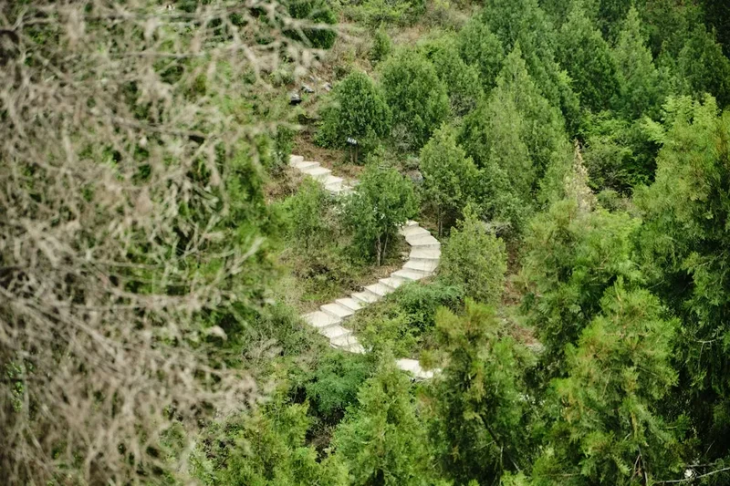
The Montcabrer Loop is a classic day hike that encapsulates the rugged beauty of the Serra de Mariola. The trail begins with a gentle ascent through fragrant pine forests, where the air is often perfumed with the scent of rosemary and thyme. As the path gains altitude, the vegetation transitions to more arid scrubland, characteristic of the Mediterranean climate. The route is well-signposted, making navigation straightforward for most hikers. The main challenge and highlight of the loop is the final push to the summit of Montcabrer, which stands at 1,389 metres. This section involves steeper gradients and some rocky terrain, requiring a moderate level of fitness. However, the effort is amply rewarded by the breathtaking 360-degree views from the summit. On a clear day, one can see across the Valencian plains, towards the Mediterranean Sea, and over the surrounding mountain ranges, including the nearby Aitana and Benicadell.
The loop design means that hikers experience a variety of scenery and terrain without needing to retrace their steps. The descent offers a different perspective, often following a parallel path or a slightly varied route back towards the recreational area. The timing of the walk is crucial; spring and autumn provide the most pleasant temperatures, with wildflowers blooming in spring and the landscape taking on golden hues in autumn. Summer can be extremely hot, making early morning or late afternoon walks advisable, while winter can bring colder temperatures and occasional frost or snow at higher elevations.
This trail is popular with local hikers and families, particularly on weekends. Despite its popularity, the expansive nature of the park and the length of the loop ensure that it rarely feels overcrowded, especially during weekdays or outside of peak seasons. The Montcabrer Loop is a testament to the natural heritage of the region, offering a fulfilling outdoor experience that combines physical activity with spectacular natural vistas.
History and Cultural Context
The Serra de Mariola, and specifically the Montcabrer area, has a rich history deeply intertwined with human settlement and resource utilisation. For centuries, this region has been a source of medicinal herbs, aromatic plants, and natural resources for the surrounding communities. The park is renowned for its diverse flora, many species of which have been traditionally used for their healing properties, contributing to the area's historical significance as a natural pharmacy.
The name "Montcabrer" itself is believed to derive from "Monte Cabrero," meaning "Goat Mountain," suggesting a long history of goat herding in the area. Goats, with their agility, are well-suited to the rugged terrain, and their presence would have been a common sight for shepherds and inhabitants for generations. This pastoral heritage has shaped the landscape, with evidence of ancient terracing and pathways still visible in some parts of the park.
During the Reconquista and subsequent periods, the mountainous terrain of the Serra de Mariola provided strategic vantage points and refuge. While Montcabrer itself may not have been the site of major historical battles, its commanding position would have been noted by military strategists. The nearby town of Cocentaina has a history dating back to Moorish times, with a significant castle and a heritage that reflects centuries of cultural exchange and conflict.
In more recent times, the Serra de Mariola has been recognised for its ecological importance, leading to its designation as a Natural Park. This protection aims to preserve its unique biodiversity, geological features, and cultural landscapes, ensuring that areas like the Montcabrer Loop remain accessible for recreation while safeguarding their natural and historical integrity. The trail itself follows ancient shepherd paths and routes that have been used for centuries, connecting the communities of the plains with the resources of the mountains.
Seasonal Highlights and Weather Reality
The Montcabrer Loop is a year-round destination, but its appeal varies significantly with the seasons. The best times to undertake this hike are undoubtedly spring and autumn, offering a balance of pleasant temperatures and beautiful natural scenery.
Spring (March-May): This is arguably the most idyllic season for the Montcabrer Loop. The landscape bursts into life with a vibrant display of wildflowers, including various species of orchids, poppies, and wild lavender. The air is fresh, and temperatures are generally mild, ranging from 10°C to 20°C. The higher elevations might still experience cooler conditions, especially in early spring, but the overall experience is one of renewal and natural beauty. The risk of rain is moderate, but showers are usually short-lived.
Summer (June-August): Summers in this region can be intensely hot, with daytime temperatures frequently exceeding 30°C, and sometimes reaching 40°C. Hiking Montcabrer during the peak summer months is not recommended for most people due to the risk of heatstroke and dehydration. If attempting the hike, it must be done very early in the morning or late in the evening, and with an ample supply of water. The landscape becomes dry and parched, and the pine forests offer limited shade on the higher, more exposed sections.
Autumn (September-November): Autumn offers a welcome respite from the summer heat. Temperatures become more moderate, typically ranging from 15°C to 25°C in September and gradually cooling down in November. The vegetation begins to change, with the greens of summer giving way to warmer, earthy tones. The air is crisp, and the skies are often clear, providing excellent visibility from the summit. This season is also excellent for observing migratory birds and enjoying the changing colours of the Mediterranean scrubland.
Winter (December-February): Winter can be cool to cold, with average daytime temperatures between 5°C and 15°C. Frost is common in the mornings, and snow is possible at the highest elevations, though it rarely accumulates for extended periods. The landscape takes on a stark, beautiful quality. While the cold might deter some, winter hiking can offer a sense of solitude and dramatic, clear views. It is essential to be prepared for colder conditions, including windproof and warm layers, and to check weather forecasts for potential icy patches on the trail.
Weather Reality: While the Serra de Mariola is generally considered to have a Mediterranean climate, mountain weather can be unpredictable. Sudden changes in wind, temperature, and precipitation can occur, especially at higher altitudes. Always check the local weather forecast before setting out and be prepared for a range of conditions, regardless of the season.
Recommended Itinerary
Montcabrer Loop - Day Hike Itinerary
Early Morning (Approx. 8:00 AM): Arrival and Trailhead Preparation
- Arrive at the Montcabrer recreational area parking lot near Cocentaina.
- Ensure you have all your gear organised and ready.
- Check the trail markers and information boards for any recent updates or conditions.
- Begin the hike from the designated trailhead.
Morning (Approx. 8:30 AM - 11:00 AM): Forested Ascent
- The initial part of the trail winds through fragrant pine forests and Mediterranean scrubland.
- Follow well-marked paths, often with yellow and white blazes.
- The gradient is moderate, allowing for a steady warm-up.
- Enjoy the scents of pine, rosemary, and thyme.
- Keep an eye out for local flora and fauna.
Midday (Approx. 11:00 AM - 1:00 PM): Rocky Ascent to the Summit
- The terrain becomes steeper and more rocky as you approach the summit of Montcabrer.
- This section requires more effort and careful footing.
- The vegetation thins out, offering increasingly expansive views.
- Reach the summit of Montcabrer (1,389 m).
- Take time to enjoy the panoramic 360-degree views of the surrounding landscape.
- Have a snack or packed lunch at the summit, weather permitting.
Afternoon (Approx. 1:00 PM - 3:00 PM): Descent and Loop Completion
- Begin the descent, following the marked loop trail.
- The descent path may offer different views and terrain compared to the ascent.
- Continue through varied landscapes as you make your way back towards the trailhead.
- The gradient will gradually decrease as you approach the recreational area.
- Arrive back at the parking lot, completing the loop.
Post-Hike (Approx. 3:00 PM onwards): Relaxation and Return
- Take time to stretch and rehydrate.
- Consider visiting the nearby town of Cocentaina for refreshments or a meal.
- Begin your journey back to your accommodation or next destination.
Important Notes:
- This is a day hike; no overnight accommodation is required.
- Carry sufficient water, especially during warmer months.
- Wear sturdy hiking boots and appropriate clothing.
- The trail is generally well-marked, but a map or GPS device is recommended.
- Be aware of the weather conditions and their potential to change rapidly.
Planning and Bookings
Book Your Trip
Everything you need to plan your journey
Accommodation
Find places to stay near Cocentaina
Flights
Search flights to Cocentaina
Essential Preparation
The Montcabrer Loop is a day hike, meaning that extensive logistical planning for accommodation is not required. However, preparation is still key to ensuring a safe and enjoyable experience. The nearest significant town is Cocentaina, which serves as the primary gateway to the Serra de Mariola Natural Park. Cocentaina offers basic amenities, including supermarkets for purchasing supplies, pharmacies, and a range of accommodation options if you plan to stay in the area before or after your hike. For international travellers, Alicante Airport (ALC) is the closest major airport, approximately a 1-hour drive from Cocentaina. From Alicante, you can rent a car, which is the most convenient way to reach the trailhead. Public transport options to Cocentaina exist but may be less frequent and require transfers, making a rental car highly recommended for flexibility.
The trailhead is located within a designated recreational area, which typically includes parking facilities. It's advisable to arrive early, especially on weekends or during peak seasons, to secure a parking spot. Familiarise yourself with the route beforehand using maps or GPS devices, and check the weather forecast for the Serra de Mariola region. Given the moderate difficulty and elevation gain, a reasonable level of fitness is recommended. The hike can be completed in 4-5 hours, so starting in the morning is ideal to allow ample time and avoid the hottest parts of the day, particularly in summer.
Trail Accommodation
This is a day hike requiring no overnight accommodation.
Required Gear
- Hiking Boots: Sturdy, broken-in hiking boots with good ankle support are essential for navigating the rocky and uneven terrain.
- Backpack: A comfortable daypack (20-30 litres) to carry essentials.
- Clothing: Layered clothing is recommended. Moisture-wicking base layers, an insulating mid-layer (fleece or light down jacket), and a waterproof and windproof outer shell are advisable.
- Headwear: A sun hat or cap for protection from the sun, and a warm hat or beanie for cooler conditions.
- Navigation: A map of the Serra de Mariola Natural Park, a compass, and/or a GPS device or smartphone with offline maps.
- Safety Gear: A basic first-aid kit including blister treatment, pain relievers, antiseptic wipes, and any personal medications. A whistle for emergencies.
- Sun Protection: High SPF sunscreen, sunglasses.
- Insect Repellent: Particularly useful during warmer months.
What to Bring
- Water: At least 1.5-2 litres of water per person, more if hiking in hot weather. There are no reliable water sources on the trail for refilling.
- Food: High-energy snacks such as nuts, dried fruit, energy bars, and sandwiches for lunch.
- Toiletries: Hand sanitiser, biodegradable toilet paper (if needed, though facilities at the trailhead are usually available).
- Personal Items: Mobile phone (fully charged), power bank (optional), camera.
- Trekking Poles: Optional, but can be helpful for stability on steep ascents and descents.
- Small plastic bags: For packing out all rubbish.
Permits
No specific permits are required to hike the Montcabrer Loop or to access the Serra de Mariola Natural Park. The park is open to the public for recreational activities, including hiking, without the need for advance booking or special permits. This makes it an easily accessible destination for day trips.
However, it is important to be aware of any park regulations that may be in place to protect the environment. These typically include rules regarding:
- Waste Disposal: All litter must be packed out.
- Fires: Open fires are generally prohibited within natural parks to prevent wildfires.
- Camping: Overnight camping is usually not permitted outside of designated areas, and for this day hike, it is not relevant.
- Flora and Fauna: It is forbidden to pick wildflowers or disturb wildlife.
Always respect the natural environment and follow any signage or guidelines provided by the park authorities. The absence of permit requirements simplifies planning, allowing for spontaneous visits, but responsible behaviour remains paramount.
Other Activities in the Area
The Serra de Mariola Natural Park and its surroundings offer a variety of activities beyond the Montcabrer Loop, catering to different interests:
- Exploring Cocentaina: Visit the historic town of Cocentaina, known for its impressive castle (Castell de Cocentaina), its charming old town, and its vibrant local markets.
- Other Hiking Trails: The Serra de Mariola is crisscrossed with numerous other hiking trails of varying difficulty. Explore routes leading to other peaks, natural springs, or historical hermitages within the park.
- Medicinal Plant Routes: The region is famous for its aromatic and medicinal plants. Guided tours or self-guided exploration focusing on identifying and learning about these plants can be a fascinating experience.
- Cycling: The park's roads and some of its wider tracks are suitable for cycling, offering a different way to experience the landscape.
- Gastronomy: Enjoy the local Valencian cuisine in Cocentaina or nearby towns. Sample regional specialities like paella, "arroz a banda," and local wines.
- Agrotourism: Explore the surrounding agricultural areas, which are known for olive oil production, fruit orchards, and vineyards.
- Rock Climbing: Certain areas within the Serra de Mariola may offer opportunities for rock climbing, though specific routes and access should be researched in advance.
Safety and Conditions
Pre-Hike Checks:
- Weather Forecast: Always check the local weather forecast for Cocentaina and the Serra de Mariola region before your hike. Mountain weather can change rapidly. Pay attention to temperature, wind speed, and precipitation.
- Trail Conditions: While the Montcabrer Loop is generally well-maintained, recent rainfall can make certain sections slippery, especially the rocky parts.
- Personal Fitness: Assess your own fitness level. The 650m elevation gain and 12.5km distance make this a moderate hike. Ensure you are prepared for the physical demands.
On the Trail:
- Water: Carry more water than you think you will need, especially during warmer months. There are no reliable water sources on the trail.
- Navigation: Stay on marked trails. While the loop is generally well-signposted, it's easy to get disoriented if you stray. A map and compass or GPS device are recommended.
- Sun Protection: The sun can be intense, even on cooler days, particularly at higher altitudes. Wear sunscreen, a hat, and sunglasses.
- Footwear: Wear sturdy hiking boots with good grip to prevent slips and provide ankle support on uneven terrain.
- First Aid: Be prepared for minor injuries. Carry a well-stocked first-aid kit and know how to use it.
- Communication: Mobile phone signal can be intermittent in mountainous areas. Inform someone of your hiking plans, including your expected return time.
- Wildlife: While large dangerous animals are not common, be aware of snakes and insects. Avoid disturbing any wildlife you encounter.
- Respect the Environment: Adhere to Leave No Trace principles. Pack out all rubbish, stay on marked paths, and do not disturb the natural environment.
Emergency Procedures: In case of an emergency, dial the European emergency number 112. Be prepared to provide your exact location, the nature of the emergency, and the number of people involved.
Side Trips and Points of Interest
Montcabrer Summit (1,389 m): The primary point of interest and the culmination of the hike. The summit offers unparalleled 360-degree panoramic views. On a clear day, you can see the Mediterranean Sea in the distance, the plains of the Valencian Community, and a vast expanse of mountain ranges including Aitana, Benicadell, and the surrounding Serra de Mariola. The summit area is rocky and exposed, often featuring a small cairn or marker.
Serra de Mariola Natural Park Flora: The loop passes through diverse ecological zones, showcasing the rich biodiversity of the park. Look out for aromatic plants like rosemary, thyme, lavender, and various species of wild herbs, many of which have traditional medicinal uses. The park is a haven for botanists and nature enthusiasts.
Pine Forests and Scrubland: The trail transitions from dense pine forests, offering shade and a distinct scent, to more open scrubland and rocky terrain as you ascend. This change in vegetation provides a dynamic visual experience throughout the hike.
Ancient Pathways: Parts of the trail may follow ancient shepherd paths or routes that have been used for centuries. These historical tracks offer a connection to the past and the traditional use of the land.
Panoramic Viewpoints: Even before reaching the summit, various points along the trail offer excellent viewpoints. These spots are ideal for taking breaks, enjoying the scenery, and capturing photographs of the expansive landscape.
Leave No Trace
The Serra de Mariola Natural Park is a precious natural environment, and it is crucial for all visitors to practice Leave No Trace principles to preserve its beauty and ecological integrity for future generations. The Montcabrer Loop, while a popular day hike, traverses sensitive ecosystems that can be easily damaged by careless behaviour.
Your responsibility as a hiker:
- Plan Ahead and Prepare: Familiarise yourself with the trail, weather conditions, and any park regulations before you go. Pack appropriately for the conditions.
- Travel and Camp on Durable Surfaces: Stick to marked trails. Avoid walking on fragile vegetation, especially wildflowers and mosses, which can take years to recover. The summit area is rocky, so tread carefully.
- Dispose of Waste Properly: Pack out everything you pack in. This includes all food scraps, wrappers, and any other litter. Use designated bins at the trailhead if available, but it's best practice to carry all waste with you.
- Leave What You Find: Do not pick wildflowers, collect rocks, or disturb natural features. Take only photographs and memories.
- Minimise Campfire Impacts: Campfires are generally prohibited in natural parks. If you are on a longer trip and permitted to have a fire, use established fire rings and ensure it is completely extinguished. For this day hike, this is not applicable.
- Respect Wildlife: Observe wildlife from a distance. Do not feed animals, as this can disrupt their natural behaviour and diet. Be aware of potential encounters with snakes or insects.
- Be Considerate of Other Visitors: Keep noise levels down, especially in natural areas. Yield to other hikers when necessary.
By adhering to these principles, you help ensure that the Montcabrer Loop and the Serra de Mariola remain a pristine and enjoyable destination for everyone.