Malerweg Trail - The Painters' Way through the Elbe Sandstone Mountains
The Malerweg, or "Painters' Way," is widely regarded as Germany's most beautiful hiking trail, a 112-kilometre loop that traverses the heart of the Saxon Switzerland National Park. This historic route follows the footsteps of 18th and 19th-century Romantic artists who were drawn to the region's surreal landscape of jagged sandstone pillars, deep verdant gorges, and dramatic table mountains. Starting and ending near the historic town of Pirna, just a short distance from Dresden, the trail is a masterclass in geological wonder and cultural heritage. It is not merely a walk through nature, but a journey through the very landscapes that defined the German Romantic movement, immortalised in the works of Caspar David Friedrich and Canaletto. The trail is divided into eight distinct stages, each offering a unique perspective on the Elbe Sandstone Mountains, from the iconic Bastei Bridge to the formidable Königstein Fortress. With a total elevation gain of approximately 3,500 metres, the Malerweg provides a moderate but rewarding challenge, combining well-maintained forest paths with adventurous "Stiegen"—steep iron ladders and stone stairways that scale the vertical rock faces. Whether you are seeking artistic inspiration, geological fascination, or a rigorous multi-day trek, the Malerweg delivers an unparalleled European hiking experience where every turn of the path feels like a framed masterpiece.
- Distance: 112.0 km loop
- Duration: 8 days
- Elevation Gain: 3,500 m
- Difficulty: Moderate (includes steep stairs and ladders)
- Best Time: May to October (Autumn foliage is particularly spectacular)
- Closest City: Dresden, Germany
- Trailhead: Pirna-Liebethal (accessible via S-Bahn and bus from Dresden)
- Direction: Traditionally walked in a clockwise loop starting on the right bank of the Elbe
Overview
The Malerweg is a trail defined by its verticality and its light. Located in the Free State of Saxony, near the border with the Czech Republic, the Elbe Sandstone Mountains (Elbsandsteingebirge) are a unique geological formation resulting from the erosion of a massive Cretaceous-era seabed. The result is a landscape of "table mountains" (Tafelberge) and slender rock needles that rise abruptly from the forest floor. The trail is meticulously waymarked with a stylized "M" and is designed to showcase the most dramatic viewpoints in the region. Unlike many alpine trails that follow long ridges, the Malerweg is a constant rhythm of descent into cool, mossy ravines and ascent onto sun-drenched rocky plateaus. This "up and down" nature is what gives the trail its significant cumulative elevation gain despite never reaching great absolute altitudes.
The experience of walking the Malerweg is deeply tied to the history of European art. In the late 1700s, artists from the Dresden Academy of Fine Arts began exploring these mountains, finding in the wild, untamed rock formations a perfect expression of the "Sublime." As you walk, you will encounter numerous information boards displaying the specific paintings created at those exact vantage points. The most famous of these is the view from the Bastei, which has drawn visitors for over 200 years. However, the trail also leads walkers into the quieter, more remote sections of the National Park, such as the Schrammsteine and the Affensteine, where the scale of the sandstone massifs becomes truly humbling.
Logistically, the Malerweg is exceptionally well-supported. The region has a long tradition of tourism, meaning that every stage ends in or near a village with a variety of "Wanderfreundlich" (hiker-friendly) accommodation. The public transport network, including the S-Bahn trains along the Elbe and the historic Kirnitzschtal tramway, allows for great flexibility. Many hikers choose to base themselves in one or two locations and use the excellent train and bus links to reach the start and end points of each stage, though the traditional multi-day trek from inn to inn remains the most immersive way to experience the "Painters' Way."
History and Cultural Context
The history of the Malerweg is inseparable from the birth of modern tourism and the Romantic era of the 18th and 19th centuries. Before it was a hiking trail, the region was a rugged wilderness used primarily by woodcutters, charcoal burners, and iron miners. The transformation began when two Swiss artists, Adrian Zingg and Anton Graff, arrived in Dresden in 1766. They were so struck by the resemblance of the local landscape to their homeland that they dubbed the region "Saxon Switzerland" (Sächsische Schweiz). Their sketches and engravings sparked a wave of interest among the European intelligentsia.
By the early 1800s, a specific route had been established for "Grand Tour" travellers and artists. This original "Painters' Way" was not a single marked path but a collection of recommended viewpoints and trails. The most famous figure associated with the trail is Caspar David Friedrich, whose 1818 painting "Wanderer above the Sea of Fog" is believed to have been inspired by the views from the Kaiserkrone and the Zirkelstein. Other notable figures who walked these paths include the composer Carl Maria von Weber, who found inspiration for his opera "Der Freischütz" in the eerie depths of the Wolfsschlucht (Wolf's Gorge), and the English painter J.M.W. Turner.
As the 19th century progressed, the trail became more formalised. The Bastei Bridge, originally built of wood in 1824 to provide better access for tourists, was replaced by the iconic sandstone structure seen today in 1851. During the 20th century, particularly during the era of the German Democratic Republic (GDR), the region became a bastion for rock climbing and outdoor recreation. The modern Malerweg was officially "re-opened" and unified as a continuous 112-kilometre loop in 2006, combining the historic paths of the painters with newer sections of the National Park's trail network. Today, it stands as a monument to the enduring human desire to find spiritual and artistic connection within the wilder corners of the natural world.
Want more background? Read extended notes on history and cultural context → Learn more
Seasonal Highlights and Weather Reality
The Malerweg is primarily a three-season trail, with the official hiking season running from late April to October. Each season offers a distinct atmosphere that mirrors the changing moods of the Romantic paintings that made the trail famous.
Spring (April to June): This is a period of vibrant renewal. The beech forests that cover much of the National Park erupt in a brilliant, translucent green. Waterfalls in the ravines are at their most active due to snowmelt and spring rains. Temperatures are generally mild, ranging from 10°C to 20°C, making for comfortable climbing. However, some of the deeper gorges can remain damp and chilly well into May.
Summer (July to August): The peak tourist season. Days are long and can be quite warm, occasionally reaching 30°C. The shade of the deep canyons and the cool air trapped between the sandstone walls provide natural air conditioning. This is the best time for those who enjoy long evenings in beer gardens, but popular spots like the Bastei Bridge can become very crowded. Early morning starts are essential to beat both the heat and the day-tripping crowds.
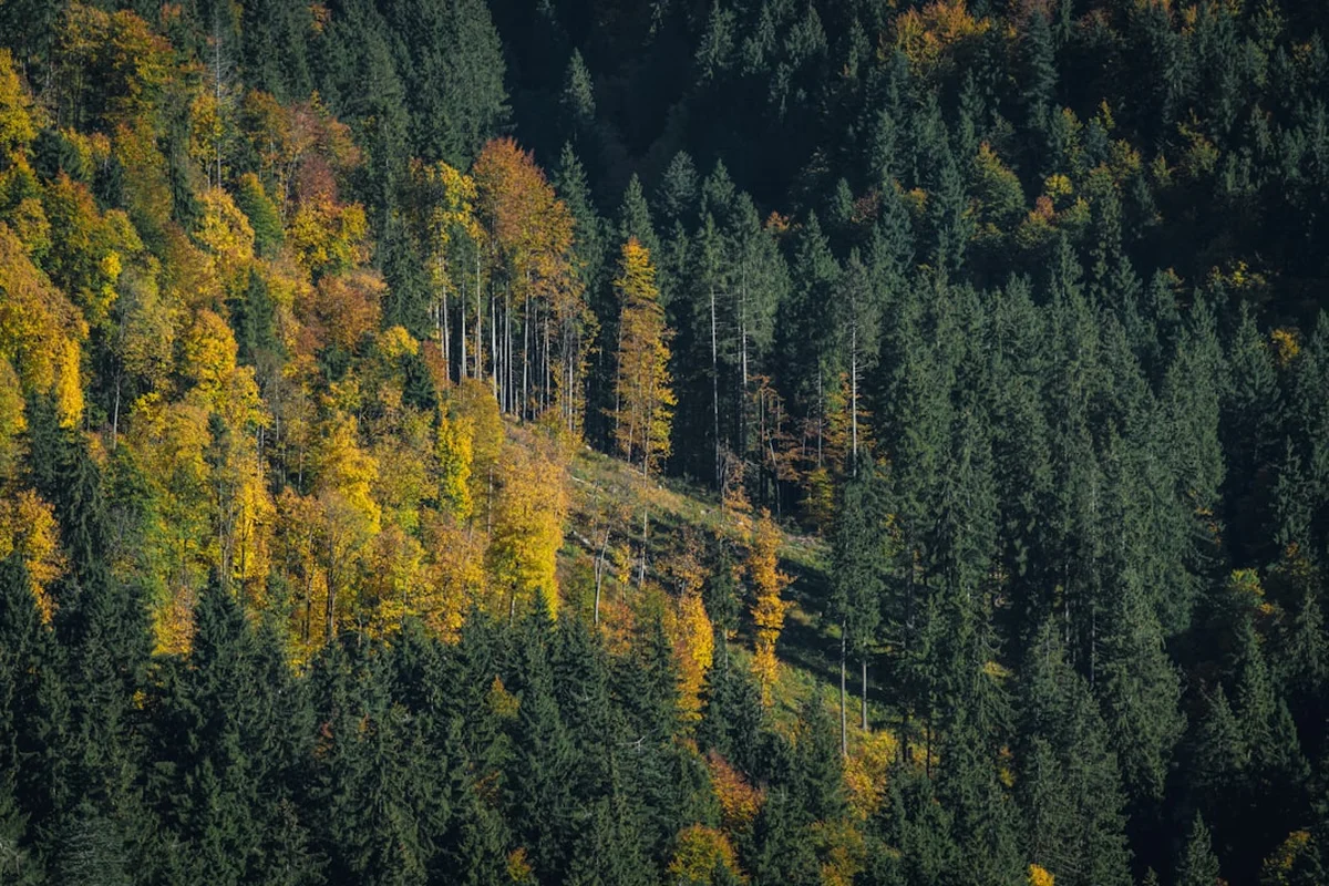
Autumn (September to October): Many consider this the "golden age" of the Malerweg. The beech and maple forests turn into a riot of gold, orange, and deep red. The morning mists, so beloved by Caspar David Friedrich, frequently fill the valleys, leaving the sandstone peaks poking out like islands in a white sea. Temperatures are crisp and perfect for hiking, though daylight hours begin to shorten significantly by late October.
Winter (November to March): While the trail is technically open, it becomes a much more serious undertaking. The "Stiegen" (ladders and stairs) can become dangerously icy and slippery. Many hotels and mountain huts close for the season. However, for the experienced hiker, a snow-covered Saxon Switzerland offers a profound, silent beauty and total solitude. If hiking in winter, traction aids (micro-spikes) are highly recommended for the steep sections.
Recommended Itinerary
8-Day Malerweg Loop Itinerary
Stage 1: Pirna-Liebethal to Stadt Wehlen
- Distance: 11.5 km
- Elevation gain: 230 m
- Time: 4 hours
- Start at the Liebethaler Grund, a romantic river valley
- Pass the world's largest Richard Wagner monument
- Walk through the "Uttewalder Felsentor" (a natural rock gate)
- Finish in the charming town of Stadt Wehlen on the banks of the Elbe
- An easy introductory day with gentle gradients and lush forest scenery
Stage 2: Stadt Wehlen to Hohnstein
- Distance: 13.2 km
- Elevation gain: 500 m
- Time: 5 hours
- The "Highlight Day": Climb from Wehlen up to the Bastei Bridge
- Spectacular views of the Elbe and the surrounding rock needles
- Descend into the Amselgrund and pass the Amselsee lake
- Climb back up to the town of Hohnstein with its medieval castle
- Expect crowds at the Bastei, but solitude returns once you head toward Hohnstein
Stage 3: Hohnstein to Altendorf
- Distance: 11.7 km
- Elevation gain: 450 m
- Time: 4.5 hours
- Walk along the "Brand," often called the "Balcony of Saxon Switzerland"
- Panoramic views of the Elbe valley and the Schrammsteine
- Descend 800 steps into the deep, cool Tiefer Grund
- Climb up to the village of Altendorf, situated on a high plateau
- Excellent views of the "Affensteine" rock massif from the plateau
Stage 4: Altendorf to Neumannmühle
- Distance: 17.6 km
- Elevation gain: 700 m
- Time: 6.5 hours
- The most demanding and spectacular stage on the right bank
- Traverse the Schrammsteine via steep iron ladders and gratings
- Follow the "Gratweg" (ridge path) for breathtaking exposure and views
- Pass the Kirnitzschtal, where the historic yellow tram runs
- Finish at the historic Neumannmühle, a technical monument and hikers' inn
Stage 5: Neumannmühle to Schmilka
- Distance: 13.6 km
- Elevation gain: 550 m
- Time: 5.5 hours
- Climb to the Zeughaus and then up to the Großer Winterberg (the second highest peak)
- Pass the "Kuhstall," a massive natural rock arch
- Descend through ancient beech forests to the border village of Schmilka
- Schmilka is a certified "Bio-village" with an excellent organic bakery and brewery
- This marks the end of the right-bank sections of the trail
Stage 6: Schmilka to Gohrisch
- Distance: 14.7 km
- Elevation gain: 550 m
- Time: 5.5 hours
- Cross the Elbe via ferry to the left bank
- Climb the Reinhardtsdorf plateau with its beautiful baroque church
- Ascend the Papststein and the Gohrisch table mountains
- The left bank features more "table mountains" (Tafelberge) compared to the needles of the right bank
- Finish in the spa village of Gohrisch
Stage 7: Gohrisch to Weißig
- Distance: 15.4 km
- Elevation gain: 550 m
- Time: 6 hours
- Climb the Pfaffenstein to see the "Barbarine," a famous 43-metre rock needle
- Visit the massive Königstein Fortress (allow 2 hours for a detour here)
- Walk through the town of Königstein and climb back up toward Weißig
- The fortress is one of the largest hilltop fortifications in Europe and is a must-see
Stage 8: Weißig to Pirna
- Distance: 12.4 km
- Elevation gain: 350 m
- Time: 4.5 hours
- Traverse the Rauenstein ridge with its adventurous paths and views back toward the Bastei
- Descend toward the Elbe and follow the river path
- Pass through the historic centre of Pirna, known as the "Gate to Saxon Switzerland"
- Finish at the Canaletto view in Pirna, where the famous painter depicted the town square
- Celebrate the completion of the loop in one of Pirna's historic taverns
Planning and Bookings
Book Your Trip
Everything you need to plan your journey
Accommodation
Find places to stay near Dresden
Flights
Search flights to Dresden
Essential Preparation
The Malerweg is a well-marked and accessible trail, but it requires a reasonable level of physical fitness due to the frequent steep ascents and descents. While the total distance of 112 kilometres is manageable over eight days, the cumulative elevation gain of 3,500 metres means you will be climbing the equivalent of a major alpine peak over the course of the week. Hikers should be comfortable with heights, as several sections involve "Stiegen"—exposed iron ladders and narrow stone steps with handrails.
Dresden is the primary gateway for the trail. It is recommended to spend at least one day in Dresden before or after your hike to appreciate the art galleries that house the paintings of the Elbe Sandstone Mountains. From Dresden, the S1 S-Bahn train runs every 30 minutes to Pirna, Königstein, and Bad Schandau, making logistics very simple. You do not need a car to complete the Malerweg; in fact, the excellent integration of trains, buses, and ferries makes public transport the preferred method of travel.
Trail Accommodation
Accommodation on the Malerweg is plentiful and varied, ranging from rustic mountain huts to high-end spa hotels. Most villages along the route have several "Wanderfreundlich" (hiker-friendly) establishments that are accustomed to hosting multi-day walkers. These places often offer luggage transfer services, packed lunches, and drying rooms for wet gear.
Types of Accommodation:
- Gasthöfe and Pensions: The most common option. These are traditional German inns offering private rooms and hearty breakfasts. Expect to pay €50–€90 per night for a double room.
- Mountain Huts (Berghütten): Located in more remote sections like the Großer Winterberg or the Brand. These offer a more rustic experience, often with spectacular sunset views.
- Boofen (Cave Camping): A unique tradition in Saxon Switzerland. "Boofen" refers to sleeping in the open air under rock overhangs. This is strictly regulated and only permitted for registered rock climbers in specific designated areas outside the core zone of the National Park. It is NOT permitted for general hikers on the Malerweg.
- Hotels: In towns like Bad Schandau or Pirna, you can find full-service hotels with wellness facilities.
Booking Requirements:
- During the peak months of July, August, and October (autumn holidays), it is essential to book accommodation several months in advance.
- Many hikers use "Luggage Transfer" services (Gepäcktransport), which allow you to walk with only a daypack while your main bag is moved to your next hotel. These services must be booked as part of a package or arranged independently with local providers.
- Costs: A typical 8-day self-guided tour including accommodation, breakfast, and luggage transfer usually costs between €700 and €1,000 per person.
Required Gear
- Hiking Boots: Sturdy boots with good ankle support and a high-grip sole (Vibram or similar) are essential. The sandstone can be slippery when wet, and the "Stiegen" require secure footing.
- Rain Gear: A high-quality waterproof jacket and overtrousers. The weather in Saxony can change rapidly, and heavy rain is common in the summer months.
- Daypack: A 20–30L pack if using luggage transfer, or a 45–55L pack if carrying all your gear. Ensure it has a waterproof cover.
- Clothing: Layering is key. Use moisture-wicking base layers (merino wool or synthetic), an insulating mid-layer (fleece), and a windproof shell.
- Navigation: While the trail is excellently marked with the "M" logo, a physical map (1:25,000 scale) or an offline GPS app (like Komoot or Outdooractive) is highly recommended for detours and emergencies.
- First Aid: Include plenty of blister plasters (Compeed), antiseptic wipes, and any personal medications.
What to Bring
- Water: At least 2 litres per day. While there are villages along the way, some sections (like the Schrammsteine) have no water sources for several hours.
- Snacks: High-energy food like nuts, dried fruit, and chocolate. Most stages end in towns with supermarkets, but midday options on the trail can be limited to mountain huts.
- Cash: Very important. Many smaller mountain huts, ferries, and rural pensions in Germany still do not accept credit cards. Carry at least €50–€100 in cash for daily expenses.
- Sun Protection: Sunscreen, sunglasses, and a hat. The exposed rock plateaus can be very hot in summer.
- Trekking Poles: Highly recommended to save your knees on the thousands of stone steps you will encounter. Ensure they are collapsible so you can strap them to your pack when climbing ladders.
- Reusable Bottle/Bladder: To reduce plastic waste in the National Park.
Permits
One of the great advantages of the Malerweg is that no permits or entry fees are required to walk the trail or enter the Saxon Switzerland National Park. Access to the wilderness is free for everyone, reflecting the German "Right to Roam" philosophy in forest areas.
Important Considerations:
- National Park Rules: While entry is free, you must adhere to strict National Park regulations. This includes staying on marked trails, not picking plants, and taking all rubbish with you.
- Ferries: You will need to cross the Elbe River at least once (usually at Schmilka or Pirna). These ferries are part of the local public transport system (VVO). If you have a "VVO Guest Card" (often provided by your hotel), the ferry may be included; otherwise, a small fee of approximately €2.50 applies.
- Königstein Fortress: While the trail passes the fortress, entry to the interior museum and ramparts requires a ticket (approx. €15 per adult). It is highly recommended to pay this fee as the views from the walls are some of the best on the trail.
- Boofen (Overnighting): As mentioned, this is only for climbers. If you are caught sleeping in a cave without being a registered climber or in a non-designated spot, you can face significant fines from National Park rangers.
Transport Logistics: The VVO (Verkehrsverbund Oberelbe) manages all trains, buses, and ferries in the region. It is highly recommended to download the "VVO Mobil" app. If you are staying in the region, ask your host for the "Sächsische Schweiz Gästekarte," which provides discounts on various attractions and sometimes free local bus travel.
Other Activities in the Area
The region surrounding the Malerweg is rich in cultural and recreational opportunities. If you have extra time, consider these additions to your itinerary:
- Dresden City Tour: Known as the "Florence on the Elbe," Dresden is home to the Frauenkirche, the Zwinger Palace, and the Old Masters Picture Gallery, where you can see the original paintings that inspired the Malerweg.
- Rock Climbing: Saxon Switzerland is the birthplace of free climbing. There are over 1,100 free-standing sandstone peaks. Local climbing schools offer introductory courses for beginners. Note that "Saxon Rules" are unique (no metal nuts or cams allowed; only rope knots).
- Kirnitzschtal Tramway: A historic electric tram that has been running since 1898. It travels from Bad Schandau deep into the National Park, providing a charming way to access the trailhead for Stage 4 or 5.
- Paddle Steamer Cruise: The "Sächsische Dampfschifffahrt" operates the world's oldest and largest fleet of paddle steamers. Taking a boat from Dresden to Bad Schandau offers a relaxing perspective of the mountains you've been hiking.
- Toskana Therme Bad Schandau: A world-class thermal spa featuring "Liquid Sound" pools. It is the perfect place to soak sore muscles after completing the trail.
- Bohemian Switzerland (Czech Republic): Just across the border, you can visit the Pravčická brána, the largest natural sandstone arch in Europe, which is only a short bus or train ride from Schmilka.
Safety and Conditions
Terrain Hazards: The primary safety concern on the Malerweg is the nature of the sandstone itself. Sandstone is porous and can become extremely slippery when wet or covered in pine needles. Many sections of the trail involve "Stiegen"—steep, narrow stairways or iron ladders bolted into the rock. While these are well-maintained and equipped with handrails, they require a steady head for heights and careful foot placement. If you suffer from severe vertigo, some sections of Stage 4 (Schrammsteine) may be challenging.
Weather: Sudden thunderstorms are common in the summer. If you are on an exposed rocky plateau or ridge when a storm approaches, descend immediately. Lightning is a genuine risk on the high sandstone peaks. In autumn, morning mists can reduce visibility, though the trail markings are generally frequent enough to prevent getting lost.
Forest Safety: Like many European forests, the region has been affected by bark beetle infestations, leading to many dead trees. In high winds, there is a risk of falling branches or trees. The National Park authorities occasionally close specific sections of the trail for safety; always heed these signs and use the provided detours.
Emergency Contacts: The general emergency number in Germany is 112. Mountain rescue (Bergwacht) is active in the region. Because the trail is often in deep gorges, mobile phone reception can be spotty. If you are in a "dead zone," you may need to climb to a higher ridge to place a call.
Ticks: Ticks are present in the tall grass and forest undergrowth from spring to autumn. Some carry Lyme disease or FSME (Tick-borne encephalitis). Wear long trousers in overgrown areas and perform a thorough tick check at the end of each day.
Side Trips and Points of Interest
The Bastei Bridge: The most famous landmark in Saxon Switzerland. This 76-metre-long stone bridge spans a deep ravine, connecting several massive rock formations. It offers a bird's-eye view of the Elbe River 194 metres below. While it is on the main trail, take the time to explore the "Felsenburg Neurathen," an open-air museum of a medieval rock castle located at the end of the bridge.
Schrammsteine Viewpoint: Reached via a series of adventurous ladders on Stage 4, this is perhaps the most dramatic panoramic view on the entire trail. The jagged, saw-toothed ridge of the Schrammsteine stretches out before you, offering a 360-degree view of the National Park and into the Czech Republic.
The Barbarine: Located on the Pfaffenstein (Stage 7), this 43-metre-high rock needle is the symbol of the region. Legend says it is a petrified girl who was cursed by her mother for going berry picking on a Sunday instead of going to church. It is a spectacular sight and a favourite subject for photographers.
Kuhstall (Cow Shed): A massive natural rock arch (11 metres high, 17 metres wide) on Stage 5. During the Thirty Years' War, locals reportedly hid their cattle here to protect them from marauding Swedish troops. Behind the arch, the "Himmelsleiter" (Ladder to Heaven) is a very narrow staircase that leads to a plateau with stunning views.
Felsenbühne Rathen: One of Europe's most beautiful natural theatres, set in a stone basin surrounded by towering cliffs. If your hike coincides with a performance (usually May to September), watching an opera or play in this setting is an unforgettable experience.
Leave No Trace
The Saxon Switzerland National Park is a fragile ecosystem. The sandstone is easily eroded, and the thin soil on the rocky plateaus supports rare plant species that are highly sensitive to trampling. As a hiker on the Malerweg, you are a guest in a protected wilderness area.
Core Principles for the Malerweg:
- Stay on the Path: This is the most important rule. Short-cutting switchbacks causes massive erosion on the steep sandstone slopes. In the "Kernzone" (Core Zone), leaving the marked trails is strictly prohibited.
- Respect the Silence: The deep gorges act as natural amphitheatres. Loud voices or music can disturb both wildlife (such as the peregrine falcon and black stork) and the experience of other hikers.
- No Wild Camping: Camping and fires are strictly forbidden throughout the National Park. Use the designated hotels, pensions, and campsites in the villages.
- Waste Management: There are no bins on the trail. Everything you bring in—including fruit peels and tissues—must be carried out. Biodegradable items take a long time to decompose in this environment.
- Water Protection: Do not use soaps or detergents in the streams or springs. The water systems in the sandstone are interconnected and easily contaminated.
- Kein Feuer (No Fire): The risk of forest fires is extremely high in the summer due to the dry pine needles and dead wood. Smoking is often prohibited in the forest during dry spells.