Makgadikgadi Pans Walk - Journey into the Great White Void
The Makgadikgadi Pans Walk is one of the most surreal and physically evocative trekking experiences on the African continent. Located in the heart of north-eastern Botswana, this 50-kilometre journey traverses the remnants of the ancient Lake Makgadikgadi—once one of the largest inland lakes in the world, now a vast, shimmering expanse of salt crust and clay. Unlike traditional mountain treks or forest trails, the Makgadikgadi Pans Walk offers a landscape of absolute minimalism. It is a place where the horizon is a perfect, unbroken line, where the curvature of the Earth becomes a visible reality, and where the silence is so profound it becomes a physical presence. This is not merely a walk; it is an exercise in sensory deprivation and spiritual expansion, challenging trekkers to find their way through a landscape that offers no landmarks, no shade, and no compromise.
- Distance: 50.0 km (approximate, depending on route across the pans)
- Duration: 2–3 days
- Season: May to October (Dry season is essential for walking on the salt crust)
- Accommodation: Fly-camping (sleeping under the stars on bedrolls)
- Highest point: 912 m (The pans are remarkably flat with negligible elevation gain)
- Difficulty: Moderate (Physically flat, but mentally demanding with extreme sun exposure)
- Direction: Typically out-and-back or point-to-point from the Gweta region
Overview
The Makgadikgadi Pans comprise two main basins—Ntwetwe and Sua—along with numerous smaller pans, covering over 16,000 square kilometres of the Kalahari Basin. To walk across them is to step back into a geological epoch where water ruled the landscape. Today, the water is gone, leaving behind a hyper-saline crust that crunches like frozen snow beneath your boots. The "walk" is typically conducted on the Ntwetwe Pan, starting from the fringes of the palm-fringed islands near Gweta and heading deep into the "void" where the land and sky merge into a single, blindingly white canvas.
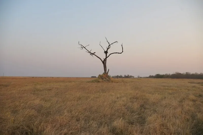
The experience is defined by the absence of scale. Without trees, rocks, or hills to provide perspective, distances become impossible to judge. A small stone on the horizon can appear as a distant mountain, and a fellow walker a few hundred metres away can seem like a giant. This phenomenon, combined with the heat haze and frequent mirages, creates a dreamlike atmosphere that is both disorienting and exhilarating. The primary draw for many is the night sky; with zero light pollution and an atmosphere so dry it feels brittle, the Milky Way casts a shadow on the white salt, and the stars appear to reach down to the very edge of the pan.
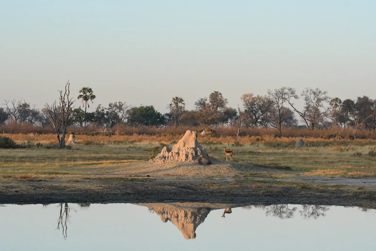
While the pans appear lifeless, the fringes are home to unique desert-adapted species. The walk often incorporates visits to habituated meerkat colonies, where these charismatic insectivores may use trekkers as lookout posts. You might also encounter the elusive brown hyena or see the tracks of lions that occasionally wander onto the pans from the neighbouring national parks. However, once you are ten kilometres into the pan, you are in a world of pure salt and sky, a wilderness so remote that it remains one of the few places on Earth where you can experience true, uninterrupted solitude.
History and Cultural Context
The history of the Makgadikgadi is a story of dramatic environmental change. Approximately 50,000 years ago, Lake Makgadikgadi covered an area of 80,000 square kilometres, fed by the Okavango, Chobe, and Zambezi rivers. Tectonic shifts and climatic drying eventually cut off these lifelines, causing the lake to shrink and eventually evaporate, leaving behind the salt deposits that define the region today. For the indigenous San people (Basarwa), the pans have been a part of their ancestral landscape for millennia. They navigated these treacherous expanses using secret water holes and the stars, hunting the migrations that still fringe the pans during the wet season.
European exploration of the area began in the mid-19th century. David Livingstone crossed the pans in the early 1850s, describing the "glaring white" expanse with a mixture of awe and trepidation. Later, the pans became a waypoint for traders and hunters travelling the "Missionaries' Road" to the north. One of the most famous landmarks in the area is Chapman’s Baobab, named after the explorer James Chapman. For decades, this massive tree served as a landmark and a "post office" for travellers, who would leave letters in its hollows for others to carry to their destinations. Though the original Chapman's Baobab collapsed in 2016, its remains and the nearby Greens Baobab continue to stand as silent witnesses to the history of exploration in the Kalahari.
Today, the Makgadikgadi Pans are recognised as a vital ecological and cultural heritage site. The region is not just a desert; it is a complex system of seasonal wetlands that supports one of Africa’s largest zebra and wildebeest migrations. The cultural connection remains strong, with local communities in Gweta and surrounding villages acting as the guardians of the pans, sharing their knowledge of the "Great White Nothing" with those who come to walk its surface.
Want more background? Read extended notes on history and cultural context → Learn more
Seasonal Highlights and Weather Reality
Timing is everything when planning a walk on the Makgadikgadi Pans. The environment undergoes a total transformation between the wet and dry seasons, and walking is only feasible—and safe—during the dry months.
The Dry Season (May to October): This is the window for trekking. As the moisture evaporates, the pan surface hardens into a firm, salty crust. The weather is characterised by clear blue skies and intense sunshine. From June to August, daytime temperatures are pleasant (20–25°C), but night-time temperatures can plummet to near freezing (0–5°C). By September and October, the heat builds significantly, often exceeding 35°C by midday, making walking much more strenuous. The dry season also offers the best visibility for the legendary night skies.
The Wet Season (November to April): During this time, the pans can transform into a shallow lake or a treacherous sea of "black cotton soil" mud. Even a small amount of rain makes the pans impassable for vehicles and dangerous for walkers, as the mud is incredibly sticky and can trap anything that attempts to cross it. However, the wet season brings the spectacular zebra and wildebeest migration to the western edges of the pans, and Sua Pan becomes a breeding ground for thousands of Greater and Lesser Flamingos. While you cannot walk deep into the pans during this time, the fringes offer incredible wildlife viewing.
Wind and Dust: In the late dry season (August and September), strong winds can whip up salt and dust storms. These "white-outs" can reduce visibility to a few metres and make navigation impossible without a GPS or a highly experienced guide. Trekkers should be prepared for the alkaline dust, which can irritate the eyes and throat.
Recommended Itinerary
3-Day Makgadikgadi Pans Trekking Itinerary
Day 1: Gweta Fringes to Ntwetwe Pan Interior
- Distance: 18 km
- Elevation gain: 10 m
- Time: 6–7 hours
- Depart from Gweta early morning via 4x4 transfer to the pan edge
- Begin walking through the "transition zone" of golden grasslands and stunted palms
- Visit a habituated meerkat colony to observe their morning foraging behaviour
- Enter the open pan; the vegetation disappears completely within the first 5 km
- Lunch break under a mobile shade structure (essential as there is no natural shade)
- Afternoon walk into the "void" where the horizon becomes a 360-degree circle
- Set up "fly-camp" on the open salt crust
- Evening spent stargazing and experiencing the absolute silence of the desert
Day 2: Deep Pan Exploration and The "Lost" Island
- Distance: 20 km
- Elevation gain: 5 m
- Time: 7–8 hours
- Pre-dawn start to witness the sunrise over the flat horizon
- Walk across the most desolate sections of the Ntwetwe Pan
- Experience the "silence test"—stopping the group to listen to the sound of your own heartbeat
- Navigate toward a distant "island" (a slightly raised mound of sand and baobabs)
- Explore the island's unique ecosystem, often containing ancient stone tools or fossils
- Afternoon trek back into the white expanse
- Second night of fly-camping; the lack of campfires (to preserve the LNT ethos) enhances the celestial views
Day 3: Pan Interior to Gweta Return
- Distance: 12 km
- Elevation gain: 5 m
- Time: 4–5 hours
- Final morning walk as the sun rises, casting long shadows across the salt ripples
- Observe the mirage effects as the heat begins to rise by mid-morning
- Rendezvous with the 4x4 support vehicle at a pre-arranged GPS coordinate
- Transfer back to Gweta, stopping at a massive baobab grove for a final bush lunch
- Arrive back in Gweta by mid-afternoon for a well-earned shower and cold drink
- Optional evening visit to a local village to learn about Kalanga culture
Important Notes:
- This route requires a support vehicle for water and emergency backup
- Walking is best done in the early morning and late afternoon to avoid peak heat
- Navigation is strictly by GPS and local knowledge; there are no trails
- The surface can be uneven with "salt polygons" that require sturdy footwear
- Total self-sufficiency is required if not part of an organised guided expedition
Planning and Bookings
Book Your Trip
Everything you need to plan your journey
Accommodation
Find places to stay near Gweta
Flights
Search flights to Gweta
Essential Preparation
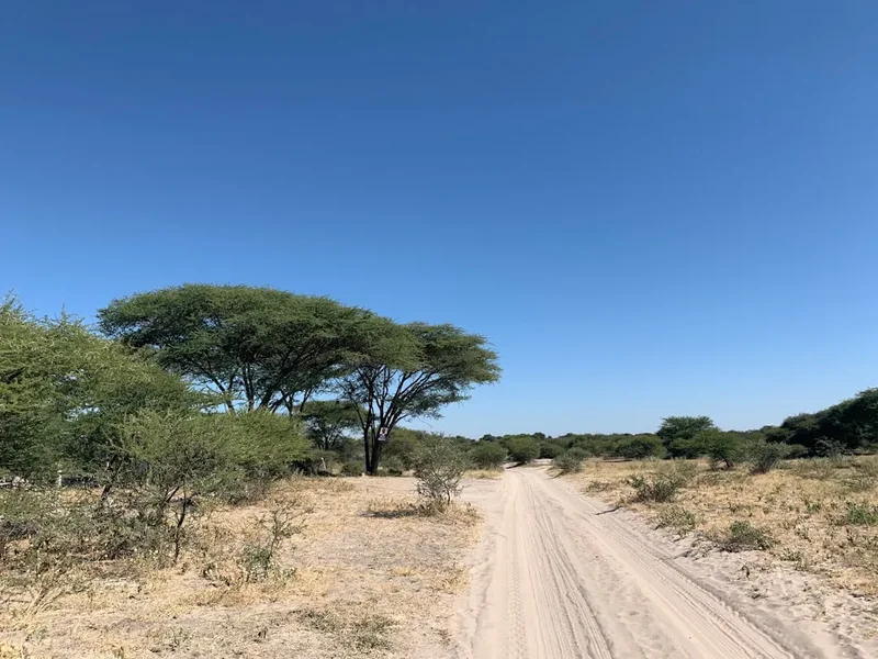
Planning a trek across the Makgadikgadi Pans is significantly different from planning a mountain hike. The primary challenge is logistics—specifically water and navigation. Because there is no surface water and the environment is hyper-arid, you must carry every litre of water you intend to use, or arrange for a support vehicle to meet you at designated points. Most walkers base themselves in Gweta, a small village on the main road between Maun and Nata, which serves as the gateway to the pans.
Fitness requirements are moderate; while the terrain is flat, the heat and the psychological impact of the vast space can be draining. You should be comfortable walking 15–20 kilometres per day in temperatures exceeding 30°C. It is strongly recommended to book through a local operator who provides a professional guide, 4x4 support, and all camping equipment. Attempting a solo, unsupported walk is extremely dangerous due to the risk of disorientation and dehydration.
Trail Accommodation
There are no permanent huts or designated campsites within the interior of the pans. Accommodation on the Makgadikgadi Pans Walk is exclusively "fly-camping."
Camping Style:
- Sleeping on bedrolls (thick mattresses) laid directly on the salt crust
- No tents are typically used, allowing for an unobstructed view of the stars
- Mobile kitchen set up by the support team (if guided)
- Portable "bush toilets" (long-drop or chemical) brought in and out
- No permanent structures of any kind exist on the pans
Facilities Provided (if guided):
- All meals and drinking water
- Bedding, pillows, and warm blankets (essential for cold desert nights)
- Basic washing water (limited to a small basin)
- Emergency satellite communication
What is NOT Provided:
- Electricity or charging points (bring power banks)
- Showers (expect to be covered in salt and dust for the duration)
- Cell phone signal (completely non-existent once on the pan)
- Shelter from wind (the pans are very exposed)
Required Gear
- Walking boots - Lightweight but sturdy with good ankle support; the salt crust can be sharp and uneven
- Gaiters - Short "scree" gaiters are excellent for keeping salt and sand out of your boots
- Sun hat - Wide-brimmed is non-negotiable; the sun reflects off the white salt, hitting you from above and below
- Sunglasses - High UV protection (Category 3 or 4); the glare on the pans can cause snow blindness
- Lightweight clothing - Long-sleeved shirts and trousers in light colours (linen or technical wicking fabrics) to protect from UV
- Warm layers - A down jacket or heavy fleece for the sudden temperature drop at sunset
- Head torch - With extra batteries and a red-light mode for preserving night vision while stargazing
- Daypack - 20–30L for carrying water, snacks, and personal items during the day
- Buff or scarf - To protect your face from dust and wind
What to Bring
- Water - If unsupported, 6–8 litres per person per day is the minimum safety requirement
- Electrolytes - Rehydration salts are essential to combat the effects of sweating in a dry environment
- High-energy snacks - Nuts, dried fruit, and biltong (dried meat) are local favourites that travel well
- Sunscreen - SPF 50+ and lip balm with UV protection; reapply every two hours
- Personal medical kit - Include blister pads, eye drops (for salt irritation), and any personal medications
- Power bank - Solar chargers work exceptionally well here given the constant sun
- Camera with extra batteries - The cold nights can drain battery life quickly
- Biodegradable wet wipes - Your primary method of "showering"
- Binoculars - For spotting distant wildlife on the pan fringes
Permits
The Makgadikgadi Pans are a mix of National Park land (Makgadikgadi Pans National Park and Nxai Pan National Park) and communal tribal grazing land. The specific permits required depend on your route. If your walk enters the National Park boundaries, you must pay daily conservation fees at the park gates (Khumni or Phuduhudu).
Permit and Fee Structure:
- National Park Entry Fees: Approximately 120 BWP (Botswana Pula) per person per day for international visitors
- Vehicle Fees: Approximately 50 BWP per vehicle per day
- Camping Fees: If staying in designated park campsites, additional fees apply (approx. 30–50 BWP)
- Community Areas: Walking on the pans outside the National Park (near Gweta) generally does not require a formal permit, but it is customary and safer to coordinate with local lodges or the village kgotla (traditional assembly)
Booking and Logistics:
- There is no central "booking system" for walking the pans like there is for the Milford Track. Instead, you book through private safari operators or lodges in Gweta
- It is highly recommended to book at least 3–6 months in advance if you require a guided expedition, especially during the peak months of July and August
- Ensure your operator has the necessary licenses to conduct walking safaris in Botswana, as regulations are strict regarding guide qualifications
Other Activities in the Area
The Makgadikgadi region offers several unique experiences that complement a multi-day walk:
- Quad Biking: For those who want to cover more ground, quad bike expeditions can reach the more remote Sua Pan and Kubu Island. This is a high-octane way to experience the vastness, though it lacks the silence of walking.
- Meerkat Encounters: Several colonies of meerkats in the Gweta area have been habituated to human presence. They are wild animals but will often climb onto your head or shoulders to get a better view of the horizon.
- Kubu Island: A dry granite rock island in the middle of Sua Pan, covered in ancient baobabs and surrounded by a sea of white salt. It is a sacred site for the local people and one of the most photogenic spots in Botswana.
- Nxai Pan National Park: A short drive from Gweta, this park is famous for "Baines' Baobabs"—a cluster of trees immortalised by the painter Thomas Baines in 1862—and excellent lion and cheetah sightings.
- Cultural Village Tours: Spend time in Gweta or Nata to learn about the traditional lives of the Kalanga and San people, including their traditional architecture and basket weaving.
Safety and Conditions
Environmental Hazards: The Makgadikgadi Pans are a beautiful but hostile environment. The primary risks are heatstroke and dehydration. Because the air is so dry, sweat evaporates instantly, and you may not realise how much fluid you are losing. Drink water proactively, even if you do not feel thirsty. The white surface reflects nearly 100% of UV radiation; without proper eye and skin protection, you can suffer severe burns or temporary "salt blindness" within hours.
Navigation and Disorientation: The pans are a featureless void. Without a GPS or a guide who knows the subtle "islands" and landmarks, it is incredibly easy to walk in circles. Mirages are constant; what looks like a lake or a forest on the horizon is often just heat shimmering over the salt. Never attempt to walk deep into the pans alone. If you become separated from your group, stay in one place; it is much easier for a support vehicle to find a stationary person than one who is moving.
Wildlife: While the interior of the pans is largely devoid of large animals, the fringes are not. Lions, leopards, and brown hyenas are present. When fly-camping, your guide will usually set up a perimeter or maintain a watch. Do not wander away from the camp at night. Scorpions are also common on the sandy islands; always check your boots before putting them on in the morning.
Emergency Communication: There is no mobile coverage on the pans. All expeditions must carry a satellite phone or a Garmin inReach device. In the event of a medical emergency, evacuation is typically by 4x4 to Gweta and then by air to Maun or Gaborone. Comprehensive travel insurance that covers emergency medical evacuation is mandatory.
Side Trips and Points of Interest
The "Lost" Baobabs: Scattered across the fringes of the pans are ancient baobabs that have stood for over a thousand years. Some of these trees have hollow centres that were historically used as shelters by San hunters. Visiting these giants provides a much-needed sense of scale and a connection to the deep history of the Kalahari.
Stone Age Tool Sites: In certain areas of the pans, particularly near the raised islands, the ground is littered with Middle Stone Age tools—hand axes and scrapers made from silcrete and chert. These artefacts are thousands of years old and indicate that the pans were once a much more hospitable environment for human habitation. Note: It is strictly illegal to remove any artefacts from the pans.
The Fossil Beds: During the dry season, the receding waters sometimes reveal the fossilised remains of ancient creatures that once lived in or around Lake Makgadikgadi, including giant zebras and extinct species of hippopotamus. These sites are rare and usually kept secret by guides to protect them from looting.
Flamingo Migrations (Sua Pan): If your walk takes you toward the eastern Sua Pan during a year of good rains, you may witness the spectacular sight of hundreds of thousands of flamingos. While the walking is harder (the ground is softer), the sight of a "pink horizon" is one of the great wildlife spectacles of Africa.
Leave No Trace
The Makgadikgadi Pans are an incredibly fragile ecosystem. The salt crust, once broken by vehicle tracks or heavy foot traffic in damp conditions, can take years or even decades to "heal." Because there is no rain for most of the year and no vegetation to cover tracks, human impact remains visible for a very long time.
Your responsibility as a walker:
- Pack out every single item of trash, including organic waste like orange peels or nut shells, which do not decompose in the hyper-saline environment
- Use designated "bush toilet" systems provided by your guide; never bury toilet paper on the pans as the wind will quickly uncover it
- Avoid walking on the pans if the surface is at all damp; your footprints will create permanent scars in the clay
- Do not collect stones, fossils, or Stone Age tools; leave them exactly where you found them for the next person to discover
- Minimise the use of soaps and detergents; even biodegradable products can contaminate the sensitive salt chemistry
- Respect the silence; the pans are a place of quiet reflection. Avoid loud music or unnecessary noise that could disturb the sense of wilderness