Lycian Way - Turkey’s Turquoise Coast Odyssey
The Lycian Way (Likya Yolu) is Turkey’s first long-distance trekking route, a 540-kilometre journey that winds through the ancient history and rugged coastal beauty of the Tekke Peninsula. Stretching from Fethiye in the west to Geyikbayırı, near Antalya, in the east, the trail follows the coastline of ancient Lycia. This is not merely a walk; it is a chronological traverse through time, where hikers navigate between limestone crags, fragrant pine forests, and the azure waters of the Mediterranean Sea. The route was meticulously researched and waymarked by Kate Clow in 1999, designed to preserve the ancient footpaths and mule trails that connected the fiercely independent city-states of the Lycian League. Today, it stands as one of the world’s premier thru-hikes, offering a challenging blend of technical terrain, archaeological wonder, and the legendary hospitality of Turkish mountain villages.
- Distance: 540.0 km one-way
- Duration: 25–35 days
- Season: April–May or September–October (avoid July and August due to extreme heat)
- Accommodation: Village guesthouses (pansiyons), wild camping, and small hotels
- Highest point: Mount Olympos (Tahtalı Dağı) saddle (approx. 1,800 m; summit 2,366 m)
- Difficulty: Challenging (rugged limestone, significant elevation changes, and water scarcity)
- Direction: Traditionally walked West to East (Fethiye to Antalya)
Overview
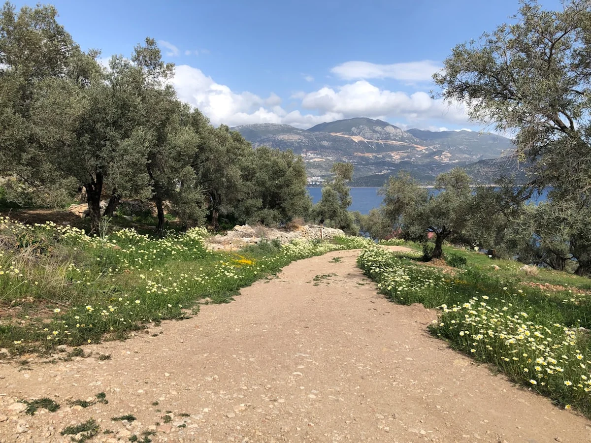
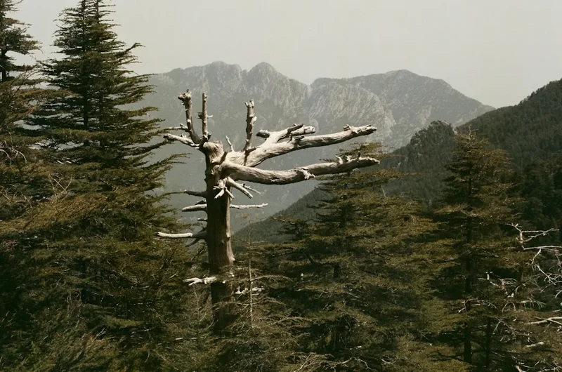
The Lycian Way is a masterclass in Mediterranean diversity. It is a trail of two halves: the western section is characterised by dramatic coastal cliffs, hidden beaches like Butterfly Valley, and the vast ruins of Patara and Xanthos. The eastern section moves further inland, ascending into the cedar forests of the Taurus Mountains, where the air is thin and the views extend across the entire turquoise coast. Unlike many European trails that follow well-groomed paths, the Lycian Way is often rocky, steep, and demanding. The terrain consists largely of ancient Roman roads, nomadic migration paths, and goat tracks that require constant attention to foot placement. With a total elevation gain of approximately 17,000 metres, the physical demand is comparable to many Himalayan treks, though the proximity to the sea provides a constant, cooling visual relief.
Culturally, the trail is unparalleled. Lycia was a unique civilisation with its own language, alphabet, and a democratic system of government that famously inspired the writers of the United States Constitution. As you walk, you will encounter the physical remnants of this culture: rock-cut tombs carved into sheer cliff faces, massive amphitheatres overlooking the sea, and sarcophagi standing solitary in the middle of olive groves. The trail does not bypass modern life; it weaves through it. You will share the path with local shepherds, drink tea in village squares where time seems to have slowed, and experience the "pansiyon" culture—small, family-run guesthouses where the food is grown in the garden and the welcome is genuine.
Logistically, the Lycian Way requires careful planning. While the route is waymarked with red and white stripes (the Grande Randonnée style), the markings can be inconsistent in remote areas or where new construction has occurred. Water is the primary concern; the limestone geology means surface water is rare, and hikers must rely on village fountains (çeşme) or ancient cisterns, many of which require treatment. However, for those who prepare, the reward is a profound sense of isolation and beauty. Whether you are standing atop the eternal flames of the Chimaera at night or watching the sunrise over the sunken city of Kekova, the Lycian Way offers a connection to the landscape that is both visceral and spiritual.
History and Cultural Context
The Lycian Way is named after the Lycian people, a fiercely independent and democratic society that inhabited this peninsula from the Bronze Age through the Roman period. The Lycians were known as the "People of the Light," and they formed the Lycian League—the first known democratic union in history. This league consisted of 23 city-states, including major hubs like Xanthos, Patara, Pinara, Tlos, Myra, and Olympos. Their unique funerary architecture, particularly the house-type rock tombs and pillar sarcophagi, remains the most striking feature of the landscape today. These tombs were designed to be visible from afar, reflecting the Lycian belief that the souls of the dead were carried to the afterlife by winged sirens.
The history of the trail itself is a modern story of preservation. Before 1999, many of the ancient paths used by the Lycians and later by Ottoman nomads (Yörüks) were being lost to modern road construction and neglect. Kate Clow, a British expatriate living in Turkey, spent years scouting these routes, interviewing local elders to find the old "yol" (road) between villages. Her efforts resulted in the formalisation of the Lycian Way, which was supported by Garanti Bank to promote sustainable tourism in the region. The trail has since become a vital economic lifeline for remote mountain villages, allowing them to maintain their traditional way of life while hosting international trekkers.
Walking the Lycian Way is an exercise in "living archaeology." In places like Sidyma or Phellos, the ruins are not fenced off or sanitised; they are part of the village fabric. You might see a farmer using an ancient sarcophagus as a water trough or find a Roman milestone acting as a doorstep. This lack of pretension makes the historical aspect of the trail feel immediate and personal. The land also bears the marks of more recent history, including the abandoned Greek village of Kayaköy (Levissi), a haunting reminder of the 1923 population exchange between Greece and Turkey. Every kilometre of the Lycian Way tells a story of migration, conflict, and the enduring resilience of the people who call this rugged coast home.
Want more background? Read extended notes on history and cultural context → Learn more
Seasonal Highlights and Weather Reality
Timing is the most critical factor for a successful Lycian Way trek. The Mediterranean climate is unforgiving in the summer and surprisingly wet in the winter. The ideal windows are Spring (April to May) and Autumn (September to October). During these months, the temperature typically ranges from 15°C to 25°C, providing comfortable walking conditions and clear skies.
Spring is arguably the most beautiful time to visit. The Taurus Mountains are still capped with snow, providing a stunning backdrop to the lush, green valleys. The trail is carpeted in wildflowers—anemones, orchids, and rockroses—and the scent of wild thyme and sage fills the air. Water sources are also more reliable in the spring as the snowmelt feeds the springs and cisterns. However, the sea may still be a bit brisk for swimming until late May.
Autumn offers a different appeal. The Mediterranean Sea has been warmed by the summer sun, making it perfect for daily swims at the end of a dusty hike. The intense heat of August begins to break in mid-September, though the landscape is much drier and more barren than in the spring. This is the season of the harvest; you will see villagers picking olives, pomegranates, and grapes, often being offered fresh fruit as you pass through. The days are shorter than in spring, so early starts are essential to reach your destination before dusk.
Winter (November to March) can be a viable option for the coastal sections, but the mountain passes will be blocked by snow. This is also the rainy season, and the limestone paths can become dangerously slippery when wet. Summer (June to August) should be avoided by all but the most heat-hardened hikers. Temperatures regularly exceed 40°C, shade is non-existent on many sections, and the risk of heatstroke and severe dehydration is extremely high. Many village guesthouses close during the peak of summer as it is simply too hot for tourism.
Recommended Itinerary

30-Day Lycian Way Full Thru-Hike
Day 1–5: The Western Coast (Fethiye to Patara)
- Day 1: Ovacık to Faralya (14 km). Start at the official yellow signpost. Dramatic views of Ölüdeniz and the climb around Baba Dağı.
- Day 2: Faralya to Kabak (12 km). A shorter day allowing for a descent into Butterfly Valley or a swim at Kabak Beach.
- Day 3: Kabak to Aladere (16 km). Steep climbs through pine forests with expansive sea views.
- Day 4: Aladere to Bel (14 km). Passing through the remote village of Gey and the ancient ruins of Sidyma.
- Day 5: Bel to Patara/Gelemis (18 km). A long descent to the 12-kilometre-long Patara Beach and the ruins of the Lycian capital.
Day 6–12: The Heart of Lycia (Patara to Kaş)
- Day 6: Patara to Kalkan (15 km). Following the Roman aqueduct (Delikkemer), a marvel of ancient engineering.
- Day 7: Kalkan to Sarıbelen (13 km). A steep ascent into the foothills, leaving the coastal humidity behind.
- Day 8: Sarıbelen to Gökçeören (12 km). Walking through high-altitude pastures and traditional farmsteads.
- Day 9: Gökçeören to Çukurbağ (20 km). A long day through the rugged interior, passing the ruins of Phellos.
- Day 10: Çukurbağ to Kaş (10 km). A spectacular descent on a zig-zagging path with Kaş and Meis island in view.
- Day 11: Rest Day in Kaş. A chance to resupply, enjoy the cafés, and perhaps dive in the crystal-clear waters.
- Day 12: Kaş to Limanağzı (10 km). Coastal walking with several opportunities for swimming in secluded bays.
Day 13–20: The Sunken Cities and Coastal Wonders (Kaş to Finike)
- Day 13: Limanağzı to Üçağız (18 km). Rugged terrain leading to the village of Üçağız, the gateway to Kekova.
- Day 14: Üçağız to Çayağzı (16 km). Passing the castle of Simena and the ruins of Istlada.
- Day 15: Çayağzı to Myra/Demre (10 km). Visit the incredible rock tombs and theatre of Myra and the Church of St. Nicholas.
- Day 16: Demre to Belören (14 km). A steep climb into the mountains, passing the ruins of Alakilise.
- Day 17: Belören to Finike (18 km). A long descent through oak forests to the orange groves of Finike.
- Day 18–20: Finike to Adrasan (various stages). This section includes the remote Gelidonya Lighthouse, often cited as the most beautiful view on the trail.
Day 21–30: The High Mountains and The Finish (Adrasan to Geyikbayırı)
- Day 21: Adrasan to Olympos (15 km). A climb over the shoulder of Mount Musa followed by a descent into the ruins of Olympos.
- Day 22: Olympos to Çıralı (5 km). A short walk along the beach to see the eternal flames of the Chimaera (Yanartaş).
- Day 23: Çıralı to Tekirova (18 km). Coastal walking through the "Chrome Mines" section, very scenic but isolated.
- Day 24: Tekirova to Phaselis (10 km). Visit the ancient harbour city of Phaselis with its three bays.
- Day 25: Phaselis to Gedelme (16 km). Moving inland and upward toward the base of Mount Olympos (Tahtalı Dağı).
- Day 26: Gedelme to Yayla Kuzdere (12 km). High mountain scenery and ancient plane trees.
- Day 27: Yayla Kuzdere to Beycik (15 km). The highest point of the trail, crossing the saddle of Mount Olympos at 1,800 m.
- Day 28: Beycik to Ulupınar (10 km). Descent through cedar and pine forests to the trout farms of Ulupınar.
- Day 29: Ulupınar to Hisarçandır (20 km). A challenging day through the Göynük Canyon area.
- Day 30: Hisarçandır to Geyikbayırı (15 km). The final stretch, ending at the rock-climbing hub of Geyikbayırı near Antalya.
Important Notes:
- The trail is marked with red and white paint. If you haven't seen a mark for 100 metres, backtrack.
- Water is scarce between villages; always carry at least 3 litres.
- Turkish Lira is essential; small villages do not accept cards.
- The "Lycian Way" app or Kate Clow’s guidebook is highly recommended for navigation.
- Wild camping is generally permitted, but avoid camping inside archaeological sites.
Planning and Bookings
Book Your Trip
Everything you need to plan your journey
Accommodation
Find places to stay near Antalya
Flights
Search flights to Antalya
Essential Preparation
The Lycian Way is a serious undertaking that requires a high level of physical fitness and self-reliance. Unlike the Camino de Santiago, the terrain is often technical, involving loose scree, steep ascents, and narrow ledges. Before departing, ensure you have a solid base of hiking fitness, particularly with a weighted pack. Navigation skills are essential; while the trail is waymarked, markings can be obscured by vegetation or destroyed by weather. Downloading offline maps (such as Gaia GPS or AllTrails) and the official Lycian Way app is mandatory for safety.
Logistically, most hikers fly into Dalaman Airport (DLM) for the western start in Fethiye or Antalya Airport (AYT) for the eastern start. Fethiye is the most common starting point and offers excellent facilities for last-minute supplies. You can buy camping gas (screw-top canisters) at outdoor shops in Fethiye or Antalya, but they are rarely available in the smaller villages along the trail. It is also wise to learn a few basic Turkish phrases; while younger people in tourist hubs speak English, village elders often only speak Turkish, and a "Merhaba" (Hello) or "Teşekkür ederim" (Thank you) goes a long way.
Trail Accommodation
Accommodation on the Lycian Way is a mix of wild camping and village guesthouses known as "pansiyons." This flexibility allows you to tailor the trek to your budget and comfort level.
Pansiyons and Guesthouses:
- Found in most villages (e.g., Faralya, Kabak, Gelemis, Kaş, Adrasan, Çıralı).
- Facilities: Usually a private or shared room, hot showers, and incredible home-cooked meals (half-board is common).
- Cost: Expect to pay between 800 and 1,500 Turkish Lira per night including breakfast and dinner.
- Booking: During peak season (April and October), it is wise to call ahead a day or two, though many hikers simply show up.
Wild Camping:
- Permitted in most areas along the trail.
- Facilities: None. You must be fully self-sufficient.
- Requirements: A lightweight, wind-resistant tent is necessary as coastal winds can be strong.
- Note: It is strictly forbidden to camp inside the fenced areas of archaeological sites like Patara or Phaselis.
What is NOT provided:
- There are no dedicated "trekker huts" or shelters like those found in the Alps or New Zealand.
- Public toilets are rare outside of villages and petrol stations.
- Electricity is only available in villages; carry a high-capacity power bank.
Required Gear
- Hiking boots: Sturdy, mid-to-high cut boots with a stiff sole are essential for the sharp limestone rocks. Trail runners are only recommended for experienced hikers with strong ankles.
- Backpack: 50–65L for thru-hikers, or 30–40L if staying exclusively in pansiyons.
- Navigation: Smartphone with offline maps, power bank, and a physical compass.
- Sun Protection: Wide-brimmed hat, high-SPF sunscreen, and polarised sunglasses. The Mediterranean sun is intense even in the shoulder seasons.
- Water Storage: Capacity for at least 3–4 litres (e.g., a 2L bladder plus two 1L bottles).
- First Aid: Focus on blister care (Compeed), rehydration salts, and antiseptic for scratches from thorny maquis vegetation.
- Emergency Whistle and Signal Mirror: For remote sections in the Taurus Mountains.
What to Bring
- Water Treatment: A Sawyer Squeeze or Katadyn BeFree filter is essential for cisterns and village taps.
- Turkish Lira: Small denominations for village shops and pansiyons. ATMs are only found in larger towns like Fethiye, Kalkan, Kaş, Demre, and Finike.
- Lightweight Clothing: Breathable, moisture-wicking fabrics. Avoid cotton. Bring a lightweight fleece or down jacket for cool mountain evenings.
- Modest Clothing: A lightweight scarf or long trousers for visiting mosques or traditional villages.
- Snacks: High-energy bars, nuts, and dried fruit. While village shops (bakkals) exist, their selection is often limited to biscuits and soda.
- Toiletries: Biodegradable soap and a small trowel for "cat holes" when camping.
- Swimwear: You will want to swim almost every day in the coastal sections.
Permits
One of the greatest appeals of the Lycian Way is its accessibility. Currently, there is no permit required to walk the trail itself. You do not need to register with any central authority, and there are no daily hiker quotas. This allows for a high degree of spontaneity in your itinerary.
Museum Passes and Site Entry:
- While the trail is free, many of the archaeological sites it passes through (Patara, Xanthos, Myra, Phaselis, Olympos) require an entry fee.
- If you plan to visit multiple sites, it is highly recommended to purchase the "MuseumPass Türkiye" or the "MuseumPass Mediterranean." These passes are valid for 15 days and provide access to over 300 sites across the country, saving significant money and time.
- Passes can be purchased at the entrance of any major site like Patara or the Fethiye Museum.
Visa Requirements:
- Most international visitors require an e-Visa to enter Turkey. This should be applied for online via the official government portal (evisa.gov.tr) at least a week before travel.
- Ensure your passport has at least six months of validity remaining from your date of entry.
Camping Regulations:
- While wild camping is generally accepted, be mindful of private property and agricultural land. If you wish to camp near a village, it is polite to ask a local for permission; they will often point you to the best spot and might even bring you tea.
- Fire permits: Lighting open fires is strictly prohibited in many forest areas, especially during the dry season, due to the extreme risk of wildfires. Use a camping stove instead.
Other Activities in the Area
The Lycian Way passes through some of Turkey’s most popular tourism hubs, offering plenty of opportunities to rest your legs and experience the region from a different perspective:
- Paragliding in Ölüdeniz: Launch from the 1,969-metre summit of Baba Dağı and soar over the Blue Lagoon. This is one of the world’s premier paragliding spots and offers a bird's-eye view of the start of the trail.
- Kekova Boat Tours: Take a "Blue Cruise" from Üçağız or Kaş to see the sunken ruins of an ancient city, visible through the clear water. Most tours include stops for swimming and a traditional lunch on board.
- Scuba Diving in Kaş: Known as the diving capital of Turkey, Kaş offers incredibly clear water, underwater caves, and even a submerged C-47 Dakota airplane wreck.
- Sea Kayaking over the Sunken City: For a more active perspective on Kekova, join a guided kayak tour that allows you to paddle directly over the submerged Lycian foundations.
- Rock Climbing in Geyikbayırı: The trail ends in one of Europe’s largest and most famous sport-climbing areas. Even if you aren't a climber, the atmosphere in the climbing camps is a great way to celebrate the end of your trek.
- Turkish Bath (Hamam): Available in Fethiye, Kaş, and Antalya. There is no better way to soothe sore muscles after 500 kilometres of walking than a traditional scrub and massage.
Safety and Conditions
Water Scarcity: This is the single greatest danger on the Lycian Way. The limestone mountains do not hold water on the surface. While there are village fountains (çeşme), they can run dry in late summer or autumn. Ancient cisterns (sarnıç) are often the only source in remote areas; these are stone-domed structures that collect rainwater. This water MUST be filtered and treated, as it is often shared with livestock. Never pass a reliable water source without topping up your bottles.
Terrain and Footwear: The trail is notoriously "stony." The sharp, jagged limestone can shred thin-soled shoes and lead to significant foot fatigue. Ankle sprains are the most common injury. Take particular care on the descent from Çukurbağ to Kaş and the high pass over Mount Olympos, where the path is narrow and the drop-offs are significant.
Heat and Sun: Heat exhaustion can occur even in the shoulder seasons. Start your walking days at dawn (5:00 AM or 6:00 AM) to complete the bulk of your mileage before the midday sun. Wear a hat that covers your neck and use electrolyte powders in your water to replace salts lost through sweat.
Wildlife:
- Scorpions and Snakes: Both exist but are rarely a problem if you are careful. Always shake out your boots in the morning and avoid sticking your hands into dark crevices in stone walls. The Ottoman Viper is present but shy.
- Wild Boar: Common in the forests. They generally avoid humans but can be noisy at night if you are camping. Store your food securely.
- Dogs: You will encounter many shepherd dogs (Kangal or Akbash). They are working animals and can be territorial. If approached, stay calm, do not run, and keep your trekking poles between you and the dog. Usually, a firm "Hayır!" (No!) or the motion of picking up a stone is enough to deter them.
Emergency Services: The emergency number in Turkey is 112 for all services (Ambulance, Police, Fire). However, mobile signal is non-existent in many deep canyons and high mountain sections. Carrying a satellite messenger (like a Garmin inReach) is highly recommended for solo thru-hikers.
Side Trips and Points of Interest
Mount Olympos (Tahtalı Dağı) Summit: While the main trail crosses the saddle at 1,800 metres, many hikers choose to summit the 2,366-metre peak. The views from the top are breathtaking, encompassing the entire coastline from Finike to Antalya. There is a cable car (Olympos Teleferik) that runs to the summit, allowing you to "cheat" the descent if your knees are suffering, or simply to grab a coffee at the summit restaurant.
The Eternal Flames of Chimaera (Yanartaş): Located above the village of Çıralı, these are natural vents where methane gas escapes from the rocks and spontaneously combusts. They have been burning for thousands of years and were used by ancient mariners as a natural lighthouse. Visit at night for the most magical experience—you can even boil a small pot of tea over the flames.
Gelidonya Lighthouse: Perched on a lonely ridge overlooking the "Five Islands," this is one of the most iconic spots on the trail. It was the site of a famous Bronze Age shipwreck excavation. The hike from Adrasan to the lighthouse is challenging but offers what many consider the finest coastal panorama in the Mediterranean.
Butterfly Valley (Kelebekler Vadisi): A deep, sheer-walled canyon that opens onto a white sand beach. While the main Lycian Way stays on the cliffs above, a steep and technical path (involving fixed ropes) descends into the valley. It is famous for the Jersey Tiger butterflies that congregate here in the summer, though the valley is worth visiting for its sheer geological scale alone.
The Ghost Village of Kayaköy: Located near the start of the trail in Fethiye, this abandoned Greek village consists of hundreds of roofless stone houses and two large churches. It is a somber and beautiful place to explore, providing deep insight into the complex modern history of the region.
Leave No Trace
The Lycian Way passes through fragile ecosystems and priceless archaeological sites. As the trail grows in popularity, the impact of hikers is becoming more visible. It is our collective responsibility to ensure that this ancient landscape remains pristine for those who follow.
Core Principles for the Lycian Way:
- Waste Management: Pack out every single piece of trash. This includes fruit peels and nut shells, which decompose slowly in the arid climate. In villages, use designated bins. Never leave trash in or near ancient cisterns.
- Human Waste: Use toilets in villages whenever possible. If you must go on the trail, dig a hole at least 15–20 cm deep and at least 50 metres away from any path, campsite, or water source. Pack out your toilet paper in a sealed bag.
- Respect Antiquities: Do not move stones, climb on fragile walls, or take "souvenirs" like pottery shards. These sites are thousands of years old and are easily damaged.
- Fire Safety: Wildfires are a catastrophic threat in Turkey. Never light a campfire. Use a small, controlled gas stove for cooking and ensure it is placed on a stable, non-flammable surface.
- Water Protection: Do not use soap (even biodegradable) directly in village fountains or cisterns. Collect water in a container and wash at least 30 metres away from the source.
- Stay on the Path: The "maquis" (shrubland) is home to many endemic plants and small animals. Cutting switchbacks causes erosion and destroys habitat.
By following these guidelines, you help preserve the "People of the Light's" heritage and ensure that the Lycian Way remains a world-class trekking destination.