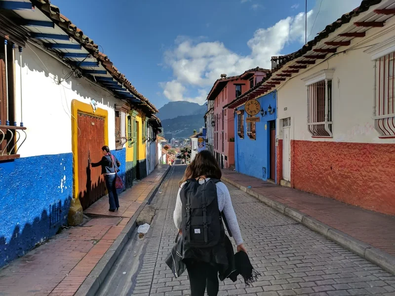
Lost City Trek (Ciudad Perdida) - Colombia's Ancient Jungle Odyssey
The Lost City Trek, known locally as the "Ciudad Perdida" or "Teyuna" trek, is widely considered South America's most rewarding multi-day jungle expedition. Carved into the steep, emerald-green ridges of the Sierra Nevada de Santa Marta—the world's highest coastal mountain range—this 47-kilometre journey is far more than a physical challenge; it is a pilgrimage through time. Unlike the well-trodden paths of the Andes, the route to Teyuna plunges walkers into a dense, humid tropical rainforest where the air is thick with the scent of damp earth and the calls of exotic birds. The destination is an archaeological marvel built by the Tayrona people around 800 AD, predating Machu Picchu by several centuries. This ancient citadel, consisting of 169 stone terraces carved into the mountainside, remained hidden from the outside world for nearly fifty years after the Spanish conquest, only to be "rediscovered" in the 1970s. Today, the trek offers a rare opportunity to interact with the living descendants of the Tayrona—the Kogi, Wiwa, Arhuaco, and Kankuamo peoples—who still inhabit these sacred lands and maintain their ancestral traditions. This is a journey of endurance, cultural immersion, and profound natural beauty, demanding respect for both the environment and the indigenous communities that serve as its guardians.
- Distance: 47.0 km return (out-and-back)
- Duration: 4 to 6 days (4 days is the standard pace)
- Elevation Gain: Approximately 1,200 m total (cumulative gain is significantly higher due to constant undulations)
- Difficulty: Challenging (primarily due to heat, humidity, and steep gradients)
- Highest Point: Ciudad Perdida (1,200 m)
- Best Time: December to March (dry season)
- Mandatory: Must be accompanied by a licensed guide from an authorised agency
- Starting Point: El Mamey (also known as Machete Pelao), Magdalena, Colombia
Overview
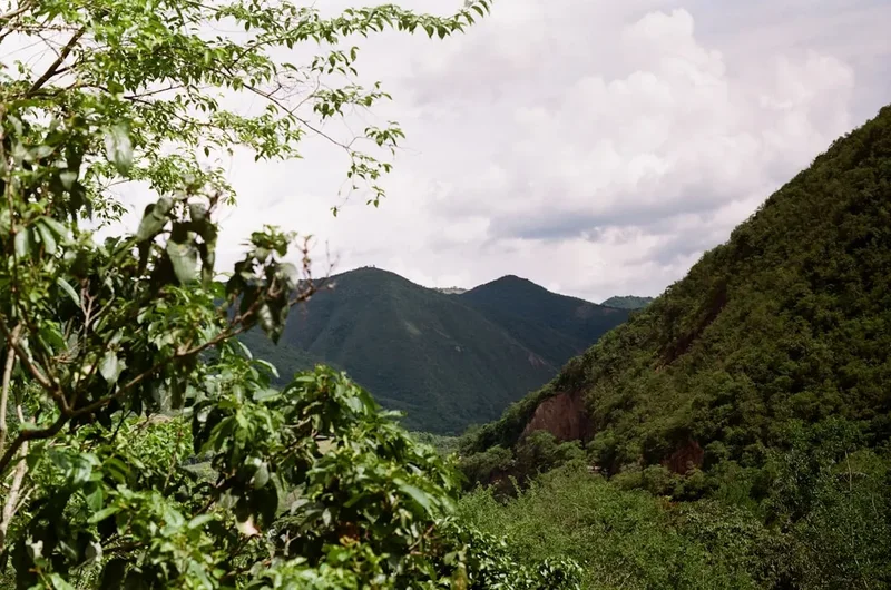
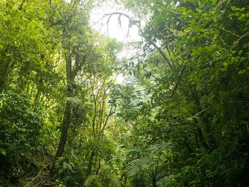
The Lost City Trek is a masterclass in tropical endurance. While the total distance of 47 kilometres might seem modest over four days, the statistics do not account for the relentless humidity, the verticality of the terrain, and the frequent river crossings that define the experience. The trail begins in the dusty foothills of the Sierra Nevada de Santa Marta, initially passing through farmland and secondary forest before ascending into the primary rainforest of the Sierra Nevada National Park. The landscape is a vertical tapestry of giant Ceiba trees, tangled lianas, and vibrant bromeliads, all thriving in a climate that remains consistently hot and humid throughout the year. The path itself is a mix of red clay tracks, which can become notoriously slippery after rain, and ancient stone steps that have survived for over a millennium.
The physical exertion is punctuated by the sensory richness of the jungle. Walkers are often accompanied by the iridescent flash of morpho butterflies, the distant roar of howler monkeys, and the constant soundtrack of cicadas. The Buritaca River serves as the trek's lifeline, providing both a navigational guide and a series of refreshing swimming holes that offer vital relief from the sweltering heat. The final ascent to the city involves climbing 1,200 narrow, moss-covered stone steps—a test of resolve that culminates in the breathtaking sight of the central terraces. Standing at the "Upper Terrace," walkers are treated to a panoramic view of the citadel framed by the jagged peaks of the Sierra Nevada, a moment that justifies every drop of sweat shed on the trail.
What sets the Lost City Trek apart from other global hikes is the living culture that surrounds it. The Sierra Nevada is not a museum; it is a "Heart of the World" for the indigenous groups who live here. Throughout the trek, you will pass through indigenous villages and see members of the Kogi and Wiwa tribes in their traditional white cotton robes, carrying "mochilas" (woven bags) and "poporos" (sacred gourds). Their presence serves as a constant reminder that you are a guest in a sacred landscape. The trek is an exercise in humility, requiring walkers to adapt to the rhythms of the jungle, the heat of the Colombian sun, and the spiritual gravity of an ancient civilisation that refused to be forgotten.
History and Cultural Context
The history of Ciudad Perdida, or Teyuna, is a narrative of architectural brilliance, colonial tragedy, and accidental rediscovery. Built by the Tayrona civilisation around 800 AD, the city served as a major political, social, and religious hub for a network of villages scattered across the Sierra Nevada de Santa Marta. The Tayrona were master engineers, developing sophisticated drainage systems, stone-paved paths, and circular terraces designed to prevent erosion in the steep, high-rainfall environment. At its peak, it is estimated that between 2,000 and 8,000 people lived in Teyuna, supported by a complex agricultural system of maize, beans, and fruit trees.
When the Spanish arrived in the 16th century, the Tayrona resisted fiercely, but the combination of warfare and European diseases eventually forced the abandonment of the city. While the Spanish never officially "found" Teyuna, the jungle quickly reclaimed the stone terraces, concealing them under a thick canopy of vegetation for nearly 450 years. During this time, the indigenous descendants—the Kogi, Wiwa, Arhuaco, and Kankuamo—maintained knowledge of the site's existence, visiting it secretly for spiritual ceremonies while keeping its location hidden from outsiders to protect its sanctity.
The modern "discovery" occurred in 1972 when a group of local treasure hunters, known as "guaqueros," stumbled upon the stone steps while searching for gold. They nicknamed the site "Infierno Verde" (Green Hell) and began looting the ancient graves for gold ornaments and ceramics. The secret was out when looted artefacts began appearing on the black market in Santa Marta. In 1975, the Colombian government intervened, sending archaeologists to excavate and restore the site. The restoration process was painstaking, involving the clearing of centuries of jungle growth and the stabilisation of the stone walls. In 1986, the area was declared a UNESCO Biosphere Reserve and National Park.
Today, the site is managed through a unique partnership between the Colombian government and the indigenous councils. The indigenous groups view the trek as an opportunity to educate the world about their philosophy of "Aluna"—the spiritual reality that underpins the physical world. They believe the Sierra Nevada is the balance point of the Earth and that their rituals are essential for maintaining global ecological harmony. As a walker, understanding this history is crucial; you are not just visiting a ruin, but entering a site that remains the spiritual epicentre for thousands of people who still call these mountains home.
Want more background? Read extended notes on history and cultural context → Learn more
Seasonal Highlights and Weather Reality
The Sierra Nevada de Santa Marta experiences a tropical climate, meaning the weather is dictated more by rainfall patterns than temperature fluctuations. Temperatures at the trailhead in El Mamey typically hover around 30°C to 34°C, while the higher elevations near the Lost City are slightly cooler, ranging from 18°C at night to 26°C during the day. Humidity is the constant factor, often exceeding 80%, which makes the perceived temperature much higher and ensures that nothing—from your boots to your shirt—ever truly dries out.
Dry Season (December to March): This is the peak trekking season and generally considered the best time to visit. The trails are firmer, river crossings are shallower and safer, and there is a higher probability of clear blue skies for photography at the ruins. However, the heat can be more intense during this period, and the trail is at its most crowded. The "Veranillo de San Juan" in June and July also offers a brief window of drier weather, making it a popular secondary season.
Wet Season (April to May and August to November): During these months, the Sierra Nevada receives heavy afternoon downpours. The trail transforms into a challenging obstacle course of thick, knee-deep mud, and the Buritaca River can rise rapidly, sometimes making crossings impossible and causing temporary delays. The advantage of the wet season is the lushness of the vegetation and the dramatic waterfalls that appear on the valley walls. September and October are typically the wettest months; trekking during this time requires a high level of physical fitness and a resilient mindset.
Annual Closure: It is critical to note that the Lost City Trek usually closes for the entire month of September. This closure is requested by the indigenous communities to allow the land to "breathe" and recover from the impact of tourism, and to permit the tribes to perform cleansing rituals. Always check with authorised agencies for the exact dates of the annual closure before planning your trip.
Recommended Itinerary
4-Day Lost City Trek Itinerary
Day 1: El Mamey to Camp 1 (Adán or Alfredo)
- Distance: 7.6 km
- Elevation gain: 450 m
- Time: 3–4 hours
- Depart Santa Marta or Taganga by 4x4 for a 3-hour drive to El Mamey
- Lunch in El Mamey before starting the ascent
- The trail begins with a steep, exposed climb on a dirt road through farmland
- Pass through the "Mirador" for the first expansive views of the Sierra Nevada
- Descend towards the Buritaca River valley
- Arrive at Camp 1 (Adán or Alfredo), featuring a natural swimming hole
- Evening briefing on the history of the region and indigenous customs
- First night sleeping in bunks or hammocks with mosquito nets
Day 2: Camp 1 to Camp 3 (Paraíso Teyuna)
- Distance: 14.7 km
- Elevation gain: 600 m
- Time: 7–8 hours
- Early 5:00 AM start to beat the midday heat
- Long ascent to the top of the ridge followed by a descent to the indigenous village of Mutanyi
- Opportunity to observe Kogi traditional houses and daily life from the trail
- Continue through dense jungle with multiple river crossings (water may be waist-deep)
- Lunch at Camp 2 (Mumake or Wiwa)
- Afternoon trek involves a challenging climb through primary rainforest
- Arrive at Camp 3 (Paraíso Teyuna), the final camp before the Lost City
- The camp is located just 1 km from the base of the ancient steps
- Early dinner and rest in preparation for the summit day
Day 3: Camp 3 to Ciudad Perdida and return to Camp 2
- Distance: 6 km (plus 3–4 hours exploring the ruins)
- Elevation: 250 m gain to the city
- Time: 7–8 hours total
- Cross the Buritaca River one final time at dawn
- Climb the 1,200 narrow, ancient stone steps to the entrance of Teyuna
- Guided tour of the archaeological site, including the residential sectors, the ceremonial terraces, and the "Map of the World" stone
- Meeting with a Mamo (indigenous leader) if available, to learn about spiritual traditions
- Time for photography at the iconic "Upper Terrace" viewpoint
- Descend the 1,200 steps back to Camp 3 for lunch
- Trek back through the jungle, retracing your steps to Camp 2 (Mumake or Wiwa)
- Evening spent sharing stories with other trekking groups at the riverside camp
Day 4: Camp 2 to El Mamey
- Distance: 18.7 km
- Elevation: Various undulations with a final steep descent
- Time: 6–8 hours
- The longest day in terms of distance, requiring an early start
- Retrace the route back through Mutanyi and over the final ridge
- The final 5 km descent to El Mamey is often the most taxing due to the heat and tired knees
- Arrival in El Mamey for a celebratory lunch with the group
- 4x4 transport back to Santa Marta, arriving late afternoon
- Optional drop-offs at Palomino or Tayrona Park entrances can often be arranged
Important Notes:
- The itinerary is fixed by the agencies; you cannot "speed up" or "slow down" independently
- River crossings can be dangerous after heavy rain; always follow the guide's instructions
- Mules are used to transport food and supplies to the camps; give them right of way on the trail
- Electricity at camps is limited (usually solar-powered) and only available for a few hours
- Water is provided at camps but must be treated or filtered if taken from the river
- The 5-day and 6-day options follow the same route but involve shorter walking days and more time at the camps
Planning and Bookings
Book Your Trip
Everything you need to plan your journey
Accommodation
Find places to stay near Santa Marta
Flights
Search flights to Santa Marta
Essential Preparation
The most critical aspect of planning the Lost City Trek is understanding that independent hiking is strictly prohibited. You must book through one of the five or six authorised agencies based in Santa Marta. These agencies are part of a local consortium that ensures fair wages for guides, support for indigenous communities, and maintenance of the trail. Booking should be done at least 2–4 weeks in advance during the peak season (December–March), though last-minute spots can often be found in the shoulder seasons.
Physical preparation is essential. While you do not need to be an elite athlete, you should be comfortable walking 7–8 hours a day in high heat and humidity. Focus on cardiovascular training and leg strength (stair climbing is particularly effective preparation for the 1,200 steps). Logistically, Santa Marta is the primary hub. Most trekkers leave their main luggage at their hostel or the trekking agency's office in Santa Marta, taking only a small 20–30 litre daypack on the trail. Ensure you have a valid Yellow Fever vaccination certificate, as it is occasionally checked by health authorities in the region.
Trail Accommodation
Accommodation on the Lost City Trek is basic but functional, consisting of a series of "campamentos" (campsites) strategically located along the route. These camps are shared by all agencies, meaning you will be staying with trekkers from various groups.
Hut Facilities:
- Bunk beds or hammocks (assigned by the guide upon arrival)
- Mosquito nets and basic blankets (though a lightweight sleeping bag liner is recommended)
- Shared bathrooms with flush toilets (usually well-maintained)
- Cold-water showers (a welcome relief from the heat)
- Common dining areas where group meals are served
- Small "tiendas" (shops) selling cold drinks, snacks, and basic toiletries
- Limited charging stations (expect queues and slow charging)
What Camps Don't Provide:
- Hot water (all showers are cold)
- Private rooms or partitions (sleeping areas are communal)
- WiFi or mobile signal (you will be completely offline)
- Towels or toiletries
- Laundry services (clothes will not dry overnight due to humidity)
Booking Requirements:
- The cost of the trek is standardised across all authorised agencies (approximately 1,750,000 COP for the 4-day trek as of 2024)
- The price includes all transport, meals, guide services, park entrance fees, and accommodation
- A deposit is usually required at the time of booking, with the balance paid in cash (Colombian Pesos) or by card (often with a surcharge) in Santa Marta
Required Gear
- Hiking boots or trail shoes - Must have excellent grip for mud and wet stone; ensure they are well broken-in
- Daypack (20–30L) - Lightweight with a rain cover; a waterproof liner or dry bags are essential for electronics
- Moisture-wicking clothing - 2–3 sets of lightweight, quick-dry shirts and shorts; avoid cotton at all costs
- Long trousers and long-sleeved shirt - For the evenings to protect against mosquitoes and "puri-puris" (sandflies)
- Sandals or flip-flops - For wearing around the camp and in the showers
- Rain poncho - A lightweight, breathable poncho is better than a heavy Gore-Tex jacket in the tropical heat
- Head torch - Essential for navigating the camps at night and for early morning starts
- Personal first aid kit - Include blister pads (Compeed), rehydration salts, anti-diarrhoea medication, and any personal prescriptions
What to Bring
- Water purification - While agencies provide boiled or filtered water, bringing a LifeStraw or purification tablets provides extra security
- Insect repellent - High DEET concentration (30%+) or Picaridin is necessary for protection against mosquitoes and sandflies
- Sun protection - SPF 50+ sunscreen, a wide-brimmed hat, and polarised sunglasses
- Toiletries - Biodegradable soap, toothbrush, toothpaste, and a quick-dry microfibre towel
- Cash (COP) - Small denominations for buying snacks, cold beers, or Gatorade at the camps (budget 150,000–200,000 COP)
- Power bank - To keep your camera and phone charged for photos
- Swimwear - For the river swimming holes
- Plastic bags - Several heavy-duty bags to separate wet clothes from dry ones
- Snacks - Energy bars, nuts, or dried fruit (though meals provided are generally very substantial)
Permits
Permits for the Lost City Trek are not issued to individuals but are managed through the authorised trekking agencies. When you book your tour, the agency handles all the necessary paperwork and fees required by the ICANH (Colombian Institute of Anthropology and History) and the indigenous councils. There is no "permit lottery" or complex application process for the walker; your booking confirmation serves as your permit.
Cost Breakdown (Standardised):
- The total price for the 4-day or 5-day trek is currently set at 1,750,000 COP (approximately £350 / €410 / $440 USD)
- This price is non-negotiable and is fixed by the local association of trekking agencies to prevent price wars and ensure sustainable tourism
- A portion of this fee (approximately 10%) goes directly to the indigenous communities for the maintenance of their villages and schools
- Another portion is allocated to the ICANH for the ongoing archaeological preservation of the site
Entry Requirements:
- You must provide your passport details to the agency at the time of booking
- It is highly recommended to carry a colour photocopy of your passport on the trail, while leaving the original in a secure safe in Santa Marta
- Travel insurance that specifically covers "hiking up to 1,500m" and "emergency medical evacuation" is mandatory for most agencies
Other Activities in the Area
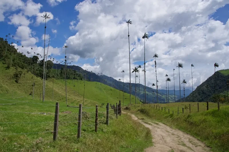
The region surrounding Santa Marta is a diverse playground of coastal and mountain landscapes. Consider these additions to your itinerary:
- Tayrona National Natural Park: Located just an hour from Santa Marta, this park features some of Colombia's most beautiful Caribbean beaches, including Cabo San Juan and La Piscina. It offers shorter day hikes through coastal jungle.
- Minca: A mountain village in the foothills of the Sierra Nevada, famous for its coffee and cacao plantations, giant hammocks at Casa Elemento, and the Marinka waterfalls. It is a cooler, more relaxed alternative to the heat of the coast.
- Palomino: A laid-back beach town known for "tubing" down the Palomino River, where you can float from the jungle all the way to the Caribbean Sea.
- Taganga: A former fishing village turned backpacker hub, offering excellent scuba diving and boat trips to secluded bays.
- Quebrada Valencia: A series of spectacular waterfalls and natural pools located between Santa Marta and Palomino, perfect for a half-day trip.
Safety and Conditions
Health and Hydration: The primary safety risk on the Lost City Trek is heat exhaustion and dehydration. The combination of high temperatures and extreme humidity means you will lose fluids rapidly. It is essential to drink at least 3–4 litres of water per day and use rehydration salts (electrolytes) every evening. If you feel dizzy, nauseous, or stop sweating, inform your guide immediately.
Insects and Tropical Diseases: Mosquitoes and sandflies (puri-puris) are prevalent. While the risk of Malaria is considered low in this specific corridor, Yellow Fever and Dengue Fever are present in the Magdalena region. Ensure your vaccinations are up to date and use high-strength repellent. Long sleeves and trousers in the evening are your best defence.
Terrain Hazards: The trail is steep and can be extremely slippery. Ankle sprains are the most common injury. Use trekking poles if you have weak knees, and always maintain three points of contact on the ancient stone steps, which can be slick with moss. During the wet season, river crossings require caution; never attempt to cross a swollen river without your guide's assistance.
Security: The Sierra Nevada de Santa Marta has a complex history involving various armed groups. However, since the mid-2000s, the trekking corridor has been secured by the Colombian military and is considered safe for international tourists. The presence of the military at certain checkpoints and near the ruins is a standard safety measure. Stick to the group and follow your guide's instructions at all times.
Side Trips and Points of Interest
The Indigenous Village of Mutanyi: On Day 2, the trail passes through or near Mutanyi, a significant Kogi village. While you cannot enter the private homes, observing the "nuhue" (ceremonial houses) and the traditional agricultural practices from the path provides a fascinating window into a culture that has remained largely unchanged for centuries. Your guide will explain the significance of the white clothing and the "poporo" gourds used by the men.
The Map of the World (Piedra de la Memoria): Located within the Lost City itself, this large, flat stone is engraved with ancient petroglyphs. Indigenous tradition holds that these carvings represent a map of the Sierra Nevada, showing the connections between different Tayrona settlements and the sacred peaks. It is a powerful testament to the geographical knowledge of the ancient inhabitants.
The Buritaca River Swimming Holes: Each camp is located near the river, and the natural pools are a highlight of the trek. The pool at Camp 1 (Adán) is particularly deep and clear, featuring a large rock for jumping. These spots are not just for recreation; they are essential for cooling the core body temperature after a day of trekking.
The Upper Terrace (The Iconic View): This is the highest point of the archaeological site and the location of the famous "postcard" view. From here, you can see the symmetry of the circular terraces and the way the city was integrated into the ridge. It is the best place to appreciate the sheer scale of the engineering required to build a city in such a vertical environment.
Leave No Trace
The Lost City Trek passes through a fragile ecosystem and a sacred indigenous territory. Practising Leave No Trace principles is not just an environmental obligation but a sign of respect for the "Elder Brothers" (the indigenous people) who believe they are protecting the balance of the world.
Your responsibility as a walker:
- Pack out all non-biodegradable waste. While camps have bins, the logistics of removing rubbish from the jungle are difficult; carrying your own micro-trash back to Santa Marta is highly encouraged.
- Never use soap or shampoo directly in the river. Use the provided showers at the camps, which have basic drainage systems.
- Stay on the established trail. Cutting switchbacks causes severe erosion in the high-rainfall environment of the Sierra Nevada.
- Respect indigenous privacy. Always ask for permission before taking photos of Kogi or Wiwa people, especially children. Some may refuse for spiritual reasons; respect this without question.
- Do not touch or remove any stones or artefacts from the ruins. The site is a protected archaeological monument.
- Keep noise levels down, especially when passing through indigenous villages or near ceremonial sites.