Lost City Pilgrimage Route - The Teyuna Odyssey
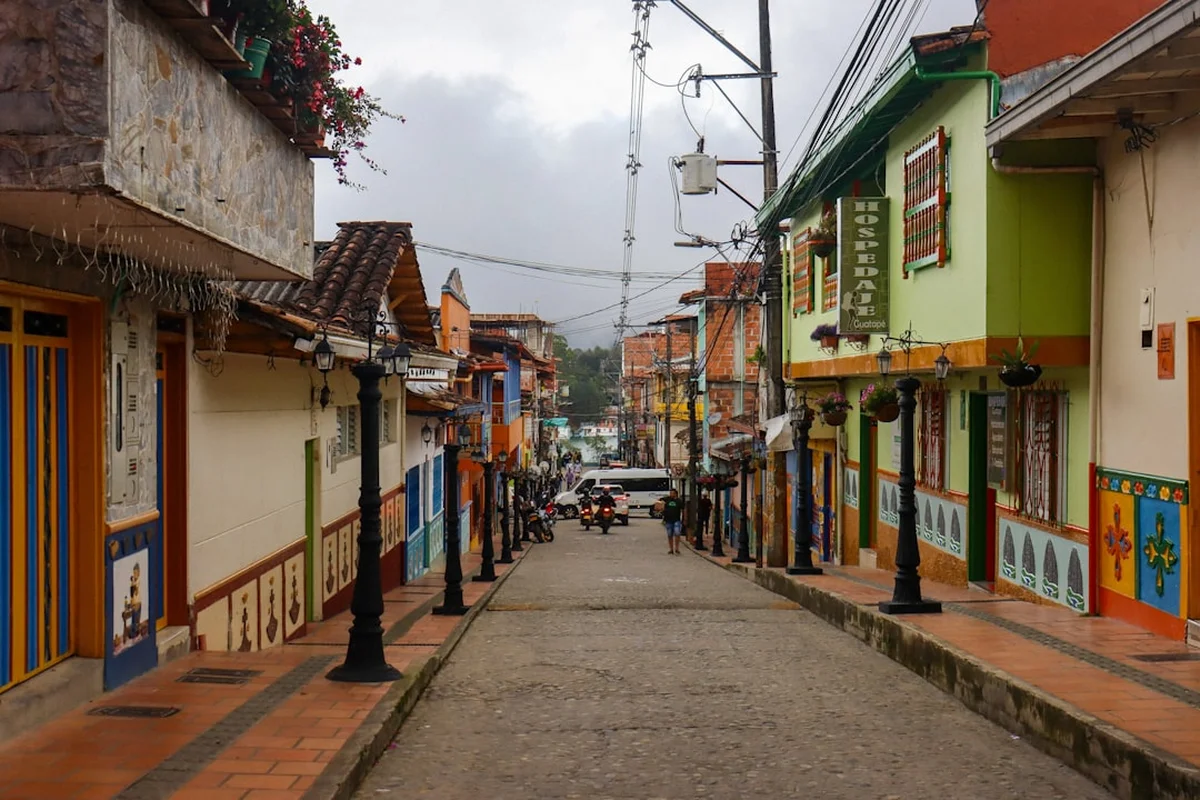
The Lost City Pilgrimage Route, known locally as the Ciudad Perdida trek, is South America’s most profound archaeological journey—a 44-kilometre expedition into the heart of the Sierra Nevada de Santa Marta in Colombia. This is not merely a hike; it is a humid, challenging, and spiritually resonant passage through the world’s highest coastal mountain range, culminating in the ancient stone terraces of Teyuna. Built by the Tairona people approximately 650 years before Machu Picchu, the "Lost City" remained hidden from the outside world by dense tropical rainforest until its accidental discovery by treasure hunters in 1972. Today, the route is managed in strict collaboration with the indigenous Kogi, Wiwa, Arhuaco, and Kankuamo communities, who consider themselves the "Older Brothers" and guardians of the Earth’s equilibrium. To walk this trail is to enter a living museum where ancient stone stairways meet emerald jungle canopies, and where the physical demand of the Sierra Nevada is matched only by the cultural depth of its inhabitants.
- Distance: 44.0 km return
- Duration: 4–6 days (4 days is the standard commercial duration)
- Season: December to March (dry season); September is typically closed for indigenous rituals
- Accommodation: Communal jungle camps (bunks or hammocks with mosquito nets)
- Highest point: Teyuna Archaeological Park (1,200 m)
- Difficulty: Challenging (due to extreme humidity, steep gradients, and river crossings)
- Access: Strictly via authorised tour operators; no independent trekking permitted
- Direction: Out-and-back (return via the same primary route)
Overview
The Lost City Pilgrimage Route is a masterclass in endurance and tropical immersion. Unlike the high-altitude, arid passes of the Andes, the Sierra Nevada de Santa Marta offers a vertical landscape defined by 90% humidity, torrential afternoon rains, and a biodiversity that is unparalleled on the continent. The trek begins in the dusty foothills of El Mamey and ascends through a mosaic of secondary forest, active cocoa and coffee plantations, and eventually, the pristine primary rainforest that cloaks the sacred peaks. The terrain is relentless; the trail consists of "Colombian flats"—a local euphemism for constant, steep undulations that test the resolve of even the most seasoned trekkers. You will cross the Buritaca River multiple times, sometimes wading through waist-deep currents, and climb over 1,200 ancient stone steps to reach the central urban complex of the Tairona civilisation.
The destination, Teyuna, is a sprawling architectural marvel consisting of 169 stone terraces carved into a mountain ridge. These terraces once supported wooden circular houses, ceremonial centres, and a sophisticated drainage system that has withstood centuries of tropical erosion. Standing on the uppermost "Rey Helipuerto" terrace, looking out over the mist-shrouded valley, walkers realise that the city was designed to exist in harmony with the mountain's topography, rather than in defiance of it. The scale of the site is humbling, yet it is the journey through the indigenous territories that provides the most lasting impact. You will pass through Wiwa and Kogi villages, where the sight of white-clad families and the scent of burning copal resin serve as a reminder that this land is not a relic of the past, but a vibrant, sacred home.
Logistically, the trek is an all-inclusive experience. Because independent hiking is prohibited to protect the archaeological integrity and respect indigenous sovereignty, walkers travel in small groups led by professional guides—many of whom are former "guaqueros" (looters) turned conservationists, or members of the indigenous communities themselves. This structure ensures that the economic benefits of tourism flow directly into the local mountain economy, supporting the very people who preserve the trail's magic. It is a demanding, sweaty, and often muddy odyssey, but for those who reach the stone circles of Teyuna, it is a transformative encounter with the soul of pre-Columbian America.
History and Cultural Context
The history of the Lost City is a narrative of resilience, disappearance, and rediscovery. Teyuna was founded around 800 AD by the Tairona, a technologically advanced society known for their sophisticated goldsmithing, pottery, and urban planning. At its peak, the city is estimated to have housed between 2,000 and 8,000 people. Unlike the Inca, who built with massive interlocking stones, the Tairona utilised the natural slate and granite of the Sierra Nevada to create a network of terraces and paved paths that allowed for high-density living in a vertical rainforest. Following the Spanish conquest in the 16th century, the city was abandoned—not because it was conquered, but because the Tairona retreated deeper into the mountains to escape European diseases and colonial incursions. The jungle quickly reclaimed the stone, and for nearly 400 years, Teyuna existed only in the oral traditions of the Kogi and Arhuaco descendants.
In 1972, the silence was broken. A family of local treasure hunters, the Sepúlvedas, discovered a series of stone steps rising from the banks of the Buritaca River. They followed the stairs to find a city of gold and emeralds, sparking a violent "gold rush" among local looters. For several years, the site was a lawless zone of archaeological plunder until the Colombian government intervened in 1976. Led by archaeologist Álvaro Soto-Holguín, the "Buritaca 200" project began the painstaking process of clearing the vegetation and restoring the terraces. The site was renamed "Ciudad Perdida" (The Lost City) for the international stage, though the indigenous people have always known it as Teyuna, the heart of their ancestral world.
Today, the cultural context of the trail is defined by the "Law of Origin." The indigenous groups of the Sierra Nevada—the Kogi, Wiwa, Arhuaco, and Kankuamo—believe the mountain is the "Heart of the World." They view themselves as the guardians of nature and see the influx of "Younger Brothers" (outsiders) as a responsibility to educate. Every year in September, the trail is closed to the public so that the mamos (spiritual leaders) can perform cleansing rituals to heal the land from the spiritual impact of tourism. This deep-seated cultural connection ensures that the Lost City is not just an archaeological site, but a living sanctuary where the past and present are inextricably linked.
Want more background? Read extended notes on history and cultural context → Learn more
Seasonal Highlights and Weather Reality
The Sierra Nevada de Santa Marta experiences a tropical mountain climate, which means weather is dictated more by rainfall patterns than by temperature fluctuations. The temperature remains consistently warm, ranging from 25°C to 32°C during the day, dropping to a refreshing 15°C to 18°C at night in the higher camps. Humidity is the defining factor, often hovering above 85%, which makes the physical exertion feel significantly more intense than the elevation gain suggests.
Dry Season (December to March): This is the peak trekking window. The trails are firmer, river levels are lower (making crossings safer and easier), and the chance of clear blue skies in the mornings is high. However, the dust on the lower sections can be significant, and the trail is at its most crowded. This is the best time for photography, as the views of the Caribbean Sea from the higher ridges are often visible before the afternoon clouds roll in.
Shoulder Season (June to August): A secondary dry window, often referred to as the "Veranillo de San Juan." While rain is more frequent than in January, it usually arrives in short, predictable afternoon bursts. The landscape is lush and vibrant green, and the heat is slightly tempered by the moisture. This is an excellent time for those who want to avoid the peak crowds of the New Year.
Wet Season (April to May and October to November): During these months, the Sierra Nevada receives its heaviest rainfall. The Buritaca River can rise rapidly, occasionally leading to trek cancellations or delays. The trails become notoriously muddy and slippery, turning steep descents into "mud slides." While the jungle is at its most atmospheric and the waterfalls are thunderous, this season requires high-quality waterproof gear and a resilient mindset. Note that the trail is almost always closed for the entire month of September for indigenous conservation and spiritual maintenance.
Recommended Itinerary
4-Day Lost City Pilgrimage Itinerary
Day 1: Santa Marta / El Mamey to Camp 1 (Adán or Alfredo)
- Distance: 7.6 km
- Elevation gain: 450 m
- Time: 3–4 hours
- Morning departure from Santa Marta via 4x4 transport to the village of El Mamey (Machete Pelao)
- Lunch in El Mamey before beginning the ascent
- The trail starts on an unshaded, dusty road through farmland and secondary forest
- Significant initial climb known as "The Three Crosses" (Las Tres Cruces)
- Arrive at Camp 1, featuring a natural swimming hole in the river
- Evening briefing on Tairona history and the days ahead
- First night in hammocks or bunks with mosquito nets
Day 2: Camp 1 to Camp 3 (Paraíso Teyuna)
- Distance: 14.7 km
- Elevation gain: 600 m
- Time: 7–8 hours
- Early 5:00 AM start to beat the midday heat
- Hike through the indigenous village of Mutanyi (Kogi community)
- Observe traditional Kogi architecture and the "Bunkwimake" (ceremonial house)
- Multiple river crossings of the Buritaca River (water levels vary)
- Steep ascent through dense primary rainforest with high humidity
- Lunch at Camp 2 (Wiwa Camp) before the final push
- Arrive at Camp 3, the closest camp to the Lost City (only 1 km away)
- The sound of the river and the deep jungle provides a powerful backdrop for the night
Day 3: Camp 3 to Ciudad Perdida to Camp 2 (Wiwa)
- Distance: 6 km (exploration) + 9.7 km (return hike)
- Elevation: 1,200 stone steps to the city
- Time: 7–8 hours
- The most significant day: crossing the river and climbing the 1,200 ancient Tairona steps
- Arrive at the lower terraces of Teyuna at sunrise
- Guided tour of the archaeological site: the Map Stone, the residential sectors, and the central terraces
- Time for meditation and photography at the iconic "Rey Helipuerto" viewpoint
- Meeting with a Kogi Mamo (if available) to learn about indigenous cosmology
- Descend back to Camp 3 for lunch
- Hike back to Camp 2 (Wiwa Camp) for the final night in the jungle
- Cultural evening with Wiwa guides, often including a demonstration of "Poporo" usage
Day 4: Camp 2 to El Mamey to Santa Marta
- Distance: 15.7 km
- Elevation: Mostly descent with several sharp "Colombian flat" climbs
- Time: 6–7 hours
- Final long day of trekking back through the diverse ecosystems of the Sierra
- Stop at Camp 1 for a final river swim and snack
- The final climb back over "The Three Crosses" is often the most mentally taxing
- Arrive in El Mamey for a celebratory lunch with the group
- Return 4x4 transport back to Santa Marta or onwards to Tayrona/Palomino
- Arrival in Santa Marta late afternoon (approx. 5:00 PM)
Important Notes:
- The itinerary is physically demanding; there are no "easy" days
- Mules are used to carry food and supplies, but can be hired for personal bags if needed
- Water is provided at camps (purified or treated)
- Electricity is limited to a few hours in the evening via generators
- The trail is out-and-back, meaning you will see the same scenery twice, but the perspective changes significantly on the descent
Planning and Bookings
Book Your Trip
Everything you need to plan your journey
Accommodation
Find places to stay near Santa Marta
Flights
Search flights to Santa Marta
Essential Preparation
The Lost City trek requires more logistical coordination than a standard day hike. Because independent trekking is prohibited, your first step is selecting an authorised tour operator. There are only a handful of licensed agencies (such as Expotur, GUA, Wiwa Tour, and Magic Tour). All agencies charge a government-regulated price (currently approx. 2,150,000 COP for 2024), so your choice should be based on the guide's language (English vs. Spanish) and the agency's cultural focus (Wiwa Tour is indigenous-owned).
Fitness is a critical component of preparation. While you do not need to be an elite athlete, you must be comfortable walking 7–8 hours a day in high heat and humidity. The trail is often muddy and slippery, requiring good balance and core strength. It is highly recommended to spend at least two days in Santa Marta or nearby Minca prior to the trek to acclimatise to the tropical heat. Ensure your Yellow Fever vaccination is up to date, as certificates are occasionally checked by health officials at the trailhead.
Trail Accommodation
Accommodation on the Lost City route is basic and communal, designed to minimise the environmental footprint in the Sierra Nevada. There are several "campamentos" (camps) spaced along the route, which are shared by the various tour agencies.
Hut Facilities:
- Bunk beds or hammocks: Most camps now offer bunks with mattresses, though hammocks are used during peak capacity.
- Mosquito nets: Every bed/hammock is equipped with a functional net (essential for protection).
- Shared bathrooms: Basic flush toilets and cold-water showers (refreshing in the heat).
- Dining areas: Long communal tables where group meals are served.
- Kitchens: Staffed by trek cooks who prepare surprisingly hearty meals.
- Limited charging: Power strips are available when generators are running (usually 6:00 PM to 9:00 PM).
What Huts Don't Provide:
- Private rooms: All sleeping quarters are open-air dormitories.
- Hot water: All showers are cold (mountain stream temperature).
- Towels or toiletries: You must bring your own.
- WiFi or mobile signal: The trail is a total digital detox zone.
- Bedding beyond a basic sheet/blanket: If you run cold, a lightweight silk liner is recommended.
Required Gear
- Trekking boots or trail runners: Must have excellent grip for mud and wet stone. Waterproofing is less important than breathability, as feet will inevitably get wet.
- Backpack (25–35L): You only need to carry your personal items; food and heavy gear are transported by mules.
- Dry bags: Essential for keeping clothes and electronics dry during afternoon downpours.
- Lightweight trekking poles: Highly recommended for the steep, slippery descents to save your knees.
- Water bladder (2L minimum): To stay hydrated between camps.
- Head torch: For navigating the camps at night and early morning starts.
- Quick-dry clothing: Synthetic or merino wool. Avoid cotton, which never dries in the humidity.
What to Bring
- Insect repellent: High DEET concentration (30%+) is necessary to ward off "pitos" and mosquitoes.
- Sun protection: SPF 50+ sunscreen, a wide-brimmed hat, and sunglasses.
- Personal first aid: Blister pads (Compeed), rehydration salts (Electrolit), anti-diarrhoeal medication, and any personal prescriptions.
- Cash: Small denominations of Colombian Pesos for buying snacks, Gatorade, or beer at the camps.
- Swimwear: For the river pools and waterfalls.
- Flip-flops or sandals: To wear around the camp and in the showers.
- Toiletries: Biodegradable soap, toothbrush, and a quick-dry travel towel.
- Snacks: While meals are provided, personal energy bars or nuts are useful for the long climbs.
Permits
Unlike many global trails where you must apply for a permit months in advance, the Lost City permit system is managed entirely by the authorised tour operators. When you book your trek with an agency, they handle the entrance fees for the Teyuna Archaeological Park and the various transit fees required by the indigenous communities and local farmers' associations.
Booking Process:
- Bookings can be made online or in person at agency offices in Santa Marta or Taganga.
- It is advisable to book at least 2–4 weeks in advance during the peak season (December–January).
- A deposit is usually required to secure your spot, with the balance paid in cash or by card (often with a surcharge) before departure.
- The price is fixed across all agencies to prevent a "race to the bottom" that would compromise guide wages or indigenous contributions.
Inclusions: Your "permit" (trek price) typically includes round-trip transport from Santa Marta, all meals, accommodation, guide services, entrance fees to the park, and a contribution to the indigenous and peasant communities. A portion of the fee also goes to ICANH (Colombian Institute of Anthropology and History) for the maintenance and preservation of the ruins.
September Closure: It is vital to realise that the trail closes every September. This is a non-negotiable closure decided by the indigenous mamos. If your travel dates fall in September, you will not be able to visit the Lost City, and no permits will be issued by any agency.
Other Activities in the Area
The region surrounding Santa Marta is a hub for adventure and relaxation. Consider these additions to your itinerary:
- Tayrona National Park: Located just an hour from Santa Marta, this park features some of Colombia's most beautiful beaches, including Cabo San Juan and La Piscina. It offers coastal hiking through tropical dry forest.
- Minca: A mountain village in the foothills of the Sierra Nevada. Known for its coffee and cacao farms, giant hammocks at Casa Elemento, and the Marinka waterfalls. It is significantly cooler than the coast.
- Palomino: A laid-back beach town famous for "tubing" down the Palomino River, where you can float from the jungle all the way to the Caribbean Sea.
- Taganga: A traditional fishing village turned scuba diving hub. It offers affordable PADI courses and boat trips to secluded bays.
- Santa Marta Historic Centre: Explore the oldest surviving city in Colombia, visit the Quinta de San Pedro Alejandrino (where Simón Bolívar died), and enjoy the vibrant nightlife at Parque de los Novios.
Safety and Conditions
Health and Tropical Diseases: The primary safety concern on the Lost City trek is health management in a tropical environment. Heat exhaustion and dehydration are common. You must drink significantly more water than usual and use rehydration salts. While malaria is rare in this specific corridor, Leishmaniasis (transmitted by sandflies) and Dengue fever are present. Using high-DEET repellent and wearing long sleeves/trousers in the evenings is the best defence. A Yellow Fever vaccination is highly recommended and sometimes mandatory for entry into the park.
Trail Conditions: The trail is physically demanding. The "steps" at the Lost City are ancient, uneven, and can be incredibly slippery when wet. Sturdy footwear with good traction is non-negotiable. During the rainy season, the Buritaca River can become a torrent; always follow your guide's instructions during crossings. If the guide deems a crossing unsafe, you must wait for the water level to drop.
Indigenous Protocols: You are a guest in sacred territory. Always ask for permission before taking photos of indigenous people, especially children. Do not offer sweets or money to children, as this encourages begging and disrupts traditional social structures. If you wish to contribute, do so through your agency's formal community programmes.
Emergency Evacuation: There are no roads in the Sierra Nevada. In the event of a serious injury, evacuation is conducted via mule or, in extreme life-threatening cases, by helicopter (weather permitting). Ensure your travel insurance specifically covers "hiking up to 1,500m" and "emergency medical evacuation."
Side Trips and Points of Interest
The 1,200 Steps: The final ascent to Teyuna is a feat of ancient engineering. These narrow, moss-covered stone steps rise steeply from the riverbank. Climbing them in the early morning mist is a rite of passage, offering a tangible connection to the thousands of Tairona who trod these same stones over a millennium ago.
The Map Stone (Piedra de la Memoria): Located within the archaeological park, this large boulder is etched with petroglyphs that many believe represent a map of the Sierra Nevada’s peaks, rivers, and paths. It serves as a testament to the Tairona’s advanced understanding of their geography.
Kogi and Wiwa Villages: While not "side trips" in the traditional sense, the villages of Mutanyi and others along the route are fascinating points of interest. Observing the traditional "white" dress (representing the snow of the peaks) and the circular thatched huts provides deep insight into a culture that has resisted Westernisation for centuries.
The Buritaca River Pools: Each camp is situated near the river, offering deep, crystal-clear swimming holes. These natural pools are the ultimate reward after a long day of sweating through the jungle. The water is cold, invigorating, and essential for muscle recovery.
Leave No Trace
The Sierra Nevada de Santa Marta is a fragile ecosystem under immense pressure from climate change and tourism. As a trekker, you have a moral and environmental obligation to minimise your impact on this sacred landscape.
Leave No Trace Principles:
- Pack it in, pack it out: Do not leave any rubbish on the trail or in the camps. This includes organic waste like banana peels, which can take a long time to decompose and attract non-native pests.
- Water Protection: Do not use conventional soaps or shampoos in the river. Use biodegradable products and wash at least 30 metres away from the water source.
- Stay on the Path: The ancient stone terraces are easily damaged. Never climb on the walls or enter restricted archaeological zones.
- Respect Wildlife: The Sierra is home to jaguars, howler monkeys, and hundreds of endemic bird species. Observe from a distance and never feed the animals.
- Cultural Respect: Treat the indigenous sites with the same reverence you would a cathedral or temple. Keep noise levels low and respect the spiritual significance of the "Heart of the World."