Los Nevados Traverse - Colombia's Andean Crown
The Los Nevados Traverse is a challenging multi-day trek through the heart of Colombia's stunning Los Nevados National Natural Park. This route offers an unparalleled journey through diverse Andean ecosystems, from lush cloud forests and páramo grasslands to the stark, volcanic landscapes surrounding snow-capped peaks. It's a trek that tests endurance and rewards with breathtaking vistas, unique flora and fauna, and a profound connection to the high-altitude wilderness. The traverse is not a single, clearly defined path but rather a network of trails that can be combined to create an epic adventure, often culminating near the iconic Nevado del Ruiz volcano.
- Distance: Approximately 55.0 km (variable depending on exact route)
- Duration: 4-5 days
- Season: December to February (dry season) is ideal, but can be attempted year-round with caution.
- Accommodation: Mountain refuges and basic campsites
- Highest point: Varies, but can exceed 4,500 metres near volcanic peaks
- Difficulty: Challenging, due to altitude, variable weather, and terrain
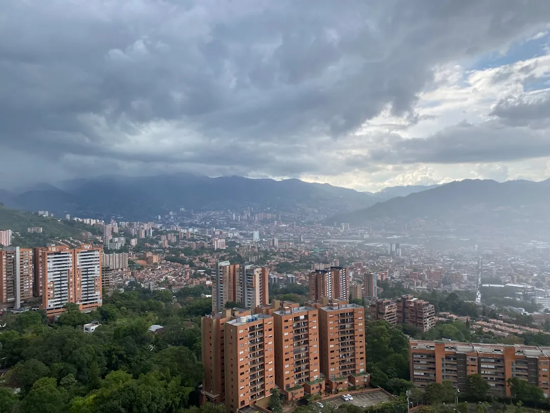
- Closest City: Manizales
Overview
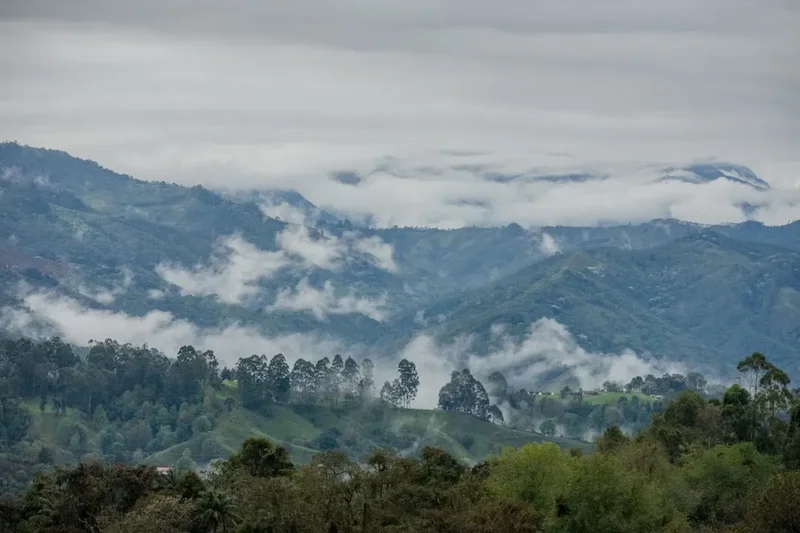
The Los Nevados Traverse is an expedition into one of Colombia's most ecologically significant and geologically active regions. This trek is renowned for its dramatic elevation changes and the stark contrast between its different ecological zones. You'll begin by ascending through vibrant cloud forests, alive with the calls of exotic birds and the scent of damp earth and orchids. As you climb, the vegetation transitions into the unique páramo, a high-altitude grassland ecosystem characterised by its spongy ground, hardy shrubs, and the iconic frailejones (Espeletia species) that dot the landscape like sentinels. These plants, with their fuzzy leaves, are masters of water conservation and are endemic to the northern Andes.
The true challenge and spectacle of the traverse lie in its proximity to the volcanic peaks. The route often takes you through landscapes shaped by volcanic activity, with opportunities to witness geothermal features like fumaroles and hot springs. The air at these altitudes can be thin, and the weather is notoriously unpredictable, capable of shifting from brilliant sunshine to freezing rain or even snow within hours. This requires careful preparation and a respect for the mountain environment.
The traverse is not a single, marked trail in the same way as some international Great Walks. Instead, it's a route pieced together using existing trails, often connecting various park entrances and refuges. This flexibility allows for customisation but also necessitates good navigation skills and a solid understanding of the park's geography. The reward for this effort is an immersion in a landscape that feels ancient and raw, a place where the power of nature is palpable, from the steaming vents of Nevado del Ruiz to the vast, windswept páramo stretching towards the horizon.
History and Cultural Context
The region encompassing Los Nevados National Natural Park has a rich history deeply intertwined with indigenous cultures and the Spanish colonial era. For centuries, indigenous communities, including the indigenous peoples of the Quimbaya and Calima cultures, inhabited these fertile valleys and utilized the high-altitude páramo for resources and spiritual practices. The volcanoes, particularly Nevado del Ruiz, were seen as powerful deities or spirits, influencing their cosmology and way of life.
During the Spanish colonial period, the region became important for agriculture and livestock, with large haciendas established in the lower valleys. The high-altitude páramo, however, remained largely wild and challenging to access. Explorers and geologists began to study the volcanic activity and unique ecosystems of the area in the 19th and 20th centuries. The potential for mining and the unique biodiversity also drew scientific interest.
The establishment of Los Nevados National Natural Park in 1970 was a crucial step in preserving this extraordinary landscape. The park was created to protect its unique páramo ecosystems, its glaciers, its volcanic features, and its rich biodiversity, including numerous endemic species. The park's designation also aimed to safeguard the water resources that originate from its high-altitude wetlands, which are vital for the surrounding regions and cities like Manizales and Pereira.
The Los Nevados Traverse, while not a historical pilgrimage route in the same vein as some ancient trails, follows paths that have been used by local farmers, herders, and explorers for generations. It offers a contemporary way to experience the grandeur and ecological significance of this protected area, connecting modern trekkers to the enduring power of the Andean landscape.
Seasonal Highlights and Weather Reality
The Los Nevados region experiences a tropical highland climate, meaning temperatures are relatively stable year-round but precipitation patterns are distinct. The park is generally accessible throughout the year, but certain periods offer more favourable conditions for trekking.
Dry Season (December to February): This is considered the best time to undertake the Los Nevados Traverse. The skies are typically clearer, offering excellent visibility of the volcanic peaks and surrounding landscapes. Rainfall is significantly reduced, making the trails less muddy and the páramo more stable. Temperatures can still be cold, especially at higher elevations, but the risk of prolonged downpours or heavy fog is lower. This is also the peak tourist season, so expect more visitors at popular trailheads and refuges.
Wet Season (March to May and September to November): These periods bring increased rainfall, often in the form of heavy afternoon thunderstorms. The páramo can become waterlogged and muddy, and river crossings can be more challenging. Fog is also more prevalent, significantly reducing visibility and potentially obscuring trails. While still possible to trek, it requires greater caution, more robust gear, and a higher tolerance for challenging conditions. The landscape, however, can be incredibly vibrant and lush during these months.
"Páramo" Weather: Regardless of the season, the weather in the páramo is highly unpredictable. Temperatures can drop below freezing at night, and even during the day, wind chill can make it feel much colder. Sudden storms, hail, and even snow flurries can occur at any time of year, especially at altitudes above 3,500 metres. It is crucial to be prepared for all conditions, regardless of the forecast.
Volcanic Activity: Nevado del Ruiz is an active volcano. While major eruptions are rare, seismic activity and gas emissions are monitored. Park authorities provide updates on any significant volcanic activity that might affect access or safety. Always check the latest park advisories before and during your trek.
Recommended Itinerary
4-Day Los Nevados Traverse Itinerary (Example)
Day 1: Termales del Ruiz to Refugio La Argentina
- Distance: Approximately 12 km
- Elevation gain: Approximately 1,000 m
- Time: 5–7 hours
- Start at Termales del Ruiz (approx. 3,500 m)
- Ascend through páramo landscape, passing geothermal features
- Observe frailejones and other unique high-altitude flora
- Reach Refugio La Argentina (approx. 4,500 m)
- This day focuses on acclimatisation and gaining significant altitude
- The air will feel noticeably thinner
- Enjoy views of surrounding volcanic peaks if weather permits
Day 2: Refugio La Argentina to Refugio El Cisne
- Distance: Approximately 15 km
- Elevation gain: Variable, with significant ascents and descents
- Time: 6–8 hours
- Traverse high páramo, potentially crossing passes over 4,000 m
- Pass by glacial lakes and rugged terrain
- Arrive at Refugio El Cisne (approx. 4,200 m)
- This day involves navigating challenging, often exposed terrain
- Weather can be a significant factor, with strong winds and potential for fog
- The landscape is stark and beautiful, showcasing the raw power of the Andes
Day 3: Refugio El Cisne to Sector Nevado del Ruiz (or nearby campsite)
- Distance: Approximately 18 km
- Elevation gain: Variable, potentially reaching higher altitudes
- Time: 7–9 hours
- Continue through páramo, with potential for closer views of Nevado del Ruiz
- Depending on route and conditions, may involve camping near the volcano's base or reaching another designated refuge/campsite
- This day is often the most demanding, with the highest potential altitudes
- Focus on careful navigation and monitoring weather conditions
- The goal is to position yourself for potential summit attempts or to begin the descent towards a different exit point
Day 4: Sector Nevado del Ruiz to Manizales (via transport)
- Distance: Variable, depending on exit point
- Elevation loss: Significant descent
- Time: 4–6 hours trekking + transport time
- Descend from the high volcanic zone
- Depending on the chosen exit, you might trek to a road access point or a pre-arranged pickup location
- Arrange for transport (jeep or bus) back to Manizales
- This day concludes the traverse, returning you to civilisation
- Reflect on the incredible journey through Colombia's volcanic heart
Important Notes:
- This itinerary is a sample and can be modified based on fitness, weather, and available transport.
- Altitude sickness is a serious concern; proper acclimatisation is crucial.
- Guides are highly recommended due to the challenging terrain and unpredictable weather.
- Accommodation in refuges must be booked in advance where possible.
- Transport to and from trailheads needs to be arranged separately.
- Always check current park conditions and volcanic activity advisories.
Planning and Bookings
Book Your Trip
Everything you need to plan your journey
Accommodation
Find places to stay near Manizales
Flights
Search flights to Manizales
Essential Preparation
The Los Nevados Traverse demands thorough preparation due to its challenging nature, high altitudes, and remote locations. The closest major city and logistical hub is Manizales. It's essential to fly into Aeropuerto La Nubia (MZL) in Manizales. From Manizales, you can arrange transport to the park's various entry points, such as Termales del Ruiz. This often involves hiring a 4x4 vehicle or coordinating with local tour operators, as public transport may be limited to the main roads.
Acclimatisation: Given the significant altitudes (often exceeding 4,000 metres), a crucial part of preparation is acclimatisation. It is highly recommended to spend at least 1-2 days in Manizales (altitude approx. 2,150 m) or a nearby higher town before starting the trek. Consider a day hike to a slightly higher elevation on your first day in the region to help your body adjust.
Guides and Porters: While it's possible to trek independently, hiring a local guide is strongly advised. Guides possess invaluable knowledge of the terrain, weather patterns, navigation, and local flora and fauna. They can also assist with emergency situations and liaise with park authorities. Porters can be hired to carry heavier gear, significantly reducing the physical strain and allowing you to focus more on the experience.
Logistics: Arrange your transport to and from the park well in advance. This includes getting to the trailhead and arranging your pickup at the end of the trek. Confirm the operational status of refuges and campsites, as facilities can vary. Ensure you have a reliable communication method, such as a satellite phone, as mobile signal is non-existent in most of the park.
Trail Accommodation
Accommodation within Los Nevados National Natural Park primarily consists of mountain refuges (refugios) and designated camping areas. These facilities are basic and designed to provide shelter in a harsh environment.
Refugios:
- Booking Requirements: It is highly recommended to book refuges in advance, especially during peak season (December-February). Contact the park authorities or your tour operator to secure reservations. Some refuges may have limited capacity.
- Facilities Provided: Basic sleeping platforms or bunks (bring your own sleeping bag and mat), a common area for cooking and socialising, and often basic cooking facilities (e.g., gas stoves, though bringing your own is wise). Some may have rudimentary toilets.
- What's NOT Provided: Food, cooking utensils, bedding (sleeping bags, mats), electricity, running water (water sources are usually nearby streams), heating, or charging facilities.
- Seasonal Availability: Refuges are generally open year-round, but access and conditions can be affected by weather.
- Costs: Costs vary but are generally modest, typically ranging from $10-$30 USD per person per night.
Campsites:
- Booking Requirements: Designated camping areas may require booking, especially within the national park. Check with park authorities.
- Facilities Provided: A flat area for pitching tents. Some may have access to basic toilets or water sources.
- What's NOT Provided: Anything beyond a designated spot. You must be entirely self-sufficient.
- Seasonal Availability: Open year-round, but camping in severe weather is not recommended.
- Costs: Typically a small fee per person per night.
Note: The exact names and availability of refuges can change. It's crucial to confirm current options and booking procedures with park authorities or a reputable local tour operator.
Required Gear
- Sturdy Hiking Boots: Waterproof, broken-in, with good ankle support. Essential for varied and often rough terrain.
- Waterproof and Windproof Outerwear: A high-quality jacket and trousers are non-negotiable. The weather can change rapidly, bringing rain, sleet, and strong winds.
- Warm Layers: Multiple insulating layers (fleece, down, or synthetic) are vital. Temperatures can drop significantly, especially at night and at higher altitudes.
- Sleeping Bag: A 3-season or 4-season bag rated for temperatures well below freezing (e.g., -5°C to -10°C comfort rating) is recommended.
- Sleeping Mat: For insulation and comfort.
- Backpack: A 50-70 litre backpack with a rain cover.
- Head Torch: With spare batteries. Essential for navigating in refuges and for early morning starts.
- Navigation Tools: Map of the area, compass, and a GPS device or reliable offline mapping app. Knowledge of how to use them is critical.
- First-Aid Kit: Comprehensive kit including blister treatment, pain relievers, antiseptic wipes, bandages, and any personal medications.
- Sun Protection: High SPF sunscreen, sunglasses, and a wide-brimmed hat. The sun at high altitudes is intense, even on cloudy days.
- Trekking Poles: Highly recommended for stability on descents and ascents, and for navigating uneven terrain.
What to Bring
- Food: High-energy, non-perishable food for all meals and snacks for the duration of the trek. Dehydrated meals are a good option.
- Water Bottles/Hydration Reservoir: Capacity for at least 2-3 litres.
- Water Purification: Water filter, purification tablets, or a UV steriliser. While water sources are usually available, purification is essential.
- Cooking Stove and Fuel: Lightweight camping stove and sufficient fuel.
- Cookware and Utensils: Pot, mug, bowl, spoon, fork, knife.
- Toiletries: Biodegradable soap, toothbrush, toothpaste, toilet paper, hand sanitiser.
- Personal Items: Camera, power bank for electronics, book or journal.
- Insect Repellent: While less of an issue at high altitudes, it can be useful in lower forest sections.
- Duct Tape and Repair Kit: For minor gear repairs.
- Plastic Bags: For waterproofing gear and packing out all waste.
- Cash: For potential small purchases, transport, or emergency use.
Permits
Access to Los Nevados National Natural Park requires permits and adherence to park regulations. It is essential to verify the latest permit requirements and fees directly with Parques Nacionales Naturales de Colombia (PNN) or through your tour operator.
Park Entrance Fees: There are typically entrance fees for accessing the national park. These fees contribute to the park's conservation efforts. The cost can vary depending on the duration of your stay and the specific entry points used.
Registration: Visitors are often required to register their trek at the park's visitor centres or designated entry points. This helps park authorities monitor visitor numbers and manage safety. You may need to provide details of your itinerary and emergency contacts.
Guides: While not always strictly mandatory for all areas, hiring a certified local guide is highly recommended and may be a requirement for certain routes or for accessing sensitive areas, especially those near active volcanic zones. Guides are often registered with the park authorities.
Volcanic Activity Advisories: Nevado del Ruiz is an active volcano. Park authorities monitor its activity closely. Depending on the current alert level, access to certain areas, particularly around the crater, may be restricted or prohibited. Always check the latest advisories from the Servicio Geológico Colombiano (Colombian Geological Service) and park officials before and during your trek.
Booking Accommodation: As mentioned in the planning section, if you intend to stay in park refuges, these often require advance booking. This is separate from the park entrance permit itself.
How to Obtain Permits:
- Online: Some park permits can be purchased online through the official PNN website or designated booking platforms.
- In Person: Permits can usually be obtained at the park's main visitor centres, such as the one in Manizales, or at specific entry points.
- Through Tour Operators: Reputable tour operators will handle all necessary permit arrangements as part of their package.
It is crucial to confirm the exact process and costs well in advance of your trip, as regulations can change.
Other Activities in the Area
Beyond the multi-day traverse, the Los Nevados region offers a variety of activities for nature enthusiasts and adventurers:
- Hot Springs at Termales del Ruiz: Located near the park entrance, these natural hot springs offer a relaxing experience amidst the high-altitude landscape. They are a perfect place to unwind after a trek or to visit as a day trip.
- Nevado del Ruiz Summit Attempt: For experienced mountaineers with proper gear and acclimatisation, a guided ascent of Nevado del Ruiz (5,321 m) is a challenging but rewarding objective. This requires specialised equipment (ice axe, crampons) and significant mountaineering experience.
- Laguna del Otún: This beautiful high-altitude lake is a popular destination within the park, known for its trout fishing (with permits) and stunning scenery. It can be accessed via various trekking routes.
- Birdwatching: The cloud forests and páramo zones are rich in avian life, with numerous endemic species. Keep an eye out for the Andean Condor, various hummingbirds, and the rare Andean Cock-of-the-rock.
- Photography: The dramatic landscapes, unique flora (especially frailejones), volcanic features, and potential wildlife sightings offer endless opportunities for photographers.
- Horseback Riding: In some areas surrounding the park, guided horseback riding tours are available, offering a different perspective on the Andean scenery.
- Exploring Manizales: The nearby city of Manizales offers cultural experiences, including its famous coffee plantations (fincas cafeteras), the historic centre, and the Monumento a los Colonizadores.
Safety and Conditions
Altitude Sickness (Soroche): This is the most significant risk on the Los Nevados Traverse. Symptoms include headache, nausea, dizziness, and fatigue. Prevention is key: ascend slowly, acclimatise properly in Manizales or higher towns, stay hydrated, avoid alcohol and heavy meals, and consider medication like Diamox (consult your doctor). If symptoms worsen, descend immediately.
Weather: The páramo weather is extremely volatile. Be prepared for rapid changes, including strong winds, heavy rain, hail, fog, and freezing temperatures. Hypothermia is a real danger. Always carry and wear appropriate layers, including waterproof and windproof outer shells.
Volcanic Activity: Nevado del Ruiz is an active volcano. Stay informed about its current alert level and any restrictions issued by park authorities or the Colombian Geological Service. Never approach the crater or fumarole areas without explicit permission and guidance from park officials or your guide.
Navigation: Trails can be poorly marked or disappear in fog or snow. A reliable GPS device or offline mapping app, along with a physical map and compass, is essential. Hiring a local guide is the safest option for navigation.
Water Crossings: Rivers and streams can become swollen and dangerous, especially during the wet season or after heavy rain. Assess crossings carefully and never attempt to cross if the water appears too fast or deep.
Geothermal Areas: Be cautious around hot springs and fumaroles. The ground can be unstable, and steam vents can cause severe burns. Stick to marked paths and follow your guide's instructions.
Communication: Mobile phone reception is virtually non-existent within the park. Carry a satellite phone or personal locator beacon (PLB) for emergencies.
Physical Fitness: The trek is physically demanding due to the altitude, distance, and elevation changes. Ensure you are in excellent physical condition and have trained adequately.
Emergency Contacts: Have a list of emergency contacts, including park authorities, your tour operator, and local emergency services.
Side Trips and Points of Interest
Laguna del Otún: A stunning high-altitude lake, often referred to as the "Pearl of Los Nevados." It's a popular destination for its scenic beauty and is known for its trout population. A visit here can be incorporated into longer treks or as a day trip from a nearby refuge. The surrounding landscape is classic páramo, with rolling hills and distant volcanic peaks.
Nevado del Ruiz Crater: While direct access to the active crater may be restricted due to volcanic activity, viewpoints offering glimpses of the volcanic complex are significant points of interest. Observing the steaming vents and the stark, mineral-rich terrain provides a visceral connection to the earth's geological power. Always follow park guidelines regarding proximity to volcanic features.
Frailejones Forests: The páramo is dominated by these unique plants (genus Espeletia). Their fuzzy, silver-green leaves are adapted to capture moisture from the air and protect them from harsh conditions. Walking through a dense forest of frailejones, especially in the mist, is a surreal and unforgettable experience. They are a key indicator of a healthy páramo ecosystem.
Geothermal Activity: Beyond the main hot springs, the volcanic nature of the region is evident in numerous smaller fumaroles and hot spots. These areas, often marked by discoloured earth and escaping steam, are fascinating to observe from a safe distance, showcasing the volcanic forces at play beneath the surface.
Glacial Lakes: Scattered throughout the higher reaches of the park are small glacial lakes, often with intensely blue or green waters. These are remnants of past glaciation and add to the dramatic, alpine character of the landscape. They serve as important water sources for the páramo ecosystem.
Leave No Trace
The Los Nevados National Natural Park is a fragile ecosystem, home to unique flora and fauna adapted to extreme conditions. Practising Leave No Trace principles is paramount to preserving this environment for future generations and ensuring the safety of all visitors.
- Plan Ahead and Prepare: Research your route, understand the conditions, and pack appropriately. Hiring a guide is part of responsible planning in this challenging environment.
- Travel and Camp on Durable Surfaces: Stick to established trails and campsites. Avoid trampling vegetation, especially the delicate páramo grasses and frailejones. If camping, choose established sites or areas with minimal vegetation.
- Dispose of Waste Properly: Pack out everything you pack in, including all food scraps, wrappers, and toilet paper. Use designated toilets where available. If no toilets are present, dig catholes at least 60 metres away from water sources, trails, and campsites.
- Leave What You Find: Do not remove plants, rocks, or any natural or cultural artifacts. Take only photographs and memories.
- Minimize Campfire Impacts: Campfires are generally discouraged or prohibited in high-altitude national parks due to the fragile vegetation and risk of wildfires. Use a lightweight stove for cooking.
- Respect Wildlife: Observe animals from a distance and never feed them. Feeding wildlife can disrupt their natural behaviours and diets, and can be harmful to their health.
- Be Considerate of Other Visitors: Keep noise levels down, especially in refuges and campsites. Yield to others on the trail.
Your actions have a direct impact on the preservation of this extraordinary Andean wilderness. Tread lightly and responsibly.