The Long Mynd Circular: Shropshire's Rolling Hills
The Long Mynd Circular is a delightful day walk that encapsulates the rugged beauty and gentle charm of the Shropshire Hills Area of Outstanding Natural Beauty. This route, centred around the expansive plateau of the Long Mynd, offers a rewarding experience for walkers of moderate fitness, blending open moorland, ancient woodlands, and panoramic vistas. It's a journey that takes you through landscapes steeped in history, from Bronze Age burial mounds to the remnants of a bygone industrial era, all while providing breathtaking views across the surrounding countryside.
- Distance: 10.0 km
- Elevation Gain: 450 m
- Duration: 3-4 hours
- Difficulty: Moderate
- Best Time: April-October
- Closest Town: Church Stretton
- Trailhead Access: Carding Mill Valley (National Trust car park, charges apply)
- Permits: Not required
Overview
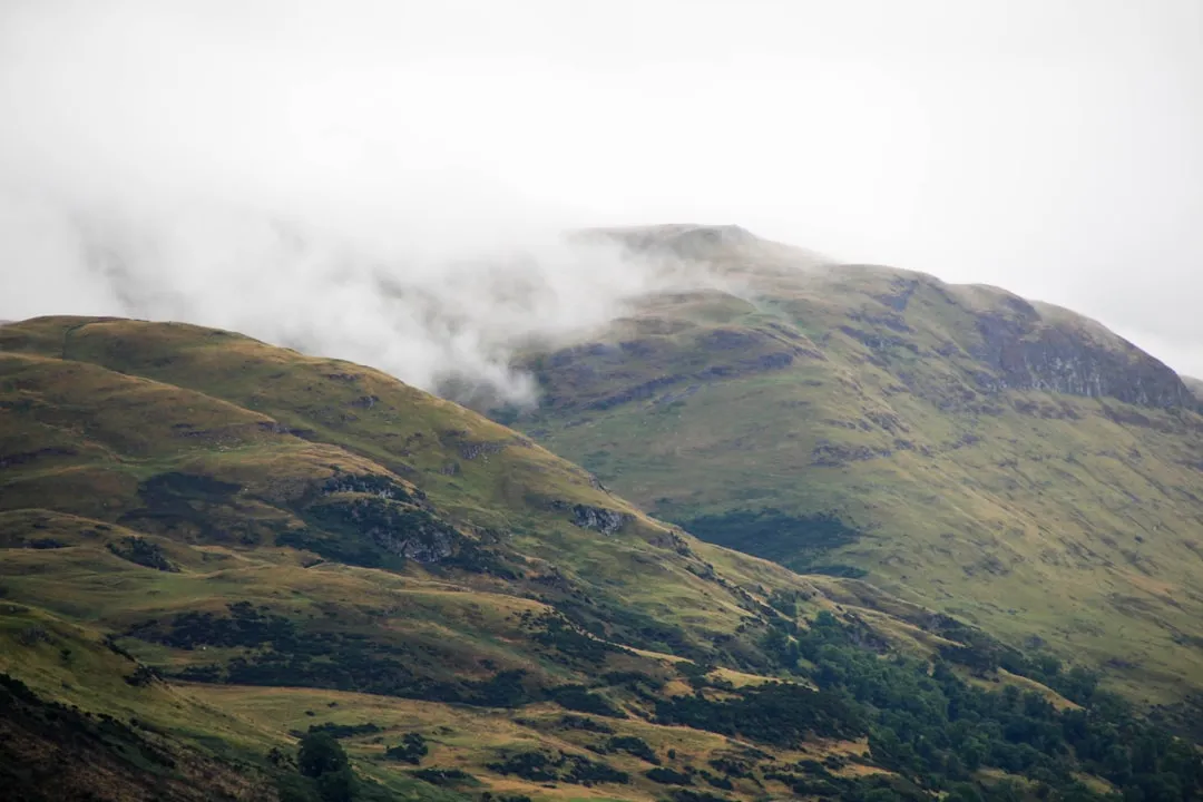
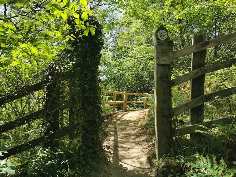
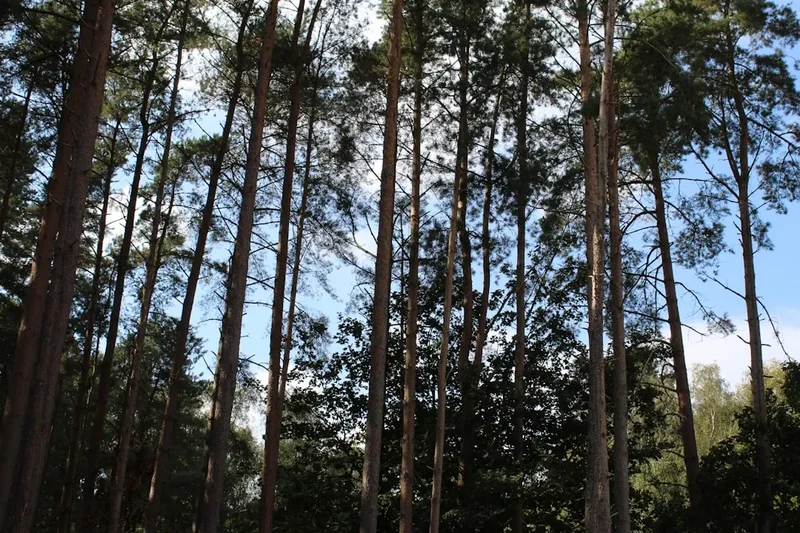
The Long Mynd Circular is a testament to the diverse topography of the Shropshire Hills. The walk begins in the picturesque Carding Mill Valley, a National Trust managed area known for its cascading stream and well-maintained paths. From here, the ascent begins, gradually leading walkers onto the vast, undulating plateau of the Long Mynd. This expansive moorland, dotted with heather, gorse, and ancient earthworks, offers a sense of wildness and solitude, even though it is relatively accessible.
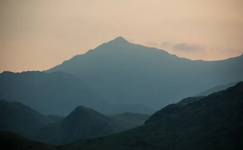
The circular nature of the route ensures a varied experience. You'll traverse open heathland, offering sweeping views towards the Welsh Marches and beyond, before descending through sheltered valleys and pockets of ancient woodland. The moderate elevation gain of 450 metres is spread across the 10 km distance, making it a manageable challenge for most walkers. The path is generally well-defined, though sections can be boggy after rain, and navigation requires attention, especially on the open moorland.
Key landmarks include the iconic Minton Batch, a steep-sided valley that provides a dramatic descent, and the historic Burway track, an ancient route that once served as a vital link across the hills. The summit of the Long Mynd, while not marked by a distinct peak, offers expansive 360-degree views on a clear day. This walk is particularly rewarding in spring and autumn when the heather is in bloom or the moorland colours are at their most vibrant, and the cooler temperatures make for comfortable walking.
History and Cultural Context
The Long Mynd has been a significant landscape for human activity for millennia. Evidence of Bronze Age settlement is scattered across the plateau, with numerous round barrows (burial mounds) still visible, silent testaments to the people who lived and died here thousands of years ago. These ancient sites speak of a time when the Long Mynd was a place of spiritual importance and a vital part of early trade routes.
During the medieval period, the Long Mynd was primarily used for sheep grazing, a practice that shaped the open moorland landscape we see today. The extensive network of ancient tracks, such as the Burway, were crucial for moving livestock and goods between settlements. These tracks were often the only viable routes across the challenging terrain, connecting communities across the Shropshire Hills and into Wales.
In more recent history, the Long Mynd played a role in industrial activity. The Carding Mill Valley itself was once home to a textile mill, the remnants of which can still be seen. The valley's stream provided the power for the machinery, and the area was a hub of local industry. Later, during the Second World War, the Long Mynd was used for military training, and some of the concrete structures and tracks from this period can still be found, albeit often overgrown and reclaimed by nature.
The National Trust now manages a significant portion of the Long Mynd, including Carding Mill Valley, preserving its natural beauty and historical significance for public enjoyment. Their efforts ensure that the landscape continues to tell its story, from ancient peoples to more recent industrial and military pasts.
Seasonal Highlights and Weather Reality
The Long Mynd Circular is a year-round destination, but each season offers a distinct experience:
Spring (April-May): The moorland begins to awaken. Wildflowers start to appear, and the landscape takes on a fresh green hue. The weather can be unpredictable, with a mix of sunshine and showers, but the longer daylight hours are a bonus. Birdsong fills the air as migratory birds return.
Summer (June-August): This is the most popular time to visit, with the heather often in full bloom, painting the hillsides in vibrant shades of purple. The weather is generally warmer, making it ideal for longer walks. However, summer can also bring increased visitor numbers and the possibility of thunderstorms. Sandflies, while not as notorious as in New Zealand, can be present in damp, sheltered areas.
Autumn (September-October): The colours of the Long Mynd are spectacular in autumn. The heather turns russet and gold, and the surrounding deciduous trees display a rich tapestry of reds and oranges. The air is crisp, and the light is often soft and atmospheric, making it a photographer's dream. This is an excellent time for walking, with fewer crowds and cooler temperatures.
Winter (November-March): The Long Mynd takes on a stark, dramatic beauty in winter. Snow can transform the landscape into a magical winter wonderland, though this can also lead to track closures or difficult conditions. The wind can be fierce on the exposed plateau, and temperatures can drop significantly. Proper winter gear is essential, and checking weather forecasts is paramount. The silence and solitude of the Long Mynd in winter can be profound.
Weather Reality: The Long Mynd is an exposed plateau, and weather can change very rapidly. Be prepared for wind, rain, and mist at any time of year. Temperatures can be significantly cooler on the summit than in the valley. Always check the local weather forecast before setting out and carry appropriate clothing layers.
Recommended Itinerary
The Long Mynd Circular: A Day Walk Itinerary
Early Morning (9:00 AM - 10:00 AM): Arrival and Preparation
- Arrive at Carding Mill Valley National Trust car park (charges apply).
- Use the facilities, check your gear, and consult the trail map.
- Begin your walk from the valley floor, following the path alongside the stream.
Morning (10:00 AM - 12:30 PM): Ascent to the Plateau
- Follow the well-trodden path upwards through Carding Mill Valley.
- Enjoy the sights and sounds of the cascading stream and the emerging woodland.
- The path gradually steepens as you approach Minton Batch.
- Ascend Minton Batch, a steep but rewarding climb offering increasingly expansive views.
- Emerge onto the open moorland of the Long Mynd plateau.
Midday (12:30 PM - 1:30 PM): Exploring the Plateau and Lunch Break
- Walk across the undulating moorland, following the general direction of the Burway track (or parallel paths).
- Look for ancient earthworks and barrows scattered across the landscape.
- Find a sheltered spot with good views for a picnic lunch.
- Take time to appreciate the panoramic vistas stretching towards the Welsh border.
Afternoon (1:30 PM - 3:30 PM): Descent and Woodland Trails
- Begin your descent, often via the historic Burway track or a parallel route.
- The descent can be steep and potentially boggy in places, so take care.
- Enter the sheltered woodland areas as you descend back towards Carding Mill Valley.
- Enjoy the change in scenery from open moorland to dappled forest light.
- Follow the stream back down the valley towards the starting point.
Late Afternoon (3:30 PM onwards): Return and Refreshments
- Arrive back at the Carding Mill Valley car park.
- Visit the National Trust tea rooms for refreshments and a chance to relax.
- Reflect on your journey across the diverse landscapes of the Long Mynd.
Important Notes:
- This is a moderate walk; good footwear is essential.
- The plateau can be disorienting in mist; carry a map and compass or GPS device.
- Weather can change rapidly; always be prepared for rain and wind.
- The Burway track can be challenging for cycling and is often used by 4x4 vehicles; be aware of other users.
Planning and Bookings
Book Your Trip
Everything you need to plan your journey
Accommodation
Find places to stay near Church Stretton
Flights
Search flights to Church Stretton
Essential Preparation
The Long Mynd Circular is a day walk, meaning no overnight accommodation is required. However, thorough preparation is still key to a safe and enjoyable experience. The closest town to the trailhead is Church Stretton, often referred to as "Little Switzerland" due to its stunning natural setting. Church Stretton offers a range of amenities, including accommodation (hotels, B&Bs, guesthouses), independent shops, supermarkets for supplies, and several pubs and cafes.
Logistics: Access to the trailhead at Carding Mill Valley is straightforward. By car, follow the A49 south from Shrewsbury or north from Ludlow, turning off towards Church Stretton. Minor roads then lead to the valley. There is a dedicated National Trust car park at Carding Mill Valley, which has charges. Public transport options include taking a train to Church Stretton station, followed by a local bus service or a taxi to the valley entrance. Alternatively, a pleasant walk from Church Stretton town centre to Carding Mill Valley is also possible (approximately 2-3 km).
Fitness: The walk is rated as moderate due to the 450 metres of elevation gain and the potentially uneven terrain. A reasonable level of fitness is required to comfortably complete the 10 km distance and the ascent/descent. It is advisable to have some experience walking on varied terrain, including moorland and potentially boggy paths.
Trail Accommodation
This is a day hike requiring no overnight accommodation.
Required Gear
- Sturdy walking boots: Waterproof and with good ankle support are essential, especially for the moorland sections which can be boggy.
- Waterproof jacket and overtrousers: The weather on the Long Mynd can change very quickly, so being prepared for rain is crucial.
- Warm layers: Even in summer, the plateau can be exposed and windy. A fleece or warm jumper is recommended.
- Navigation tools: A map of the Long Mynd and Church Stretton area (Ordnance Survey Explorer Map OL25) and a compass are highly recommended, particularly if visibility is poor. A GPS device or smartphone with offline maps can also be useful.
- First aid kit: Including blister plasters, antiseptic wipes, pain relievers, and any personal medication.
- Head torch: Useful if you are delayed or start very early/finish late, especially during winter months.
What to Bring
- Food and drink: Plenty of water (at least 1.5-2 litres per person) and high-energy snacks. There are no facilities for purchasing food or water on the moorland itself, though the National Trust tea rooms at Carding Mill Valley offer refreshments at the start/end of the walk.
- Sun protection: Sunscreen, sunglasses, and a hat, even on cloudy days, as the sun can be strong at higher altitudes.
- Insect repellent: May be useful during warmer months, particularly in sheltered, damp areas.
- Mobile phone: For emergencies, though signal can be intermittent on the plateau.
- Small backpack: To carry all your essentials comfortably.
- Walking poles (optional): Can be helpful for the steep ascents and descents, particularly on wet or slippery ground.
Permits
No permits are required to walk the Long Mynd Circular. The land is largely accessible to the public, with the Carding Mill Valley section managed by the National Trust. While there is a charge for parking at the Carding Mill Valley car park, this is the only cost associated with accessing the trail itself.
Parking: The National Trust car park at Carding Mill Valley is well-signposted and offers ample space. Charges apply, and payment can typically be made via pay-and-display machines or through the National Trust app. It is advisable to check the current parking charges on the National Trust website before your visit.
Access: The trail is accessible year-round, though conditions can vary significantly with the seasons. It is important to be aware of potential closures or advisories, particularly during severe weather events, although these are rare for this particular route.
Other Activities in the Area
The Long Mynd and the surrounding Shropshire Hills offer a wealth of activities for visitors:
- Church Stretton town: Explore the charming market town with its independent shops, cafes, and historic buildings.
- Other walks: Numerous other walking routes exist in the vicinity, including the Stretton Hills, Wenlock Edge, and the Shropshire Way.
- Cycling: The Long Mynd is popular with mountain bikers, with dedicated trails and the challenging Burway track.
- Horse riding: Several stables in the area offer guided rides across the hills.
- National Trust properties: Visit nearby Attingham Park or Wroxeter Roman City for further historical exploration.
- Local history: Discover the rich industrial and geological heritage of the Shropshire Hills.
- Birdwatching: The varied habitats support a diverse range of bird species.
Safety and Conditions
Weather: The most significant safety consideration on the Long Mynd is the unpredictable weather. Always check the Met Office forecast for Church Stretton and the surrounding hills before you set off. Be prepared for rapid changes, including strong winds, heavy rain, and mist, which can reduce visibility to a few metres. Hypothermia is a risk, even in milder months, if you become wet and cold.
Navigation: While the main paths are generally clear, the open moorland can be disorienting, especially in mist or poor light. Carry a map and compass and know how to use them. Consider using a GPS device or a reliable offline mapping app on your smartphone. Inform someone of your intended route and expected return time.
Terrain: Sections of the route, particularly Minton Batch and the descent via the Burway, can be steep, rocky, and slippery, especially after rain. Wear appropriate footwear with good grip. Be aware of potential boggy patches on the moorland, particularly after wet weather.
Other Users: The Long Mynd is popular with a variety of users, including walkers, cyclists, and occasionally 4x4 vehicles on the Burway track. Be courteous and aware of others, especially on narrow paths.
Emergency: In case of an emergency, dial 999 or 112 and ask for the police. If you have a mobile signal, you can also use the emergency SMS service (text '304 m to 112). Be prepared to give your exact location, which can be challenging on the moorland. A Personal Locator Beacon (PLB) is not typically required for this day walk but can offer peace of mind for remote excursions.
Side Trips and Points of Interest
Minton Batch: This steep, narrow valley is a dramatic feature of the Long Mynd's ascent. The climb up Minton Batch offers increasingly spectacular views back down Carding Mill Valley and across the surrounding countryside. It's a challenging but rewarding section that truly opens up the landscape.
Burway Track: An ancient track that crosses the Long Mynd plateau. Historically, it was a vital route for drovers and travellers. Today, it's a popular route for walkers and mountain bikers, though it can be rough and challenging, especially in wet conditions. Following sections of the Burway provides a sense of the historical significance of this landscape.
Bronze Age Barrows: Scattered across the Long Mynd plateau are numerous Bronze Age burial mounds. These subtle earthworks are a reminder of the ancient human presence in this area. Look for them as you traverse the moorland; they are often marked on detailed maps.
Carding Mill Valley: The starting and ending point of the walk, this National Trust managed valley is a beautiful area in its own right. The cascading stream, woodland, and remnants of the old mill offer a pleasant contrast to the open moorland. The tea rooms here are a perfect place to relax after your walk.
The "Grotto": A small, man-made rock feature located near the summit area, offering a sheltered spot and a unique point of interest on the plateau.
Leave No Trace
The Long Mynd is a precious natural and historical landscape, and it's vital that we all play our part in preserving it. Adhering to Leave No Trace principles ensures that this beautiful area remains enjoyable for generations to come.
- Plan Ahead and Prepare: Familiarise yourself with the route, check the weather forecast, and pack appropriate gear. Know the local regulations and any specific considerations for the area.
- Travel and Camp on Durable Surfaces: Stick to marked paths and trails. Avoid walking on fragile vegetation, especially the heather and mosses on the moorland, which can take a long time to recover.
- Dispose of Waste Properly: Pack out everything you pack in. This includes all litter, food scraps, and anything else you bring with you. Use the bins provided at the car park or take your waste home.
- Leave What You Find: Do not disturb or remove any natural objects, historical artefacts, or cultural heritage sites. The Bronze Age barrows are ancient monuments and should be treated with respect.
- Minimise Campfire Impacts: Campfires are not permitted on the Long Mynd.
- Respect Wildlife: Observe wildlife from a distance and never feed animals. They have specific dietary needs, and human food can be harmful.
- Be Considerate of Other Visitors: Keep noise levels down, yield to other users on narrow paths, and be mindful of the experience of others.
By following these principles, you help to protect the natural beauty, historical integrity, and wild character of the Long Mynd.