Llanquihue Lake Trail - The Jewel of Chile's Lake District
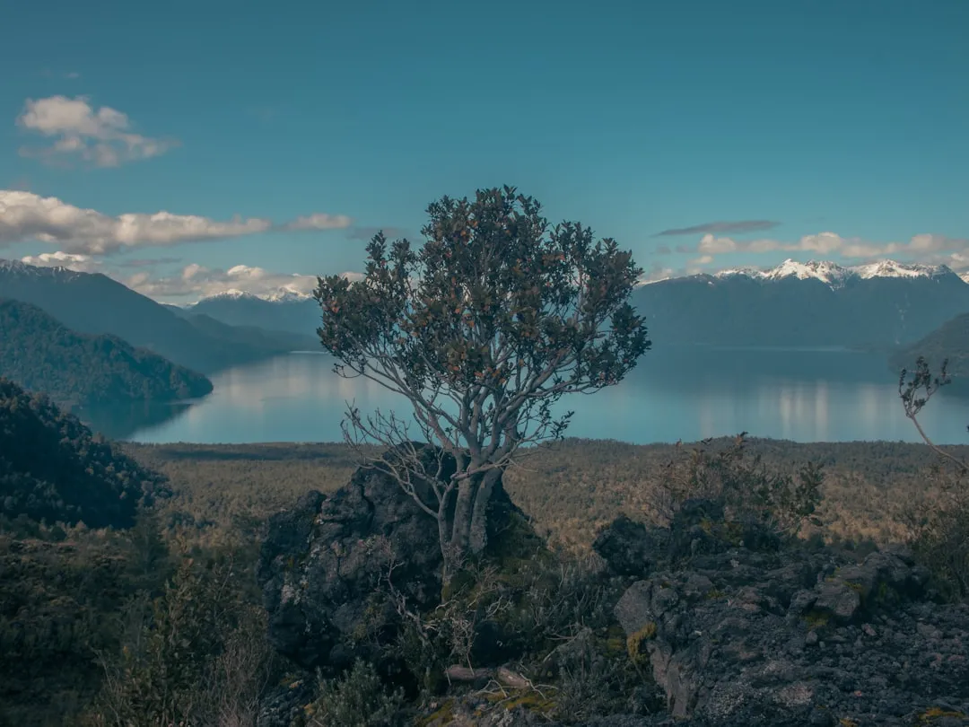
The Llanquihue Lake Trail is a spectacular multi-day walk encircling the second-largest lake in Chile, Lago Llanquihue. This 90 km journey offers a diverse tapestry of landscapes, from the charming lakeside towns and agricultural plains to the dramatic volcanic backdrops of Osorno and Calbuco. Unlike many remote wilderness treks, the Llanquihue Lake Trail offers a unique blend of natural beauty and cultural immersion, passing through vibrant communities, historic sites, and offering constant, breathtaking views of the pristine, expansive lake and its surrounding snow-capped peaks. It's a walk that caters to those seeking both physical challenge and a deep connection with the Chilean culture and its stunning natural environment.
- Distance: 90.0 km one-way (circumnavigation)
- Duration: 4–5 days
- Season: October to April (Spring and Summer in Chile)
- Difficulty: Moderate
- Closest City: Puerto Varas
- Trailhead Access: Nearest airport: Puerto Montt (PMC). From Puerto Montt, take a bus to Puerto Varas (approx. 30 mins). The trail circles Lake Llanquihue, so access is possible from various points. Start point in Puerto Varas. Parking available in Puerto Varas. No permits required.
- Highest point: Varies depending on exact route, but generally low elevation gain.
- Daily walkers: No restrictions.
- Direction: Circular route, can be started from any point.
Overview
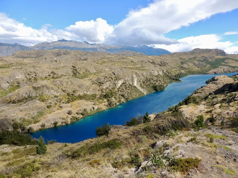
The Llanquihue Lake Trail is a captivating circumnavigation of one of Chile's most iconic natural landmarks. Lago Llanquihue, a vast glacial lake, is framed by the majestic presence of volcanoes Osorno and Calbuco, their snow-capped summits often reflected in the lake's clear waters. The trail is not a single, continuous path but rather a network of existing roads, tracks, and designated walking paths that hug the lake's perimeter. This allows for a flexible itinerary, enabling walkers to experience the diverse character of the region.
The journey begins and often ends in Puerto Varas, a picturesque town with German colonial architecture and a vibrant lakeside promenade. From here, the trail winds through fertile agricultural lands, dotted with dairy farms and smallholdings, where the scent of fresh grass and wildflowers fills the air. As you progress, you'll encounter charming lakeside villages like Frutillar, known for its Teatro del Lago (Lake Theatre) and its strong German heritage, and Llanquihue, the town that lends its name to the lake itself. Each settlement offers a glimpse into the local way of life, with opportunities to sample regional cuisine and interact with friendly locals.
The trail's moderate difficulty is attributed to its generally low elevation gain, with most of the route following the lake's contours. However, some sections may involve walking on unpaved roads or uneven terrain, requiring sturdy footwear. The true challenge lies in the distance and the need for self-sufficiency, as accommodation and resupply points are spread out. The ever-present views of the lake, the volcanoes, and the surrounding Patagonian landscape make every kilometre a rewarding experience. The best time to undertake this trek is during the Chilean spring and summer (October to April), when the weather is generally mild and sunny, though Fiordland-like rain showers are always a possibility in this region.
History and Cultural Context
The region surrounding Lago Llanquihue has a rich and complex history, deeply intertwined with the indigenous Huilliche people, followed by waves of European colonisation, primarily German immigrants in the mid-19th century. The Huilliche, part of the Mapuche nation, were the original inhabitants of this fertile land, utilising its resources for sustenance and spiritual connection. Their presence is still felt in the local place names and cultural traditions.
The significant German colonisation of the Llanquihue region began in the 1850s, encouraged by the Chilean government to settle and develop the southern territories. German immigrants brought with them their architectural styles, agricultural techniques, and cultural practices, which have left an indelible mark on towns like Puerto Varas and Frutillar. The distinctive wooden houses with their steep roofs and decorative balconies are a testament to this heritage. This period of settlement transformed the landscape, with vast tracts of forest cleared for farming and the establishment of thriving communities.
The lake itself, Lago Llanquihue, is of glacial origin, carved out by ancient ice flows. Its immense size and freshwater reserves have always been central to the region's development, providing water for agriculture, power generation, and a vital transportation route in earlier times. The volcanoes Osorno and Calbuco, while dormant, have shaped the land through their past eruptions, contributing to the rich volcanic soil that makes the region so agriculturally productive.
The development of tourism in the 20th century further shaped the area, with the natural beauty of the lake and volcanoes attracting visitors from across Chile and eventually the world. The Llanquihue Lake Trail, while not a formally designated national park trail, has emerged organically from the network of roads and paths used by locals for generations, offering a contemporary way to experience this historically and culturally significant landscape.
Seasonal Highlights and Weather Reality
The Llanquihue Lake Trail is best experienced during the warmer months of the Chilean year, from October to April. This period generally offers the most stable and pleasant weather for walking, with longer daylight hours and milder temperatures.
Spring (October–November): This is a beautiful time to walk as the region awakens from winter. Wildflowers begin to bloom, and the landscape turns a vibrant green. Temperatures are cool but pleasant, typically ranging from 10°C to 18°C. There's a higher chance of rain during spring, but showers are often brief, interspersed with sunny periods. The surrounding mountains may still hold some snow, adding to the dramatic scenery.
Summer (December–February): This is the peak tourist season and generally offers the warmest and driest weather. Daytime temperatures can reach 20°C to 25°C, sometimes higher inland. The long daylight hours are perfect for extended walks. However, summer can also bring occasional heatwaves and, like any Patagonian region, unpredictable weather shifts. Sandflies can be present, though generally less problematic than in more humid coastal areas.
Autumn (March–April): Autumn offers a spectacular display of colours as the deciduous trees change hue. The weather becomes cooler, with temperatures ranging from 8°C to 15°C. While generally drier than spring, rain is still possible, and the days become noticeably shorter. This season offers a more tranquil experience with fewer crowds.
Winter (May–September): This is the off-season for walking. Temperatures drop significantly, often hovering around 0°C to 10°C, with frost and occasional snow. Many tourist facilities may be closed or have reduced hours. While the snow-capped volcanoes are stunning, the cold, wet conditions and shorter daylight hours make this period unsuitable for the full circumnavigation unless you are an experienced winter hiker with appropriate gear and knowledge of the region's winter conditions.
General Weather Considerations: The weather in the Lake District can be highly variable. Even during summer, it's essential to be prepared for rain, wind, and sudden temperature drops, especially if venturing to higher viewpoints or during periods of volcanic activity (though Osorno and Calbuco are closely monitored). Always check local weather forecasts before setting out each day.
Recommended Itinerary
4-Day Llanquihue Lake Trail Itinerary
Day 1: Puerto Varas to Frutillar
- Distance: 25 km
- Elevation gain: 150 m
- Time: 5–6 hours
- Start in Puerto Varas, exploring its German architecture and lakeside promenade.
- Follow the northern shore of Lake Llanquihue, initially on paved roads and then transitioning to gravel tracks and some sections of dedicated walking path.
- Pass through agricultural land with views of Osorno Volcano.
- Arrive in Frutillar, a town renowned for its German heritage and the stunning Teatro del Lago.
- Accommodation: Hostels, guesthouses, or hotels in Frutillar.
Day 2: Frutillar to Puerto Octay
- Distance: 20 km
- Elevation gain: 100 m
- Time: 4–5 hours
- Continue along the northern shore, enjoying expansive lake views.
- Pass through smaller hamlets and rural landscapes.
- The town of Puerto Octay offers a more tranquil experience with a historic church and a pleasant lakeside setting.
- Accommodation: Guesthouses or small hotels in Puerto Octay.
Day 3: Puerto Octay to Ensenada (near Volcán Osorno)
- Distance: 25 km
- Elevation gain: 200 m
- Time: 5–7 hours
- The trail heads towards the base of Volcán Osorno.
- This section offers dramatic views of the volcano and its lava fields.
- Ensenada is a small village at the foot of Osorno, a popular base for exploring the volcano.
- Accommodation: Cabins or basic guesthouses in Ensenada.
Day 4: Ensenada to Puerto Varas (via Volcán Osorno ascent option)
- Distance: 20 km (direct) or longer if including volcano ascent
- Elevation gain: 100 m (direct) or significant if ascending Osorno
- Time: 4–5 hours (direct) or full day with ascent
- Option 1 (Direct): Follow the southern shore back towards Puerto Varas, enjoying final lake vistas.
- Option 2 (Volcano Ascent): Dedicate the day to ascending Volcán Osorno. A chairlift and cable car system can take you most of the way up, with a final hike to the summit crater for unparalleled panoramic views. This significantly extends the day and requires good fitness.
- Arrive back in Puerto Varas in the afternoon.
- Accommodation: Various options in Puerto Varas.
Alternative 5-Day Itinerary:
- Day 1: Puerto Varas to Frutillar (25 km)
- Day 2: Frutillar to Puerto Octay (20 km)
- Day 3: Puerto Octay to Las Cascadas (15 km) - a shorter day allowing for exploration of the Las Cascadas area.
- Day 4: Las Cascadas to Ensenada (10 km) - a short walk to Ensenada, allowing ample time for activities around Volcán Osorno.
- Day 5: Ensenada to Puerto Varas (20 km) - completing the circuit.
Important Notes:
- This is a self-guided walk; accommodation and food must be booked in advance, especially during peak season.
- Resupply points are available in larger towns, but carrying some provisions is recommended.
- The trail is not always a single, well-marked path; navigation skills or GPS devices are advisable.
- Volcán Osorno ascent is optional and weather-dependent.
- Be prepared for variable weather conditions.
Planning and Bookings
Book Your Trip
Everything you need to plan your journey
Accommodation
Find places to stay near Puerto Varas
Flights
Search flights to Puerto Varas
Essential Preparation
The Llanquihue Lake Trail is a journey of discovery that requires careful planning, particularly regarding accommodation and logistics. Unlike highly regulated treks, this route relies on existing infrastructure in towns and villages around the lake. Therefore, booking your accommodation well in advance is crucial, especially if travelling during the peak summer season (December to February).
Puerto Varas is the primary gateway city. It is easily accessible via Puerto Montt's El Tepual Airport (PMC). From the airport, taxis or airport buses can take you to Puerto Montt's bus terminal, from where frequent buses depart for Puerto Varas (approximately 30 minutes). Puerto Varas offers a wide range of accommodation, from budget hostels to boutique hotels, as well as supermarkets, outdoor gear shops, and restaurants. It's an ideal place to finalise your preparations, purchase any last-minute supplies, and enjoy a meal before starting your trek.
Consider the flexibility of the route. While a 4-5 day itinerary is suggested, you can adapt it based on your fitness and interests. Some sections can be covered by local buses if you wish to shorten a day's walk or if weather conditions are unfavourable. Familiarise yourself with the local bus schedules for these sections.
Trail Accommodation
Accommodation along the Llanquihue Lake Trail primarily consists of hotels, guesthouses (hostales and hospedajes), cabins, and hostels located in the towns and villages surrounding the lake. There are no designated backcountry huts or campsites in the traditional sense for this route.
Types of Accommodation:
- Hotels and Guesthouses: Available in larger towns like Puerto Varas, Frutillar, and Puerto Octay, offering varying levels of comfort and amenities.
- Cabins: Often found in more rural or scenic locations, providing self-catering facilities.
- Hostels: A budget-friendly option, common in Puerto Varas and Frutillar, offering dormitory-style beds and private rooms.
Booking Requirements:
- Advance Booking Essential: Especially during the peak season (December–February) and weekends, booking accommodation several weeks or even months in advance is highly recommended to secure your preferred options.
- Flexibility: If travelling outside peak season or mid-week, you may find more availability, but booking ahead is still prudent.
Facilities Provided:
- Typically include private or shared bathrooms, bedding, and common areas.
- Many guesthouses and hotels offer breakfast.
- Cabins often include kitchenettes or full kitchens.
What's NOT Provided:
- No cooking facilities are guaranteed in hostels or hotels (though some may have communal kitchens).
- No food supplies are available on the trail between towns.
- No specific "trail" facilities like drying rooms or warden services.
Seasonal Availability: Most accommodations operate year-round, but services may be reduced during the winter months (May–September). During the walking season (October–April), availability is highest.
Costs: Prices vary significantly. Hostels might range from US$20–40 per night for a dorm bed, while mid-range guesthouses and hotels can cost US$60–150 per night. Cabins can vary widely based on size and amenities.
Required Gear
- Sturdy Walking Boots: Waterproof, broken-in boots with good ankle support are essential for varied terrain, including paved roads, gravel tracks, and potentially muddy paths.
- Waterproof Jacket and Trousers: Essential for protection against rain, which is common in the region regardless of season. Look for breathable, waterproof materials.
- Backpack: A comfortable daypack (25–35 litres) is sufficient if you are staying in towns each night. If carrying more supplies or camping, a larger pack (40–50 litres) might be needed. A rain cover for your pack is highly recommended.
- Layers of Clothing: Include moisture-wicking base layers (merino wool or synthetic), insulating mid-layers (fleece or down jacket), and a warm hat and gloves, as temperatures can drop, especially in the evenings or at higher elevations near the volcanoes.
- Navigation Tools: A good quality map of the Llanquihue Lake region, a compass, and a GPS device or smartphone with offline maps are highly recommended. Trail marking can be inconsistent.
- First-Aid Kit: Comprehensive kit including blister treatment, pain relievers, antiseptic wipes, bandages, and any personal medications.
- Sun Protection: High SPF sunscreen, sunglasses, and a wide-brimmed hat are necessary, as the sun can be intense, especially reflecting off the lake.
- Head Torch: With spare batteries, useful for early starts, late finishes, or in accommodation without reliable lighting.
What to Bring
- Food and Snacks: While towns offer resupply opportunities, carry sufficient snacks (energy bars, nuts, dried fruit) and lunch for each day's walk. Consider packing some meals if staying in cabins with cooking facilities.
- Water Bottles or Hydration Reservoir: Carry at least 1.5–2 litres of water per person. Water sources are generally available in towns, but it's advisable to treat water from natural sources if not in a populated area.
- Water Treatment: A water filter or purification tablets are recommended for treating water from streams or natural sources, especially if camping or in remote sections.
- Toiletries: Biodegradable soap, toothbrush, toothpaste, hand sanitiser, and any personal hygiene items.
- Insect Repellent: While not as severe as some other regions, sandflies can be present, particularly near water and during warmer months.
- Camera: To capture the stunning scenery.
- Power Bank: For charging electronic devices, as charging facilities may be limited in some accommodations.
- Small Towel: Quick-drying travel towel.
- Cash: While credit cards are widely accepted in towns, it's wise to carry some Chilean Pesos for smaller purchases, local buses, or in more remote areas.
- Duct Tape and Cordage: Useful for repairs.
Permits
A significant advantage of the Llanquihue Lake Trail is that it does not require any special permits or booking for the trail itself. The route largely follows public roads, existing walking paths, and trails that are accessible to everyone. This makes it a more spontaneous and accessible trek compared to highly regulated national park routes.
However, it is crucial to understand that while the trail access is free, accommodation in the towns and villages along the route must be booked and paid for separately. This is where advance planning is essential, particularly during the high season (December to February) and on weekends, when popular hotels, guesthouses, and hostels can fill up quickly.
Key Considerations:
- Accommodation Bookings: As mentioned in the "Trail Accommodation" section, securing your lodging in advance is the most critical booking requirement for this trail. Websites like Booking.com, Expedia, or local Chilean travel sites are useful resources. Direct contact with smaller guesthouses can sometimes yield better rates or availability.
- Transportation: If you plan to use local buses to cover certain sections of the trail, check their schedules and fares. These are typically paid for in cash on the bus.
- Volcán Osorno Ascent: If you plan to use the chairlift and cable car system to ascend Volcán Osorno, there will be a fee for this service. This is usually paid on-site.
- National Park Entry (if applicable): While the trail itself does not require permits, if you decide to visit specific areas within national parks near the lake (e.g., Vicente Pérez Rosales National Park which encompasses Volcán Osorno), there may be entry fees. However, the standard trail route does not necessitate entering these paid areas.
The lack of permit requirements for the trail itself contributes to the Llanquihue Lake Trail's appeal as a more flexible and accessible adventure for independent travellers.
Other Activities in the Area
The Llanquihue Lake region is rich with activities beyond the trail itself, offering opportunities to deepen your experience of this beautiful part of Chile:
- Ascend Volcán Osorno: Even if not part of your daily walk, a dedicated trip to Volcán Osorno is highly recommended. Take the chairlift and cable car system to near the summit for breathtaking panoramic views of the lake, surrounding volcanoes, and the Pacific Ocean. Hiking trails are also available for those who wish to explore the volcanic slopes further.
- Visit Frutillar's Teatro del Lago: This architecturally stunning open-air theatre on the shores of Lake Llanquihue hosts a variety of cultural events, including music festivals and performances. Even if there isn't a show, the venue itself is worth visiting for its unique design and setting.
- Explore Puerto Varas: Spend time wandering through the town's charming streets, admiring the German-inspired architecture, visiting the local market, and enjoying the vibrant lakeside promenade.
- Kayaking or Paddleboarding on Lago Llanquihue: Rent equipment in Puerto Varas or other lakeside towns for a serene experience on the water, offering a different perspective of the surrounding landscape.
- Visit Petrohué Falls (Saltos del Petrohué): Located within Vicente Pérez Rosales National Park, these spectacular waterfalls cascade over dark, volcanic rock formations, with Volcán Osorno providing a dramatic backdrop.
- Explore Puerto Montt: The larger neighbouring city offers a bustling fish market (Mercado de Angelmó), artisan crafts, and a more urban Chilean experience.
- Day trip to Chiloé Island: A short ferry ride and drive from Puerto Montt leads to the mystical Chiloé Island, known for its unique wooden churches (UNESCO World Heritage sites), stilt houses, and distinct folklore.
- Horseback Riding: Several ranches in the region offer guided horseback riding tours through the countryside and along the lake shores.
Safety and Conditions
General Safety:
- Road Safety: Be aware of vehicle traffic, especially on paved sections of the trail. While many roads are quiet, local drivers may not expect pedestrians. Walk facing oncoming traffic where possible and wear bright clothing.
- Petty Theft: As with any tourist area, be mindful of your belongings, especially in towns and crowded areas. Secure your accommodation and avoid leaving valuables unattended.
- Water Safety: While the lake is beautiful, be cautious if swimming. Currents can be strong, and water temperatures can be cold.
Trail Conditions:
- Terrain: The trail varies from paved roads to gravel tracks, dirt paths, and potentially muddy sections, especially after rain. Sturdy, waterproof footwear is essential.
- Navigation: Trail marking can be inconsistent. Rely on maps, GPS, and local knowledge. It is advisable to have a downloaded offline map of the area on your smartphone or a dedicated GPS device.
- Weather: The weather in the Lake District can change rapidly. Be prepared for sunshine, rain, and wind, even within the same day. Always check the local forecast before setting out. Temperatures can drop significantly in the evenings and at higher elevations near the volcanoes.
Volcanic Activity: Volcán Osorno and Volcán Calbuco are monitored for seismic activity. While significant eruptions are rare, it's wise to stay informed about any official advisories from local authorities or national geological services. The chairlift and cable car operations on Osorno are also subject to weather conditions and volcanic activity.
Emergency Contacts:
- Emergency Services (Carabineros, Ambulance, Fire): Dial 133 (Carabineros), 131 (Ambulance), 132 (Fire).
- Local Tourist Information Centres: In Puerto Varas and other towns, these centres can provide up-to-date information on trail conditions, weather, and local services.
Travel Insurance: It is highly recommended to have comprehensive travel insurance that covers medical emergencies, trip cancellations, and potential evacuation, especially if you plan to undertake activities like ascending Volcán Osorno.
Side Trips and Points of Interest
Volcán Osorno Ascent: This is arguably the most significant "side trip" and a highlight for many visitors. The volcano's near-perfect conical shape and snow-capped summit make it an iconic landmark. A chairlift and cable car system transport visitors to an altitude of approximately 1,200 metres, offering spectacular views. From the upper station, a short hike leads to the crater rim. The panoramic vistas from the top are unparalleled, encompassing Lago Llanquihue, Volcán Calbuco, the surrounding fjords, and the Pacific Ocean on a clear day. The ascent is weather-dependent and can be a full-day activity.
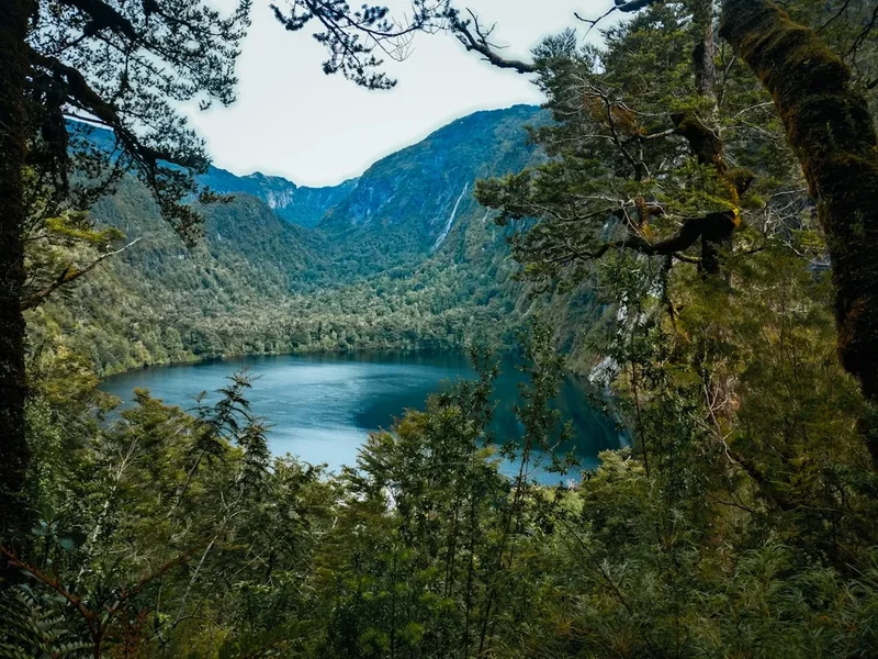
Petrohué Falls (Saltos del Petrohué): Located within the Vicente Pérez Rosales National Park, these unique waterfalls are formed as the Petrohué River flows over dark, jagged basalt rock formations. The vibrant turquoise colour of the water against the black rock, with the imposing silhouette of Volcán Osorno in the background, creates a dramatic and photogenic scene. The park also offers short walking trails through the Valdivian rainforest.
Frutillar's Teatro del Lago: This modern architectural marvel is more than just a theatre; it's a cultural centre that hosts international festivals and events. Its unique design, with a stage that opens onto the lake, makes it a striking landmark. Even without attending a performance, visiting the theatre complex and its surroundings offers a pleasant cultural interlude.
Lakeside Villages: Each town along the trail—Puerto Varas, Frutillar, Puerto Octay, and Ensenada—offers its own charm and points of interest. Puerto Varas is known for its German heritage and lively atmosphere, Frutillar for its cultural scene and German museum, Puerto Octay for its historic church and tranquil setting, and Ensenada as the gateway to Volcán Osorno. Exploring these settlements provides a rich cultural dimension to the walk.
Agricultural Landscapes: The fertile plains surrounding Lago Llanquihue are a significant agricultural region. Observing the dairy farms, rolling green hills, and traditional rural life offers a glimpse into the economic heart of the region and a contrast to the dramatic volcanic scenery.
Leave No Trace
The Llanquihue Lake Trail traverses a region of significant natural beauty and cultural heritage. While it doesn't have the same strict regulations as some national parks, practising Leave No Trace principles is vital to preserving the environment and ensuring a positive experience for all visitors.
Plan Ahead and Prepare: Research your route, accommodation, and potential weather conditions. Pack appropriately for variable weather and carry sufficient food and water to minimise reliance on fragile ecosystems.
Travel and Camp on Durable Surfaces: Stick to established roads, paths, and trails. Avoid walking on vegetation, especially in sensitive areas like meadows or near the lake shore, to prevent erosion and damage to plant life.
Dispose of Waste Properly: Pack out everything you pack in. This includes all food scraps, wrappers, and any other litter. Use designated bins in towns and villages. If camping, carry out all waste, including toilet paper.
Leave What You Find: Do not remove plants, rocks, or any natural or cultural artefacts. Take only photographs and memories.
Minimise Campfire Impacts: Campfires are generally not permitted along this route, as accommodation is in established towns. If you are camping in designated areas (which are rare on this route), use established fire rings and ensure fires are completely extinguished.
Respect Wildlife: Observe wildlife from a distance. Do not feed animals, as this can disrupt their natural behaviours and diets. Store food securely to prevent attracting animals.
Be Considerate of Other Visitors: Keep noise levels down, especially in towns and residential areas. Yield to other walkers and cyclists on shared paths. Respect the local culture and customs.
By adhering to these principles, you help maintain the beauty and integrity of the Llanquihue Lake region for future generations and ensure a more enjoyable experience for everyone.
Useful Links
- Chile Travel - Puerto Varas and Llanquihue Region
- CONAF - Vicente Pérez Rosales National Park (for Petrohué Falls and Volcán Osorno info)
- MeteoChile (Chilean Meteorological Directorate)
- Aeropuerto El Tepual (PMC) - Puerto Montt Airport
- Turismo Chile - Puerto Varas
- Accommodation in Puerto Varas (example booking site)