Monte Lema to Monte Tamaro Traverse
The Monte Lema to Monte Tamaro Traverse is a spectacular day hike in the Swiss Alps, offering breathtaking panoramic views and a rewarding physical challenge. This route connects two prominent peaks in the Ticino region, traversing a ridge that provides continuous vistas of the surrounding mountains, lakes, and valleys. It's a journey that combines natural beauty with accessible alpine terrain, making it a popular choice for hikers seeking a memorable day out in Switzerland.
- Distance: 11.7 km
- Elevation Gain: 750 m
- Duration: 4–5 hours
- Difficulty: Moderate
- Best Time: June to October
- Closest City: Lugano
- Trailhead Access: Nearest airport: Lugano Airport (LUG). From Lugano, take a train to Miglieglia, then a bus to the Monte Lema cable car base. Alternatively, drive to Miglieglia (parking available). Take the cable car to Monte Lema.
- Permits: No permits required.
Overview
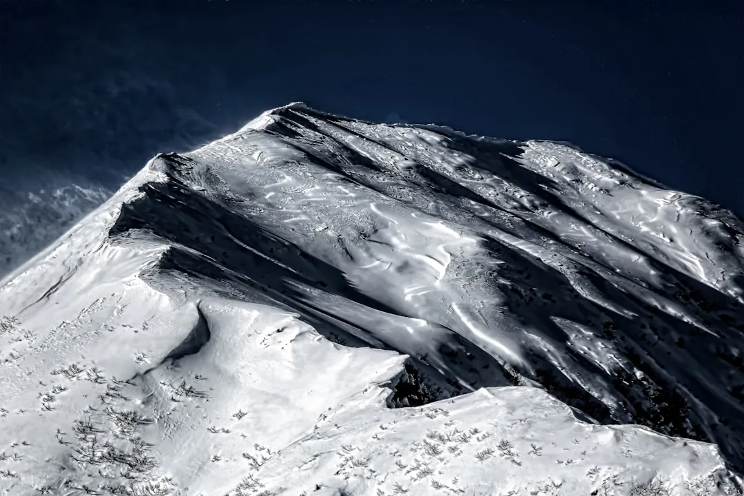
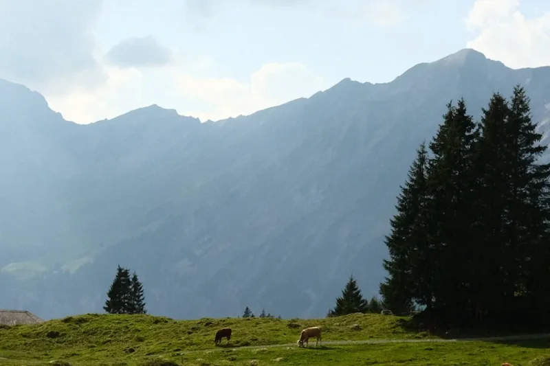
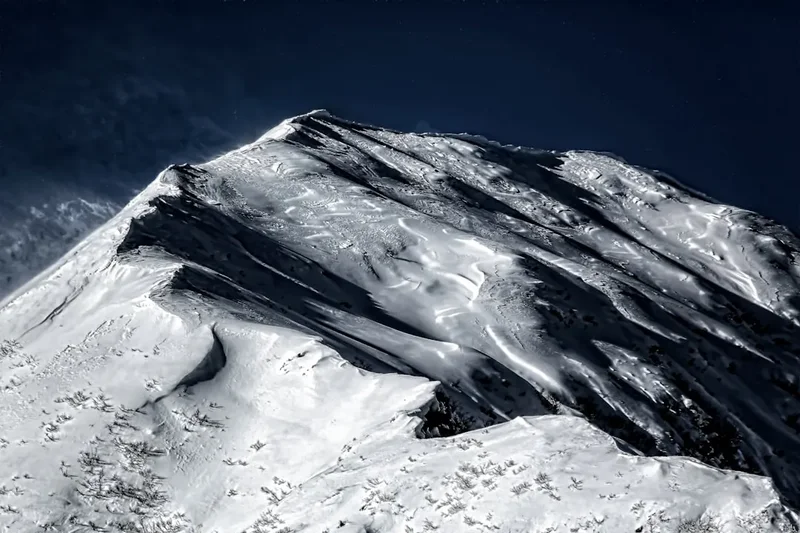
The Monte Lema to Monte Tamaro Traverse is a classic ridge walk that epitomises the scenic beauty of the Swiss Alps. Starting from the summit of Monte Lema, accessible via a scenic cable car ride, the trail immediately immerses you in a landscape of rolling alpine meadows and rugged peaks. The path predominantly follows the crest of the mountain range, offering uninterrupted 360-degree views that stretch across the Italian border and towards the shimmering waters of Lake Lugano and Lake Maggiore.
The traverse is characterised by its undulating terrain. While there is a significant overall elevation gain, the trail involves numerous ascents and descents as it navigates the natural contours of the ridgeline. This makes for an engaging hike, keeping your senses alert and your muscles working. The path is generally well-maintained and clearly marked, though sections can be rocky and uneven, requiring sturdy footwear.
As you progress towards Monte Tamaro, the landscape gradually shifts. The open meadows give way to more rocky outcrops and steeper sections, particularly as you approach the final ascent to the summit. The summit of Monte Tamaro itself is marked by a distinctive church and a panoramic tower, offering even more expansive views. The descent from Monte Tamaro is typically via another cable car, providing a convenient and swift return to the valley floor.
This hike is best undertaken during the warmer months, from June to October, when the weather is generally more stable and the trails are free of snow. The vibrant green of the alpine pastures in early summer contrasts beautifully with the rugged grey of the rock formations, while autumn brings a palette of warm colours to the surrounding forests. The moderate difficulty level makes it accessible to most reasonably fit hikers, but the elevation gain and length mean it's a full-day commitment.
History and Cultural Context
The region encompassing Monte Lema and Monte Tamaro has a rich history intertwined with human settlement, agriculture, and strategic importance. For centuries, these mountains have served as natural boundaries and routes for local communities. The peaks themselves have likely been used for grazing livestock during the summer months, a practice common throughout the Alps, with temporary shelters or huts dotting the higher pastures.
The development of cable cars in the mid-20th century significantly transformed access to these mountain summits. The Monte Lema cable car, for instance, was established to open up the area for tourism and recreation, making the stunning vistas accessible to a wider audience. Similarly, the Monte Tamaro cable car facilitated easier access to its summit, which became a focal point for leisure activities.
The presence of the Chiesa di San Michele (Church of Saint Michael) on Monte Tamaro is a notable cultural landmark. Designed by the renowned Swiss architect Mario Botta, this modern church, built in the early 1990s, stands in stark contrast to the natural landscape, yet its minimalist design and strategic placement have made it an iconic feature. It symbolises the blend of nature and human artistry that characterises the region.
Historically, the border between Switzerland and Italy runs through this mountainous area, and the ridgeline traversed by the hike often forms part of this demarcation. This has meant that the region has, at various times, held strategic significance, though today it is primarily a destination for tourism and outdoor pursuits. The cultural heritage of the Ticino region, with its Italian influences, is evident in the local traditions, cuisine, and architecture, adding another layer of richness to the hiking experience.
Seasonal Highlights and Weather Reality
The Monte Lema to Monte Tamaro Traverse is a seasonal hike, with the optimal period for undertaking this trek falling between June and October. During these months, the weather is generally more favourable for high-altitude walking, and the trails are typically free from snow and ice.
Spring (May-June): As the snow melts, the alpine meadows begin to bloom, creating a vibrant carpet of wildflowers. The air is fresh, and the temperatures are pleasant for hiking. However, early spring can still see lingering snow at higher elevations, and some sections of the trail might be muddy or wet. The cable cars usually commence their summer operations in May or June.
Summer (July-August): This is peak season for the traverse. The days are long, offering ample daylight for hiking. The weather is typically warm, though afternoon thunderstorms are common in the Alps and can develop rapidly. It's essential to be prepared for sudden changes in weather, including rain, wind, and cooler temperatures, especially at higher altitudes. Sandflies can be present, though generally less problematic than in some other alpine regions.
Autumn (September-October): Autumn offers a spectacular display of colours as the foliage changes. The air is crisp and clear, often providing excellent visibility for the panoramic views. The crowds tend to thin out compared to summer. However, temperatures begin to drop, and the possibility of early snowfall increases, particularly in late October. The cable cars typically cease operations by mid-to-late October, so checking their schedules is crucial.
Winter (November-April): The traverse is generally not recommended during winter due to snow, ice, and potentially hazardous conditions. The cable cars are usually closed, and the trails can be impassable without specialised winter mountaineering equipment and expertise. The region experiences significant snowfall during these months.
Weather Considerations: Regardless of the season, mountain weather is notoriously unpredictable. Always check the local weather forecast before setting out and be prepared for a range of conditions. The ridgeline can be exposed to strong winds, and temperatures can drop significantly with altitude.
Recommended Itinerary

Monte Lema to Monte Tamaro Traverse - Day Hike
Early Morning: Ascent to Monte Lema
- Travel to Miglieglia, the base station for the Monte Lema cable car.
- Take the cable car up to the summit of Monte Lema (approx. 15-20 minute ride).
- Enjoy the initial panoramic views from the summit area.
- Prepare your gear and have a quick snack before starting the hike.
Morning: The Ridge Traverse Begins
- Start the hike from Monte Lema summit.
- Follow the well-marked trail heading east along the ridgeline.
- The initial section involves gentle ascents and descents through alpine meadows.
- Enjoy expansive views of Lake Lugano and the surrounding pre-Alps.
- Key waypoints may include smaller peaks or distinctive rock formations along the ridge.
Midday: Reaching the Mid-Point and Lunch
- Continue along the ridgeline, with the trail gradually becoming more rugged in places.
- The path may involve some steeper ascents and descents, requiring careful footing.
- Find a suitable spot along the ridge for a picnic lunch, taking in the breathtaking scenery.
- Observe the changing vegetation and geological features as you progress.
Afternoon: Approaching Monte Tamaro
- The final approach to Monte Tamaro involves a more sustained climb.
- The terrain becomes rockier, and the path may be steeper.
- Pass by the distinctive Chiesa di San Michele (Church of Saint Michael) as you near the summit.
- Reach the summit of Monte Tamaro.
Late Afternoon: Descent and Departure
- Enjoy the panoramic views from Monte Tamaro summit, including the observation tower.
- Descend to the Monte Tamaro cable car station.
- Take the cable car down to the valley base (Alpe Foppa).
- From Alpe Foppa, you can access further amenities or begin your journey back to Lugano.
Important Notes:
- Check the operating times of both cable cars before your hike.
- Carry sufficient water and snacks, as facilities on the trail are limited.
- Wear sturdy hiking boots with good ankle support.
- Be prepared for rapidly changing mountain weather.
- The trail is well-marked but can be challenging in sections.
Planning and Bookings
Book Your Trip
Everything you need to plan your journey
Accommodation
Find places to stay near Lugano
Flights
Search flights to Lugano
Essential Preparation
The Monte Lema to Monte Tamaro Traverse is a day hike, meaning accommodation is not a primary concern for the trail itself. However, careful planning is essential to ensure a smooth and enjoyable experience. The closest major city is Lugano, which serves as the primary gateway for accessing the trailheads. Lugano offers a wide range of accommodation options, from budget-friendly hostels to luxury hotels, catering to all preferences and budgets.
Logistics: Access to the Monte Lema cable car base is typically via the village of Miglieglia. From Lugano, you can reach Miglieglia by public transport (train to Miglieglia, then a short bus ride) or by car. Parking is available at the Miglieglia cable car station. Similarly, the Monte Tamaro cable car base is accessible from the valley. It is advisable to check the operating schedules for both cable cars in advance, as they can vary seasonally and may have specific opening and closing times.
Fitness Requirements: This hike is considered moderately difficult due to the significant elevation gain (750 m) and the undulating nature of the ridgeline. Hikers should have a good level of cardiovascular fitness and be comfortable walking for 4-5 hours with ascents and descents. Prior experience with mountain hiking is beneficial.
Booking Coordination: While no specific bookings are required for the trail itself, it is highly recommended to check the operating status and schedules of the Monte Lema and Monte Tamaro cable cars. Purchasing tickets for the cable cars in advance, especially during peak season, can save time.
Trail Accommodation
This is a day hike requiring no overnight accommodation.
Required Gear
- Hiking Boots: Sturdy, waterproof hiking boots with good ankle support are essential. The terrain can be rocky and uneven.
- Backpack: A comfortable daypack (20-30 litres) to carry essentials.
- Waterproof Jacket: A lightweight, breathable waterproof jacket is crucial, as mountain weather can change rapidly.
- Warm Layers: Even in summer, temperatures can be cooler at higher altitudes. Bring a fleece or insulating jacket.
- Headwear: A sun hat for protection and a warm hat (beanie) for cooler conditions.
- Gloves: Lightweight gloves can be useful for cooler mornings or windy conditions.
- Navigation: A map of the area and a compass, or a GPS device/smartphone with offline maps. While the trail is generally well-marked, it's always wise to have backup navigation.
- First-Aid Kit: A basic first-aid kit including blister treatment, pain relievers, antiseptic wipes, and any personal medications.
- Sun Protection: High SPF sunscreen, sunglasses.
What to Bring
- Water: Carry at least 1.5-2 litres of water per person. There are limited opportunities to refill water bottles on the trail.
- Food: Pack plenty of high-energy snacks and a substantial lunch. Options for purchasing food on the trail are scarce.
- Trekking Poles: Recommended for stability on ascents and descents, and to reduce strain on knees.
- Camera: To capture the stunning panoramic views.
- Mobile Phone: For emergencies (ensure it's fully charged). Signal may be intermittent.
- Small Towel: Useful if you get caught in rain or for wiping sweat.
- Personal Items: Lip balm, insect repellent (though usually not a major issue on this trail).
Permits
No specific permits are required to hike the Monte Lema to Monte Tamaro traverse. The trails are part of the public hiking network in Switzerland. However, access to the trailheads is facilitated by cable cars, and tickets for these are required.
Cable Car Tickets:
- Monte Lema Cable Car: Operates from Miglieglia to Monte Lema summit. Tickets can be purchased at the base station. It is advisable to check the operating hours and prices on the official Monte Lema website, as these can vary by season.
- Monte Tamaro Cable Car: Operates from Rivera to Alpe Foppa (near the summit). Tickets can be purchased at the base station. Again, checking the official Monte Tamaro website for schedules and pricing is recommended.
Important Considerations:
- Operating Seasons: Both cable cars typically operate from late spring (May/June) through autumn (October). Ensure they are operational on your planned hiking date.
- Peak Season: During summer months, it's wise to arrive early to avoid queues for the cable cars, especially on weekends and public holidays.
- Weather Dependency: Cable car operations can be suspended in adverse weather conditions (e.g., strong winds, heavy fog, or storms). Always check the status on the day of your hike.
Other Activities in the Area
The region around Monte Lema and Monte Tamaro offers a variety of activities for visitors looking to extend their stay or explore beyond the main traverse:
- Monte Tamaro Adventure Park: Located near the Alpe Foppa cable car station, this park offers a range of thrilling activities including a treetop adventure park, a zip line, and a summer toboggan run. It's a great option for families or those seeking an adrenaline rush.
- Chiesa di San Michele (Church of Saint Michael): The striking modern church designed by Mario Botta on Monte Tamaro is a significant architectural landmark. Visitors can explore its unique design and enjoy the serene atmosphere.
- Monte Lema Observatory: If you are interested in astronomy, the observatory on Monte Lema offers opportunities for stargazing and learning about the cosmos. Check their schedule for public viewing nights.
- Lake Lugano Activities: The city of Lugano, situated on the shores of Lake Lugano, offers numerous water-based activities such as boat tours, swimming, and lakeside promenades.
- Swissminiatur: Located in Melide, on the shores of Lake Lugano, this open-air museum features detailed models of famous Swiss buildings and monuments.
- Hiking in the surrounding valleys: Beyond the main traverse, there are numerous other hiking trails in the Ticino region, offering diverse landscapes and varying levels of difficulty.
- Culinary Experiences: Ticino is known for its delicious cuisine, influenced by Italian flavours. Enjoy local specialities like risotto, polenta, and regional wines in the many restaurants and grottoes (traditional eateries) in Lugano and surrounding villages.
Safety and Conditions
Pre-Hike Checks:
- Weather Forecast: Always check the most up-to-date mountain weather forecast for the Ticino region before you set out. Websites like MeteoSwiss provide detailed forecasts for specific mountain areas.
- Cable Car Status: Verify the operating status and schedules of both the Monte Lema and Monte Tamaro cable cars on the day of your hike.
- Trail Conditions: While generally well-maintained, check for any recent alerts regarding trail closures or hazardous conditions, especially after periods of heavy rain or early snowfall. Local tourist information offices or the cable car operators may have this information.
On the Trail:
- Navigation: The trail is generally well-marked with yellow hiking signs. However, it is essential to carry a map and compass or a reliable GPS device, especially if visibility is poor.
- Terrain: Be aware that sections of the trail can be rocky, uneven, and steep. Sturdy hiking boots with good ankle support are crucial. Trekking poles can provide additional stability.
- Weather Changes: Mountain weather can change very quickly. Be prepared for sudden shifts in temperature, wind, and precipitation. Hypothermia is a risk even in summer if you get wet and cold.
- Hydration and Nutrition: Carry sufficient water and high-energy food. There are very few, if any, places to purchase supplies or refill water bottles along the ridgeline.
- Communication: Mobile phone reception can be intermittent in mountainous areas. Consider carrying a fully charged power bank for your phone. For serious emergencies, a personal locator beacon (PLB) might be considered, though for a day hike with cable car access, it's usually not deemed essential unless venturing off the main route.
- Wildlife: While encounters are rare, be aware of local wildlife. Keep a safe distance and do not feed any animals.
- Emergency Contacts: Know the emergency numbers for Switzerland (112 or 144 for ambulance, 117 for police, 118 for fire).
Specific Hazards:
- Exposure: The ridgeline is exposed to the elements. Strong winds can make walking difficult and increase the risk of hypothermia.
- Steep Sections: Some ascents and descents can be quite steep and require careful footing.
- Visibility: Fog or cloud can descend rapidly, severely reducing visibility and making navigation challenging.
Side Trips and Points of Interest
Monte Tamaro Observation Tower: Located near the summit of Monte Tamaro, this modern observation tower offers unparalleled 360-degree panoramic views. Ascending the tower provides an even higher vantage point, allowing you to fully appreciate the vastness of the surrounding landscape, including the lakes, valleys, and distant mountain ranges.
Chiesa di San Michele (Church of Saint Michael): This iconic modern church, designed by architect Mario Botta, is situated on Monte Tamaro. Its minimalist design and striking location make it a significant point of interest. Visitors can explore the interior and appreciate the architectural harmony with the natural environment.
Monte Lema Summit Area: Before or after your traverse, take time to explore the summit area of Monte Lema. There are usually restaurants or cafes offering refreshments and stunning views. The area is also a popular spot for paragliding and hang gliding, so you might see enthusiasts taking to the skies.
Alpine Meadows and Flora: Depending on the season, the alpine meadows along the traverse are rich with diverse flora. In spring and early summer, wildflowers are abundant, creating a colourful spectacle. Take time to appreciate the natural beauty of the alpine vegetation.
Panoramic Viewpoints: The entire traverse is dotted with numerous natural viewpoints offering breathtaking vistas. Make frequent stops to admire the scenery, identify landmarks, and capture photographs. The changing light throughout the day can dramatically alter the appearance of the landscape.
Leave No Trace
The Monte Lema to Monte Tamaro Traverse winds through pristine alpine environments. Adhering to Leave No Trace principles is crucial to preserving the natural beauty and ecological integrity of this region for future visitors.
Plan Ahead and Prepare:
- Check weather forecasts and trail conditions before you go.
- Pack appropriate gear to prevent the need for unexpected rescues or improvisations.
- Be aware of any local regulations or guidelines.
Travel and Camp on Durable Surfaces:
- Stay on marked trails to avoid damaging fragile vegetation and soil. The alpine meadows are particularly sensitive.
- Avoid creating new paths or shortcuts.
Dispose of Waste Properly:
- Pack out everything you pack in, including all food scraps, wrappers, and any other litter.
- Use designated toilet facilities where available. If not, dig a cathole at least 60 metres away from water sources, trails, and campsites, and bury human waste. Pack out toilet paper.
Leave What You Find:
- Do not disturb or remove any natural objects, such as rocks, plants, or flowers.
- Respect historical and cultural sites.
Minimise Campfire Impacts:
- Campfires are generally not permitted on this day hike. If you are camping in designated areas (not applicable for this traverse), use established fire rings and keep fires small.
Respect Wildlife:
- Observe wildlife from a distance. Do not feed animals, as it can harm their health, alter their natural behaviours, and expose them to predators and other dangers.
Be Considerate of Other Visitors:
- Yield to other hikers on the trail.
- Keep noise levels down to appreciate the natural sounds of the environment.
- Allow others to enjoy the scenery without interruption.