Laugavegur Trail (Day Section) - A Journey Through Iceland's Volcanic Heart
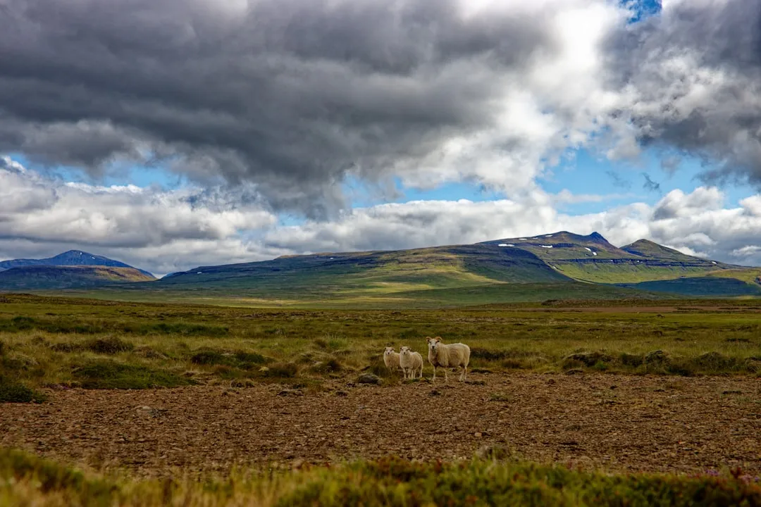
The Laugavegur Trail is widely considered one of the most spectacular hiking routes on the planet, typically undertaken as a four-day trek from the geothermal wonderland of Landmannalaugar to the lush valley of Þórsmörk. However, for those with limited time or those seeking a concentrated dose of Iceland's raw geological power, the opening day section—stretching from the Landmannalaugar base camp toward the Hrafntinnusker plateau—offers an unparalleled day-walking experience. This 12-kilometre return journey (or loop) traverses a landscape that feels fundamentally primordial: obsidian lava fields, steaming fumaroles, and the famous multi-coloured rhyolite mountains that glow in shades of ochre, pink, and cobalt. Located in the Fjallabak Nature Reserve within the southern Highlands, this trail is a masterclass in volcanic diversity, providing hikers with a sensory immersion into the "Land of Fire and Ice" without the logistical complexity of a multi-day expedition.
- Distance: 12.0 km (return to Stórihver or loop via Brennisteinsalda)
- Duration: 4–6 hours
- Elevation Gain: 400 m
- Difficulty: Moderate (steep sections and uneven volcanic terrain)
- Best Time: Late June to early September (dependent on F-road access)
- Highest Point: Approximately 1,000 m (near the plateau approach)
- Terrain: Volcanic ash, loose rhyolite scree, obsidian rock, and snow patches
- Closest Hub: Landmannalaugar (Highland Base)
Overview
The Laugavegur Trail, which translates literally to "The Road of the Laug" (The Hot Spring Road), begins its journey in the heart of the Torfajökull volcanic system. This specific day section captures the essence of the Icelandic Highlands, moving from the valley floor at 600 metres elevation up toward the high-altitude plateau. The landscape is defined by its lack of vegetation and its abundance of mineral wealth. Unlike the green, mossy coastal regions of Iceland, the Laugavegur day section is a world of stone and steam. The rhyolite mountains here are a geological anomaly, created by silica-rich lava that cools slowly, allowing for a spectrum of colours—yellows from sulphur, reds from iron oxidation, and greens from copper—that appear almost painted onto the slopes.
The walk begins by navigating the Laugahraun lava field, a jagged expanse of obsidian and basalt that formed during an eruption in 1477. From here, the trail ascends steadily toward Brennisteinsalda, often cited as the most colourful mountain in Iceland. As you climb, the air becomes thick with the scent of sulphur, and the ground beneath your boots begins to hiss and steam. This is one of the most active geothermal areas in the country, where boiling mud pots and roaring steam vents (fumaroles) serve as a constant reminder of the tectonic forces at play beneath the surface. The transition from the dark, glassy lava of the valley to the bright, ethereal heights of the plateau provides a visual rhythm that keeps even the most seasoned hikers in a state of constant awe.
While the full Laugavegur trek continues for another 43 kilometres, this day section provides a natural turnaround point at the Stórihver geothermal area. Here, hikers can witness massive steam columns rising against the backdrop of the Hrafntinnusker ice caps before descending back to the warmth of the Landmannalaugar natural hot springs. It is a walk that demands physical effort—particularly during the steep ascent of the rhyolite slopes—but rewards the traveller with views that are frequently described as "otherworldly" or "extra-terrestrial." In the Highlands, the scale of the landscape is humbling, and the clarity of the air allows for vistas that stretch across the black sands of the interior toward distant glaciers like Mýrdalsjökull and Eyjafjallajökull.
History and Cultural Context
The history of the Laugavegur Trail is inextricably linked to the history of Icelandic exploration and the nation's relationship with its volatile interior. For centuries, the Icelandic Highlands were considered a place of outlaws, spirits, and extreme danger. Known as the "Óbyggðir" (the unbuilt or uninhabited places), the interior was rarely traversed except by those seeking to cross the country quickly or by shepherds driving sheep to summer pastures. Landmannalaugar itself, however, has long been known to locals for its "Laug" (hot springs), which provided a rare sanctuary of warmth in an otherwise inhospitable environment. Travellers would stop here to bathe and rest their horses before attempting the treacherous mountain passes.
The modern trail as we know it was formally established and marked by the Ferðafélag Íslands (Icelandic Touring Association, or FÍ) in 1979. Before this, the route was a series of disconnected sheep paths and cairn-marked trails used by local farmers. The vision of the FÍ was to create a world-class hiking route that showcased the diversity of the Icelandic landscape. Since its inception, the trail has grown from a niche local secret to an international bucket-list destination. Despite its popularity, the trail remains a symbol of Icelandic conservation efforts; the Fjallabak Nature Reserve, established in 1979, protects the fragile rhyolite formations and geothermal features from industrial development and excessive tourism impact.
Culturally, the Laugavegur holds a special place in the Icelandic psyche. It represents the "Highland Summer"—a brief, intense window of light and life in a country that spends much of the year in darkness. The names of the landmarks along the trail reflect this heritage: Brennisteinsalda means "Sulphur Wave," Laugahraun means "Hot Spring Lava," and Hrafntinnusker means "Obsidian Skerry." These names are descriptive and functional, rooted in the Old Norse language that has remained largely unchanged for a millennium. Walking this trail is not just a physical exercise; it is a walk through the geological and linguistic history of the North Atlantic.
Want more background? Read extended notes on history and cultural context → Learn more
Seasonal Highlights and Weather Reality
The Laugavegur day section is only accessible during a very narrow window, typically from late June to early September. This is dictated by the opening of the "F-roads" (mountain roads), which are closed throughout the winter and spring due to heavy snow and impassable river crossings. Even in the height of summer, the weather in the Highlands is notoriously fickle and can change from bright sunshine to a blinding blizzard within minutes. Hikers must be prepared for "four seasons in one day," a cliché that holds literal truth in Iceland.
Early Season (Late June to mid-July): During this period, large sections of the trail, particularly the higher elevations toward Hrafntinnusker, may still be covered in snow. This adds a layer of difficulty to the navigation and requires sturdy, waterproof footwear. However, the contrast between the white snow and the vibrant rhyolite mountains is exceptionally photogenic. The "Midnight Sun" provides nearly 24 hours of daylight, allowing for late-evening hikes in ethereal, golden light.
High Summer (Late July to August): This is the most stable period for weather, though "stable" is a relative term. Temperatures typically range from 5°C to 15°C, but wind chill can make it feel significantly colder. This is when the geothermal activity is most visible, as the warm steam contrasts with the cool mountain air. The trail is at its busiest during this time, but the vastness of the landscape ensures that it rarely feels crowded once you move a few kilometres away from the Landmannalaugar base camp.
Late Season (September): As September approaches, the days begin to shorten, and the first frosts return to the Highlands. The mosses turn a deep, rusty red, and the crowds thin out significantly. While the weather becomes more unpredictable and the risk of autumn storms increases, the possibility of seeing the Northern Lights (Aurora Borealis) begins to emerge for those staying overnight at the Landmannalaugar hut. By mid-September, the F-roads usually close, and the Highlands return to their winter slumber, accessible only by specialised "Super Jeeps."
Recommended Itinerary
Laugavegur Day Section: Landmannalaugar to Stórihver Return
Waypoint 1: Landmannalaugar Trailhead to Laugahraun Lava Field
- Distance: 1.5 km
- Elevation: Minimal
- Time: 30–45 minutes
- Start at the main information board near the Landmannalaugar hut.
- Follow the well-marked path (red or blue markers) leading west into the Laugahraun lava field.
- The terrain consists of jagged, glassy obsidian and basalt blocks. The path is well-trodden but requires careful foot placement.
- Observe the "Brennisteinsalda" mountain looming ahead, its yellow and red slopes contrasting with the black lava.
Waypoint 2: Laugahraun to Vondugil Canyon and Brennisteinsalda Base
- Distance: 2.5 km
- Elevation: 100 m gain
- Time: 45–60 minutes
- The trail skirts the edge of the lava field, offering views into the wide, braided riverbeds of Vondugil Canyon.
- Pass through a small geothermal area at the base of Brennisteinsalda where steam vents hiss from the ground.
- The path begins to climb steadily. This is a good place to adjust layers, as the ascent will increase body temperature while the wind exposure increases.
Waypoint 3: Brennisteinsalda Ascent to the Plateau
- Distance: 2.0 km
- Elevation: 200 m gain
- Time: 1 hour
- A steep, zigzagging climb up the shoulder of Brennisteinsalda. The ground is composed of loose rhyolite scree.
- As you gain height, the views back toward Landmannalaugar and the Frostastaðavatn lake become increasingly dramatic.
- Reach the top of the first ridge. The landscape shifts from colourful mountains to a high-altitude plateau of dark sands and snow patches.
Waypoint 4: Plateau to Stórihver Geothermal Area (Turnaround Point)
- Distance: 2.0 km
- Elevation: 100 m gain
- Time: 45 minutes
- Cross the plateau, following the markers (often wooden stakes). This area is prone to fog, so keep the next marker in sight.
- Arrive at Stórihver, a massive geothermal area featuring a large, boiling spring and intense steam activity.
- This is the ideal spot for a lunch break and the natural turnaround point for day hikers. The heat from the ground provides a welcome respite from the Highland wind.
Waypoint 5: Return Journey to Landmannalaugar
- Distance: 4.0–6.0 km (depending on route)
- Elevation: 400 m descent
- Time: 1.5–2 hours
- Option A: Retrace your steps for the most direct route.
- Option B (Recommended): Descend via the "Grænagil" (Green Gorge) trail. This route takes you through a spectacular canyon of green rhyolite and back into the Laugahraun lava field from a different angle.
- Finish the day with a soak in the natural hot river at Landmannalaugar—a mandatory Icelandic tradition.
Important Notes:
- The trail is marked with coloured stakes (usually red for the main Laugavegur). Ensure you follow the correct colour for your intended route.
- Weather can obscure markers; a GPS or offline map is essential.
- The descent through Grænagil can be slippery after rain; trekking poles are highly recommended.
- Always check the "SafeTravel" board at the Landmannalaugar warden's hut before setting out.
Planning and Bookings
Book Your Trip
Everything you need to plan your journey
Accommodation
Find places to stay near Landmannalaugar
Flights
Search flights to Landmannalaugar
Essential Preparation
Planning a day hike in the Icelandic Highlands requires more logistical foresight than a standard coastal walk. The primary challenge is transport. Landmannalaugar is located in the interior and is only accessible via "F-roads" (mountain roads). If you are driving, you MUST have a 4x4 vehicle; rental companies strictly prohibit 2WD cars on these roads, and insurance will be voided if you attempt it. The drive from Reykjavik takes approximately 3 to 4 hours, involving gravel roads and at least one significant river crossing just before the Landmannalaugar camp. Many visitors choose to park before the river and use the pedestrian bridge to avoid the risk of drowning their vehicle's engine.
Alternatively, several bus companies (such as Reykjavik Excursions and Trex) operate "Highland Pass" services from the BSÍ terminal in Reykjavik. These specially modified buses are the safest and most stress-free way to reach the trailhead. It is highly recommended to book these tickets at least several weeks in advance during the July–August peak. Fitness-wise, hikers should be comfortable with 400 metres of elevation gain over uneven, sometimes loose terrain. There are no shops or services once you leave the base camp, so self-sufficiency is key.
Trail Accommodation
As this is a day hike, overnight accommodation on the trail itself is not required. However, most hikers choose to stay at the Landmannalaugar base camp either the night before or the night after their walk to maximise their time in the area.
Landmannalaugar Hut (Ferðafélag Íslands):
- A large, two-storey mountain hut accommodating up to 78 people in dormitory-style bunks.
- Facilities: Large communal kitchen with gas stoves, running cold water, and basic dining areas.
- Booking: Must be booked months in advance via the FÍ website. It is almost always full during summer.
- Cost: Approximately 11,000 ISK to 13,000 ISK per night.
Landmannalaugar Campsite:
- A large, rocky camping area surrounding the hut. No pre-booking is required for tents.
- Facilities: Access to a separate toilet and shower block (showers cost extra, approx. 500 ISK for 5 minutes).
- Note: The ground is very hard and volcanic; sturdy tent pegs and a good sleeping mat are essential.
- Cost: Approximately 2,500 ISK per person, per night.
Mountain Mall:
- A unique "shop" housed in two converted green school buses. It sells basic snacks, coffee, and some camping supplies (gas canisters, etc.). Prices are high due to the remote location.
Required Gear
- Hiking Boots: Sturdy, waterproof boots with good ankle support are non-negotiable. The volcanic rock is sharp, and the rhyolite scree can be slippery.
- Waterproof Shell: A high-quality waterproof jacket and overtrousers (Gore-Tex or similar). Icelandic rain is often horizontal, and wind will drive moisture through basic "water-resistant" gear.
- Layering System: A base layer of merino wool or synthetic wicking material. Avoid cotton at all costs, as it retains moisture and leads to rapid cooling. Add a fleece or "puffy" mid-layer for insulation.
- Navigation: A physical map and compass, or a GPS device with offline maps (AllTrails or Gaia GPS). Fog can descend instantly, making trail markers invisible.
- Trekking Poles: Highly recommended for the steep, loose descents and for testing stability on snow patches.
- Head Torch: Even in the season of the Midnight Sun, a head torch is a vital safety item if you are delayed or if visibility drops significantly.
What to Bring
- Food: High-energy, packable meals. Think nuts, dried fruit, chocolate, and sandwiches. There is no food available on the trail.
- Water: At least 2 litres per person. While there are streams, the geothermal activity can sometimes affect water quality (sulphur content). It is best to fill up at the Landmannalaugar camp.
- Sun Protection: Sunscreen and sunglasses. The Highland sun is intense, and the reflection off snow patches can cause rapid sunburn and snow blindness.
- Personal First Aid: Blister plasters (Compeed), antiseptic wipes, and any personal medications.
- Swimwear and Towel: For the natural hot river at the end of the hike. This is the ultimate reward for your efforts.
- Power Bank: Cold temperatures drain phone batteries quickly. Ensure you have a backup for navigation and photos.
Permits
One of the great appeals of the Laugavegur day section is that no formal hiking permit is required for individual day walkers. The trail is located within a public Nature Reserve, and access is free. However, there are several logistical "permits" and fees that you must be aware of to ensure a smooth trip.
Parking and Service Fees:
- If you are driving your own 4x4 to Landmannalaugar, you may be required to pay a "Service Fee" (approx. 500–1,000 ISK) if you use the facilities at the base camp (toilets, picnic tables, etc.). This is usually paid at the warden's hut.
- As of 2024, there have been discussions regarding a mandatory parking reservation system for Landmannalaugar during peak hours to manage congestion. Always check the official Umhverfisstofnun (Environment Agency of Iceland) website before your trip.
Bus Transport:
- While not a permit, your bus ticket acts as your "entry" to the Highlands. These must be booked in advance. Prices range from 14,000 ISK to 20,000 ISK for a return trip from Reykjavik.
Safety Registration:
- It is strongly encouraged (though not legally mandatory) to leave a travel plan with SafeTravel.is. This is the primary resource used by Icelandic Search and Rescue (ICE-SAR) if you go missing. You can log your route and expected return time on their website or via their app.
- At the Landmannalaugar warden's office, there is often a logbook. Signing in and out is a simple but effective safety measure.
Group Regulations:
- If you are organising a commercial tour or a large group (typically 10+ people), you may need to notify the Environment Agency of Iceland in advance to ensure compliance with conservation guidelines.
Other Activities in the Area
Landmannalaugar is a hub for Highland adventure. If you have extra time or energy, consider these nearby options:
- The People's Pool (Laug): The natural hot river located just 100 metres from the hut. It is a mix of cold spring water and boiling geothermal water. Find your perfect temperature by moving upstream or downstream. It is free for all visitors.
- Bláhnúkur (Blue Peak) Hike: A challenging 3–4 hour loop to the summit of the "Blue Peak." The mountain is composed of blue-grey volcanic ash and offers perhaps the best 360-degree view of the entire Landmannalaugar area.
- Ljótipollur (Ugly Pond): Despite the name, this is a stunning red-crater lake filled with turquoise water. It is accessible via a 4-hour return hike or a short drive (4x4 only).
- Brennisteinsalda Loop: If you don't want to go all the way to Stórihver, you can do a shorter 2–3 hour loop that summits Brennisteinsalda and returns via the lava field.
- Horse Riding: During the peak summer months, some operators offer Highland horse tours, allowing you to experience the landscape as Icelanders did for centuries.
- Sigöldugljúfur (Valley of Tears): Located on the drive toward Landmannalaugar (F208 north), this canyon features dozens of waterfalls cascading into a turquoise river. It is one of the most photographed spots in the Highlands.
Safety and Conditions
The Icelandic Weather: The single greatest danger on the Laugavegur Trail is the weather. It is not uncommon for hikers to be caught in gale-force winds or dense fog that reduces visibility to less than five metres. If the forecast looks poor, do not hesitate to cancel or postpone your hike. The wardens at Landmannalaugar have access to the most accurate mountain forecasts; always consult them before departing.
Navigation and Fog: The plateau section toward Hrafntinnusker is notorious for "whiteouts"—not just from snow, but from low-hanging clouds. In these conditions, it is incredibly easy to lose the trail markers. If you lose the trail, stop immediately. Do not wander. Use your GPS to retrace your steps to the last known marker. If you are truly lost, seek shelter and wait for visibility to improve or for help to arrive.
Geothermal Hazards: The steaming vents and mud pots are spectacular but dangerous. The ground around these areas can be unstable and thin; stepping off the marked path can result in breaking through the crust into boiling water or mud. Always stay on the designated trails in geothermal zones. The steam itself can also contain high concentrations of hydrogen sulphide, which is toxic in large amounts; avoid standing directly in thick steam clouds for extended periods.
River Crossings: While this specific day section does not require any major river crossings on foot, the drive to the trailhead does. Never attempt to cross a river in a vehicle unless you are certain of its depth and your vehicle's capabilities. Watch others cross first, and always drive slowly in low gear. If in doubt, park before the river and walk across the pedestrian bridge.
Emergency Services: In an emergency, dial 112. Note that mobile signal is patchy in the Highlands. Carrying a Personal Locator Beacon (PLB) or a satellite communication device (like a Garmin inReach) is highly recommended for solo hikers or those heading deep into the interior.
Side Trips and Points of Interest
The Obsidian Fields of Laugahraun: As you begin your hike, take a moment to examine the rocks. You will find large chunks of obsidian—natural volcanic glass. It is jet black, shiny, and incredibly sharp. In ancient times, this was used for making tools and arrowheads. Please remember that it is strictly forbidden to take any rocks or minerals from the Nature Reserve.
Brennisteinsalda Summit: While the main Laugavegur trail skirts the shoulder of this mountain, a small detour leads to the summit. The extra 150 metres of climbing is worth it for the perspective it gives you on the "Sulphur Wave" and the surrounding lava flows. The colours here are at their most intense, especially after a light rain which makes the minerals "pop."
Grænagil (Green Gorge): On your return journey, choosing the path through Grænagil offers a completely different aesthetic. The canyon walls are made of a unique green rhyolite, and the valley floor is often lush with moss, providing a rare splash of green in the otherwise monochromatic volcanic landscape. It is a sheltered, quiet alternative to the main trail.
Stórihver: This is more than just a turnaround point; it is a geological marvel. The name means "Large Hot Spring," and it marks the boundary between the colourful rhyolite mountains and the dark, obsidian-rich plateau of Hrafntinnusker. The contrast between the boiling water and the nearby snowbanks is a perfect distillation of the Icelandic landscape.
Leave No Trace
The Icelandic Highlands are an incredibly fragile ecosystem. Because of the short growing season and the harsh climate, damage to the land can take decades, or even centuries, to heal. As a visitor, you have a profound responsibility to protect this wilderness.
Key Principles for the Laugavegur:
- Stay on the Path: This is the most important rule. Walking off-trail crushes the delicate mosses and creates "social trails" that lead to erosion. In the Highlands, a single footprint in the volcanic ash can remain visible for years.
- Pack It In, Pack It Out: There are no bins on the trail. Every piece of litter, including organic waste like orange peels or banana skins (which do not decompose in this climate), must be carried back to Landmannalaugar.
- Respect the Moss: Icelandic moss is ancient and extremely slow-growing. Never step on it, and never, under any circumstances, "moss-surf" or pull it up.
- Human Waste: Use the facilities at Landmannalaugar before you start. If you are caught short on the trail, you must pack out your toilet paper. Use a "wag bag" or similar system. Never leave waste near water sources or geothermal areas.
- No Drones: Drones are generally discouraged or prohibited in the Nature Reserve to protect the peace of other hikers and the local birdlife. Check current regulations at the warden's hut.