Larapinta Trail - The Spirit of the West MacDonnell Ranges
The Larapinta Trail is Australia's most iconic desert trek—a 223-kilometre odyssey that traverses the ancient spine of the West MacDonnell Ranges (Tjoritja) in the Northern Territory. Stretching from the historic Alice Springs Telegraph Station to the dramatic summit of Mount Sonder (Rwetyepme), the trail offers a profound immersion into one of the oldest landscapes on Earth. This is a journey through a world of deep red quartzite gorges, purple-hued ridges, and hidden permanent waterholes that serve as oases for unique desert flora and fauna. Walking the Larapinta is not merely a physical challenge; it is a spiritual encounter with the Arrernte people's ancestral lands, where every ridge and valley holds a story from the Altyerre (The Dreaming). With its vast horizons, brilliant starry nights, and the ever-changing colours of the Central Australian outback, the Larapinta Trail has earned its reputation as a world-class long-distance walking experience that demands endurance and rewards with incomparable beauty.
- Distance: 223 km one-way
- Duration: 12–20 days for a full through-hike
- Season: April to September (strictly winter months; summer temperatures are life-threatening)
- Sections: 12 distinct sections ranging from 9 km to 31 km
- Highest point: Mount Sonder (1,380 m)
- Total Elevation Gain: Approximately 6,950 m
- Direction: Generally walked East to West (Alice Springs to Mount Sonder)
Overview
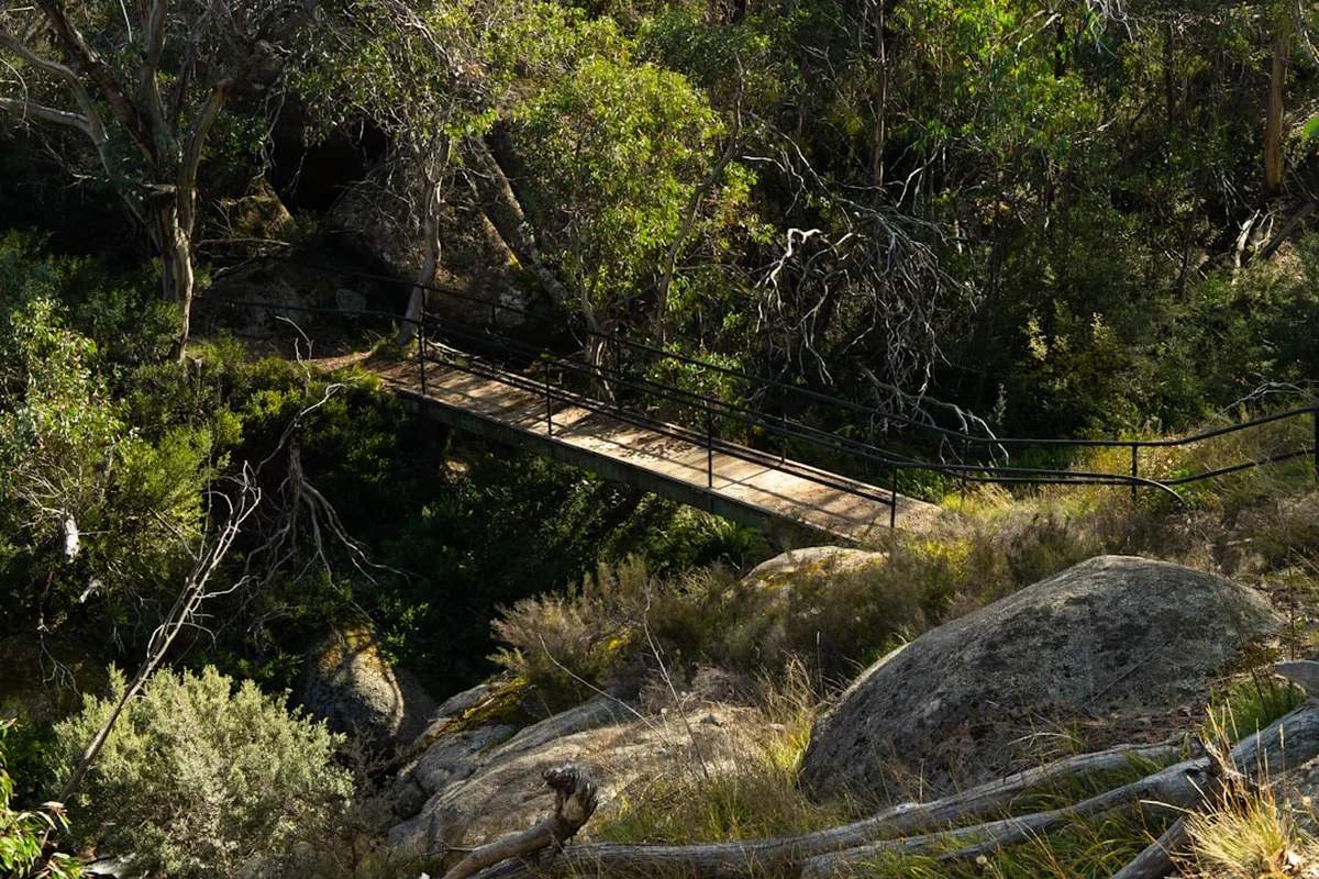
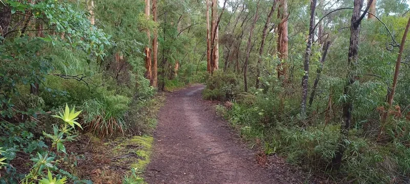
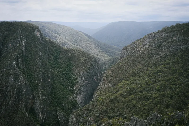
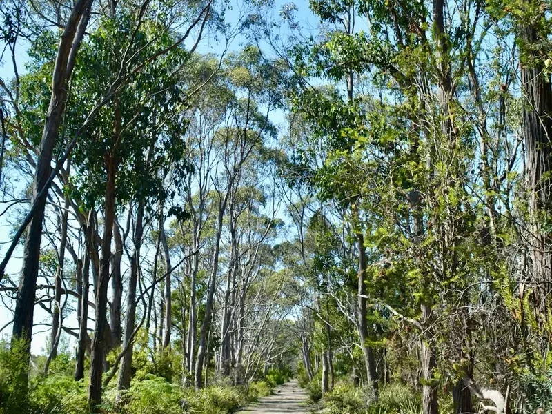
The Larapinta Trail is a masterclass in desert topography, following the ridgelines of the West MacDonnell Ranges. The trail is divided into 12 sections, each offering a distinct character and varying levels of difficulty. Unlike many coastal or alpine tracks, the Larapinta is defined by its ruggedness; the terrain is dominated by sharp quartzite rocks, loose scree, and sandy creek beds. The "spine" of the range provides walkers with constant panoramic views of the surrounding plains, where the scale of the Australian interior becomes truly palpable. The contrast between the high, exposed ridges like Brinkley Bluff and the deep, cool shadows of gorges like Standley Chasm or Ormiston Gorge creates a rhythmic experience of expansion and intimacy.
Geologically, the ranges are a remnant of a massive mountain system formed over 300 million years ago. The red colour that defines the trail comes from the oxidation of iron-rich minerals in the rock, a process that has occurred over eons. For the walker, this means traversing a landscape that feels prehistoric. You will encounter the MacDonnell Ranges Cycad, a "living fossil" that has survived in the sheltered microclimates of the gorges since the time of the dinosaurs. The trail also crosses the Finke River, believed to be one of the oldest river systems in the world, which only flows after significant rainfall but maintains permanent waterholes that support a surprising diversity of life, including the Black-footed Rock-wallaby and the iconic Ghost Gum with its startlingly white bark.
The difficulty of the Larapinta Trail should not be underestimated. While the elevation gain of 6,950 metres is spread over 223 kilometres, the nature of the path—often rocky and uneven—requires significant foot strength and balance. Water management is the most critical logistical factor, as natural water sources are scarce and unreliable. Northern Territory Parks maintains water tanks at most section trailheads, but through-hikers must meticulously plan their consumption and food drops. Despite these challenges, the trail is exceptionally well-marked with blue arrows, and the sense of accomplishment upon reaching the summit of Mount Sonder to watch the sunrise is a bucket-list experience for hikers worldwide.
History and Cultural Context
The Larapinta Trail winds through the traditional lands of the Arrernte people, who have lived in and cared for this region for over 50,000 years. To the Arrernte, the West MacDonnell Ranges are known as Tjoritja. The landscape is a living map of their culture, with many sites along the trail being of immense spiritual significance. For example, the Caterpillar (Ayepe-arenye) Dreaming is central to the creation of the ranges themselves. Walkers are guests on this land and are encouraged to travel with respect, acknowledging the deep and continuing connection the Arrernte people have to their country. Many of the gaps and gorges along the trail are "Dreaming" sites where ancestral beings performed ceremonies or rested during their journeys across the continent.
European history in the area began in the mid-19th century with explorers like John McDouall Stuart, who sought a route across the centre of Australia. The establishment of the Alice Springs Telegraph Station in 1872 was a pivotal moment, linking Australia to the rest of the world via the Overland Telegraph Line. This station now serves as the eastern trailhead. The trail itself is a relatively modern creation, conceived in the 1980s by the Conservation Commission of the Northern Territory. Construction began in 1987 and was completed in 2002, involving years of painstaking work to create a sustainable path through such unforgiving terrain. The trail was designed to allow people to experience the wilderness of the ranges while protecting the fragile desert environment from unmanaged access.
Today, the Larapinta Trail is managed by the Northern Territory Parks and Wildlife Service. It stands as a testament to successful conservation and cultural partnership. The name "Larapinta" is derived from the Arrernte word for the Finke River, "Lhere-pirte," meaning a salty river. This name reflects the ancient nature of the landscape and the vital importance of water in the desert. As you walk, you are following in the footsteps of both ancient ancestors and modern pioneers, making the Larapinta a journey through time as much as through space.
Want more background? Read extended notes on history and cultural context → Learn more
Seasonal Highlights and Weather Reality
The Larapinta Trail is strictly a seasonal walk. The window for a safe and enjoyable trek is between April and September. During these months, the Central Australian winter provides clear blue skies and manageable daytime temperatures, typically ranging from 18°C to 25°C. However, walkers must be prepared for extreme temperature fluctuations. Once the sun sets, the desert heat dissipates rapidly, and night-time temperatures frequently drop below freezing (0°C to -5°C), especially in the high-altitude camps like Brinkley Bluff.
April and May: These months offer the tail end of the warmth. The landscape may still be green if there were significant summer rains, and waterholes are likely to be at their fullest. The days are longer than in mid-winter, providing more walking hours.
June, July, and August: This is the peak season. The weather is most stable, with almost guaranteed sunshine. However, this is also when the nights are coldest. Frost is common, and a high-quality sleeping bag is essential. This is the best time for those who prefer walking in cooler conditions (15°C–20°C).
September: Spring brings the blooming of desert wildflowers, including wattles, mulla mullas, and desert peas, transforming the red earth into a vibrant tapestry of colour. Temperatures begin to rise, often reaching the low 30s by the end of the month.
October to March: Walking the Larapinta during these months is highly discouraged and can be fatal. Temperatures regularly exceed 40°C, and the risk of heatstroke and severe dehydration is extreme. Many transport services and tour operators cease operations during this period, and the trail is effectively closed to through-hikers for safety reasons.
Recommended Itinerary
12-Day Full Through-Hike Itinerary (East to West)
Day 1: Alice Springs Telegraph Station to Simpsons Gap
- Distance: 23.8 km
- Time: 7–9 hours
- Terrain: Gentle undulating hills, crossing the Todd River and Euro Ridge
- Highlights: Views back towards Alice Springs from Euro Ridge; arriving at the dramatic Simpsons Gap
- Note: A long first day; ensure you start early to reach camp before dark
Day 2: Simpsons Gap to Jay Creek
- Distance: 24.5 km
- Time: 7–9 hours
- Terrain: Sandy creek beds and rocky ridges; includes the "High Route" or "Low Route" options
- Highlights: Spring Gap and the rugged beauty of the Chewings Range
- Note: The High Route offers spectacular views but is significantly more demanding
Day 3: Jay Creek to Standley Chasm
- Distance: 13.6 km
- Time: 5–6 hours
- Terrain: Very rocky and technical; involves scrambling over boulders
- Highlights: The narrow, towering walls of Standley Chasm (Angkerle Atwatye)
- Note: A shorter distance but slow going due to the terrain; private camping fees apply at the Chasm
Day 4: Standley Chasm to Birthday Waterhole
- Distance: 17.7 km
- Time: 7–9 hours
- Terrain: Steep climbs and descents; traverses Brinkley Bluff
- Highlights: 360-degree views from the summit of Brinkley Bluff (1,209 m)
- Note: Many hikers choose to dry-camp on top of Brinkley Bluff for the sunrise, though it is very exposed and cold
Day 5: Birthday Waterhole to Hugh Gorge
- Distance: 16 km
- Time: 6–8 hours
- Terrain: Following the Spencer Gorge and crossing Linear Pass
- Highlights: The dramatic Razorback Ridge and the deep, cool pools of Hugh Gorge
- Note: Hugh Gorge can be difficult to navigate after rain; check water levels
Day 6: Hugh Gorge to Ellery Creek Big Hole
- Distance: 31.2 km
- Time: 10–12 hours
- Terrain: Long, flat sections across the Alice Valley followed by rocky ridges
- Highlights: Reaching the massive permanent waterhole at Ellery Creek
- Note: The longest section of the trail; many hikers split this into two days by camping at Rocky Gully
Day 7: Ellery Creek Big Hole to Serpentine Gorge
- Distance: 13.8 km
- Time: 5–6 hours
- Terrain: Relatively easy walking through limestone hills and valleys
- Highlights: The stunning Serpentine Gorge and its hidden waterhole
- Note: A good "recovery" day after the long trek from Hugh Gorge
Day 8: Serpentine Gorge to Serpentine Chalet Dam
- Distance: 13.4 km
- Time: 5–6 hours
- Terrain: Includes the climb to Counts Point
- Highlights: The view from Counts Point is arguably the best on the trail, looking west toward Mount Sonder
- Note: Serpentine Chalet Dam is a historic site with interesting ruins nearby
Day 9: Serpentine Chalet Dam to Ormiston Gorge
- Distance: 28.6 km
- Time: 9–11 hours
- Terrain: Crossing the Inarlanga Pass and the Heavitree Range
- Highlights: The ancient cycads in Inarlanga Pass and the spectacular Ormiston Gorge amphitheatre
- Note: Ormiston Gorge has a kiosk (seasonal) and is a popular spot for a "real" meal
Day 10: Ormiston Gorge to Finke River
- Distance: 9.1 km
- Time: 3–4 hours
- Terrain: Easy, undulating path through low scrub
- Highlights: Crossing the ancient Finke River bed
- Note: A very short day, allowing for rest or exploration of the Ormiston Pound Walk
Day 11: Finke River to Redbank Gorge
- Distance: 26 km
- Time: 8–10 hours
- Terrain: Long stretches of desert woodland and the climb to Hill 602
- Highlights: The changing colours of the desert as you approach the base of Mount Sonder
- Note: Ensure you have plenty of water for this exposed section
Day 12: Redbank Gorge to Mount Sonder Summit (Return)
- Distance: 15.8 km (return)
- Time: 6 hours
- Terrain: Steady climb on a well-defined but rocky track
- Highlights: Sunrise from the summit of Mount Sonder (1,380 m), the highest point of the trail
- Note: Most hikers start at 2:00 AM or 3:00 AM to reach the summit for dawn
Planning and Bookings
Book Your Trip
Everything you need to plan your journey
Accommodation
Find places to stay near Alice Springs
Flights
Search flights to Alice Springs
Essential Preparation
The Larapinta Trail requires meticulous logistical planning, particularly regarding food and water. Most through-hikers base themselves in Alice Springs for several days before starting to organise food drops and transport. Alice Springs has several major supermarkets, outdoor stores, and a dedicated visitor centre. You must coordinate your food drops at specific locations: Standley Chasm, Ellery Creek, Serpentine Chalet Dam, and Ormiston Gorge. These are managed via secure storage lockers that must be booked in advance through local transfer operators or NT Parks.
Fitness is paramount. You will be carrying a heavy pack (often 18–22 kg including water) over uneven, rocky ground for 6–8 hours a day. Training should include multi-day hikes with a weighted pack and exercises to strengthen ankles and knees. Additionally, you must register your walking intent with the NT Parks "Walking Track Registration" system and consider carrying a Satellite Messenger or PLB, as mobile reception is non-existent for 95% of the trail.
Trail Accommodation
Accommodation on the Larapinta Trail consists primarily of designated wilderness campsites. There are no huts or permanent buildings for sleeping along the route. Each of the 12 section trailheads features a campsite, most of which are equipped with basic facilities.
Campsite Facilities:
- Tent platforms or cleared sandy areas for pitching tents
- Water tanks (supplied by NT Parks; must be treated before drinking)
- Composting toilets (at most major trailheads)
- Picnic tables and basic shelters (for shade and cooking, not sleeping)
- Fire pits (only at specific sites; strict fire bans often apply)
- Emergency radio or "blue phone" at some locations
What is NOT Provided:
- Bedding or mattresses
- Cooking equipment or fuel
- Food or supplies (except at Ormiston Gorge and Standley Chasm kiosks)
- Electricity or charging points
- Trash cans (you must pack out all rubbish)
Costs and Bookings:
- Camping fees apply for all overnight stays on the trail
- Bookings must be made online via the NT Parks booking system before you start
- Fees are approximately AU$4–$10 per person, per night, depending on the site
- Standley Chasm is privately managed; separate camping fees apply there (approx. AU$15–$20)
Required Gear
- Hiking Boots: High-quality, leather or heavy-duty synthetic boots with excellent ankle support. The quartzite rock is incredibly abrasive and will destroy lightweight trail runners.
- Backpack: 65–75L capacity with a robust harness system to carry heavy water loads.
- Sleeping Bag: Rated to at least -5°C. Desert nights are freezing.
- Sleeping Mat: High R-value (insulation) is necessary to prevent heat loss to the cold ground.
- Tent: A lightweight, 3-season tent with a good fly. While it rarely rains, the wind on the ridges can be intense.
- Navigation: Topographic maps (Larapinta Trail map pack), a compass, and a GPS or offline map app (like FarOut).
- Emergency Communication: A Personal Locator Beacon (PLB) or Garmin inReach is mandatory for safety.
- Headlamp: With spare batteries, essential for early morning starts and camp life.
What to Bring
- Water Capacity: You must be able to carry 5–7 litres of water. This is non-negotiable for the longer, exposed sections.
- Water Treatment: Purification tablets or a filter (e.g., Sawyer Squeeze) for tank water.
- Food: Lightweight, high-calorie dehydrated meals. Plan for 3,000–4,000 calories per day.
- Electrolytes: Powdered supplements to prevent hyponatremia and dehydration.
- Clothing: Moisture-wicking base layers, a warm fleece or down jacket for nights, a wide-brimmed hat, and long-sleeved sun shirts.
- First Aid: Extensive blister kit (Leukoplast tape is a favourite), antiseptic, pressure bandages (for snake bites), and personal medications.
- Sun Protection: SPF 50+ sunscreen, lip balm with UV protection, and high-quality sunglasses.
- Toiletries: Biodegradable soap, trowel for waste (where toilets aren't available), and hand sanitiser.
- Repair Kit: Duct tape, needle and thread, and spare buckles for your pack.
Permits
While there is no "permit" in the traditional sense to walk the trail, all walkers must book their campsites in advance through the Northern Territory Parks and Wildlife online booking system. This system acts as a way to manage numbers and ensure that campsites do not become overcrowded. You should book your entire itinerary well in advance, especially if travelling during the peak months of June and July.
Registration of Intent:
- It is highly recommended to register your trek with the NT Parks "Walking Track Registration" scheme. This is not a booking but a safety measure so authorities know who is on the trail.
- You should also leave a detailed itinerary with a reliable "emergency contact" person who is not walking with you.
Commercial Fees:
- If you are using a commercial transfer service for food drops or trailhead transport, they will often handle some of the logistics, but you are still responsible for your individual camping bookings.
- Standley Chasm (Section 3/4) is on private Aboriginal land. You must pay an entry fee and a separate camping fee directly to the Standley Chasm kiosk.
Vehicle Access:
- If you have a support vehicle, note that some trailheads (like Hugh Gorge or Serpentine Chalet Dam) require a high-clearance 4WD. Standard rental cars are often prohibited from these tracks.
Other Activities in the Area
Alice Springs and the West MacDonnell Ranges offer numerous experiences to complement your hike:
- Alice Springs Desert Park: An excellent introduction to the flora, fauna, and culture of the region before you start your walk.
- Hot Air Ballooning: Experience the vastness of the Outback and the MacDonnell Ranges from the air at sunrise.
- Cultural Tours: Join an Arrernte guide for a walking tour to learn about bush tucker, traditional medicine, and the Dreaming stories of the region.
- Royal Flying Doctor Service (RFDS) Tourist House: Learn about the vital medical link for remote Australia in Alice Springs.
- Swimming: While Ellery Creek and Ormiston Gorge are on the trail, they are also accessible by car and are perfect for a post-hike soak (though the water is very cold!).
- The Ochre Pits: Located near Section 9, these colourful cliffs are still used by the Arrernte people for ceremonial ochre.
Safety and Conditions
Water Management: This is the single greatest risk on the Larapinta Trail. Never rely on natural waterholes, as they can dry up or become contaminated. Always fill your containers to capacity at the NT Parks tanks. If a tank is empty (rare but possible), use your emergency communication device to alert authorities and stay put if you cannot safely reach the next source. Aim to drink at least 4–6 litres per day while walking.
Heat and Exposure: Even in winter, the sun is intense. Heat exhaustion can occur on days as cool as 25°C if you are over-exerting. Wear a hat, use sunblock, and try to complete the bulk of your walking before the mid-afternoon heat. Learn the signs of heatstroke: confusion, lack of sweating, and rapid pulse.
Remote Communication: There is almost no mobile phone coverage on the trail. A PLB (Personal Locator Beacon) is essential. In the event of a life-threatening emergency, activating a PLB will alert the Australian Maritime Safety Authority (AMSA), who will coordinate a rescue. For non-emergencies, a satellite messenger (like an inReach or Zoleo) allows you to check in with family or request non-urgent assistance.
Wildlife: Central Australia is home to several species of venomous snakes, including the King Brown and Western Brown. They are generally shy and will move away if they hear you coming, but always watch where you step, especially in long grass or rocky crevices. Carry a broad pressure immobilisation bandage and know how to use it. Dingoes are also present; keep your food secured and never feed them.
Navigation: While the trail is well-marked, it is easy to lose the path in sandy creek beds or on rocky plateaus. Always carry a physical map and compass as a backup to electronic devices. If you lose the trail, backtrack to the last known marker rather than pushing forward.
Side Trips and Points of Interest
Mount Sonder (Rwetyepme) Sunrise: The ultimate Larapinta experience. The 1,380-metre summit offers a view that encompasses the entire range you have just walked. The climb from Redbank Gorge takes about 3 hours. Watching the shadow of the mountain stretch across the desert floor as the sun rises is a moment of profound beauty.
Counts Point: Located on Section 8, this lookout provides a spectacular perspective of the "Heavitree Quartzite" ridges. You can see the high peaks of the Chewings Range to the north and the vast Alice Valley to the south. It is often cited by through-hikers as their favourite view of the entire trip.
Inarlanga Pass: A narrow, dramatic gap in the Heavitree Range filled with ancient MacDonnell Ranges Cycads. The towering red walls and the prehistoric plants create an atmosphere that feels like stepping back millions of years. It is a short detour from the main trail near Serpentine Chalet Dam.
Ormiston Pound Walk: If you have an extra day at Ormiston Gorge, this 3–4 hour loop walk takes you into the heart of the "Pound"—a massive natural amphitheatre surrounded by mountains. It offers excellent birdwatching and geological interest.
Brinkley Bluff: While part of the main trail, spending a night camping on the summit is a popular "extra" for those with the gear to handle the cold and wind. The sunset and sunrise from this high point are legendary.
Leave No Trace
The desert environment is incredibly fragile. Footprints and tyre tracks can last for decades, and the slow growth rates of desert plants mean that damage takes a long time to heal. As a walker, you have a responsibility to minimise your impact.
Key Principles for the Larapinta:
- Carry Out All Rubbish: This includes organic waste like orange peels and apple cores, which do not decompose quickly in the arid environment and can harm local wildlife.
- Respect Cultural Sites: Never touch or remove rock art or artefacts. Stay on the marked trail to avoid entering restricted sacred sites.
- Human Waste: Use the provided composting toilets at trailheads. If you must go between camps, dig a hole at least 15–20 cm deep and at least 100 metres from any watercourse or the trail. Pack out your used toilet paper in a sealed bag.
- No Fires: Use a fuel stove for cooking. Wood is scarce and provides vital habitat for insects and lizards. Many areas have permanent fire bans.
- Protect Water Sources: Never wash yourself or your dishes directly in waterholes. Even small amounts of soap, sunscreen, or insect repellent can kill the delicate aquatic life in these isolated oases. Carry water 50 metres away from the source for washing.