Langtang Valley Trek - The Valley of Glaciers
The Langtang Valley Trek is one of Nepal’s most accessible yet profoundly beautiful high-altitude journeys, offering a spectacular window into the heart of the Central Himalayas. Located approximately 80 kilometres north of Kathmandu, this 51 km return journey traverses the Langtang National Park, the first Himalayan national park established in Nepal. The route follows the Langtang Khola river, ascending from the lush subtropical forests of Syabrubesi through dense bamboo and rhododendron groves, eventually emerging into a high-alpine world of glacial moraines, yak pastures, and towering peaks that straddle the border with Tibet. Dominated by the massive presence of Langtang Lirung (7,227 m), the valley is often referred to as the "Valley of Glaciers" due to the numerous ice flows that hang from the surrounding summits.
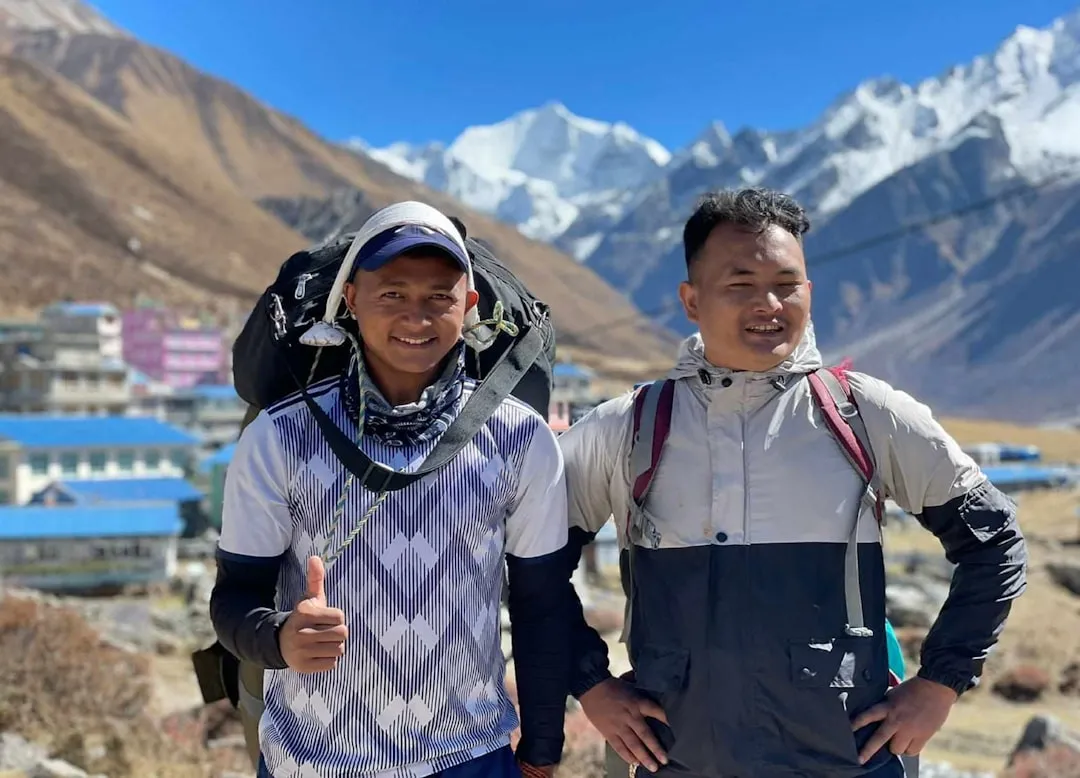
Beyond its geological grandeur, the Langtang Valley Trek is a journey of cultural immersion and remarkable human resilience. The region is primarily inhabited by the Tamang and Sherpa people, whose Tibetan-influenced traditions, language, and Buddhist practices are woven into the landscape through ancient monasteries (gompas), mani walls, and fluttering prayer flags. The valley gained international attention following the devastating 7.8 magnitude earthquake in April 2015, which triggered a massive debris avalanche that completely buried Langtang Village. Today, the trek serves as a testament to the strength of the local community, who have rebuilt their teahouses and lives with extraordinary determination. By walking this trail, trekkers contribute directly to the continued economic recovery of a region that offers some of the most intimate mountain views in the world without the overwhelming crowds of the Everest or Annapurna regions.
- Distance: 51.0 km (out-and-back)
- Duration: 6–8 days
- Season: March–May (Spring) and October–November (Autumn)
- Accommodation: Local teahouses (lodges)
- Highest point: Kyanjin Ri (4,773 m) or Tserko Ri (4,984 m)
- Difficulty: Moderate (requires good cardiovascular fitness and acclimatisation)
- Permits: Langtang National Park Entry Permit and TIMS Card
- Starting Point: Syabrubesi (1,550 m)
Overview
The Langtang Valley Trek is a masterclass in ecological diversity, compressed into a relatively short geographical distance. The journey begins at an elevation of 1,550 metres in Syabrubesi, where the air is humid and the vegetation is thick with oak, maple, and various species of bamboo—the primary habitat for the elusive Red Panda. As the trail climbs, the landscape undergoes a dramatic transformation. By the time trekkers reach the upper valley at Kyanjin Gompa (3,870 m), the forest has vanished, replaced by a stark, beautiful alpine tundra where only hardy shrubs and grasses survive. This rapid transition provides a unique perspective on the verticality of the Himalayas, where one can experience multiple climatic zones in just a few days of walking.
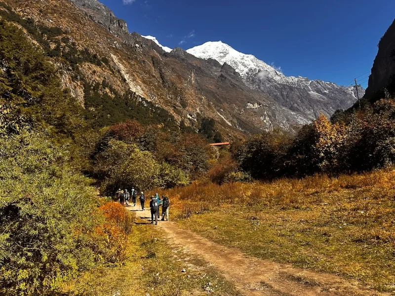
The trek is characterised by its "U-shaped" glacial valley, a classic geological formation carved over millennia by moving ice. The valley floor is relatively wide in the upper reaches, providing expansive views of the surrounding peaks, including Dorje Lakpa (6,966 m), Gangchenpo (6,387 m), and the formidable Langtang Lirung. Unlike the steep, narrow gorges found in other parts of Nepal, the Langtang Valley feels open and airy, allowing for a sense of scale that is both humbling and exhilarating. The presence of the Langtang Khola, a turquoise river fed by glacial melt, provides a constant soundtrack of rushing water that accompanies the trekker from the trailhead to the high-altitude pastures.
What sets the Langtang Valley apart from other popular Nepalese treks is the intimacy of the experience. Because the valley is a dead-end (terminating at the high peaks bordering Tibet), the trail feels more like a pilgrimage into a hidden sanctuary. The teahouses are generally smaller and more family-run than those on the Everest Base Camp route, offering a deeper connection to the local Tamang culture. Trekkers often find themselves sitting around a central wood-burning stove in the evenings, sharing stories with lodge owners who have lived in the valley for generations. This blend of world-class alpine scenery and genuine Himalayan hospitality makes the Langtang Valley Trek a quintessential mountain experience.
History and Cultural Context
The history of the Langtang Valley is inextricably linked to the migration of Tibetan people across the Himalayan passes centuries ago. The local inhabitants, the Tamang, are descendants of Tibetan horse traders and warriors who settled in the high valleys of Nepal. Their name, "Tamang," is derived from the Tibetan words 'Ta' (horse) and 'Mang' (trader or warrior). This heritage is visible in every aspect of valley life, from the architecture of the stone houses to the religious practices centred around Vajrayana Buddhism. The valley is dotted with sacred sites, including the Kyanjin Gompa, a monastery believed to be several hundred years old, which serves as the spiritual heart of the upper valley.
According to local legend, the valley was discovered by a Buddhist monk who was chasing a lost yak. The name "Langtang" itself reflects this myth: 'Lang' means yak and 'Tang' means to follow. The monk followed the yak into the valley and was so struck by its beauty and fertility that he encouraged his people to settle there. For centuries, the valley remained a secluded enclave of subsistence farming and yak herding, largely untouched by the outside world until the first mountaineering expeditions arrived in the mid-20th century. The legendary British explorer Bill Tilman was the first Westerner to explore the valley in 1949, famously describing it as one of the most beautiful valleys in the world.
The most defining moment in the valley's modern history occurred on 25 April 2015. The massive Gorkha earthquake triggered a catastrophic landslide of ice, rock, and mud from the slopes of Langtang Lirung. The resulting air blast and debris flow completely obliterated the original Langtang Village, claiming the lives of over 300 people, including locals, Nepalese guides, and international trekkers. The tragedy was a profound blow to the region, but the subsequent years have seen an inspiring recovery. The village has been rebuilt slightly further up the valley, and a memorial wall inscribed with the names of those lost stands as a solemn reminder of the power of nature and the resilience of the human spirit. Walking through the valley today, one sees a community that has not only survived but is actively working to preserve its heritage while welcoming the world back to its mountains.
Want more background? Read extended notes on history and cultural context → Learn more
Seasonal Highlights and Weather Reality
The Langtang Valley experiences a classic Himalayan monsoon climate, which dictates the trekking seasons. Understanding these cycles is crucial for safety and for ensuring the best possible views of the peaks.
Spring (March to May): This is arguably the most beautiful time to trek. As the winter snow melts, the lower forests erupt in colour. The rhododendrons—Nepal’s national flower—bloom in shades of crimson, pink, and white, creating a vibrant contrast against the snow-capped peaks. Temperatures are moderate, with daytime highs in the lower valley reaching 15–20°C, though it remains cold at night in Kyanjin Gompa. This is also the best time for wildlife spotting, as animals become more active with the warming weather.
Autumn (October to November): This is the peak trekking season. Following the monsoon rains, the atmosphere is washed clean of dust, resulting in the sharpest, clearest views of the mountains. The weather is generally stable, with deep blue skies and crisp air. While the flora is less vibrant than in spring, the golden hues of the alpine grasses and the clear visibility make it a photographer's dream. Temperatures are cooler than in spring, and trekkers should be prepared for sub-zero temperatures at night in the upper reaches of the valley.
Winter (December to February): Winter brings clear skies but extreme cold and heavy snowfall. Many teahouses in the upper valley close as locals migrate to lower elevations to escape the freezing temperatures. Trekking is possible but requires advanced cold-weather gear and the ability to navigate snow-covered trails. The risk of avalanches on the steep valley walls increases significantly after heavy snowfalls.
Monsoon (June to September): This is the least favourable time to trek. Heavy rains bring clouds that obscure the mountains, and the trails become muddy and slippery. The lower forest sections become infested with leeches, and the risk of landslides and rockfalls is at its highest. However, for those interested in botany, the monsoon is when the alpine meadows are at their lushest, filled with rare wildflowers.
Recommended Itinerary
6-Day Langtang Valley Itinerary
Day 1: Syabrubesi to Lama Hotel
- Distance: 11.3 km
- Elevation gain: 930 m
- Time: 5–6 hours
- The trail begins by crossing the Bhote Koshi river and following the Langtang Khola upstream.
- Pass through dense forests of oak, maple, and alder.
- Keep an eye out for grey langur monkeys and various bird species in the canopy.
- The ascent is steady, with several steep sections known locally as "Nepali flats" (a mix of up and down).
- Arrive at Lama Hotel (2,480 m), a collection of teahouses nestled in a forest clearing.
Day 2: Lama Hotel to Langtang Village
- Distance: 14.8 km
- Elevation gain: 950 m
- Time: 5–6 hours
- The trail continues through the forest, gradually climbing to Ghoda Tabela (3,000 m), where the valley begins to open up.
- Pass the National Park check post where permits are verified.
- The landscape shifts from dense forest to alpine meadows and yak pastures.
- Walk through the site of the old Langtang Village, now a vast field of boulders and debris from the 2015 earthquake.
- Pass the memorial wall and arrive at the new Langtang Village (3,430 m).
- Views of Langtang Lirung become dominant to the north.
Day 3: Langtang Village to Kyanjin Gompa
- Distance: 6.8 km
- Elevation gain: 440 m
- Time: 3–4 hours
- A shorter day to allow for acclimatisation as you move into the high-alpine zone.
- The trail passes through small villages like Mundu and Singdun.
- Cross several wooden bridges over glacial streams and pass extensive mani walls (stone walls inscribed with Buddhist mantras).
- Arrive at Kyanjin Gompa (3,870 m), the final permanent settlement in the valley.
- Afternoon visit to the local yak cheese factory or the ancient monastery.
Day 4: Acclimatisation Day (Kyanjin Ri or Tserko Ri)
- Distance: 4–8 km (return)
- Elevation gain: 900 m to 1,100 m
- Time: 5–8 hours
- Option 1: Hike to Kyanjin Ri (4,773 m) for a panoramic view of the Langtang peaks and glaciers.
- Option 2: A more challenging trek to Tserko Ri (4,984 m), the highest point accessible without climbing gear.
- The summit of Tserko Ri offers a 360-degree view including Yala Peak, Langshisha Ri, and the Tibetan border peaks.
- Return to Kyanjin Gompa for the night.
Day 5: Kyanjin Gompa to Lama Hotel
- Distance: 21.6 km
- Elevation loss: 1,390 m
- Time: 6–7 hours
- Retrace your steps down the valley. The descent is much faster, but hard on the knees.
- Enjoy the changing perspective of the valley as you head back into the tree line.
- Stop for lunch in Langtang Village or Ghoda Tabela.
- Arrive back at Lama Hotel for the final night in the forest.
Day 6: Lama Hotel to Syabrubesi
- Distance: 11.3 km
- Elevation loss: 930 m
- Time: 4–5 hours
- The final descent back to the trailhead.
- The air becomes noticeably warmer and more humid as you drop in elevation.
- Celebrate the completion of the trek in Syabrubesi.
- Prepare for the jeep or bus journey back to Kathmandu the following morning.
Important Notes:
- The itinerary can be extended by adding a day trip to Langshisha Kharka from Kyanjin Gompa.
- Acclimatisation is key; do not rush the ascent between Day 2 and Day 3.
- Drinking plenty of water (3–4 litres per day) helps prevent altitude sickness.
- Always walk to the left of mani walls and prayer wheels in accordance with Buddhist tradition.
Planning and Bookings
Book Your Trip
Everything you need to plan your journey
Accommodation
Find places to stay near Kathmandu
Flights
Search flights to Kathmandu
Essential Preparation
Preparation for the Langtang Valley Trek begins in Kathmandu. While the trek is considered moderate, the rapid elevation gain requires a good level of physical fitness. Cardiovascular training (hiking, running, or cycling) in the months leading up to the trip is highly recommended. Logistics involve arranging transport to Syabrubesi, which is a 7–9 hour journey from Kathmandu. You can choose between a local bus (cheaper but crowded and slow) or a private 4WD jeep (more expensive but faster and more comfortable). The road is notorious for being bumpy and narrow, particularly during or after the monsoon.
It is essential to coordinate your permits before leaving Kathmandu. While some permits can be obtained on the trail, having them ready saves time and potential stress. Most trekkers spend at least two nights in Kathmandu before the trek to finalise gear, meet guides, and adjust to the local environment. Thamel is the primary hub for trekkers, offering everything from high-end gear shops to budget guesthouses.
Trail Accommodation
Accommodation on the Langtang Valley Trek is provided by teahouses. These are small, family-run lodges that offer basic but comfortable lodging and meals. Following the 2015 earthquake, many teahouses have been rebuilt using modern earthquake-resistant techniques, often featuring better insulation than older structures.
Hut/Teahouse Facilities:
- Twin-share rooms with wooden beds and foam mattresses.
- Common dining area, usually heated by a central wood or yak-dung stove in the evenings.
- Meals: A variety of Nepalese and international dishes (Dal Bhat, pasta, pancakes, eggs).
- Toilets: Usually shared, ranging from Western-style flush toilets to traditional squat toilets.
- Showers: Hot showers are often available for an extra fee (usually solar-powered or gas-heated).
- Charging: Electricity for charging phones and cameras is available in most teahouses for a small fee.
What Teahouses Don't Provide:
- Bedding: While blankets are often provided, a high-quality sleeping bag is essential for hygiene and warmth.
- Toiletries: You must bring your own soap, shampoo, and toilet paper.
- Towels: No towels are provided.
- WiFi: Available in some villages (like Kyanjin Gompa) for a fee, but it is often slow and unreliable.
Booking Requirements:
- During peak season (October/November), teahouses can fill up quickly. If travelling with a guide, they will usually call ahead to secure rooms.
- Independent trekkers should aim to arrive at their destination by early afternoon to ensure a spot.
- Costs: A room typically costs between 500 and 1,000 NPR per night, provided you eat your meals at the teahouse.
Required Gear
- Hiking Boots: Waterproof, well-broken-in boots with good ankle support are mandatory.
- Down Jacket: Essential for the cold evenings and mornings in Kyanjin Gompa (rated to -10°C).
- Sleeping Bag: A 4-season bag (comfort rating -10°C) is recommended for the high-altitude nights.
- Waterproof Shell: A high-quality Gore-Tex jacket and trousers to protect against wind and rain.
- Trekking Poles: Highly recommended for the steep descents to protect your knees.
- Backpack: A 40–50L pack if carrying your own gear, or a smaller daypack if using a porter.
- Headlamp: Essential for early morning summit pushes and navigating teahouses at night.
- First Aid Kit: Including blister pads, rehydration salts, and Diamox (for altitude).
What to Bring
- Water Treatment: Purification tablets or a filter (e.g., Sawyer Squeeze) to avoid buying plastic bottles.
- Sun Protection: SPF 50+ sunscreen, lip balm with SPF, and a wide-brimmed hat. The UV is intense at 4,000 m.
- Snacks: Energy bars, nuts, and chocolate. While food is available, having your own high-energy snacks is vital.
- Toiletries: Biodegradable soap, wet wipes, hand sanitiser, and enough toilet paper for the duration.
- Layers: Merino wool base layers, fleece mid-layers, and quick-dry trekking trousers.
- Cash: Sufficient Nepalese Rupees (NPR) for the entire trek. There are no ATMs in the Langtang Valley.
- Personal Documents: Passport, permit copies, and insurance details.
Permits
To trek in the Langtang Valley, international visitors require two primary permits. These permits are essential for maintaining the national park and tracking the safety of trekkers in the region. It is mandatory to carry these documents at all times, as they will be checked at various military and park checkpoints along the trail.
1. Langtang National Park Entry Permit:
- Cost: 3,000 NPR (approximately 23 USD) for foreigners; 1,500 NPR for SAARC nationals.
- Where to get it: The Nepal Tourism Board office in Kathmandu or at the park entrance gate in Dunche/Syabrubesi.
- Validity: Single entry for the duration of the trek.
2. TIMS (Trekkers' Information Management System) Card:
- Cost: 2,000 NPR (approximately 15 USD).
- Requirement: As of 2023, the Nepal government has made it mandatory for most trekking regions to have a licensed guide. The TIMS card is usually processed by your trekking agency.
- Where to get it: Through a registered trekking agency in Kathmandu.
Important Permit Regulations:
- You will need at least four passport-sized photographs for the permit applications.
- Keep digital copies of your permits on your phone as a backup.
- Failure to produce permits at checkpoints can result in fines or being turned back.
- The fees collected go towards trail maintenance, environmental conservation, and local community projects within the Langtang National Park.
Other Activities in the Area
If you have extra time or wish to extend your Himalayan adventure, the Langtang region offers several excellent alternatives and additions:
- Gosaikunda Lake Trek: A sacred alpine lake located at 4,380 m. This can be added to the Langtang trek by branching off at Thulo Syabru. It is a major pilgrimage site for Hindus and Buddhists.
- Tamang Heritage Trail: A lower-altitude cultural trek that focuses on the traditional villages and customs of the Tamang people. It offers a more community-based experience with homestay options.
- Helambu Trek: A scenic route that leads back towards Kathmandu through the lush forests and Sherpa villages of the Helambu region.
- Yala Peak Climbing: For those with mountaineering ambitions, Yala Peak (5,520 m) is a non-technical trekking peak that can be climbed from Kyanjin Gompa with the appropriate permits and gear.
- Langshisha Kharka: A long day-hike from Kyanjin Gompa further up the valley to a vast pasture surrounded by glaciers. It offers a true wilderness feel away from the main teahouse route.
Safety and Conditions
Altitude Sickness (AMS): Acute Mountain Sickness is the primary safety concern on this trek. The trail ascends from 1,550 m to nearly 4,000 m in just three days. Symptoms include headache, nausea, dizziness, and loss of appetite. The golden rule is: if symptoms persist or worsen, descend immediately. Ensure you have a rest day or a short day at Kyanjin Gompa before attempting Tserko Ri.
Weather and Trail Conditions: The weather in the Himalayas is notoriously unpredictable. Even in peak season, sudden snowstorms or heavy rain can occur. The trail between Lama Hotel and Langtang Village passes through several landslide-prone areas. Always check with locals or your guide about current conditions, especially after rain. In winter, the risk of avalanches from the surrounding peaks is a serious consideration.
Water Safety: Never drink untreated water from streams or taps. Use purification tablets, a UV purifier, or a high-quality filter. Staying hydrated is essential for acclimatisation, but waterborne illnesses can quickly end a trek.
Communication: Mobile signal (Ncell and Nepal Telecom) is available in Syabrubesi and sporadically up to Langtang Village. Kyanjin Gompa often has limited signal or satellite-based WiFi. It is highly recommended to carry a satellite messenger (like a Garmin inReach) for emergencies, especially if trekking in a small group.
Insurance: Ensure your travel insurance specifically covers trekking up to 5,000 m and includes emergency helicopter evacuation. Helicopter rescues are common in Nepal for serious AMS or injuries, and they are extremely expensive if not covered by insurance.
Side Trips and Points of Interest
Tserko Ri (4,984 m): This is the ultimate viewpoint of the Langtang Valley. The climb is steep and demanding, taking 4–5 hours to reach the summit from Kyanjin Gompa. However, the reward is a breathtaking 360-degree panorama of the Langtang Lirung glacier, the peaks of Tibet, and the entire Langtang range. It is the highest point most trekkers will reach and requires a very early start to avoid the afternoon clouds.
Kyanjin Ri (4,773 m): A slightly lower and more accessible alternative to Tserko Ri. It offers equally stunning views of the glaciers and the valley floor. There are two peaks (Lower and Upper Kyanjin Ri), and the trail is well-marked with prayer flags.
Langtang Cheese Factory: Established with Swiss assistance in the 1950s, this factory produces famous yak cheese. Visitors can see the production process (during the right season) and purchase fresh cheese, which is a calorie-dense and delicious snack for the trail.
Kyanjin Gompa Monastery: A beautiful, ancient monastery that serves as the spiritual anchor for the upper valley. Visitors are welcome to observe the morning or evening prayers, provided they are respectful and remove their shoes. The monastery was damaged in the earthquake but has been beautifully restored.
The Langtang Memorial: Located at the site of the original Langtang Village, this is a place for quiet reflection. The sheer scale of the debris field provides a sobering perspective on the events of 2015 and the incredible effort required to rebuild the community.
Leave No Trace
The Langtang Valley is a fragile ecosystem under increasing pressure from tourism and climate change. As a trekker, it is your responsibility to minimise your impact on this pristine environment. The "Leave No Trace" principles are essential for preserving the valley for future generations.
Waste Management: Nepal struggles with waste management in high-altitude regions. Pack out all non-biodegradable waste, including plastic wrappers, batteries, and feminine hygiene products. Avoid buying bottled water; instead, use purification methods to refill your reusable bottles from teahouse taps.
Respect Wildlife and Flora: Langtang National Park is home to the endangered Red Panda, Himalayan Tahr, and Musk Deer. Observe wildlife from a distance and never feed them. Do not pick wildflowers or damage vegetation, as the growing season at high altitudes is extremely short and plants take a long time to recover.
Cultural Respect: The Langtang Valley is a living cultural landscape. Always ask for permission before taking photos of people or their homes. Dress modestly, especially when visiting monasteries. Respect the local traditions by walking clockwise around mani walls and stupas.
Energy Conservation: Wood is a scarce resource in the high valley. Support teahouses that use solar power or gas for cooking and heating rather than wood. Keep your showers short and avoid asking for room heating unless absolutely necessary.