Kungsleden - The King of Arctic Trails
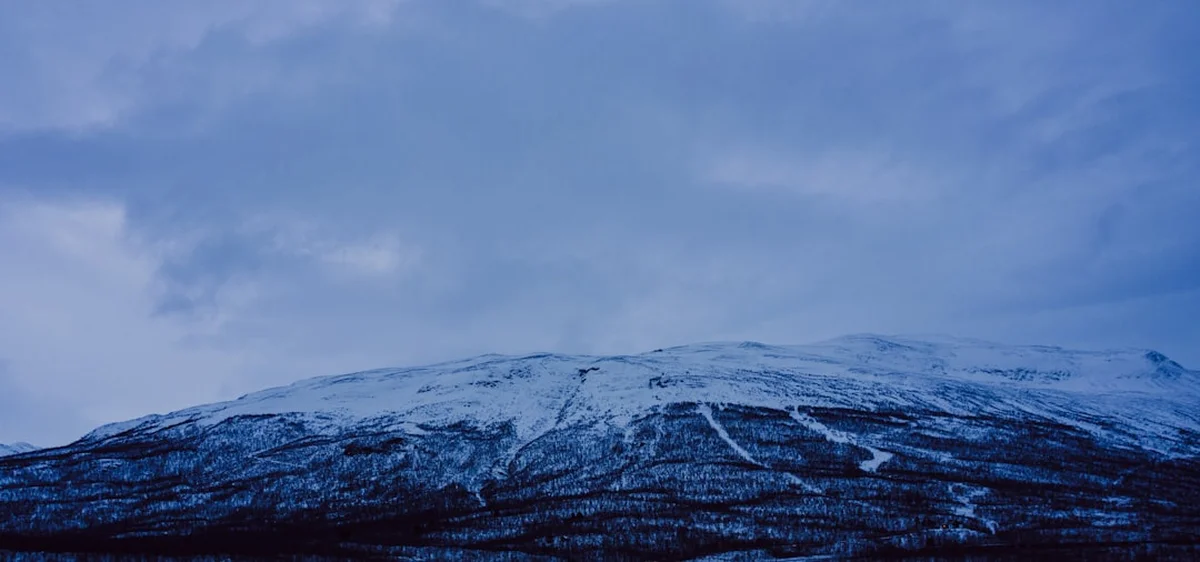
Kungsleden, or "The King's Trail," is Sweden's most famous and prestigious long-distance trekking route, stretching approximately 440 kilometres through the wild heart of Swedish Lapland. Traversing a landscape of immense scale, the trail leads hikers from the lush birch forests of Abisko in the north to the rolling fells of Hemavan in the south. This is a journey through one of Europe's last remaining wilderness areas, crossing the Arctic Circle and passing through four distinct national parks: Abisko, Stora Sjöfallet, Sarek, and Pieljekaise. The route is a masterclass in Scandinavian geography, featuring dramatic U-shaped glacial valleys, high alpine plateaus, crystal-clear mountain lakes, and the towering massif of Kebnekaise—Sweden's highest peak.
What sets Kungsleden apart is its unique blend of accessibility and raw isolation. While the northernmost section is well-serviced by a network of mountain huts managed by the Svenska Turistföreningen (STF), the southern reaches offer a more solitary experience where self-sufficiency becomes paramount. The trail is not merely a physical challenge; it is a cultural immersion into the ancestral lands of the Sami people, who have herded reindeer across these fells for millennia. Whether you are tackling the popular 105-kilometre northern loop or committing to the full 440-kilometre thru-hike, Kungsleden offers a profound connection to the subarctic environment that is increasingly rare in the modern world.
- Distance: 440.0 km (full thru-hike)
- Duration: 20–30 days (full length); 5–7 days (northern section)
- Season: Late June to September (summer trekking); February to April (winter skiing)
- Accommodation: STF Mountain Huts and wild camping
- Highest point: Tjäktja Pass (1,150 m)
- Elevation Gain: Approximately 6,100 m total
- Difficulty: Moderate (well-marked but remote with significant weather variables)
- Direction: Traditionally walked North to South (Abisko to Hemavan)
Overview
The Kungsleden was conceived at the end of the 19th century by the Swedish Tourist Association (STF) with the ambitious goal of making the Swedish mountains accessible to the general public. Today, it stands as a testament to that vision, offering a world-class trekking experience that caters to both seasoned thru-hikers and those seeking a shorter alpine escape. The trail is traditionally divided into five main sections, each with its own distinct character and logistical requirements. The northernmost section from Abisko to Kebnekaise is the most frequented, known for its dramatic scenery and frequent hut intervals, while the sections south of Kvikkjokk are significantly more remote, requiring hikers to carry more supplies and often rely on wild camping.
The landscape of Kungsleden is defined by its glacial history. Hikers spend much of their time walking through vast, open valleys carved by ancient ice sheets. These valleys are often flanked by steep, dark mountains that rise abruptly from the tundra. In the north, the "Lapporten" (The Sami Gate) serves as an iconic natural landmark—a massive U-shaped gap in the mountains that has guided travellers for centuries. As you move south, the terrain shifts from high alpine environments to dense birch forests and eventually into the more rounded, ancient fells of the Västerbotten region. Water is a constant companion; the trail crosses numerous rivers via sturdy bridges or rowing boats, and the abundance of freshwater means that hikers are rarely more than a few kilometres from a pristine drinking source.
One of the most remarkable aspects of Kungsleden is the "Allemansrätten," or the Right of Public Access. This Swedish constitutional right allows anyone to roam freely in the countryside, pick berries and mushrooms, and camp almost anywhere for a night or two, provided they do not disturb or destroy. This freedom, combined with the STF hut system, creates a trekking culture that is both welcoming and deeply respectful of the environment. However, the Arctic environment is unforgiving. Even in the height of summer, temperatures can drop toward freezing, and the "mountain weather" can shift from brilliant sunshine to horizontal sleet within minutes. Success on Kungsleden requires a balance of physical stamina, proper gear, and a deep respect for the shifting moods of the North.
History and Cultural Context
The history of Kungsleden is inextricably linked with the birth of Swedish mountain tourism. In the late 1800s, the Swedish Tourist Association (STF) was formed by a group of geologists and explorers who wanted to encourage Swedes to discover their own wilderness. The first sections of the trail were marked in the early 1900s, and the first huts were built shortly thereafter. The name "Kungsleden" was first used in the 1920s, intended to signify that this was the "King" of all trails—a route of such grandeur that it stood above all others in the Scandinavian peninsula. Over the decades, the trail was extended southward, finally reaching Hemavan in 1975.
However, the human history of this land goes back much further than the STF. Kungsleden passes through Sápmi, the cultural region traditionally inhabited by the Sami people. For thousands of years, the Sami have lived in harmony with this environment, following the seasonal migrations of reindeer. The trail often follows ancient paths used by Sami herders to move their flocks between summer and winter pastures. Hikers will frequently encounter "vistes" (Sami settlements), reindeer enclosures, and active herding operations. It is crucial for trekkers to understand that this is not an empty wilderness, but a working cultural landscape. Reindeer are sensitive animals, especially during the calving season in early summer, and hikers are expected to keep their distance and avoid disturbing the herds.
The trail also touches upon the history of Swedish conservation. By passing through four national parks, Kungsleden highlights the country's long-standing commitment to preserving its natural heritage. Sarek National Park, which borders the trail near Saltoluokta, was one of the first national parks established in Europe (1909). The preservation of these areas ensures that the "King's Trail" remains a corridor of biodiversity, where golden eagles, arctic foxes, and reindeer continue to thrive alongside the thousands of hikers who visit each year.
Want more background? Read extended notes on history and cultural context → Learn more
Seasonal Highlights and Weather Reality
The trekking season on Kungsleden is relatively short, dictated by the harsh Arctic climate. Most hikers visit between late June and mid-September. Each month offers a vastly different experience, and choosing the right window is essential for a successful trip.
Late June to July: This is the season of the Midnight Sun. North of the Arctic Circle, the sun does not set, providing 24 hours of daylight. This allows for incredible flexibility in hiking schedules, as there is no risk of being caught out in the dark. However, this is also the peak season for mosquitoes and "knott" (biting midges), which can be relentless in the birch forests and marshy areas. Snow patches may still linger on high passes like Tjäktja, and river levels can be high due to snowmelt.
August: Often considered the "prime" month for Kungsleden. The mosquito population begins to dwindle as the nights get cooler, and the weather is generally more stable. The berries (cloudberries, blueberries, and lingonberries) begin to ripen, providing a delicious trail-side snack. The first hints of autumn colour may appear toward the end of the month, and the chance of seeing the Aurora Borealis (Northern Lights) begins to increase as the first true nights return.
September: This is the season of "Ruska"—the spectacular autumn explosion of colour. The tundra turns vibrant shades of red, orange, and gold. The air is crisp and clear, and the mosquitoes are completely gone. However, the weather becomes much more unpredictable. Early snowstorms are common, and many STF huts begin to close in mid-September. This is a season for experienced hikers who are prepared for freezing temperatures and shorter days.
Winter (February to April): While this guide focuses on summer trekking, Kungsleden is a world-class winter destination for ski touring. The trail is marked with red winter crosses, and the STF huts are open for skiers. This requires specialised equipment, winter navigation skills, and a high tolerance for extreme cold. The period from late February to April offers the best combination of daylight and snow stability.
Recommended Itinerary
21-Day Kungsleden Thru-Hike Itinerary
Section 1: Abisko to Singi (The Northern Highlights)
- Day 1: Abisko to Abiskojaure (15 km, +100 m). A gentle start through Abisko National Park's birch forests along the Abiskojåkka river.
- Day 2: Abiskojaure to Alesjaure (20 km, +600 m). A steady climb out of the forest onto the high tundra. Pass through the "Sami Gate" area.
- Day 3: Alesjaure to Tjäktja (13 km, +250 m). A shorter day heading toward the highest point of the trail. The landscape becomes increasingly rocky and alpine.
- Day 4: Tjäktja to Sälka (12 km, +150 m gain, -300 m loss). Cross the Tjäktja Pass (1,150 m), the highest point on Kungsleden. Spectacular views of the Tjäktjavagge valley.
- Day 5: Sälka to Singi (12 km, -100 m). A stunning walk through a classic U-shaped valley. This is the junction for those heading to Kebnekaise.
Section 2: Singi to Saltoluokta (The Heart of the Fells)
- Day 6: Singi to Kaitumjaure (13 km, -150 m). The trail follows the river through dramatic mountain scenery. The Kaitumjaure hut offers one of the best views on the trail.
- Day 7: Kaitumjaure to Teusajaure (9 km, +200 m, -300 m). A short but steep climb over a ridge followed by a descent to Lake Teusajaure. Requires a boat crossing.
- Day 8: Teusajaure to Vakkotavare (15 km, +400 m, -400 m). A climb onto a high plateau with views into Stora Sjöfallet National Park. Ends at the road.
- Day 9: Vakkotavare to Saltoluokta (Bus + Boat). A mandatory bus journey across the dam at Suorva, followed by a boat across Lake Langas to the historic Saltoluokta Mountain Station.
- Day 10: Rest Day at Saltoluokta. Highly recommended to enjoy the famous buffet and historic atmosphere of the mountain station.
Section 3: Saltoluokta to Kvikkjokk (The Forest and Lakes)
- Day 11: Saltoluokta to Sitojaure (19 km, +300 m). A climb back onto the fells with views toward the jagged peaks of Sarek National Park.
- Day 12: Sitojaure to Aktse (10 km + boat, +200 m). Includes a boat crossing of Lake Sitojaure. Aktse is the gateway to the famous Rapadalen delta.
- Day 13: Aktse to Pårte (22 km, +200 m, -200 m). A long day through ancient coniferous forests and over boulder fields.
- Day 14: Pårte to Kvikkjokk (16 km, -100 m). Mostly forested trail leading to the historic village of Kvikkjokk.
Section 4: Kvikkjokk to Ammarnäs (The Remote Wilderness)
- Day 15: Kvikkjokk to Jäkkvik (Boat + 2-3 days trekking). This section is remote with no STF huts. Hikers must wild camp. Total distance approx. 80 km.
- Day 16: Continuing toward Jäkkvik. Crossing the Arctic Circle (unmarked in the wilderness).
- Day 17: Arrive Jäkkvik. A small village with a grocery store. A chance to resupply.
- Day 18: Jäkkvik to Ammarnäs (Approx. 80 km over 3 days). Another remote section through Pieljekaise National Park.
- Day 19: Continuing toward Ammarnäs. High alpine plateaus and birch forests.
- Day 20: Arrive Ammarnäs. A beautiful Sami village known for the "Potato Hill."
Section 5: Ammarnäs to Hemavan (The Southern Fells)
- Day 21: Ammarnäs to Hemavan (Approx. 80 km over 4-5 days). This final section is well-serviced by STF huts again (Aigert, Serve, Tärnasjö, Viterskalet).
- Final Day: Arrive Hemavan. The southern terminus of the trail. Celebrate at the Kungsleden portal.
Planning and Bookings
Book Your Trip
Everything you need to plan your journey
Accommodation
Find places to stay near Kiruna
Flights
Search flights to Kiruna
Essential Preparation
Planning a Kungsleden thru-hike requires careful logistical coordination, especially regarding transport and food. Most hikers start in Abisko, which is easily reached by a direct overnight train from Stockholm or a flight to Kiruna followed by a bus or train. Hemavan, the southern end, has its own small airport with flights to Stockholm, or you can take a bus to Umeå and then a train. If you are only doing the northern section, you will likely exit via Nikkaluokta, which requires a bus back to Kiruna.
Physical fitness is important, but Kungsleden is more a test of endurance than technical skill. The trail is well-marked with cairns and red paint, and the terrain is generally manageable, though boulder fields and muddy sections can slow you down. You should be comfortable carrying a pack weighing 12–18 kg (depending on whether you stay in huts or camp) for 15–25 kilometres per day. It is highly recommended to spend a day in Kiruna or Abisko before starting to finalise gear and check the latest mountain weather forecasts.
Trail Accommodation
The accommodation on Kungsleden is a mix of STF Mountain Huts (Fjällstugor), Mountain Stations (Fjällstationer), and wild camping. The STF system is world-renowned for its efficiency and hospitality.
STF Mountain Huts: These are basic but comfortable cabins located every 10–20 km in the northern and southernmost sections. They provide bunk beds with mattresses and pillows (you must bring a sleeping bag or liner), communal kitchens with gas stoves and equipment, and wood-burning stoves for heat. There is no electricity or running water; you fetch water from a nearby stream and use composting toilets. Most huts have a small shop selling dried food and essentials. Some huts (like Alesjaure and Sälka) feature wood-fired saunas—a highlight of the Swedish trekking experience.
Mountain Stations: Located at Abisko, Saltoluokta, Kvikkjokk, and Hemavan, these are more like hostels or hotels. They offer private rooms, hot showers, electricity, restaurants, and full-service shops. These are excellent places for rest days.
Wild Camping: Thanks to Allemansrätten, you can camp almost anywhere along the trail. If you camp near an STF hut, you must pay a "service fee" (approx. 200–300 SEK) to use their kitchen and toilet facilities. Camping is free if you are at least 100–200 metres away from the huts and follow Leave No Trace principles.
Required Gear
- Trekking Boots: Waterproof and well-broken-in. The trail is often wet, muddy, and rocky. Leather boots are traditional, but high-quality synthetic boots with a Gore-Tex liner also work well.
- Rain Gear: A high-quality waterproof jacket and trousers are non-negotiable. Arctic rain can be persistent and wind-driven.
- Backpack: 50–65L for thru-hikers. Ensure it has a sturdy hip belt and a waterproof rain cover.
- Sleeping System: A 3-season sleeping bag (comfort rating to 0°C or -5°C) and a sleeping mat if camping. If staying only in huts, a lightweight liner is sufficient.
- Navigation: Lantmäteriet mountain maps (BD6, BD8, BD10, etc.) and a compass. While the trail is marked, maps are essential for safety and identifying landmarks.
- Mosquito Protection: A head net and high-strength repellent (containing DEET or Icaridin) are essential in July and August.
- Camp Stove: If camping or trekking the remote middle sections. Alcohol (Trangia) or canister gas stoves are the most common.
What to Bring
- Food: While you can buy supplies at many STF huts, they are expensive and the selection is limited. Most thru-hikers carry 5–7 days of lightweight dehydrated meals and supplement with hut purchases (oatmeal, pasta, chocolate, canned meats).
- Water Treatment: Generally not needed as the water in fast-flowing streams is pristine. However, a lightweight filter (like a Sawyer Squeeze) is good for peace of mind near Sami settlements or during low-flow periods.
- Clothing Layers: Merino wool base layers, a fleece or wool mid-layer, and a lightweight down or synthetic "puffy" jacket for evenings. Avoid cotton.
- First Aid: Blister kits (Compeed is the local favourite), antiseptic wipes, painkillers, and any personal medications.
- Power Bank: To keep your phone/camera charged, as there is no electricity in the mountain huts.
- Cash/Card: Most STF huts accept credit cards, but the connection can be spotty. Carry some Swedish Krona (SEK) as a backup.
- Sun Protection: Sunglasses and sunscreen. The Arctic sun can be surprisingly intense, especially with snow reflection.
Permits
One of the great joys of trekking in Sweden is that no permits are required to hike Kungsleden. The Right of Public Access (Allemansrätten) ensures that the trail is open to everyone. There are no daily quotas or entry fees for the national parks.
STF Membership: While not a permit, joining the Svenska Turistföreningen (STF) is highly recommended. Membership costs approximately 450 SEK per year and provides significant discounts on hut stays (usually 100–150 SEK less per night) and boat crossings. It also supports the maintenance of the trail and the huts.
Hut Bookings: During the peak season, it is advisable to pre-book your hut stays on the STF website. While the huts will never turn anyone away in an emergency (they have a "guaranteed roof" policy), pre-booking ensures you have a bed and helps the wardens manage capacity. If you haven't booked, you may be asked to sleep on a mattress on the floor in the common room.
Boat Crossings: Several lakes along the trail require boat crossings. Some are serviced by scheduled motorboats (run by STF or local Sami), which cost between 150 and 400 SEK. Others are "rowing crossings" where the STF provides rowing boats. The rule is that there must always be at least one boat on each side of the lake. This means if you take the last boat from one side, you must row across, tow a second boat back, and then row across again (the "three-trip" rule). This can be physically demanding in windy conditions.
Other Activities in the Area
The region surrounding Kungsleden offers numerous opportunities to deepen your Arctic experience:
- Kebnekaise Summit: Many hikers take a 2-day detour from Singi to the Kebnekaise Mountain Station to attempt the summit of Sweden's highest peak. The "Western Route" is a strenuous but non-technical hike, while the "Eastern Route" requires a guide and involves basic glacier crossing and scrambling.
- Abisko Sky Station: Located at the start of the trail, this is one of the best places in the world to view the Northern Lights (in late season) or enjoy the Midnight Sun from the chairlift.
- Sami Cultural Tours: In places like Jäkkvik and Ammarnäs, you can arrange tours to learn about Sami history, reindeer herding, and traditional crafts (Duodji).
- Icehotel in Jukkasjärvi: If you are visiting in the shoulder season or winter, the world-famous Icehotel is located near Kiruna, about 1.5 hours from Abisko.
- Fishing: The lakes and rivers of Lapland are world-class for trout, char, and grayling. You will need to purchase a local fishing permit (Fiskekort).
- Sarek National Park: For the truly adventurous, Sarek offers a completely trail-less wilderness experience. Many experienced hikers combine a section of Kungsleden with a foray into the "Alps of the North."
Safety and Conditions
Weather Awareness: The biggest safety risk on Kungsleden is the weather. Even in July, snowstorms can occur. Hypothermia is a genuine threat if you are not properly equipped with waterproofs and warm layers. Always check the weather forecast at the STF huts; the wardens receive daily updates via radio.
River Crossings: While most major rivers have bridges, some smaller streams must be forded, especially after heavy rain or during early season snowmelt. Never attempt to cross a river that is above knee-height or flowing too fast. Use trekking poles for stability and keep your backpack waist belt unclipped so you can jettison it if you fall.
Terrain Hazards: Boulder fields (blockterräng) can be slippery when wet and are a common site for ankle injuries. Take your time and ensure every step is secure. In the southern sections, the trail can become extremely muddy; gaiters are highly recommended to keep debris and water out of your boots.
Communication: Mobile phone coverage is non-existent for large stretches of the trail. Do not rely on your phone for emergencies. STF huts have emergency radios that can contact mountain rescue (Fjällräddningen). Carrying a satellite messenger (like a Garmin inReach or Zoleo) is highly recommended for thru-hikers.
Wildlife: Bears and wolverines live in the area but are extremely shy and rarely seen. The most dangerous "wildlife" are the mosquitoes, which do not carry diseases but can cause significant psychological stress and skin irritation. Reindeer should be treated with respect; never approach them or try to feed them.
Side Trips and Points of Interest
Skierfe Cliff: Often cited as the most beautiful view in Sweden. A side trip from Aktse leads you to the top of this 700-metre vertical cliff overlooking the Rapadalen delta in Sarek National Park. The sight of the turquoise glacial river winding through the green valley is unforgettable.
Tjäktja Pass: The physical and symbolic high point of the trail. The pass offers a stark, lunar landscape that contrasts sharply with the lush valleys below. The small emergency shelter at the top is a welcome spot for a lunch break in windy weather.
The Tärnasjö Bridges: In the southern section near Hemavan, the trail crosses Lake Tärnasjö via a series of seven interconnected suspension bridges. It is a feat of engineering in the middle of the wilderness and offers great views of the surrounding fells.
Lapporten: While you don't walk through it on the main Kungsleden, the "Sami Gate" is visible for the first few days of the hike from Abisko. It is one of the most photographed natural features in Sweden and a sacred site for the Sami people.
Leave No Trace
The Arctic ecosystem is extremely fragile. Due to the short growing season, a single footprint off-trail can damage vegetation that takes years to recover. As a hiker on Kungsleden, you are a guest in a sensitive environment and a cultural landscape.
Leave No Trace Principles for Kungsleden:
- Plan Ahead and Prepare: Know the regulations of the national parks. For example, in Abisko National Park, camping is only allowed in designated areas near the Abiskojaure hut.
- Travel and Camp on Durable Surfaces: Stay on the marked trail. Use existing campsites when wild camping to avoid creating new scars on the tundra.
- Dispose of Waste Properly: Pack out all trash, including food scraps and cigarette butts. Use the toilets at the STF huts whenever possible. If you must go in the wild, dig a "cathole" at least 15 cm deep and 60 metres from water. Pack out your toilet paper.
- Leave What You Find: Do not pick flowers or remove rocks. Respect Sami cultural sites and do not touch reindeer enclosures or ancient hearths.
- Minimise Campfire Impacts: Use a stove for cooking. Campfires are generally discouraged and often prohibited during dry spells. If you must have a fire, use established fire rings and only use dead wood found on the ground (never cut standing trees).
- Respect Wildlife: Observe reindeer from a distance. If they stop grazing and look at you, you are too close. Keep dogs on a leash at all times—this is a legal requirement in the mountains.