Kumano Kodo - The Sacred Pilgrimage of the Kii Peninsula
The Kumano Kodo is not merely a hiking trail; it is a thousand-year-old spiritual odyssey through the mist-shrouded mountains of Japan’s Kii Peninsula. As one of only two pilgrimage routes in the world designated as a UNESCO World Heritage site (the other being the Camino de Santiago in Spain), this network of ancient paths connects three of Japan’s most sacred Shinto shrines, known collectively as the Kumano Sanzan. For over ten centuries, everyone from retired emperors and aristocrats to humble peasants has traversed these rugged ridges, seeking purification and spiritual rebirth in the dense forests of cedar and cypress. The Nakahechi route, stretching approximately 70 kilometres from the coastal town of Tanabe to the grand shrines of Hongu and Nachi, remains the most popular and culturally rich section of the network, offering a profound immersion into the syncretic religious traditions of Shintoism and Buddhism.
- Distance: 70.0 km (Nakahechi Route)
- Duration: 5–7 days
- Season: Spring (April–May) and Autumn (October–November) are optimal
- Accommodation: Traditional Minshuku, Ryokan, and Shukubo (temple lodgings)
- Highest point: Echizen-toge Pass (871 m)
- Total Elevation Gain: Approximately 2,000 m
- Difficulty: Moderate (requires steady fitness for steep, stone-paved ascents and descents)
- Direction: Generally walked West to East (Kii-Tanabe to Nachi Taisha)
Overview
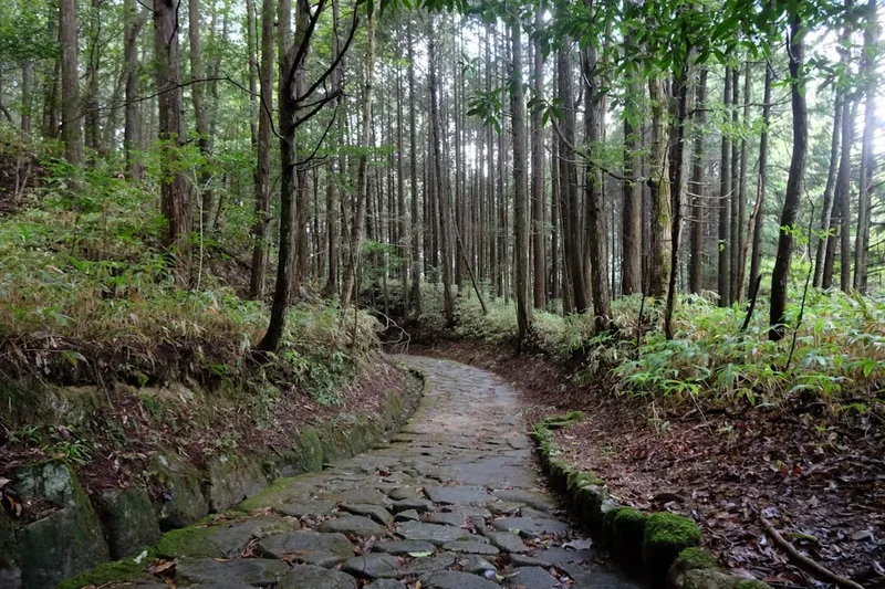
The Kumano Kodo represents the spiritual heart of Japan. Located south of Osaka and Kyoto in Wakayama Prefecture, the trail weaves through a landscape that has been considered the "Land of the Gods" since prehistoric times. Unlike many modern hiking trails designed for recreation, the Kumano Kodo was built for devotion. The path is characterised by "ishidatami"—ancient moss-covered stone steps—that were meticulously laid centuries ago to prevent erosion and provide a stable footing for pilgrims during the region’s frequent heavy rains. Walking this trail is an exercise in mindfulness, where the physical exertion of climbing steep mountain passes is balanced by the serene beauty of hidden "Oji" shrines and the soothing heat of natural hot springs (onsen) that dot the valleys.
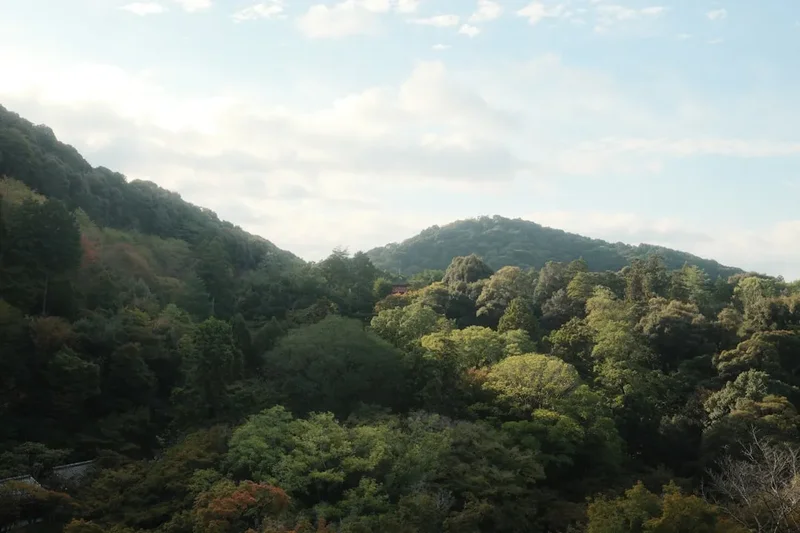
The Nakahechi route is the quintessential Kumano experience. It begins at Takijiri-oji, considered the entrance to the sacred realm, and climbs steadily into the mountains. The terrain is a relentless succession of ridges and valleys, meaning walkers will rarely find flat ground. You will traverse ancient forests of towering Japanese cedar (sugi) and cypress (hinoki), pass through tiny, isolated mountain hamlets where time seems to have slowed, and eventually reach the three Grand Shrines: Kumano Hongu Taisha, Kumano Hayatama Taisha, and Kumano Nachi Taisha. The journey culminates at the spectacular Nachi Falls, Japan’s tallest single-drop waterfall, which serves as a powerful symbol of the natural world’s divinity.
What sets the Kumano Kodo apart is the "Dual Pilgrimage" connection with the Camino de Santiago. This international partnership celebrates the shared human experience of the long-distance spiritual journey. Walkers who complete both trails can register as "Dual Pilgrims," receiving a special certificate and a unique stamp. This global recognition has transformed the Kumano Kodo from a hidden Japanese treasure into a world-class destination for those seeking a deeper connection between nature, history, and the self. Whether you are a seasoned trekker or a cultural enthusiast, the Kumano Kodo offers a rare opportunity to walk through a living museum of Japanese spirituality.
History and Cultural Context
The history of the Kumano Kodo is inextricably linked to the evolution of Japanese religion. Long before the arrival of Buddhism in the 6th century, the Kii Peninsula was a centre of nature worship. The towering trees, massive boulders, and thundering waterfalls were believed to be "kami"—divine spirits or deities. When Buddhism was introduced, it did not replace these indigenous beliefs but rather merged with them in a process known as "Shinbutsu-shugo." The Kumano deities came to be seen as manifestations of Buddhas and Bodhisattvas, making the region a unique site of syncretic worship where Shinto and Buddhist practices coexisted for over a millennium.
The pilgrimage reached its zenith during the Heian Period (794–1185). Retired emperors and members of the imperial court would undertake the arduous journey from the capital in Kyoto, a trek that could take up to 40 days. These royal processions were elaborate affairs, yet the pilgrims were required to observe strict rituals of purification, including frequent ablutions in cold mountain streams. As the centuries progressed, the trail became accessible to the samurai class and eventually to the general public. During the Edo Period (1603–1868), the sight of white-clad pilgrims snaking through the mountains was so common that it was described as "ants of Kumano" (Kumano-moude).
Along the trail, you will encounter numerous "Oji" shrines. These are sub-shrines of the Kumano Grand Shrines and served as important waypoints for pilgrims to offer prayers and perform rituals. There were once 99 Oji along the route, though many have fallen into ruin or been replaced by small stone markers. Each Oji has its own legend, often involving miraculous events or the protection of travellers. The preservation of these paths is a testament to the local communities who, despite the modernisation of Japan, recognised the cultural and spiritual value of the Kodo. In 2004, the "Sacred Sites and Pilgrimage Routes in the Kii Mountain Range" were inscribed as a UNESCO World Heritage site, ensuring that the footsteps of the ancient emperors would continue to be followed by modern seekers.
Want more background? Read extended notes on history and cultural context → Learn more
Seasonal Highlights and Weather Reality
The Kii Peninsula is one of the wettest regions in Japan, and weather plays a significant role in the Kumano Kodo experience. The mountains act as a barrier to moisture coming off the Pacific Ocean, resulting in frequent rainfall that feeds the lush, emerald-green forests and numerous waterfalls. While the trail is technically open year-round, the experience varies dramatically with the seasons.
Spring (April to May): This is arguably the most popular time to walk. The weather is generally mild, with temperatures ranging from 10°C to 20°C. In early April, cherry blossoms (sakura) bloom in the lower valleys, particularly around Tanabe and Nachi. The fresh green of new leaves creates a vibrant backdrop for the ancient stone paths. However, this is also the busiest season, and accommodation must be booked many months in advance.
Autumn (October to November): Autumn offers stable weather and crisp, clear air. The humidity of summer dissipates, making the steep climbs much more comfortable. The highlight of this season is the "koyo" (autumn foliage), as the maples and ginkgo trees turn brilliant shades of red and gold. This is a spectacular time for photography, especially around the Nachi Taisha shrine complex. Like spring, autumn is a peak period for walkers.
Summer (June to September): Summer in the Kii Mountains is hot, humid, and wet. June and early July mark the "tsuyu" (rainy season), where heavy, persistent downpours are common. Temperatures can soar above 30°C, and the humidity makes the physical exertion of the trail significantly more taxing. Leeches can also be an issue in the damp forest sections. However, the forests are at their most lush, and the mountain streams offer a refreshing respite.
Winter (December to March): Winter is the quietest time on the trail. While the coastal areas remain mild, the higher passes like Echizen-toge can experience snow and ice. Many small guesthouses close during the coldest months, and daylight hours are short. For experienced hikers seeking solitude and a different perspective on the landscape, winter can be rewarding, but proper cold-weather gear and traction devices for boots are essential.
Recommended Itinerary
5-Day Nakahechi Route Itinerary
Day 1: Takijiri-oji to Takahara
- Distance: 4 km
- Elevation gain: 430 m
- Time: 2–3 hours
- Start at Takijiri-oji, the traditional gateway to the sacred Kumano mountains
- Immediate steep climb on ancient stone steps through dense forest
- Pass the "Tsurugi-ishi" (Sword Rock) and "Chiba-no-iwaya" (Milk Rock)
- Arrive in the "Village in the Mist" (Takahara), offering stunning views of the Hatenashi mountain range
- Stay in a local minshuku to experience traditional Japanese hospitality
- A short but intense introduction to the trail's vertical nature
Day 2: Takahara to Tsugizakura-oji
- Distance: 13 km
- Elevation gain: 830 m
- Time: 5–7 hours
- Continue climbing through cedar and cypress plantations
- Pass through the ruins of several ancient tea houses (chaya)
- Reach the Gyubado-doji statue, a famous symbol of the Kumano Kodo
- Descend into the small settlement of Chikatsuyu for lunch by the river
- Final climb to Tsugizakura-oji, famous for its "Nonaka-no-Ipponsugi" (giant cedar trees)
- Visit the Toganoki-chaya, a restored traditional thatched-roof rest house
Day 3: Tsugizakura-oji to Kumano Hongu Taisha
- Distance: 21 km
- Elevation gain: 800 m
- Time: 7–9 hours
- The longest and most demanding day of the Nakahechi route
- Traverse several high passes, including Kobiro-toge and Hosshinmon-oji
- The section from Hosshinmon-oji to Hongu is particularly beautiful, passing through mountain hamlets and terraced tea fields
- Arrive at Kumano Hongu Taisha, the spiritual heart of the trail
- Visit Oyunohara, the original site of the shrine, marked by the world’s largest Torii gate (33.9 metres tall)
- Take a local bus to the nearby onsen villages of Yunomine or Kawayu for a well-earned soak
Day 4: Kumano Hongu Taisha to Koguchi
- Distance: 13 km
- Elevation gain: 670 m
- Time: 4–6 hours
- Take a bus to Ukegawa to begin the "Kogumo-tori-goe" section
- Steady climb to the Hyakken-gura viewpoint, offering one of the best panoramas of the "3,600 peaks of Kumano"
- Walk along high ridges through mossy forests
- Long descent into the quiet valley of Koguchi
- Stay at the Koguchi Shizen-no-Ie, a converted schoolhouse hostel, or a local minshuku
- Prepare for the final "body-breaking" climb the following day
Day 5: Koguchi to Kumano Nachi Taisha
- Distance: 14.5 km
- Elevation gain: 800 m gain, 900 m descent
- Time: 6–8 hours
- The "Ogumo-tori-goe" (Great Cloudless Pass) section
- Begin with the infamous "Dogiri-zaka" (Body-breaking Slope), a relentless 800 m ascent over 5 km
- Pass the Jizo-chaya remains and the Funatama-jinja shrine
- Reach the highest point of the Nakahechi route at Echizen-toge Pass
- Descend towards the coast, catching your first glimpse of the Pacific Ocean
- Arrive at Kumano Nachi Taisha and Seiganto-ji Temple
- Conclude the journey at the magnificent Nachi Falls, the 133-metre cascade that is the spiritual climax of the pilgrimage
Important Notes:
- Accommodation must be booked well in advance, especially in small villages like Koguchi and Takahara
- The trail is well-marked with wooden signposts in both Japanese and English
- Luggage transfer services are available between most stages, allowing you to walk with only a daypack
- Always carry a physical map and a bear bell
- Public buses connect major trailheads and onsen villages, providing flexibility if you need to skip a section
Planning and Bookings
Book Your Trip
Everything you need to plan your journey
Accommodation
Find places to stay near Osaka
Flights
Search flights to Osaka
Essential Preparation
The Kumano Kodo requires more logistical planning than a standard wilderness hike due to the reliance on small-scale village accommodation. The primary hub for planning is the Tanabe City Kumano Tourism Bureau, which operates an exceptional online booking system. Because the trail passes through remote mountain communities with limited bed capacity, it is common for the entire route to be fully booked six months in advance during the peak spring and autumn seasons.
Physical preparation is crucial. While the maximum elevation is not extreme, the cumulative elevation gain and the nature of the terrain—steep, uneven stone steps—can be punishing on the knees and calves. Training should include hill climbs and walking on uneven surfaces. Most walkers start their journey in Kii-Tanabe, which is easily reached from Osaka (Kansai International Airport) via the JR Kuroshio Limited Express train. It is highly recommended to spend your first night in Tanabe to collect maps, pilgrim stamps (collecting stamps in a "shuincho" book is a highlight), and attend a trail orientation briefing.
Trail Accommodation
Accommodation on the Kumano Kodo is a highlight of the cultural experience. There are no campsites on the Nakahechi route; instead, walkers stay in traditional Japanese lodgings.
Types of Accommodation:
- Minshuku: Family-run bed and breakfasts. These offer a glimpse into local life, with home-cooked meals (usually featuring local mountain vegetables and river fish) and tatami-mat rooms with futons.
- Ryokan: Traditional Japanese inns, often larger and more formal than minshuku, frequently featuring their own onsen (hot spring) baths.
- Shukubo: Temple lodgings, primarily found in areas like Koyasan or near the Grand Shrines. These offer a chance to participate in morning prayers and eat "shojin ryori" (Buddhist vegetarian cuisine).
Facilities and Etiquette:
- Most lodgings provide a "yukata" (light cotton robe) to wear after bathing and during dinner.
- Meals are typically included (breakfast and dinner), and many hosts will provide a "bento" (packed lunch) for the next day's walk if requested in advance.
- Bathrooms and toilets are often shared, even in nicer minshuku.
- Shoes must be removed at the entrance; slippers are provided for indoor use, but even these must be removed before stepping on tatami mats.
- Costs typically range from 10,000 to 15,000 Japanese Yen per person, per night, including two meals.
Required Gear
- Hiking Boots: Waterproof boots with good ankle support are essential. The ancient stone paths become extremely slippery when wet, and the descents are steep. Ensure they are well broken-in.
- Rain Gear: A high-quality waterproof jacket and overtrousers are mandatory. The Kii Peninsula is famous for sudden, heavy downpours.
- Walking Poles: Highly recommended to save your knees on the long "ishidatami" descents. Ensure they have rubber tips to protect the ancient stones.
- Backpack: A 30–40L pack is sufficient if using luggage transfer services. If carrying all gear, a 50–60L pack is required.
- Bear Bell: Black bears (kuma) inhabit these mountains. While sightings are rare, a bell is a standard safety precaution to alert them of your presence.
- Clothing: Moisture-wicking layers. Avoid cotton. Even in summer, a light fleece is useful for cool mountain evenings.
What to Bring
- Cash (Japanese Yen): Many minshuku and small shops in the mountains do not accept credit cards. Ensure you have enough cash for your entire trek before leaving Tanabe.
- Pilgrim Stamp Book (Shuincho): Available at Takijiri-oji or Tanabe. Collecting stamps at shrines and waypoints is a cherished tradition.
- Portable Power Bank: While most lodgings have power, your phone battery will drain quickly using GPS and taking photos.
- Personal First Aid: Blister pads (Compeed), antiseptic cream, and any personal medications.
- Sun Protection: Hat, sunglasses, and sunscreen, as some sections pass through open ridges and tea fields.
- Water Bottle/Bladder: At least 2 litres of capacity. While there are vending machines in some villages, long stretches have no water access.
- Small Towel: Useful for the frequent "ashiyu" (foot baths) found in onsen villages.
Permits
One of the most appealing aspects of the Kumano Kodo is that no official permits or fees are required to walk the trails. The paths are public and open to all. However, the "permit" in a practical sense is your accommodation booking. Because wild camping is strictly prohibited and there are no mountain huts (yamagoya) like those in the Japanese Alps, you cannot legally or safely walk the trail without confirmed nightly accommodation.
Dual Pilgrim Program:
If you have previously walked the Camino de Santiago (specifically the last 100 km on foot or 200 km by bicycle), you are eligible to become a "Dual Pilgrim." To complete the Kumano Kodo portion, you must walk one of the following:
- Takijiri-oji to Kumano Hongu Taisha (38 km)
- Koyasan to Kumano Hongu Taisha (70 km)
- Ise-ji route (160 km)
- Or visit all three Kumano Grand Shrines on foot
Upon completion, you can present your credential at the Kumano Hongu Heritage Centre to receive a beautiful handmade washi paper certificate and be featured on the official Dual Pilgrim website.
Booking Strategy:
- Window: Aim to book 5–6 months in advance for April, May, October, and November.
- Bureau: Use the Tanabe City Kumano Tourism Bureau website. It is the only centralised system for the small family-run guesthouses.
- Flexibility: If the Nakahechi is full, consider the Kohechi (more rugged) or the Ise-ji (coastal) routes, which are often less crowded.
Other Activities in the Area
The Kii Peninsula offers a wealth of cultural and natural attractions beyond the main trail:
- Yunomine Onsen: One of the oldest hot spring villages in Japan. Visit "Tsuboyu," a tiny stone cabin bath that is the only UNESCO World Heritage-listed hot spring you can actually bathe in. It is said to change colour seven times a day.
- Kawayu Onsen: Located on the Oto River, where hot thermal water seeps through the riverbed. In winter, the "Sennin-furo" (a massive outdoor bath) is created by digging into the riverbank.
- Traditional Boat Tour: Take a flat-bottomed wooden boat tour down the Kumano-gawa River from near Hongu to Hayatama Taisha in Shingu, mimicking the route taken by ancient pilgrims.
- Koyasan: The centre of Shingon Buddhism, located north of the Kumano Kodo. Stay in a temple (shukubo), explore the vast Okunoin cemetery, and witness the morning fire ceremonies.
- Whale Watching in Katsuura: The coastal town of Nachi-Katsuura is famous for its tuna market and seasonal whale and dolphin watching tours in the Pacific.
- Daimon-zaka: A stunning 600-metre cobblestone staircase lined with centuries-old cedar trees, leading up to Nachi Taisha. You can rent Heian-period costumes here for a unique photo opportunity.
Safety and Conditions
Terrain and Physicality: The Kumano Kodo is a mountain trek. The most common injuries are twisted ankles and knee strain caused by the uneven "ishidatami" stones. These stones are beautiful but can be treacherous when covered in moss or wet from rain. Use walking poles and take your time on descents. The "Dogiri-zaka" (Body-breaking Slope) on the final day is a genuine physical challenge that should not be underestimated.
Wildlife:
- Bears: Asian Black Bears are present. They are generally shy but can be dangerous if surprised, especially mothers with cubs. Carry a bear bell and avoid hiking in the dark.
- Hornets: The Japanese Giant Hornet (suzumebachi) is active in late summer and autumn. They are aggressive and their sting is serious. If you see one, move away slowly and quietly; do not swat at it.
- Mamushi Snakes: A venomous pit viper found in Japan. They are well-camouflaged; stay on the path and watch where you step in tall grass.
- Leeches: Common in the damp forests during the rainy season (June–August). Wear long socks and use salt or repellent.
Weather and Navigation: While the trail is well-marked, mountain weather can change rapidly. Fog can reduce visibility to a few metres on the high passes. Always carry a physical map and a compass or a reliable GPS app with offline maps (like Yamap or AllTrails). If you are caught in a heavy storm, seek shelter in one of the many wooden rest huts (azumaya) along the route rather than attempting to cross high ridges.
Emergency Contacts: The emergency number in Japan is 119 for fire and ambulance, and 110 for police. Mobile signal is generally good on ridges but non-existent in deep valleys. It is wise to inform your accommodation host of your intended route and estimated arrival time each day.
Side Trips and Points of Interest
Oyunohara: Located a short walk from Kumano Hongu Taisha, this is the original site of the Grand Shrine before it was partially destroyed by a flood in 1889. Today, it is a vast, peaceful clearing dominated by the "Otorii"—the largest shrine gate in the world. Standing at nearly 34 metres tall, it marks the entrance to the sacred ground where the gods are said to have descended. It is a place of immense spiritual energy and a perfect spot for reflection.
Tsuboyu Onsen: In the village of Yunomine, this tiny bath is steeped in legend. It is central to the story of Oguri Hangan, a nobleman who was said to have been cured of a terminal illness by bathing in its waters. It is the only hot spring in the world where you can bathe that is part of a UNESCO World Heritage site. Private 30-minute sessions are available on a first-come, first-served basis.
Nachi Falls (Nachi-no-Otaki): At 133 metres high and 13 metres wide, this is Japan’s tallest waterfall with a single uninterrupted drop. It is not just a natural wonder but a "kami" (deity) itself. The sight of the white water plunging against the backdrop of the primeval forest, with the three-story red pagoda of Seiganto-ji Temple in the foreground, is one of the most iconic images of Japan.
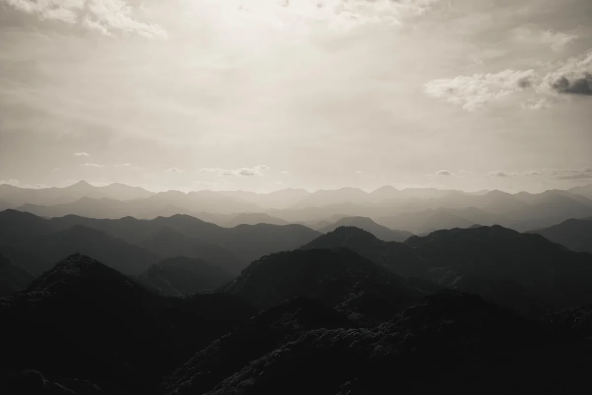
Hyakken-gura: On the Kogumo-tori-goe section (Day 4), this viewpoint offers a breathtaking 360-degree view of the Kii Mountains. On a clear day, you can see the "3,600 peaks of Kumano" rolling away like waves to the horizon. It is a powerful reminder of the scale and isolation of the wilderness you are traversing.
Leave No Trace
The Kumano Kodo is a sacred landscape. For over a thousand years, it has been maintained by the devotion of pilgrims and the hard work of local villagers. As a modern walker, you are a guest in this spiritual space, and your conduct should reflect that respect.
Principles for the Kumano Kodo:
- Respect the Stones: The "ishidatami" paths are ancient. Avoid using metal-tipped walking poles without rubber protectors, as they chip and damage the stones.
- Carry Out All Trash: There are no rubbish bins on the trail or at the Oji shrines. You must carry all your waste, including fruit peels and tissues, back to your accommodation or to a town.
- Stay on the Path: The forest floor is home to rare mosses and delicate ferns. Straying from the path causes erosion and damages the ecosystem.
- No Wild Camping: Camping is strictly prohibited along the entire Nakahechi route. This is to protect the environment and respect the local communities.
- Shrine Etiquette: When passing through a Torii gate, it is customary to bow slightly. Do not walk in the centre of the path leading to a shrine, as this is reserved for the deities. If you use the "chozuya" (purification fountain), follow the correct procedure: wash your left hand, then your right, then rinse your mouth.
- Quiet Reflection: Many people walk the Kumano Kodo for spiritual reasons. Keep noise to a minimum and avoid playing music through speakers.