Karhunkierros Trail - The Legendary Bear's Ring
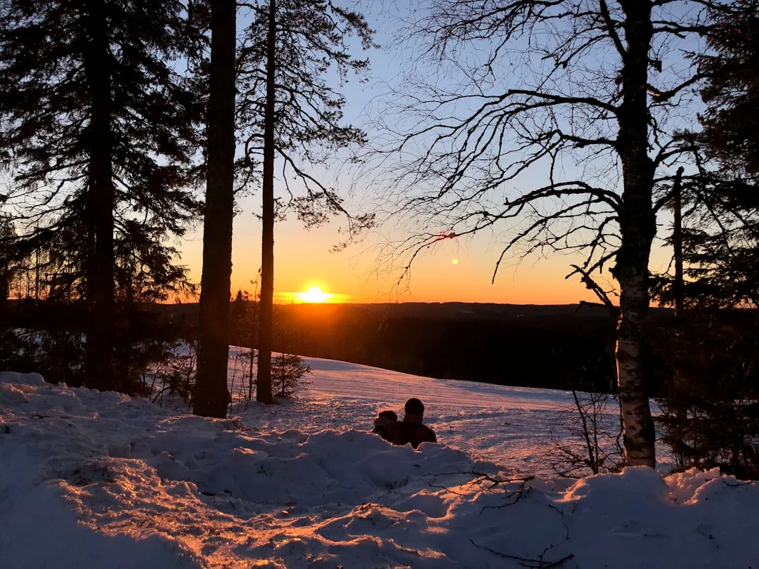
The Karhunkierros Trail, known internationally as the "Bear's Trail" or "The Bear's Ring," is Finland's most celebrated and storied hiking route. Stretching 82 kilometres through the wild, rugged landscapes of Oulanka National Park and the surrounding fells of Kuusamo, this trail offers an unparalleled immersion into the taiga forest of the Arctic Circle. Despite its name, the trail is not a loop but a linear journey that traverses a landscape defined by roaring white-water rapids, sheer dolomite cliffs, ancient pine forests, and expansive mires. It is a route that captures the very essence of the Finnish wilderness—a place where the silence of the northern woods is broken only by the thunder of waterfalls and the call of the Siberian jay. Whether you are navigating the iconic hanging bridges over the Oulanka River or standing atop the windswept summit of Valtavaara, the Karhunkierros provides a profound sense of isolation and natural majesty that has drawn hikers for over seven decades.
- Distance: 82.0 km one-way
- Duration: 4–7 days
- Season: June to September (best for hiking); January to April (winter trekking/skiing)
- Accommodation: Free wilderness huts and designated campsites
- Highest point: Valtavaara Fell (492 m)
- Difficulty: Moderate (well-marked but involves significant elevation changes in the southern section)
- Direction: Usually walked North to South (Hautajärvi to Ruka)
Overview
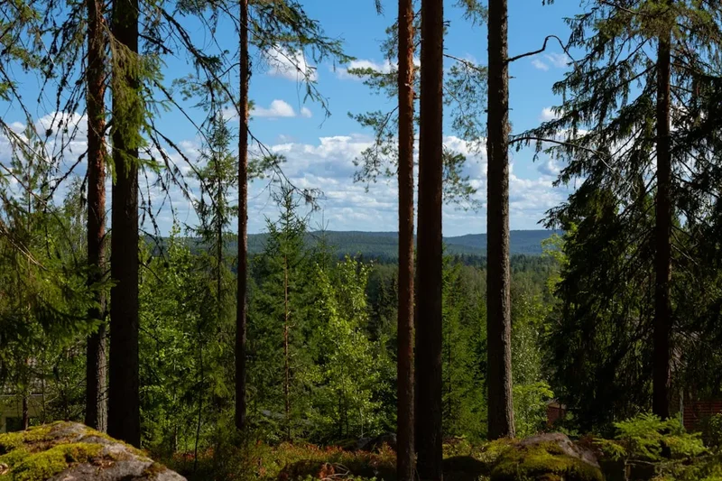
The Karhunkierros Trail is more than just a walk; it is a rite of passage for Finnish outdoor enthusiasts and a premier destination for international trekkers seeking the raw beauty of the North. The trail is situated in the Koillismaa region, right on the edge of the Arctic Circle, where the landscape is a dramatic transition between the boreal forests of the south and the treeless fells of Lapland. The route is famous for its diversity: the northern section is characterised by the wide, meandering Oulanka River and its dramatic canyons, while the southern section transforms into a challenging series of steep climbs and descents over the ancient fells of the Kuusamo region.
One of the defining features of the Karhunkierros is its accessibility to pristine water. The trail follows the Oulanka and Kitka rivers for much of its length, providing hikers with a constant soundtrack of flowing water. The geological history of the area is visible in the exposed dolomite rock formations, which support a unique microclimate and rare plant species found nowhere else in Finland. The trail is also famous for its hanging bridges—narrow, swaying structures that allow hikers to cross turbulent rapids with a thrilling perspective of the river below. These bridges are not merely functional; they are iconic landmarks of the Karhunkierros experience.
While the trail is well-maintained and clearly marked with orange paint on trees, it should not be underestimated. The total elevation gain of approximately 1,500 metres is concentrated heavily in the final 20 kilometres, where the trail summits several fells in quick succession. This "sting in the tail" requires good physical fitness and steady legs. However, the reward for these climbs is a series of breathtaking panoramas that stretch across the border into Russia, over a sea of endless green forest and shimmering blue lakes. The Karhunkierros offers a perfect balance of challenge and infrastructure, with a network of free wilderness huts that provide a unique cultural experience of Finnish "Everyman's Right" and communal outdoor living.
History and Cultural Context
The history of the Karhunkierros Trail is deeply intertwined with the establishment of Oulanka National Park in 1956. However, the route itself predates the park's formal status. The first sections of the trail were marked in the 1950s as a way to encourage Finns to explore the remote northeastern wilderness. The name "Karhunkierros" (Bear's Ring) is somewhat of a misnomer today, as the modern trail is linear, but the original vision included a more circular route. The "Bear" in the name pays homage to the brown bears that inhabit these forests, though they are notoriously shy and rarely seen by hikers.
The region has a long history of human activity, primarily related to reindeer husbandry and logging. Before the national park was established, the Oulanka River was a vital artery for timber floating. Loggers would navigate the treacherous rapids to move timber from the deep forests to the mills. You can still see remnants of this era in the old log-cabin-style wilderness huts, some of which were originally built as shelters for forest workers or reindeer herders. The area also holds significant wartime history; the proximity to the Russian border meant that this region was a sensitive zone during the Second World War, and the landscape still bears the quiet scars of that era in the form of old border markers and overgrown trenches.
Culturally, the Karhunkierros represents the Finnish concept of "Sisu"—a combination of grit, resilience, and a deep-seated love for the forest. For many Finns, completing the "Bear's Trail" is a significant milestone. The trail also passes through areas of spiritual importance to the indigenous Sámi people, who historically moved through these valleys following reindeer migrations. Today, the trail is managed by Metsähallitus (the Finnish Forest Administration), which ensures that the delicate Arctic ecosystem is protected while remaining open to the public. The preservation of the Oulanka River as a free-flowing waterway, saved from hydroelectric development in the mid-20th century, remains one of Finland's greatest conservation victories.
Want more background? Read extended notes on history and cultural context → Learn more
Seasonal Highlights and Weather Reality
The Karhunkierros Trail experiences the full intensity of the four seasons, each offering a vastly different hiking experience. Choosing the right time to visit is crucial for managing expectations regarding weather, insects, and trail conditions.
Summer (June to August): This is the most popular time to hike. June brings the phenomenon of the Midnight Sun, where the sun never fully sets, allowing for 24-hour hiking if desired. However, June and July are also the peak of the "Räkkä" season—the emergence of billions of mosquitoes, blackflies, and midges. Without proper protection, the insects can be overwhelming. August is often considered the "sweet spot," as the insect numbers begin to dwindle, the weather remains warm (15–25°C), and the wild berries (bilberries and cloudberries) are ripe for picking.
Autumn (September): Many experienced hikers consider September the best month for the Karhunkierros. This is the season of "Ruska," when the deciduous trees and ground vegetation turn vibrant shades of gold, orange, and crimson. The air is crisp and cool, the insects are gone, and the northern lights (Aurora Borealis) begin to dance in the night sky. Night-time temperatures can drop below freezing, so a warm sleeping bag is essential.
Winter (January to April): The trail transforms into a challenging winter expedition route. The path is not maintained for walking in winter; instead, it is tackled by experienced trekkers on backcountry skis or snowshoes. Temperatures can plummet to -30°C or lower. The wilderness huts remain open, but reaching them requires significant effort through deep snow. This is a world of blue twilight, frozen waterfalls, and absolute silence.
Spring (May): This is the "shoulder season" to avoid. The snow melt (flood season) turns the trail into a muddy morass, and the rivers swell to dangerous levels. Many sections of the trail may be underwater, and the risk of damaging the fragile ground vegetation is high. Most hikers wait until at least early June for the trails to dry out.
Recommended Itinerary
5-Day Karhunkierros Itinerary (North to South)
Day 1: Hautajärvi to Savilampi
- Distance: 15 km
- Elevation gain: 150 m
- Time: 4–5 hours
- Start at the Hautajärvi Visitor Centre (Arctic Circle crossing)
- Easy walking through pine forests and over mire boardwalks
- Cross the Koutajoki river via bridge
- Arrive at Savilampi wilderness hut, situated near the dramatic Oulanka Canyon
- Take a short evening walk to the Oulanka Canyon lookout for spectacular views of the vertical rock walls
- The terrain is relatively flat, making it an ideal warm-up day
Day 2: Savilampi to Taivalköngäs
- Distance: 13 km
- Elevation gain: 200 m
- Time: 4–5 hours
- Follow the Oulanka River downstream through lush riverside meadows
- Pass through the "Ristikallio" area if taking the alternative northern start (though this itinerary follows the main Hautajärvi route)
- The trail becomes more rugged with roots and stones
- Arrive at Taivalköngäs, where the river splits into three channels
- Cross the iconic hanging bridges over the turbulent rapids
- Stay at the Taivalköngäs wilderness hut, located on an island between the rapids
Day 3: Taivalköngäs to Jussinkämppä
- Distance: 19 km
- Elevation gain: 250 m
- Time: 6–7 hours
- Pass the Oulanka Visitor Centre (Kiutaköngäs rapids are a must-see 1 km detour)
- The trail follows the wide, sandy banks of the Oulanka River
- Walk through ancient forests with massive pine trees
- The path is relatively easy but the distance makes it a long day
- Arrive at Jussinkämppä wilderness hut, situated on the shore of Lake Kulmakkojärvi
- This is a classic spot for a wilderness swim in the clear lake water
Day 4: Jussinkämppä to Siilastupa (Juuma)
- Distance: 14 km
- Elevation gain: 300 m
- Time: 5–6 hours
- The trail leaves the Oulanka River and heads towards the Kitka River
- Pass the spectacular Jyrävä waterfall, one of the most powerful in Finland
- Enter the "Pieni Karhunkierros" (Small Bear's Trail) section, which is more crowded but very scenic
- Cross several more hanging bridges over the Kitka River
- Arrive at Siilastupa wilderness hut near the village of Juuma
- This area has excellent facilities and is a popular spot for a mid-trip rest
Day 5: Siilastupa to Ruka
- Distance: 21 km
- Elevation gain: 600 m
- Time: 7–9 hours
- The most challenging day of the trek with significant elevation changes
- The trail climbs out of the river valleys and onto the fells
- Summit Konttainen fell for views over the surrounding lakes
- The final climb is up Valtavaara fell (492 m), the highest point of the trail
- Pass the Valtavaara day hut (an old fire lookout tower)
- Descend into the Ruka Ski Resort to the finish line
- Celebrate with a meal and a sauna in Ruka village
Important Notes:
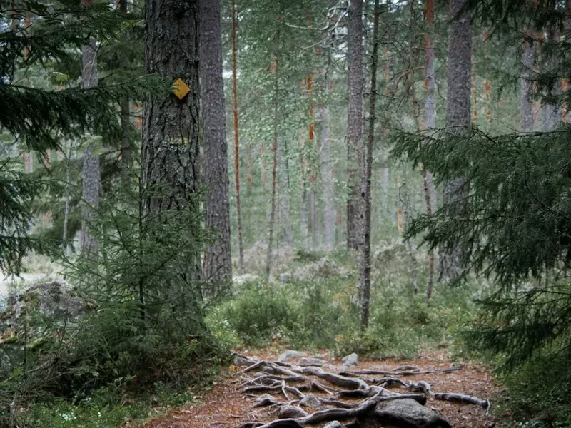
- The trail is marked with orange paint on trees and wooden poles
- Water is plentiful from rivers and lakes, but treatment is recommended
- Wilderness huts are free but can be crowded; always carry a tent as a backup
- The Karhunkierros bus runs between Ruka, Kuusamo, and the trailheads
- Mobile phone signal is generally good but can be spotty in deep canyons
Planning and Bookings
Book Your Trip
Everything you need to plan your journey
Accommodation
Find places to stay near Kuusamo
Flights
Search flights to Kuusamo
Essential Preparation
Planning for the Karhunkierros requires coordinating transport to a remote part of northeastern Finland. The closest major town is Kuusamo, which has an airport (KUS) with regular flights from Helsinki. From Kuusamo, the "Karhunkierros Bus" is the primary lifeline for hikers, running seasonally between the airport, the town centre, Ruka, and the trailheads at Hautajärvi and Juuma. It is highly recommended to leave your vehicle in Ruka (the finish point) and take the bus to the start at Hautajärvi to avoid logistical headaches at the end of the trek.
Physical preparation is important, particularly for the final 20 kilometres. While the northern sections are relatively gentle, the southern fells involve steep, rocky ascents and descents that can be taxing on the knees. Hikers should be comfortable carrying a full multi-day pack (typically 12–18 kg) over varied terrain. There are no shops along the trail once you leave the trailheads, so all food must be carried from the start, although the Oulanka Visitor Centre (midway) has a small café with limited snacks.
Trail Accommodation
The Karhunkierros is famous for its network of free wilderness huts (autiotupa). These are basic log cabins maintained by the state. They operate on a first-come, first-served basis, with a unique Finnish etiquette: the last person to arrive always has the right to a space, meaning those already inside must make room, even if it means sleeping on the floor.
Hut Facilities:
- Wooden sleeping platforms (no mattresses provided)
- Wood-burning stove for heating and drying clothes
- Gas stove for cooking (in most, but not all, huts)
- Dry toilets (outside)
- Woodshed with firewood and an axe
- Basic table and benches
- Nearby water source (river or lake)
What Huts Don't Provide:
- Bedding, pillows, or mattresses
- Electricity or lighting (bring candles or a head torch)
- Food or waste disposal (you must pack out all rubbish)
- Running water or showers
Camping: Camping is permitted in the immediate vicinity of the wilderness huts and at designated campfire sites. In Oulanka National Park, camping outside these designated areas is strictly prohibited to protect the fragile environment. Most hikers carry a lightweight tent or tarp even if they plan to stay in huts, as the cabins can become full during the peak season (July and September).
Required Gear
- Hiking Boots: Sturdy, waterproof boots with good ankle support are essential. The trail has many sections with exposed roots and slippery rocks.
- Rain Gear: A high-quality waterproof jacket and trousers. Arctic weather can change rapidly, and heavy rain is common.
- Backpack: A 50–70 litre pack with a rain cover. Ensure it is properly fitted for carrying weight over multiple days.
- Sleeping System: A 3-season sleeping bag (comfort rating 0°C to -5°C for autumn) and a lightweight sleeping mat.
- Navigation: While the trail is well-marked, a physical map (Rukatunturi-Oulanka 1:50,000) and a compass are mandatory safety items.
- First Aid: Blister plasters (Compeed), antiseptic wipes, painkillers, and any personal medications.
- Lighting: A head torch with spare batteries, especially from August onwards when the nights begin to darken.
What to Bring
- Food: Lightweight, high-calorie dehydrated meals, porridge, nuts, chocolate, and coffee/tea. Plan for at least one extra day of rations.
- Water Treatment: While many locals drink directly from the streams, a filter or purification tablets are recommended to avoid stomach issues.
- Insect Repellent: Essential from June to early August. Look for products with high DEET concentration or "Thermacell" devices for camp use. A head net is highly recommended.
- Cooking Equipment: A lightweight stove (Trangia or Jetboil), fuel, a pot, and a "kuksa" (traditional wooden cup) or plastic mug and spoon.
- Toiletries: Biodegradable soap, toothbrush, and a small trowel (though dry toilets are available at all campsites).
- Clothing Layers: Merino wool base layers, a fleece or down mid-layer, and moisture-wicking hiking socks (plus spares).
Permits
One of the greatest appeals of the Karhunkierros Trail is that no permits or fees are required to hike the trail or stay in the wilderness huts. This is a reflection of Finland's "Everyman's Right" (Jokamiehenoikeus), which allows anyone to roam freely in nature. However, because the trail passes through a National Park, there are specific regulations that must be followed to ensure the area's conservation.
Registration and Regulations:
- No Booking Required: You cannot book the free wilderness huts. They are open to everyone. There are a few "reservable huts" (varaustupa) in the region, but these are not located directly on the main Karhunkierros route.
- Group Size: Large groups (over 10 people) are encouraged to notify the Oulanka Visitor Centre in advance and should always use tents rather than occupying the entire space in a wilderness hut.
- Fire Policy: Campfires are only permitted at designated campfire sites using the firewood provided. During forest fire warnings (common in dry summers), all open fires are strictly prohibited, even at designated sites. You may still use a gas stove.
- Fishing: If you plan to fish in the Oulanka or Kitka rivers, you must purchase a national fisheries management fee and a local Oulanka fishing permit. These can be bought online or at the visitor centres.
Visitor Centres: It is highly recommended to stop at the Hautajärvi Visitor Centre (at the start) or the Oulanka Visitor Centre (midway). The staff provide up-to-date information on trail conditions, river levels, and weather forecasts. You can also purchase maps and basic supplies here.
Other Activities in the Area
The Kuusamo and Oulanka region is a hub for outdoor adventure. If you have extra time before or after your hike, consider these activities:
- Canoeing and Rafting: The Oulanka River is one of Finland's best routes for paddling. You can rent canoes for a gentle multi-day trip through the park's lower reaches or join a guided white-water rafting excursion on the Kitka River's famous rapids.
- Pieni Karhunkierros: If 82 km is too long, this 12 km "Small Bear's Trail" starting from Juuma offers a "best-of" experience, including the Jyrävä waterfall and several hanging bridges. It can be done in 4–6 hours.
- Riisitunturi National Park: Located about an hour from Ruka, this park is famous for its "tykky" (heavy rimed snow) in winter and expansive hill-top mires in summer. The views from the summit are some of the best in Finland.
- Bear Watching: Several operators near the Russian border offer safe, guided bear-watching nights from hides. This is the best way to actually see the animal the trail is named after.
- Ruka Village: A vibrant alpine-style village with excellent restaurants, saunas, and a summer bobsleigh track. In winter, it is one of Finland's premier ski resorts.
- Husky and Reindeer Farm Visits: Learn about the traditional Arctic way of life and meet the animals that are central to northern culture.
Safety and Conditions
Pre-Departure Checks:
- Check the weather forecast via the Finnish Meteorological Institute (Ilmatieteen laitos). Arctic weather can be unpredictable.
- Visit the "Nationalparks.fi" website for current trail alerts, such as bridge maintenance or storm damage.
- Ensure someone knows your planned itinerary and expected finish date.
- Check for forest fire warnings; these are strictly enforced and affect your ability to cook over wood fires.
Terrain Hazards: The Karhunkierros is not technically difficult, but it is physically demanding. The most common injuries are twisted ankles and knee strain, particularly on the rocky descents of the southern fells. The boardwalks over mires can be extremely slippery when wet; walk with caution. The hanging bridges have weight limits (usually 1–3 people at a time); always follow the posted instructions to avoid excessive swaying or structural stress.
Wildlife: While brown bears live in the area, they are extremely wary of humans. To avoid a surprise encounter, make noise (talk or whistle) when moving through dense brush. Store your food securely inside the huts or hang it from a tree if camping. The most significant "dangerous" wildlife are actually ticks (in the long grass) and the sheer volume of biting insects, which can cause allergic reactions or significant distress if you are unprepared.
Water Safety: The rivers in Oulanka are powerful. Never attempt to ford the Oulanka or Kitka rivers; always use the provided bridges. During the spring melt, river levels can rise rapidly, making some low-lying sections of the trail muddy or temporarily impassable.
Emergency Services: The universal emergency number in Finland is 112. It is recommended to download the "112 Suomi" app, which automatically sends your GPS coordinates to emergency services if you call through the app. While there is mobile coverage on most of the trail, the deep canyons can create dead zones.
Side Trips and Points of Interest
Kiutaköngäs Rapids: Located just 1 km from the Oulanka Visitor Centre, these are perhaps the most famous rapids in Finland. The river squeezes through a narrow gorge of red dolomite rock, creating a thunderous display of white water. The contrast between the red stone and the dark water is a photographer's dream. It is an easy detour and should not be missed.
Ristikallio Cliffs: If you take the alternative northern start from the Ristikallio parking area, you will pass these impressive cliffs overlooking the Aventojoki River. The view from the top of the cliffs across the vast, untouched forest towards the horizon is one of the most iconic vistas in the region.
Valtavaara Fire Lookout: On the final day, the trail passes a small wooden hut on the summit of Valtavaara fell. This was originally a fire lookout tower. It is now a day-trip hut where you can take shelter from the wind. The 360-degree views from here are the highest on the trail, offering a clear view of the Ruka ski jumps and the vast wilderness stretching into Russia.
Jyrävä Waterfall: Located near Juuma, this 9-metre vertical drop is one of the most powerful waterfalls in the country. The sound is deafening, and the mist from the falls creates a lush, mossy microclimate around the base. There is a well-maintained viewing platform that allows you to get very close to the brink of the falls.
Oulanka Canyon: Near the Savilampi hut at the northern end of the trail, the Oulanka River has carved a deep, narrow canyon into the bedrock. A short loop trail leads to the edge of the canyon, where vertical walls drop straight into the dark water below. It is a starkly beautiful and somewhat intimidating landscape.
Leave No Trace
Oulanka National Park is a sanctuary for rare Arctic and boreal species. The ecosystem here is fragile; the growing season is short, and recovery from human impact can take decades. Hikers are expected to follow the principles of "Litter-Free Hiking."
Your responsibility as a walker:
- Pack It In, Pack It Out: There are no rubbish bins on the trail or at the wilderness huts. You must carry all your waste back to the trailheads. This includes food scraps and organic waste, which do not decompose quickly in the cold climate.
- Stay on the Path: Use the provided boardwalks when crossing mires. Stepping off the path crushes delicate mosses and peat, leading to erosion and the widening of the trail.
- Respect the Huts: Leave the wilderness huts cleaner than you found them. Sweep the floor, replenish the firewood for the next guest, and ensure the gas is turned off.
- Water Protection: Do not wash dishes or yourself directly in the lakes or rivers. Carry water 30 metres away from the source and use biodegradable soap.
- Fire Safety: Only use designated fire pits. Use wood sparingly, as it must be transported to the sites by park rangers. Never leave a fire unattended and ensure it is completely extinguished with water before leaving.
- Wildlife: Observe animals from a distance. Do not feed birds or squirrels, as this habituates them to humans and can be harmful to their health.
By following these principles, you ensure that the Karhunkierros remains a pristine wilderness for the next generation of hikers. The goal is to leave no sign of your passage.