John Muir Trail - A Sierra Nevada Odyssey
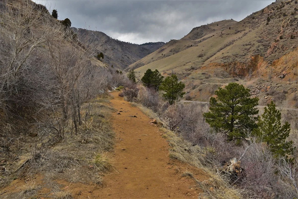
The John Muir Trail (JMT) is an iconic long-distance hiking route traversing the Sierra Nevada mountain range in California, USA. Stretching approximately 338.6 kilometres (338.6 km) from Yosemite Valley to Mount Whitney, it is a pilgrimage for many hikers seeking to experience the raw, untamed beauty of the High Sierra. Named after the renowned naturalist and conservationist John Muir, the trail winds through some of the most spectacular alpine scenery in North America, including granite peaks, pristine alpine lakes, vast meadows, and ancient forests. The JMT is renowned for its challenging terrain, breathtaking vistas, and the profound sense of accomplishment it offers to those who complete it.
- Distance: 338.6 km one-way
- Elevation Gain: Approximately 14,000 m (14,020 m)
- Duration: 3–4 weeks
- Difficulty: Very Challenging
- Best Time: Late July to early September (snow-free conditions)
- Trailhead Access: Yosemite Valley (Happy Isles) to Mount Whitney (Whitney Portal)
- Permits: Required for overnight stays and day use in Yosemite and Sequoia/Kings Canyon National Parks
Overview
The John Muir Trail is more than just a hike; it's an immersion into the heart of the Sierra Nevada. Beginning at the iconic Happy Isles trailhead in Yosemite Valley, the trail gradually ascends, leading hikers through the grandeur of Yosemite National Park, past the dramatic granite domes and high alpine lakes of the Ansel Adams Wilderness, through the majestic peaks and deep canyons of Kings Canyon National Park, and finally culminating at the summit of Mount Whitney, the highest point in the contiguous United States. The trail is a masterpiece of natural design, weaving through diverse ecosystems, from the lush forests of the lower elevations to the stark, windswept alpine tundra above the treeline.
Each section of the JMT offers a unique character. Yosemite's high country is a realm of granite domes, cascading waterfalls, and vast, open meadows. The Ansel Adams Wilderness presents a more rugged, remote feel, with numerous pristine lakes and challenging passes. Kings Canyon National Park boasts some of the most dramatic scenery, including the Great Western Divide and the deep, glacially carved canyons. Finally, the ascent of Mount Whitney is a fitting climax, a demanding climb rewarded with unparalleled panoramic views of the Sierra Nevada.
The JMT is a testament to the vision of John Muir, who advocated tirelessly for the preservation of these wild lands. His legacy is palpable along the trail, inspiring awe and a deep appreciation for the natural world. While the trail is well-marked, it is a wilderness experience, demanding self-sufficiency, preparedness, and respect for the environment. The elevation gain is substantial, with numerous passes exceeding 3,000 metres, making it a physically demanding undertaking that requires significant training and acclimatisation.
History and Cultural Context
The John Muir Trail's origins lie in the early 20th century, a period of burgeoning conservationist sentiment in the United States. John Muir, a Scottish-born naturalist, explorer, and writer, was a pivotal figure in the establishment of national parks, most notably Yosemite. His passionate advocacy for the preservation of wilderness inspired a generation of hikers and conservationists.
The concept of a trail connecting Yosemite to Mount Whitney began to take shape in the early 1900s. Muir himself envisioned a continuous trail through the Sierra Nevada. In 1915, the Sierra Club, under the leadership of William Colby, began the arduous task of surveying and constructing the trail. The initial sections were completed in stages, with significant contributions from the Civilian Conservation Corps (CCC) in the 1930s. The trail was officially completed in 1938, though it has undergone numerous improvements and reroutes over the decades to enhance safety and sustainability.
The trail's route was carefully chosen to showcase the most spectacular and ecologically significant areas of the Sierra Nevada, following a path that Muir himself had explored and written about extensively. It passes through lands that were later designated as national forests and national parks, including Yosemite National Park, Sierra National Forest, and Kings Canyon National Park. The trail's construction and ongoing maintenance are a collaborative effort involving federal agencies, the Sierra Club, and countless volunteers, reflecting a continued commitment to Muir's vision of preserving these wild places for public enjoyment and inspiration.
Seasonal Highlights and Weather Reality
The primary hiking season for the John Muir Trail is dictated by snow conditions. The High Sierra is a land of extreme weather, and the JMT is only truly accessible and safe for most hikers from late July through early September. During this window, the majority of the snow has melted from the higher passes, and the weather is generally more stable.
Late July to Early September: This is the peak season. Days are typically warm and sunny, with cool nights. Afternoon thunderstorms are common, so starting hikes early in the day is crucial. Water sources are generally abundant, though some smaller streams may begin to dry up by late August. This period offers the best chance for snow-free passage over the higher passes.
Early July: Some years, early July can still see significant snowpack, especially on the northern aspects of passes. This can make navigation difficult and require snow travel skills and equipment (ice axe, crampons). Water crossings can also be hazardous due to high snowmelt runoff.
Mid-September to October: The weather can still be pleasant in early autumn, with fewer crowds. However, the risk of early snowstorms increases significantly. Temperatures drop, and daylight hours shorten. Some services may begin to close down in the gateway towns.
Winter (November to June): The JMT is largely impassable and extremely dangerous during winter months due to heavy snowfall, extreme cold, and avalanche risk. Only highly experienced winter mountaineers with appropriate gear and skills should consider attempting any section of the trail during this period.
Weather Considerations: The Sierra Nevada is known for its rapidly changing weather. Hikers must be prepared for a wide range of conditions, including intense sun, high winds, rain, hail, and even snow, regardless of the season. Afternoon thunderstorms are a daily occurrence during the summer months and can bring lightning, heavy rain, and flash floods.
Recommended Itinerary
John Muir Trail: A Typical 3-Week Itinerary (Southbound)
Note: This is a sample itinerary. Actual pace and daily distances will vary based on individual fitness, acclimatisation, weather, and resupply points.
Week 1: Yosemite Valley to Reds Meadow (near Mammoth Lakes)
- Day 1: Happy Isles (Yosemite Valley) to Little Yosemite Valley
- Distance: 8.7 km
- Elevation Gain: 610 m
- Time: 3–4 hours
- Start at Happy Isles, ascend past Vernal Fall and Nevada Fall via the Mist Trail or John Muir Trail
- Camp in Little Yosemite Valley (permit required)
- Day 2: Little Yosemite Valley to Sunrise Creek
- Distance: 16.1 km
- Elevation Gain: 914 m
- Time: 6–8 hours
- Continue ascent towards Sunrise High Sierra Camp area
- Camp near Sunrise Creek
- Day 3: Sunrise Creek to May Lake
- Distance: 14.5 km
- Elevation Gain: 457 m
- Time: 5–6 hours
- Pass through meadows and forests, with views of surrounding peaks
- Camp near May Lake
- Day 4: May Lake to Thousand Island Lake
- Distance: 16.1 km
- Elevation Gain: 610 m
- Time: 6–7 hours
- Cross Island Pass (3,048 m)
- Arrive at the stunning Thousand Island Lake, a classic JMT vista
- Camp near Thousand Island Lake
- Day 5: Thousand Island Lake to Garnet Lake
- Distance: 8 km
- Elevation Gain: 152 m
- Time: 3–4 hours
- Short, scenic day to another iconic lake
- Camp near Garnet Lake
- Day 6: Garnet Lake to Shadow Creek (near Ediza Lake)
- Distance: 10.5 km
- Elevation Gain: 305 m
- Time: 4–5 hours
- Pass through the beautiful Shadow Creek area
- Camp near Ediza Lake
- Day 7: Shadow Creek to Reds Meadow (Resupply Point)
- Distance: 16.1 km
- Elevation Gain: 457 m
- Time: 6–7 hours
- Descend towards Reds Meadow, a popular resupply and camping area
- Option to visit Devils Postpile National Monument
- Resupply and rest day preparation
Week 2: Reds Meadow to Muir Trail Ranch (near Florence Lake)
- Day 8: Reds Meadow to Duck Pass
- Distance: 14.5 km
- Elevation Gain: 762 m
- Time: 6–7 hours
- Ascend over Duck Pass (3,078 m)
- Camp in the Duck Pass area
- Day 9: Duck Pass to Purple Lake
- Distance: 16.1 km
- Elevation Gain: 457 m
- Time: 6–7 hours
- Continue through alpine terrain
- Camp near Purple Lake
- Day 10: Purple Lake to Evolution Lake
- Distance: 16.1 km
- Elevation Gain: 610 m
- Time: 7–8 hours
- A challenging day with significant elevation gain
- Arrive at the spectacular Evolution Lake
- Camp near Evolution Lake
- Day 11: Evolution Lake to McClure Meadow
- Distance: 14.5 km
- Elevation Gain: 305 m
- Time: 5–6 hours
- Descend through the Evolution Valley
- Camp at McClure Meadow
- Day 12: McClure Meadow to Muir Trail Ranch (Resupply Point)
- Distance: 16.1 km
- Elevation Gain: 457 m
- Time: 6–7 hours
- Pass through scenic meadows and forests
- Arrive at Muir Trail Ranch (private, requires pre-arranged resupply)
- Resupply and rest day preparation
- Day 13: Muir Trail Ranch to Piute Creek
- Distance: 14.5 km
- Elevation Gain: 610 m
- Time: 6–7 hours
- Ascend towards Piute Pass area
- Camp near Piute Creek
- Day 14: Piute Creek to Hutchinson Meadow
- Distance: 16.1 km
- Elevation Gain: 457 m
- Time: 6–7 hours
- Continue through the high country
- Camp at Hutchinson Meadow
Week 3: Muir Trail Ranch to Mount Whitney
- Day 15: Hutchinson Meadow to Rae Lakes
- Distance: 14.5 km
- Elevation Gain: 610 m
- Time: 6–7 hours
- Cross Glen Pass (3,579 m), one of the highest on the JMT
- Descend to the stunning Rae Lakes basin
- Camp near Rae Lakes
- Day 16: Rae Lakes to Woods Creek
- Distance: 16.1 km
- Elevation Gain: 305 m
- Time: 5–6 hours
- Descend along Woods Creek
- Camp near Woods Creek
- Day 17: Woods Creek to Forester Pass
- Distance: 14.5 km
- Elevation Gain: 914 m
- Time: 7–8 hours
- Ascend to Forester Pass (4,009 m), the highest point on the JMT
- Camp on the southern side of Forester Pass
- Day 18: Forester Pass to Guitar Lake
- Distance: 16.1 km
- Elevation Gain: 457 m
- Time: 6–7 hours
- Continue south through dramatic alpine scenery
- Camp at Guitar Lake, the last camp before the Mount Whitney summit trail
- Day 19: Guitar Lake to Mount Whitney Summit and Whitney Portal
- Distance: 14.5 km (to summit), 22.5 km (to Whitney Portal)
- Elevation Gain: 610 m (to summit), 1,615 m descent (to Whitney Portal)
- Time: 6–8 hours (to summit), 4–6 hours (to Whitney Portal)
- Early morning summit attempt of Mount Whitney (4,421 m)
- Descend to Whitney Portal
- End of the JMT!
Planning and Bookings
Book Your Trip
Everything you need to plan your journey
Accommodation
Find places to stay near Fresno
Flights
Search flights to Fresno
Essential Preparation
The John Muir Trail is a significant undertaking requiring meticulous planning. Due to its popularity and the wilderness nature of the route, securing permits is the most critical and often challenging aspect of preparation. The JMT passes through three distinct jurisdictions: Yosemite National Park, Sierra National Forest, and Sequoia and Kings Canyon National Parks. Each has its own permit requirements for overnight stays.
Permit Strategy:
- Lottery System: Yosemite National Park uses a lottery system for overnight wilderness permits for the JMT. Applications are typically accepted in the autumn for the following summer's hiking season. It is highly competitive.
- First-Come, First-Served: A small percentage of permits are released on a first-come, first-served basis closer to the hiking date.
- Walk-up Permits: Limited walk-up permits may be available, but relying on these is risky.
- Sequoia and Kings Canyon National Parks: Permits are also required for overnight stays in these parks. These can be obtained online or in person.
- Wilderness Permits: Ensure your permit covers the entire length of your intended hike.
Logistics:
- Direction: Most hikers travel southbound from Yosemite to Mount Whitney. This allows for better acclimatisation and generally easier ascents of the major passes.
- Resupply: The JMT requires at least two, and ideally three, resupply points. Common resupply locations include Tuolumne Meadows (Yosemite), Reds Meadow (near Mammoth Lakes), and Muir Trail Ranch (near Florence Lake). Planning and mailing your resupply packages well in advance is essential.
- Transportation: Arrange transportation to the Happy Isles trailhead in Yosemite Valley and from Whitney Portal at the southern terminus. This often involves shuttle services or pre-arranged rides.
- Acclimatisation: Spend at least 2-3 days in Yosemite Valley or at a higher elevation before starting your hike to help prevent altitude sickness.
Base Town/City Information:
- Yosemite Valley: The starting point. Offers a range of accommodation from camping to hotels. Services include grocery stores, gear shops, and visitor centres.
- Mammoth Lakes: A popular gateway town near the Reds Meadow resupply point. Offers hotels, restaurants, and outdoor gear shops.
- Fresno: The closest major city to the southern end of the JMT (Whitney Portal). Offers a full range of services, including an international airport (FAT).
Trail Accommodation
The John Muir Trail is a wilderness trail, and accommodation is primarily primitive camping. There are no established huts or lodges along the JMT itself. Hikers must be prepared to camp in designated wilderness areas or at established backcountry campsites.
Camping:
- Wilderness Camping: Hikers are permitted to camp in designated wilderness areas, adhering to Leave No Trace principles and specific regulations for each park and national forest. This typically involves camping at least 30 m from water sources and trails.
- Established Campsites: In some popular areas, designated campsites may exist. These are often marked with a fire ring or a small cleared area.
- High Sierra Camps (Yosemite): These are rustic, tent-based camps offering a more comfortable experience within Yosemite National Park. However, they are not directly on the JMT and require separate reservations.
- Muir Trail Ranch: A private facility offering lodging, meals, and resupply services for hikers. Reservations are essential and book up far in advance.
Booking Requirements:
- Wilderness permits are mandatory for overnight stays in Yosemite, Sequoia, and Kings Canyon National Parks. These are obtained through lotteries or first-come, first-served systems.
- Reservations for Muir Trail Ranch must be made months, if not a year, in advance.
Facilities Provided:
- Natural water sources (streams, lakes) – treatment is essential.
- Bear-resistant food storage canisters are mandatory in Yosemite and recommended throughout the trail.
- Pit toilets may be available at some trailheads and popular camping areas, but are rare in the backcountry.
What's NOT Provided:
- Shelter, bedding, cooking equipment, food, electricity, charging facilities, or any amenities.
Seasonal Availability: Camping is generally available from late June/early July through September, depending on snowmelt and weather conditions. Winter camping is for experienced individuals only.
Costs: Permit fees vary by park and are generally modest. Muir Trail Ranch services are expensive.
Required Gear
- Backpack: 50-70 litre capacity, with a comfortable and adjustable suspension system. A rain cover is essential.
- Tent: Lightweight, durable, and waterproof backpacking tent.
- Sleeping Bag: Rated for 0°C to -7°C (-6°C to -17°C) for comfort, as nights can be cold at high altitudes.
- Sleeping Pad: Insulated for warmth and comfort.
- Hiking Boots: Sturdy, waterproof, and well broken-in hiking boots with good ankle support.
- Water Filter/Purifier: Essential for treating all water sources. A backup purification method (tablets) is recommended.
- Navigation: Topographic maps of the entire JMT, compass, and a GPS device or smartphone with downloaded offline maps. A satellite messenger (e.g., Garmin inReach, SPOT) is highly recommended for emergency communication.
- First-Aid Kit: Comprehensive kit including blister treatment, pain relievers, antiseptic wipes, bandages, gauze, medical tape, and any personal medications.
- Headlamp/Flashlight: With extra batteries.
- Sun Protection: High SPF sunscreen, sunglasses, wide-brimmed hat, and lip balm.
- Insect Repellent: Effective against mosquitoes and biting flies.
- Trekking Poles: Highly recommended for stability, reducing strain on knees, and aiding in stream crossings.
- Bear Canister: Mandatory in Yosemite and highly recommended throughout the JMT for safe food storage.
- Water Bottles/Reservoir: Capacity for at least 3-4 litres.
What to Bring
- Food: Lightweight, high-calorie backpacking meals, snacks (nuts, dried fruit, energy bars), and electrolyte supplements. Plan for 2,500-4,000 calories per day, depending on exertion.
- Clothing:
- Moisture-wicking base layers (synthetic or merino wool)
- Insulating mid-layer (fleece or down jacket)
- Waterproof and windproof outer shell jacket and trousers
- Hiking trousers or shorts
- Hiking socks (wool or synthetic) – bring multiple pairs
- Camp shoes or sandals
- Warm hat and gloves
- Toiletries: Biodegradable soap, toothbrush, toothpaste, toilet paper, trowel (for catholes), hand sanitiser.
- Repair Kit: Duct tape, cordage, safety pins, needle and thread, gear repair patches.
- Knife or Multi-tool.
- Fire Starter: Waterproof matches or lighter (use only where permitted and safe).
- Whistle: For emergency signalling.
- Permits and Identification: Keep copies of all permits and your ID easily accessible.
- Cash: For potential small purchases or emergencies.
- Book or journal: For downtime.
Permits
Securing the correct permits is the most crucial step in planning a John Muir Trail thru-hike. The trail traverses three distinct land management agencies: Yosemite National Park, Sierra National Forest, and Sequoia and Kings Canyon National Parks. Each has its own permit system and regulations.
Yosemite National Park (Northern Terminus):
- Wilderness Permits: Required for all overnight stays within Yosemite. The JMT trailhead at Happy Isles is one of the most popular entry points.
- Lottery System: The majority of JMT permits for Yosemite entry are issued through a lottery system. Applications are typically accepted in the autumn (usually October) for the following hiking season (typically June-October). It is highly competitive, with demand far exceeding supply.
- First-Come, First-Served: A small percentage of permits are released online approximately seven days before the permit pick-up date. These are also highly sought after.
- Walk-up Permits: A very limited number of walk-up permits may be available at the Yosemite Wilderness Centre, but this is not a reliable option for a thru-hike.
- Permit Pick-up: If successful in the lottery or online reservation, you must pick up your physical permit in person at a Yosemite Wilderness Centre.
Sierra National Forest (Middle Section):
- Wilderness Permits: Required for overnight stays in the designated wilderness areas of the Sierra National Forest.
- Online Reservations: Permits can often be reserved online through Recreation.gov or the Forest Service's own reservation system.
- Walk-up Permits: May be available at ranger stations.
Sequoia and Kings Canyon National Parks (Southern Section):
- Wilderness Permits: Required for overnight stays within these parks.
- Online Reservations: Permits are available through Recreation.gov.
- Walk-up Permits: Available at park wilderness centres, but highly recommended to reserve in advance.
Mount Whitney Portal (Southern Terminus):
- Mount Whitney Trail Permit: A separate permit is required for anyone hiking the Mount Whitney Trail, whether as a day hike or as the end of the JMT. This permit is also highly competitive and obtained through a lottery system administered by Inyo National Forest.
- Quota System: There is a strict daily quota for the Mount Whitney Trail.
Key Considerations:
- Start Date Flexibility: Be prepared to be flexible with your start date, as securing a permit for your exact preferred date can be challenging.
- Entry Trailhead: Ensure your permit specifies the correct entry trailhead (e.g., Happy Isles for the JMT).
- Exit Trailhead: For the Mount Whitney Trail permit, specify your exit point (Whitney Portal).
- Resupply Permits: If using services like Muir Trail Ranch, ensure you have made arrangements and understand their permit requirements.
Other Activities in the Area
While the JMT is the primary draw, the surrounding Sierra Nevada offers a wealth of other activities for those extending their trip or seeking alternatives:
- Day Hiking in Yosemite National Park: Explore iconic trails like the hike to Yosemite Falls, Half Dome (requires a separate permit), or the trails around Tuolumne Meadows.
- Climbing and Bouldering: Yosemite Valley is a world-renowned climbing destination. The High Sierra also offers numerous opportunities for rock climbing and bouldering.
- Fishing: Many of the alpine lakes and streams along the JMT are stocked with trout, offering excellent fishing opportunities (a California fishing license is required).
- Photography: The JMT is a photographer's paradise, with stunning landscapes at every turn. Sunrise and sunset over the granite peaks and alpine lakes are particularly spectacular.
- Stargazing: The remote, high-altitude locations along the JMT offer incredibly dark skies, perfect for observing the Milky Way and constellations.
- Visiting Gateway Towns: Explore towns like Mammoth Lakes, Bishop, and Lone Pine, which offer amenities, local culture, and access to other recreational activities.
- Exploring National Monuments: Devils Postpile National Monument, near Reds Meadow, features a unique columnar basalt formation.
- Scenic Drives: The Tioga Pass Road (CA-120) in Yosemite and US-395 along the eastern Sierra offer breathtaking scenic drives with numerous viewpoints and access to trailheads.
Safety and Conditions
The John Muir Trail is a remote wilderness experience, and safety is paramount. Hikers must be well-prepared for the challenges of the High Sierra.
Altitude Sickness (Acute Mountain Sickness - AMS):
- The JMT reaches elevations over 4,000 metres. AMS can affect anyone, regardless of fitness level.
- Symptoms: Headache, nausea, dizziness, fatigue, shortness of breath.
- Prevention: Acclimatise gradually by spending 2-3 days at higher elevations before starting your hike. Stay well-hydrated. Avoid alcohol and strenuous activity on your first day.
- Treatment: Descend to a lower elevation if symptoms worsen. Diamox (acetazolamide) can be prescribed by a doctor to aid acclimatisation.
Weather:
- Afternoon Thunderstorms: Common during summer months. Seek shelter immediately if lightning is present. Avoid high ridges and open areas. Start your hiking day early to be below treeline by early afternoon.
- Cold Temperatures: Nights can be very cold, even in summer, especially at higher elevations. Hypothermia is a risk. Ensure you have adequate warm clothing and a suitable sleeping bag.
- Snow: Early season snow can linger on passes, making navigation difficult and travel hazardous. Late season snowstorms can occur.
Water Crossings:
- Rivers and streams can be swift and dangerous, especially during peak snowmelt (early to mid-summer).
- Assess the depth and speed of the water before attempting a crossing.
- If in doubt, do not cross. Wait for conditions to improve or find an alternative route.
- Use trekking poles for stability.
Wildlife:
- Bears: Black bears are common. Proper food storage (bear canisters) is mandatory in Yosemite and highly recommended throughout the trail. Never leave food unattended.
- Rodents: Squirrels and marmots can chew through gear to get to food. Store food securely.
- Insects: Mosquitoes and biting flies can be intense, especially in meadows and near water sources during summer.
Navigation:
- The JMT is generally well-marked, but it is essential to carry and know how to use maps, a compass, and a GPS device.
- Trail conditions can change due to snow, fallen trees, or washouts.
Emergency Communication:
- Cell phone service is virtually non-existent along most of the JMT.
- A satellite messenger (e.g., Garmin inReach, SPOT) is highly recommended for emergency communication and check-ins.
Physical Fitness: The JMT is a strenuous hike. Proper physical conditioning is essential. Train with a weighted pack on hilly terrain.
Leave No Trace: Adhering to Leave No Trace principles is crucial for preserving the wilderness.
Side Trips and Points of Interest
The John Muir Trail is renowned for its spectacular side trips and points of interest, offering hikers opportunities to explore beyond the main path and witness even more of the Sierra Nevada's grandeur.
Vernal and Nevada Falls (Yosemite): Early in the hike, the Mist Trail offers a dramatic, albeit wet, ascent alongside these iconic Yosemite waterfalls. The JMT itself provides a less direct but equally scenic route.
Cathedral Lakes (Yosemite): A popular side trip from the main JMT route, offering stunning views of Cathedral Peak and its surrounding alpine lakes. This detour adds a day but is highly rewarding.
Thousand Island Lake: While a major waypoint on the JMT, the sheer beauty of this lake, with its numerous islets and the imposing Banner Peak in the background, makes it a highlight worthy of extended admiration and photography.
Ediza Lake: Located near Shadow Creek, Ediza Lake is a picturesque alpine lake with dramatic views of the Minarets. It's a popular spot for photographers and a beautiful place to camp.
Devils Postpile National Monument: Accessible from Reds Meadow, this monument features striking hexagonal basalt columns formed by volcanic activity. A short detour offers a unique geological spectacle.
Evolution Lake and Sapphire Lake: These interconnected lakes in the Evolution Basin are considered by many to be among the most beautiful on the JMT. The vibrant blue waters and surrounding granite peaks create a breathtaking scene.
Rae Lakes Loop: While not a direct side trip from the JMT, the Rae Lakes basin is a major highlight. Hikers can spend extra days exploring the various lakes and passes within this stunning area.
Mount Whitney Summit: The ultimate side trip and the end goal for most JMT hikers. The ascent from Guitar Lake to the summit of Mount Whitney (4,421 m) is a challenging but immensely rewarding experience, offering unparalleled 360-degree views of the Sierra Nevada.
Cirque Crest Trail: For those seeking more challenging terrain and solitude, sections of the Cirque Crest Trail offer spectacular high-alpine routes with incredible views, though they are often less maintained and require advanced navigation skills.
Leave No Trace
The John Muir Trail traverses some of the most pristine and ecologically sensitive wilderness areas in the United States. Adhering to the principles of Leave No Trace (LNT) is not just a recommendation; it is a critical responsibility for all hikers to protect this fragile environment for future generations.
1. Plan Ahead and Prepare:
- Research trail conditions, regulations, and permit requirements.
- Pack appropriate gear and food to minimise waste.
- Be aware of weather forecasts and potential hazards.
2. Travel and Camp on Durable Surfaces:
- Stay on established trails to avoid damaging vegetation.
- Camp in designated campsites or on durable surfaces like rock, gravel, or dry grass. Avoid camping in meadows or near water sources.
3. Dispose of Waste Properly:
- Pack it in, pack it out: Carry out all trash, including food scraps, wrappers, and toilet paper.
- Human Waste: Dig catholes at least 6-8 inches deep and 60 m (about 70 paces) from water, trails, and campsites. Scatter the soil and cover the cathole when finished. In high-use areas, consider using a portable toilet system.
4. Leave What You Find:
- Do not remove or disturb natural objects, plants, or cultural artifacts.
- Avoid carving or marking trees or rocks.
5. Minimise Campfire Impacts:
- Campfires are often prohibited in the High Sierra due to the risk of wildfire and limited fuel. Check current regulations for fire restrictions.
- If fires are permitted, use existing fire rings and keep fires small. Burn only dead and downed wood. Ensure fires are completely extinguished.
6. Respect Wildlife:
- Observe wildlife from a distance. Never feed animals, as this can harm their health and alter their natural behaviour.
- Store food properly in bear-resistant containers to protect both your food and the bears.
7. Be Considerate of Other Visitors:
- Yield to other hikers, especially on narrow trails.
- Keep noise levels down to preserve the wilderness experience for others.
- Allow others to enjoy the solitude and natural sounds of the environment.
By diligently following these principles, hikers can help ensure the John Muir Trail remains a wild and beautiful place for generations to come.
Useful Links
- Yosemite National Park Wilderness Permits
- Sierra National Forest Wilderness Permits
- Sequoia and Kings Canyon National Parks Wilderness Permits
- Mount Whitney Trail Permits (Inyo National Forest)
- Yosemite National Park - John Muir Trail
- Sierra Club - John Muir Trail Guide
- Devils Postpile National Monument
- Yosemite National Park Official Site
- Sequoia and Kings Canyon National Parks Official Site