Jebel Uweinat Traverse - The Lost World of the Deep Sahara
The Jebel Uweinat Traverse is one of the most remote, logistically challenging, and archaeologically significant desert treks on Earth. Situated at the precise intersection of Egypt, Libya, and Sudan, Jebel Uweinat (the "Mountain of Small Fountains") rises like a massive granite and sandstone island from the flat, hyper-arid plains of the Great Sand Sea. This 150-kilometre journey is not merely a physical challenge; it is a voyage through time, traversing a landscape that was once a lush savannah teeming with life, now preserved as a silent museum of prehistoric rock art and dramatic geological formations. Unlike any other mountain range in the Sahara, Uweinat possesses a unique "lost world" quality, where the silence is absolute and the sense of isolation is profound. To walk here is to step beyond the reach of modern civilisation, requiring total self-sufficiency, expert navigation, and a deep respect for the unforgiving environment of the world's largest hot desert.
- Distance: 150.0 km (approximate, depending on wadi navigation)
- Duration: 7–10 days
- Season: October to March (strictly avoided in summer due to lethal heat)
- Accommodation: Wild camping only (total self-sufficiency required)
- Highest point: Mount Uweinat summit (1,934 m)
- Difficulty: Very Challenging (requires high fitness and desert survival skills)
- Access: Expedition-style 4x4 support is mandatory for water and logistics
- Direction: Variable, typically a circuit or point-to-point through major wadis
Overview
The Jebel Uweinat Traverse is the pinnacle of desert exploration. The mountain itself is a massive granite intrusion capped with sandstone, covering an area of approximately 1,500 square kilometres. It stands as a sentinel in the "Empty Quarter" of the Sahara, hundreds of kilometres from the nearest permanent human settlement. The traverse typically focuses on the complex network of wadis (dry riverbeds) that dissect the mountain, such as Karkur Talh and Karkur Murr, which serve as the primary conduits for movement and contain the highest concentrations of archaeological sites.
The landscape is a study in contrasts. The lower elevations are dominated by vast boulder fields and sandy wadi floors, while the higher plateaus offer jagged granite peaks and hidden basins. Because the mountain receives slightly more rainfall than the surrounding desert—though still less than 100 mm annually—it supports a fragile ecosystem of acacia trees, desert shrubs, and occasional rock pools (gueltas) that have sustained life for millennia. For the modern trekker, the challenge lies in the terrain: soft sand that saps energy, sharp granite that tears at boots, and the constant, shimmering heat that demands meticulous water management.
What sets the Jebel Uweinat Traverse apart from other desert treks is its status as a prehistoric gallery. The mountain contains thousands of petroglyphs and pictographs, some dating back over 8,000 years. These artworks depict a time when the Sahara was green, showing giraffes, lions, ostriches, and herds of domesticated cattle, providing a haunting window into the lives of the people who once called this mountain home. Walking through these wadis feels like trespassing in a sacred space, where every overhang might hide a masterpiece of ancient human expression. This is a journey for those who seek the ultimate solitude, where the only tracks you see are likely your own, and the night sky reveals a density of stars impossible to witness anywhere else on the planet.
History and Cultural Context
The history of Jebel Uweinat is a narrative of climate change and human resilience. During the African Humid Period (roughly 11,000 to 5,000 years ago), the region was part of a vast savannah ecosystem. Archaeological evidence suggests that the mountain was a seasonal refuge for hunter-gatherers and, later, pastoralists. The rock art found throughout the traverse—particularly in the "Cattle Period" style—documents the transition from hunting to herding, showing sophisticated social structures and a deep connection to the environment. As the Sahara began to dry out around 4,000 years ago, the inhabitants were forced to retreat to the Nile Valley or southern oases, leaving the mountain to the wind and the sand.
In modern history, Jebel Uweinat remained a mystery to the outside world until the early 20th century. It was "discovered" by the Egyptian explorer Ahmed Hassanein Pasha in 1923, who was the first to document the mountain's existence and its vital water sources. Following Hassanein, the mountain became a focal point for the "Golden Age" of Saharan exploration in the 1930s. Figures such as the Hungarian explorer László Almásy (the inspiration for the novel and film The English Patient) and the British explorer Ralph Bagnold conducted extensive surveys of the area, using early motor vehicles to penetrate the deep desert. During World War II, the region saw activity from the Long Range Desert Group (LRDG), who used the mountain's remote wadis as hideouts and navigation markers for their raids behind enemy lines.
Today, Jebel Uweinat sits at a sensitive geopolitical junction. The borders of Egypt, Libya, and Sudan meet on its slopes, making it a complex area for modern travellers. The mountain remains uninhabited, though it is occasionally visited by nomadic Tibu herders from the south or trans-Saharan traders. For the trekker, the history of the mountain is palpable; from the prehistoric paintings to the rusted fuel tins left by 1930s expeditions, every step on the traverse is a step through the layers of Saharan history.
Want more background? Read extended notes on history and cultural context → Learn more
Seasonal Highlights and Weather Reality
The window for a Jebel Uweinat Traverse is narrow and dictated entirely by the extreme Saharan climate. There are only two seasons in the deep desert: the hot season and the slightly less hot season. Attempting this trek outside the winter months is not just difficult; it is life-threatening.
Winter (October to March): This is the only viable time for the traverse. During these months, daytime temperatures typically range from 20°C to 30°C, which is manageable for heavy trekking. However, the sun remains intense, and the lack of shade in the wadis can make it feel significantly hotter. The real challenge in winter is the night-time temperature, which can plummet to 0°C or even lower on the higher plateaus. Trekkers must be prepared for extreme diurnal temperature swings, requiring both sun protection and heavy thermal gear.
The Khamsin (Spring): From late February through April, the region is prone to the Khamsin—a hot, sand-laden wind that can blow for days. These sandstorms reduce visibility to near zero, make navigation impossible, and can cause severe respiratory distress. If a sandstorm hits during the traverse, the only option is to find shelter and wait it out, which can significantly impact water supplies and schedules.
Summer (April to September): During the summer, temperatures at Jebel Uweinat regularly exceed 45°C and can reach 50°C. In these conditions, the human body cannot consume enough water to offset the rate of perspiration during physical exertion. Most expedition companies refuse to operate during this period, and the region becomes a "no-go" zone for any form of foot travel. The heat is radiant, coming from both the sun and the scorched granite rocks, creating an oven-like environment that is fatal to the unprepared.
Recommended Itinerary
10-Day Jebel Uweinat Traverse Itinerary
Day 1: Arrival at the Base of Karkur Talh
- Distance: 5 km (acclimatisation walk)
- Elevation gain: 100 m
- Time: 2–3 hours
- Final 4x4 approach to the eastern entrance of Jebel Uweinat
- Establish base camp at the mouth of Karkur Talh ("Wadi of the Acacias")
- Short afternoon walk to scout the entrance and view the first sets of petroglyphs
- Evening briefing on desert navigation and water rationing
- The scale of the mountain becomes apparent as the sun sets over the granite spires
Day 2: Karkur Talh to the Upper Reach
- Distance: 18 km
- Elevation gain: 300 m
- Time: 7–8 hours
- Trek deep into the main wadi, following the sandy floor lined with ancient acacia trees
- Frequent stops to document rock art sites featuring giraffes and early hunters
- The terrain is relatively flat but the soft sand makes for slow progress
- Camp in a sheltered bend of the wadi under the shadow of the main massif
- This day introduces the "gallery" nature of Uweinat, with art appearing on almost every suitable rock face
Day 3: Ascent to the Sandstone Plateau
- Distance: 12 km
- Elevation gain: 600 m
- Time: 8–9 hours
- Leave the wadi floor for a steep scramble up the sandstone ramparts
- Navigation becomes technical as you weave through "lost city" rock formations
- Spectacular views back over the Sudanese and Egyptian plains
- Establish a high camp on the plateau; temperatures will be significantly lower here
- Water must be carried up from the support vehicles at the wadi base
Day 4: Plateau Traverse and Mount Uweinat Summit
- Distance: 15 km
- Elevation gain: 400 m
- Time: 9–10 hours
- Cross the rugged, wind-scoured plateau toward the highest point
- Final scramble to the summit of Mount Uweinat (1,934 m)
- Stand at the tri-border point where Egypt, Libya, and Sudan meet
- 360-degree views of the most remote part of the Sahara
- Return to plateau camp for a second night at altitude
Day 5: Descent to Karkur Murr
- Distance: 14 km
- Elevation loss: 700 m
- Time: 7–8 hours
- Technical descent through steep gullies into Karkur Murr ("Wadi of the Bitter Water")
- The granite boulders here are massive, requiring careful footwork and occasional pack-hauling
- Reach the permanent gueltas (rock pools) of Karkur Murr
- Camp near the water source, though the water is often too saline for human consumption without treatment
- Observe the unique flora that survives around the moisture of the gueltas
Day 6: Exploring the Western Wadis
- Distance: 20 km
- Elevation: Minimal gain/loss
- Time: 8 hours
- Long trek across the western flanks of the mountain
- Visit the "Italian Cave" and other sites documented during the 1930s expeditions
- The landscape opens up into vast gravel plains punctuated by isolated granite "inselbergs"
- Rendezvous with 4x4 support for water resupply and fresh provisions
- Night camp in the open desert, away from the mountain walls for maximum star visibility
Day 7: The Wadi Sora Detour (The Cave of Swimmers)
- Distance: 15 km (plus vehicle transfer)
- Elevation: 100 m gain
- Time: 6 hours
- Short vehicle transfer to the Wadi Sora area (technically part of the Gilf Kebir complex but essential to the traverse)
- Trek to the famous Cave of Swimmers and Cave of Beasts
- Witness the most famous rock art in the Sahara, depicting figures swimming in a long-vanished lake
- Reflect on the dramatic climate shift that transformed this region
- Camp at the base of the Gilf Kebir escarpment
Day 8: Crossing the Great Sand Sea Fringe
- Distance: 22 km
- Elevation: Minimal
- Time: 9 hours
- A challenging day of "dune bashing" on foot
- Navigate the edge of the Great Sand Sea, where the dunes meet the mountain's base
- The physical toll of the sand is high; frequent breaks are necessary
- Experience the "singing sands" phenomenon caused by wind moving over the dunes
- Camp in the lee of a large longitudinal dune
Day 9: Return to Karkur Talh via the Eastern Flank
- Distance: 18 km
- Elevation gain: 200 m
- Time: 7–8 hours
- Complete the circuit by trekking along the eastern base of the mountain
- Pass through "The Gateway," a narrow gap between two massive granite blocks
- Final opportunities for rock art photography in the smaller side wadis
- Re-enter Karkur Talh for the final night's camp
- Celebration dinner with the expedition team and local guides
Day 10: Departure and Extraction
- Distance: 5 km
- Time: 2 hours
- Short morning walk to the extraction point
- Final pack-down of equipment and loading of 4x4 vehicles
- Begin the multi-day drive back to Kufra (Libya) or Dakhla (Egypt)
- The journey concludes with a deep appreciation for the silence and scale of the deep desert
Important Notes:
- This itinerary is highly dependent on the availability of 4x4 support for water drops
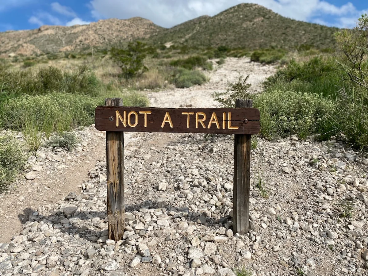
- Navigation is by GPS and local knowledge; there are no marked trails
- Daily distances may vary based on sand conditions and heat
- Total self-sufficiency is required between vehicle rendezvous points
- Satellite phones are the only form of communication available
Planning and Bookings
Book Your Trip
Everything you need to plan your journey
Accommodation
Find places to stay near Kufra
Flights
Search flights to Kufra
Essential Preparation
Planning a Jebel Uweinat Traverse is a monumental task that typically begins 6–12 months in advance. Because of the extreme remoteness and the sensitive border locations, it is virtually impossible to conduct this trek independently. You must coordinate with a specialised expedition operator who has experience in deep-desert logistics and the necessary connections with military and border authorities.
Fitness requirements are high. While the elevation gain is not extreme by alpine standards, the combination of soft sand, heat, and the weight of carrying daily water (if support is not immediate) is exhausting. Trekkers should focus on endurance training and, crucially, breaking in footwear that can withstand both fine sand and sharp granite. Logistics are usually based out of Kufra (Libya), Dakhla Oasis (Egypt), or Khartoum (Sudan), depending on current political stability and permit availability. Most expeditions involve a 3–4 day 4x4 journey just to reach the trailhead.
Trail Accommodation
There is no formal accommodation of any kind on the Jebel Uweinat Traverse. This is a wild camping expedition in its purest form.
Camping Conditions:
- Tents: Lightweight, sand-stable tents are required. In calm weather, many trekkers prefer sleeping under the stars on a sand mat.
- Sites: Campsites are chosen based on wind protection (behind boulders or dunes) and proximity to the day's end point.
- Facilities: There are no toilets, showers, or structures. All waste must be managed according to strict desert LNT principles.
- Water: All water is brought in by 4x4 support. There are no reliable, safe drinking water sources on the mountain.
- Cooking: Done over portable gas stoves or small acacia-wood fires (where permitted and wood is dead/downed).
What is NOT provided:
- Everything. You must bring your own sleeping system, clothing, and personal items.
- Expedition operators usually provide the mess tent, main meals, and water logistics, but this must be confirmed during booking.
Required Gear
- Desert trekking boots - High-top to keep out sand, breathable, with a stiff sole for granite scrambling.
- Sand gaiters - Essential to prevent fine sand from entering boots and causing blisters.
- Trekking poles - Crucial for stability on shifting dunes and boulder fields.
- High-capacity hydration bladder - 3–4 litre capacity plus backup bottles.
- GPS and Compass - Even with a guide, personal navigation tools are a vital safety backup.
- Satellite Messenger (Garmin inReach/Zoleo) - For emergency communication.
- High-UV Sunglasses - Category 4 lenses recommended for intense desert glare.
- Wide-brimmed hat - With neck flap (Legionnaire style) for maximum protection.
- Thermal layers - High-quality merino wool for sub-zero desert nights.
- Lightweight down jacket - For evening and early morning warmth.
What to Bring
- Water treatment - Chlorine dioxide tablets or a UV purifier (for emergency use at gueltas).
- High-calorie desert food - Mix of dehydrated meals and high-energy snacks (nuts, dates, electrolytes).
- Sunscreen - SPF 50+ (multiple tubes), lip balm with SPF.
- First aid kit - Focus on blister care (Compeed), rehydration salts, and broad-spectrum antibiotics.
- Personal hygiene - Biodegradable wet wipes (water is for drinking, not washing), hand sanitiser.
- Dust-proof bags - Dry bags or Ziplocs for all electronics and cameras; Saharan dust penetrates everything.
- Power bank - Solar-compatible for charging GPS and cameras.
- Headlamp - With extra batteries and a red-light mode for preserving night vision.
- Mirror and Whistle - Low-tech emergency signalling devices.
Permits
Securing permits for Jebel Uweinat is the single greatest hurdle for any expedition. Because the mountain sits on the borders of Egypt, Libya, and Sudan, you are entering a highly sensitive military zone. The requirements change frequently based on the regional political climate.
Permit Process:
- Military Clearance: In Egypt, permits must be obtained from the Ministry of Defence and the Border Guard Force. This process takes at least 3 months.
- National Park Fees: If entering from the Egyptian side, fees for the Gilf Kebir National Park apply.
- Guide Requirements: It is mandatory to be accompanied by a licensed local guide and, often, a military escort or a representative from the Ministry of Tourism.
- Libya/Sudan Access: Currently, access from the Libyan and Sudanese sides is extremely restricted due to internal conflicts. Most modern expeditions attempt access from the Egyptian New Valley Governorate.
- Cost: Permit costs are high, often running into thousands of dollars per group, which is why most trekkers join organised expeditions to share the administrative burden.
Important Warning: Attempting to enter this region without the correct paperwork is extremely dangerous. You will be intercepted by military patrols, and the consequences can include arrest, deportation, and the confiscation of all equipment. Always use a reputable operator who handles the "permits and permissions" as part of their service.
Other Activities in the Area
Given the effort required to reach Jebel Uweinat, most travellers combine the traverse with other deep-desert explorations:
- Gilf Kebir Plateau: A massive sandstone plateau north of Uweinat, home to the "Great Barrier" and more spectacular rock art sites.
- The Great Sand Sea: Exploring the world's third-largest dune field, featuring dunes that can reach 100 metres in height.
- Silica Glass Hunting: Searching for Libyan Desert Glass, a rare natural glass formed by a meteorite impact 26 million years ago, found in the plains between the Gilf Kebir and Uweinat.
- Dakhla and Kharga Oases: Visiting the ancient "Old Towns" and Roman ruins in the oases that serve as the jumping-off points for the expedition.
- Stargazing: With zero light pollution and extremely low humidity, the region offers some of the best astronomical viewing on Earth.
Safety and Conditions
Environmental Hazards: The primary threat is the environment itself. Dehydration can occur with terrifying speed; a trekker can lose up to 1 litre of water per hour through perspiration. Heatstroke is a constant risk, and the "dry heat" means you may not realise how much you are sweating. Hyponatremia (salt depletion) is also common, making electrolyte replacement mandatory.
Navigation: The landscape is repetitive and vast. Without GPS and expert local knowledge, it is incredibly easy to become disoriented. A "wrong turn" into a side wadi can lead you kilometres away from your water resupply. Always stay within sight of your group or guide.
Medical Emergencies: You are days away from the nearest hospital. Any serious injury or illness requires a satellite-coordinated evacuation, which is logistically complex and prohibitively expensive. There is no "search and rescue" service in the Sahara; you are responsible for your own extraction.
Wildlife: While rare, scorpions and saw-scaled vipers exist in the wadis. Always shake out boots in the morning and use a headlamp when walking at night. The "Uweinat Sheep" (Barbary sheep) are harmless but shy.
Political Stability: The tri-border area is prone to smuggling and occasional military activity. Always check current travel advisories from your home country and rely on the real-time intelligence of your local expedition leader.
Side Trips and Points of Interest
The Cave of Beasts (Wadi Sora II): Located a short distance from the main Uweinat massif, this is perhaps the most significant rock art site in the Sahara. Discovered in 2002, it features over 5,000 paintings, including the mysterious "beasts"—headless creatures that appear to be consuming or protecting human figures. The level of detail and preservation is unparalleled.
Karkur Talh Petroglyphs: The "Wadi of the Acacias" is an open-air museum. Look for the "Great Giraffe" engravings, which are life-sized and demonstrate the incredible skill of prehistoric artists. The wadi also contains numerous "Cattle Period" paintings showing daily life, dancing, and rituals.
The LRDG Relics: Scattered throughout the wadis are the remains of World War II activity. You may find rusted "flimsy" tins (fuel containers), shell casings, or even the occasional vehicle part. These are historical artefacts and must be left exactly where they are found.
The High Gueltas: In the upper reaches of Karkur Murr, hidden rock pools may contain water after rare rain events. These are vital for the local wildlife and offer a glimpse of the "fountains" that give the mountain its name. The water is often dark and stagnant, but it represents the lifeblood of the mountain.
Leave No Trace
The Jebel Uweinat environment is hyper-arid, meaning that biological decomposition is almost non-existent. A piece of orange peel or a tissue can remain visible for decades. The rock art is even more fragile; the oils from human skin can degrade the ancient pigments, and the dust kicked up by careless walking can obscure the images.
Desert Ethics:
- Never touch the rock art. Even a light touch transfers destructive oils.
- Pack out ALL waste, including toilet paper and food scraps. Use "wag bags" for human waste if required by your operator.
- Do not collect "souvenirs." Every stone, pot shard, and rusted tin is part of the historical record.
- Stay on established wadi floors or rock surfaces to avoid crushing the fragile "cryptobiotic" soil crusts that prevent erosion.
- Use water sparingly. Every drop has been hauled hundreds of kilometres by vehicle.
- Do not use soap or detergents in or near gueltas; these are the only water sources for desert animals.