Janda Natural Park Coast Hike - Where Continents Converge
The Janda Natural Park Coast Hike is a breathtaking 15.5-kilometre journey along the southernmost tip of the Iberian Peninsula, where the Atlantic Ocean meets the Mediterranean Sea. This moderate day walk traverses the rugged coastline of the Parque Natural del Estrecho, offering hikers an unparalleled vantage point of the African continent, located just 14 kilometres across the Strait of Gibraltar. The route winds through a landscape of dramatic limestone cliffs, hidden sandy coves, and ancient Roman ruins, all while being buffeted by the legendary winds of the region. Starting from the vibrant, wind-swept town of Tarifa and concluding at the archaeological marvel of Bolonia, this trail is more than just a physical exercise; it is a walk through millennia of human history and a masterclass in coastal geology. Hikers will encounter unique "flysch" rock formations, vast migrating bird populations, and the scent of wild rosemary and rockrose that defines the Andalusian scrubland.
- Distance: 15.5 km one-way
- Duration: 5–6 hours
- Difficulty: Moderate (due to wind exposure and sandy sections)
- Elevation Gain: 150 m
- Highest Point: 120 m (cliffs near Punta Paloma)
- Best Time: March–May and September–November
- Closest City: Tarifa, Spain
- Trailhead: Tarifa (near the Port/Castillo de Guzmán el Bueno)
Overview
The Janda Natural Park Coast Hike, often referred to locally as part of the "Colada de la Costa," is a sensory-rich experience that captures the raw essence of the Cadiz coastline. The trail is defined by its constant dialogue with the sea. To your left, the deep blue of the Strait of Gibraltar provides a backdrop where massive cargo ships and ferries appear like toys against the towering silhouette of Morocco’s Jebel Musa. To your right, the rolling hills of the Sierra de la Plata rise, covered in a dense tapestry of Mediterranean matorral—a hardy scrubland of lentisk, wild olive, and prickly pear.
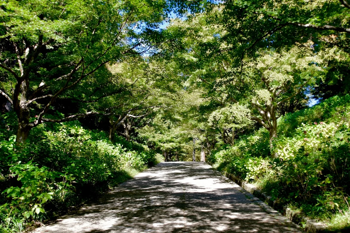
The terrain is remarkably varied for a coastal walk. It begins with well-defined gravel paths and ancient cattle tracks that have been used for centuries by local shepherds. As the journey progresses, the path transitions into narrow cliff-side trails where the geology becomes the star of the show. Hikers will witness the "flysch"—extraordinary sedimentary rock layers that have been tilted vertically by tectonic forces, creating a ribbed, wave-like appearance on the shore below. These formations are not only a geological wonder but also create sheltered rock pools that teem with marine life during low tide.
One of the most defining characteristics of this hike is the wind. Tarifa is known as the wind capital of Europe, and the trail is exposed to two primary winds: the Levante (a warm, strong wind from the east) and the Poniente (a cooler, moisture-laden wind from the west). The wind shapes everything here, from the leaning posture of the stone pines to the massive, shifting sand dunes of Valdevaqueros and Bolonia. Walking this trail requires an appreciation for this elemental force; on a calm day, the silence is profound, but on a windy day, the hike becomes a bracing, salt-sprayed adventure that makes the eventual arrival at the sheltered ruins of Baelo Claudia feel like a hard-earned sanctuary.
The hike concludes at the Duna de Bolonia, a natural monument of staggering proportions. This 30-metre-high sand dune is slowly encroaching upon the surrounding pine forest, creating a surreal landscape of half-buried trees. Standing atop the dune, looking back at the path travelled, hikers gain a true sense of the wild, untamed beauty of the Costa de la Luz. This is a landscape that refuses to be manicured, offering a genuine wilderness experience just a short distance from the bustling cafes of Tarifa.
History and Cultural Context
The ground beneath your boots on the Janda Natural Park Coast Hike has been trodden by Phoenicians, Romans, Moors, and Napoleonic soldiers. The strategic importance of the Strait of Gibraltar cannot be overstated, and the trail is littered with the remnants of these various eras. The most significant historical site is the Roman city of Baelo Claudia, located at the trail's end in Bolonia. Founded in the 2nd century BC, it was a vital centre for the production of "garum"—a fermented fish sauce that was a staple of the Roman diet. The ruins, which include a well-preserved theatre, forum, and basilica, offer a hauntingly beautiful glimpse into an ancient maritime economy that relied on the same Atlantic waters you walk beside today.
Along the cliffs, you will notice several circular stone structures and ruined watchtowers. These are part of a coastal defence system dating back to the 16th and 17th centuries, designed to alert the inland towns of impending pirate raids from North Africa. The Torre de la Peña, perched high above the trail, served as a sentinel for centuries. More recently, the area was heavily fortified during and after the Spanish Civil War and World War II. Hikers will pass several concrete bunkers and machine-gun nests built into the rock, a stark reminder of the 20th-century tensions that once simmered at this continental crossroads.
The cultural heritage of the region is also tied to the "Almadraba"—an ancient and highly sustainable method of tuna fishing that dates back to the Phoenician era. During the spring months, the Atlantic Bluefin Tuna migrate through the Strait, and the local coastal communities still celebrate this tradition. The trail passes through areas where the seasonal rhythms of the sea still dictate the local way of life. The name "Janda" itself refers to the former Laguna de la Janda, once one of Europe's largest wetlands before it was drained for agriculture in the mid-20th century. While the hike stays on the coast, the history of the inland marshes and the struggle for land reclamation provides a backdrop to the environmental consciousness of the modern Natural Park.
Want more background? Read extended notes on history and cultural context → Learn more
Seasonal Highlights and Weather Reality
The Janda Natural Park Coast Hike is a year-round destination, but the experience changes dramatically with the seasons. Unlike the high mountains, the primary challenge here is not snow, but heat and wind. Understanding the local weather patterns is essential for a successful and comfortable journey.
Spring (March to May): This is arguably the best time to hike. The Andalusian countryside is in full bloom, with wildflowers like yellow gorse, purple lavender, and white rockrose carpeting the hillsides. The temperatures are mild, typically ranging from 18°C to 22°C, making the 15.5-kilometre distance feel manageable. This is also the peak time for bird migration; thousands of storks, eagles, and vultures can be seen soaring overhead as they make the crossing from Africa to Europe.
Autumn (September to November): The second "golden window" for hikers. The intense heat of summer has faded, but the Atlantic waters remain warm enough for a post-hike swim in Bolonia. The light in autumn is particularly beautiful, with crisp, clear days providing the best visibility of the Moroccan coastline. The autumn migration is equally spectacular, as birds return south for the winter.
Summer (June to August): Summer hiking requires caution. Temperatures frequently exceed 30°C, and there is virtually no shade along the coastal path. The sun is exceptionally strong, and the reflection off the white sand and limestone can lead to rapid dehydration and heatstroke. If hiking in summer, an early start (before 7:00 AM) is mandatory, and you must carry at least 3 litres of water. The beaches will be crowded, but the trail itself remains relatively quiet.
Winter (December to February): Winter is the season of the "Poniente" storms. While temperatures are rarely cold (averaging 14°C to 16°C), the wind can be fierce and the rain, when it comes, is often horizontal. However, on clear winter days, the air is incredibly fresh, and you will likely have the entire trail to yourself. It is a time of dramatic seas and moody skies, perfect for those who prefer solitude and rugged conditions.
Recommended Itinerary
Janda Coast Day Hike Itinerary
Early Morning: Tarifa Trailhead to Playa de los Lances
- Distance: 4 km
- Time: 1 hour
- Start at the Port of Tarifa, near the Castillo de Guzmán el Bueno.
- Walk past the Isla de las Palomas (the southernmost point of mainland Europe).
- Follow the wooden boardwalk along Playa de los Lances, a vast beach famous for kitesurfing.
- Enjoy the flat, easy terrain as you warm up your legs.
- Observe the early morning light hitting the African coast across the water.
Mid-Morning: Rio Jara to Punta Paloma
- Distance: 6 km
- Time: 2 hours
- Cross the Rio Jara (note: during heavy rain, this may require wading or a slight inland detour to the bridge).
- The path leaves the beach and begins to climb slightly onto the low cliffs.
- Pass through sections of stone pine forest and Mediterranean scrub.
- Reach the Valdevaqueros area, where the trail skirts the base of the first major sand dunes.
- Stop at one of the elevated viewpoints to see the colourful kites of the surfers below.
Midday: Punta Paloma to the Flysch Cliffs
- Distance: 3 km
- Time: 1.5 hours
- This is the most technical section of the hike, involving narrow paths and rocky uneven ground.
- The trail winds around the headland of Punta Paloma.
- Look down to see the "flysch" rock formations—long fingers of stone reaching into the sea.
- Pass several abandoned military bunkers and gun emplacements.
- The elevation gain here provides the best panoramic views of the entire Strait.
Afternoon: The Descent to Bolonia and Baelo Claudia
- Distance: 2.5 km
- Time: 1 hour
- The trail begins a gradual descent towards the bay of Bolonia.
- The massive Duna de Bolonia comes into full view, a wall of golden sand against the green pines.
- Arrive at the edge of the Baelo Claudia archaeological site.
- Finish the walk at the Bolonia beachfront, where several small "chiringuitos" (beach bars) offer cold drinks and local tapas.
- Optional: Spend an hour exploring the Roman ruins before catching a taxi or pre-arranged transport back to Tarifa.
Important Notes:
- The trail is one-way; ensure you have a plan for the return journey (taxi or bus).
- Check the tide times; some beach sections are much easier to walk at low tide.
- The Rio Jara crossing can be deep after winter storms; use the N-340 bridge if necessary.
- There are no water refill points between Tarifa and Bolonia.
- The wind can make the temperature feel cooler than it is; don't forget sunscreen.
Planning and Bookings
Book Your Trip
Everything you need to plan your journey
Accommodation
Find places to stay near Tarifa
Flights
Search flights to Tarifa
Essential Preparation
The Janda Natural Park Coast Hike is a moderate undertaking, but its linear nature requires some logistical coordination. Most hikers base themselves in Tarifa, a vibrant town with a wide range of accommodation from boutique hotels to surf hostels. Tarifa is well-connected by bus to Algeciras and Cadiz, but having a rental car provides the most flexibility for reaching the trailhead and exploring the wider Janda region.
Physical fitness requirements are moderate. While the elevation gain is minimal (150 m), the distance of 15.5 km combined with walking on soft sand and uneven rocky paths can be tiring. Ensure you have "broken in" your footwear before attempting the full distance. There is no mobile signal in some of the deeper cliff sections, so downloading offline maps is highly recommended. Before setting out, check the wind forecast; a Levante wind exceeding 40 km/h can make the cliff sections unpleasant and even slightly dangerous due to blowing sand and grit.
Trail Accommodation
This is a day hike requiring no overnight accommodation on the trail itself. Camping is strictly prohibited within the boundaries of the Parque Natural del Estrecho to protect the fragile ecosystem and prevent forest fires. However, there are excellent options at both ends of the trail.
Tarifa: Offers everything from luxury "Casas Rurales" to budget-friendly hostels. It is the best place to stay for those who enjoy a lively evening atmosphere with numerous restaurants and bars. Bolonia: A much smaller, quieter hamlet. There are a few small hostals and apartments available for rent, perfect for those who want to wake up next to the Roman ruins and the great dune. Campsites: There are several high-quality campsites along the N-340 road between Tarifa and Bolonia (e.g., Camping Valdevaqueros, Camping Paloma). These offer pitches for tents and vans, as well as small bungalows. They are usually open from March to October.
Required Gear
- Hiking Shoes or Boots: Lightweight hiking shoes with good grip are ideal. Full boots are not strictly necessary but provide better ankle support on the rocky cliff sections. Avoid flip-flops or flimsy trainers.
- Windbreaker/Light Jacket: Even on warm days, the wind in the Strait can be chilling. A breathable, windproof layer is essential.
- Sun Protection: A wide-brimmed hat with a chin strap (to prevent it blowing away), high-SPF sunscreen, and UV-rated sunglasses.
- Daypack: A 20–30 litre pack with a rain cover and a comfortable hip belt.
- Navigation: A physical map or a reliable offline GPS app (like Gaia GPS or AllTrails). The path is generally clear but can be confusing near the river crossings.
- First Aid Kit: Include blister plasters (moleskin), antiseptic wipes, and any personal medications.
What to Bring
- Water: Minimum 2 litres per person (3 litres in summer). There are no potable water sources on the trail.
- Food: A packed lunch and high-energy snacks (nuts, dried fruit, energy bars). Bolonia has restaurants, but there is nothing in between.
- Electrolytes: Rehydration salts are useful if hiking in the heat.
- Swimwear and Lightweight Towel: For a dip in the Atlantic at Bolonia or one of the hidden coves.
- Cash: For the taxi back to Tarifa or for drinks at the Bolonia chiringuitos (some smaller places may not accept cards).
- Binoculars: Highly recommended for bird watching and for looking across to the Moroccan coast.
- Power Bank: To ensure your phone remains charged for navigation and photos.
Permits
No permits are required to hike the Janda Natural Park Coast Hike. The trail is located within a public Natural Park and is free for all to access. However, there are strict regulations that all visitors must follow to ensure the continued protection of this sensitive environment.
Access and Parking:
- Tarifa: Parking can be difficult in the town centre during summer. Use the large public car parks near the Playa de los Lances and walk to the trailhead.
- Bolonia: There is a large car park near the Baelo Claudia museum. During peak summer months (July and August), this car park fills up very early, and access to the village may be restricted by local police once capacity is reached.
- Group Sizes: While there is no formal limit for individuals, organised commercial groups of more than 10 people may need to notify the Park Office in Algeciras in advance.
Return Logistics:
- Since the hike is one-way, most hikers take a taxi back to Tarifa. Taxis can be found near the entrance to the Baelo Claudia ruins. The cost is approximately €25–€35 depending on the season and time of day.
- There is a limited bus service (Comes bus line) that runs between Tarifa and Bolonia, but it usually only operates during the summer months and the schedule is infrequent. Always check the latest timetable at the Tarifa bus station before starting your hike.
Other Activities in the Area
The region surrounding Tarifa and the Janda Natural Park offers a wealth of activities for nature lovers and history buffs:
- Whale and Dolphin Watching: Take a boat trip from Tarifa port into the Strait. You can see Pilot Whales, Bottlenose Dolphins, and, during the summer, Orcas and Fin Whales.
- Kitesurfing and Windsurfing: Tarifa is world-famous for wind sports. Numerous schools offer lessons for beginners at Playa de los Lances and Valdevaqueros.
- Baelo Claudia Museum: Even if you don't do the full hike, the visitor centre and museum at the Roman ruins are world-class and provide deep insight into the region's history.
- Rock Climbing: The limestone crags of San Bartolo, near Bolonia, offer some of the best sport climbing in southern Spain, with routes for all levels and stunning sea views.
- Horse Riding: Several stables offer guided rides along the beaches and through the pine forests of the Natural Park, a truly magical way to experience the landscape at sunset.
- Day Trip to Tangier: The fast ferry from Tarifa can whisk you across to Morocco in just 45 minutes, allowing for a fascinating cultural contrast in a single day.
Safety and Conditions
Weather and Wind: The most significant safety factor is the wind. The Levante can reach speeds that make walking difficult and can blow sand into your eyes and mouth. Always check the forecast on sites like Windguru or Windy.com. If gusts are predicted to exceed 60 km/h, consider postponing the hike, especially the cliff sections.
Sun Exposure: The Andalusian sun is fierce. Heat exhaustion is a real risk, particularly on the sections of the trail that are inland and away from the cooling sea breeze. Wear a hat, use high-factor sunscreen, and drink water regularly, even if you don't feel thirsty.
Terrain Hazards: The cliff paths near Punta Paloma can be narrow and have loose stones. While not "extreme," they require careful foot placement. Avoid walking too close to the edge of the cliffs, as the limestone can be undercut and unstable. After heavy rain, the clay-rich soil in some sections can become incredibly slippery.
Tides and River Crossings: The Rio Jara crossing near Tarifa is the only significant water obstacle. During low tide and dry weather, it is a shallow stream. However, after heavy rain or during a high spring tide, it can become deep and fast-flowing. Do not attempt to cross if the water is above knee height; instead, walk inland to the N-340 road bridge.
Emergency Contacts: The general emergency number in Spain is 112. Be aware that mobile coverage can be spotty along the base of the cliffs. It is always wise to tell someone your planned route and expected return time.
Side Trips and Points of Interest
Duna de Bolonia: This massive sand dune is a natural monument and a must-visit. You can climb to the top for an incredible view of the bay, the Roman ruins, and the pine forest. The effort of trudging up the soft sand is rewarded by the sensation of being in a mini-Sahara right on the edge of the Atlantic.
Faro de Camarinal: Located just beyond Bolonia, this historic lighthouse is built into an old 16th-century watchtower (Torre del Cabo de Gracia). A short walk from Bolonia leads you to this iconic landmark, which offers views toward the lighthouse of Trafalgar to the west.
Cueva del Moro: For those interested in prehistory, this cave contains Paleolithic rock art, including engravings of horses. It is located in the hills above the trail and requires a bit of a detour, but it represents some of the oldest human activity in the region.
The Flysch Formations: Take the time to scramble down to the water's edge (where safe) to see these geological wonders up close. The rhythmic patterns of the rock layers are a photographer's dream, especially during the "golden hour" of late afternoon.
Piscinas Naturales (Natural Pools): At low tide, the rocky shelf between Punta Paloma and Bolonia reveals several large pools trapped in the flysch. These are perfect for a quick, sheltered swim away from the waves of the open ocean.
Leave No Trace
The Janda Natural Park is a fragile sanctuary for many endangered species of flora and fauna. The increase in tourism puts significant pressure on this environment, and it is the responsibility of every hiker to minimise their impact. The "Leave No Trace" principles are not just guidelines here; they are essential for the survival of the park's unique character.
Protecting the Dunes: The sand dunes are living systems. Walking on the face of the smaller, vegetated dunes can destroy the delicate plants (like sea marram) that hold the sand in place. Stick to established paths and the main Duna de Bolonia, which is robust enough for visitors.
Waste Management: There are no bins along the trail. You must pack out everything you bring in, including organic waste like banana skins or apple cores, which do not decompose quickly in this salty, dry environment and can be harmful to local wildlife. If you find litter left by others, please consider picking it up to help keep the coast pristine.
Wildlife Respect: The Strait is a critical corridor for bird migration. Avoid making excessive noise, and never attempt to approach or feed any animals you encounter. If you are hiking with a dog, it must be kept on a lead at all times to prevent it from disturbing nesting birds or local livestock.
Flora: Do not pick wildflowers or plants. Many species in the Janda region are endemic and found nowhere else on Earth. Stay on the marked trails to avoid trampling the "matorral" crust, which protects the soil from erosion.