Isle of Wight Coastal Path - A Journey Around the Garden Isle
The Isle of Wight Coastal Path is a spectacular 112.6-kilometre long-distance trail that circumnavigates the entire perimeter of the Isle of Wight, an island off the south coast of England recognised as a UNESCO Biosphere Reserve. This trail offers an extraordinary diversity of landscapes, ranging from the iconic white chalk stacks of The Needles to the lush, sub-tropical microclimate of the Ventnor Undercliff. Walking the path is a journey through time, passing Roman villas, medieval castles, and Victorian seaside resorts that once hosted the likes of Queen Victoria and Alfred Lord Tennyson. The route is characterised by its accessibility and variety, making it a premier choice for walkers seeking a multi-day adventure that combines rugged cliff-top trekking with charming village hospitality. Unlike many remote wilderness treks, the Isle of Wight Coastal Path provides a unique blend of natural beauty and cultural heritage, where a morning spent on a lonely, windswept down can be followed by an afternoon enjoying a traditional cream tea in a bustling harbour town.
- Distance: 112.6 km loop
- Duration: 6–8 days
- Elevation Gain: Approximately 2,700 m
- Difficulty: Moderate (undulating terrain with some steep climbs)
- Best Time: April to October (for optimal weather and ferry schedules)
- Closest City: Southampton (via ferry)
- Trailhead: Traditionally starts and ends in Ryde, but can be started at any ferry port (Cowes, Yarmouth, or Fishbourne)
Overview
The Isle of Wight Coastal Path is more than just a walk; it is an immersive exploration of one of the most geologically and ecologically diverse regions in the United Kingdom. The path is traditionally walked in a clockwise direction, starting from the Victorian pier at Ryde, though its circular nature allows for complete flexibility. The terrain is a constant tapestry of change: the northern coast is defined by sheltered estuaries, ancient oak woodlands, and the busy sailing waters of the Solent; the western tip features the dramatic, high-altitude chalk downs and the world-famous Needles; the southern coast offers rugged, eroding cliffs and the unique "Undercliff" landslip zone; and the eastern shore provides long, sandy beaches and traditional seaside charm.
One of the most striking features of the trail is the constant presence of the sea. Whether you are walking 150 metres above the waves on Tennyson Down or strolling along the promenade at Sandown, the maritime influence is inescapable. The island’s status as a UNESCO Biosphere Reserve is evident in the rich array of flora and fauna encountered along the way. Walkers should keep a keen eye out for the rare red squirrel, which thrives here in the absence of the grey squirrel found on the mainland, as well as Peregrine falcons nesting in the chalk cliffs and a vast array of migratory seabirds. The geology of the island is equally fascinating, with the "Island in the Sky" offering a cross-section of Earth's history from the Cretaceous period to the present day, making it a world-renowned site for dinosaur fossil hunting, particularly along the southwestern "Back of the Wight."
Logistically, the Isle of Wight Coastal Path is exceptionally well-serviced. The island’s comprehensive bus network, the Southern Vectis, allows walkers to easily return to a central base or skip sections if weather conditions turn unfavourable. Accommodation options are plentiful, ranging from high-end boutique hotels and historic inns to coastal campsites and youth hostels. This infrastructure makes the trail accessible to a wide range of fitness levels, as daily distances can be easily adjusted to suit individual preferences. However, walkers should not underestimate the physical challenge; while the maximum elevation is only 147 metres, the cumulative ascent of 2,700 metres over the course of the week involves many short, sharp climbs that will test the legs of even experienced hikers.
History and Cultural Context
The history of the Isle of Wight is inextricably linked to its coastline. For millennia, the island has served as a gateway to Britain, a defensive bastion, and a place of retreat. The Coastal Path passes through numerous sites of historical significance that tell the story of the United Kingdom’s maritime and royal past. In the north, the trail skirts the edges of the Osborne estate, where Queen Victoria and Prince Albert built their summer residence. Victoria famously remarked, "It is impossible to imagine a prettier spot," and her influence transformed the island into a fashionable destination for the Victorian elite, leading to the development of the grand seaside architecture seen in Ryde, Ventnor, and Cowes.
To the west, the path ascends Tennyson Down, named after the Poet Laureate Alfred Lord Tennyson, who lived at nearby Farringford House for nearly 40 years. Tennyson walked these downs daily, drawing inspiration from the "air that is worth sixpence a pint" and the dramatic views of the English Channel. The trail also encounters the island’s military history, passing the Needles Old Battery, a Victorian coastal defence fort, and numerous lookout points that played crucial roles during the Napoleonic Wars and World War II. The island was a key site for the development of radar and the testing of the Black Knight and Black Arrow rockets during the Cold War, remnants of which can still be seen near the Needles.
Culturally, the island remains a hub for maritime activity. Cowes is globally recognised as the home of international yacht racing, hosting Cowes Week, the oldest and largest sailing regatta in the world, every August. The Coastal Path provides front-row seats to this spectacle. Furthermore, the island has a deep-rooted connection to the arts and music, famously hosting the 1970 Isle of Wight Festival, which was the largest rock festival of its time. Today, the island maintains a relaxed, creative atmosphere, with many local galleries and craft centres located along the trail, particularly in the West Wight and the Ventnor Fringe area.
Want more background? Read extended notes on history and cultural context → Learn more
Seasonal Highlights and Weather Reality
The Isle of Wight enjoys one of the mildest climates in the British Isles, often receiving more sunshine hours than the mainland. However, being an island, it is subject to the whims of the English Channel, and weather conditions can change rapidly. Choosing the right season is essential for balancing weather, daylight hours, and the availability of services.
Spring (April to June): This is arguably the best time to walk the Coastal Path. The clifftops are carpeted in wildflowers, including thrift, bluebells, and wild garlic. The weather is generally mild, and the trails are less crowded than in the peak summer months. Birdwatchers will find this season particularly rewarding as migratory species arrive and nesting begins on the cliffs.
Summer (July and August): Summer offers the warmest temperatures (averaging 20–22°C) and the longest daylight hours, allowing for leisurely walking days. However, this is also the busiest time on the island. Accommodation should be booked well in advance, and popular sections of the path near the main resorts can be crowded. The sea is at its warmest, making it the perfect time for a mid-walk swim at Freshwater Bay or Compton Bay.
Autumn (September to October): September is a fantastic month for walking, with the sea still warm and the summer crowds departing. The autumn light is particularly beautiful for photography, especially on the white chalk cliffs. By late October, the weather becomes more unpredictable, and some seasonal cafes or attractions may begin to close, but the path remains fully accessible.
Winter (November to March): While the path remains open, winter walking on the Isle of Wight is for the hardy. Strong southwesterly gales can make clifftop walking dangerous, and the "Back of the Wight" sections can be extremely muddy and slippery. Many tourist facilities close during this period, and daylight is limited. However, for those seeking solitude and dramatic, crashing waves, a winter walk can be a powerful experience, provided you have high-quality waterproof gear and check the forecast carefully.
Recommended Itinerary
8-Day Isle of Wight Coastal Path Itinerary
Day 1: Ryde to Cowes
- Distance: 13 km
- Elevation gain: 150 m
- Time: 3–4 hours
- Start at Ryde Pier, the world's oldest seaside pleasure pier
- Walk through the coastal woodlands of Quarr, passing the ruins of the 12th-century Quarr Abbey and the modern Benedictine monastery
- Pass through the village of Fishbourne (ferry terminal)
- Follow the path through the outskirts of the Osborne estate
- Arrive in East Cowes, take the "floating bridge" (chain ferry) across the River Medina to West Cowes
- Explore the world capital of yachting and its historic high street
Day 2: Cowes to Yarmouth
- Distance: 24 km
- Elevation gain: 320 m
- Time: 6–7 hours
- A longer day following the northern coast through Gurnard and Thorness Bay
- The path moves inland slightly to navigate the Newtown River estuary, a National Trust nature reserve
- Excellent birdwatching opportunities in the salt marshes and mudflats
- Pass through the ancient town of Newtown, once the island's capital
- Finish in the historic harbour town of Yarmouth, home to Yarmouth Castle
Day 3: Yarmouth to Freshwater Bay
- Distance: 11 km
- Elevation gain: 280 m
- Time: 3–4 hours
- A shorter but spectacular day heading towards the island's western tip
- Walk along the sea wall to Totland Bay and Colwell Bay
- Ascent to Headon Warren for views across to the mainland and the Hurst Castle spit
- Pass the Needles New Battery and the rocket testing sites
- View the iconic Needles chalk stacks and the lighthouse
- Descend into Freshwater Bay, a stunning cove surrounded by chalk cliffs
Day 4: Freshwater Bay to Chale
- Distance: 18 km
- Elevation gain: 450 m
- Time: 5–6 hours
- The most dramatic clifftop walking on the island, following the "Back of the Wight"
- Ascend Tennyson Down to the Tennyson Monument (147 m)
- Follow the high chalk ridge of Brook Down and Compton Down
- Descend to the beach at Compton Bay, famous for dinosaur footprints at low tide
- Continue along the eroding cliffs of Military Road towards the village of Chale
- Views of the "Blackgang" area, where the cliffs are constantly shifting
Day 5: Chale to Ventnor
- Distance: 10.5 km
- Elevation gain: 250 m
- Time: 3–4 hours
- Enter the unique landscape of the Undercliff, a 10 km long complex of prehistoric and historic landslides
- Pass St Catherine’s Lighthouse, the southernmost point of the island
- Walk through the lush, jungle-like vegetation of the Landslip, protected from the wind by high inland cliffs
- Pass through the village of Niton and the famous Buddle Inn
- Arrive in the Victorian spa town of Ventnor, built into the steep hillsides
Day 6: Ventnor to Sandown
- Distance: 14 km
- Elevation gain: 380 m
- Time: 4–5 hours
- Walk through the Ventnor Botanic Garden and the Bonchurch Landslip
- Pass the tiny St Boniface Old Church, dating back to the 11th century
- Follow the coastal path to the village of Luccombe and the wooded ravine of Shanklin Chine
- Walk along the promenade from Shanklin to Sandown, passing traditional beach huts and piers
- Enjoy the long, sandy beaches of Sandown Bay
Day 7: Sandown to Bembridge
- Distance: 10 km
- Elevation gain: 220 m
- Time: 3 hours
- Ascend the dramatic white cliffs of Culver Down
- Visit the Yarborough Monument and enjoy panoramic views of the eastern Solent
- Descend towards the village of Bembridge, passing the Bembridge Lifeboat Station
- Walk around the harbour and see the Bembridge Windmill, the only surviving windmill on the island
- Explore the quiet, pebble beaches of the eastern tip
Day 8: Bembridge to Ryde
- Distance: 12.1 km
- Elevation gain: 150 m
- Time: 3–4 hours
- The final leg follows the sheltered eastern coast
- Pass through the seaside village of Seaview, known for its sailing club and regattas
- Walk along the sea wall at Appley, passing the gothic Appley Tower
- Return to Ryde Esplanade to complete the circuit
- Celebrate the finish at one of Ryde's many pubs or cafes
Important Notes:
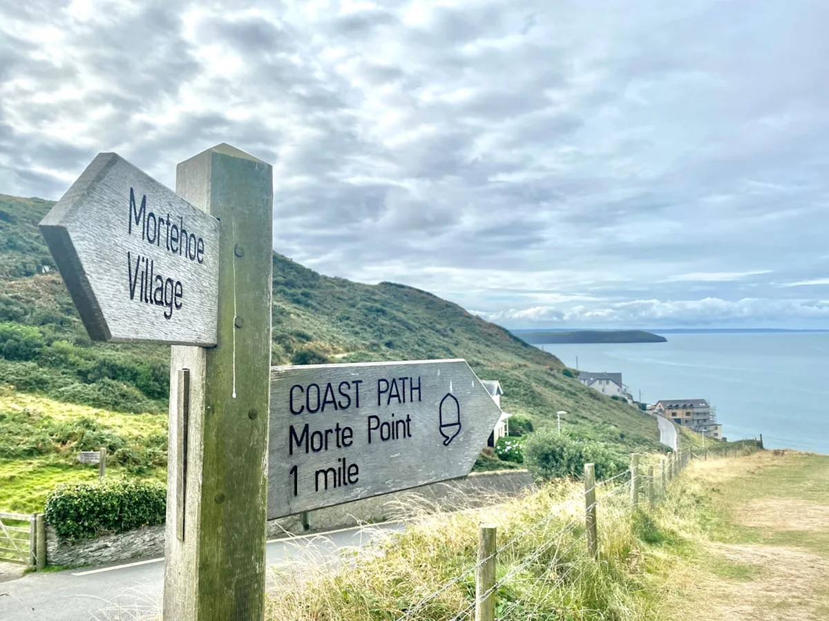
- The path is well-marked with the acorn symbol (National Trail style) and blue coastal path signs.
- Tide times are crucial for sections like Ryde to Seaview and parts of the northern coast; always check local tide tables.
- Cliff erosion is a serious issue; never ignore "Path Closed" signs or diversions.
- The Southern Vectis bus network is excellent for returning to your start point if you prefer to stay in one location.
Planning and Bookings
Book Your Trip
Everything you need to plan your journey
Accommodation
Find places to stay near Southampton
Flights
Search flights to Southampton
Essential Preparation
The Isle of Wight Coastal Path requires moderate physical fitness. While the elevations are not extreme, the constant "up and down" nature of the coastal terrain can be tiring over multiple days. It is recommended to undertake several 15–20 km training walks with a loaded pack before attempting the full circuit. Logistics are relatively straightforward, but booking your ferry crossing in advance is essential, especially if travelling with a car. The main ferry ports are Southampton (to East Cowes or West Cowes), Portsmouth (to Ryde or Fishbourne), and Lymington (to Yarmouth). If you are travelling by train, the "Wightlink" catamaran from Portsmouth Harbour station to Ryde Pier Head is the most seamless connection.
Base towns like Ryde, Sandown, or Newport (the island's central hub) offer the most amenities. If you prefer not to carry a heavy pack, several luggage transfer services operate on the island, moving your bags between accommodations each day. This allows you to walk with only a small daypack, significantly increasing your enjoyment of the steeper sections.
Trail Accommodation
The Isle of Wight offers a vast array of accommodation, but because the trail passes through popular tourist areas, booking ahead is vital during the summer months and school holidays.
Options Include:
- Hotels and Guesthouses: Plentiful in Ryde, Cowes, Yarmouth, Ventnor, and Sandown. Many are historic Victorian buildings with sea views.
- Inns and Pubs: Traditional options like the Buddle Inn (Niton) or the Wight Mouse Inn (Chale) offer characterful rooms and hearty meals.
- Campsites: There are numerous coastal campsites, particularly on the west and south coasts (e.g., Grange Farm in Brighstone). Note that wild camping is illegal in England without the landowner's permission.
- Youth Hostels: YHA Totland Bay is perfectly situated for the western section of the trail.
- Glamping: The island has a thriving glamping scene, with yurts, safari tents, and eco-pods available near the path.
Facilities: Most towns have supermarkets (Tesco, Sainsbury's, Co-op) for restocking supplies. Public toilets are generally available in seaside towns, though some may charge a small fee or have seasonal opening hours.
Required Gear
- Walking Boots: Waterproof with good ankle support. The "Back of the Wight" can be very muddy after rain, while the chalk downs can be slippery when dry.
- Waterproof Jacket and Trousers: Essential for the unpredictable British weather. Breathable fabrics like Gore-Tex are recommended.
- Walking Socks: High-quality wool-blend socks to prevent blisters.
- Backpack: 35–50L if carrying your own gear; 20L daypack if using a luggage transfer service. Ensure it has a waterproof rain cover.
- Navigation: OS Explorer Map OL29 (Isle of Wight) is the gold standard. A compass and a GPS app (like OS Maps or AllTrails) are also highly recommended.
- Sun Protection: Sunscreen, sunglasses, and a wide-brimmed hat. The coastal breeze can mask the intensity of the sun.
- First Aid Kit: Including plenty of blister plasters (Compeed), antiseptic wipes, and any personal medications.
What to Bring
- Water Bottles/Bladder: At least 2 litres capacity. While there are many cafes, some stretches (like Freshwater to Chale) have few refill points.
- High-Energy Snacks: Trail mix, energy bars, and fruit to keep energy levels up between towns.
- Portable Power Bank: To keep your phone and GPS charged, especially if using navigation apps.
- Reusable Coffee Cup and Straw: To reduce plastic waste in the island's many cafes.
- Swimwear and Lightweight Towel: For spontaneous dips in the sea at the island's many beautiful beaches.
- Binoculars: For spotting seals, Peregrine falcons, and the various ships passing through the Solent.
- Cash and Card: Most places accept contactless payment, but some smaller cafes or rural pubs may still prefer cash.
Permits
One of the great advantages of the Isle of Wight Coastal Path is that no permits or fees are required to walk the trail itself. The path follows public rights of way, which are free for all to use. However, there are several logistical costs and "permits" of a different kind that you must consider when planning your trip.
Ferry Bookings: While not a permit, your ferry ticket is your "entry pass" to the island. Prices vary significantly depending on the time of day and how far in advance you book. Foot passenger tickets are generally affordable (approx. £20–£35 return), but car ferry prices can exceed £100 during peak summer weekends. It is highly recommended to book your ferry as soon as your walking dates are confirmed.
National Trust and Heritage Sites: While the path is free, many of the landmarks it passes—such as the Needles Old Battery, Mottistone Manor, and Newtown Old Town Hall—are managed by the National Trust. If you plan to visit these, a National Trust membership is highly cost-effective. Similarly, English Heritage manages Yarmouth Castle, Carisbrooke Castle, and Osborne House.
Parking: If you are driving to the island and leaving your car at a trailhead, you will need to pay for long-stay parking. Ryde and Cowes have long-stay car parks, but costs can add up over 6–8 days (approx. £8–£12 per day). Some B&Bs may allow you to leave your car for a small fee if you stay with them on your first and last nights.
Tide Awareness: In certain areas, particularly on the northern coast and around Ryde/Seaview, the "official" coastal path may offer a beach alternative at low tide. This is not a permit issue, but a safety one. Always consult the local tide tables (available at harbour offices or online) before attempting to walk on the sand or rocks below the cliffs.
Other Activities in the Area
The Isle of Wight is a major tourist destination with a wealth of activities to complement your walk. If you have extra days, consider the following:
- Osborne House: Visit the palatial holiday home of Queen Victoria and Prince Albert in East Cowes. Explore the royal apartments, the Swiss Cottage, and the private beach where the Queen used her bathing machine.
- Carisbrooke Castle: Located near the centre of the island in Newport, this historic castle is where King Charles I was imprisoned before his execution. You can walk the castle walls and see the famous donkeys working the 16th-century well-wheel.
- The Needles Landmark Attraction: Take the chairlift down to the beach at Alum Bay to see the famous multi-coloured sands and get a close-up view of the Needles rocks and lighthouse.
- Dinosaur Isle: Located in Sandown, this purpose-built museum is a must-visit for anyone interested in the island's prehistoric past. They also offer guided fossil-hunting walks on local beaches.
- Sailing and Watersports: Try your hand at sailing in Cowes, kayaking in Freshwater Bay, or surfing at Compton Bay, which is considered one of the best surf spots on the south coast of England.
- Isle of Wight Steam Railway: Take a nostalgic journey through the island's countryside on a beautifully restored steam train, running from Havenstreet to Smallbrook Junction.
- Ventnor Botanic Garden: Discover a Mediterranean-style garden that thrives in the unique microclimate of the Undercliff, featuring plants from around the world that cannot grow anywhere else in the UK.
Safety and Conditions
While the Isle of Wight Coastal Path is not a high-altitude mountain trek, it presents its own set of unique safety challenges that walkers must respect.
Cliff Erosion and Landslips: The Isle of Wight has some of the fastest-eroding coastlines in Europe. The soft clays and sands of the "Back of the Wight" and the Undercliff are prone to sudden collapses, especially after heavy rain. Never ignore "Path Closed" signs. These diversions are put in place for your safety. Stay well away from cliff edges, as they can be undercut and unstable. Similarly, avoid sitting directly under cliffs on beaches, as rockfalls are common.
Tides: Several sections of the path can be cut off by the tide if you choose to walk on the beach rather than the inland cliff-top route. Always check the tide times before you set off. If in doubt, stay on the higher, marked path. The tide comes in surprisingly quickly in the flat estuaries of the north coast.
Weather and Exposure: The clifftops are highly exposed to the wind. In strong gales, walking on Tennyson Down or Culver Down can be dangerous due to the risk of being blown off balance. If high winds are forecast, consider using the island's bus network to skip the most exposed sections. Conversely, in summer, the lack of shade on the downs can lead to heat exhaustion; carry plenty of water and wear sun protection.
Livestock: Many of the downs are grazed by cattle and sheep. Always keep dogs on a lead around livestock and give cattle a wide berth, especially if they have calves. Close all gates behind you.
Emergency Services: In the event of an emergency, dial 999 and ask for the Coastguard if you are on the cliffs or beach. Mobile signal is generally good across the island, but there are "dead zones" in the deep valleys of the Undercliff and at the base of high cliffs.
Side Trips and Points of Interest
To truly experience the Isle of Wight, consider these notable detours and landmarks along the Coastal Path:
Tennyson Down and the Monument: This is the highest point on the trail and offers perhaps the most iconic view in Southern England. The massive granite cross commemorates Alfred Lord Tennyson. On a clear day, you can see across the Solent to the New Forest, east to Portsmouth and the Spinnaker Tower, and south across the vast expanse of the English Channel. The turf here is ancient "chalk grassland," home to rare orchids and butterflies like the Adonis Blue.
St Catherine’s Oratory (The Pepperpot): A short, steep climb inland from the path near Chale leads to the "Pepperpot," the remains of a medieval lighthouse built in 1328 as penance by a local landowner who had stolen wine from a shipwrecked monastery vessel. It is the only medieval lighthouse surviving in England and offers incredible 360-degree views of the island.
The Undercliff and Steephill Cove: Between Ventnor and Niton, the path winds through the Undercliff. Be sure to stop at Steephill Cove, a hidden gem accessible only by foot or boat. It is a traditional fishing cove with no road access, famous for its fresh crab pasties and lobster salads served right on the beach.
Newtown National Nature Reserve: This detour on the northern coast takes you into a world of silence and salt marshes. The "town" of Newtown was once a thriving medieval port before being destroyed by French raiders in 1377. Today, only a few houses and the 17th-century Town Hall remain, surrounded by a vast wilderness that is a haven for Brent geese, curlews, and redshanks.
The Bembridge Windmill: A short walk inland from the path at Bembridge leads to this iconic 1700s windmill, now owned by the National Trust. It is the last of its kind on the island and still contains much of its original wooden machinery. It provides a fascinating glimpse into the island's agricultural history.
Leave No Trace
The Isle of Wight’s UNESCO Biosphere status is a testament to its ecological importance. As a walker, you play a vital role in preserving this environment for future generations. The island’s ecosystems, particularly the chalk grasslands and the maritime cliffs, are fragile and easily damaged.
Principles to Follow:
- Stick to the Path: To prevent erosion and protect rare plants like the early gentian, always stay on the marked trail. This is especially important on the chalk downs.
- Pack It In, Pack It Out: There are no bins on the remote sections of the cliffs. Carry all your litter, including fruit peels and nut shells, back to the nearest town.
- Respect Wildlife: Do not disturb nesting birds on the cliffs. If you are lucky enough to see a red squirrel, keep your distance and do not attempt to feed it.
- No Wild Fires: The dry grass on the downs is highly flammable in summer. Never light fires or use disposable BBQs on the trail.
- Protect Water Sources: Do not use soaps or detergents in the island's streams or estuaries.
- Leave What You Find: While it is tempting to take fossils from the beach, please follow the local fossil-collecting code. Only take small, loose fossils and never hammer into the cliffs, which is both dangerous and illegal in many areas.