Highland Boundary Fault Trail - Crossing the Great Divide
The Highland Boundary Fault Trail is a journey across the literal and metaphorical heart of Scotland. Stretching 107.2 kilometres from the coastal town of Helensburgh on the Firth of Clyde to the market town of Crieff in Perthshire, this route follows one of the most significant geological features in Europe: the Highland Boundary Fault. This ancient fracture in the Earth's crust separates the rugged, metamorphic peaks of the Scottish Highlands from the softer, sedimentary rolling hills of the Lowlands. Walking this trail is not merely a physical challenge; it is a traverse through 400 million years of planetary history, where every step takes you across a threshold between two distinct worlds. The trail weaves through the Loch Lomond and The Trossachs National Park, offering a masterclass in landscape diversity—from shimmering sea lochs and dense oak forests to dramatic mountain passes and tranquil riverside paths.
- Distance: 107.2 km one-way
- Duration: 6–7 days
- Season: April–October (best for weather and daylight; winter requires advanced navigation)
- Accommodation: Village B&Bs, local inns, and designated campsites
- Highest point: Conic Hill (361 m) or nearby moorland passes (approx. 450 m)
- Difficulty: Moderate (well-marked paths but requires multi-day stamina)
- Direction: West to East (Helensburgh to Crieff)
Overview
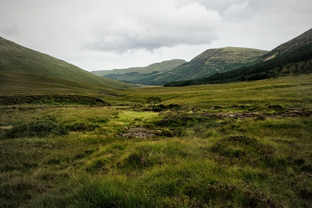
The Highland Boundary Fault Trail offers a unique perspective on the Scottish landscape that few other long-distance routes can match. While the famous West Highland Way seeks the high peaks and the Great Glen Way follows the water, this trail follows the "seam" of the country. The fault line itself is a geological boundary where the Dalradian rocks of the north meet the Old Red Sandstone of the south. For the walker, this translates into a constantly shifting horizon. One moment you are immersed in the lush, fertile valleys of the Lowlands, and the next, you are staring at the jagged, formidable silhouettes of the Arrochar Alps and the southern Highlands.
The route is strategically designed to be accessible yet rewarding. Starting in Helensburgh, just a short train journey from Glasgow, the trail immediately climbs into the hills, providing panoramic views back over the Clyde estuary. It then descends to the "bonnie banks" of Loch Lomond, where the fault line is most visible in the chain of islands that bisect the loch. The journey continues through the Trossachs—often described as the "Highlands in Miniature"—where the landscape becomes more intimate, filled with hidden lochans and ancient woodland. The final stages lead through the historic "Gateway to the Highlands" towns of Callander and Comrie, finishing in the elegant town of Crieff.
Physically, the trail is classified as moderate. While it avoids the extreme altitudes of the Munros, it involves consistent daily distances of 15 to 22 kilometres and cumulative elevation gains that test the legs. The terrain varies from well-maintained forest tracks and old military roads to rugged moorland paths that can become boggy after the inevitable Scottish rain. This is a trail for those who appreciate the nuances of the land—the way the light changes on a granite face versus a sandstone cliff, and the way the flora shifts from lowland meadows to highland heather.
History and Cultural Context
The history of the Highland Boundary Fault Trail is written in the rocks themselves. Formed during the Caledonian Orogeny approximately 400 million years ago, the fault was created by the collision of ancient continents. This geological event didn't just shape the mountains; it shaped the destiny of the Scottish people. For centuries, the fault line served as a cultural and linguistic barrier. To the south lay the Scots-speaking Lowlands, focused on agriculture and eventually industry; to the north lay the Gaelic-speaking Highlands, a land of clans, cattle raiding, and a distinct warrior culture.
As you walk, you will encounter remnants of this turbulent past. The trail passes near the birthplace of Rob Roy MacGregor, the legendary outlaw and folk hero who operated in the "no man's land" of the Trossachs. You will see the ruins of "shielings"—summer dwellings used by highlanders for grazing cattle—and old drove roads that were once the lifelines of the Scottish economy. The Highland Clearances of the 18th and 19th centuries also left their mark on this landscape; many of the quiet glens you traverse were once bustling communities, now returned to the wild or replaced by commercial forestry.
In more recent history, the trail incorporates sections of old railway lines and military roads built by General Wade in the 1700s to "civilise" the Highlands. These engineering feats now provide smooth passage for modern walkers, serving as a reminder of the long struggle to connect the two halves of Scotland. The trail is a tribute to this enduring connection, celebrating the point where the two Scotlands meet and merge.
Want more background? Read extended notes on history and cultural context → Learn more
Seasonal Highlights and Weather Reality
Scotland's weather is famously unpredictable, and the Highland Boundary Fault Trail is no exception. The walking season typically runs from April to October, with each month offering a distinct character. Spring (April and May) is perhaps the most beautiful time to visit. The bluebells carpet the oak woods of Loch Lomond, the gorse is a vibrant yellow, and the air is crisp. Crucially, this is before the arrival of the "midge"—the tiny biting insect that can plague walkers in the summer months.
Summer (June to August) brings the longest days, with daylight lasting until 10:00 PM or later, allowing for a relaxed pace. However, this is also the peak season for both tourists and midges. Walkers should be prepared for humid conditions and carry effective repellent. The weather can shift from brilliant sunshine to a "Scotch mist" (a fine, soaking rain) within minutes, so high-quality waterproofs are essential even on the warmest days.
Autumn (September and October) offers a spectacular display of colour as the bracken turns rust-red and the larch trees turn gold. The air is often clearer, providing the best long-distance views across the fault line. The temperatures begin to drop, and the first dusting of snow may appear on the higher Highland peaks in the distance, creating a dramatic backdrop for the walk.
Winter (November to March) transforms the trail into a serious undertaking. While the lower sections remain accessible, the moorland passes can be covered in deep snow, and daylight is limited to around seven hours. Many local B&Bs close during this period, and public transport is less frequent. Only experienced walkers with winter navigation skills and appropriate equipment should attempt the full route during these months.
Recommended Itinerary
7-Day Highland Boundary Fault Trail Itinerary
Day 1: Helensburgh to Luss
- Distance: 14.5 km
- Elevation gain: 320 m
- Time: 4–5 hours
- Start at Helensburgh Central station and climb through Duchess Wood
- Follow the "Stoneymollan Road," an ancient coffin road with views over the Firth of Clyde
- Cross the Muir of Glen Fruin, site of a famous clan battle in 1603
- Descend into the picturesque conservation village of Luss on the shores of Loch Lomond
- Key Waypoint: The Goukhill Muir viewpoint for the first glimpse of the Highland peaks
Day 2: Luss to Balmaha (via Ferry)
- Distance: 12.0 km (walking) + Ferry crossing
- Elevation gain: 150 m
- Time: 4 hours
- Walk the shoreline path north of Luss through ancient oak woodland
- Take the local ferry/water bus from Luss to Balmaha, crossing the Highland Boundary Fault line
- The ferry passes the islands of Inchmurrin and Inchcailloch, which sit directly on the fault
- Explore the village of Balmaha and the National Park Visitor Centre
- Key Waypoint: Inchcailloch Island (optional detour) for its ancient church ruins and viewpoint
Day 3: Balmaha to Aberfoyle
- Distance: 21.0 km
- Elevation gain: 480 m
- Time: 6–7 hours
- Climb Conic Hill (361 m) for the most iconic view of the fault line islands
- Follow the forest tracks through the Garadhban Forest
- Cross the open moorland of the Kelty Glen
- Descend into Aberfoyle, a village famous for its "Fairy Hill" (Doon Hill) and slate quarrying history
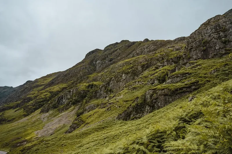
- Key Waypoint: The summit of Conic Hill, where the geological split is visible beneath your feet
Day 4: Aberfoyle to Callander
- Distance: 18.5 km
- Elevation gain: 350 m
- Time: 5–6 hours
- Follow the Menteith Hills, staying on the southern edge of the Trossachs
- Pass the tranquil Loch Venachar and the Victorian filter beds
- Walk through the Coilhallan Wood, a site of ancient hazel and oak
- Arrive in Callander, the bustling "Gateway to the Highlands"
- Key Waypoint: The Samson’s Stone, a massive glacial erratic perched on the hillside
Day 5: Callander to Strathyre
- Distance: 14.5 km
- Elevation gain: 220 m
- Time: 4–5 hours
- Follow the route of the old Callander and Oban Railway
- Pass through the dramatic Pass of Leny, where the river crashes through a narrow gorge
- Walk alongside the shores of Loch Lubnaig, surrounded by steep forested slopes
- Arrive in the quiet village of Strathyre, nestled in the glen
- Key Waypoint: The Falls of Leny, a spectacular series of cascades near the start of the day
Day 6: Strathyre to Comrie
- Distance: 20.2 km
- Elevation gain: 510 m
- Time: 6–7 hours
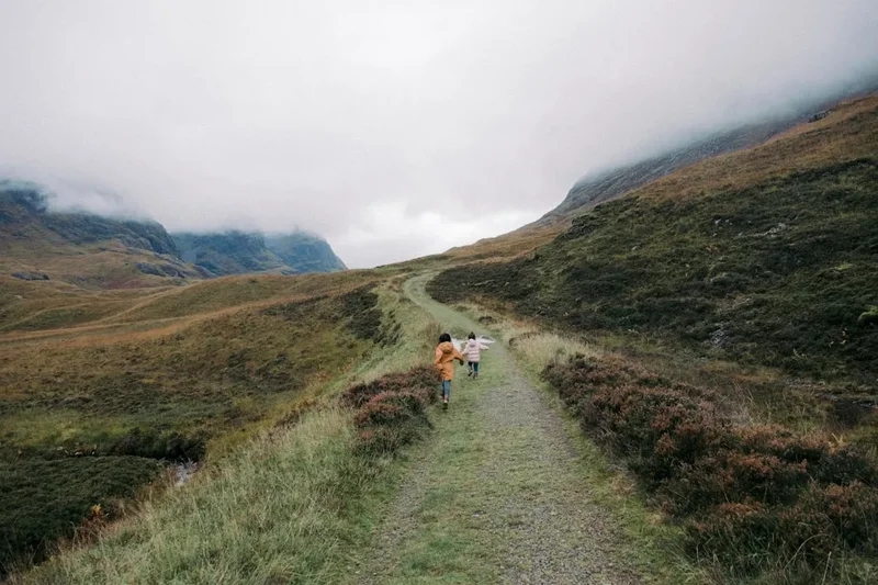
- The most "Highland" day of the trek, crossing the high pass of Glen Artney
- Follow the old drove roads used for centuries to move cattle to the Crieff tryst
- Experience true wilderness with views of Ben Vorlich and Stuc a' Chroin
- Descend into Comrie, known as the "Shaky Toun" due to its position on the fault line
- Key Waypoint: The Earthquake House in Comrie, built to house the world's first seismometers
Day 7: Comrie to Crieff
- Distance: 6.5 km
- Elevation gain: 120 m
- Time: 2–3 hours
- A gentle concluding walk along the banks of the River Earn
- Pass through the grounds of the historic Drummond Castle (optional detour)
- Climb the final rise into the centre of Crieff
- Celebrate the completion of the 107.2 km journey at the Crieff Hydro or a local inn
- Key Waypoint: Lady Mary’s Walk, a beautiful beech-lined riverside path
Important Notes:
- The ferry from Luss to Balmaha is seasonal (April–October) and weather-dependent
- Accommodation in smaller villages like Strathyre and Balmaha should be booked months in advance
- The Glen Artney section (Day 6) is remote; ensure you have full supplies and a charged phone
- Scottish "Right to Roam" laws apply, but please respect livestock and farm gates
- Water is plentiful but should be treated if taken from open streams
Planning and Bookings
Book Your Trip
Everything you need to plan your journey
Accommodation
Find places to stay near Glasgow
Flights
Search flights to Glasgow
Essential Preparation
The Highland Boundary Fault Trail requires a moderate level of fitness. While the gradients are rarely extreme, walking 15–20 kilometres daily for a week with a pack requires stamina. It is highly recommended to undertake several full-day training hikes in the weeks leading up to your trip. Logistics are relatively straightforward due to the trail's proximity to Glasgow. Most walkers base themselves in Glasgow for a night before taking the train to Helensburgh Central to begin the walk. Crieff, the finish point, is well-connected by bus to Perth and Stirling, which have direct rail links back to Glasgow and Edinburgh.
Booking coordination is the most critical part of planning. Because the trail passes through popular tourist areas like Loch Lomond and the Trossachs, accommodation can fill up quickly, especially on weekends. It is advisable to book your accommodation at least 3–4 months in advance for summer trips. If you are planning to use a baggage transfer service (available through several local operators), ensure they service the specific villages on this route, as it is less "standard" than the West Highland Way.
Trail Accommodation
Accommodation along the Highland Boundary Fault Trail is varied, ranging from traditional Scottish inns and bed-and-breakfasts to campsites and hostels. There are no dedicated "trail huts" in the New Zealand or Alpine sense; instead, you will stay in the villages that the trail connects.
Village Options:
- Helensburgh: Numerous hotels and B&Bs. Good for last-minute supplies.
- Luss: Limited and expensive. Book early. Includes a luxury hotel and several high-end B&Bs.
- Balmaha: A popular bunkhouse, a local inn, and a campsite. Very busy in summer.
- Aberfoyle: Good range of mid-range hotels and guest houses.
- Callander: The largest town on the route with the most options, including a youth hostel.
- Strathyre: A few local inns and a caravan park with camping pods.
- Comrie/Crieff: Excellent range of hotels, from budget-friendly to the luxury Crieff Hydro.
Wild Camping: Under the Scottish Outdoor Access Code, wild camping is legal and generally welcomed if done responsibly. However, special "Camping Management Bylaws" apply within parts of the Loch Lomond and The Trossachs National Park from March to September. In these zones (which cover parts of Day 2 and 3), you must stay in a designated campsite or purchase a camping permit (approx. £4 per night) for specific permit areas. Outside these zones, follow the "lightweight, stay one night, leave no trace" rule.
Required Gear
- Footwear: Waterproof hiking boots with good ankle support. The terrain includes rocky paths and boggy moorland. Ensure they are well broken-in.
- Waterproofs: A high-quality breathable waterproof jacket and overtrousers. In Scotland, "waterproof" is a relative term; look for a high hydrostatic head rating.
- Clothing: The layering system is essential. Use moisture-wicking base layers (merino wool or synthetic), an insulating mid-layer (fleece), and avoid cotton which stays cold when wet.
- Navigation: OS Landranger maps (Sheets 56, 57, and 58) or a dedicated GPS device. While the trail is mostly marked, signs can be obscured or missing in remote sections like Glen Artney.
- Pack: A 35–50L backpack with a waterproof liner or rain cover.
- Safety: A whistle, a basic first aid kit (including blister plasters), and a space blanket.
What to Bring
- Midge Protection: A head net and "Smidge" or DEET-based repellent. This is non-negotiable from June to August.
- Food: While villages have shops and pubs, you should carry enough high-energy snacks (nuts, chocolate, dried fruit) and a packed lunch for each day. Day 6 has no shops between Strathyre and Comrie.
- Water: A 2L capacity. While tap water in Scotland is excellent, if you refill from streams, use a filter (like a Sawyer Squeeze) or purification tablets to protect against agricultural runoff.
- Sun Protection: Even in Scotland, the sun can be intense on open moorland. Bring SPF30+ sunscreen and sunglasses.
- Power: A portable power bank for your phone/GPS. Signal is patchy in the glens, which drains batteries quickly.
- Cash: While most places take cards, some smaller B&Bs or rural pubs may prefer cash for small purchases.
Permits
One of the greatest joys of walking in Scotland is the Land Reform (Scotland) Act 2003, which provides a statutory right of responsible access to most land and water. This means you do not need a permit to walk the Highland Boundary Fault Trail itself. However, there are specific administrative requirements for certain sections and activities.
National Park Camping Permits:
- If you intend to wild camp between March 1st and September 30th within the Loch Lomond and The Trossachs National Park, you must check if you are in a "Camping Management Zone."
- Permits for these zones must be booked online in advance via the National Park website. They cost approximately £4 per tent, per night.
- Permits are for specific areas and do not provide facilities like toilets or water; they simply grant the right to camp in a protected area.
Fishing Permits:
- If you plan to fish in Loch Lomond or the River Earn during your trip, you must purchase a local permit. These are available at post offices or local tackle shops in Balmaha, Callander, and Crieff.
Organised Groups:
- Large organised groups (usually 20+ people) or charity events should notify the National Park authority and local councils in advance to ensure there are no conflicts with other events or sensitive land management activities.
Seasonal Restrictions:
- During the stag stalking season (July 1st to October 20th), access to some open moorland sections (particularly Day 6) may be restricted for safety. Check the "Heading for the Scottish Hills" website for real-time information on where stalking is taking place. Usually, staying on established tracks is sufficient to avoid issues.
Other Activities in the Area
The Highland Boundary Fault Trail passes through some of Scotland's most popular tourist regions, making it easy to add extra days for sightseeing:
- Loch Lomond Cruises: Take a larger sightseeing boat from Luss or Tarbet to explore the northern, fjord-like reaches of the loch where the mountains drop straight into the water.
- Stirling Castle: Located a short bus or train ride from Callander or Crieff, this is one of Scotland's most important historical sites, sitting atop an extinct volcano.
- Glengoyne Distillery: Situated near the fault line south of Aberfoyle, this distillery offers tours and tastings of its famous Highland single malt whisky.
- The Lodge Forest Visitor Centre: Located just above Aberfoyle, it offers wildlife hides (great for spotting red squirrels), a Go Ape high-ropes course, and easy walking trails.
- Crieff Hydro: A destination in itself, offering horse riding, off-road driving, and extensive spa facilities to relax your muscles after the walk.
- Auchingarrich Wildlife Centre: Near Comrie, this is a great stop for families or those interested in local and exotic fauna.
Safety and Conditions
Weather Awareness:
- The primary danger on this trail is the weather. Hypothermia can occur even in summer if a walker becomes wet and is exposed to high winds on open moorland. Always carry your waterproofs and an extra warm layer in a dry bag.
- Check the Mountain Weather Information Service (MWIS) for the "Southern Uplands" or "Southeastern Highlands" forecast before setting out each morning.
Terrain Hazards:
- Bogs: Some sections, particularly in Glen Artney and the Kelty Glen, can be extremely boggy. Use trekking poles to test the depth of the ground and avoid jumping onto bright green moss, which usually indicates deep water.
- Livestock: You will frequently walk through fields with sheep and cattle. Keep dogs on a short lead, especially during lambing season (March–May). If cattle approach you, stay calm and move away quietly; do not run.
- Ticks: Lyme Disease is present in Scotland. Check your body for ticks every evening. Use a tick removal tool if you find one, and monitor the site for a "bullseye" rash.
Communication:
- Mobile signal is generally good in the villages but non-existent in the glens and on the higher passes. Do not rely on a phone for primary navigation. Download offline maps (like OS Maps or Gaia) and carry a physical map and compass.
- Tell someone your daily itinerary and expected arrival time at your next accommodation.
Emergency Services: In the event of an emergency, dial 999 or 112 and ask for "Police" then "Mountain Rescue." Be prepared to give your grid reference.
Side Trips and Points of Interest
Conic Hill: While part of the main route on Day 3, it deserves special mention. The hill is a "mini-mountain" that sits directly on the fault line. From the summit, you can see the line of islands—Inchmurrin, Creinch, Torrinch, and Inchcailloch—stretching across Loch Lomond in a perfect straight line. This is the clearest visual evidence of the Highland Boundary Fault in the entire country.
The Bracklinn Falls: A short 2 km detour from Callander leads to these spectacular waterfalls on the Keltie Water. A modern bridge spans the deep gorge, providing a dramatic view of the water as it thunders over the sandstone steps. It was a favourite spot of Queen Victoria and remains one of the most photographed locations in the Trossachs.
The Earthquake House, Comrie: Comrie sits directly on the fault line and experiences more micro-tremors than anywhere else in the UK. In the 19th century, local residents built a small, dedicated building to house the world's first seismometers. It is a tiny, fascinating piece of scientific history located just a short walk from the village centre.
Ben A'an: For those with extra energy in Aberfoyle, a short drive or bus to Loch Katrine allows for a hike up Ben A'an. Known as the "mountain in miniature," it offers one of the best views in Scotland for relatively little effort, looking down the length of Loch Katrine toward the peaks of the west.
Drummond Castle Gardens: Located just outside Crieff, these are among the finest formal gardens in Europe. The "St. Andrew's Cross" design and the perfectly manicured hedges are a stark, beautiful contrast to the wild moorland you will have traversed in the days prior.
Leave No Trace
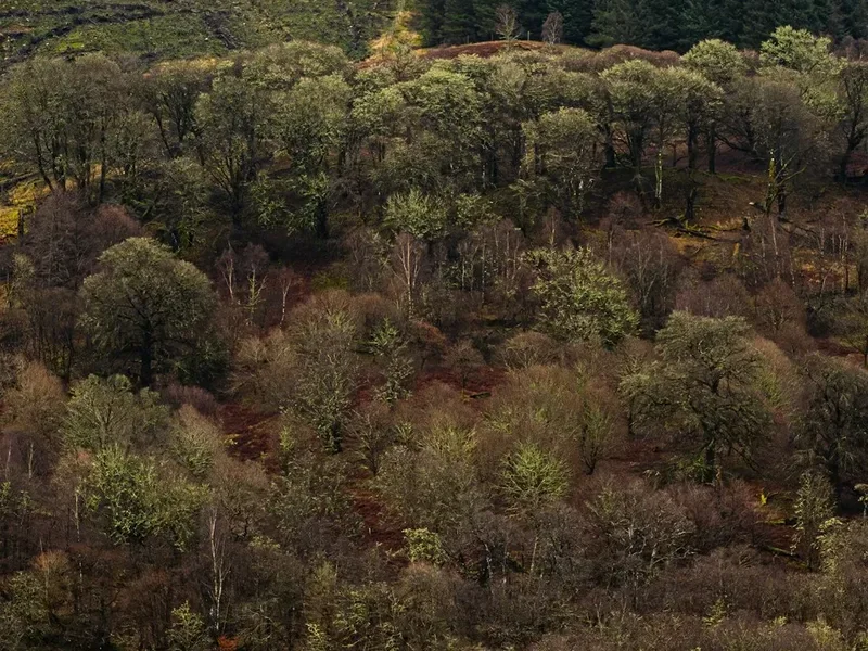
The Highland Boundary Fault Trail passes through sensitive ecosystems, including ancient Atlantic oakwoods and fragile peatlands. As a walker, you are a guest in these landscapes and have a responsibility to protect them for future generations. The Scottish Outdoor Access Code is based on three main principles: respect the interests of other people, care for the environment, and take responsibility for your own actions.
Specific Guidelines for this Trail:
- Waste: Pack out all litter, including biodegradable items like banana skins and orange peels, which take years to decompose in the cold Scottish climate.
- Human Waste: Use public toilets in villages whenever possible. If you must go in the wild, do so at least 30 metres from water sources and bury waste in a shallow hole (15 cm deep). Pack out all toilet paper and sanitary products in a sealed bag.
- Fires: Never light an open fire. The peaty soil can catch fire underground and burn for weeks. Use a lightweight camping stove for cooking.
- Wildlife: Do not disturb nesting birds, especially on the moorland sections. Keep your distance from deer and wild goats.
- Path Erosion: Stay on the marked path, even if it is muddy. Walking on the edges of the path widens the scar on the landscape and destroys fragile vegetation.
- Invasive Species: Clean your boots before and after the walk to prevent the spread of pathogens like Phytophthora ramorum, which is currently threatening Scotland's larch and oak forests.