Hebridean Way Coastal Segments - A Journey to the Edge of the Atlantic
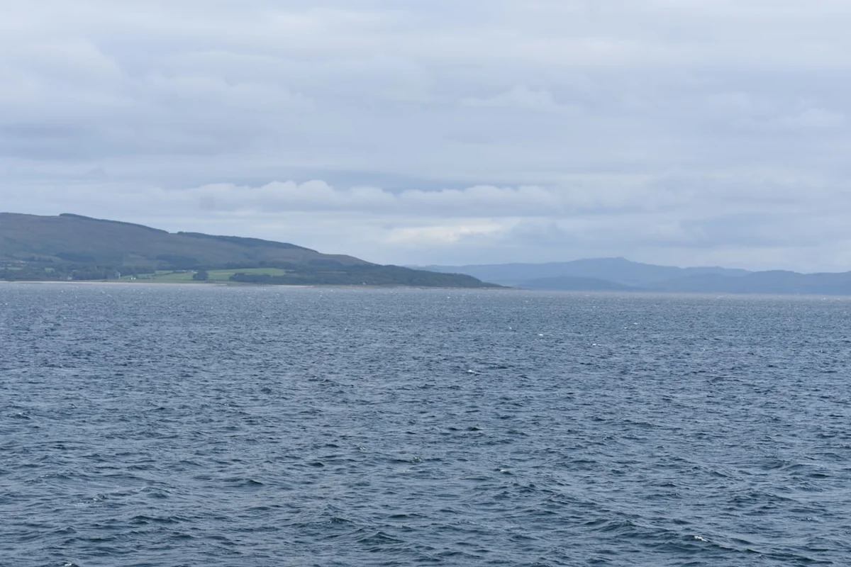
The Hebridean Way is a spectacular long-distance route that traverses the length of the Outer Hebrides, an archipelago off the west coast of Scotland known for its raw beauty, ancient Gaelic culture, and some of the most stunning coastal landscapes in Europe. Spanning approximately 247.4 kilometres, the trail leads walkers across ten islands, linked by six causeways and two ferries, starting from the island of Vatersay in the south and culminating at the Butt of Lewis in the north. This is a journey through a landscape of extremes: from the turquoise waters and silver sands of the southern isles to the rugged, peat-covered moorlands and towering sea cliffs of the north. The coastal segments of this trail are particularly renowned, offering walkers an intimate encounter with the Atlantic Ocean, where the air is salt-laden and the horizon seems infinite.
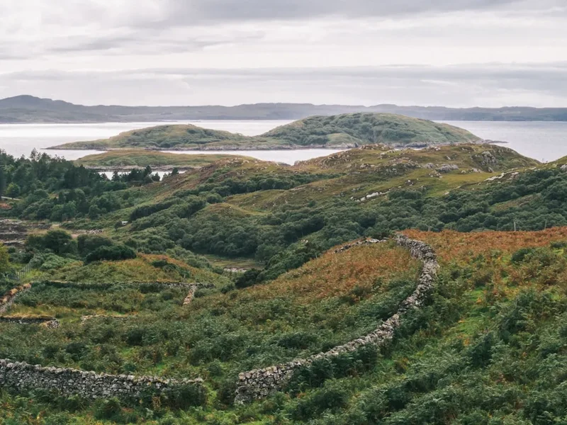
Walking the Hebridean Way is more than just a physical challenge; it is an immersion into a unique way of life. The islands are a stronghold of the Scottish Gaelic language, and the rhythm of life here is still dictated by the tides and the weather. The trail passes through "machair"—a rare, fertile coastal grassland found only in western Scotland and Ireland—which erupts into a carpet of wildflowers during the summer months. It also navigates through some of the oldest geology on Earth, with the Lewisian Gneiss forming the bedrock of the islands, dating back over three billion years. Whether you are crossing the vast tidal flats of North Uist or standing atop the dramatic cliffs of Harris, the Hebridean Way provides a profound sense of solitude and a connection to the natural world that is increasingly rare in the modern age.
- Distance: 247.4 km total
- Duration: 7–10 days
- Season: April to October (best weather and longest daylight)
- Accommodation: Hostels, B&Bs, hotels, and wild camping
- Highest point: Approximately 250 m (on the Clisham pass, though the coastal route stays lower)
- Difficulty: Moderate (long distances and unpredictable weather)
- Direction: South to North (recommended to keep the prevailing wind at your back)
Overview
The Hebridean Way is a masterclass in island-hopping, offering a diverse range of terrains that change almost as frequently as the weather. The southern section of the trail, encompassing Vatersay, Barra, Eriskay, and the Uists, is defined by its low-lying coastal plains and incredible beaches. Here, the trail often follows the "machair" coastline, where the sand is composed of crushed seashells, giving it a brilliant white appearance that contrasts sharply with the deep blues of the Atlantic. This section is relatively flat but requires careful navigation through boggy sections and across tidal causeways. The sense of openness here is unparalleled, with views stretching across the Minch to the mountains of the mainland or out towards the remote archipelago of St Kilda on a clear day.
As the trail moves northwards into Harris and Lewis, the landscape undergoes a dramatic transformation. The "coastal segments" here become more rugged and vertical. Harris is famous for its "lunar" landscape of exposed rock and deep sea lochs, alongside some of the most famous beaches in the world, such as Luskentyre and Seilebost. The trail climbs over mountain passes that offer panoramic views of the Sound of Harris before descending back to the coast. Lewis, the largest and northernmost island, offers a mix of vast peat moorlands and dramatic sea cliffs. The final approach to the Butt of Lewis is a highlight, where the trail follows the cliff edge to the iconic lighthouse, marking the northernmost point of the Outer Hebrides. Here, the full force of the Atlantic is on display, with massive swells crashing against the ancient rock.
Weather is the defining factor of any Hebridean journey. The islands are exposed to the full brunt of Atlantic weather systems, meaning that sunshine, rain, and gale-force winds can all occur within a single hour. This unpredictability is part of the trail's character, requiring walkers to be self-sufficient and resilient. However, the rewards are immense: the light in the Hebrides is legendary among photographers for its clarity and ever-changing quality, and the wildlife—including golden eagles, sea eagles, otters, and corncrakes—is among the best in the United Kingdom. The Hebridean Way is not just a walk; it is an odyssey through a landscape that feels as though it belongs to another time.
History and Cultural Context
The history of the Outer Hebrides is etched into the landscape, from Neolithic standing stones to the ruins of 19th-century "blackhouses." The islands have been inhabited for over 6,000 years, and the Hebridean Way passes through numerous sites of immense archaeological significance. The most famous of these are the Calanais (Callanish) Standing Stones on Lewis, a cruciform arrangement of megaliths that predates Stonehenge. These stones, along with numerous duns (forts), cairns, and stone circles scattered across the islands, speak to a long and complex history of human settlement in this challenging environment.
The cultural identity of the islands is deeply rooted in the Gaelic language and the crofting system. Crofting is a traditional form of small-scale landholding unique to the Scottish Highlands and Islands, and much of the trail passes through active crofting communities. You will see sheep grazing on the machair and peat banks where fuel is still harvested by hand in the traditional manner. The islands were also a focal point of the Highland Clearances in the 18th and 19th centuries, a period of forced displacement that saw many islanders emigrate to the Americas. The ruins of abandoned villages along the coast serve as a poignant reminder of this turbulent period. The Gaelic language remains the first language for many residents, and preserving this linguistic heritage is a central part of modern island life.
The islands also played a role in more recent history, notably during the Jacobite Risings. Prince Charles Edward Stuart (Bonnie Prince Charlie) famously landed on the island of Eriskay in 1745 to begin his attempt to reclaim the British throne. The "Prince’s Beach" on Eriskay is one of the many historical landmarks walkers will encounter. Today, the islands are known for their vibrant traditional music scene and the production of Harris Tweed, a world-renowned textile that must, by law, be handwoven by the islanders in their own homes. Walking the Hebridean Way allows you to witness the resilience of a culture that has survived centuries of hardship while maintaining a deep connection to the land and sea.
Want more background? Read extended notes on history and cultural context → Learn more
Seasonal Highlights and Weather Reality
The best time to walk the Hebridean Way is between April and October. During this window, the days are long—in midsummer, it barely gets dark at all—and the ferry services are most frequent. However, each month offers a different experience of the islands.
Spring (April to May): This is often the driest period in the Hebrides. The machair begins to wake up, and the birdlife is incredibly active as migratory species return. The air is crisp, and the visibility is often at its best. However, temperatures can still be low, and snow is not uncommon on the higher peaks of Harris in early April.
Summer (June to August): This is the peak season for the machair wildflowers, which create a stunning mosaic of colour along the coast. The weather is generally warmer, but this is also the season of the "midge"—a tiny biting insect that can be a significant nuisance on still, damp days. Summer also brings the most tourists, so booking accommodation in advance is essential. The long daylight hours allow for flexible walking schedules.
Autumn (September to October): The crowds thin out, and the landscape turns to shades of gold and russet. The midge population declines, making for more comfortable walking. However, the weather becomes more unsettled, with a higher frequency of Atlantic storms and shorter daylight hours. This is a great time for those seeking solitude and dramatic, moody landscapes.
Winter (November to March): Walking the full Hebridean Way in winter is only recommended for highly experienced trekkers. Many accommodation providers and some ferry services close or operate on a reduced schedule. Gale-force winds are frequent, and the weather can be dangerously unpredictable. However, for those who are prepared, the winter light and the raw power of the storms offer a unique perspective on the islands.
Recommended Itinerary
10-Day Hebridean Way Itinerary
Day 1: Vatersay to Castlebay (Barra)
- Distance: 14 km
- Elevation gain: 350 m
- Time: 4–5 hours
- Start at the official monument on Vatersay beach
- Cross the causeway to Barra
- Follow coastal paths with views of Kisimul Castle in the bay
- Arrive in Castlebay, the main village of Barra
- A gentle introduction with stunning white sand beaches and turquoise waters
Day 2: Castlebay to Eriskay and South Uist (Daliburgh)
- Distance: 26 km (including ferry)
- Elevation gain: 200 m
- Time: 7–8 hours
- Walk across Barra to the northern ferry terminal at Ardmhòr
- Take the ferry to Eriskay (40 minutes)
- Walk across Eriskay, passing the Prince’s Beach
- Cross the causeway to South Uist and continue to Daliburgh
- Experience the transition between islands and the unique charm of Eriskay
Day 3: Daliburgh to Howmore (South Uist)
- Distance: 22 km
- Elevation gain: 100 m
- Time: 6–7 hours
- Follow the low-lying machair coastline of South Uist
- Pass numerous ancient ruins and small crofting townships
- Arrive at Howmore, famous for its historic chapel ruins and Gatliff Hostel
- Flat, easy walking but can be boggy after rain; incredible birdwatching opportunities
Day 4: Howmore to Liniclate (Benbecula)
- Distance: 20 km
- Elevation gain: 150 m
- Time: 5–6 hours
- Continue north through the watery landscape of South Uist
- Cross the causeway to the island of Benbecula
- Follow the coast to Liniclate, passing the ruins of Borve Castle
- Benbecula is a "stepping stone" island with a unique, flat, loch-filled interior
Day 5: Liniclate to Clachan Sands (North Uist)
- Distance: 28 km
- Elevation gain: 150 m
- Time: 8–9 hours
- Cross the causeway from Benbecula to North Uist
- Navigate the complex coastline and tidal flats of North Uist
- Pass through the village of Lochmaddy (optional detour)
- Arrive at Clachan Sands, a stunning coastal area
- A long day requiring careful navigation through a maze of lochs and inlets
Day 6: Clachan Sands to Berneray
- Distance: 18 km
- Elevation gain: 100 m
- Time: 5–6 hours
- Follow the northern coast of North Uist
- Cross the causeway to the beautiful island of Berneray
- Walk the famous West Beach of Berneray, often voted one of the best in the world
- Stay in the Berneray Gatliff Hostel, a traditional thatched blackhouse
- A shorter day allowing time to enjoy the spectacular beaches of Berneray
Day 7: Berneray to Leverburgh and Horgabost (Harris)
- Distance: 15 km (plus ferry)
- Elevation gain: 300 m
- Time: 5–6 hours
- Take the ferry from Berneray to Leverburgh on Harris (1 hour)
- Walk the rugged coastal path of South Harris
- Pass the medieval St Clement’s Church in Rodel
- Arrive at Horgabost, overlooking the sands of Luskentyre
- The landscape shifts dramatically to the rugged, rocky terrain of Harris
Day 8: Horgabost to Tarbert (Harris)
- Distance: 22 km
- Elevation gain: 500 m
- Time: 7–8 hours
- Follow the "Golden Road" or the coastal hills towards Tarbert
- Spectacular views of the Luskentyre estuary and the mountains of North Harris
- Arrive in Tarbert, the main hub of Harris and home to the Harris Tweed and Gin distillery
- Challenging terrain with significant elevation changes and rewarding vistas
Day 9: Tarbert to Achmore (Lewis)
- Distance: 34 km
- Elevation gain: 600 m
- Time: 9–10 hours
- The longest and most demanding day of the trail
- Cross the rugged border between Harris and Lewis
- Follow the old "postman’s path" through the mountains
- Descend into the vast peat moorlands of Lewis
- Arrive in the small settlement of Achmore
Day 10: Achmore to Stornoway and the Butt of Lewis
- Distance: 25 km (to Stornoway) + transport to Butt of Lewis
- Elevation gain: 200 m
- Time: 7–8 hours
- Final walk into Stornoway, the capital of the Outer Hebrides
- Pass through the grounds of Lews Castle
- Many walkers take a bus or taxi to the Butt of Lewis for the final cliff-top walk to the lighthouse
- Celebrate the completion of the journey at the northernmost tip of the islands
Important Notes:
- Ferry schedules are seasonal and weather-dependent; always check CalMac updates
- Sunday is a day of rest in many parts of the islands (especially Lewis and Harris); shops and transport may be closed
- Waterproof footwear is essential as many sections are permanently boggy
- The trail is waymarked, but a map and compass (and the ability to use them) are necessary for poor visibility
- Wild camping is permitted under the Scottish Outdoor Access Code, but respect local crofting activities
Planning and Bookings
Book Your Trip
Everything you need to plan your journey
Accommodation
Find places to stay near Stornoway
Flights
Search flights to Stornoway
Essential Preparation
Planning a trip on the Hebridean Way requires more logistical coordination than many other UK long-distance trails due to the island-hopping nature of the route. The most critical element is coordinating your arrival and departure with the ferry schedules operated by Caledonian MacBrayne (CalMac). It is highly recommended to travel from South to North to take advantage of the prevailing south-westerly winds, which can be a significant factor in your daily progress.
Fitness requirements are moderate; while the trail doesn't involve high-altitude mountaineering, the daily distances are significant, and the terrain is often uneven, boggy, or rocky. You should be comfortable walking 20–30 kilometres per day with a loaded pack. Stornoway is the main service centre, but smaller villages like Castlebay, Lochmaddy, and Tarbert offer essential services. Be aware that the islands are remote, and medical facilities are limited to local GPs and a small hospital in Stornoway.
Trail Accommodation
Accommodation on the Hebridean Way ranges from traditional B&Bs and small hotels to unique hostels and wild camping. Because the islands have limited capacity, booking well in advance (3–6 months) is essential, especially during the summer months.
Huts and Hostels:
- Gatliff Hebridean Hostels Trust: These are iconic, basic hostels located in traditional buildings (like the thatched blackhouses at Howmore and Berneray). They offer a unique experience but cannot be booked in advance—it is a first-come, first-served system.
- Independent Hostels: Located in Castlebay, Lochmaddy, and Tarbert. These usually offer bunk rooms, communal kitchens, and drying rooms.
- B&Bs and Guest Houses: Plentiful but scattered. They offer a high standard of hospitality and often include a hearty "Full Scottish" breakfast.
Facilities Provided: Most formal accommodation provides hot showers, kitchen access, and bedding. However, the Gatliff hostels are more basic, and you should bring your own sleeping bag liner and food.
Costs: Hostels typically cost £20–£30 per night, while B&Bs range from £80–£150 per room. Wild camping is free but must be done responsibly.
Required Gear
- Walking boots: Must be waterproof and well broken-in. The terrain is frequently wet and boggy.
- Waterproof jacket and trousers: High-quality Gore-Tex or equivalent is essential. The Hebrides are famous for horizontal rain.
- Gaiters: Highly recommended to keep peat and water out of your boots in boggy sections.
- Navigation: OS Landranger or Explorer maps (Sheets 13, 14, 18, 22, 31), a reliable compass, and a GPS device or offline map app.
- Backpack: 50–65L if camping, 30–40L if staying in B&Bs. Ensure it has a high-quality rain cover.
- Midge protection: A fine-mesh midge head net and repellent (Smidge is a popular local choice).
- Trekking poles: Very useful for stability on uneven ground and for testing the depth of boggy patches.
What to Bring
- Food supplies: While there are shops in the main villages, they are few and far between. Carry at least two days' worth of emergency rations.
- Water treatment: While tap water is safe, if you are drawing from streams, use a filter or purification tablets due to livestock (sheep and deer) presence.
- Sun protection: The Atlantic sun can be surprisingly strong, even when it feels cool. Bring SPF 50+ and sunglasses.
- First aid: Include plenty of blister plasters (Compeed), antiseptic cream, and a tick removal tool (ticks are common in the bracken).
- Power bank: To keep your phone and GPS charged, as some hostels have limited outlets.
- Cash: While most places take cards, some smaller B&Bs and honesty boxes for produce still require cash.
Permits
One of the great joys of walking in Scotland is the "Right to Roam." Under the Land Reform (Scotland) Act 2003, you have a legal right to access most land and inland water for recreation, provided you do so responsibly. This means no permits are required to walk the Hebridean Way or to wild camp along the route.
Scottish Outdoor Access Code:
- You must follow the Scottish Outdoor Access Code, which is based on three main principles: respect the interests of other people, care for the environment, and take responsibility for your own actions.
- Avoid fields with livestock, especially during lambing season (April–May).
- Keep dogs under close control or on a lead, particularly near sheep.
- Leave gates as you find them.
Ferry Bookings: While you don't need a permit for the trail, you effectively need "permits" for the ferries. CalMac ferries between Barra and Eriskay, and Berneray and Harris, can be busy. While foot passengers rarely sell out, it is still wise to check schedules and book in advance during peak season to ensure your itinerary stays on track.
Camping: If you are wild camping, you do not need a permit, but you should avoid camping in enclosed fields of crops or near buildings. On the machair, be particularly careful not to damage the fragile turf or disturb nesting birds.
Other Activities in the Area
The Outer Hebrides offer a wealth of experiences beyond the trail. Consider adding a few days to your trip to explore these options:
- St Kilda Boat Trips: If weather permits, a boat trip to the remote, abandoned archipelago of St Kilda (a dual UNESCO World Heritage site) is a once-in-a-lifetime experience. It is home to the UK's highest sea cliffs and massive colonies of seabirds.
- Distillery Visits: Visit the Isle of Harris Distillery in Tarbert for their world-famous gin and nascent "The Hearach" whisky, or the Abhainn Dearg Distillery on Lewis.
- Harris Tweed Weaving: Visit a local weaver's shed to see the traditional process of creating Harris Tweed. Many weavers offer demonstrations and have small shops.
- Wildlife Boat Tours: Take a boat from Castlebay or Lochmaddy to spot seals, dolphins, basking sharks, and the elusive white-tailed sea eagle.
- Gearrannan Blackhouse Village: Explore this restored village of traditional thatched houses on the west coast of Lewis to see how islanders lived until the mid-20th century.
- Surfing: The west coast of Lewis, particularly around Dalmore and Barvas, offers some of the most consistent and uncrowded surf breaks in Europe.
Safety and Conditions
Weather Awareness: The biggest safety risk on the Hebridean Way is the weather. Conditions can deteriorate rapidly, and wind speeds can make walking difficult or even dangerous on exposed ridges. Always check the Met Office mountain forecast or the MWIS (Mountain Weather Information Service) for the Northwest Highlands. If a gale is forecast, consider staying put for the day.
Boggy Terrain: Much of the trail passes through peat bog. These areas can be deceptively deep, especially after heavy rain. Use trekking poles to test the ground before committing your weight. If you find yourself in a particularly soft patch, move slowly and try to find firmer ground or tufts of heather.
Navigation: While the trail is waymarked with the Hebridean Way logo, markers can be obscured by mist, knocked over by livestock, or simply far apart in open moorland. You must be confident using a map and compass. Do not rely solely on a mobile phone, as battery life drops in the cold and signal is non-existent in many areas.
Ticks and Lyme Disease: Ticks are prevalent in the bracken and long grass of the islands. They can carry Lyme Disease. Wear long trousers tucked into socks, use repellent, and check your body thoroughly every evening. If you find a tick, remove it correctly with a tick tool.
Emergency Services: In an emergency, dial 999 or 112 and ask for the Police and then Mountain Rescue or Coastguard. Be prepared to give your grid reference. Carrying a Personal Locator Beacon (PLB) is a sensible precaution for solo walkers in the more remote sections of Harris and Lewis.
Side Trips and Points of Interest
Calanais (Callanish) Standing Stones: Located on the west coast of Lewis, these stones are a short detour or bus ride from the main trail. The main site consists of about 50 stones in a cross-shaped setting, with a central burial cairn. The stones are made of local Lewisian Gneiss and have a haunting, ethereal presence, especially at sunrise or sunset.
Luskentyre Sands: While the trail passes nearby, taking a few hours to walk the full length of Luskentyre beach on Harris is highly recommended. The contrast of the white sand, turquoise water, and the dark mountains of North Harris is one of the most iconic sights in Scotland.
St Clement’s Church, Rodel: This 16th-century church at the southern tip of Harris is the finest medieval building in the Outer Hebrides. It contains the magnificent tomb of Alexander MacLeod, featuring intricate stone carvings that are remarkably well-preserved.
The Butt of Lewis Lighthouse: The official end (or start) of the trail. Designed by David Stevenson and built in 1862, the lighthouse stands on 30-metre-high cliffs. It is a place of immense power, where you can watch the Atlantic swells roll in from thousands of kilometres away. It is also a prime spot for whale and dolphin watching.
Eriskay Ponies: Keep an eye out for the rare Eriskay Ponies on their home island. These small, hardy, grey ponies are a distinct breed that has lived on the islands for centuries. They are generally friendly but should not be fed or disturbed.
Leave No Trace
The Outer Hebrides are home to some of the UK's most fragile ecosystems. The machair, in particular, is a globally rare habitat that supports a huge variety of plants and birds. As a walker, it is your responsibility to ensure that your presence does not degrade this environment.
Core Principles for the Hebrides:
- Waste Management: Pack out all litter, including biodegradable items like banana skins and orange peels, which take a long time to decompose in this climate. If you need to go to the toilet and there are no facilities, bury solid waste at least 15 centimetres deep and 50 metres from water sources. Pack out all toilet paper and sanitary products.
- Camping: Use a stove rather than lighting fires. Peat is highly flammable and fires can spread underground, causing devastating moorland fires. If wild camping, move your tent every night to avoid damaging the vegetation.
- Wildlife: Observe wildlife from a distance. During the nesting season (March–July), be particularly careful on the machair and beaches to avoid disturbing ground-nesting birds like lapwings and corncrakes.
- Water: Use biodegradable soaps and detergents, and ensure all washing is done at least 30 metres away from lochs and streams.
By following these principles, you help ensure that the Hebridean Way remains a pristine wilderness for those who follow in your footsteps.