The Hayduke Trail - A Desert Odyssey Across the Colorado Plateau
The Hayduke Trail is not a trail in the traditional sense; it is a masterpiece of wilderness navigation, a 1,287.5-kilometre route that traverses the heart of the Colorado Plateau in the United States. Unlike the well-trodden paths of the Appalachian or Pacific Crest Trails, the Hayduke is a rugged, cross-country journey that links six of America’s most iconic National Parks: Arches, Canyonlands, Capitol Reef, Bryce Canyon, Grand Canyon, and Zion. It is a route defined by its defiance of the easy path, leading hikers through deep sandstone canyons, across sun-scorched mesas, over high alpine ridges, and into the most remote corners of the American Southwest. This is a journey for the experienced navigator, the lover of solitude, and those who seek to understand the raw, geological soul of the desert.
- Distance: 1,287.5 km (approximate, depending on route choices)
- Duration: 8–12 weeks
- Season: Spring (March–May) or Autumn (September–November)
- Total Elevation Gain: 34,126 m
- Highest Point: Mount Ellen, Henry Mountains (3,512 m)
- Lowest Point: Colorado River, Grand Canyon (approx. 550 m)
- Difficulty: Very Challenging (requires advanced navigation and desert survival skills)
- Direction: Typically travelled East to West (Arches to Zion)
Overview
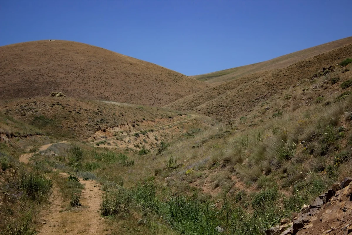
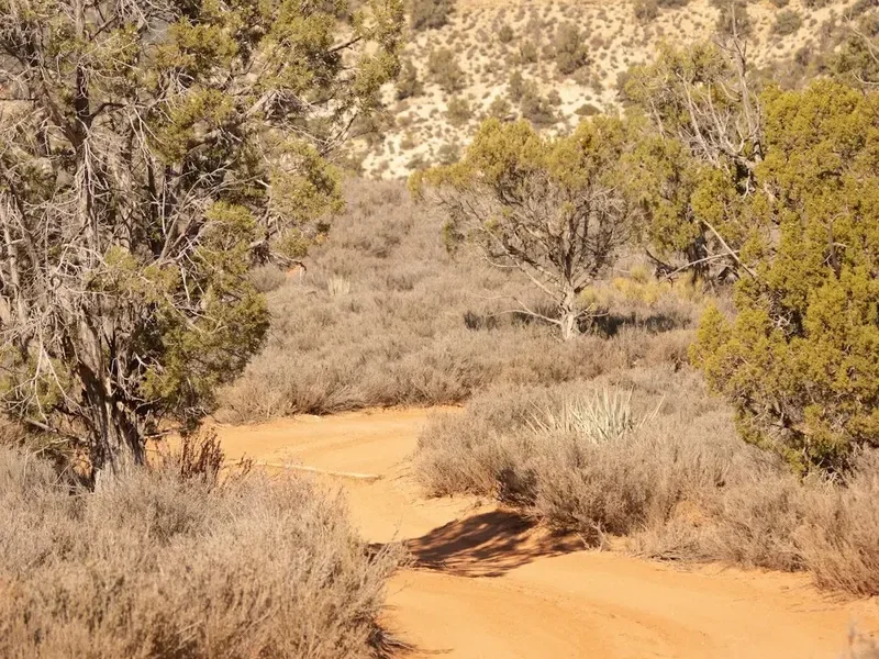
The Hayduke Trail is a premier long-distance route that offers an unparalleled immersion into the "Grand Circle" of the American Southwest. Conceived as a way to showcase the incredible diversity of the Colorado Plateau, the route avoids paved roads and developed areas whenever possible, opting instead for the silence of slot canyons and the vastness of the high desert. It is a journey of extremes: one day you may be wading through the icy waters of the Virgin River, and the next you could be struggling through deep sand under a relentless 35°C sun. The sheer scale of the landscape is humbling, with geological layers representing millions of years of Earth's history exposed in the canyon walls.
Because the Hayduke is a route rather than a maintained trail, hikers must be prepared for significant stretches of cross-country travel. There are no white blazes to follow here. Instead, you will rely on topographic maps, GPS coordinates, and an intuitive understanding of desert geography. You will follow dry washes (arroyos), ancient cattle paths, and occasional sections of established trail, but much of the magic of the Hayduke lies in finding your own way through the labyrinthine sandstone. The route is divided into 14 distinct sections, each with its own unique character, from the needles of Canyonlands to the towering amphitheatre of Bryce and the depths of the Grand Canyon.
Solitude is perhaps the Hayduke’s greatest gift. In a world where wilderness is increasingly crowded, the Hayduke offers weeks of isolation. It is common to go several days without seeing another human being, sharing the landscape only with bighorn sheep, ravens, and the occasional mountain lion. This isolation demands a high level of self-reliance. Water is the primary currency of the desert; finding it, treating it, and carrying enough of it to reach the next source is the central challenge of the trek. For those who rise to the challenge, the reward is a profound connection to one of the most spectacular and unforgiving landscapes on the planet.
History and Cultural Context
The Hayduke Trail is named in honour of George Washington Hayduke, the fictional protagonist of Edward Abbey’s 1975 novel, The Monkey Wrench Gang. Hayduke was a quintessential desert rat and environmental saboteur who fought against the industrialisation and "development" of the American Southwest. The trail embodies Hayduke’s spirit of fierce independence and deep love for the untamed desert. It was envisioned and mapped by Joe Mitchell and Mike Coronella in the late 1990s, who spent years scouting routes that would link the region's protected lands into one continuous, wild journey. Their guidebook, published in 2005, remains the definitive resource for those attempting the route.
Beyond its literary namesake, the land traversed by the Hayduke Trail has a human history stretching back thousands of years. The Colorado Plateau is the ancestral home of numerous Indigenous peoples, including the Hopi, Navajo (Diné), Zuni, Ute, and Southern Paiute. Throughout the route, hikers will encounter the remnants of the Ancestral Puebloan and Fremont cultures, who thrived in these canyons between 600 and 1300 AD. Granaries perched high on cliff ledges, intricate petroglyphs etched into varnish-covered sandstone, and scattered pottery shards serve as silent reminders of those who lived here long before the concept of a "thru-hike" existed. These sites are sacred and protected; they must be treated with the utmost respect.
The modern history of the region is one of exploration and conservation. From the early Spanish explorers to the daring river expedition of John Wesley Powell in 1869, the Colorado River and its tributaries have long captivated the human imagination. The creation of the National Parks and Monuments along the route represents a century-long effort to preserve these landscapes from mining, damming, and over-grazing. Walking the Hayduke is, in many ways, a journey through the history of American conservation, witnessing both the beauty of protected lands and the fragility of the ecosystems that lie outside their borders.
Want more background? Read extended notes on history and cultural context → Learn more
Seasonal Highlights and Weather Reality
Timing is everything on the Hayduke Trail. The desert is a land of extremes, and the window for a safe and successful thru-hike is narrow. Most hikers choose to start in the spring (March or April) or the autumn (September or October) to avoid the lethal heat of summer and the impassable snows of winter.
Spring (March–May): This is the most popular time for an eastbound or westbound attempt. The days are generally mild, and the desert is often in bloom, with wildflowers and cacti providing bursts of colour against the red rock. Water is more abundant in the spring due to snowmelt from the high plateaus, though this can also make river crossings (such as the Dirty Devil or the Virgin River) more dangerous. However, spring in the desert is also the season of wind; relentless gusts can scour the landscape and make camping difficult. High-elevation sections, like the Henry Mountains or the Kaibab Plateau, may still hold significant snow until late May.
Autumn (September–November): Autumn offers more stable weather and cooler temperatures than spring. The "monsoon" season (July–August) has usually subsided, though the risk of flash floods remains a critical concern. Water sources are at their lowest in the autumn, meaning hikers must be more strategic about water caches and long carries. The changing colours of the cottonwood trees in the canyon bottoms provide a spectacular golden contrast to the blue desert skies. By November, temperatures at high elevations can drop well below freezing, and the first winter storms can bring snow to the rims of the Grand Canyon and Bryce.
Summer and Winter: Attempting the Hayduke in summer is widely considered suicidal due to temperatures regularly exceeding 40°C and the near-total absence of water in many sections. Winter brings its own set of challenges, with deep snow on the plateaus and ice in the slot canyons making navigation and travel extremely hazardous. Only those with specialised winter desert experience should consider travel during these months.
Recommended Itinerary
The 14 Stages of the Hayduke Trail
Stage 1: Arches National Park to Hurrah Pass
- Distance: 65 km
- Key Waypoints: Moab, Colorado River, Amasa Back
- The journey begins at the Salt Valley Wash in Arches National Park.
- Navigate through the iconic fins and arches before dropping down to the Colorado River near Moab.
- This section serves as an introduction to the sandy washes and slickrock navigation that define the trail.
- Moab provides the last major resupply point for several weeks.
Stage 2: Hurrah Pass to Canyonlands (The Needles)
- Distance: 92 km
- Key Waypoints: Lockhart Basin, Elephant Hill
- A rugged traverse of Lockhart Basin, following the base of towering red cliffs.
- Enter the Needles District of Canyonlands National Park, famous for its striped sandstone spires.
- Requires careful navigation through complex canyon systems like Chesler Park.
Stage 3: The Needles to The Maze
- Distance: 84 km
- Key Waypoints: Colorado River Crossing, Spanish Bottom, The Doll House
- Includes a mandatory crossing of the Colorado River (requires pre-arranged packraft or shuttle).
- Enter The Maze, one of the most remote and inaccessible areas in the lower 48 states.
- Steep climbs and descents through the "Land of Standing Rocks."
Stage 4: The Maze to Hite
- Distance: 105 km
- Key Waypoints: Dirty Devil River, Poison Springs Canyon
- A long, dry stretch followed by a descent into the Dirty Devil River canyon.
- Expect heavy silt and mud while following the river corridor.
- Hite serves as a critical (though minimal) resupply point or cache location.
Stage 5: Hite to the Henry Mountains
- Distance: 78 km
- Key Waypoints: Mount Ellen, Wickiup Pass
- A dramatic change in scenery as the route climbs from the desert floor to the alpine ridges of the Henry Mountains.
- The highest point of the trail (3,512 m) offers panoramic views of the entire Colorado Plateau.
- Home to one of the only free-roaming bison herds in the US.
Stage 6: Henry Mountains to Capitol Reef
- Distance: 82 km
- Key Waypoints: Burr Trail, Muley Twist Canyon
- Descend from the mountains into the Waterpocket Fold of Capitol Reef National Park.
- Navigate the spectacular narrows of Muley Twist Canyon.
- Classic "reef" geology with massive tilted layers of sandstone.
Stage 7: Capitol Reef to Escalante
- Distance: 110 km
- Key Waypoints: Upper Escalante River, Death Hollow
- One of the most beautiful and challenging sections.
- Death Hollow features deep pools and technical bypasses on slickrock.
- The town of Escalante is a welcome resupply point with real food and showers.
Stage 8: Escalante to Bryce Canyon
- Distance: 95 km
- Key Waypoints: The Box, Under-the-Rim Trail
- Climb from the Escalante River system toward the high Paunsaugunt Plateau.
- Enter Bryce Canyon National Park, walking beneath the world-famous hoodoos.
- Significant elevation gain as you move from the "Grey Cliffs" to the "Pink Cliffs."
Stage 9: Bryce Canyon to Grand Staircase
- Distance: 88 km
- Key Waypoints: Sheep Creek, Hackberry Canyon
- Descend back into the rugged wilderness of the Grand Staircase-Escalante National Monument.
- Follow Hackberry Canyon, a long and scenic riparian corridor.
- Remote and rarely visited by anyone other than Hayduke hikers.
Stage 10: Grand Staircase to Paria River
- Distance: 72 km
- Key Waypoints: Cottonwood Wash, Paria Townsite
- Navigate through the Cockscomb, a massive geological uplift.
- Join the Paria River, a major drainage that leads toward the Arizona border.
Stage 11: Paria River to Buckskin Gulch
- Distance: 60 km
- Key Waypoints: Buckskin Gulch, Wire Pass
- Traverse Buckskin Gulch, the longest and deepest slot canyon in the world.
- Requires wading through "cesspools" of stagnant water and navigating logjams.
- Extremely dangerous in the event of rain; flash flood risk is absolute.
Stage 12: Arizona Strip to North Rim
- Distance: 115 km
- Key Waypoints: Kaibab Plateau, Nankoweap Trail
- Cross the high, forested Kaibab Plateau before reaching the North Rim of the Grand Canyon.
- The descent via the Nankoweap Trail is considered the most difficult "maintained" trail in the canyon.
- Incredible exposure and world-class views of the Colorado River.
Stage 13: Grand Canyon Traverse
- Distance: 140 km
- Key Waypoints: Bright Angel Creek, Tonto Trail, Kanab Creek
- A massive section following the Tonto Platform and various inner-canyon routes.
- Requires intense water management and heat tolerance.
- Exit the canyon via the formidable Kanab Creek drainage.
Stage 14: Kanab Creek to Zion National Park
- Distance: 102 km
- Key Waypoints: Barracks of the Virgin River, Weeping Rock
- The final push toward Zion.
- Follow the East Fork of the Virgin River through "The Barracks," a stunning and less-visited canyon.
- Finish at the Temple of Sinawava or Weeping Rock in Zion Canyon.
Planning and Bookings
Book Your Trip
Everything you need to plan your journey
Accommodation
Find places to stay near Moab, Utah
Flights
Search flights to Moab, Utah
Essential Preparation
The Hayduke Trail requires a level of preparation far beyond that of a standard backpacking trip. Physical fitness is a baseline requirement; you must be capable of walking 25–35 kilometres per day over uneven, sandy, or vertical terrain while carrying a heavy pack. However, mental fortitude and navigational skills are even more critical. You must be proficient with a map and compass, as well as GPS technology. Many hikers spend six months to a year planning their logistics, including water caches and resupply boxes.
Moab, Utah, is the primary gateway for the eastern end of the trail, while Springdale, Utah, serves the western end. Both towns have full services, including gear shops and grocery stores. Because the trail is so remote, most hikers rely on "caching"—driving to remote road crossings weeks in advance to bury water and food. If you are travelling from overseas, you may need to hire a local shuttle service to help with these caches.
Trail Accommodation
The Hayduke Trail is almost entirely a wilderness camping experience. There are no huts, shelters, or established lodges along the route, with the exception of a few developed campgrounds within the National Parks.
Camping Realities:
- Wild Camping: Most nights will be spent at "at-large" campsites on BLM (Bureau of Land Management) or Forest Service land. You must choose durable surfaces like slickrock or dry sand to minimise impact.
- National Park Campgrounds: In Arches, Canyonlands, Bryce, and Zion, you may stay in established campgrounds if you have a reservation. These often have toilets and water, but they book up months in advance.
- Backcountry Permits: While you are "camping," you are often required to have a backcountry permit for specific zones within National Parks (see Permits section).
- What's Provided: Nothing. You are responsible for your own shelter, bedding, and warmth.
- Costs: BLM camping is generally free. National Park backcountry permits range from US$10 to US$30 per night.
Required Gear
- Footwear: Non-waterproof trail runners or lightweight boots with excellent drainage. Your feet will get wet in canyons, and "waterproof" boots will simply trap the water inside.
- Navigation: High-resolution topographic maps (printed), a reliable GPS unit (Garmin inReach or similar), and a smartphone with offline maps (Gaia GPS or FarOut).
- Shelter: A lightweight, wind-resistant tent or pyramid tarp. The desert can be incredibly windy, and sand will get into everything.
- Pack: A 50–70L pack capable of carrying up to 10 litres of water (10 kg) plus food and gear.
- Sun Protection: A wide-brimmed hat, polarised sunglasses, and lightweight, long-sleeved sun shirts (UPF 50+).
- Cold Weather Gear: Even in the desert, temperatures can drop below freezing at night. Bring a high-quality down jacket and a sleeping bag rated to at least -7°C.
What to Bring
- Water Treatment: A primary filter (Sawyer Squeeze) plus chemical backup (Aquamira or Chlorine Dioxide). Desert water is often silty; bring a pre-filter or "settling" bucket to remove mud before filtering.
- Food: High-calorie, nutrient-dense food. You will burn 4,000–6,000 calories per day. Resupply points are far apart, so you may need to carry 7–10 days of food at a time.
- Electrolytes: Essential for preventing hyponatremia in the heat. Bring powder or tablets to add to every litre of water.
- Wag Bags: Mandatory in many canyon environments (like the Narrows or the Grand Canyon) where human waste does not decompose. You must pack out your solid waste.
- Repair Kit: Gear takes a beating from the sandstone. Bring Tenacious Tape, a needle and thread, and spare parts for your stove and water filter.
Permits
Navigating the permit system for the Hayduke Trail is often described as the "Permit Hell" of the American Southwest. Because the route crosses multiple National Parks, each with its own independent booking system, coordinating a continuous thru-hike requires meticulous timing and a bit of luck.
Key Permit Areas:
- Arches National Park: Requires a permit for overnight stays in the backcountry.
- Canyonlands National Park: Separate permits required for the Needles, Island in the Sky, and Maze districts. These are highly competitive and should be booked four months in advance.
- Capitol Reef National Park: Free backcountry permits are required, available at the visitor centre.
- Bryce Canyon National Park: Permits required for the Under-the-Rim Trail.
- Grand Canyon National Park: The most difficult permit to obtain. You must apply for a Backcountry Permit through a lottery system or the "Early Access" system four months in advance. You must specify every campsite for every night you are within the park.
- Zion National Park: Permits required for the Narrows and other backcountry areas.
- Glen Canyon / Paria Canyon: Permits required for the Paria River and Buckskin Gulch. The "Coyote Buttes North" (The Wave) area requires a separate, extremely competitive lottery permit if you choose to detour there.
Strategy: Most Hayduke hikers do not have all their permits before they start. They secure the "big" ones (Grand Canyon and Canyonlands) and then pick up others at visitor centres as they walk. However, during peak season, you may be denied a permit for a specific night, requiring you to adjust your itinerary or wait for an opening.
Other Activities in the Area
The Colorado Plateau is a world-class destination for outdoor enthusiasts. If you have extra time before or after your hike, consider these activities:
- Mountain Biking in Moab: Home to the famous "Slickrock Trail" and the "Whole Enchilada." Moab is the mountain biking capital of the US.
- Canyoneering: Hire a guide in Escalante or Springdale to explore technical slot canyons that require rappelling and rope work.
- Rafting the Colorado River: Experience the Grand Canyon or Cataract Canyon from the water. Multi-day rafting trips offer a different perspective on the geology you've been walking through.
- Photography Tours: The "Golden Hour" in the desert is legendary. Many professional photographers offer workshops in Arches or Bryce Canyon.
- Stargazing: Most of the Hayduke Trail passes through International Dark Sky Parks. The clarity of the Milky Way in the remote desert is life-changing.
Safety and Conditions
Flash Floods: This is the single greatest objective hazard on the Hayduke Trail. In a narrow slot canyon, there is no escape from a wall of water triggered by a storm kilometres away. Never enter a slot canyon if rain is in the forecast for the drainage area. Learn to recognise the signs of an impending flood: a sudden change in wind, the smell of wet earth, or a distant roar.
Water Scarcity: Dehydration and heatstroke are genuine risks. You must know the status of your next water source before leaving the current one. Use crowdsourced apps like FarOut for real-time water reports from other hikers, but always have a backup plan (like a cache) if a spring is dry.
Navigation: Getting lost in the desert is easy; every canyon can look the same. Always maintain "situational awareness." If you are unsure of your position, stop, consult your map, and do not proceed until you are certain. Rescues in these remote areas are difficult, expensive, and can take days to coordinate.
Wildlife: While mountain lions and bears exist, the most common "dangerous" animals are rattlesnakes and scorpions. Watch where you put your hands and feet, especially in rocky areas or near water. Most snakes will move away if given space. Use a "shakedown" technique for your boots every morning to ensure no scorpions have taken up residence.
Communication: Cell phone service is non-existent for 95% of the trail. A satellite messenger (like a Garmin inReach or Zoleo) is mandatory for checking weather, communicating with resupply contacts, and summoning emergency help.
Side Trips and Points of Interest
The Wave (Coyote Buttes North): Located near the Paria River, this is one of the most photographed geological formations in the world. Access is strictly limited by a daily lottery. If you are lucky enough to win a permit, it is a spectacular 10-kilometre detour from the main Hayduke route.
Reflection Canyon: A stunning overlook of Lake Powell where the water winds through a deep sandstone canyon in a perfect "S" curve. It requires a difficult cross-country trek from the Hole-in-the-Rock Road near Escalante.
The Narrows (Zion): While the Hayduke typically follows the "Barracks" of the Virgin River, many hikers choose to finish by walking through the world-famous Zion Narrows. This involves wading through the river between 300-metre-high walls of Navajo sandstone.
Nankoweap Granaries: High above the Colorado River in the Grand Canyon, these ancient Ancestral Puebloan storage structures offer one of the most iconic views in the entire park system. The climb to reach them is steep but the historical and visual reward is immense.
Leave No Trace
The desert is a deceptively fragile environment. A single footprint in the wrong place can cause damage that lasts for decades. As a Hayduke hiker, you have a responsibility to protect this landscape.
Cryptobiotic Soil: Much of the desert is covered in a living crust of cyanobacteria, lichens, and mosses. This "black crust" prevents erosion and fixes nitrogen in the soil. Stepping on it kills it instantly, and it can take 50 to 100 years to recover. Always walk on slickrock, in dry washes, or on established trails. Never "bust the crust."
Waste Management: In arid environments, human waste does not decompose. In high-use areas or narrow canyons, you must use a "Wag Bag" to pack out your solid waste. In other areas, bury waste at least 15–20 centimetres deep and 60 metres from water sources. Pack out all toilet paper.
Cultural Sites: Do not touch petroglyphs (the oils from your skin damage them), do not enter ancient structures, and never remove pottery shards or arrowheads. Leave everything exactly as you found it for the next person to discover.