The Walker's Haute Route: Chamonix to Zermatt
The Walker's Haute Route is arguably the most prestigious and visually spectacular long-distance trek in the European Alps. Stretching approximately 180 kilometres from the foot of Mont Blanc in Chamonix, France, to the base of the iconic Matterhorn in Zermatt, Switzerland, this journey is a masterclass in alpine grandeur. Unlike its sister route—the classic mountaineering "High Level Route" which requires skis, ropes, and crampons to traverse glaciers—the Walker's Haute Route stays primarily on demanding mountain paths, crossing eleven high-altitude passes and descending into lush, culturally rich Valaisan valleys. It is a trek of immense physical challenge, requiring the navigation of 12,000 metres of vertical ascent and descent over 12 to 15 days of continuous effort.
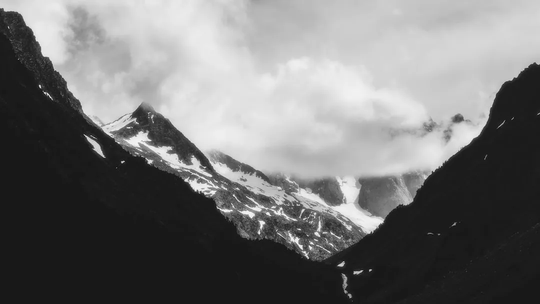
This is not merely a walk; it is a high-altitude odyssey through the heart of the Pennine Alps. The route weaves through a landscape of staggering contrasts: from the jagged, granite spires of the Aiguilles de Chamonix to the serene, turquoise waters of Lac de Moiry, and from the traditional timber-and-stone hamlets of the Val d'Hérens to the sophisticated alpine centres of the Swiss Valais. Walkers are treated to constant views of "four-thousanders"—the highest peaks in Western Europe—including the Grand Combin, the Dent Blanche, and the Weisshorn. The journey concludes with the dramatic reveal of the Matterhorn, a peak so distinctive it has become the global symbol of the mountains. For those seeking the ultimate European trekking experience, the Haute Route offers a level of sustained beauty and physical reward that is difficult to surpass.
- Distance: 180 km (approximate, depending on variants)
- Duration: 12–15 days
- Season: Mid-June to mid-September (snow-free conditions essential)
- Accommodation: Mountain huts (cabanes/refuges), village hotels, and gîtes
- Highest point: Fenêtre d'Arpette (2,665 m) or Col de Prafleuri (2,987 m)
- Total Elevation Gain: ~12,000 m
- Difficulty: Very Challenging (requires high fitness and mountain experience)
- Direction: West to East (Chamonix to Zermatt)
Overview
The Walker's Haute Route is a journey of transition and endurance. It begins in the French department of Haute-Savoie, quickly crossing the border into the Swiss canton of Valais, where the majority of the trek takes place. The route is defined by its "up and over" nature; almost every day involves climbing a significant mountain pass (col) in the morning and descending into a new valley by the afternoon. This rhythmic progression allows trekkers to experience the distinct character of each valley, from the French-speaking Val d'Entremont and Val d'Hérens to the German-speaking Mattertal. The cultural shift is as palpable as the geological one, reflected in the architecture, the local dialects, and the regional cuisine served in the mountain huts.
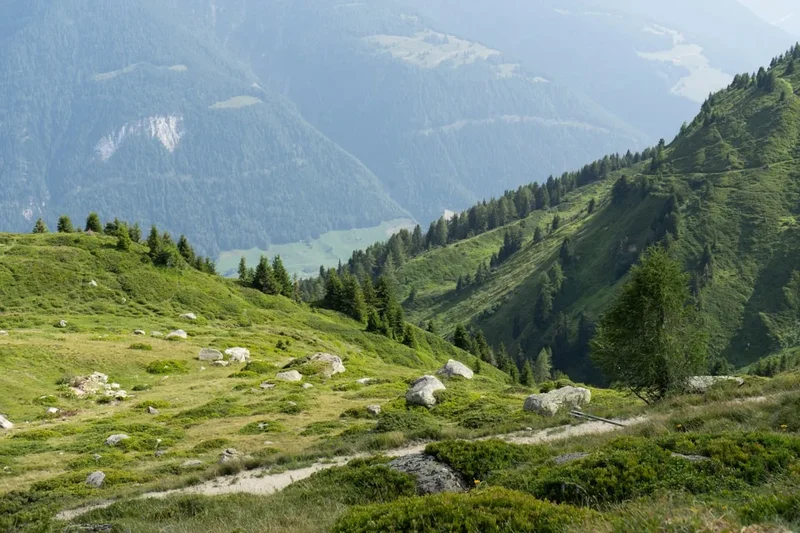
The terrain is exceptionally varied. Trekkers will find themselves traversing ancient larch forests, crossing high alpine meadows filled with wildflowers and the sound of marmot whistles, and navigating "moonscapes" of glacial moraine and boulder fields. While the route is a "walking" route, it is frequently rugged and steep. Some sections, such as the Pas de Chèvres, involve climbing vertical steel ladders, while others, like the crossing of the Grand Désert, require careful navigation across vast, rocky plateaus where snow can linger well into August. The sheer scale of the landscape is humbling; the vertical relief between the valley floors and the surrounding peaks often exceeds 2,500 metres, creating a sense of immense space and isolation despite the proximity of world-class mountain resorts.
Logistically, the Haute Route is a feat of organisation. Unlike the Tour du Mont Blanc, which is a circuit, the Haute Route is a linear point-to-point journey. This means every step takes you further from your starting point and closer to the ultimate goal. The infrastructure is excellent, with a network of Swiss Alpine Club (SAC) and French Alpine Club (CAF) huts positioned strategically at high altitudes, supplemented by charming hotels in the valley villages. This allows for a "light" trekking style, as walkers can rely on huts for half-board accommodation (dinner and breakfast), eliminating the need to carry heavy camping gear or large quantities of food. However, the physical demand remains high; the cumulative fatigue of 12,000 metres of ascent over two weeks requires significant mental fortitude and physical preparation.
The Haute Route is also a journey through time. You will walk past glaciers that are visibly retreating, providing a sobering look at the changing climate of the Alps. You will pass through villages where traditional farming practices still exist alongside modern tourism, and you will follow paths that have been used for centuries by shepherds, smugglers, and early mountaineers. It is a trek that demands respect for the environment and the elements, rewarding the prepared walker with some of the most profound mountain vistas on the planet.
History and Cultural Context
The origins of the Haute Route are inextricably linked to the "Golden Age" of Alpinism in the mid-19th century. The route was first conceived as a summer mountaineering expedition by members of the British Alpine Club in 1861. Led by figures such as Frederick William Jacomb and William Mathews, the original "High Level Route" was designed to connect the two great mountaineering centres of Chamonix and Zermatt via the high glaciers. At the time, this was a formidable undertaking, requiring technical ice skills and a high degree of exploration. The name "Haute Route" (High Route) was later popularised by the French, particularly after the route was first completed on skis in 1911 by Roget Naquin and his party, which cemented its status as the world's premier ski tour.
The "Walker's" version of the Haute Route is a more recent evolution. As hiking grew in popularity during the mid-20th century, trekkers sought a way to experience the majesty of the Chamonix-to-Zermatt traverse without the need for technical mountaineering equipment or glacier travel. Over several decades, a network of existing hiking trails, ancient mule paths, and shepherd tracks was linked together to create the route we know today. This version stays below the permanent snow line where possible, though it still reaches significant altitudes and crosses terrain that would be considered "mountaineering" in many other parts of the world. The publication of definitive guidebooks in the 1980s and 90s helped standardise the route and brought it to the attention of the international trekking community.
Culturally, the Haute Route is a fascinating study of the Valais region. For centuries, these valleys were isolated by high mountains and difficult weather, leading to the development of unique traditions and dialects. The Valais is famous for its "Eringer" (Hérens) cattle—a sturdy, black-and-maroon breed known for their natural fighting instinct. You will likely see these cows in the high pastures, and if you are lucky, you might witness a "Combat de Reines" (Battle of the Queens), where the cows compete for dominance in a non-lethal display of strength. The architecture of the region is also distinct; look for the "raccards"—traditional grain stores built on stone stilts with large flat discs to prevent rodents from entering. These structures are a testament to the ingenuity required to survive in a harsh mountain environment.
Want more background? Read extended notes on history and cultural context → Learn more
Seasonal Highlights and Weather Reality
The window for successfully completing the Walker's Haute Route is relatively narrow, dictated by the presence of snow on the high passes. Unlike lower-altitude trails, the Haute Route spends a significant amount of time above 2,500 metres, where winter conditions can persist long into the summer months.
Early Season (Mid-June to Early July): This is a beautiful but challenging time to trek. The valleys are vibrant green and the wildflowers are at their peak. However, the high passes (especially the Fenêtre d'Arpette, Col de Louvie, and Col de Prafleuri) will almost certainly still have significant snow patches. This can make navigation difficult and increases the risk of slips. Trekkers during this period should be comfortable using an ice axe and potentially micro-spikes. Some high-altitude huts may only just be opening, and certain variants may remain impassable.
Peak Season (Mid-July to August): This is the most popular time for the Haute Route. The snow has usually melted from the paths, the weather is generally more stable, and all huts and mountain lifts are fully operational. Days are long and can be quite warm in the valleys, though afternoon thunderstorms are a common occurrence in the Alps. These storms can be violent and develop rapidly, making it essential to reach your destination or a safe shelter by mid-afternoon. This is also the busiest time, meaning hut bookings must be made months in advance.
Late Season (September): Many experienced trekkers consider September the best month for the Haute Route. The summer crowds have thinned, the air is often crisper and clearer (providing better views), and the autumn colours begin to touch the larch forests. The weather is often more stable than in August, though the days are shorter and the temperature at night can drop significantly below freezing at the huts. By mid-September, some huts begin to close, and the first dustings of winter snow can arrive on the high peaks, potentially closing the route for the season.
Winter and Spring: From October to May, the Walker's Haute Route is not a hiking trail. It is a serious winter environment prone to heavy snowfall and high avalanche risk. During this time, the route belongs to ski mountaineers following the traditional High Level Route. Attempting to walk the route in winter is not possible and would be extremely dangerous.
Recommended Itinerary
14-Day Walker's Haute Route Itinerary
Day 1: Chamonix to Argentière
- Distance: 9 km
- Elevation gain: 400 m
- Time: 3–4 hours
- A gentle start following the Petit Balcon Nord
- Winding through pine forests with views of the Mer de Glace
- Arrive in the charming village of Argentière
- Perfect for testing gear and warming up the legs
Day 2: Argentière to Trient (via Col de Balme)
- Distance: 13 km
- Elevation gain: 1,000 m
- Time: 5–6 hours
- Climb to the Col de Balme (2,191 m) on the French-Swiss border
- Iconic views back towards Mont Blanc and the Aiguille Verte
- Descend into the Swiss village of Trient, famous for its pink church
- First taste of Swiss alpine hospitality
Day 3: Trient to Champex-Lac (via Fenêtre d'Arpette)
- Distance: 14 km
- Elevation gain: 1,400 m
- Time: 7–9 hours
- The "Bovines" route is an easier alternative, but the Fenêtre d'Arpette (2,665 m) is the true Haute Route experience
- A steep, rocky ascent followed by a demanding descent through a boulder-strewn valley
- Views of the Trient Glacier are spectacular
- Finish at the beautiful lakeside town of Champex-Lac
Day 4: Champex-Lac to Le Châble
- Distance: 14 km
- Elevation gain: 100 m (mostly descent)
- Time: 4–5 hours
- A "rest" day descending through Swiss meadows and traditional villages like Sembrancher
- Follows the Val d'Entremont
- Le Châble is the gateway to the Verbier ski resort
- Opportunity to restock supplies and enjoy a valley hotel
Day 5: Le Châble to Cabane du Mont Fort
- Distance: 9 km (or less with lift)
- Elevation gain: 1,600 m (can be reduced by taking the cable car to Ruinettes)
- Time: 4–6 hours
- A sustained climb through the Verbier ski area
- The Cabane du Mont Fort (2,457 m) offers one of the best sunsets in the Alps
- Views of the Grand Combin and the Mont Blanc massif
Day 6: Cabane du Mont Fort to Cabane de Prafleuri
- Distance: 14 km
- Elevation gain: 900 m
- Time: 6–7 hours
- A high-altitude day crossing three passes: Col de Termin, Col de Louvie, and Col de Prafleuri
- Traverses the "Grand Désert"—a rocky, glaciated plateau
- Remote and rugged terrain with frequent ibex sightings
- Stay at the functional Cabane de Prafleuri (2,662 m)
Day 7: Cabane de Prafleuri to Arolla
- Distance: 16 km
- Elevation gain: 700 m
- Time: 6–7 hours
- Climb over the Col des Roux with views of the Lac des Dix (the world's highest gravity dam)
- Long traverse above the lake followed by a climb to the Pas de Chèvres (2,855 m)
- Descend the famous vertical steel ladders to reach the Cheilon Glacier moraine
- Finish in the mountaineering village of Arolla
Day 8: Arolla to La Sage
- Distance: 10 km
- Elevation gain: 200 m
- Time: 3–4 hours
- A shorter day descending through the Val d'Hérens
- Pass through Les Haudères, a village of beautifully preserved timber houses
- Climb slightly to the hamlet of La Sage
- Excellent local food and a chance to recover before the final stages
Day 9: La Sage to Cabane de Moiry
- Distance: 10 km
- Elevation gain: 1,600 m
- Time: 6–7 hours
- A massive climb over the Col de Tsaté (2,868 m)
- Descend to the turquoise Lac de Moiry before climbing again to the hut
- The Cabane de Moiry (2,825 m) is a modern architectural marvel perched next to the Moiry Glacier
- One of the most spectacular hut locations in the world
Day 10: Cabane de Moiry to Zinal
- Distance: 14 km
- Elevation gain: 500 m
- Time: 5–6 hours
- Cross the Col de Sorebois (2,838 m)
- Stunning views of the "Imperial Crown"—a circle of 4,000 m peaks including the Zinalrothorn and Weisshorn
- Steep descent (or cable car) into the resort of Zinal
Day 11: Zinal to Gruben
- Distance: 14 km
- Elevation gain: 1,200 m
- Time: 6–7 hours
- Cross the Forcletta Pass (2,874 m), the linguistic border between French and German-speaking Switzerland
- Enter the remote and quiet Turtmanntal
- Stay in the tiny summer-only village of Gruben
Day 12: Gruben to St. Niklaus
- Distance: 16 km
- Elevation gain: 1,100 m
- Time: 6–7 hours
- The final high pass: Augstbordpass (2,894 m)
- A long, knee-jarring descent into the Mattertal
- Views of the Dom and other peaks of the Mischabel range
- Stay in the valley town of St. Niklaus
Day 13: St. Niklaus to Europahütte
- Distance: 16 km
- Elevation gain: 1,000 m
- Time: 6–7 hours
- The start of the Europaweg, often cited as the most beautiful two-day walk in the Alps
- High traverse above the valley with constant views
- Cross the Charles Kuonen Suspension Bridge (the world's longest pedestrian suspension bridge)
- Stay at the Europahütte (2,265 m)
Day 14: Europahütte to Zermatt
- Distance: 12 km
- Elevation gain: 400 m
- Time: 5–6 hours
- The grand finale: a high-level traverse towards Zermatt
- The Matterhorn finally reveals itself in all its glory
- Descend into the bustling, car-free streets of Zermatt
- Celebratory dinner in the shadow of the world's most famous mountain
Planning and Bookings
Book Your Trip
Everything you need to plan your journey
Accommodation
Find places to stay near Chamonix
Flights
Search flights to Chamonix
Essential Preparation
The Haute Route is a serious undertaking that requires meticulous planning. Physical fitness is the most critical component; you should be capable of walking 6–8 hours a day with a 10 kg pack, involving 1,000 metres of ascent and descent, for multiple days in a row. Training should focus on hill climbing and descending to toughen the knees. Logistically, you must decide whether to walk the entire route or use "cheats" (buses, trains, and cable cars) to shorten certain sections. Chamonix and Zermatt are both easily accessible from Geneva Airport (GVA) via train or mountain shuttle. It is highly recommended to spend at least two days in Chamonix before starting to acclimatise to the altitude and ensure your gear is in order.
Trail Accommodation
Accommodation on the Haute Route is a mix of high-altitude mountain huts (cabanes in Switzerland, refuges in France) and valley hotels or gîtes. The huts are generally owned by the Swiss Alpine Club (SAC) or are privately run. They provide a unique social experience but require specific etiquette.
Hut Facilities:
- Dormitory-style sleeping (usually 4–12 people per room, sometimes larger)
- Half-board (dinner and breakfast included in the price)
- Common dining areas where everyone eats together at set times
- Basic washing facilities (showers are often available for a small fee, but water is limited)
- Slippers/crocs provided (boots are not allowed inside the living areas)
- Charging stations (often limited and in high demand)
What Huts Don't Provide:
- Private rooms (though some newer huts have a few 2-person rooms)
- Bed linen (you MUST bring a silk or cotton sleeping bag liner)
- Towels or toiletries
- Free drinking water (at high altitudes, water is often scarce and must be purchased)
- WiFi (signal is rare at high-altitude huts)
Booking Requirements:
- Bookings are essential and should be made 4–6 months in advance for peak season (July/August)
- Most Swiss huts can be booked through a central SAC online portal, while private huts require direct email or website bookings
- Costs: Approximately 80–110 CHF per night for half-board. SAC members receive a discount
Required Gear
- Trekking boots: High-quality, waterproof, and thoroughly broken in. Ankle support is essential for rocky terrain
- Backpack: 35–45 litres is ideal. Anything larger encourages overpacking
- Waterproofs: High-end Gore-Tex jacket and overtrousers. Alpine storms are unforgiving
- Clothing layers: Merino wool base layers, a fleece or "puffy" mid-layer, and quick-dry trekking trousers
- Navigation: Topographic maps (1:25,000), a compass, and a GPS device or smartphone with offline maps (e.g., Outdooractive or Gaia GPS)
- Trekking poles: Highly recommended to save your knees on the long descents
- Sun protection: Category 3 or 4 sunglasses, high-SPF sunscreen, and a wide-brimmed hat
- First aid: Blister kits (Compeed), basic medications, and an emergency whistle
What to Bring
- Sleeping bag liner: Silk is lightest and most compact (mandatory for huts)
- Water treatment: While tap water in villages is safe, a filter (like a Sawyer Squeeze) is useful for stream water
- Cash: Many huts in Switzerland prefer Swiss Francs (CHF), though most now accept cards. Carry at least 200 CHF in cash for emergencies
- Power bank: To keep your phone/GPS charged when hut outlets are full
- Earplugs: Essential for sleeping in crowded dormitories
- Snacks: High-energy bars, nuts, and dried fruit. Lunch can be purchased at huts, but it is expensive
- Personal toiletries: Biodegradable soap, travel towel, and a small toothbrush/paste
- Head torch: For navigating huts at night or early morning starts
Permits
One of the great advantages of the Haute Route is that no official permits are required to walk the trail itself. There are no daily quotas or trail passes needed to enter the mountains in France or Switzerland. However, the "permit" in practice is your hut reservation. Because wild camping is strictly regulated and often prohibited in many areas along the route, your ability to complete the trek depends entirely on securing a bed each night.
Booking Strategy:
- Start planning in January or February for a summer trek
- Use the Swiss Alpine Club (SAC) central booking system for the majority of the Swiss huts
- For private huts (like Cabane du Mont Fort or Europahütte), book directly through their websites
- If a hut is full, look for alternative routes or nearby valley accommodation. For example, if Cabane de Prafleuri is full, you might have to push through to Arolla or stay at the Hotel de la Sage
- Always carry a copy of your booking confirmations (digital or paper)
Wild Camping Rules:
- In France (Chamonix area): "Bivouacking" (setting up a tent at sunset and taking it down at sunrise) is generally allowed above the treeline, provided you are not in a protected nature reserve
- In Switzerland (Valais): Rules are much stricter. Wild camping is generally prohibited in the forest, in nature reserves, and near huts. It is technically allowed above the treeline in some areas for a single night, but local regulations vary by commune. It is always better to use designated campsites in the valleys
Costs: While there is no permit fee, the cost of the trek is significant due to the price of Swiss huts and valley services. Budget approximately 120–150 CHF per day to cover accommodation, food, and occasional transport.
Other Activities in the Area
The regions surrounding Chamonix and Zermatt are world-class destinations in their own right. Consider adding a few days to your itinerary to experience these highlights:
- Aiguille du Midi (Chamonix): Take the highest cable car in France to 3,842 m for unparalleled views of Mont Blanc and the surrounding glaciers.
- Gornergrat Railway (Zermatt): A historic cogwheel railway that takes you to 3,089 m for the classic panoramic view of the Matterhorn and the Gorner Glacier.
- Thermal Baths (Saillon or Leukerbad): After two weeks of trekking, soak your tired muscles in the natural thermal waters of the Valais.
- Paragliding: Both Chamonix and Zermatt are world-renowned for tandem paragliding, offering a bird's-eye view of the route you just walked.
- Wine Tasting in the Rhone Valley: The Valais is Switzerland's premier wine region. Stop in the valley towns to try local Fendant (white) or Pinot Noir (red).
- Matterhorn Museum (Zermatt): Learn about the dramatic and tragic history of the first ascent of the Matterhorn in 1865.
Safety and Conditions
Mountain Weather: The weather in the Alps can change with terrifying speed. A clear blue morning can transform into a violent thunderstorm with hail and lightning by 2:00 PM. Always check the local forecast (Météo-France for Chamonix, MeteoSwiss for the Valais) before setting out. If the forecast predicts thunderstorms, aim to be off the high passes and at your destination by midday.
Altitude: While the Haute Route does not reach extreme altitudes, you will spend significant time between 2,500 m and 3,000 m. Some trekkers may experience mild symptoms of Acute Mountain Sickness (AMS), such as headaches or nausea. Stay hydrated, avoid alcohol at high huts, and descend if symptoms persist.
Terrain Hazards:
- Snow Patches: Even in mid-summer, north-facing slopes can hold steep snow. A slip on frozen snow can be fatal. Carry micro-spikes and a lightweight ice axe if trekking before mid-July.
- Rockfall: In areas of glacial retreat and on steep couloirs, rockfall is a genuine risk. Move quickly through identified "danger zones" and avoid trekking during or immediately after heavy rain.
- Ladders and Exposure: Sections like the Pas de Chèvres involve vertical ladders. While they are well-maintained and bolted, they require a steady head for heights. If you suffer from severe vertigo, research the alternative routes (such as the Col de Riedmatten).
Navigation: While the trails are generally well-marked with yellow signs and red-and-white paint blazes, fog can reduce visibility to a few metres. In these conditions, it is incredibly easy to lose the path on rocky plateaus like the Grand Désert. You must be proficient with a map and compass or have a reliable GPS with offline maps.
Emergency Services: In Switzerland, the emergency number is 144 (medical) or 1414 (REGA - Air Rescue). In France, it is 112. Ensure you have mountain rescue insurance (such as that provided by the SAC or Air Glaciers) as helicopter evacuations are extremely expensive.
Side Trips and Points of Interest
Lac Blanc (Chamonix): If you have an extra day in Chamonix, the hike to Lac Blanc is essential. It offers the quintessential reflection of the Mont Blanc massif in its still waters. It can be accessed via the Flégère cable car, making it a perfect "warm-up" hike.
The Charles Kuonen Suspension Bridge: Located on the Europaweg between St. Niklaus and Zermatt, this 494-metre-long bridge is a feat of engineering. It hangs 85 metres above the Grabengufer ravine. Walking across it is a highlight of the trek, though there is a valley-level detour for those who prefer to avoid the height.
Moiry Glacier Ice Fall: From the Cabane de Moiry, a short 30-minute walk takes you to the edge of the Moiry Glacier. The "ice fall"—where the glacier tumbles down a steep rock face in a jumble of blue seracs—is one of the most impressive sights on the route.
The Grand Dixence Dam: On Day 7, you will walk past the base of this gargantuan structure. At 285 metres high, it is the tallest gravity dam in the world. You can take a guided tour of the interior or simply marvel at the engineering required to hold back the massive Lac des Dix.
Zmutt Village: On the final descent into Zermatt, take the path through the ancient hamlet of Zmutt. These sun-blackened timber houses are over 500 years old and provide a peaceful, historic contrast to the modern bustle of Zermatt.
Leave No Trace
The Alps are a fragile ecosystem under significant pressure from climate change and high tourism volume. As a trekker on the Haute Route, you have a responsibility to minimise your impact on this pristine environment.
Core Principles:
- Pack it in, pack it out: There are no rubbish bins in the mountains. Carry all your trash (including organic waste like banana peels) back down to the valley villages.
- Respect the wildlife: The Valais is home to ibex, chamois, and marmots. Observe them from a distance and never attempt to feed them.
- Stay on the path: Alpine flora is extremely slow-growing. Taking shortcuts on switchbacks causes erosion and destroys delicate wildflowers.
- Water protection: Do not use soap (even biodegradable) in alpine lakes or streams. Carry water 30 metres away from the source for washing.
- Hut Etiquette: Respect the quiet hours in huts (usually 10:00 PM to 6:00 AM). Conserve water and electricity, as these are precious resources at high altitude.
By following these principles, you ensure that the Haute Route remains a wild and beautiful experience for the generations of trekkers who will follow in your footsteps.