Hallett Peak Trail - A High Alpine Odyssey in the Rockies
The Hallett Peak Trail is one of the most iconic and visually rewarding high-altitude treks within Rocky Mountain National Park, Colorado. Rising to a majestic summit of 3,875 metres, Hallett Peak stands as a sentinel over the Bear Lake corridor, offering walkers a profound transition from lush subalpine forests to the stark, wind-swept beauty of the alpine tundra. This 16.7-kilometre return journey is not merely a walk; it is a vertical pilgrimage that challenges the lungs and rewards the spirit with some of the most expansive panoramas in the American West. As you ascend nearly 1,000 vertical metres, the landscape unfolds in a dramatic sequence of glacial cirques, crystalline alpine lakes, and the jagged teeth of the Continental Divide. The trail is celebrated for its accessibility relative to its height, providing fit walkers with a "true mountain" experience without the need for technical climbing equipment during the summer months. However, its beauty is matched by its temperament; the peak is a place of extreme weather, where the thin air and sudden afternoon electrical storms demand respect, preparation, and a keen eye on the horizon. For those who reach the summit cairn, the reward is a 360-degree view that encompasses the Great Plains to the east and the endless waves of the Rocky Mountains to the west, making it a definitive Colorado experience.
- Distance: 16.7 km return
- Elevation Gain: 975 m
- Duration: 6–8 hours
- Difficulty: Challenging (due to altitude and steady incline)
- Highest Point: 3,875 m (3,874 m)
- Trailhead: Bear Lake Trailhead (2,880 m)
- Best Time: July to September (snow-free window)
- Location: Rocky Mountain National Park, Colorado, USA
Overview
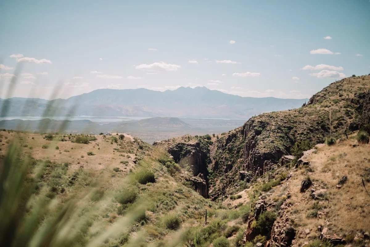
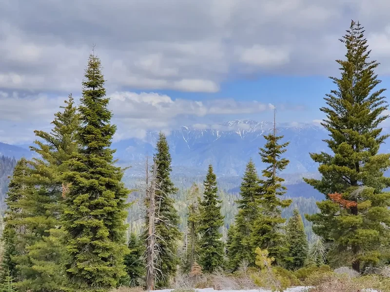
The Hallett Peak Trail is a masterclass in ecological transition. Starting at the bustling Bear Lake Trailhead, situated at an elevation of 2,880 metres, the route begins in a dense forest of Engelmann spruce, subalpine fir, and lodgepole pine. The initial kilometres are shared with the popular Flattop Mountain Trail, a well-maintained path that serves as the primary artery for those seeking the higher reaches of the Continental Divide. As the trail gains elevation, the forest begins to thin, revealing glimpses of the "Great Wall" of Hallett Peak—a sheer 300-metre north face that is a legendary destination for technical rock climbers. For the walker, however, the path takes a more measured approach, winding up the eastern flank of the mountain via a series of long, steady switchbacks.
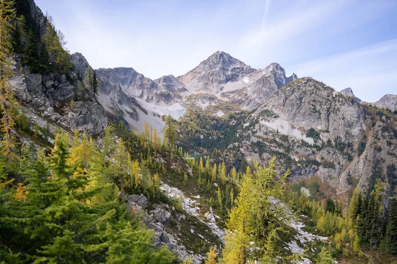
Upon reaching the 3,300-metre mark, the trees become stunted and twisted—a phenomenon known as krummholz (German for "crooked wood"). Here, the environment shifts dramatically into the alpine tundra. This is a land of extreme conditions, where the growing season is measured in weeks and the flora consists of hardy mosses, lichens, and tiny wildflowers that hug the ground to escape the relentless winds. The views from this section are breathtaking; looking down, one can see the emerald jewels of Dream Lake and Emerald Lake nestled deep within the Tyndall Gorge, their waters reflecting the surrounding granite spires.
The final push to the summit involves leaving the maintained Flattop Mountain Trail and navigating a less-defined, rockier path toward the peak itself. This section requires careful footwork over stable talus and scree. The summit of Hallett Peak is a broad, rocky plateau that feels like the roof of the world. To the north, the massive bulk of Longs Peak (4,346 m) dominates the skyline, while to the west, the mountains of the Never Summer Range stretch toward the horizon. The descent follows the same route, offering a different perspective on the glacial valleys and providing a gradual re-entry into the oxygen-rich air of the lower forests. This trail is a quintessential Rocky Mountain adventure, combining physical exertion with profound natural beauty and a deep sense of isolation once the lower lake trails are left behind.
History and Cultural Context
The mountains of the Front Range, including Hallett Peak, have been a significant presence in human history for millennia. Long before the arrival of European explorers, the Ute and Arapaho peoples traversed these high passes. For the indigenous tribes, these mountains were not just physical barriers but spiritual landmarks. The Arapaho referred to the area around Bear Lake and the surrounding peaks as a place of great importance for seasonal hunting and vision quests. They utilised the high-altitude passes to travel between the lush valleys of the west and the plains of the east, leaving behind stone cairns and trails that, in some cases, align with the modern paths used by hikers today.
The peak is named after William Hallett, a prominent early explorer and mountaineer who was instrumental in the early surveying of the region in the late 19th century. Hallett was a pioneer of "recreational" climbing in the Rockies, often venturing into the high peaks with little more than a sturdy staff and a sense of curiosity. His name is synonymous with the golden age of Colorado exploration, a time when the mountains were being mapped and the first tourists were beginning to realise the spectacular nature of the American West. The establishment of Rocky Mountain National Park in 1915 by President Woodrow Wilson ensured that peaks like Hallett would be preserved for future generations, protecting the landscape from the mining and logging interests that were prevalent at the time.
In the mid-20th century, Hallett Peak became a focal point for the evolution of American rock climbing. The sheer north face, often referred to as the "Third Pillar" or the "Great Wall," saw first ascents by legendary climbers who pushed the boundaries of what was considered possible on vertical granite. While the hiking trail avoids these technical precipices, the history of the mountain is inextricably linked to the spirit of adventure and the desire to conquer the vertical. Today, the trail serves as a bridge between this rugged history and the modern conservation movement, reminding every walker of the enduring power of the wilderness.
Want more background? Read extended notes on history and cultural context → Learn more
Seasonal Highlights and Weather Reality
The window for a safe and enjoyable hike to the summit of Hallett Peak is remarkably narrow. Due to its high elevation, the trail is typically covered in deep snow from October through June. Even in early July, significant snowfields can persist on the upper switchbacks, requiring traction devices like micro-spikes or an ice axe for safe passage. The "prime" season is strictly from mid-July to mid-September, when the alpine wildflowers are in bloom and the trail is mostly clear of ice.
Summer (July–August): This is the most popular time to visit. The tundra is vibrant with life, including the rare Alpine Forget-Me-Not and Sky Pilot. However, summer in the Rockies brings the "monsoon" pattern—nearly daily afternoon thunderstorms. These storms are extremely dangerous on the exposed ridges of Hallett Peak. Lightning is a frequent and lethal hazard; the general rule is to be off the summit and heading back below the treeline by noon. Temperatures at the summit can be 15–20 degrees Celsius cooler than in the town of Estes Park, and wind chills can drop below freezing even on a sunny day.
Autumn (September): September is arguably the best month for the Hallett Peak Trail. The afternoon storms become less frequent, the air is crisp and clear, and the aspen trees in the lower valleys begin their spectacular transformation into gold and orange. While the days are shorter, the stability of the weather makes for a more relaxed hiking experience. However, the first dusting of winter snow can arrive as early as Labor Day, so hikers must be prepared for sudden shifts in conditions.
Winter and Spring (October–June): During these months, the Hallett Peak Trail becomes a serious mountaineering undertaking. The route is prone to avalanches, particularly in the Tyndall Gorge area. Deep snow obscures the trail, and navigation requires GPS and map-reading skills. High winds exceeding 100 km/h are common on the Continental Divide, creating life-threatening wind chill factors. Only those with extensive winter backcountry experience, avalanche safety training, and specialised equipment should attempt the peak during this period.
Recommended Itinerary
Hallett Peak Day Hike Progression
Phase 1: The Ascent to the Treeline (Bear Lake to Flattop Junction)
- Distance: 0.0 km – 3.5 km
- Elevation: 2,880 m to 3,200 m
- Time: 1 – 1.5 hours
- Start at the Bear Lake Trailhead. Follow signs for Flattop Mountain.
- The trail begins with a steady, well-graded climb through a forest of spruce and fir.
- Pass several viewpoints offering glimpses of Bear Lake below and the towering face of Hallett Peak ahead.
- The air begins to thin; maintain a steady, rhythmic pace to allow for acclimatisation.
- Reach the junction for the Dream Lake overlook—a perfect spot for a quick water break.
Phase 2: The Alpine Tundra and Switchbacks
- Distance: 3.5 km – 7.0 km
- Elevation: 3,200 m to 3,750 m
- Time: 1.5 – 2.5 hours
- The forest gives way to krummholz and then open tundra.
- Navigate a series of long switchbacks that climb the eastern shoulder of Flattop Mountain.
- Spectacular views of the Tyndall Glacier and the jagged spires of the "Cathedral Wall" to the south.
- The wind usually increases significantly here; this is the time to add an insulating layer or windbreaker.
- Keep an eye out for elk or bighorn sheep, which are frequently spotted grazing on the high-altitude grasses.
Phase 3: The Summit Push (Flattop Mountain to Hallett Peak)
- Distance: 7.0 km – 8.35 km
- Elevation: 3,750 m to 3,875 m
- Time: 45 minutes – 1 hour
- At the top of the Flattop Mountain plateau, the maintained trail ends. Look for the large cairns marking the route south toward Hallett Peak.
- The terrain becomes a "talus hop"—walking over large, stable granite blocks.
- The final 125 metres of vertical gain are the most taxing due to the altitude.
- Arrive at the summit of Hallett Peak. The summit is marked by several large rock shelters built by previous hikers to block the wind.
- Take time to identify Longs Peak, the Mummy Range, and the Grand Lake area to the west.
Phase 4: The Descent
- Distance: 8.35 km – 16.7 km
- Elevation: 3,875 m to 2,880 m
- Time: 2.5 – 3.5 hours
- Retrace your steps carefully across the talus field back to the Flattop Mountain Trail.
- The descent is easier on the lungs but harder on the knees; trekking poles are highly recommended.
- Monitor the sky for building cumulus clouds; if thunder is heard, accelerate your descent to the treeline.
- Enjoy the changing light on the granite faces as you descend back into the forest.
- Finish back at Bear Lake, where a celebratory soak of the feet in the cold lake water is a local tradition.
Important Notes:
- Start early: Aim to be at the trailhead by 05:00 or 06:00 to secure parking and beat the storms.
- Hydration: Drink more water than usual to combat the effects of high altitude.
- Pacing: This is a marathon, not a sprint. The "Colorado Step"—a slow, deliberate pace—is the most efficient way to climb.
- Wildlife: Never approach or feed the marmots or pikas at the summit; they are highly adapted to their environment and human food is harmful to them.
Planning and Bookings
Book Your Trip
Everything you need to plan your journey
Accommodation
Find places to stay near Estes Park, Colorado
Flights
Search flights to Estes Park, Colorado
Essential Preparation
The most critical aspect of planning a Hallett Peak hike is understanding the physical demands of high-altitude trekking. At 3,875 metres, there is approximately 40% less effective oxygen than at sea level. If you are travelling from a lower elevation, it is essential to spend at least two to three days in Estes Park (2,293 m) or similar altitudes to acclimatise before attempting the summit. Failure to do so significantly increases the risk of Acute Mountain Sickness (AMS).
Logistically, the Bear Lake corridor is the most popular area of Rocky Mountain National Park. Parking at the trailhead usually fills by 05:30 during the summer months. If the lot is full, you must use the Park and Ride shuttle system located further down Bear Lake Road. Ensure you have checked the shuttle schedule, as the last bus usually departs in the early evening. Estes Park serves as the primary base for this hike, offering a full range of services including outdoor gear shops, grocery stores, and medical facilities.
Trail Accommodation
This is a day hike requiring no overnight accommodation on the trail itself. Camping is strictly prohibited along the Hallett Peak/Flattop Mountain route to protect the fragile alpine environment. However, there are several options for staying nearby to facilitate an early start.
Nearby Options:
- Moraine Park Campground: Located within the park, approximately 15 minutes from the trailhead. Requires advanced booking via Recreation.gov (often 6 months in advance). Facilities include toilets, water, and bear boxes. No showers.
- Glacier Basin Campground: Also within the park, offering similar facilities and requiring early booking.
- Estes Park Lodging: A wide variety of hotels, motels, and cabins are available in the town of Estes Park, ranging from budget-friendly to luxury resorts like the historic Stanley Hotel.
- Backcountry Camping: If you wish to incorporate Hallett Peak into a multi-day trip, you must obtain a Wilderness Permit from the NPS. The nearest legal backcountry sites are in the North Inlet or Tonahutu Creek areas, which are several kilometres away from the peak.
Required Gear
- Footwear: Sturdy hiking boots with good ankle support and a vibram-style sole for grip on granite talus. Ensure they are well broken-in.
- Clothing Layers: A moisture-wicking base layer (merino wool is best), an insulating mid-layer (fleece or down), and a high-quality waterproof/windproof shell. Avoid cotton at all costs.
- Sun Protection: High-SPF sunscreen, lip balm with SPF, and polarised sunglasses. The UV radiation at 3,800 metres is intense and can cause severe burns in less than 30 minutes.
- Navigation: A physical topographic map of the Bear Lake/Longs Peak area and a compass. While the trail is well-marked, cloud cover can reduce visibility to a few metres instantly.
- Trekking Poles: Highly recommended for the 975-metre descent to protect knees and provide stability on loose rock.
- Headlamp: Essential for early morning starts or in case the hike takes longer than expected. Bring spare batteries.
What to Bring
- Water: At least 3 litres per person. There are no reliable water sources above the treeline, and the dry alpine air accelerates dehydration.
- Water Treatment: If you plan to refill at Bear Lake or lower streams, use a filter or chemical treatment to protect against Giardia.
- High-Energy Food: Pack calorie-dense snacks like nuts, dried fruit, energy bars, and a substantial lunch. Digestion is slower at altitude, so small, frequent snacks are often better than one large meal.
- Electrolytes: Powdered electrolyte mixes can help maintain mineral balance and prevent cramping.
- Emergency Kit: A basic first aid kit (blister pads, antiseptic, bandages), a whistle, and a lightweight emergency bivvy or space blanket.
- Personal Items: Tissues, small rubbish bag (to pack out all waste), and a mobile phone (though signal is intermittent at best).
Permits
To hike Hallett Peak during the peak season (typically late May through mid-October), you must navigate the Rocky Mountain National Park Timed Entry Permit System. This system was implemented to manage extreme congestion and protect the park's resources. There are two types of permits, and for Hallett Peak, you specifically need the "Park Access+" permit, which includes the Bear Lake Road corridor.
Permit Details:
- Booking Platform: All permits must be reserved through Recreation.gov.
- Release Schedule: Permits are released in monthly blocks on the first day of the previous month (e.g., July permits are released on June 1st). A small number of additional permits are released at 19:00 MDT the night before the desired date.
- Cost: There is a small non-refundable processing fee (typically US$2) for the timed entry reservation. This is in addition to the standard Park Entrance Fee (US$30 per vehicle for a 1-day pass or US$35 for a 7-day pass).
- Validation: You must enter the Bear Lake Road gate during your designated two-hour window. Once inside, you can stay as long as you like.
Strategy for Success: Permits for the early morning slots (05:00–07:00) are the most coveted and disappear within seconds of being released. Create your Recreation.gov account in advance, ensure your payment details are saved, and be logged in exactly when the window opens. If you fail to secure a permit, your only option is to enter the Bear Lake Road corridor before 05:00 or after 18:00, when the permit requirement is not enforced.
Other Activities in the Area
The Bear Lake area and the nearby town of Estes Park offer a wealth of experiences for those looking to round out their trip:
- Dream Lake and Emerald Lake: If the full Hallett Peak climb feels too daunting, these lower-elevation lakes offer spectacular scenery with significantly less effort. The trail to Emerald Lake is 5.8 km return and passes through some of the park's most photographed landscapes.
- Trail Ridge Road: Known as the "Highway to the Sky," this is the highest continuous paved road in the United States, reaching 3,713 metres. It offers an effortless way to experience the alpine tundra and see the park's western side.
- The Stanley Hotel: Located in Estes Park, this historic hotel was the inspiration for Stephen King's "The Shining." It offers daily history and ghost tours.
- Fly Fishing: The Big Thompson River and various alpine lakes provide world-class trout fishing. Ensure you have a valid Colorado fishing licence.
- Wildlife Viewing: Moraine Park and Horseshoe Park are prime locations for spotting massive herds of elk, especially during the autumn "rut" (mating season) when the bulls bugle.
- Rock Climbing: For those with the skills, the Lumpy Ridge area near Estes Park offers legendary granite trad climbing with shorter approaches than the high peaks.
Safety and Conditions
Altitude Sickness (AMS): This is the most common health issue on Hallett Peak. Symptoms include headache, nausea, dizziness, and extreme fatigue. The only cure is descent. If you or anyone in your party begins to show signs of AMS, stop ascending immediately. If symptoms do not improve with rest and hydration, descend at least 500 vertical metres. Ignoring AMS can lead to life-threatening conditions like HAPE or HACE.
Lightning and Weather: In the Colorado Rockies, lightning is a daily summer threat. The summit of Hallett Peak is a lightning rod. If you see clouds building vertically (cumulus congestus), hear thunder, or feel your hair stand on end, you are in immediate danger. Descend below the treeline as quickly as possible. Do not seek shelter under isolated trees or in small caves; stay in the middle of a forest of uniform height if you cannot reach a vehicle or building.
Dehydration and Nutrition: The air at 3,800 metres is incredibly dry. You lose significant moisture through respiration alone. Drink frequently, even if you do not feel thirsty. Similarly, your body burns calories at a higher rate to maintain core temperature and fuel the increased respiratory effort. Eat small amounts of carbohydrates regularly.
Navigation: While the Flattop Mountain Trail is a "highway," the final scramble to Hallett Peak is not. In heavy fog or "whiteout" conditions, it is very easy to become disoriented on the summit plateau. Always carry a compass and know your back-bearing. If visibility drops to zero, stay put until it clears or follow your GPS track exactly.
Emergency Contacts: In the event of a serious injury, call 911 if you have signal. If not, send a member of your party to the trailhead to alert a Park Ranger. Carrying a Satellite Messenger (like a Garmin inReach) is highly recommended for solo hikers or those venturing into the high alpine.
Side Trips and Points of Interest
Flattop Mountain Summit: The Hallett Peak Trail actually passes within a few hundred metres of the summit of Flattop Mountain (3,756 m). While the "summit" is a broad, flat expanse rather than a sharp peak, it is worth the five-minute detour to stand on the actual Continental Divide—the hydrological backbone of the continent where water flows either to the Atlantic or the Pacific.
Tyndall Glacier Overlook: Between Flattop and Hallett, there are several safe vantage points where you can look down into the Tyndall Gorge. Here, you can see the Tyndall Glacier, one of the few remaining permanent ice fields in the park. The contrast between the ancient blue ice and the grey granite walls is a highlight for photographers.
The "Keyhole" View: From the summit of Hallett, looking north-east, you can get a unique perspective of the "Keyhole" on Longs Peak. This is the famous notch that hikers must pass through on the standard route up Colorado's most famous 14er. Seeing it from Hallett provides a sense of the immense scale of the Longs Peak massif.
Alpine Sunflowers (Old Man of the Mountain): During late July, the tundra is home to the Tetraneuris grandiflora, a sunflower that only grows in the high alpine and always faces east to catch the morning sun. These resilient plants are a testament to the tenacity of life in the high Rockies.
Leave No Trace
The alpine tundra is one of the most fragile ecosystems on Earth. A single footstep off the trail can destroy plants that have taken decades to grow. Because the growing season is so short, the "healing" process for the landscape is incredibly slow. As a visitor to this high-altitude wilderness, you have a moral and legal obligation to minimise your impact.
Core Principles for Hallett Peak:
- Travel on Durable Surfaces: Stay on the established trail at all times. When navigating the talus field to the summit, step only on large, stable rocks rather than the small patches of soil and vegetation between them.
- Dispose of Waste Properly: Pack out everything. This includes orange peels, nut shells, and especially toilet paper. The cold, dry air at the summit prevents organic matter from decomposing; a banana peel can last for years in the alpine.
- Leave What You Find: Do not collect rocks, wildflowers, or artefacts. Leave the summit cairns as they are; do not build new ones, as this can confuse other hikers and disturbs the soil.
- Respect Wildlife: Observe marmots, pikas, and elk from a distance. Feeding wildlife causes them to lose their natural foraging instincts and can lead to aggressive behaviour or disease.
- Be Considerate of Others: Keep noise levels low. The sound of the wind and the silence of the peaks are part of the experience for everyone. If using a mobile phone, use headphones or keep it on silent.