Gunung Rinjani Summit Trek - The Roof of Lombok
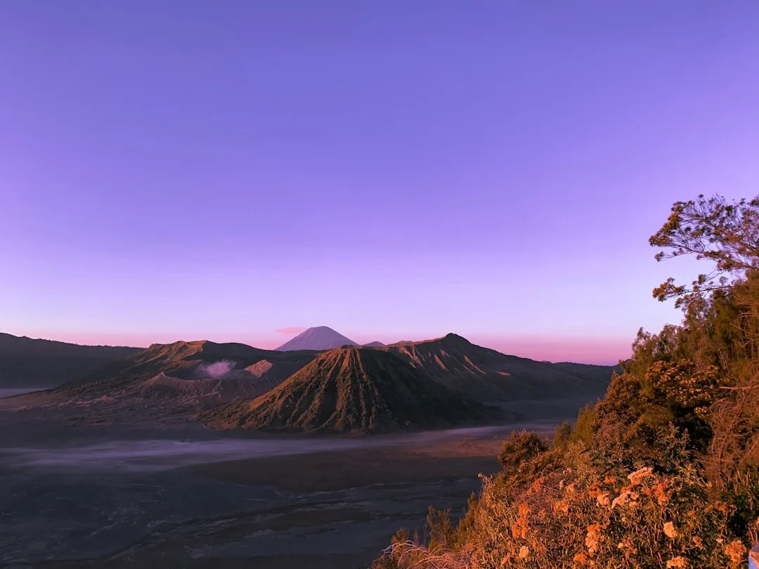
Gunung Rinjani, standing at a formidable 3,726 metres, is not merely a mountain; it is a towering icon of the Indonesian archipelago and the second-highest volcano in the country. Located on the island of Lombok, this massive stratovolcano dominates the landscape, casting a literal and spiritual shadow over the surrounding plains. The trek to its summit is widely regarded as one of the most challenging yet rewarding trekking experiences in Southeast Asia. It is a journey that traverses distinct ecological zones, from lush tropical rainforests teeming with macaques to high-altitude savannahs, and finally to the stark, lunar-like scree slopes of the summit ridge. The centrepiece of this volcanic massif is the breathtaking Segara Anak caldera, a 6-by-8.5-kilometre wide crater partially filled by a deep turquoise lake, within which sits the active "new" volcano, Gunung Barujari.
- Distance: 25.0 km (approximate total for summit and lake circuit)
- Elevation Gain: 2,000 m+ (cumulative gain is significantly higher)
- Duration: 3–4 days
- Difficulty: Very Challenging
- Highest Point: 3,726 m (Summit)
- Best Time: April to December (Dry Season)
- Closest City: Mataram / Senggigi
- Trailhead Access: Sembalun Lawang or Senaru Village
Overview
The Gunung Rinjani Summit Trek is a pilgrimage of physical endurance and mental fortitude. Unlike many popular mountain treks that offer gradual inclines, Rinjani is relentless. The journey typically begins in the high-altitude valley of Sembalun, where the air is thin and the sun is fierce, or in the humid jungle of Senaru. For those aiming for the summit, the Sembalun route is the standard approach, offering a more direct path to the crater rim. The trek is defined by its dramatic verticality; hikers must ascend over 2,000 metres of elevation, often on loose volcanic ash and scree that makes every two steps forward feel like one step back. This is a landscape of extremes, where daytime temperatures can soar to 30 degrees Celsius in the lower valleys, only to plummet to near-freezing at the summit before dawn.
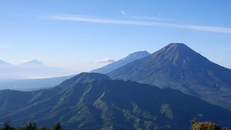
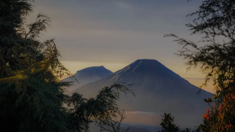
The visual rewards, however, are unparalleled. Reaching the Sembalun Crater Rim (Plawangan Sembalun) at sunset provides a panoramic view of the Segara Anak lake, shimmering 600 metres below. The lake itself is a sacred site for both the local Sasak people and Balinese Hindus, who make annual pilgrimages to its shores to leave offerings and bathe in the nearby hot springs. The presence of Gunung Barujari, a smaller, smoking cone rising from the lake's waters, serves as a constant reminder of the mountain's volatile nature. The final push to the summit, usually undertaken at 2:00 AM, is a test of resolve. Under a canopy of stars, trekkers navigate a narrow, wind-swept ridge. As the sun rises over the horizon, the shadow of Rinjani is projected across the sea toward Bali, where the silhouette of Mount Agung stands in silent greeting. On a clear day, the view extends across the entire island of Lombok, the Gili Islands, and even the distant peaks of Sumbawa.
This trek is not for the faint-hearted or the unprepared. It requires a high level of cardiovascular fitness and a willingness to endure basic camping conditions. However, for those who reach the "Roof of Lombok," the sense of achievement is profound. It is a raw, unadulterated encounter with the power of the Ring of Fire, offering a perspective on the natural world that few other trails can provide. The combination of geological wonder, cultural depth, and physical challenge makes the Rinjani Summit Trek a bucket-list adventure for serious hikers worldwide.
History and Cultural Context
The history of Gunung Rinjani is inextricably linked to the geological evolution of the Indonesian archipelago and the spiritual traditions of the Sasak people. Geologically, the mountain is a titan. In 1257, a cataclysmic eruption of the Samalas volcano (which was part of the Rinjani complex) occurred, an event now recognised by scientists as one of the largest volcanic eruptions in recorded human history. This eruption was so massive that it released enough ash and sulphur into the atmosphere to trigger a "year without a summer" in Europe and significantly altered the global climate. The collapse of the Samalas cone created the massive Segara Anak caldera we see today, fundamentally reshaping the island of Lombok.
Culturally, Rinjani is a "Gunung Agung" or Great Mountain. For the Sasak people, the indigenous inhabitants of Lombok, the mountain is the abode of the gods and the spirits of their ancestors. The name "Rinjani" is believed to be derived from an Old Javanese term for "God." Every year, thousands of pilgrims ascend the mountain for the "Mulang Pakelem" ceremony. During this ritual, offerings of gold and jewellery, often shaped like fish, are cast into the Segara Anak lake to appease the mountain spirits and ensure fertility for the land and prosperity for the people. The lake's name, Segara Anak, translates to "Child of the Sea," reflecting the belief that the lake is a terrestrial extension of the ocean's power.
Balinese Hindus also hold Rinjani in high esteem, considering it one of the three most sacred mountains alongside Mount Agung in Bali and Mount Semeru in Java. They believe the mountain is a seat of the Hindu trinity (Brahma, Vishnu, and Shiva). Throughout the trek, you may encounter small shrines or evidence of ritual offerings (canang sari) tucked into rock crevices or near the water's edge. This spiritual layer adds a profound dimension to the trek; you are not just walking on a volcano, but traversing a landscape that has been venerated for centuries. Understanding this context is vital for any visitor, as it dictates the respect required when interacting with the environment and the local guides who call this mountain home.
Want more background? Read extended notes on history and cultural context → Learn more
Seasonal Highlights and Weather Reality
The trekking season on Gunung Rinjani is strictly dictated by the Indonesian monsoon cycle. The mountain is typically open to trekkers from early April to late December. Outside of this window, during the peak of the rainy season (January to March), the Rinjani National Park Authority (TNGR) usually closes the trails. This closure is a critical safety measure, as heavy rains make the steep, clay-heavy paths dangerously slippery, increase the risk of landslides, and make the summit ridge impassable due to high winds and low visibility.
April to June (Post-Monsoon): This is arguably the most beautiful time to trek. The landscape is incredibly lush and green after the rains, and the air is relatively clear. The waterfalls are at their most powerful, and the savannahs of Sembalun are vibrant. However, there is still a lingering chance of afternoon rain showers, and the trails can be muddy in sections.
July to September (Peak Dry Season): This is the most popular time for trekking. The weather is consistently dry, providing the best chances for a clear sunrise at the summit. The downside is that the mountain becomes very crowded, and the dust on the trails can be significant. The vegetation begins to turn golden-brown, and the temperatures at night can be particularly cold due to the lack of cloud cover.
October to December (Shoulder Season): As the dry season wanes, the crowds thin out. The weather remains generally good, though the humidity begins to rise, and the first rains of the monsoon may arrive in late November or December. This is a good time for those seeking a quieter experience, provided they are prepared for the possibility of wet weather.
Regardless of the season, weather on Rinjani is unpredictable. A clear morning can quickly turn into a misty afternoon. The summit ridge is notorious for high winds that can reach gale force, making the final ascent feel significantly colder than the actual temperature. Trekkers must be prepared for "four seasons in a day," carrying gear that can handle both tropical heat and alpine cold.
Recommended Itinerary
3-Day / 2-Night Rinjani Summit & Lake Itinerary
Day 1: Sembalun Village to Sembalun Crater Rim
- Distance: 10 km
- Elevation gain: 1,500 m
- Time: 6–8 hours
- Start at the Rinjani Information Centre (RIC) in Sembalun (1,156 m) for registration
- Trek through open savannah and rolling hills (Pos 1 and Pos 2)
- Lunch break at Pos 2 (1,500 m) or Pos 3 (1,800 m)
- The "Seven Hills of Regret": A steep, relentless climb from Pos 3 to the crater rim
- Arrive at Sembalun Crater Rim (Plawangan Sembalun, 2,639 m) by late afternoon
- Set up camp, enjoy sunset views over the lake and the summit ridge
- Early dinner and rest in preparation for the midnight summit push
Day 2: Summit Push, Descent to Lake, and Hot Springs
- Distance: 10 km (including summit and descent to lake)
- Elevation: 1,100 m gain to summit, 1,700 m descent to lake
- Time: 10–12 hours
- 2:00 AM wake-up call for the summit attempt
- Trek along the narrow, sandy ridge to the summit (3,726 m)
- Reach the summit for sunrise; views of Bali, Sumbawa, and the entire caldera
- Descend back to Sembalun Crater Rim for a late breakfast
- Begin the steep, rocky descent into the caldera to Segara Anak Lake (2,000 m)
- Arrive at the lakeside by mid-afternoon
- Visit the natural hot springs (Aik Kalak) located a short walk from the campsite
- Camp overnight by the lake, enjoying the serenity of the caldera
Day 3: Lake to Senaru Crater Rim and Senaru Village
- Distance: 12 km
- Elevation: 600 m gain to rim, 2,000 m descent to village
- Time: 8–10 hours
- Ascend from the lake to the Senaru Crater Rim (Plawangan Senaru, 2,641 m)
- Final panoramic views of the lake and the summit from the opposite side
- Long descent through the tropical rainforest toward Senaru Village
- Pass through various vegetation zones, spotting black ebony monkeys and tropical birds
- Lunch at Pos 2 (Montong Satas, 1,500 m)
- Arrive at Senaru Village (601 m) by late afternoon
- Transfer back to Senggigi, Mataram, or the airport
Important Notes:
- This itinerary is physically demanding; a 4-day version is recommended for a more relaxed pace
- The summit ridge is composed of loose volcanic scree; trekking poles are highly recommended
- Water sources are limited to the lake and specific springs; guides will manage water supplies
- Temperatures at the summit can drop to 0–5°C; warm layers are essential
- Always follow the instructions of your guide regarding weather and safety
Planning and Bookings
Book Your Trip
Everything you need to plan your journey
Accommodation
Find places to stay near Mataram
Flights
Search flights to Mataram
Essential Preparation
Preparation for Rinjani begins months before you set foot on the island of Lombok. The most critical factor is physical fitness. This is not a casual hike; it is a high-altitude trek with significant vertical gain. Focus on cardiovascular training, leg strength (squats and lunges), and endurance. If possible, train on hills or stairs with a weighted pack to simulate the conditions of the "Seven Hills of Regret."
Logistically, most trekkers base themselves in either Senggigi or Mataram before the trek. However, staying in the trailhead villages of Sembalun or Senaru the night before you start is highly recommended to assist with acclimatisation and ensure an early start. Most trekking packages include transport from the airport or ferry terminal to your accommodation. Booking a reputable trekking organiser is essential, as independent trekking is generally discouraged and often restricted by park regulations. A good organiser will provide guides, porters, camping equipment, and all meals, allowing you to focus on the climb.
Trail Accommodation
Accommodation on the Gunung Rinjani trek consists entirely of wilderness camping. There are no permanent huts, lodges, or hostels on the mountain. All trekkers must stay in designated campsite areas managed by the National Park.
Campsite Facilities:
- Designated flat areas for tents at Sembalun Rim, Senaru Rim, and the Lake
- No permanent toilet blocks; trekking companies provide "toilet tents" (small privacy tents over a dug hole)
- No running water or showers; water is sourced from springs or the lake and must be treated
- No electricity or charging stations; bring power banks for your devices
- Cooking is done on portable gas stoves by the porters
What is Provided (by most trekking companies):
- Tents (usually 2-person dome tents)
- Sleeping mats (foam or inflatable)
- Sleeping bags and small pillows
- All meals and snacks
- Drinking water (boiled or filtered)
What is NOT Provided:
- Personal toiletries and towels
- Luxury bedding or private rooms
- Indoor heating (it will be cold in the tents at the rim)
- Waste disposal for personal items (you must pack out your own trash)
Required Gear
- Trekking boots - High-cut with excellent grip and ankle support. The scree on the summit ridge is brutal on footwear.
- Trekking poles - Essential for the steep descents and for stability on the loose volcanic ash.
- Headlamp - Crucial for the 2:00 AM summit push. Bring spare batteries.
- Warm jacket - A lightweight down jacket or heavy fleece is necessary for the crater rim and summit.
- Waterproof shell - A high-quality rain jacket (Gore-Tex or similar) for unexpected tropical downpours.
- Base layers - Moisture-wicking thermal tops and bottoms for sleeping and the summit climb.
- Trekking trousers - Lightweight, quick-dry trousers (avoid jeans).
- Daypack - 25–35L pack to carry your water, snacks, camera, and layers. Porters will carry the heavy camping gear.
- Gloves and beanie - Essential for the freezing temperatures at the summit.
What to Bring
- Sun protection - High SPF sunscreen, lip balm with SPF, sunglasses, and a wide-brimmed hat. The sun at 3,000 metres is intense.
- Personal first aid - Blister pads (Compeed), ibuprofen, rehydration salts (ORS), and any personal medications.
- Water treatment - While guides provide water, having purification tablets or a LifeStraw provides an extra layer of safety.
- Toiletries - Biodegradable wet wipes, hand sanitiser, toothbrush, and small toothpaste.
- Snacks - Energy bars, trail mix, or chocolate for an extra boost during the summit push.
- Power bank - To keep your phone and camera charged for the many photo opportunities.
- Cash - Small denominations of Indonesian Rupiah (IDR) for tipping guides and porters at the end of the trek.
- Sandals/Flip-flops - To wear around the campsite and at the hot springs to give your feet a break from boots.
Permits

Access to Gunung Rinjani is strictly regulated through a quota system managed by the Gunung Rinjani National Park (TNGR). Permits must be secured in advance, and the park has moved toward a digital booking system known as "e-Rinjani."
Booking Process:
- Most trekkers obtain their permits through their chosen trekking organiser. The organiser will require a copy of your passport and your trekking dates to secure the booking.
- If booking independently, you must use the e-Rinjani mobile app or website. However, quotas for independent trekkers are very limited and often sell out months in advance.
- The daily quota is currently limited to approximately 150–200 people per trailhead (Sembalun and Senaru) to prevent overcrowding and environmental degradation.
- Permits are date-specific. If you miss your start date, your permit is void and non-refundable.
Costs and Requirements:
- Entrance fees for international visitors are approximately IDR 150,000 per day (subject to change). For a 3-day trek, this totals IDR 450,000.
- Domestic visitors pay a significantly lower rate (approx. IDR 5,000–10,000 per day).
- Insurance is mandatory and is usually included in the permit fee or the trekking package.
- A health certificate from a doctor stating you are fit to trek is often required at the registration point. Many trekking companies can facilitate a quick check-up in Senaru or Sembalun if needed.
Guide and Porter Regulations:
- National Park regulations mandate that all foreign trekkers must be accompanied by a certified local guide.
- Porters are not legally mandatory but are highly recommended. They carry the tents, food, and water, and their knowledge of the mountain is invaluable. Hiring porters also directly supports the local economy of the mountain villages.
Other Activities in the Area
Lombok offers a wealth of experiences beyond the mountain. Consider these activities to round out your trip:
- Sendang Gile and Tiu Kelep Waterfalls: Located in Senaru, these are two of Lombok's most spectacular waterfalls. Tiu Kelep, in particular, is a magical spot where water thunders into a deep pool surrounded by emerald jungle.
- The Gili Islands: After the dust and cold of Rinjani, the white sands and turquoise waters of Gili Trawangan, Gili Meno, or Gili Air are the perfect antidote. These islands offer world-class snorkelling and diving.
- Kuta Lombok: Located on the south coast, Kuta is the island's surfing hub. It features rugged coastlines, hidden coves like Mawun Beach, and a more laid-back vibe than its namesake in Bali.
- Sasak Cultural Villages: Visit Sade or Ende village to learn about traditional Sasak architecture, weaving (tenun), and customs.
- Tetebatu: Often called the "Ubud of Lombok," this area offers beautiful rice terrace walks and a glimpse into the island's agricultural heartland on the southern slopes of Rinjani.
Safety and Conditions
Altitude Sickness (AMS): At 3,726 metres, Acute Mountain Sickness is a genuine risk. Symptoms include headache, nausea, dizziness, and fatigue. The best prevention is a slow ascent and proper hydration. If symptoms persist or worsen, the only cure is to descend immediately. Ensure your guide is trained to recognise the signs of AMS.
Volcanic Activity: Rinjani is an active volcano. The National Park Authority monitors seismic activity closely. If there is an increase in volcanic tremors or smoke from Gunung Barujari, the park may close certain sections (like the lake) or the entire mountain. Always heed official warnings and do not attempt to enter restricted zones.
Terrain Hazards: The trail is steep and often unstable. The descent from the crater rims involves loose rock and steep drops. Ankle sprains and knee strain are common. Use trekking poles and take your time. The summit ridge is narrow; in high winds, it can be dangerous. If your guide advises against the summit push due to wind, respect their decision.
Hypothermia: Despite being in the tropics, the temperature at the crater rim and summit can be dangerously low, especially when combined with wind and rain. Wet clothing is a major risk factor. Always keep a set of dry clothes in a waterproof bag inside your pack.
Emergency Evacuation: There are no helicopters for mountain rescue on Rinjani. Evacuation is typically done by porters carrying the injured person on a makeshift stretcher down the mountain. This is a slow and painful process. Ensure you have comprehensive travel insurance that covers high-altitude trekking and medical evacuation.
Side Trips and Points of Interest
Aik Kalak Hot Springs: Located just a few hundred metres from the Segara Anak lakeside, these natural thermal pools are a highlight of the trek. The water is rich in minerals and is believed by locals to have healing properties for skin ailments and muscle aches. Soaking in the warm water while looking up at the caldera walls is an unforgettable experience.
Gunung Barujari (The Baby Volcano): While you cannot climb Barujari (it is highly active and dangerous), the lakeside campsite offers a front-row seat to this geological marvel. Watching smoke drift from its cone across the still waters of the lake is a stark reminder of the earth's internal power.
Gua Susu (Milk Cave): A small cave near the hot springs where steam creates a natural sauna. It is a place of meditation for pilgrims. The name comes from the white, milk-like mineral deposits on the cave walls. It is often used for traditional "mandi" (bathing) rituals.
The "Seven Hills of Regret": While not a side trip, this section of the trail between Pos 3 and the Sembalun Rim is a landmark in its own right. It consists of a series of false peaks that test the mental endurance of every trekker. Reaching the top of the seventh hill is a major milestone of the journey.
Leave No Trace
Gunung Rinjani has faced significant environmental challenges in recent years, primarily due to the sheer volume of trash left behind by trekkers and poorly managed trekking groups. As a visitor, you have a moral and legal responsibility to protect this fragile ecosystem.
Leave No Trace Principles on Rinjani:
- Pack It In, Pack It Out: This is the most critical rule. Ensure your trekking company has a strict trash policy. Check that they are packing out all plastic bottles, tins, and food wrappers. Do not leave micro-trash like cigarette butts or fruit peels.
- Respect Wildlife: Do not feed the monkeys. Feeding them alters their natural behaviour and can make them aggressive toward humans. Store your food securely inside your tent.
- Proper Waste Disposal: Use the toilet tents provided by your company. If you must go on the trail, move at least 50 metres from the path and water sources, dig a deep hole, and bury your waste. Pack out your used toilet paper in a sealed bag.
- Stay on the Trail: Avoid taking shortcuts on the switchbacks. This causes severe soil erosion, especially during the rainy season, and destroys the native flora.
- No Fires: Use only portable stoves for cooking. Campfires are prohibited as they deplete the limited wood supply and pose a significant wildfire risk in the dry savannah.
- Water Protection: Do not use soap or shampoo directly in the lake or the hot springs. Even biodegradable soaps can harm the delicate aquatic balance of Segara Anak.
By following these principles, you help ensure that Rinjani remains a majestic destination for future generations of trekkers and pilgrims.