Guatemala Volcano Circuit - The Ring of Fire Odyssey
The Guatemala Volcano Circuit is a premier high-altitude trekking experience that traverses the dramatic spine of the Sierra Madre de Chiapas. Covering approximately 75 kilometres of rugged terrain, this 4-to-5-day journey offers an unparalleled immersion into the volcanic heart of Central America. The route primarily focuses on the massive stratovolcanoes surrounding the colonial jewel of Antigua and the mystical shores of Lake Atitlán, including the iconic twin peaks of Acatenango and the hyper-active Volcán de Fuego. This is not merely a hike; it is a pilgrimage through diverse ecological zones, from lush cloud forests and coffee plantations to desolate, wind-swept alpine tundras and active lava fields. The circuit demands physical resilience and mental fortitude, rewarding trekkers with the rare opportunity to stand on the shoulder of an erupting volcano while watching the sunrise over a sea of clouds that stretches to the Pacific Ocean.
- Distance: 75.0 km (approximate total including transfers and primary trekking legs)
- Duration: 4–5 days
- Season: November to April (Dry season; essential for visibility and safety)
- Accommodation: High-altitude campsites and eco-lodges
- Highest point: Volcán Acatenango Summit (3,976 m)
- Total Elevation Gain: 3,000 m+
- Difficulty: Challenging (requires high fitness and acclimatisation)
- Direction: Typically North-West from Antigua towards Lake Atitlán
Overview
The Guatemala Volcano Circuit represents the pinnacle of adventure in Central America. Guatemala is home to 37 volcanoes, three of which are currently active, and this circuit brings walkers into intimate contact with this raw geological power. The journey is defined by its verticality; walkers will experience a staggering range of microclimates, often starting a day in the humid heat of a tropical valley and ending it in sub-zero temperatures on a volcanic ridge. The landscape is a masterclass in contrast: the vibrant greens of the Guatemalan highlands are punctuated by the stark, monochromatic greys of volcanic ash and basaltic flows.
The centrepiece of the circuit is the Acatenango-Fuego complex. Acatenango, the third-highest peak in Central America, provides the ultimate grandstand for viewing Volcán de Fuego, one of the world's most consistently active volcanoes. Fuego has been erupting almost continuously since the colonial era, and witnessing its nocturnal displays—where incandescent lava fountains illuminate the night sky—is an experience that defies description. Beyond the pyrotechnics, the circuit explores the cultural landscape of the Mayan people, whose ancestors have lived in the shadows of these "fire mountains" for millennia. The route winds through indigenous communities where traditional languages are still spoken and ancient agricultural practices continue on the fertile volcanic slopes.
Logistically, the circuit is a serious undertaking. Unlike well-marked European or North American trails, the Guatemala Volcano Circuit relies on a combination of established paths, loose scree slopes, and navigation through dense forest. While the physical demand is high, the infrastructure in the base town of Antigua is world-class, providing the necessary support for such an expedition. This trek is designed for those who seek more than just a walk; it is for those who wish to witness the earth in its most primal, creative, and destructive state.
History and Cultural Context
The volcanoes of Guatemala are deeply woven into the fabric of both Mayan mythology and colonial history. For the indigenous Maya, these peaks are not merely geological features but powerful deities and portals to the underworld (Xibalba). In the Popol Vuh, the sacred text of the Kʼicheʼ people, volcanoes are often associated with the creative forces of the universe. Even today, it is common to encounter Mayan ceremonies at the summits or on the slopes of these mountains, where shamans offer prayers, incense, and flowers to the spirits of the earth. The fertile soil provided by volcanic ash has sustained Mayan civilisations for over 3,000 years, allowing for the cultivation of maize, beans, and more recently, some of the world's finest highland coffee.
The colonial history of the region is equally defined by volcanic activity. The city of Antigua Guatemala (originally Santiago de los Caballeros de Guatemala) served as the capital of the Kingdom of Guatemala for over 200 years. However, its history is a cycle of destruction and rebirth. The city was moved several times due to catastrophic events, most notably the 1541 mudslide from Volcán de Agua that destroyed the second capital, and the devastating Santa Marta earthquakes of 1773, which led to the capital being moved to its current location, Guatemala City. The ruins of Antigua, now a UNESCO World Heritage site, stand as a testament to the enduring human spirit in the face of volcanic volatility.
Exploration of these peaks by Europeans began shortly after the conquest, with Spanish friars often being the first to attempt summits, sometimes placing crosses at the top to "exorcise" the perceived demonic forces of the eruptions. In the modern era, the volcanoes have become a symbol of national identity and a focal point for scientific study. The Instituto Nacional de Sismología, Vulcanología, Meteorología e Hidrología (INSIVUMEH) monitors these peaks constantly, providing a bridge between ancient reverence and modern geological understanding. Walking this circuit is a journey through these layers of time, where every step on volcanic ash is a step through history.
Want more background? Read extended notes on history and cultural context → Learn more
Seasonal Highlights and Weather Reality
The timing of a Guatemala Volcano Circuit trek is the single most important factor in its success. The country experiences two distinct seasons: the dry season (Verano) and the wet season (Invierno). For high-altitude trekking, the dry season is the only recommended window for most walkers.
Dry Season (November to April): This is the "golden window" for the circuit. During these months, the skies are typically crystal clear, especially in the mornings, providing the spectacular long-distance views that make the trek famous. November and December are particularly beautiful as the landscape remains lush from the recent rains, but the air is crisp and dry. However, this is also the coldest time of year. At altitudes above 3,000 metres, temperatures frequently drop below freezing at night, and frost is common. Strong winds, known as "Los Vientos de Octubre," can persist into December, making ridge walking particularly challenging.
Wet Season (May to October): While the lower elevations remain vibrant and green, the volcanoes are often shrouded in thick cloud and mist. Afternoon thunderstorms are frequent and can be violent, bringing a high risk of lightning strikes on exposed ridges. The volcanic ash paths become slippery and difficult to navigate when saturated. Furthermore, the "views" that define this trek are often non-existent during the wet season. However, for those who don't mind the rain, the mornings can still offer brief, dramatic clearings, and the flora is at its most spectacular.
Temperature and Altitude: It is a common mistake to assume that because Guatemala is in the tropics, it is always warm. The "tierra fría" (cold land) above 2,000 metres follows its own rules. For every 1,000 metres of ascent, the temperature drops by approximately 6.5 degrees Celsius. On the summit of Acatenango (nearly 4,000 m), the wind chill can make it feel like -10 degrees Celsius, even when the valley below is basking in 25-degree heat. Proper layering and high-quality cold-weather gear are non-negotiable year-round.
Recommended Itinerary
5-Day Guatemala Volcano Circuit Itinerary
Day 1: La Soledad to Acatenango Base Camp
- Distance: 8 km
- Elevation gain: 1,100 m
- Time: 5–6 hours
- Morning transfer from Antigua to the village of La Soledad (2,400 m)
- Steep ascent through four distinct ecological zones: farmland, tropical cloud forest, high alpine forest, and the volcanic blast zone
- The trail is primarily composed of loose volcanic soil and "switchbacks" that test endurance
- Arrive at high-altitude base camp (approx. 3,500 m) in the mid-afternoon
- Evening spent watching the eruptions of the neighbouring Volcán de Fuego from across the valley
- First night of high-altitude camping; temperatures will drop significantly after sunset
Day 2: Acatenango Summit and Fuego Ridge Traverse
- Distance: 12 km
- Elevation gain: 600 m gain, 800 m descent
- Time: 7–9 hours
- Pre-dawn summit push to the peak of Acatenango (3,976 m) for sunrise
- 360-degree views of the Guatemalan highlands, including Volcán de Agua and the distant Tajumulco
- Descent to the "saddle" between Acatenango and Fuego
- Optional (conditions permitting): Traverse the knife-edge ridge toward the active vent of Volcán de Fuego to stand within 500 metres of the eruptions
- Return to a lower camp or continue the traverse toward the Alotenango valley
- This is the most physically demanding day of the circuit due to altitude and technical terrain
Day 3: Descent to Alotenango and Transfer to Lake Atitlán
- Distance: 15 km
- Elevation: 1,500 m descent
- Time: 5–6 hours
- Long, knee-jarring descent through dense cloud forest on the southern flanks of the volcano
- Pass through coffee plantations as the altitude decreases and temperatures rise
- Arrive in the town of Alotenango for a traditional Guatemalan lunch
- Private shuttle transfer (approx. 3 hours) to the shores of Lake Atitlán, specifically the village of Panajachel or San Marcos
- Evening of recovery by the lake, often cited as one of the most beautiful in the world
- Transition from the "Fire" phase of the trek to the "Water" phase
Day 4: Volcán San Pedro or Atitlán Ascent
- Distance: 10–14 km (depending on peak chosen)
- Elevation gain: 1,200 m
- Time: 6–8 hours
- Early morning boat transfer to the trailhead of Volcán San Pedro (3,020 m) or the more challenging Volcán Atitlán (3,535 m)
- Ascent through primary forest, home to the rare Horned Guan and Resplendent Quetzal
- Summit views offer a bird's-eye perspective of the entire Lake Atitlán caldera and the surrounding volcanic chain
- Descent back to the lakeside villages
- Cultural immersion in the afternoon, visiting local Mayan weaving cooperatives
Day 5: The Indian Nose Sunrise and Circuit Conclusion
- Distance: 8 km
- Elevation: 400 m gain
- Time: 3–4 hours
- Short but steep hike to "La Nariz del Indio" (The Indian Nose) for the final sunrise of the circuit
- This viewpoint offers the most iconic panorama of the lake, with the volcanoes San Pedro, Tolimán, and Atitlán perfectly aligned
- Descent to San Juan La Laguna
- Final group meal and reflection on the journey
- Afternoon transfer back to Antigua or Guatemala City
Important Notes:
- Guides are mandatory for the Acatenango/Fuego section due to safety and navigation
- Water must be carried for the duration of the Acatenango leg (no reliable sources on the mountain)
- Altitude sickness (AMS) is a genuine risk; ensure at least 2 days of acclimatisation in Antigua (1,500 m) before starting
- Volcanic activity is unpredictable; the itinerary may change based on INSIVUMEH safety reports
- Porters are available and highly recommended to support local economies and ease the physical burden
Planning and Bookings
Book Your Trip
Everything you need to plan your journey
Accommodation
Find places to stay near Antigua
Flights
Search flights to Antigua
Essential Preparation
The Guatemala Volcano Circuit is a high-altitude expedition that requires significant physical preparation. Walkers should be comfortable with sustained ascents of over 1,000 metres per day while carrying a pack. Acclimatisation is the most critical element of preparation. Spending at least 48 to 72 hours in Antigua (1,500 m) prior to the trek is essential to reduce the risk of Acute Mountain Sickness (AMS). During this time, stay hydrated and avoid heavy alcohol consumption.
Booking coordination is best handled through reputable trekking agencies in Antigua. While it is possible to piece the circuit together independently, the logistics of transport between trailheads, securing safe campsites, and monitoring volcanic activity make an organised tour or a private guide highly advisable. Ensure your chosen operator provides high-quality camping gear and has a clear emergency evacuation protocol. Most treks depart from Antigua, which serves as the perfect base with its wide range of hostels, boutique hotels, and gear shops.
Trail Accommodation
Accommodation on the circuit is a mix of rugged high-altitude camping and comfortable lakeside lodges. On Volcán Acatenango, walkers stay in established base camps. These are basic, consisting of levelled platforms for tents or permanent wooden shelters. Facilities are minimal: there is no running water, and "toilets" are typically simple pit latrines or designated areas. Most agencies provide tents, sleeping bags, and thermal mats, but the quality varies, so verify this before booking.
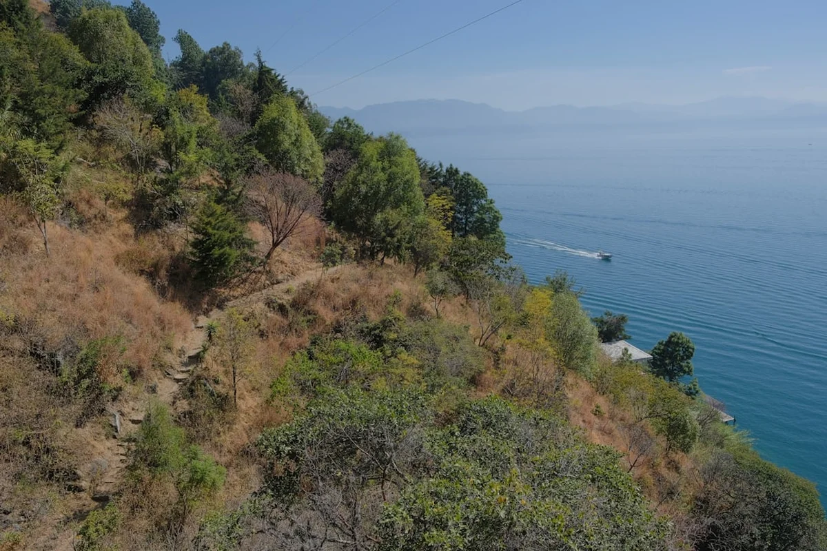
Once the circuit moves to Lake Atitlán, the accommodation options expand significantly. Trekkers can choose from budget-friendly hostels in San Pedro, eco-lodges in San Marcos, or high-end boutique hotels in Santa Cruz. These provide a welcome opportunity for a hot shower and a comfortable bed between the volcanic ascents. During the dry season, it is advisable to book lakeside accommodation at least a few weeks in advance, as the area is a popular destination for international travellers.
Required Gear
- Footwear: Sturdy, waterproof hiking boots with deep tread. The volcanic scree is abrasive and slippery; ankle support is essential.
- Clothing Layers: A moisture-wicking base layer, a warm fleece or down mid-layer, and a high-quality waterproof/windproof outer shell.
- Headwear: A warm beanie for nights and a wide-brimmed hat for daytime sun protection.
- Gloves: Insulated, windproof gloves are mandatory for the pre-dawn summit pushes.
- Backpack: A 50–65L pack if carrying your own gear, or a 20–30L daypack if using porters. Ensure it has a waterproof rain cover.
- Lighting: A powerful head torch with spare batteries (essential for night hiking and camp life).
- Trekking Poles: Highly recommended for the steep descents on loose volcanic ash to protect the knees.
What to Bring
- Water: You must carry all the water you need for the Acatenango leg (typically 4–6 litres per person). There are no water sources on the volcano.
- Water Treatment: Purification tablets or a filter for the Lake Atitlán section where tap water is not potable.
- Food: High-energy snacks (nuts, chocolate, energy bars). Most guided tours provide meals, but supplemental snacks are vital for morale and energy.
- Sun Protection: High-factor sunscreen (SPF 50+), lip balm with SPF, and polarised sunglasses. The UV radiation at 4,000 metres is intense.
- First Aid: Personal medications, blister kits (Compeed), ibuprofen, and Diamox (if prescribed by a doctor for altitude).
- Toiletries: Biodegradable wet wipes, hand sanitiser, and toilet paper (pack it out).
- Power: A portable power bank for charging phones and cameras; there is no electricity at the volcanic camps.
Permits
Permit requirements for the Guatemala Volcano Circuit are relatively straightforward but involve multiple local jurisdictions. Unlike the rigid booking systems of New Zealand or the USA, permits here are often paid as "entrance fees" at the trailhead or to local community cooperatives.
Acatenango and Fuego: The entrance fee for Volcán Acatenango is typically around 50 Quetzales (approx. US$6.50). This is usually paid at the visitor centre in La Soledad. If you are with a guided group, this fee is almost always included in your package price. It is important to keep your receipt, as rangers may check it at various points on the mountain.
Lake Atitlán Volcanoes: Volcán San Pedro is managed by a local park service, and the entrance fee (approx. 100 Quetzales) includes a local guide, which is mandatory for security and navigation. Volcán Atitlán and Tolimán may require permission from local landowners or community leaders, which is why a guide is essential to navigate these informal requirements.
Security and Guides: While not a "permit" in the legal sense, hiring a guide is a de facto requirement for safety. In the past, certain volcanoes had issues with robberies; however, the presence of the Tourist Police (POLITUR) and the use of established guiding companies have significantly improved security. Never attempt the Acatenango or Fuego sections alone; the risk of getting lost in the cloud forest or wandering into a volcanic hazard zone is too high.
Other Activities in the Area
Guatemala's volcanic highlands offer a wealth of experiences beyond the trekking trails:
- Antigua Coffee Tours: Visit a working "finca" to learn how the volcanic soil produces some of the world's best coffee, from bean to cup.
- Mayan Cooking Classes: Learn to prepare traditional dishes like Pepián (a rich, spicy stew) using ancient techniques and local ingredients.
- Pacaya Volcano Day Trip: For those who haven't had enough lava, Volcán Pacaya offers a more accessible hike where you can often roast marshmallows over hot volcanic vents.
- Chichicastenango Market: A few hours from the lake, this is one of the largest and most vibrant traditional markets in the Americas, held every Thursday and Sunday.
- Kayaking Lake Atitlán: Explore the shoreline of the caldera from the water, visiting hidden coves and thermal springs.
- Spanish Language Schools: Antigua is world-famous for its high-quality, affordable one-on-one Spanish immersion programmes.
Safety and Conditions
Volcanic Hazards: The most unique risk on this circuit is volcanic activity. Volcán de Fuego is extremely active. While the standard trekking routes stay on "safe" ridges, an unexpected large-scale eruption can produce pyroclastic flows and ash fall. Always check the latest bulletins from INSIVUMEH. If the volcano is showing signs of increased paroxysmal activity, guides may cancel the Fuego ridge traverse. Do not pressure guides to enter restricted zones.
Altitude Sickness: Acute Mountain Sickness (AMS) can affect anyone regardless of fitness level. Symptoms include headache, nausea, dizziness, and fatigue. The best treatment is descent. If symptoms persist or worsen into a persistent cough or loss of coordination (signs of HAPE or HACE), immediate evacuation to a lower altitude is mandatory. Drink plenty of water and ascend slowly.
Weather Extremes: Hypothermia is a genuine threat on Acatenango. The combination of sweat-soaked clothes, high winds, and freezing temperatures can be lethal. Always change into dry base layers immediately upon arriving at camp. Conversely, the tropical sun at high altitudes can cause severe sunburn and heat exhaustion during the day.
Security: While security has improved, it is still wise to hike in groups and use reputable agencies. Avoid carrying excessive jewellery or large amounts of cash. Stick to the established trails and follow the advice of your local guide and the POLITUR officers.
Emergency Contacts: Ensure you have the contact details for your embassy and the local emergency services (Bomberos Voluntarios). Travel insurance that specifically covers high-altitude trekking (up to 4,000 m) and volcanic activity is essential.
Side Trips and Points of Interest
Volcán Tajumulco: If you have an extra three days, consider heading further west to the department of San Marcos to climb Tajumulco. At 4,220 metres, it is the highest point in Central America. The climb is less technical than Acatenango but offers a profound sense of isolation and views that, on a clear day, reach all the way to the Mexican border and the Pacific coast.
The Almolonga Valley: Known as the "Garden of Central America," this incredibly fertile valley near Quetzaltenango (Xela) is a fascinating example of how volcanic activity supports intensive agriculture. The valley is famous for its oversized vegetables and its natural hot springs, such as Fuentes Georginas, which are perfect for soaking tired muscles after a long trek.
Maximón Shrines: In the lakeside villages like Santiago Atitlán, you can visit the shrine of Maximón (San Simón), a folk saint who represents a blend of Mayan and Catholic beliefs. Visitors offer him cigars, alcohol, and candles in exchange for protection or favours. It is a window into the complex, syncretic spiritual life of the highlands.
Cloud Forest Birdwatching: The slopes of Volcán Atitlán are one of the best places in the world to see the Resplendent Quetzal. These birds are most active at dawn and dusk in the high-altitude cloud forests. Hiring a specialist birding guide can greatly increase your chances of spotting this elusive national symbol of Guatemala.
Leave No Trace
The volcanic ecosystems of Guatemala are under increasing pressure from tourism and climate change. As a walker, you have a responsibility to minimise your impact on these fragile environments. The high-altitude forests and alpine tundras take a long time to recover from disturbance.
Leave No Trace Principles:
- Pack it in, pack it out: This includes all trash, including organic waste like orange peels and banana skins, which decompose very slowly at high altitudes.
- Dispose of waste properly: Use the provided latrines at base camps. If none are available, bury human waste in a "cathole" at least 15 cm deep and 60 metres from any trail or potential water source. Pack out your toilet paper.
- Respect Wildlife: Do not feed the animals. This includes the stray dogs that often follow hikers up the volcanoes; feeding them encourages them to stay at altitudes where they cannot survive without human help.
- Stay on the Trail: Cutting switchbacks causes massive erosion on the loose volcanic soil, destroying the trail for future users and damaging the surrounding vegetation.
- No Campfires: Wood is scarce at high altitudes, and the risk of forest fires is high during the dry season. Use a lightweight camping stove for cooking.
- Leave what you find: Do not take volcanic rocks, plants, or archaeological artefacts.