GR7 - The Grand Traverse of Spain
The GR7 (Gran Recorrido 7) is one of Europe’s most ambitious and culturally rich long-distance trekking routes, forming the Spanish portion of the E4 European long-distance path. Stretching approximately 1,250 kilometres from the southernmost tip of the Iberian Peninsula at Tarifa to the high peaks of the Pyrenees at the French border, it offers a profound journey through the heart of rural Spain. Unlike the more famous Camino de Santiago, the GR7 is a path of solitude, rugged mountain ranges, and ancient "Pueblos Blancos" (white villages) that have remained largely unchanged for centuries. It traverses seven distinct autonomous communities: Andalusia, Murcia, Valencia, Castile-La Mancha (briefly), Aragon, and Catalonia, providing an ever-shifting tapestry of geology, flora, and local tradition.
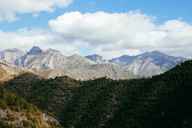
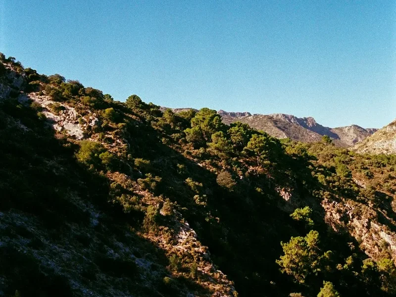
The trail is defined by its immense verticality, boasting a cumulative elevation gain of approximately 50,000 metres. This is not a coastal stroll; it is a high-altitude odyssey that skirts the edges of the Sierra Nevada, winds through the limestone crags of the Maestrazgo, and eventually climbs into the alpine grandeur of the Pyrenees. For the thru-hiker, the GR7 represents the ultimate test of endurance and navigation in Spain. It is a route that demands respect for the Mediterranean climate—where water is a precious commodity and the sun is a constant companion—but rewards the traveller with unparalleled hospitality in remote hamlets and views that stretch across the Mediterranean Sea to the mountains of North Africa.
- Distance: 1,250.0 km (approximate, depending on variants)
- Elevation Gain: 50,000 m
- Duration: 50–60 days
- Difficulty: Challenging
- Best Time: Spring (April–June) or Autumn (September–October)
- Highest Point: Approximately 2,100 m (near the Sierra Nevada section, though Mulhacén at 3,482 m is a common side trip)
- Direction: Typically walked South to North (Tarifa to Andorra/France)
- Closest City: Granada (central hub for the southern section)
Overview
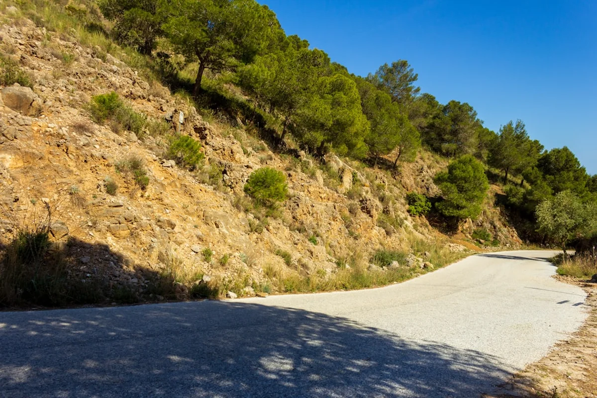
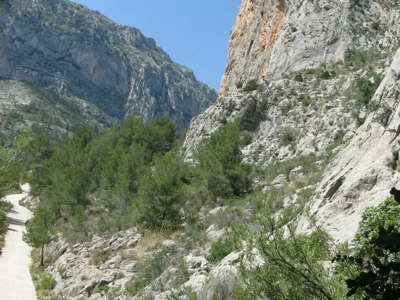
The GR7 is a masterclass in Mediterranean diversity. It was the first long-distance path to be marked in Spain, beginning in the 1970s, and it remains a symbol of the country's wild interior. The journey begins at the Strait of Gibraltar, where the Atlantic meets the Mediterranean, and immediately climbs into the Alcornocales Natural Park, home to the world's largest cork oak forests. From here, the trail enters the Serranía de Ronda and the Grazalema mountains, famous for their dramatic limestone cliffs and the highest rainfall in Spain, despite their southern latitude.
As the trail progresses into the Alpujarras—the southern foothills of the Sierra Nevada—the landscape transforms into a labyrinth of terraced hillsides and irrigation channels (acequias) dating back to the Moorish era. This section is arguably the most popular, offering hikers the chance to stay in iconic white-washed villages like Bubión and Capileira. The route then strikes north-east through the arid, lunar landscapes of Almería and the high plateaus of Murcia, where the silence of the "España Vaciada" (Empty Spain) becomes palpable. Here, the challenge shifts from steep climbs to long, exposed stretches where water management becomes the hiker's primary concern.
The northern half of the GR7 takes walkers through the Valencian Community and the rugged Maestrazgo region of Aragon. This is a land of medieval walled towns, such as Morella, and deep canyons carved by the Ebro River's tributaries. The final stages in Catalonia lead through the Ports de Tortosa-Beseit and the holy mountain of Montserrat, before the trail finally ascends into the Pyrenees. Throughout the 1,250 kilometres, the GR7 avoids major urban centres, preferring the company of shepherds' paths, Roman roads, and medieval trade routes. It is a journey for those who seek to understand Spain beyond the beaches—a journey of grit, history, and immense natural beauty.
History and Cultural Context
The GR7 is more than a recreational trail; it is a corridor through Spanish history. Many segments of the path follow the "Cañadas Reales"—ancient transhumance routes used for centuries by shepherds moving livestock between summer and winter pastures. These routes were protected by royal decree as far back as the 13th century, ensuring a public right of way that modern hikers still benefit from today. In the southern reaches, the trail is heavily influenced by the 800-year Moorish occupation of Al-Andalus. The architecture of the villages, the sophisticated water-sharing systems, and the very crops grown on the hillsides (almonds, olives, and citrus) are all legacies of this era.
The trail also bears the scars and stories of the Spanish Civil War. In the mountains of the Maestrazgo and the Sierra de Espadán, hikers pass ruins of fortifications and hideouts used by the "Maquis"—anti-Franco guerrilla fighters who held out in these remote ranges long after the war officially ended. The cultural experience of the GR7 is defined by the "Pueblos Blancos." These villages were often built on defensive ridges, their narrow, winding streets designed to provide shade and confuse invaders. Staying in these villages allows hikers to experience the "España Profunda" (Deep Spain), where the pace of life is dictated by the seasons and the local "plaza" remains the social heart of the community.
The GR7 was officially inaugurated as a hiking route in 1972, inspired by the French "Grande Randonnée" system. It was the first of its kind in Spain, paved the way for the extensive GR network that now crisscrosses the country. It serves as a vital link in the E4 European path, which eventually stretches all the way to Cyprus. Walking the GR7 is an act of connecting these disparate historical threads—from Roman engineering to Moorish agriculture and modern European integration.
Want more background? Read extended notes on history and cultural context → Learn more
Seasonal Highlights and Weather Reality
Timing is the most critical factor when planning a GR7 thru-hike. Because the trail spans the entire length of Spain and involves significant elevation changes, weather conditions can vary wildly between the southern coast and the northern mountains.
Spring (April to June): This is widely considered the optimum window for the southern and central sections. In Andalusia and Murcia, the wildflowers are in full bloom, the hills are vibrant green, and the temperatures are comfortably warm (15–25°C). Crucially, water sources that dry up in summer are usually still flowing. However, hikers reaching the Pyrenees in June should still be prepared for lingering snow on high passes.
Autumn (September to October): Another excellent window, particularly for the northern sections in Catalonia and Valencia. The summer heat has broken, and the autumn colours in the beech and oak forests are spectacular. In the south, September can still be very hot, so a late September start from Tarifa is advisable. This season also coincides with the harvest of almonds and grapes in many regions.
Summer (July to August): Thru-hiking the entire GR7 in summer is generally discouraged and can be dangerous. Temperatures in the valleys of Andalusia and Murcia regularly exceed 40°C. The risk of heatstroke and dehydration is severe, and many natural water sources disappear. Furthermore, the risk of forest fires is at its peak, often leading to the closure of certain forest tracks. If hiking in summer, stick to the high Pyrenean sections only.
Winter (November to March): While the coastal start at Tarifa might be pleasant, the GR7 quickly climbs into ranges like the Sierra Nevada and the Sierra de Gredos (on variants) where heavy snow is common. Many mountain refugios are unstaffed, and navigation becomes significantly harder. Winter hiking is only suitable for those with alpine experience and proper cold-weather gear, and even then, the central plateaus can be bitterly cold and wind-swept.
Recommended Itinerary
The Southern Traverse: Tarifa to Puebla de Don Fadrique (Andalusia)
This 400 km section is the most iconic part of the GR7, taking walkers through the heart of Andalusia.
Days 1–5: The Strait and the Cork Forests
- Day 1: Tarifa to Pelayo (22 km) - Start at the southernmost point of Europe; views of Africa.
- Day 2: Pelayo to Los Barrios (20 km) - Entering the Alcornocales Natural Park.
- Day 3: Los Barrios to Castillo de Castellar (24 km) - A stunning hilltop fortress village.
- Day 4: Castillo de Castellar to Jimena de la Frontera (21 km) - Walking through ancient cork oak groves.
- Day 5: Jimena de la Frontera to Ubrique (28 km) - A steep climb into the limestone Grazalema mountains.
Days 6–12: The Serranía de Ronda and the White Villages
- Day 6: Ubrique to Villaluenga del Rosario (18 km) - The highest village in Cádiz province.
- Day 7: Villaluenga to Montejaque (20 km) - Rugged karst landscapes and hidden valleys.
- Day 8: Montejaque to Arriate (via Ronda) (25 km) - A chance to visit the famous Tajo gorge in Ronda.
- Day 9: Arriate to El Burgo (24 km) - Crossing into the Sierra de las Nieves.
- Day 10: El Burgo to Ardales (22 km) - Near the famous Caminito del Rey.
- Day 11: Ardales to Valle de Abdalajís (26 km) - Dramatic limestone cliffs and olive groves.
- Day 12: Valle de Abdalajís to Antequera (23 km) - Home to ancient dolmens and the El Torcal karst park.
Days 13–20: The Alpujarras and the Sierra Nevada Foothills
- Day 13: Antequera to Villanueva de Cauche (20 km) - Transitioning toward the Axarquía.
- Day 14: Villanueva de Cauche to Riogordo (18 km) - Classic Andalusian agricultural landscapes.
- Day 15: Riogordo to Canillas de Aceituno (24 km) - Walking beneath the peak of La Maroma.
- Day 16: Canillas de Aceituno to Cómpeta (22 km) - Famous for its local wine and white streets.
- Day 17: Cómpeta to Játar (26 km) - A high-altitude crossing of the Sierra de Almijara.
- Day 18: Játar to Jayena (20 km) - Descending into the pine forests.
- Day 19: Jayena to Albuñuelas (22 km) - Entering the Lecrín Valley.
- Day 20: Albuñuelas to Lanjarón (18 km) - The gateway to the Alpujarras and famous for its spring water.
The Central Plateau and Levante: Murcia to Valencia
This section (approx. 350 km) is more arid and remote, requiring careful planning.
Days 21–35: Highlights of Murcia and Valencia
- Day 21–25: Lanjarón to Trevélez (The High Alpujarras) - Staying in the highest villages in Spain.
- Day 26–30: Trevélez to Puerto de la Ragua - Crossing the high pass of the Sierra Nevada.
- Day 31–35: Entering Murcia via Moratalla - A landscape of rosemary, thyme, and vast horizons.
- Day 36–40: The Sierra de Espadán (Valencia) - Dense cork forests and red sandstone peaks.
- Day 41–45: Morella and the Maestrazgo - Medieval history and rugged canyon lands.
The Northern Finale: Catalonia to the Pyrenees
The final 400 km takes the hiker through some of Catalonia's most dramatic scenery.
Days 46–60: The Road to the Pyrenees
- Day 46–50: Crossing the Ebro River and entering the Ports de Tortosa-Beseit.
- Day 51–55: The Priorat wine region and the Montserrat massif - A spiritual and geological highlight.
- Day 56–60: The final ascent through the Cadí-Moixeró Natural Park toward the border of Andorra and France.
Planning and Bookings
Book Your Trip
Everything you need to plan your journey
Accommodation
Find places to stay near Granada
Flights
Search flights to Granada
Essential Preparation
The GR7 is a serious undertaking that requires significant physical and logistical preparation. Unlike the Camino de Santiago, the GR7 is not "catered." You will often go days without seeing another hiker, and English is rarely spoken in the remote villages of the interior. A basic command of Spanish is highly recommended for booking accommodation and purchasing supplies. Fitness is paramount; the trail involves constant "yo-yoing" in and out of deep river valleys, often with a heavy pack. Thru-hikers should be comfortable with 20–30 km days in mountainous terrain.
Logistically, the trail is best accessed via major airports in Malaga (for the southern start), Granada (for the Alpujarras), or Barcelona (for the northern sections). From these hubs, local buses (ALSA is the primary operator) serve the larger trail towns. It is essential to carry a GPS device with pre-loaded tracks, as waymarking can be inconsistent, particularly in the Murcia and Valencia regions where the trail is less frequented.
Trail Accommodation
Accommodation on the GR7 is a mix of village-based pensions and mountain refugios. Because the trail passes through a village almost every day in the southern and northern sections, many hikers choose to stay in "Hostales" or "Casas Rurales."
Types of Accommodation:
- Hostales and Pensiones: Found in most villages. Expect to pay €25–€45 per night. They are usually clean, basic, and offer a glimpse into local life.
- Refugios (Mountain Huts): In the Sierra Nevada and Pyrenees, there are staffed huts (Refugios Guardados) providing bunks and meals. These must be booked in advance. There are also unstaffed "Refugios Vivac" (shelters) which are free but offer only a stone floor and a roof.
- Camping: Wild camping is a legal grey area in Spain. Generally, it is prohibited in National Parks (like Sierra Nevada) except above certain altitudes for one night. In other areas, "bivouacking" (setting up at sunset, leaving at sunrise) is often tolerated if done discreetly and away from water sources. Always check regional regulations as fire risk makes authorities very strict in summer.
Booking Requirements: During the peak spring and autumn seasons, it is wise to call ahead 24–48 hours to secure a room in smaller villages, as some guesthouses may be closed or full with local workers.
Required Gear
- Footwear: Sturdy, well-broken-in hiking boots or high-quality trail runners. The terrain is often rocky and abrasive.
- Navigation: A dedicated GPS unit or a smartphone with an offline mapping app (e.g., Gaia GPS, Wikiloc). Physical maps are excellent for overview but can be hard to find for the entire 1,250 km route.
- Backpack: A 40–50L pack is usually sufficient if staying in villages; 60L+ if carrying camping gear.
- Clothing: A layering system is essential. Even in the south, mountain temperatures can drop to near freezing at night. Include a lightweight down jacket and a high-quality waterproof shell.
- Sun Protection: A wide-brimmed hat, high-SPF sunscreen, and quality sunglasses are non-negotiable. The Spanish sun is intense, even in April.
- Emergency Gear: A basic first aid kit, a whistle, and a space blanket. A Personal Locator Beacon (PLB) is recommended for the more remote sections of Murcia and the Maestrazgo.
What to Bring
- Water Treatment: A lightweight filter (e.g., Sawyer Squeeze) or purification tablets. While village fountains (fuentes) are usually safe, mountain streams may be contaminated by livestock.
- Power Bank: To keep your navigation devices charged during long days between villages.
- Food Supplies: Always carry at least 24 hours of emergency rations. While villages have shops (tiendas), they often close for "siesta" (14:00–17:00) and may be closed entirely on Sundays.
- Cash: Many small village bars and pensions do not accept credit cards. Carry enough Euros to last several days.
- Language Guide: A small phrasebook or an offline translation app to help with menus and logistics.
Permits
For the vast majority of the GR7, no formal permits are required to walk the trail. It is a public right of way. However, there are specific exceptions and regulations to be aware of, particularly regarding protected areas and overnight stays.
National and Natural Parks: When passing through National Parks such as the Sierra Nevada or the Cadí-Moixeró, you must adhere to strict environmental regulations. No permits are needed to hike, but if you plan to wild camp, you must check the specific altitude and distance-from-road requirements. In the Sierra Nevada, for example, you must notify the park office via email if you plan to bivouac with a group larger than a certain size.
Hunting Season: Much of the GR7 passes through "Cotos de Caza" (private hunting estates). During the hunting season (typically October to February), it is vital to stay on the marked path. While no permit is needed to cross these lands, being aware of local signage is crucial for safety.
Fire Permits: Making fires is strictly prohibited along the entire route for most of the year. During high-risk periods (June to October), even using a camping stove may be restricted in certain forested areas. Always check the local "Nivel de Incendio" (Fire Level) at the start of each stage.
Other Activities in the Area
The GR7 passes through some of Spain's most culturally significant regions. Consider taking a "zero day" to explore these attractions:
- The Alhambra (Granada): A short bus ride from the trail in the Alpujarras, this UNESCO World Heritage site is the pinnacle of Moorish architecture in Europe. Book tickets months in advance.
- Caminito del Rey (Málaga): Located near the Ardales stage, this once-dangerous walkway pinned to the side of a gorge has been restored and offers spectacular views.
- Wine Tasting in Priorat: As the trail passes through Catalonia, it winds through some of the world's most prestigious vineyards. Many "bodegas" offer tours and tastings.
- Caving in the Serranía de Ronda: The limestone mountains are home to some of Europe's deepest and most beautiful cave systems, such as the Cueva del Gato.
- The Dolmens of Antequera: Visit these massive megalithic burial mounds, which are among the most important prehistoric structures in Europe.
Safety and Conditions
Heat and Hydration: The single greatest danger on the GR7 is heat exhaustion. In the southern half of the trail, shade is often non-existent for hours. Hikers must carry at least 3–4 litres of water during the hotter months and start their days at dawn to avoid the midday sun. Learn the signs of heatstroke and never push through extreme dizziness or nausea.
Navigation: Waymarking on the GR7 is "variable." In Andalusia and Catalonia, it is generally excellent (red and white stripes). In Murcia and parts of Valencia, it can be non-existent for kilometres. Do not rely solely on trail markers; always have a GPS backup and the ability to read a topographic map.
Livestock Guardian Dogs: In the remote mountains of the Maestrazgo and the Pyrenees, you will encounter large white dogs (Mastines) guarding sheep and goats. These are not pets; they are working animals. If you encounter them, do not run. Walk slowly around the flock, keep your trekking poles down, and do not make eye contact. They will bark to warn you off, but will rarely attack if you respect their space.
Flash Floods: In the autumn, Spain can experience "La Gota Fría"—intense, localized rainstorms. Dry riverbeds (ramblas) can turn into raging torrents in minutes. Never camp in a dry riverbed and avoid crossing deep water during or after heavy rain.
Emergency Services: The emergency number in Spain is 112. Be aware that mobile signal is often absent in the deep canyons and high sierras. A PLB is a wise investment for solo thru-hikers.
Side Trips and Points of Interest
Mulhacén Summit: While the GR7 skirts the southern flanks of the Sierra Nevada, many hikers take a two-day detour from Trevélez or Capileira to summit Mulhacén (3,482 m), the highest peak in mainland Spain. On a clear day, you can see the Rif Mountains of Morocco across the Mediterranean.
The Gorge of Gaitanes: Near the village of El Chorro, the trail offers views of this incredible limestone canyon. It is a geological marvel and a world-class destination for rock climbers.
Morella: This ancient walled city in the north of Castellón is one of the most beautiful towns in Spain. The GR7 passes right through its medieval gates. The castle, perched on a massive rock, offers 360-degree views of the Maestrazgo mountains.
Montserrat Monastery: In Catalonia, the trail climbs through the "serrated mountains" of Montserrat. The Benedictine abbey tucked into the cliffs is a major pilgrimage site and home to the famous Black Madonna. The unique conglomerate rock formations here are unlike anywhere else on the trail.
Leave No Trace
The GR7 traverses fragile Mediterranean ecosystems that are particularly susceptible to erosion and fire. As a hiker, you are a guest in these rural landscapes, many of which are privately owned agricultural lands.
Core Principles for the GR7:
- Fire Safety: Never light an open fire. A single spark can devastate thousands of hectares of forest and olive groves. Use a contained gas stove only in cleared areas.
- Water Respect: Do not use soap (even biodegradable) in village fountains or mountain streams. These are often the primary water sources for livestock and local communities.
- Waste Management: Pack out all trash, including fruit peels and nut shells, which decompose slowly in arid climates. In rocky areas where burying human waste is difficult, carry a "poop bag" kit.
- Gate Etiquette: The trail often passes through livestock enclosures. Always leave gates exactly as you found them (open or closed).
- Respect the Silence: Many of the villages along the GR7 are home to elderly populations. Keep noise to a minimum, especially during siesta hours and late at night.