GR6: The Great Traverse from the Alps to the Atlantic
The GR6 (Sentier de Grande Randonnée 6) is one of France's most ambitious and diverse long-distance trekking routes, spanning approximately 1,230 kilometres across the southern half of the country. This epic thru-hike begins in the rugged, high-altitude landscapes of the Maritime Alps at Saint-Paul-sur-Ubaye and concludes at the silver-sanded shores of the Atlantic Ocean in Arcachon. Along its course, the trail serves as a geographical and cultural bridge, linking the snow-capped peaks of the Ubaye Valley, the lavender-scented plateaus of Provence, the dramatic limestone gorges of the Gard, the rolling hills of the Périgord, and the vast pine forests of the Landes. It is a journey of immense scale, requiring 6 to 8 weeks of dedicated walking to complete in its entirety, though many hikers choose to experience it in regional sections.
- Distance: 1,230 km one-way
- Duration: 42–56 days (6–8 weeks)
- Season: June to September (high alpine sections), April to October (lowland sections)
- Accommodation: Gîtes d'étape, mountain refuges, campsites, and local hotels
- Highest point: Col de la Pare (2,655 m)
- Total Elevation Gain: Approximately 25,400 m
- Difficulty: Challenging (due to length and alpine terrain in the east)
- Direction: East to West (Alps to Atlantic) is the traditional route
Overview
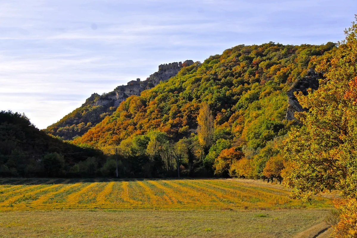
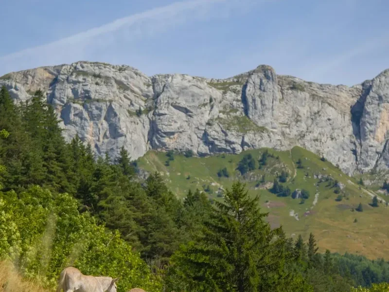
The GR6 is a masterclass in landscape transition. Unlike many thru-hikes that maintain a consistent ecological character, the GR6 is defined by its evolution. The journey begins in the Alpes-de-Haute-Provence, where the air is thin, the gradients are steep, and the scenery is dominated by jagged peaks and glacial valleys. Here, the trail demands physical resilience and respect for mountain weather. As the path winds westward, the alpine drama softens into the Mediterranean charm of the Vaucluse and the Luberon. The scent of wild thyme and rosemary replaces the smell of pine needles, and the trail weaves through some of France's most beautiful villages, including Gordes and Lacoste.
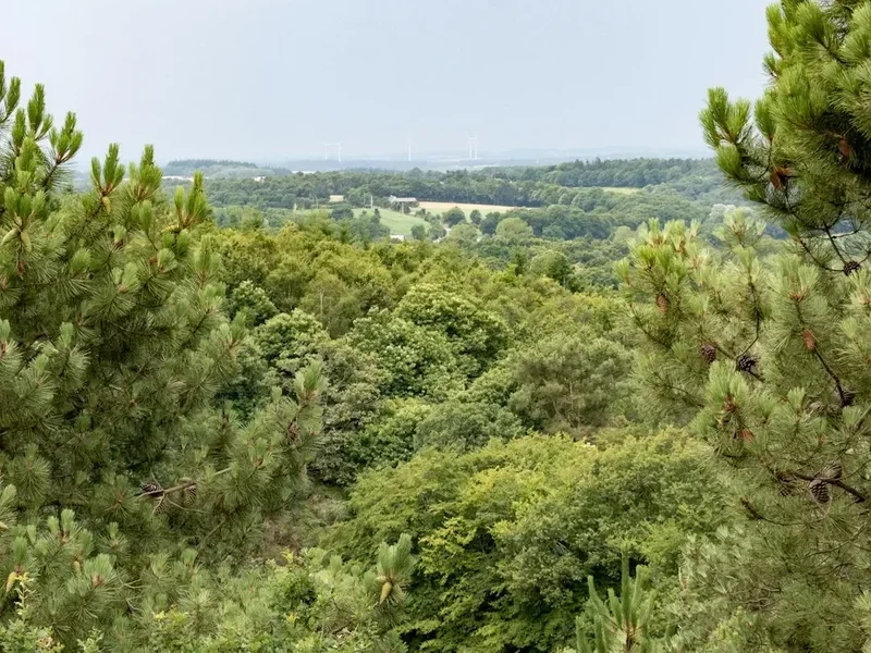
Crossing the Rhône River, the GR6 enters the Gard and the Cevennes, a region of rugged limestone plateaus known as *causses* and deep, forested valleys. This middle section offers a sense of isolation and wildness that contrasts sharply with the manicured vineyards of Provence. The trail then moves into the Quercy and the Dordogne, where the focus shifts to human history and gastronomy. Hikers walk through medieval bastide towns, past prehistoric cave sites, and alongside the meandering Lot and Dordogne rivers. The final leg of the journey traverses the vast, flat expanses of the Gironde and the Landes de Gascogne Regional Natural Park—the largest maritime pine forest in Europe—before the trail terminates at the Bassin d'Arcachon and the towering Dune du Pilat.
Walking the GR6 is as much a cultural immersion as it is a physical challenge. The route is punctuated by weekly markets, historic châteaux, and Roman ruins. It is a trail that rewards the patient walker with a deep understanding of the French "terroir"—the unique combination of soil, climate, and tradition that defines each region. Whether you are navigating the technical scree slopes of the Alps or the sandy tracks of the Atlantic coast, the GR6 offers a profound sense of accomplishment and a panoramic view of the French soul.
History and Cultural Context
The GR6 is part of the extensive *Sentiers de Grande Randonnée* network, a system of long-distance footpaths in France, Belgium, the Netherlands, and Spain. The concept of the GR network was born in the post-WWII era, spearheaded by Jean Loiseau and the *Comité National des Sentiers de Grande Randonnée* (now the FFRandonnée). The goal was to encourage the French public to rediscover their countryside through walking, utilizing ancient trade routes, Roman roads, and rural paths that had been used for centuries by shepherds, pilgrims, and merchants.
The GR6 specifically incorporates segments of the *Chemins de Saint-Jacques-de-Compostelle* (the Way of St. James). In the Quercy and Périgord regions, hikers will often find themselves sharing the path with pilgrims heading toward Santiago de Compostela. The trail also passes through regions with deep historical scars and triumphs, from the Roman occupation of Provence—evident in the ruins of Glanum near Saint-Rémy—to the strongholds of the Resistance in the Vercors and Cevennes during World War II. The architecture along the route tells a story of adaptation: the stone *bories* (dry-stone huts) of the Luberon, the fortified *bastides* of the Dordogne, and the timber-framed houses of the Gironde all reflect the local materials and the historical needs for defense and shelter.
Culturally, the GR6 traverses several linguistic and traditional boundaries. In the east, the influence of the Occitan language and Alpine culture is strong. In the west, the traditions of the Aquitaine and the maritime culture of the Atlantic coast take precedence. To walk the GR6 is to witness the historical tapestry of France unfolding step by step, from the prehistoric era to the modern day.
Want more background? Read extended notes on history and cultural context → Learn more
Seasonal Highlights and Weather Reality
Timing is critical when planning a GR6 thru-hike due to the extreme variation in altitude and latitude. The high alpine sections in the Alpes-de-Haute-Provence are typically only accessible from late June to mid-September. Before June, snow can block high passes like the Col de la Pare, and after September, early winter storms can make the terrain dangerous for those without mountaineering experience.
In contrast, the sections through Provence and the Gard can be punishingly hot in July and August. Temperatures in the Luberon and the Rhône Valley frequently exceed 35°C, and the limestone plateaus offer little shade. For these southern sections, late spring (May and June) or early autumn (September and October) provide the most comfortable walking conditions, with the added benefit of blooming lavender in June or the grape harvest in September.
The western half of the trail, through the Dordogne and the Gironde, is more temperate but can be quite humid. Rainfall is more frequent here than in the Mediterranean sections, particularly in the spring. The pine forests of the Landes provide good shade in the summer, but the sandy tracks can become heavy and difficult to walk on during dry spells. For a full thru-hike, a start in early June from the Alps is often the best strategy, allowing the hiker to clear the high peaks before the heat of mid-summer hits the lower valleys, and reaching the Atlantic as the autumn air begins to cool the coast.
Recommended Itinerary
The 8-Stage GR6 Traverse
Stage 1: The High Alps (Saint-Paul-sur-Ubaye to Sisteron)
- Distance: 165 km
- Elevation: 6,200 m gain
- Time: 7–9 days
- Key Waypoints: Saint-Paul-sur-Ubaye, Fouillouse, Barcelonnette, Seyne-les-Alpes, Sisteron
- Highlights: Crossing the Col de la Pare (2,655 m), the highest point of the trail. Dramatic alpine meadows and the citadel of Sisteron, known as the "Gateway to Provence."
- Terrain: Steep mountain paths, scree slopes, and high-altitude ridges.
Stage 2: Provence and the Luberon (Sisteron to Tarascon)
- Distance: 180 km
- Elevation: 3,800 m gain
- Time: 8–10 days
- Key Waypoints: Forcalquier, Oppedette, Gordes, Bonnieux, Saint-Rémy-de-Provence, Tarascon
- Highlights: The Gorges d'Oppedette, the "perched villages" of the Luberon, and the Roman ruins of Glanum. The trail crosses the Alpilles mountains before reaching the Rhône River.
- Terrain: Limestone plateaus, oak forests, and olive groves.
Stage 3: The Gard and the Cevennes (Tarascon to Mende)
- Distance: 195 km
- Elevation: 4,500 m gain
- Time: 9–11 days
- Key Waypoints: Beaucaire, Uzès, Alès, Florac, Mende
- Highlights: The medieval town of Uzès and the rugged landscapes of the Cevennes National Park. This section is wilder and more sparsely populated.
- Terrain: Rocky paths, river crossings, and steep valley climbs.
Stage 4: The Aubrac and the Quercy (Mende to Figeac)
- Distance: 170 km
- Elevation: 3,200 m gain
- Time: 7–9 days
- Key Waypoints: Chanac, Sainte-Enimie, Espalion, Figeac
- Highlights: The Gorges du Tarn and the volcanic plateaus of the Aubrac. Figeac is a major hub on the Camino de Santiago and features stunning medieval architecture.
- Terrain: High plateaus (*causses*) and deep river canyons.
Stage 5: The Dordogne Valley (Figeac to Sarlat-la-Canéda)
- Distance: 110 km
- Elevation: 2,100 m gain
- Time: 5–6 days
- Key Waypoints: Lacapelle-Marival, Rocamadour, Souillac, Sarlat
- Highlights: The cliffside pilgrimage site of Rocamadour and the world-famous gastronomy of Sarlat. This is the heart of the Périgord Noir.
- Terrain: Rolling hills, walnut groves, and riverbank paths.
Stage 6: The Périgord and the Bergeracois (Sarlat to Sainte-Foy-la-Grande)
- Distance: 130 km
- Elevation: 1,800 m gain
- Time: 6–7 days
- Key Waypoints: Les Eyzies, Le Bugue, Bergerac, Sainte-Foy-la-Grande
- Highlights: Prehistoric cave paintings near Les Eyzies and the vineyards of Bergerac. The trail follows the Dordogne River westward.
- Terrain: Forested tracks and vineyard paths.
Stage 7: The Gironde and the Landes (Sainte-Foy-la-Grande to Belin-Béliet)
- Distance: 145 km
- Elevation: 800 m gain
- Time: 6–8 days
- Key Waypoints: Pellegrue, Monségur, Langon, Villandraut, Belin-Béliet
- Highlights: The bastide towns of the Gironde and the transition into the vast pine forests of the Landes de Gascogne.
- Terrain: Flat agricultural land and sandy forest tracks.
Stage 8: The Atlantic Coast (Belin-Béliet to Arcachon)
- Distance: 135 km
- Elevation: 400 m gain
- Time: 5–7 days
- Key Waypoints: Salles, Le Teich, Gujan-Mestras, Arcachon
- Highlights: The Leyre delta, the oyster ports of the Bassin d'Arcachon, and the final climb up the Dune du Pilat for a sunset view over the Atlantic.
- Terrain: Sandy paths, coastal marshes, and forest trails.
Planning and Bookings
Book Your Trip
Everything you need to plan your journey
Accommodation
Find places to stay near Nice
Flights
Search flights to Nice
Essential Preparation
A thru-hike of the GR6 requires meticulous planning, particularly regarding logistics and physical conditioning. Because the trail spans over 1,200 kilometres, hikers must be prepared for a wide range of environments. Fitness is paramount; the first two weeks in the Alps involve significant elevation gain and loss, often on technical terrain. It is recommended to undertake several multi-day training hikes with a fully loaded pack before attempting the GR6.
Logistically, the GR6 is well-supported by the French rail and bus network, but many trailheads are in remote villages. Nice (NCE) is the closest major airport to the eastern start, while Bordeaux (BOD) serves the western terminus. Learning basic French is highly recommended, as English is not widely spoken in the rural hamlets of the Cevennes or the Quercy. Resupply planning is easier than on North American trails, as you will pass through a village or town almost every day, but be aware of French shop hours (many close for lunch and on Sundays/Mondays).
Trail Accommodation
The GR6 offers a variety of accommodation options, ranging from rustic mountain huts to comfortable village gîtes. In the Alpine sections, *Refuges* provide dormitory-style sleeping and communal meals. These must be booked in advance, especially in July and August. As you move into Provence and the Dordogne, *Gîtes d'étape* become the primary option. These are specifically designed for hikers and offer affordable beds and often a "demi-pension" (half-board) option including dinner and breakfast.
Accommodation Types:
- Refuges: High-altitude huts with basic facilities. Blankets are provided, but a silk liner is mandatory.
- Gîtes d'étape: Found in villages; offer dorms, kitchens, and hot showers. Costs range from €20 to €50 per night.
- Camping: Official campsites (*Campings Municipaux*) are common and affordable. Wild camping (*Bivouac*) is generally tolerated in most areas if you set up at dusk and leave at dawn, but it is strictly prohibited in certain parts of National Parks and high-fire-risk zones in Provence.
- Chambres d'hôtes: French B&Bs, offering a more private and comfortable experience in larger towns.
Required Gear
- Footwear: Sturdy, waterproof trekking boots with good ankle support for the Alps. Some hikers switch to lighter trail runners for the flatter western sections.
- Backpack: A 50–65 litre pack with a high-quality suspension system and a waterproof rain cover.
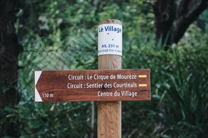
- Navigation: Topographic maps (IGN 1:25,000 scale) or a reliable GPS app with offline French maps (e.g., Iphigénie or Komoot). The trail is marked with red and white blazes, but these can be inconsistent in forest sections.
- Clothing: A versatile layering system including moisture-wicking base layers, a fleece or down mid-layer, and a high-quality Gore-Tex shell.
- Safety Gear: A basic first aid kit, a whistle, a multi-tool, and a lightweight emergency bivy or space blanket.
What to Bring
- Water Treatment: While tap water in villages is safe (*Eau Potable*), a filter or purification tablets are necessary for stream water in the Alps and Cevennes.
- Sun Protection: High-SPF sunscreen, a wide-brimmed hat, and quality sunglasses are essential for the exposed plateaus of Provence.
- Sleeping Liner: A silk or cotton liner is mandatory for hygiene in refuges and gîtes.
- Power Bank: To keep navigation devices charged, as outlets in older gîtes can be limited.
- Cash: Many small gîtes and village bakeries do not accept credit cards. Carry at least €100–200 in small denominations.
- Food: While you can buy fresh bread and cheese daily, always carry 1–2 days of emergency rations (nuts, dried fruit, energy bars) for remote sections.
Permits
One of the great advantages of hiking in France is the lack of a formal permit system for the GR6. Unlike the Pacific Crest Trail or the Milford Track, there is no quota for the number of hikers allowed on the trail. You are free to start and finish whenever you choose. However, this freedom comes with the responsibility of booking your own accommodation. During the peak summer months (July and August), refuges in the Alps and popular gîtes in Rocamadour or Sarlat can fill up weeks in advance.
Key Considerations:
- National Park Regulations: While no permit is needed to enter the Cevennes National Park or the Landes de Gascogne Regional Park, you must adhere to strict rules regarding fire, waste, and camping.
- Hunting Season: In the autumn (starting mid-September), hunting is common in rural France. While not a permit issue, hikers should wear bright colours and stay on the marked trail.
- Taxe de Séjour: Most accommodation providers will charge a small "tourist tax" (usually €0.50 to €2.00 per night), which is used to maintain local infrastructure.
Other Activities in the Area
The GR6 passes through some of France's most iconic tourist regions, offering numerous opportunities for side adventures:
- Canoeing the Dordogne: Take a break from walking and rent a canoe in Souillac or Beynac to see the châteaux from the water.
- Wine Tasting: The trail passes through the heart of the Bergerac and Bordeaux wine regions. Many vineyards offer tours and tastings (*Dégustation*).
- Prehistoric Exploration: Visit the Lascaux IV cave replica near Montignac for a world-class look at Upper Paleolithic art.
- Market Days: Plan your stops to coincide with local markets (e.g., Saturday in Sarlat or Wednesday in Saint-Rémy) for the best local produce.
- Oyster Tasting: At the trail's end in Arcachon, visit the oyster shacks of Gujan-Mestras for fresh seafood straight from the bay.
Safety and Conditions
Safety on the GR6 is primarily a matter of managing environmental risks and physical health. In the eastern sections, mountain weather is the greatest threat. Thunderstorms can develop rapidly in the afternoons, bringing lightning and sudden temperature drops. Always aim to cross high passes before noon. In the southern sections, heatstroke and dehydration are genuine risks. Carry at least 3 litres of water when crossing the *causses* of the Gard and Vaucluse.
Wildlife and Livestock: In the Alps and the Cevennes, you will encounter large flocks of sheep protected by *Patous* (Great Pyrenees guard dogs). These dogs are not pets; they are working animals trained to protect the flock from wolves. If you encounter a Patou, stop, stay calm, do not make eye contact, and walk in a wide circle around the flock. Never try to pet the dog or the sheep.
Navigation: While the GR6 is generally well-marked with red and white horizontal stripes, markers can be obscured by vegetation or lost during logging operations in the Landes. Always carry a backup navigation method. Cell phone coverage is excellent in Provence but can be non-existent in the deep valleys of the Cevennes.
Side Trips and Points of Interest
Mont Ventoux: While the GR6 passes to the south of the "Giant of Provence," a two-day detour can take you to the summit (1,912 m) for unparalleled views of the Rhône Valley and the Alps. This is a legendary climb for cyclists and hikers alike.
The Gorges du Verdon: Located slightly south of the GR1 ms Alpine section, the "Grand Canyon of Europe" is worth a multi-day detour for its turquoise waters and sheer limestone cliffs. You can reconnect with the GR6 near Forcalquier.
Rocamadour: The GR6 passes directly through this vertical village built into a cliffside. It has been a site of pilgrimage for over a thousand years. Be sure to climb the 216 steps of the Grand Escalier and visit the Chapelle Notre-Dame to see the Black Madonna.
Dune du Pilat: The official end of the GR6 is often considered the summit of this dune, the tallest in Europe. Standing 100 metres above sea level, it offers a 360-degree view of the Atlantic Ocean and the vast pine forests you have just traversed.
Leave No Trace
The GR6 traverses many fragile ecosystems, from alpine tundra to coastal dunes. As a thru-hiker, your impact over 1,200 kilometres can be significant. Adhering to Leave No Trace principles is essential to maintaining the trail's beauty and ensuring continued access for future walkers.
Core Principles for the GR6:
- Fire Safety: Wildfires are a catastrophic risk in Provence and the Landes. Never light an open fire. Use a contained backpacking stove only in designated areas.
- Waste Management: Pack out all trash, including organic waste like orange peels or apple cores, which decompose slowly in arid environments. Use village bins whenever possible.
- Respect Private Land: Much of the GR6 passes through private farms and vineyards. Stay on the marked path and always close gates behind you.
- Water Protection: Do not use soap (even biodegradable) directly in streams or troughs used by livestock. Wash at least 60 metres away from water sources.