GR41 - The Heart of the Massif Central
The GR41 is one of France's most evocative long-distance footpaths, a journey that traverses the "Diagonale du Vide" (the Empty Diagonal) to reveal the hidden, rugged soul of the country's interior. While the full route stretches over 400 kilometres from the Loire Valley to the volcanic heights of the Massif Central, this 180-kilometre section from La Chaise-Dieu to the outskirts of Saint-Étienne offers the most dramatic topographical and cultural transition. Starting at the high-altitude plateau of the Haute-Loire, the trail weaves through ancient pine forests, descends into the dramatic Gorges de l'Allier, and climbs over the volcanic "puys" that characterise the Auvergne region. This is a walk of profound silence and immense scale, where the history of Benedictine monks, medieval knights, and industrial pioneers is etched into every stone bridge and granite outcrop. With 6,000 metres of cumulative elevation gain, it is a moderate but rewarding challenge that demands respect for the variable mountain weather and a deep appreciation for the slow, rhythmic pace of rural French life.
- Distance: 180.0 km
- Elevation Gain: 6,000 m
- Duration: 9–12 days
- Difficulty: Moderate
- Best Time: May to October
- Closest City: Clermont-Ferrand
- Trailhead: La Chaise-Dieu, Haute-Loire
- Direction: South-east to North-west (flexible, but described here from La Chaise-Dieu)
Overview
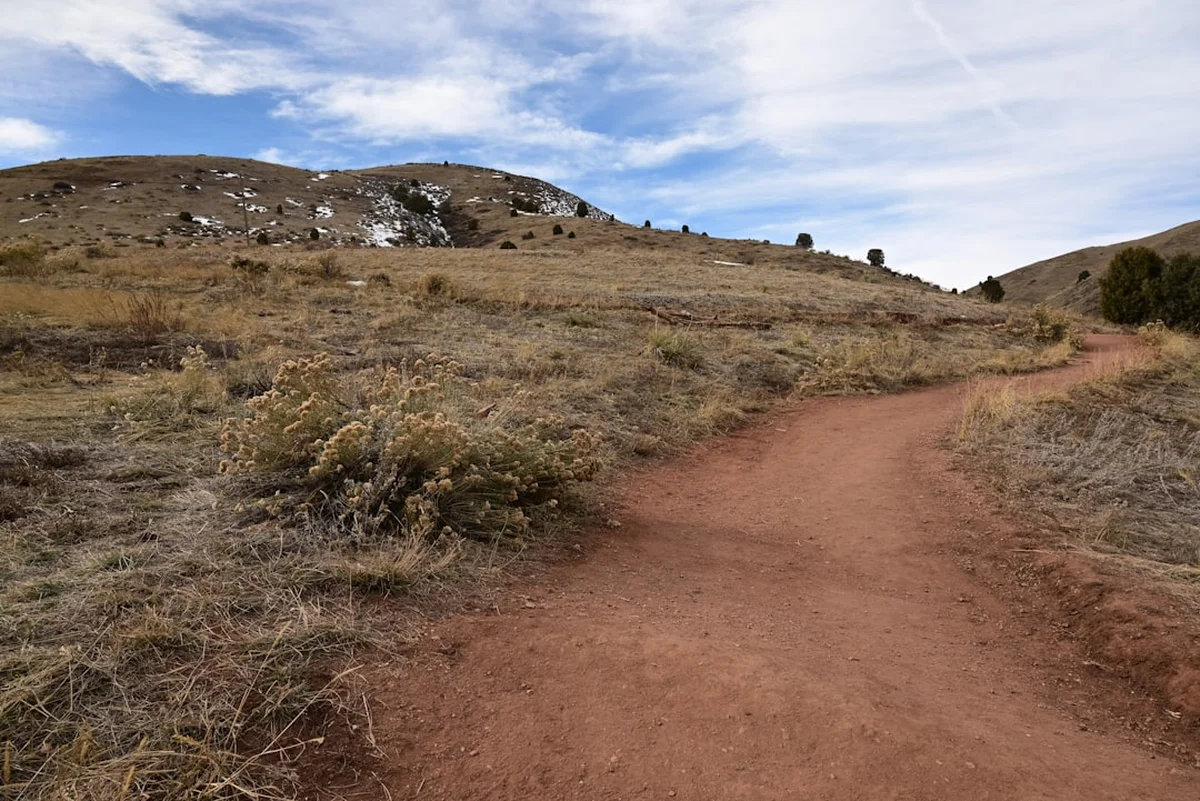
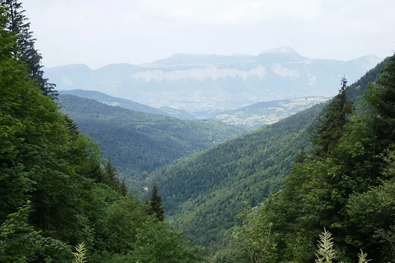
The GR41 is a masterclass in landscape diversity, offering a walking experience that feels far removed from the crowded tourist corridors of the Alps or the Pyrenees. The route begins in the mystical atmosphere of La Chaise-Dieu, a village dominated by its massive 14th-century abbey, sitting at an altitude of 1,082 metres. From here, the trail embarks on a grand descent and ascent through the Livradois-Forez Regional Natural Park, a territory defined by its "monts" (mountains) and "vallees" (valleys). The first third of the journey is characterised by high-altitude plateaux and dense coniferous forests, where the air is crisp and the views stretch across the volcanic chains of the Velay. As you progress, the landscape softens into the rolling hills of the Cher valley transition, only to be punctuated by the dramatic basalt cliffs and deep river incisions of the Allier and Loire gorges.
What sets the GR41 apart is its "terroir"—the deep connection between the land and its people. You will walk through villages built from dark volcanic stone, pass by Romanesque churches that have stood for a millennium, and cross rivers that once powered the lace-making and ribbon-weaving industries of the region. The elevation gain of 6,000 metres is spread across numerous "montées" and "descentes," ensuring that while no single climb is overwhelming, the cumulative effort requires a steady level of fitness. The trail is well-marked with the iconic red and white blazes of the Grande Randonnée network, yet it retains a sense of wildness; it is not uncommon to walk for hours without encountering another soul, save for the occasional herd of Salers cattle or a soaring red kite.
This is a landscape defined by fire and water. The ancient volcanic activity of the Massif Central has created a unique geology of "orgues basaltiques" (basalt columns) and "puys" (volcanic domes), while the rivers have carved deep, sheltered canyons that host a microclimate of Mediterranean flora. Whether you are standing on the ramparts of a medieval fortress overlooking the Loire or resting in a sun-drenched meadow filled with wild narcissus, the GR41 provides a constant sense of discovery. It is a journey for the contemplative walker, one who seeks to understand the geological and cultural layers of France's rugged heartland.
History and Cultural Context
The history of the GR41 is inextricably linked to the spiritual and industrial evolution of central France. The starting point, La Chaise-Dieu (literally "The House of God"), was founded in 1043 by Robert de Turlande. The abbey became one of the most powerful Benedictine houses in Europe, a centre of art and theology that influenced the entire region. Walking the trail today, you can still feel the echoes of the pilgrims who travelled these paths to reach the abbey's famous "Danse Macabre" fresco or to hear the echoes of its world-renowned organ. The trail follows sections of ancient Roman roads and medieval trade routes that connected the high plateaux of the Auvergne with the commercial hubs of the Loire and Cher valleys.
As the trail moves towards the Gorges de l'Allier and the Loire, the history shifts from the spiritual to the defensive and industrial. The region is dotted with "châteaux-forts" (fortified castles) like Polignac and Rochebaron, built on volcanic "necks" to control the river crossings and protect the local populations during the Hundred Years' War. In the 18th and 19th centuries, the rivers themselves became the lifeblood of the region. The Allier was a major transport artery for timber and wine, while the smaller tributaries powered the mills of the "dentellières" (lace-makers) in villages like Retournac. The GR41 passes through these "villes d'art et d'histoire," where the industrial heritage is preserved in museums and the very architecture of the houses, which often feature large windows designed to let in maximum light for delicate handiwork.
The cultural context of the GR41 is also found in its agricultural traditions. The "lentille verte du Puy" (green lentils of Le Puy) and the various "AOP" cheeses like Saint-Nectaire and Fourme d'Ambert are products of this specific volcanic soil. The trail is not just a physical path but a culinary and social journey through a part of France that has fiercely protected its identity and traditions against the tide of modernisation. To walk the GR41 is to walk through a living museum of French rural life.
Want more background? Read extended notes on history and cultural context → Learn more
Seasonal Highlights and Weather Reality
The GR41 is best experienced from late spring to early autumn, with each season offering a distinct character to the landscape. Because much of the trail sits between 600 and 1,100 metres, the weather can be significantly cooler and more volatile than in the lowlands of France. Preparation for sudden changes in temperature and precipitation is essential regardless of the month.
Spring (May to June): This is perhaps the most beautiful time to walk. The high plateaux are carpeted in wildflowers, including wild daffodils, narcissus, and orchids. The rivers are full from the spring melt, making the waterfalls in the gorges particularly spectacular. However, spring can be fickle; "giboulées" (sudden heavy showers) are common, and temperatures can drop sharply at night. Snow can occasionally linger on the highest points near La Chaise-Dieu until early May.
Summer (July to August): Summer brings stable weather and long daylight hours, ideal for covering the longer 20-kilometre stages. The deep forests provide welcome shade, and the river gorges offer opportunities for cooling off. However, the Massif Central is prone to "orages" (violent afternoon thunderstorms) that can develop rapidly. Heatwaves can also push temperatures above 30°C, making the climbs out of the valleys strenuous. This is the peak season for local festivals and open-air markets.
Autumn (September to October): September is often considered the "golden month" for the GR41. The crowds (what few there are) have dispersed, the air is crisp and clear, and the deciduous forests of the gorges turn vibrant shades of ochre and gold. This is also the season for mushroom foraging and the "brame du cerf" (the rutting of the red deer), which can be heard echoing through the woods. By mid-October, the risk of frost increases, and many seasonal "gîtes" begin to close for the winter.
Winter (November to April): Outside the main season, the GR41 becomes a challenging environment. Heavy snow is common on the plateaux, and many sections of the trail become impassable without snowshoes or skis. Most accommodation is closed, and the short daylight hours make navigation difficult. This period is only recommended for experienced winter hikers with autonomous camping gear.
Recommended Itinerary
10-Day GR41 Itinerary: La Chaise-Dieu to Firminy
Day 1: La Chaise-Dieu to Allègre
- Distance: 24 km
- Elevation gain: 550 m
- Time: 6–7 hours
- Start at the Abbey of La Chaise-Dieu (1,082 m)
- Traverse the high-altitude pine forests of the Livradois-Forez
- Pass through the volcanic peat bogs of the Plateau de la Chaise-Dieu
- Arrive in Allègre, a village built at the foot of the "Volcan du Mont Bar"
- Key Waypoint: The "Potence d'Allègre," the remains of a medieval castle overlooking the village
Day 2: Allègre to Saint-Paulien
- Distance: 22 km
- Elevation gain: 450 m
- Time: 5–6 hours
- Descend from the volcanic heights towards the Borne valley
- Pass the Château de Rochelambert, built into a basalt cliff
- Walk through rolling farmland and small hamlets
- Arrive in Saint-Paulien, the ancient Roman capital of the Velay region
- Key Waypoint: The Romanesque church of Saint-Georges with its distinctive multi-coloured stone
Day 3: Saint-Paulien to Polignac
- Distance: 20 km
- Elevation gain: 400 m
- Time: 5 hours
- Follow the trail through the "pays des sucs" (volcanic domes)
- Gradual climb with views of the Puy-en-Velay basin
- Arrive in Polignac, dominated by its massive fortress on a volcanic plateau
- Key Waypoint: The Forteresse de Polignac, offering 360-degree views of the Auvergne volcanoes
Day 4: Polignac to Vorey-sur-Arzon
- Distance: 22 km
- Elevation gain: 650 m
- Time: 6–7 hours
- Descend into the dramatic Gorges de l'Allier
- Follow the river through steep, wooded terrain
- Pass through the village of Lavoûte-sur-Loire with its riverside castle
- Arrive in Vorey, a bustling village at the confluence of the Arzon and the Loire
- Key Waypoint: The "Pont de Lavoûte," a historic bridge over the Loire
Day 5: Vorey to Retournac
- Distance: 18 km
- Elevation gain: 500 m
- Time: 5 hours
- Follow the "Sentier des Gorges de la Loire"
- Walk through ancient oak and beech forests
- Pass several small waterfalls and rocky outcrops
- Arrive in Retournac, the historic centre of the lace-making industry
- Key Waypoint: The Musée des Manufactures de Dentelles (Lace Museum)
Day 6: Retournac to Bas-en-Basset
- Distance: 22 km
- Elevation gain: 700 m
- Time: 6–7 hours
- A challenging day with several steep climbs out of the Loire valley
- Pass the ruins of the Château de Rochebaron perched high above the river
- Walk through the "Parc de la Biodiversité" wetlands
- Arrive in Bas-en-Basset, a historic town with a Mediterranean feel
- Key Waypoint: The falconry displays at Rochebaron (seasonal)
Day 7: Bas-en-Basset to Aurec-sur-Loire
- Distance: 18 km
- Elevation gain: 450 m
- Time: 5 hours
- Follow the river banks and high ridges overlooking the Loire
- Pass through the medieval village of Monistrol-sur-Loire (nearby)
- Arrive in Aurec-sur-Loire, a town with a rich medieval heritage
- Key Waypoint: The Château d'Aurec and its surrounding gardens
Day 8: Aurec-sur-Loire to Saint-Victor-sur-Loire
- Distance: 16 km
- Elevation gain: 600 m
- Time: 5–6 hours
- Enter the "Réserve Naturelle des Gorges de la Loire"
- Steep climbs and descents through rugged, rocky terrain
- Views of the "Barrage de Grangent" and its island castle
- Arrive in Saint-Victor, a picturesque village with a popular inland beach
- Key Waypoint: The viewpoint of the "Maison de la Réserve"
Day 9: Saint-Victor to Unieux
- Distance: 10 km
- Elevation gain: 300 m
- Time: 3 hours
- A shorter day allowing for exploration of the nature reserve
- Follow the ridges above the Grangent reservoir
- Descend into the industrial valley of the Ondaine
- Arrive in Unieux, a town marking the transition to the Saint-Étienne basin
- Key Waypoint: The "Pertuiset" bridge, a modern architectural landmark
Day 10: Unieux to Firminy
- Distance: 8 km
- Elevation gain: 200 m
- Time: 2 hours
- A final easy walk through urban parks and woodland
- Finish at the Firminy-Vert architectural site
- Easy access to trains for Clermont-Ferrand or Lyon
- Key Waypoint: The Site Le Corbusier, the largest collection of the architect's work in Europe
Planning and Bookings
Book Your Trip
Everything you need to plan your journey
Accommodation
Find places to stay near Clermont-Ferrand
Flights
Search flights to Clermont-Ferrand
Essential Preparation
The GR41 requires a moderate level of physical fitness and some experience with multi-day trekking. While the trail is not technically difficult, the cumulative elevation gain of 6,000 metres means you should be comfortable walking 20 kilometres a day with a loaded pack. Training on hilly terrain prior to your trip is highly recommended. Logistics are relatively straightforward, but because the trail passes through rural areas, coordination of accommodation and food is vital.
Clermont-Ferrand is the primary logistical hub. From the airport (CFE) or the central train station, you can take a regional train (TER) to Brioude. From Brioude, a local bus or taxi transfer is required to reach the trailhead at La Chaise-Dieu. It is advisable to spend a night in La Chaise-Dieu before starting to visit the abbey and acclimatise to the altitude. Most walkers choose to carry their own gear, but luggage transfer services (like La Malle Postale) operate on certain sections of the trail during the peak season.
Trail Accommodation
Accommodation on the GR41 is varied and reflects the hospitality of rural France. You will find a mix of "Gîtes d'étape" (hikers' hostels), "Chambres d'hôtes" (B&Bs), and small local hotels. In larger towns like Saint-Paulien or Retournac, there are more options, but in smaller hamlets, you must book well in advance.
Gîtes d'étape: These are specifically designed for hikers. They offer dormitory-style sleeping (usually 4–10 beds per room) and often provide a "demi-pension" (half-board) option which includes dinner and breakfast. Facilities include hot showers, shared toilets, and sometimes a communal kitchen. Costs typically range from €40 to €60 for half-board.
Chambres d'hôtes: These offer a more private and comfortable experience in local homes. They almost always include breakfast and often offer a "table d'hôtes" (communal dinner) with the hosts. Costs range from €60 to €100 per night for two people.
Camping: There are municipal campsites in most of the larger villages (Allègre, Vorey, Bas-en-Basset). Wild camping (bivouacking) is generally tolerated in the Livradois-Forez Regional Park if you set up at sunset and leave at sunrise, but it is strictly prohibited in the Réserve Naturelle des Gorges de la Loire.
Required Gear
- Walking boots: Sturdy, waterproof, and well broken-in. The terrain includes rocky paths and muddy forest tracks.
- Rain gear: A high-quality waterproof jacket and overtrousers. The Massif Central is known for sudden, heavy rain.
- Backpack: 35–50 litres if staying in gîtes; 60+ litres if carrying camping gear. Ensure it has a waterproof cover.
- Clothing: Layering is key. Include moisture-wicking base layers, a fleece or down mid-layer, and lightweight trekking trousers.
- Navigation: Topographic maps (IGN 1:25,000) or a reliable GPS app with offline maps. The red and white blazes are good but can be missed in fog.
- Sun protection: Hat, sunglasses, and high-SPF sunscreen. The sun at 1,000 metres is stronger than it feels.
- First aid: Blister kits (Compeed), antiseptic wipes, basic painkillers, and any personal medications.
What to Bring
- Water: At least 2 litres of carrying capacity. While there are fountains in villages, some may not be potable ("eau non potable").
- Food: High-energy snacks (nuts, dried fruit, chocolate). While you can buy lunch supplies in villages, some shops close on Mondays or for "siesta" (12:00–14:30).
- Water treatment: A small filter or purification tablets as a backup for stream water.
- Toiletries: Biodegradable soap and shampoo, a quick-dry travel towel, and a small roll of toilet paper.
- Power: A portable power bank for your phone/GPS, as some older gîtes have limited charging points.
- Cash: Many small gîtes and village bakeries do not accept credit cards. Carry at least €100–200 in cash.
- Sleep sheet: A silk or cotton "sac à viande" is mandatory in most gîtes d'étape for hygiene.
Permits
One of the great joys of hiking in France is the freedom of access. No permits are required to walk the GR41, and there are no entry fees for the Livradois-Forez Regional Natural Park or the Réserve Naturelle des Gorges de la Loire. The trail is a public right-of-way maintained by the FFRandonnée (French Hiking Federation) and local volunteers.
Booking Strategy: While no permits are needed, booking your accommodation is essential, especially during the French summer holidays (July and August) and on holiday weekends (Ascension, Pentecost). Many gîtes are small and can fill up with a single group. It is recommended to book at least 2–4 weeks in advance for peak season, or 1–2 days in advance during the shoulder season.
Hunting Season: Be aware that the hunting season ("la chasse") typically runs from September to February. During this time, it is advisable to wear bright colours and stay strictly on the marked trails. Local tourist offices can provide information on specific hunting days in each commune.
Fishing Permits: If you plan to fish in the Allier or Loire rivers, you must purchase a "Carte de Pêche," which is available online or at local tobacco shops ("Tabacs").
Other Activities in the Area
The region surrounding the GR41 is rich in cultural and natural attractions that are worth an extra day or two of exploration:
- Le Puy-en-Velay: A UNESCO World Heritage site and the starting point of the Via Podiensis (St James Way). Visit the cathedral, the Notre-Dame de France statue, and the Saint-Michel d'Aiguilhe chapel perched on a volcanic needle.
- Puy de Dôme: Located near Clermont-Ferrand, this iconic volcanic dome offers panoramic views of the Chaîne des Puys. You can hike to the top or take the panoramic rack railway.
- Vulcania: An interactive theme park and museum dedicated to volcanology, located in the heart of the Auvergne Volcanoes Regional Park.
- Canoeing and Kayaking: The Gorges de l'Allier and the Loire offer excellent opportunities for paddling, with rentals available in Vorey and Bas-en-Basset.
- Wine Tasting: Explore the "Côtes d'Auvergne" vineyards near Clermont-Ferrand, known for their unique volcanic terroir and Gamay/Pinot Noir blends.
- Michelin Museum: In Clermont-Ferrand, "L'Aventure Michelin" tells the story of the world-famous tyre company and its impact on travel and gastronomy.
Safety and Conditions
Weather Awareness: The Massif Central is a high-altitude environment where weather can change with startling rapidity. Thunderstorms ("orages") are a genuine risk in summer; if you see dark clouds building or hear thunder, descend from high ridges immediately. Fog can also roll in quickly on the plateaux, reducing visibility to a few metres. Always check the "Météo France" mountain forecast before setting out.
Terrain Hazards: The trail is generally well-maintained, but some sections in the gorges can be steep, rocky, and slippery after rain. Sturdy footwear with good grip is essential. Be cautious on road-walking sections; while the GR41 mostly uses trails, there are short stretches on narrow country roads where you must be mindful of local traffic.
Health Risks: Ticks are present in the forests and long grass, especially in spring and early summer. They can carry Lyme disease, so perform a thorough tick check every evening. Use repellent and wear long trousers in dense vegetation. Hydration is also critical; the climbs out of the gorges can be very hot, and there are long stretches between villages without water sources.
Emergency Services: The universal European emergency number is 112. Mobile signal is generally good on the ridges but can be non-existent in the deep sections of the gorges. It is always wise to inform your host at your next accommodation of your expected arrival time.
Side Trips and Points of Interest
The Abbey of La Chaise-Dieu: Before you start, spend time in this 14th-century masterpiece. The "Danse Macabre" fresco, a 15th-century mural depicting the equality of all before death, is one of the finest examples of its kind in Europe. The abbey's acoustics are legendary, and if your walk coincides with the music festival in late August, it is an unforgettable experience.
The Forteresse de Polignac: A short detour from the main trail on Day 3, this fortress sits on a 100-metre-high basalt platform. It was the ancestral seat of the powerful Polignac family and offers a fascinating look at medieval defensive architecture, including a 32-metre-high keep and a sophisticated rainwater collection system.
The Gorges de la Loire Nature Reserve: The final stages of the trail pass through this protected area. It is a haven for biodiversity, including the short-toed snake eagle and the European beaver. The viewpoints overlooking the Grangent reservoir, with the 11th-century Château de Grangent sitting on its island, are among the most photographed in the region.
Le Corbusier's Firminy-Vert: The trail ends at one of the most significant architectural sites of the 20th century. Firminy-Vert includes the Maison de la Culture, the Unité d'Habitation, the Stadium, and the stunning Saint-Pierre Church, which was completed posthumously. It is a stark, modernist contrast to the medieval villages you will have traversed.
Leave No Trace
The GR41 passes through several sensitive ecosystems, including the Livradois-Forez Regional Natural Park and the Réserve Naturelle des Gorges de la Loire. Preserving these landscapes is the responsibility of every hiker. The "Leave No Trace" principles are strictly encouraged to ensure the trail remains pristine for future generations.
Guidelines for the GR41:
- Pack out all rubbish, including organic waste like banana skins or orange peels, which decompose slowly in the high-altitude climate.
- Stay on the marked red and white trails to prevent soil erosion and protect fragile flora like wild orchids.
- Respect private property; many sections of the trail pass through working farms. Close all gates behind you and do not disturb livestock.
- Keep noise to a minimum, especially in the nature reserves, to avoid disturbing nesting birds and other wildlife.
- Use public toilets in villages whenever possible. If you must go in the woods, bury waste at least 15 cm deep and 50 metres from any water source.
- Never light fires. The risk of forest fires in the Massif Central is high during the summer months.
- Do not pick wildflowers; many species in the Auvergne are protected by law.