GR4 Trail - From the Atlantic to the Mediterranean
The GR4 (Grande Randonnée 4) is one of France's most ambitious and diverse long-distance trekking routes, spanning approximately 1,500 kilometres across the heart of the country. This epic thru-hike begins at the salt-sprayed Atlantic coast in Royan and concludes at the perfume-scented hills of Grasse, overlooking the Mediterranean Sea. It is a journey of immense geographical and cultural transition, taking walkers from the flat, maritime landscapes of the Charente-Maritime, through the ancient volcanic heart of the Massif Central, across the rugged limestone plateaus of the Ardèche, and finally into the sun-drenched lavender fields and dramatic canyons of Provence. Unlike the more famous GR5 or GR20, the GR4 offers a profound sense of solitude and an authentic immersion into "La France Profonde"—the deep, rural heart of the nation where time seems to move at a different pace.
- Distance: 1,500 km one-way
- Duration: 6–8 weeks
- Elevation Gain: Approximately 43,000 m
- Difficulty: Challenging (due to length and remote sections)
- Best Time: May to September
- Highest Point: Puy de Sancy (1,885 m)
- Regions Crossed: Nouvelle-Aquitaine, Auvergne-Rhône-Alpes, Provence-Alpes-Côte d'Azur
- Direction: Generally walked West to East (Royan to Grasse)
Overview
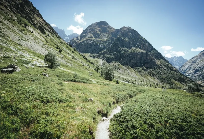
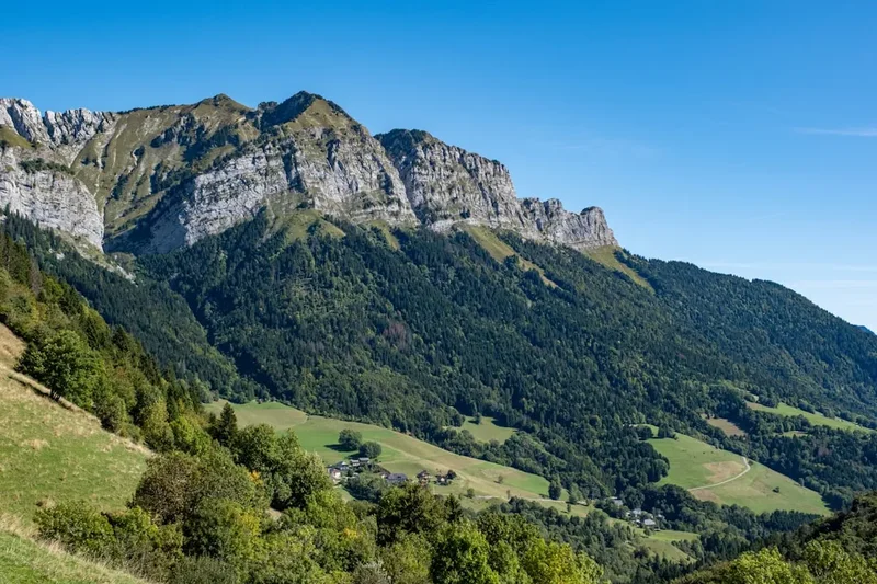
The GR4 is a masterclass in European landscape diversity. It is not merely a mountain trek or a coastal walk; it is a comprehensive cross-section of the French landmass. The trail is managed by the Fédération Française de la Randonnée Pédestre (FFRandonnée) and is marked by the iconic red-and-white blazes that define the Grande Randonnée network. For the thru-hiker, the GR4 represents a significant physical and mental undertaking, requiring sustained endurance over nearly two months of continuous travel. The route avoids the high-altitude extremes of the Alps or Pyrenees for much of its length, yet the cumulative elevation gain of 43,000 metres reveals a landscape that is constantly undulating, particularly through the volcanic regions of Auvergne and the deep gorges of the Verdon.
The journey begins with the gentle, maritime air of the Gironde estuary. Here, the path is relatively flat, winding through vineyards and historic Romanesque villages. As the trail moves inland through the Limousin, the scenery shifts to rolling green hills, dense deciduous forests, and quiet river valleys. This is a land of granite and water, where the "Plateau de Millevaches" (Plateau of a Thousand Springs) provides a tranquil, almost melancholic atmosphere. The transition into the Auvergne marks the first major physical crescendo. The trail climbs into the Chaîne des Puys, a spectacular alignment of over 80 dormant volcanoes. Walking along the rims of these ancient craters, including the iconic Puy de Dôme, offers some of the most unique geological perspectives in Europe.
South of the volcanic peaks, the GR4 enters the rugged, sun-baked landscapes of the Ardèche and the Cévennes. The terrain becomes more arid and rocky, characterised by limestone "causses" (plateaus) and deep river incisions. The final third of the trail is perhaps the most visually dramatic, as it enters Provence. Here, the GR4 traverses the Gorges du Verdon—Europe's answer to the Grand Canyon—where turquoise waters flow beneath limestone cliffs rising 700 metres high. The trail concludes in the Pre-Alps of Grasse, where the air changes once more, carrying the scent of jasmine and roses from the world's perfume capital, with the shimmering Mediterranean finally appearing on the horizon. The GR4 is a journey for those who seek to understand the soul of France, away from the tourist hubs, one step at a time.
History and Cultural Context
The GR4 is part of the vast "Sentiers de Grande Randonnée" network, which was established in the post-war era to encourage the French public to rediscover their countryside through walking. The development of the GR4 specifically aimed to link the two seas—the Atlantic and the Mediterranean—by traversing the most rural and geologically interesting parts of the interior. Much of the trail follows ancient paths that have been used for centuries: Roman roads, medieval salt routes, and "drailles" (traditional sheep migration paths) used by shepherds for transhumance.
Culturally, the GR4 is a living museum. In the Charente, walkers pass through Saintes, a city rich with Roman heritage, including a remarkably preserved amphitheatre. In the Limousin and Auvergne, the trail encounters the "plus beaux villages de France," where stone architecture reflects the local geology—grey volcanic stone in the north and warm limestone in the south. The history of the French Resistance is also palpable in the remote forests of the Limousin and the rugged terrain of the Vercors and Ardèche, where "maquis" groups hid during World War II. The trail also intersects with the Way of St. James (Camino de Santiago) at various points, particularly in the Limousin, where modern hikers share the path with pilgrims following routes that have been active since the 10th century.
The southern sections of the trail reflect the history of the Provence region, from the ancient olive groves that have sustained local communities for millennia to the historic perfume industry of Grasse. Walking the GR4 is as much a journey through French history as it is through its geography. Every village along the route has a story, often centred around its "mairie" (town hall), "église" (church), and the local "boulangerie" which remains the social heartbeat of rural France.
Want more background? Read extended notes on history and cultural context → Learn more
Seasonal Highlights and Weather Reality
Given its 1,500-kilometre length and varied elevation, the GR4 experiences a wide range of climatic conditions. Planning the timing of a thru-hike is critical to avoid both the deep snows of the Massif Central and the incinerating heat of a Provençal summer.
Spring (May to June): This is arguably the best time to start from the Atlantic coast. The Charente and Limousin are lush and green, wildflowers are in full bloom, and the days are lengthening. However, hikers must be aware that snow can linger on the higher peaks of the Auvergne (Puy de Sancy) until late May. In the south, the Verdon and Provence are pleasantly warm before the summer heat peaks.
Summer (July to August): While this is the most popular time for hiking in France, it presents challenges on the GR4. The central volcanic regions are spectacular in summer, but the southern sections through the Ardèche and Provence can see temperatures exceeding 35°C. Water sources in the limestone regions can dry up, and the risk of forest fires often leads to the closure of certain trail sections in Provence. If hiking during this period, early starts are essential to avoid the midday sun.
Autumn (September to October): September is a "golden window" for the GR4. The heat in the south begins to subside, the summer crowds vanish, and the deciduous forests of the Limousin and Auvergne turn vibrant shades of orange and gold. By mid-October, however, the first frosts appear in the Massif Central, and many seasonal gîtes (hostels) begin to close for the winter.
Winter (November to April): Thru-hiking the GR4 in winter is not recommended for recreational walkers. The Massif Central becomes a world of deep snow and sub-zero temperatures, requiring snowshoes or skis. Many sections of the trail become indistinguishable, and the majority of hiker-specific accommodation is closed. This is a period for local day-walks in the lower elevations of the Charente or the coastal Pre-Alps only.
Recommended Itinerary
The GR4 Thru-Hike: A 7-Stage Breakdown
Stage 1: The Atlantic Coast and Charente (Days 1–7)
- Distance: 165 km
- Elevation Gain: 1,200 m
- Key Waypoints: Royan, Talmont-sur-Gironde, Saintes, Cognac
- Start at the Grande Conche beach in Royan
- Follow the Gironde estuary through "carrelets" (traditional fishing huts on stilts)
- Explore the Roman ruins and amphitheatre in Saintes
- Walk through the world-famous vineyards of the Cognac region
- Terrain: Mostly flat, sandy paths and vineyard tracks
Stage 2: The Limousin Heartlands (Days 8–16)
- Distance: 210 km
- Elevation Gain: 3,500 m
- Key Waypoints: Saint-Léonard-de-Noblat, Aubusson, Plateau de Millevaches
- Enter the rolling green hills of the Limousin
- Cross the Vienne River and follow ancient pilgrim paths
- Visit Aubusson, famous for its UNESCO-listed tapestry heritage
- Traverse the remote and misty Plateau de Millevaches
- Terrain: Forested tracks, granite-strewn hills, and quiet country lanes
Stage 3: The Auvergne Volcanoes (Days 17–25)
- Distance: 190 km
- Elevation Gain: 7,500 m
- Key Waypoints: Orcival, Puy de Dôme, Mont-Dore, Puy de Sancy
- Ascend into the Chaîne des Puys (UNESCO World Heritage site)
- Summit the Puy de Dôme (1,465 m) for panoramic views of 80 volcanic craters
- Climb the Puy de Sancy (1,885 m), the highest point of the GR4
- Descend into the glacial valleys of the Cantal
- Terrain: Steep alpine climbs, ridgeline walking, and volcanic ash paths
Stage 4: The Margeride and Ardèche Uplands (Days 26–33)
- Distance: 180 km
- Elevation Gain: 5,200 m
- Key Waypoints: Saint-Flour, Langogne, Villefort
- Cross the high, windswept granite plateaus of the Margeride
- Enter the rugged Ardèche, a land of deep ravines and chestnut forests
- Pass through the medieval village of La Garde-Guérin
- Walk along the shores of Lake Villefort
- Terrain: Rocky plateaus, steep valley descents, and ancient stone paths
Stage 5: The Gorges and Causses (Days 34–41)
- Distance: 175 km
- Elevation Gain: 6,100 m
- Key Waypoints: Les Vans, Pont-Saint-Esprit, Malaucène
- Navigate the limestone "causses" with their unique Mediterranean flora
- Cross the Rhône River at Pont-Saint-Esprit
- Enter the Vaucluse and approach the foothills of Mont Ventoux
- Experience the transition from continental to Mediterranean climate
- Terrain: Arid limestone tracks, scrubland (garrigue), and river crossings
Stage 6: The Verdon and Haute-Provence (Days 42–50)
- Distance: 200 km
- Elevation Gain: 8,400 m
- Key Waypoints: Riez, Moustiers-Sainte-Marie, Gorges du Verdon, Castellane
- Walk through the lavender fields of the Valensole Plateau (best in late June/July)
- Visit Moustiers-Sainte-Marie, perched against limestone cliffs
- Traverse the rim of the Gorges du Verdon, with spectacular views into the canyon
- Climb through the rugged Pre-Alps of Haute-Provence
- Terrain: High limestone ridges, dramatic canyon edges, and lavender fields
Stage 7: The Pre-Alps to the Riviera (Days 51–56)
- Distance: 130 km
- Elevation Gain: 4,500 m
- Key Waypoints: Saint-Auban, Entrevaux, Grasse
- Pass through the fortified town of Entrevaux with its Vauban citadel
- Navigate the "Clues"—narrow, dramatic river gorges carved through the rock
- Final descent through olive groves and flower plantations
- Arrive in Grasse, the perfume capital of the world
- Terrain: Technical rocky paths, forested descents, and Mediterranean terraces
Important Notes:
- The GR4 is a long-distance thru-hike; fitness and mental preparation are paramount
- Resupply points are frequent but require planning around French shop opening hours (many close for lunch)
- Water management is critical in the southern limestone sections
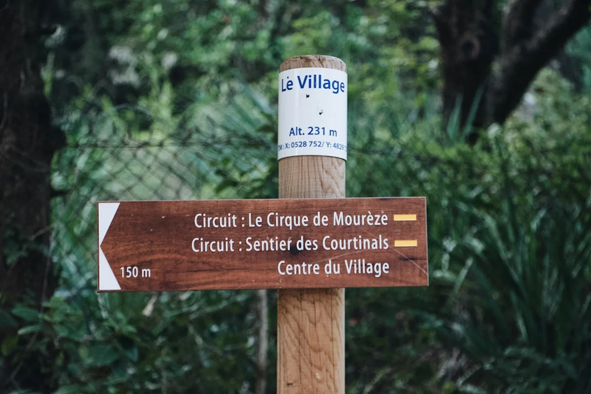
- The red-and-white blazes are generally excellent, but a GPS backup is highly recommended
- Accommodation should be booked at least 24–48 hours in advance during peak season
Planning and Bookings
Book Your Trip
Everything you need to plan your journey
Accommodation
Find places to stay near Nice
Flights
Search flights to Nice
Essential Preparation
Planning a 1,500-kilometre trek requires meticulous logistical preparation. The GR4 is not a wilderness trail in the North American sense; it passes through or near villages almost daily, which simplifies food logistics but complicates accommodation planning. Physical fitness is the first priority—prospective hikers should be comfortable walking 25–30 kilometres per day with a 10–12 kg pack for multiple consecutive weeks. Training should include significant elevation gain to prepare for the Auvergne and Provence sections.
Logistically, the "Topo-guides" published by FFRandonnée are the gold standard for the GR4. These books provide detailed 1:50,000 maps, descriptions of the route, and lists of accommodation. Note that the GR4 is covered by several different guides (e.g., "La Creuse à pied," "L'Auvergne à pied," etc.), so thru-hikers will need to carry multiple guides or use digital equivalents like the Iphigénie or MonGR apps. Transport to the start in Royan is easy via train from Paris or Bordeaux. Returning from Grasse is equally simple, with frequent bus and train links to Nice and its international airport.
Trail Accommodation
The GR4 offers a variety of accommodation options, ranging from rustic to comfortable. Because the trail passes through many rural areas, hikers can experience authentic French hospitality.
Types of Accommodation:
- Gîtes d'étape: These are specifically designed for hikers. They offer dormitory-style sleeping, communal kitchens, and often the option for "demi-pension" (half-board, including dinner and breakfast). Costs typically range from €20 to €50 per night.
- Refuges: Found in the higher elevations of the Auvergne and the Pre-Alps. These are more basic, often remote, and may not have hot water or electricity.
- Chambres d'hôtes: French Bed & Breakfasts. These are more expensive but offer private rooms and high-quality local food.
- Campings Municipaux: Almost every French village has a municipal campsite. These are very affordable (€5–€15) and provide showers and toilets.
- Hotels: Available in larger towns like Saintes, Limoges, and Grasse.
Booking Requirements:
- During July and August, booking gîtes at least 2–3 days in advance is essential.
- In the "off-season" (May, June, September), 24 hours' notice is usually sufficient.
- Many gîtes close between November and March.
- Wild camping (le bivouac) is generally tolerated in France if you set up at dusk and leave at dawn, but it is strictly prohibited in certain National Parks and highly restricted in Provence due to fire risks.
Required Gear
- Footwear: High-quality trekking boots or trail runners. Given the distance, many hikers prefer trail runners for the flatter sections and lightweight boots for the rocky south. Ensure they are well broken-in.
- Rain Gear: A high-quality waterproof jacket (Gore-Tex or similar) and a pack cover. The Massif Central can experience intense thunderstorms and prolonged rain.
- Pack: A 40–50 litre backpack is usually sufficient if staying in gîtes. If camping, 55–65 litres may be required. Aim for a base weight under 10 kg.
- Navigation: Topo-guides, a compass, and a GPS device or smartphone with offline maps (e.g., Gaia GPS or Iphigénie).
- Sleeping: A lightweight sleeping bag or "meat bag" (silk liner) is required for gîtes. If camping, a 3-season tent and sleeping mat are necessary.
- Safety: A basic first aid kit, including plenty of blister care (Compeed), a whistle, and a multi-tool.
What to Bring
- Clothing: Moisture-wicking base layers, a fleece or down mid-layer for cold mornings in the mountains, and lightweight hiking trousers/shorts. Bring at least three pairs of high-quality wool-blend socks.
- Water Treatment: While tap water in villages is safe (look for "Eau Potable"), a filter (like a Sawyer Squeeze) or purification tablets are essential for the long stretches between towns, especially in the Ardèche.
- Sun Protection: SPF 50+ sunscreen, a wide-brimmed hat, and high-quality sunglasses. The sun in Provence is exceptionally strong.
- Electronics: A power bank (10,000mAh+), charging cables, and a European plug adapter.
- Toiletries: Biodegradable soap, a quick-dry towel, and hand sanitiser.
- Food: A small "emergency" stash of high-energy snacks (nuts, dried fruit, chocolate). Most hikers buy fresh bread, cheese, and fruit daily in the villages.
Permits
One of the great joys of hiking in France is the lack of a formal permit system for the majority of the trails. The GR4 is free to access for everyone, and there are no daily quotas or entry fees for the trail itself. However, there are specific regulations you must follow as you pass through protected areas.
Regional Natural Parks (PNR): The GR4 passes through several Regional Natural Parks, such as the PNR des Volcans d'Auvergne and the PNR du Verdon. While no permits are required to enter, these parks have strict rules regarding "bivouacking" (temporary camping). Generally, you are allowed to pitch a small tent from 7:00 PM to 9:00 AM, provided you are at least an hour's walk from the park boundaries or road access. Fires are strictly prohibited.
Gorges du Verdon: This area is particularly sensitive. During the summer months, access to certain trails within the canyon may be restricted due to high fire risk. Always check the local "préfecture" website or visit the tourism office in Moustiers-Sainte-Marie or Castellane for daily updates on trail accessibility.
Hunting Season (La Chasse): From September to February, hunting is a common activity in rural France. While the trail remains open, hikers should wear bright colours (high-visibility vests are recommended) and stay strictly on the marked path. Hunting is usually most active on weekends and public holidays.
Other Activities in the Area
The GR4 passes through some of France's most culturally rich regions. If you have extra time, consider these activities:
- Cognac Tasting: In the town of Cognac, visit the famous houses like Hennessy, Martell, or Rémy Martin for a tour and tasting of the world's most famous brandy.
- Vulcania: Located near the Puy de Dôme, this interactive theme park and museum is dedicated to volcanoes and Earth sciences—perfect for understanding the geology you've just walked over.
- Kayaking the Verdon: Rent a kayak or pedal boat at the Galetas Bridge to paddle into the mouth of the Gorges du Verdon from Lake Sainte-Croix.
- Perfume Workshops in Grasse: Celebrate the end of your journey by creating your own bespoke fragrance at historic perfumeries like Fragonard, Molinard, or Galimard.
- The Michelin Museum: In Clermont-Ferrand (near the trail), explore the history of the world's most famous tyre and travel guide company.
- Caving in the Ardèche: The region is home to some of Europe's most spectacular caves, including the Grotte Chauvet 2, a perfect replica of the world's oldest cave paintings.
Safety and Conditions
Weather Hazards: The most significant danger on the GR4 is the weather. In the Massif Central, thunderstorms can develop rapidly in the afternoon, bringing lightning and heavy rain. If you are on a ridgeline (like the Chaîne des Puys), descend immediately. In the south, heatstroke and dehydration are genuine risks. Always carry at least 3 litres of water when traversing the limestone plateaus of the Ardèche and Provence.
Navigation: While the GR4 is generally well-marked with red-and-white blazes, markers can be missing at critical junctions, or obscured by summer vegetation. Always carry a map and compass or a GPS. Do not rely solely on your phone, as battery life can be an issue and signal is non-existent in deep valleys like the Verdon.
Wildlife: There are few dangerous animals in France. Wild boars (sangliers) are common but generally avoid humans. Ticks are a significant concern in the forests of the Limousin and Auvergne; check your body daily for ticks to prevent Lyme disease. In the southern mountains, you may encounter "Patous"—large white livestock guardian dogs. If you see one, stay calm, keep your distance, and walk slowly around the flock; do not try to pet the dog or the sheep.
Emergency Services: The universal European emergency number is 112. This can be dialled from any mobile phone, even without a SIM card or if the network is locked. Be prepared to give your coordinates (latitude/longitude) if you need rescue.
Side Trips and Points of Interest
The Sentier Martel (Gorges du Verdon): While the GR4 follows the rim of the canyon, many hikers take a day to descend into the gorge itself to walk the Sentier Martel. This 15 km trail takes you along the riverbed, through tunnels (torch required), and up steep ladders. It is one of the most spectacular day hikes in Europe.
Puy de Sancy Summit: The GR4 passes near the summit, but taking the short detour to the very top (1,885 m) is essential. On a clear day, you can see as far as the Alps to the east and the Dordogne valley to the west. The jagged volcanic ridges here feel more like the high Alps than central France.
The Village of Moustiers-Sainte-Marie: Often cited as one of the most beautiful villages in France, Moustiers is famous for its ceramics and the "gold star" suspended on a chain between two cliffs above the town. It is a perfect place for a "rest day" before the final push to Grasse.
The Roman Amphitheatre of Saintes: Early in the trek, this 1st-century AD structure is a haunting reminder of the Roman presence in Gaul. It once held 15,000 spectators and is remarkably well-preserved, allowing you to walk through the same tunnels used by gladiators.
Leave No Trace
The GR4 traverses fragile ecosystems, from volcanic grasslands to Mediterranean scrub. As a thru-hiker, your cumulative impact over 1,500 km can be significant. Following Leave No Trace principles ensures the trail remains pristine for the next generation of walkers.
Key Principles for the GR4:
- Plan Ahead and Prepare: Know the local regulations for bivouacking in each Regional Park.
- Travel and Camp on Durable Surfaces: Stay on the marked GR4 path. Cutting switchbacks causes erosion, especially on the steep volcanic slopes of the Auvergne.
- Dispose of Waste Properly: Pack out all trash. In France, "trash" includes organic waste like banana peels or orange skins, which decompose slowly in arid southern climates. Use public toilets in villages whenever possible.
- Leave What You Find: Do not pick wildflowers or remove rocks. In the Verdon, the limestone formations are protected.
- Minimise Campfire Impacts: Fires are strictly prohibited along almost the entire length of the GR4 due to the extreme risk of forest fires. Use a lightweight camping stove instead.
- Respect Wildlife: Observe animals from a distance. Do not feed the semi-wild horses in the Auvergne or the sheep in Provence.
- Be Considerate of Others: Keep noise levels down, especially when passing through quiet rural hamlets. Remember that the GR4 often passes through private farmland; respect gates and fences.