GR36 - La Grande Randonnée des Alpes
The GR36, also known as the Grande Randonnée des Alpes, is a monumental long-distance hiking trail traversing the length of the French Alps. This epic journey, stretching from the shores of Lake Geneva to the Mediterranean coast near Nice, offers an unparalleled immersion into the diverse landscapes, cultures, and challenges of one of Europe's most iconic mountain ranges. From the high alpine meadows and snow-capped peaks of the northern Alps to the rugged, sun-drenched Maritime Alps in the south, the GR36 presents a continuous tapestry of breathtaking scenery, charming mountain villages, and demanding ascents and descents.
This trail is not a single, uniform path but rather a composite of existing GR routes, meticulously linked to form a continuous north-to-south traverse. It demands significant physical endurance, navigational skill, and mental fortitude, typically requiring between six to seven weeks to complete. Walkers will encounter a spectrum of environments: the crystalline waters and dense forests of the Vanoise National Park, the dramatic granite spires of the Mont Blanc massif (though not directly on the main GR36, it's a significant nearby feature), the vast, open plateaus of the Southern Alps, and the deep, verdant valleys carved by ancient glaciers and rivers. The GR36 is a true test of a hiker's capabilities, rewarding them with an intimate understanding of the Alps' grandeur and a profound sense of accomplishment.
- Distance: 1916 km one-way
- Duration: 6–7 weeks
- Season: May to October (weather dependent, higher passes may be snow-covered until July)
- Accommodation: Mountain refuges, gîtes d'étape, campsites, and village hotels
- Highest point: Varies significantly, but passes over 2,500 m in several sections
- Difficulty: Moderate to challenging, with significant daily elevation changes
- Direction: North to South (Lake Geneva to Nice) is the most common direction, but can be walked in reverse
Overview
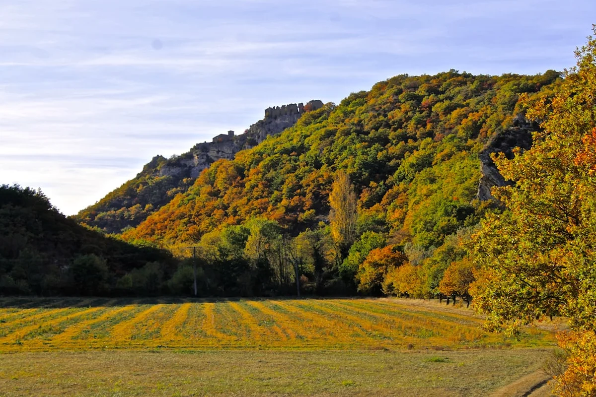
The GR36 is a colossal undertaking, a pilgrimage through the very spine of the French Alps. It begins in the picturesque town of Thonon-les-Bains on the southern shore of Lake Geneva, immediately plunging into the pre-alpine foothills before ascending into the heart of the high Alps. The initial stages are characterised by rolling hills, dense forests, and the first glimpses of the majestic peaks that lie ahead. As the trail progresses northwards, it enters the Vanoise National Park, a protected wilderness renowned for its dramatic glacial landscapes, abundant wildlife (including ibex and chamois), and challenging mountain passes.
The route then navigates through a series of mountain ranges, including the Pelvoux massif, home to the highest peak in the French Alps, Barre des Écrins. Here, the terrain becomes increasingly rugged, with steep ascents to high mountain refuges and exhilarating descents into remote valleys. The GR36 often follows ancient shepherd's paths, mule tracks, and former military routes, offering a historical perspective alongside the natural beauty. The trail's character shifts dramatically as it moves south. The high alpine environment gradually gives way to more arid, Mediterranean landscapes. The Maritime Alps present a different kind of challenge: steep, rocky terrain, intense sun exposure, and a stark, beautiful wilderness that feels a world away from the snow-capped giants of the north.
Throughout its 1916 km, the GR36 offers an extraordinary diversity of flora and fauna. From the alpine wildflowers of spring and summer to the hardy scrub and pine forests of the south, the ecosystem changes with altitude and latitude. The trail is well-marked with the characteristic red and white GR stripes, but its length and remoteness mean that self-sufficiency, careful planning, and a robust spirit are essential for success. It is a journey that tests physical limits, broadens horizons, and leaves an indelible mark on all who complete it.
History and Cultural Context
The GR36, as a defined long-distance route, is a relatively modern concept, born from the efforts of the Fédération Française de la Randonnée Pédestre (FFRP) to connect existing trails and create a coherent traverse of the French Alps. However, the paths it follows are ancient. For centuries, these routes have been used by shepherds moving their flocks between summer pastures (alpages) and winter valleys, by traders carrying goods across mountain passes, and by pilgrims and soldiers. The strategic importance of the Alps meant that many passes were fortified, and remnants of old military installations can still be found along the route.
The development of mountain tourism in the 19th and early 20th centuries saw the establishment of many of the mountain refuges that now serve hikers. These refuges, often built in remote and spectacular locations, were initially intended for mountaineers and explorers but have since become vital infrastructure for long-distance hikers. The concept of "Grande Randonnée" (long walk) gained traction in France after World War II, with the FFRP systematically marking and promoting these long-distance trails. The GR36, by linking together several existing GR routes (such as the GR5, GR52, and others), became a flagship route for alpine trekking.
Culturally, the GR36 passes through regions with distinct traditions, dialects, and cuisines. From the Savoyard culture of the north, with its hearty cheese dishes and robust wines, to the Provençal influences of the south, with its Mediterranean flavours and more relaxed pace of life, the trail offers a rich tapestry of French alpine heritage. The trail also touches upon areas with a history of mining, forestry, and even early hydroelectric power development, reflecting the human interaction with this challenging but resource-rich environment.
Seasonal Highlights and Weather Reality
The GR36 is a trail that spans a vast range of altitudes and latitudes, meaning its seasonal characteristics are highly variable.
Spring (May - June): The lower sections of the trail, particularly in the southern Alps, begin to open up in May. Wildflowers bloom profusely, and the air is fresh. However, higher passes in the northern and central Alps, such as those in the Vanoise or Écrins, will likely still be covered in snow. This period is best for starting in the south and working north, or for those with winter mountaineering experience who can tackle snow-covered sections. Temperatures can be cool, with a risk of late snowfalls even at moderate altitudes.
Summer (July - August): This is the peak season for hiking the GR36. All passes are generally clear of snow, and mountain refuges are fully operational. The weather is typically warmer, with long daylight hours. However, this is also the time when thunderstorms are most frequent, particularly in the afternoons. Hikers must be prepared for rapid weather changes, including sudden downpours, hail, and strong winds. The southern sections can become very hot, requiring careful hydration and sun protection.
Autumn (September - October): September often offers some of the most stable and beautiful weather, with clear skies and crisp air. The autumn colours in the forests can be spectacular. However, as October progresses, temperatures drop significantly, and the first snowfalls can occur at higher elevations, potentially blocking passes. Refuges begin to close towards the end of October, so careful planning is essential for late-season hikers. The risk of early winter conditions increases with each passing week.
Weather Considerations: The Alps are notorious for unpredictable weather. Even in summer, conditions can change from glorious sunshine to a full-blown storm within an hour. Hikers must always carry appropriate waterproof and warm layers, regardless of the forecast. Altitude plays a significant role; temperatures can drop dramatically with every 100 metres gained. Wind chill can make even mild temperatures feel frigid, especially at exposed passes.
Recommended Itinerary
A Conceptual Itinerary for the GR36 (1916 km)
This is a highly generalised itinerary. Actual daily distances and times will vary significantly based on terrain, weather, and individual fitness. It is divided into approximate stages, with each stage representing a significant geographical or logistical section of the trail.
Stage 1: Lake Geneva to Vanoise National Park (Approx. 10-14 days)
- Start: Thonon-les-Bains (Lake Geneva)
- End: Val Thorens or similar gateway to Vanoise
- Focus: Pre-alpine foothills, forests, first high mountain views, introduction to alpine flora.
- Key Waypoints: Morzine, Samoëns, Sixt-Fer-à-Cheval, Col de la Forclaz, Chamonix (optional detour), Les Houches.
- Accommodation: Gîtes d'étape, village hotels, campsites.
Stage 2: Vanoise National Park Traverse (Approx. 7-10 days)
- Start: Gateway to Vanoise (e.g., near Val Thorens)
- End: Modane or similar valley town
- Focus: High alpine landscapes, glacial cirques, abundant wildlife, challenging passes.
- Key Waypoints: Col de la Vanoise, Refuge de la Femma, Refuge du Roc de la Pêche, Refuge de la Dent Parrachée.
- Accommodation: Mountain refuges (mandatory booking), some valley accommodation.
Stage 3: Maurienne Valley to Écrins National Park (Approx. 10-14 days)
- Start: Modane or similar
- End: Briançon or similar gateway to Écrins
- Focus: Transition to more rugged, higher peaks, dramatic granite formations, historic mountain passes.
- Key Waypoints: Col de l'Échelle, Refuge du Thabor, Nevache Valley, Col de la Cula, Col d'Arsine.
- Accommodation: Refuges, gîtes, village hotels.
Stage 4: Écrins National Park Traverse (Approx. 7-10 days)
- Start: Gateway to Écrins (e.g., near La Bérarde)
- End: Gap or similar valley town
- Focus: High alpine wilderness, glaciers, challenging ascents and descents, remote valleys.
- Key Waypoints: Col du Galibier (nearby), Col des Aiguilles d'Arves, Refuge de l'Alpe de Villar d'Arène, Col de la Muande.
- Accommodation: Refuges, gîtes, campsites.
Stage 5: Southern Alps - Champsaur to Mercantour (Approx. 10-14 days)
- Start: Gap or similar
- End: Gateway to Mercantour National Park
- Focus: Transition to drier, more Mediterranean landscapes, vast plateaus, different flora and fauna.
- Key Waypoints: Col de Manse, Mont Guillaume, Col de la Croix, Parc National des Écrins (southern edge), Parc National du Mercantour.
- Accommodation: Gîtes, village hotels, campsites.
Stage 6: Mercantour National Park and Maritime Alps (Approx. 7-10 days)
- Start: Gateway to Mercantour (e.g., Saint-Étienne-de-Tinée)
- End: Nice (Mediterranean Coast)
- Focus: Rugged, arid mountain scenery, ancient shepherd trails, proximity to the sea.
- Key Waypoints: Col de la Bonette (nearby), Val d'Allos, Col de la Cayolle, Parc National du Mercantour, Sospel, GR52 sections.
- Accommodation: Refuges, gîtes, village hotels, campsites.
Important Considerations:
- This itinerary is a guide; flexibility is paramount.
- Daily distances will average 20-30 km, but with significant elevation gain/loss.
- Booking accommodation in advance, especially mountain refuges during peak season, is essential.
- Weather can force significant changes to the plan.
- Resupply points (villages) are spaced out; plan food and supplies accordingly.
Planning and Bookings
Book Your Trip
Everything you need to plan your journey
Accommodation
Find places to stay near Caen
Flights
Search flights to Caen
Essential Preparation
The GR36 is a serious undertaking requiring meticulous planning. Given its length and the varied terrain, preparation must be comprehensive. This includes physical conditioning, logistical arrangements for resupply and accommodation, and mental preparation for extended periods of solitude and challenge.
Physical Fitness: Hikers should be accustomed to carrying a loaded backpack for multiple consecutive days, with significant daily elevation gains and losses (often 1,000-1,500 metres or more). Training should include long hikes with a weighted pack, hill training, and cardiovascular exercises. The ability to recover quickly from strenuous days is crucial.
Logistics: The trail passes through numerous villages and towns, offering opportunities for resupply. However, some sections are remote, requiring hikers to carry several days' worth of food. Planning resupply points in advance is vital. Accommodation ranges from basic mountain refuges to comfortable village hotels. Booking ahead, especially for refuges during July and August, is highly recommended. Consider using a luggage transfer service for parts of the route if you prefer to hike with a lighter pack, though this is less common for the entire GR36.
Base Towns/Cities:
- North: Thonon-les-Bains or Évian-les-Bains (Lake Geneva) for the start. Chamonix is a significant detour but a major hub for alpine activities.
- Central Alps: Modane, Briançon, and Gap are key towns for resupply, accommodation, and transport links.
- South: Digne-les-Bains, Saint-Étienne-de-Tinée, and Nice are important points for the latter stages and the finish.
Access to the start and from the end can be achieved via train networks connecting to major cities like Geneva, Lyon, and Marseille. Driving is possible but parking for the entire duration of the hike is impractical.
Trail Accommodation
The GR36 offers a variety of accommodation options, catering to different budgets and preferences. It is crucial to book in advance, especially during the peak summer months (July and August).
Mountain Refuges (Refuges de Montagne):
- Description: Basic shelters located at high altitudes, often in remote areas. They typically offer dormitory-style sleeping (bunk beds), a communal dining area, and sometimes a small lounge.
- Facilities Provided: Mattresses, blankets (sometimes), communal toilets, and often a half-board option (dinner and breakfast). Some have charging facilities for electronics, but this is not guaranteed.
- What's NOT Provided: Sleeping bags (usually required), towels, toiletries, cooking equipment (unless specified), food for packed lunches (can often be purchased).
- Seasonal Availability: Generally open from June/July to September/October, depending on the specific refuge and altitude. Some may open earlier or close later, but snow can block access.
- Booking Requirements: Highly recommended, often mandatory, especially for popular refuges during peak season. Book directly with the refuge manager.
- Costs: Variable, but expect €30-€60 per night for a dorm bed, with half-board costing extra.
Gîtes d'Étape:
- Description: Similar to hostels or B&Bs, often found in villages along the route. They offer dormitory-style rooms or private rooms.
- Facilities Provided: Beds, communal kitchens, bathrooms, common areas. Often offer meals.
- What's NOT Provided: Sleeping bags (usually), toiletries, cooking utensils (sometimes).
- Seasonal Availability: Generally open year-round, but hours may be reduced outside peak season.
- Booking Requirements: Recommended, especially in smaller villages or during busy periods.
- Costs: €20-€40 per night for a dorm bed.
Village Hotels and Hostels:
- Description: Standard hotel or hostel accommodation found in towns and larger villages.
- Facilities Provided: Private rooms, en-suite bathrooms, restaurants, bars.
- What's NOT Provided: Specific to hotel standards.
- Seasonal Availability: Generally year-round.
- Booking Requirements: Recommended, especially during peak tourist seasons.
- Costs: €50-€150+ per night for a double room.
Campsites (Camping):
- Description: Designated camping areas, ranging from basic fields to well-equipped sites. Wild camping is generally discouraged or prohibited in national parks and on private land, though exceptions may exist in very remote areas for a single night (check local regulations).
- Facilities Provided: Varies greatly, from basic pitches to showers, toilets, and electricity.
- What's NOT Provided: Tents, sleeping gear.
- Seasonal Availability: Typically open from May/June to September/October.
- Booking Requirements: Recommended during peak season.
- Costs: €10-€25 per night for a pitch.
Required Gear
- Hiking Boots: Sturdy, waterproof, broken-in hiking boots with good ankle support are essential.
- Backpack: A 50-70 litre backpack with a comfortable harness and hip belt. A rain cover is crucial.
- Waterproof Jacket: A high-quality, breathable, waterproof and windproof jacket (e.g., Gore-Tex).
- Waterproof Overtrousers: Essential for protection against rain and wind.
- Sleeping Bag: A 3-season sleeping bag (comfort rating around 0-5°C) is necessary for refuges and camping.
- Head Torch: With spare batteries, for use in refuges and early/late hiking.
- Navigation Tools: Detailed maps of the GR36 sections (IGN maps are standard in France), a compass, and a GPS device or smartphone with offline mapping capabilities.
- First-Aid Kit: Comprehensive kit including blister treatment, pain relievers, antiseptic wipes, bandages, personal medications.
- Trekking Poles: Highly recommended for stability on ascents and descents, and to reduce strain on knees.
- Sun Protection: High SPF sunscreen, sunglasses, wide-brimmed hat or cap.
- Insect Repellent: Especially for lower altitudes and forested areas.
What to Bring
- Clothing:
- Moisture-wicking base layers (merino wool or synthetic)
- Insulating mid-layers (fleece or down jacket)
- Hiking trousers (quick-drying, convertible trousers are useful)
- Hiking socks (wool or synthetic, multiple pairs)
- Warm hat (beanie) and gloves
- Camp shoes or sandals (for use in refuges)
- Food and Water:
- High-energy food for lunches and snacks (dried fruit, nuts, energy bars, jerky).
- Water bottles or hydration reservoir (minimum 2-3 litre capacity).
- Water purification tablets or filter (essential for treating stream water).
- Toiletries:
- Biodegradable soap and shampoo
- Toothbrush and toothpaste
- Quick-drying towel
- Toilet paper (carry out used paper if not using refuge facilities)
- Hand sanitiser
- Miscellaneous:
- Passport/ID and relevant travel documents
- Cash (Euros) for refuges and small villages where card payment may not be accepted
- Mobile phone and power bank
- Duct tape and cord for repairs
- Small knife or multi-tool
- Book or journal for downtime
- Camera
Permits
The GR36 itself does not require specific permits for hiking. It is a public footpath system managed by the FFRP and local authorities. However, there are important considerations regarding access and accommodation:
National Parks: Large sections of the GR36 pass through protected areas, notably the Vanoise National Park and Mercantour National Park. While general hiking is permitted, specific regulations may apply:
- Camping: Wild camping is generally prohibited within national parks. Designated campsites or official refuges must be used. Some parks may have specific rules about bivouacking (sleeping out in the open) in very remote areas, but this is usually restricted to a single night and requires careful adherence to local guidelines. Always check the park's official website or visitor centre for current regulations.
- Fires: Open fires are strictly forbidden in national parks and most alpine areas due to the high risk of wildfires.
- Wildlife: Feeding or disturbing wildlife is prohibited.
Accommodation Bookings: As mentioned in the planning section, booking accommodation in mountain refuges and popular gîtes d'étape is essential, especially during the peak season (July and August). These are not permits but are crucial logistical requirements to ensure you have a place to stay. Failure to book can result in being turned away, particularly in remote refuges.
Transport: While not a permit, understanding transport options for accessing the start and leaving the end of the trail is vital. Train and bus networks serve many of the towns along the route, but schedules can be infrequent, especially in more remote areas. Researching and booking onward travel in advance is advisable.
General Advice: Always carry identification and be aware of local regulations. While the GR36 is a well-established trail, respecting the environment and local customs is paramount. Information centres in towns and villages along the route can provide up-to-date details on any specific local rules or conditions.
Other Activities in the Area
The GR36 traverses regions rich in natural beauty and cultural heritage, offering numerous opportunities for exploration beyond the main trail:
- Via Ferrata: Several sections of the Alps offer "via ferrata" routes – protected climbing paths with steel cables, rungs, and ladders. These provide a thrilling way to experience cliff faces and high mountain scenery without requiring advanced climbing skills.
- Mountain Biking: Many valleys and lower-altitude routes are popular with mountain bikers. Dedicated bike parks and trails exist in areas like the Chamonix valley and parts of the Southern Alps.
- Climbing: The French Alps are a world-renowned destination for rock climbing and mountaineering. Areas like Chamonix, the Écrins, and the Mercantour offer routes for all skill levels, from beginner sport climbing to challenging alpine ascents.
- Paragliding: The thermals and dramatic landscapes of the Alps make it a prime location for paragliding. Tandem flights are widely available in popular tourist areas, offering a bird's-eye view of the trails you've walked.
- Cultural Tourism: Explore charming alpine villages, visit local museums detailing regional history and traditions, and sample local gastronomy. Towns like Annecy, Grenoble, and Nice offer significant cultural attractions.
- Lake Activities: Near the start at Lake Geneva, activities include swimming, sailing, and lakeside walks.
- Geological and Botanical Tours: Some regions offer guided tours focusing on the unique geology or diverse flora of the Alps.
Safety and Conditions
Weather: The most significant safety concern on the GR36 is the unpredictable alpine weather. Hikers must be prepared for rapid changes, including thunderstorms, heavy rain, hail, strong winds, and snow, even in summer. Afternoon thunderstorms are common in July and August. Always check the mountain forecast before setting out each day and be prepared to alter your plans if conditions deteriorate.
Altitude: While the GR36 doesn't consistently stay at extreme altitudes, many passes exceed 2,500 metres. Altitude sickness (acute mountain sickness) can affect individuals, especially if ascending too quickly. Symptoms include headache, nausea, dizziness, and fatigue. Acclimatise gradually, stay hydrated, and descend if symptoms worsen.
Terrain: The trail involves significant elevation changes, often on steep, rocky, and uneven ground. Loose scree, exposed ridges, and narrow paths are common. Good footwear, trekking poles, and careful foot placement are essential to prevent slips and falls. In some sections, especially early in the season, snow can linger on passes, requiring caution and potentially specialised equipment (e.g., microspikes).
Navigation: Although the GR36 is marked with red and white blazes, it is crucial to carry detailed maps and a compass and know how to use them. Fog, snow, or poor visibility can obscure the trail markers. GPS devices or smartphone apps with downloaded offline maps are valuable backups.
Remoteness and Communication: Many sections of the GR36 are remote, with limited or no mobile phone signal. Inform someone of your itinerary and expected check-in times. Consider carrying a personal locator beacon (PLB) or satellite messenger for emergencies.
Wildlife: While generally not aggressive, encounters with wildlife such as chamois, ibex, or marmots are possible. Maintain a safe distance and never feed wild animals. Be aware of potential hazards like vipers in warmer, rocky areas, though they are generally shy.
Water: Water sources are generally plentiful from streams and springs, especially in the higher alpine regions. However, it is always recommended to treat water using a filter or purification tablets to avoid waterborne illnesses.
Emergency Contacts: Know the emergency numbers for France (112 is the pan-European emergency number). Have contact details for local mountain rescue services if available.
Side Trips and Points of Interest
The GR36 offers numerous opportunities for rewarding side trips and exploration of significant landmarks:
Mont Blanc Massif (Detour): While the main GR36 route bypasses the immediate vicinity of Mont Blanc, a significant detour via Chamonix offers access to iconic alpine scenery. The Tour du Mont Blanc (TMB) trail circumnavigates the massif and can be combined with sections of the GR36 for a truly epic experience. Views of Mont Blanc itself, the Mer de Glace glacier, and numerous high alpine peaks are unparalleled.
Écrins National Park Glaciers: The GR36 passes through or near the Écrins National Park, home to France's highest peak, Barre des Écrins. Several glaciers are accessible via marked trails from the main route, offering a chance to witness these impressive natural phenomena up close (though direct glacier travel requires mountaineering expertise and equipment).
Col de la Bonette: Located in the Maritime Alps, this is one of the highest paved roads in Europe (2,802 m). While the GR36 may not traverse the very summit, it passes close by, offering spectacular panoramic views of the surrounding mountain ranges and the Mediterranean coast on clear days. A short hike to the Cime de la Bonette (3,062 m) provides an even grander vista.
Mercantour National Park's Wildlife: This park is renowned for its diverse wildlife, including ibex, chamois, marmots, and a rich variety of birdlife. Keep an eye out for these animals, particularly in the early morning and late evening. The park also boasts unique geological formations and ancient rock carvings.
Charming Alpine Villages: Numerous villages along the route offer cultural and historical interest. Examples include Samoëns, known for its medieval architecture; Nevache, a picturesque valley village; and Saint-Véran, one of the highest villages in Europe. These offer a glimpse into traditional alpine life.
Lakes and Waterfalls: The GR36 passes by numerous alpine lakes, often with stunning reflections of the surrounding peaks. Waterfalls are also common, particularly in the Vanoise and Écrins regions, fed by glacial meltwater.
Leave No Trace
The GR36 traverses some of Europe's most pristine and ecologically sensitive mountain environments. Adhering to Leave No Trace principles is paramount to preserving these landscapes for future generations and ensuring the safety and enjoyment of all hikers.
1. Plan Ahead and Prepare: Research your route, understand the terrain, weather, and accommodation options. Pack appropriate gear and sufficient food. Know the regulations for national parks and protected areas.
2. Travel and Camp on Durable Surfaces: Stick to marked trails to avoid damaging fragile vegetation. When camping, use designated campsites or durable surfaces like rock or gravel where permitted. Avoid camping in meadows or near water sources.
3. Dispose of Waste Properly: Pack out everything you pack in, including all food scraps, wrappers, and toilet paper. Use designated toilets in refuges and campsites. If no facilities are available, dig catholes at least 60 metres away from water, trails, and campsites, and bury human waste.
4. Leave What You Find: Do not remove plants, rocks, or historical artefacts. Take only photographs and memories.
5. Minimize Campfire Impacts: Campfires are generally prohibited in alpine environments and national parks. If permitted in specific areas (rare), use existing fire rings and keep fires small. Ensure fires are completely extinguished before leaving.
6. Respect Wildlife: Observe wildlife from a distance. Never feed animals, as it can disrupt their natural behaviours and diets, and can be harmful to their health. Store food securely to prevent attracting animals.
7. Be Considerate of Other Visitors: Keep noise levels down, especially in refuges and natural areas. Yield to other hikers on narrow trails. Respect the solitude and natural quiet of the mountains.
By following these principles, you contribute to the conservation of the GR10 ms magnificent landscapes and ensure a positive experience for yourself and others.