GR20 (Northern Half) - Europe's Most Formidable Mountain Traverse
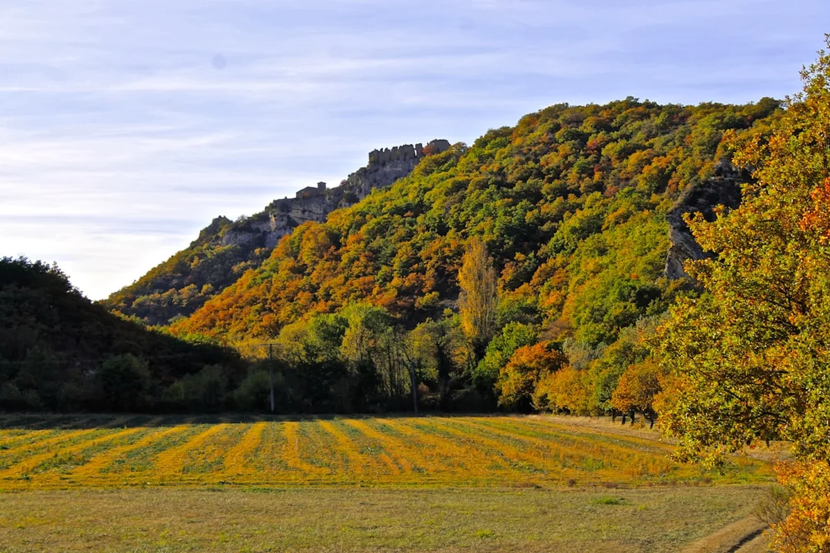
The GR20 (Grande Randonnée 20) is widely regarded as the most difficult long-distance trail in Europe, a legendary route that bisects the Mediterranean island of Corsica along its jagged crystalline spine. While the full trail stretches approximately 180 kilometres from Calenzana in the north to Conca in the south, it is the Northern Half—the section from Calenzana to the mountain pass of Vizzavona—that holds the most fearsome reputation. Spanning roughly 80 kilometres with a staggering 6,000 metres of vertical ascent, this segment is a relentless sequence of steep granite ridges, technical scree slopes, and exposed alpine plateaus. It is not merely a walk; it is a high-altitude odyssey through a landscape of prehistoric intensity, where the scent of the maquis shrubland meets the thin, cold air of the Monte Cinto massif.
The Northern Half is defined by its uncompromising terrain. Unlike many continental European trails that follow gentle valley floors, the GR20 North stays high, often hugging the ridgelines and requiring trekkers to use their hands for balance on frequent scrambles. The rewards, however, are commensurate with the effort. Trekkers are treated to views of the turquoise Mediterranean shimmering in the distance while standing amidst snow-flecked peaks, glacial lakes like Lac de Capitello, and ancient forests of Laricio pines. This is a journey for the physically prepared and the mentally resilient, offering a profound sense of isolation and achievement in one of the last true wildernesses of Western Europe.
- Distance: 80.0 km (Northern Half only)
- Elevation Gain: 6,000 m
- Duration: 7–9 days
- Difficulty: Very Challenging (requires high fitness and mountain experience)
- Best Time: June to September
- Closest City: Calvi (North), Ajaccio (South/Vizzavona)
- Trailhead: Calenzana (accessible via bus or taxi from Calvi)
- Accommodation: PNRC Refuges and designated campsites (mandatory)
Overview
The GR20 Northern Half is a masterclass in verticality. From the moment you leave the village of Calenzana, the trail wastes no time in ascending into the high mountains. The geology of the north is dominated by granite and schist, creating a landscape of sharp needles (aiguilles) and deep, shadowed cirques. The path is often indistinct, marked by the iconic red-and-white blazes of the French GR network, but the terrain itself is the primary navigator. You will find yourself traversing narrow ledges, navigating boulder fields where every step must be calculated, and descending steep "casse-cou" (neck-breaker) slopes that test the durability of both boots and knees.
One of the defining characteristics of the Northern Half is the "stage" system. The trail is traditionally broken into nine stages, each ending at a refuge managed by the Parc Naturel Régional de Corse (PNRC). These refuges are strategically placed near the only reliable water sources in the high mountains. Because wild camping is strictly prohibited to protect the fragile ecosystem and prevent forest fires, the rhythm of the trek is dictated by these mountain outposts. This creates a unique social atmosphere; despite the physical hardship, there is a shared camaraderie among the "GR20ists" who gather each evening to share stories of the day's climb over bowls of Corsican lentil soup.
The climate adds another layer of complexity. While Corsica is a Mediterranean island, the GR20 North is a high-alpine environment. Even in mid-summer, temperatures can plummet after sunset, and the island is notorious for its "orages"—violent afternoon thunderstorms that can turn dry granite into a slippery, dangerous hazard within minutes. Trekkers must be prepared for intense heat in the valleys and freezing winds on the passes (cols). The Northern Half is also home to the highest point on the island, Monte Cinto (2,706 m), which can be summited as a challenging detour from the main route. This section of the trail is not just a physical test; it is a sensory immersion into the rugged soul of Corsica, far removed from the glitzy beaches of the coast.
History and Cultural Context
The GR20 is a relatively modern creation, but the paths it follows are ancient. For centuries, these mountain tracks were the exclusive domain of Corsican shepherds practicing transhumance—the seasonal movement of livestock between lowland winter pastures and high-altitude summer grazing lands. The stone ruins of "bergeries" (shepherd huts) scattered along the trail are silent witnesses to this pastoral history. These shepherds, known for their fierce independence and deep knowledge of the terrain, carved out the routes that now form the backbone of the trek.
The formalisation of the GR20 began in the late 1960s and early 1970s. It was the brainchild of Michel Fabrikant, a French mountaineer and writer who envisioned a continuous traverse of the island's mountain crests. In 1972, the trail was officially inaugurated by the PNRC. Fabrikant’s goal was to create a route that showcased the interior of Corsica, which at the time was being abandoned as the population shifted toward the coastal cities. By bringing hikers into the mountains, the trail helped revitalise the highland economy and provided a reason to preserve the unique Laricio pine forests and endemic wildlife, such as the Mouflon (a wild mountain sheep) and the Bearded Vulture.
Culturally, the GR20 is deeply tied to Corsican identity. The island, often called the "Mountain in the Sea," has a history marked by resistance and a strong sense of local pride. The trail passes through regions that were once strongholds of Corsican independence movements. Even today, the language heard in the refuges is often Corsican (Corsu), a Romance language closely related to Italian. Trekkers are encouraged to respect this heritage by learning a few words of the local tongue and appreciating the traditional products—such as Figatellu (liver sausage) and Brocciu (sheep or goat milk cheese)—that are still produced in the mountain villages and served at the refuges. The GR20 is more than a hike; it is a journey through the living history of a rugged, resilient people.
Want more background? Read extended notes on history and cultural context → Learn more
Seasonal Highlights and Weather Reality
The window for safely attempting the GR20 Northern Half is relatively narrow, dictated by the presence of snow in the high passes and the availability of services at the refuges. The official season runs from late May to early October, but each month offers a distinct experience and set of challenges.
June: This is arguably the best time for the trek. The days are long, the mountain flowers are in full bloom, and the water sources are at their peak. However, snow can often linger in the high couloirs and north-facing slopes until mid-June, particularly on the Cirque de la Solitude bypass or the ascent of Monte Cinto. Trekkers in early June should be comfortable with snow travel and may need to carry lightweight crampons or an ice axe depending on the previous winter's snowfall.
July and August: These are the busiest months. The weather is generally stable, but the heat can be oppressive, especially during the steep climbs out of the valleys. Afternoon thunderstorms are a significant risk; they typically build up around 2:00 PM or 3:00 PM, making early starts (often at 5:00 AM) essential to ensure you are off the high ridges before the lightning begins. The refuges are often crowded, and water sources can begin to dry up, though the main PNRC huts usually have reliable supplies.
September: A favourite for experienced trekkers. The crowds thin out, the temperatures become more manageable, and the light has a crisp, golden quality perfect for photography. The risk of snow returns toward the end of the month, and the days become noticeably shorter. By late September, some of the private bergeries may begin to close, though the main PNRC refuges remain guarded until early October.
Winter (October to May): Outside the guarded season, the GR20 North becomes a serious mountaineering undertaking. The trail is covered in deep snow, the red-and-white markers are buried, and the refuges are left in "winter mode" (unheated, no food, no gas). Only those with advanced winter navigation and alpine survival skills should attempt the route during this time. Avalanche risk is high in the steep cirques of the north.
Recommended Itinerary
9-Day GR20 Northern Half Itinerary
Day 1: Calenzana to Refuge d'Ortu di u Piobbu
- Distance: 10.5 km
- Elevation: 1,550 m gain, 50 m loss
- Time: 6–7 hours
- Start in the village of Calenzana (275 m)
- A relentless, steep ascent through the maquis and into the pine forest
- Pass the Fontane de Ortu di u Piobbu
- Arrive at Refuge d'Ortu di u Piobbu (1,520 m)
- Spectacular views back toward the Bay of Calvi and the Mediterranean
- This is a "wake-up call" day that tests your fitness immediately
Day 2: Refuge d'Ortu di u Piobbu to Refuge de Carozzu
- Distance: 7 km
- Elevation: 750 m gain, 1,050 m loss
- Time: 6–7 hours
- High alpine terrain with significant scrambling
- Cross the Bocca d'Avartoli and Bocca della Pisciaghja
- Navigate steep granite slabs and narrow ridges
- Descend into the forest to reach Refuge de Carozzu (1,270 m)
- The technical nature of this stage means the short distance is deceptive
Day 3: Refuge de Carozzu to Asco Stagnu
- Distance: 6 km
- Elevation: 800 m gain, 650 m loss
- Time: 5–6 hours
- Cross the famous Spasimata suspension bridge (Passerelle de Spasimata)
- Ascent over smooth granite slabs (dangerous when wet)
- Reach the Bocca di Stagnu with views of Monte Cinto
- Steep descent to the former ski station of Asco Stagnu (1,422 m)
- Access to a hotel and small shop for restocking
Day 4: Asco Stagnu to Refuge de Tighjettu
- Distance: 8 km
- Elevation: 1,200 m gain, 1,000 m loss
- Time: 8–9 hours
- This stage now uses the Monte Cinto bypass (replacing the closed Cirque de la Solitude)
- Ascend to the Pointe des Eboulis (2,607 m), the highest point on the GR20
- Optional summit of Monte Cinto (2,706 m) adds 1.5–2 hours
- Long, technical descent over scree and boulders
- Arrive at Refuge de Tighjettu (1,683 m) or Bergeries de Vallone
Day 5: Refuge de Tighjettu to Refuge de Mori
- Distance: 13 km
- Elevation: 600 m gain, 650 m loss
- Time: 6 hours
- A gentler day through the Golo Valley
- Pass the Bergeries de Vallone and walk through ancient Laricio pine forests
- Multiple rock pools in the Golo River perfect for a cold swim
- Ascend to the Col de Vergio and continue to Refuge de Mori (1,600 m)
- Refuge de Mori is the highest on the trail and can be very cold
Day 6: Refuge de Mori to Refuge de Manganu
- Distance: 14.5 km
- Elevation: 400 m gain, 600 m loss
- Time: 6 hours
- Relatively flat section across the Plateau du Camputile
- Pass the stunning Lac de Nino (1,743 m), famous for its "pozzines" (peat bogs) and wild horses
- Easy walking compared to previous days
- Arrive at Refuge de Manganu (1,601 m) at the edge of the plateau
Day 7: Refuge de Manganu to Refuge de Petra Piana
- Distance: 8.5 km
- Elevation: 850 m gain, 700 m loss
- Time: 6–7 hours
- Return to high-altitude, technical terrain
- Ascend to the Breche de Capitello (2,225 m)
- Views of the glacial lakes Lac de Capitello and Lac de Melo far below
- Follow the ridgeline (the "Sentier des Crêtes") with significant exposure
- Arrive at Refuge de Petra Piana (1,842 m) perched on a rocky outcrop
Day 8: Refuge de Petra Piana to Refuge de l'Onda
- Distance: 10 km (High Route) or 10 km (Valley Route)
- Elevation: 500 m gain, 900 m loss (High Route)
- Time: 5–6 hours
- High Route (Alpine): Follows the crest of the Serra di Tenda
- Valley Route (Manganello): Follows the river with beautiful waterfalls and pools
- Arrive at Refuge de l'Onda (1,430 m), known for its excellent food and large camping area
Day 9: Refuge de l'Onda to Vizzavona
- Distance: 10 km
- Elevation: 700 m gain, 1,200 m loss
- Time: 6 hours
- Ascend to the Bocca d'Onda and the summit of Monte d'Oro (optional)
- Long descent through the forest of Vizzavona
- Pass the "Cascade des Anglais" (Englishman's Waterfall)
- Finish at Vizzavona (920 m), the midpoint of the GR20
- Train station available for transport to Bastia, Ajaccio, or Calvi
Important Notes:
- The itinerary can be shortened by "doubling up" stages, but this is only recommended for elite-level hikers.
- Water is scarce between refuges; always carry at least 3 litres.
- The Cirque de la Solitude is officially closed; the Monte Cinto route is the mandatory path.
- Vizzavona has a train station, making it the perfect place to end the Northern Half or rest before the South.
Planning and Bookings
Book Your Trip
Everything you need to plan your journey
Accommodation
Find places to stay near Calvi
Flights
Search flights to Calvi
Essential Preparation
The GR20 North requires a level of physical preparation that exceeds most other European treks. You should be comfortable carrying a 12–15 kg pack over steep, uneven terrain for 6–9 hours a day. Training should include significant elevation gain and descent to toughen the knees. Logistics are relatively straightforward but require coordination: most trekkers fly into Calvi or Bastia and take a bus or taxi to the trailhead in Calenzana. It is highly recommended to spend a night in Calenzana to acclimatise and start early the next morning.
Booking coordination is vital. The PNRC refuges have limited space and must be booked months in advance. If you plan to use the train to exit at Vizzavona, check the Chemins de Fer de la Corse (CFC) schedules, as they can vary seasonally. Base yourself in Calvi for a few days before the trek to enjoy the beach and finalise your gear; it is a well-equipped town with several outdoor retailers.
Trail Accommodation
Accommodation on the GR20 North consists of PNRC-managed refuges, private bergeries, and designated camping areas surrounding the refuges. Wild camping is strictly prohibited throughout the Regional Natural Park of Corsica.
Refuge Facilities:
- Dormitory bunks with basic mattresses (sleeping bags are mandatory; no blankets provided)
- Outdoor "kitchen" areas with gas rings (available for those staying in the refuge or camping)
- Cold showers (hot water is rare and often requires a fee)
- Turkish-style or basic composting toilets
- Small "épicerie" (shop) selling basic supplies like pasta, tuna, chocolate, and bread
- Evening meals (must be requested upon arrival, usually served around 6:30 PM or 7:00 PM)
Camping:
- You can bring your own tent and pay a small fee to use the refuge facilities.
- "Rental tents" (Quechua pop-up tents with mattresses) are available at most refuges and must be pre-booked. This is a popular option to save pack weight.
Costs and Availability:
- Refuge bunk: Approximately €15–€20 per night.
- Camping with your own tent: Approximately €7–€9 per person.
- Rental tent: Approximately €18–€25 per night.
- Refuges are guarded from late May to early October. Outside these dates, they are open but unstaffed, with no food or gas available.
Required Gear
- Footwear: High-quality trekking boots with excellent grip (Vibram soles recommended). The granite is abrasive and will shred thin soles. Ensure they are well broken-in.
- Backpack: 40–55 litres. Keep the total weight under 15 kg if possible. A rain cover is essential.
- Sleeping Bag: A 2-season bag (comfort rating 5°C to 10°C) is usually sufficient for summer, as refuges can be warm, but it can freeze at Mori or Petra Piana.
- Clothing: Moisture-wicking base layers, a fleece or down mid-layer, and a high-quality waterproof shell (Gore-Tex). Do not forget a sun hat and a warm beanie for the evenings.
- Navigation: IGN maps (1:25,000) for the relevant sections or a dedicated GPS device/app with offline maps. The trail is well-marked, but fog can obscure markers.
- Trekking Poles: Highly recommended to save your knees on the 1,000 m+ descents.
What to Bring
- Water Treatment: While refuge water is generally safe, a filter or purification tablets are recommended for stream water. Carry at least 3 litres of capacity.
- Food: Carry 2 days of emergency rations. While you can buy food at refuges, it is expensive and selection is limited. Breakfasts and lunches (bread, cheese, sausage) are the most common purchases.
- Cash: Essential. Most refuges do not accept credit cards, and there are no ATMs between Calenzana and Vizzavona. Budget €40–€50 per day for food and stay.
- Sun Protection: High SPF sunscreen, lip balm with UV protection, and Category 3 or 4 sunglasses. The Mediterranean sun at 2,000 m is intense.
- First Aid: Focus on blister care (Compeed), antiseptic wipes, painkillers, and any personal medications. A survival bag or space blanket is mandatory.
- Power Bank: Refuges have very limited charging points, often with long queues. A solar charger or large power bank is necessary for phones and cameras.
Permits
There is no "permit" required to walk the GR20 in the sense of a restricted entry pass. However, because wild camping is illegal, your "permit" is effectively your refuge or campsite reservation. The PNRC (Parc Naturel Régional de Corse) manages the booking system, and it is mandatory to book your accommodation in advance if you intend to stay in the refuges or use their rental tents.
Booking Process:
- Bookings typically open in January or February for the upcoming summer season.
- Reservations are made through the official PNRC website (pnr-resa.corsica).
- You must book each night individually at the specific refuge.
- During peak July and August, popular refuges like Petra Piana and Manganu can sell out months in advance.
Logistics and Fees:
- If you arrive at a refuge without a booking, the warden (gardien) may allow you to camp if there is space, but you will be charged a higher "on-site" rate.
- Keep a digital or printed copy of your booking confirmation; wardens will check this upon arrival.
- If you are using a tour operator, they will usually handle these bookings for you, but verify this before departure.
Other Activities in the Area
Corsica offers a wealth of experiences beyond the high peaks of the GR20. Consider these options before or after your trek:
- Calvi Citadel and Beach: Explore the historic Genoese citadel in Calvi and relax on the 6 km stretch of white sand beach—a perfect reward for finishing the first few stages or a great place to rest before starting.
- Scandola Nature Reserve: A UNESCO World Heritage site accessible by boat from Calvi or Porto. It features dramatic red porphyry cliffs, hidden caves, and incredible marine biodiversity.
- The "Trinichellu" Train: Take the narrow-gauge railway from Vizzavona to Ajaccio or Bastia. It is one of the most scenic train journeys in Europe, winding through mountain tunnels and over high viaducts designed by Gustave Eiffel.
- Canyoning in the Bavella: While located further south, the Aiguilles de Bavella offer some of the best canyoning in the Mediterranean, with emerald pools and natural granite slides.
- Ajaccio: Visit the birthplace of Napoleon Bonaparte, explore the vibrant markets, and enjoy the sophisticated café culture of the Corsican capital.
- Restonica Valley: Located near Corte, this valley offers shorter day hikes to Lac de Melo and Lac de Capitello for those who want the GR20 views without the full commitment.
Safety and Conditions
Weather Hazards: The most significant danger on the GR20 North is the weather. Afternoon thunderstorms (orages) are frequent and violent. Lightning is a genuine threat on the exposed ridges. If you see clouds building, descend from the ridgeline immediately. Additionally, the "Mistral" and "Libeccio" winds can reach gale force, making narrow ridges dangerous. Always check the Meteo France mountain forecast (displayed at every refuge) before setting out.
Terrain and Physical Injury: The trail is exceptionally rocky. Ankle sprains and knee strain are the most common injuries. The granite slabs of the Spasimata and the scree slopes of Monte Cinto require constant focus. Dehydration and heatstroke are risks in the lower valleys; start your day at dawn to complete the hardest climbing before the midday heat.
Water Safety: Do not rely on seasonal streams marked on maps, especially in late summer. Only the springs at refuges and bergeries are guaranteed. Always treat water from non-tap sources. Carry a minimum of 3 litres of water on every stage.
Emergency Services: Mobile phone signal is extremely spotty and non-existent in many deep valleys. In an emergency, the international number is 112. However, you may need to send someone to the nearest refuge to alert the warden, who has radio contact with the PGHM (Peloton de Gendarmerie de Haute Montagne), the elite mountain rescue unit. Helicopter evacuations are common on the GR20 but should only be summoned for genuine emergencies.
Fire Risk: Corsica is extremely prone to wildfires. Smoking is discouraged on the trail, and open fires are strictly prohibited. Be extremely careful with camping stoves and only use them in designated areas at the refuges.
Side Trips and Points of Interest
Monte Cinto Summit: At 2,706 metres, Monte Cinto is the highest peak in Corsica. The modern GR20 route passes very close to the summit at the Pointe des Eboulis. The detour to the actual summit takes about 1.5–2 hours return and involves some light scrambling. On a clear day, you can see the entire island and even the coast of Italy and the French Alps.
Lac de Nino: Located on Stage 6, this is one of the most iconic sights in Corsica. The lake is surrounded by "pozzines"—deep, water-filled peat bogs that create a vibrant green patchwork. Wild horses often graze here, and the flat terrain provides a rare moment of easy walking and reflection.
The Spasimata Suspension Bridge: A 30-metre long bridge that swings over a dramatic waterfall and canyon. It is a highlight of Stage 3 and a favourite spot for photography, though it can be intimidating for those with a fear of heights.
Lac de Capitello and Lac de Melo: These two glacial lakes are visible from the high ridge on Stage 7. Capitello is the deepest lake in Corsica (42 m) and is often frozen well into the summer. The view from the Breche de Capitello, looking down at the deep blue water framed by jagged granite walls, is arguably the most spectacular on the entire trail.
Cascade des Anglais: Located near the end of the Northern Half in the Vizzavona forest. These beautiful waterfalls and crystal-clear pools are a popular spot for a final swim before reaching the village. The name comes from the English aristocrats who used to holiday in Vizzavona during the 19th century.
Leave No Trace
The GR20 passes through the Parc Naturel Régional de Corse, a protected area home to rare endemic species. With thousands of hikers traversing the trail each year, the environmental impact is significant. It is the responsibility of every trekker to minimise their footprint.
Leave No Trace Principles on the GR20:
- Pack it in, pack it out: There is no rubbish collection in the high mountains. While refuges have bins, they are often overflowing and difficult to empty. Carry your trash down to the valley towns.
- Respect the water: Do not use soap (even biodegradable) in the mountain lakes or streams. The pozzines at Lac de Nino are particularly sensitive to pollution.
- Stay on the trail: Short-cutting switchbacks causes severe erosion on the steep Corsican slopes. Follow the red-and-white markers.
- No wild camping: This is strictly enforced to prevent fires and protect wildlife. Use only the designated areas around refuges.
- Protect the wildlife: Do not feed the wild horses at Lac de Nino or the foxes that often scavenge around refuges. This alters their natural behaviour and can make them aggressive.
- Human waste: Use the toilets at the refuges. If you must go between stages, bury waste at least 20 cm deep and 60 metres from water sources. Pack out your toilet paper.