GR1: Historic Trail (Catalonia)
The GR1, also known as the "Historic Trail" or "Ruta Històrica," is a monumental long-distance hiking route traversing the diverse landscapes of Catalonia, Spain. Stretching approximately 1,250 kilometres from the Mediterranean coast to the Pyrenean foothills, this trail offers an unparalleled journey through Catalonia's rich history, varied geography, and vibrant culture. It connects ancient Iberian settlements, medieval villages, Romanesque churches, and dramatic natural parks, providing a comprehensive exploration of the region's heritage. The GR1 is not merely a walk; it is an immersion into the very soul of Catalonia, revealing its past and present through its trails, architecture, and the enduring spirit of its people.
- Distance: 1,250 km one-way
- Duration: 50–60 days
- Season: Spring (April–June) or Autumn (September–October)
- Difficulty: Challenging
- Highest point: Varies significantly, with passes in the Pyrenees reaching over 2,000 metres
- Lowest point: Sea level on the Costa Brava
- Direction: Generally west to east, starting near the French border and finishing on the coast
- Access: Trailheads accessible from various towns and cities, with the eastern end near Empúries and the western end near the Pyrenean foothills.
Overview
The GR1 is a tapestry woven from Catalonia's most significant historical and natural threads. It begins its epic journey near the ancient Greek and Roman ruins of Empúries on the Costa Brava, a fitting starting point that echoes with millennia of human presence. From the azure waters of the Mediterranean, the trail embarks on a westward trajectory, gradually ascending through rolling hills dotted with vineyards and olive groves, characteristic of the Catalan countryside. It winds through charming medieval villages, each with its own unique story and architectural treasures, such as Besalú with its imposing Romanesque bridge, and Rupit, a picturesque village perched dramatically on a rocky outcrop.
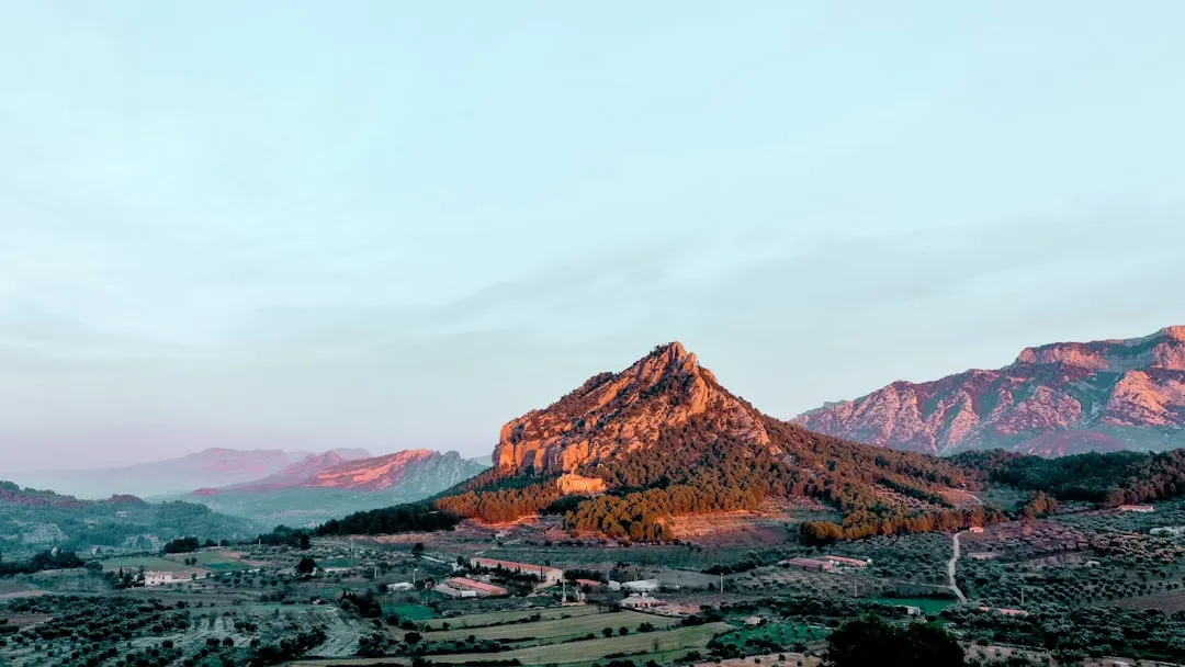
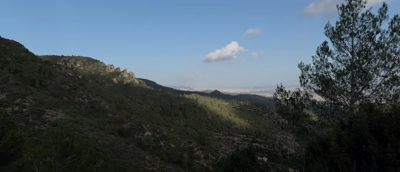
As the GR1 progresses inland, the landscape transforms. It ventures into the pre-Pyrenean hills, offering increasingly dramatic vistas and a more rugged terrain. Here, the trail navigates through natural parks like the Garrotxa Volcanic Zone, where ancient volcanic cones and lava flows create a surreal and beautiful environment. Further west, the route delves into the foothills of the Pyrenees, presenting steeper ascents, deeper valleys, and the crisp, clean air of higher altitudes. It passes through remote hamlets, ancient shepherd routes, and areas rich in biodiversity, showcasing the wilder side of Catalonia.
The GR1 is a challenging undertaking, demanding significant physical endurance and mental fortitude due to its considerable distance and varied terrain. However, the rewards are immense. Walkers are treated to an ever-changing panorama of landscapes, from coastal beauty to volcanic fields, rolling hills, and majestic mountain ranges. The cultural immersion is equally profound, with opportunities to connect with local traditions, sample regional cuisine, and witness the enduring legacy of Catalonia's past. This trail is a comprehensive exploration, offering a deep understanding of the region's identity, shaped by centuries of history and the enduring power of its natural environment.
History and Cultural Context
The GR0 ms route is intrinsically linked to the historical development of Catalonia. Its path often follows ancient routes used for centuries by traders, pilgrims, and shepherds. The trail's designation as a "Historic Trail" is well-earned, as it passes through sites that bear witness to Catalonia's long and complex past.
The eastern section, near Empúries, is steeped in classical history. Empúries itself was a significant Greek and Roman settlement, a vital port of trade and cultural exchange in antiquity. Walking here evokes the presence of ancient mariners and settlers who shaped the early Iberian Peninsula.
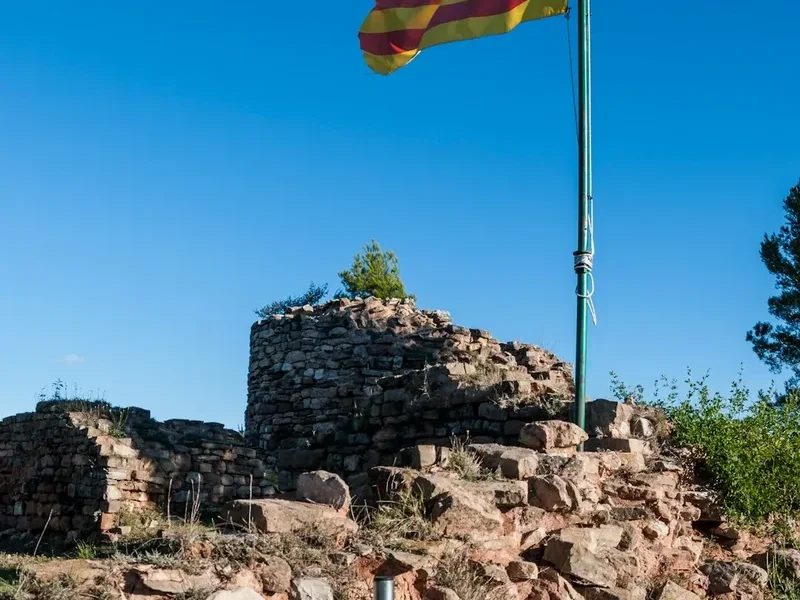
Moving inland, the GR1 traverses areas that were crucial during the medieval period. Many of the villages it connects, such as Besalú, Castellfollit de la Roca, and Ripoll, boast well-preserved Romanesque architecture, including churches, monasteries, and fortifications. These structures are testaments to the region's religious and feudal past, reflecting periods of both prosperity and conflict. The trail often skirts the edges of territories that were historically significant for their strategic importance or as centres of monastic life.
The GR1 also touches upon the more recent history of rural Catalonia. It passes through agricultural landscapes that have been cultivated for generations, showcasing traditional farming methods and the enduring connection between the Catalan people and their land. The route's progression towards the Pyrenees reflects ancient transhumance routes, where shepherds moved their flocks between summer pastures in the mountains and wintering grounds in the valleys.
The trail's modern conception as a long-distance route aims to preserve and promote this rich heritage, connecting disparate historical sites and natural wonders into a cohesive and accessible journey. It allows walkers to experience firsthand the layers of history that have shaped Catalonia, from its ancient origins to its medieval heart and its enduring rural traditions.
Seasonal Highlights and Weather Reality
The GR0 ms extensive length and varied topography mean that weather conditions can differ significantly along its route and throughout the year. The best times to undertake this challenging trek are during the spring and autumn months, when temperatures are generally moderate and the landscapes are at their most picturesque.
Spring (April–June): This is an ideal season for the GR1. Wildflowers bloom profusely across the hills and meadows, particularly in the pre-Pyrenean and Pyrenean foothills, creating a vibrant spectacle of colour. The weather is typically mild, with pleasant temperatures for walking, though higher elevations may still experience snow in early spring. Rainfall can be more frequent, especially in the mountains, so waterproof gear is essential. The longer daylight hours in late spring are also a significant advantage for covering long distances.
Summer (July–August): While possible, summer is generally not the preferred season for the GR1. Daytime temperatures can become very hot, especially in the lower-lying inland areas and the Mediterranean coast, making strenuous hiking uncomfortable and potentially dangerous. The Pyrenean sections offer cooler relief at higher altitudes, but the overall heat can be a significant challenge. Water sources may also be less reliable in some areas during the driest months.
Autumn (September–October): Autumn is another excellent season for the GR1. The intense heat of summer subsides, and the landscapes are often bathed in a warm, golden light. The forests, particularly in the pre-Pyrenean regions, display stunning autumnal colours, adding another layer of beauty to the journey. The weather is generally stable, though increasingly cooler as the season progresses. Higher mountain passes may experience early snowfalls towards the end of October.
Winter (November–March): Winter is generally unsuitable for completing the entire GR1 due to snow, ice, and cold temperatures, especially in the Pyrenean sections. Many mountain refuges and services may be closed. While shorter sections might be walkable in milder coastal or pre-Pyrenean areas, attempting the full route in winter requires advanced winter mountaineering skills and equipment, and is not recommended for the average hiker.
Weather Considerations: Regardless of the season, weather in mountainous regions can change rapidly. Hikers should always be prepared for sudden shifts in temperature, wind, and precipitation. Checking local weather forecasts before and during the trek is crucial.
Recommended Itinerary
GR1: Historic Trail (Catalonia) - Sample 55-Day Itinerary
This is a sample itinerary and can be adjusted based on individual pace, interests, and available time. Distances and times are approximate and can vary based on terrain and conditions.
Days 1-5: Costa Brava & Empúries Region
- Day 1: Empúries to L'Escala (Coastal walk, ruins exploration)
- Day 2: L'Escala to Sant Pere Pescador (Coastal paths, beaches)
- Day 3: Sant Pere Pescador to Roses (Inland through agricultural land)
- Day 4: Roses to Cadaqués (Scenic coastal path, Dali Museum optional)
- Day 5: Cadaqués to Port de la Selva (Cap de Creus Natural Park, rugged coastline)
Days 6-15: Inland Catalonia & Volcanic Landscapes
- Day 6: Port de la Selva to Figueres (Inland, Dali Theatre-Museum)
- Day 7: Figueres to Besalú (Medieval town, Romanesque bridge)
- Day 8: Besalú to Castellfollit de la Roca (Volcanic landscapes, unique village)
- Day 9: Castellfollit de la Roca to Olot (Garrotxa Volcanic Zone Natural Park)
- Day 10: Olot to Santa Pau (Exploring volcanic cones and lava fields)
- Day 11: Santa Pau to Ripoll (Monastery of Ripoll)
- Day 12: Ripoll to Camprodon (Pre-Pyrenean foothills)
- Day 13: Camprodon to Setcases (Entering higher mountain terrain)
- Day 14: Setcases to Vallter Ski Resort (Alpine scenery)
- Day 15: Vallter Ski Resort to Molló (Return towards lower altitudes)
Days 16-30: Pyrenean Foothills & Natural Parks
- Day 16: Molló to Prats de Molló (France - short cross-border section)
- Day 17: Prats de Molló to Arles-sur-Tech (France)
- Day 18: Arles-sur-Tech to Amélie-les-Bains (France)
- Day 19: Amélie-les-Bains to Céret (France)
- Day 20: Céret to Le Boulou (France)
- Day 21: Le Boulou to Perthus (France - border crossing)
- Day 22: Perthus to Figueres (Return to Spain)
- Day 23: Figueres to La Jonquera (Inland, towards Albera Massif)
- Day 24: La Jonquera to Sant Llorenç de la Muga (Historic village)
- Day 25: Sant Llorenç de la Muga to Albanyà (Albera Natural Park)
- Day 26: Albanyà to Darnius (Reservoir views)
- Day 27: Darnius to Maçanet de Cabrenys (Pre-Pyrenean landscapes)
- Day 28: Maçanet de Cabrenys to Argelès-sur-Mer (France - coastal town)
- Day 29: Argelès-sur-Mer to Collioure (France - scenic coastal town)
- Day 30: Collioure to Banyuls-sur-Mer (France - vineyards, coastal)
Days 31-50: Central Catalonia & High Pyrenees
- Day 31: Banyuls-sur-Mer to Cerbère (France - border crossing back to Spain)
- Day 32: Cerbère to Portbou (Coastal walk)
- Day 33: Portbou to Llançà (Coastal scenery)
- Day 34: Llançà to El Port de la Selva (Revisiting some coastal areas)
- Day 35: El Port de la Selva to Vilamaniscle (Inland, vineyards)
- Day 36: Vilamaniscle to Garriguella (Albera Massif foothills)
- Day 37: Garriguella to Peralada (Historic town)
- Day 38: Peralada to Sant Martí de Empúries (Return towards coast briefly)
- Day 39: Sant Martí de Empúries to L'Armentera (Inland agricultural land)
- Day 40: L'Armentera to Ventalló (Rural Catalonia)
- Day 41: Ventalló to La Bisbal d'Empordà (Pottery town)
- Day 42: La Bisbal d'Empordà to Monells (Medieval village)
- Day 43: Monells to Cruïlles (Charming villages)
- Day 44: Cruïlles to Sant Sadurní de l'Heura (Forests and rural paths)
- Day 45: Sant Sadurní de l'Heura to Santa Coloma de Farners (Towards Montseny Natural Park)
- Day 46: Santa Coloma de Farners to Montseny (Montseny Natural Park)
- Day 47: Montseny to Sant Celoni (Descent from Montseny)
- Day 48: Sant Celoni to Cardedeu (Rural landscapes)
- Day 49: Cardedeu to Granollers (Approaching Barcelona metropolitan area)
- Day 50: Granollers to Montcada i Reixac (Urban fringe)
Days 51-55: Final Stretch & Completion
- Day 51: Montcada i Reixac to Barcelona (Urban walk, city exploration)
- Day 52: Barcelona (Rest and exploration)
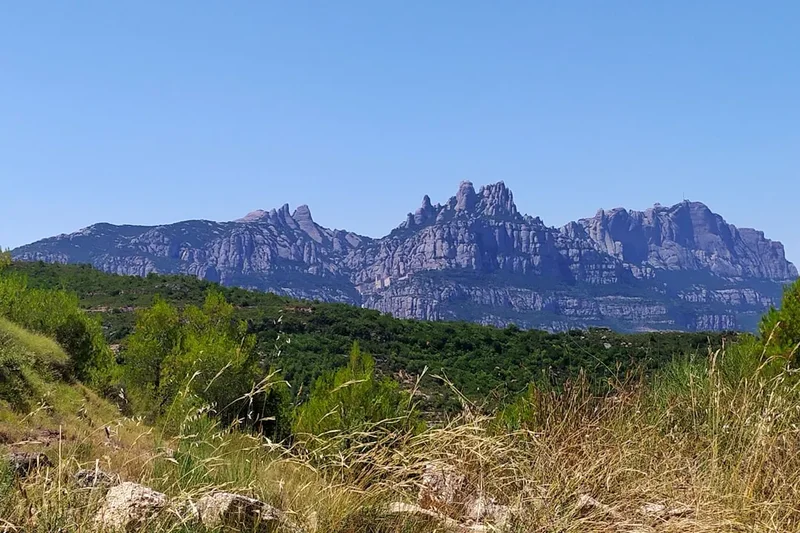
- Day 53: Barcelona to Montserrat (Day trip or start of a new section)
- Day 54: Montserrat (Monastery, hiking)
- Day 55: Montserrat to Manresa (Final section towards historic city)
Note: This itinerary is a conceptual outline. The GR1 is a complex network, and specific waypoints and daily stages will require detailed map study and planning. Many sections can be broken down further or combined depending on fitness and preference. The route may also involve sections on roads or tracks that are not exclusively pedestrian.
Planning and Bookings
Book Your Trip
Everything you need to plan your journey
Accommodation
Find places to stay near Barcelona
Flights
Search flights to Barcelona
Essential Preparation
The GR1 is a long-distance trek requiring significant preparation. Given its 1,250 km length and the need to traverse varied terrain, a realistic timeframe of 50-60 days is recommended for completion. This allows for a reasonable daily mileage (averaging 20-25 km) and includes buffer days for rest, resupply, and potential weather delays, especially in the Pyrenean sections.
Fitness: A high level of cardiovascular fitness and muscular endurance is essential. Regular training involving long hikes with a weighted pack, including significant elevation changes, is crucial. Familiarity with multi-day trekking and carrying all necessary gear is paramount. The trail's difficulty is rated as challenging due to its length, varied terrain (from coastal paths to steep mountain ascents/descents), and potential for remote sections.
Logistics: The GR1 is not a point-to-point track with fixed accommodation like some European trails. It passes through numerous towns and villages, offering a range of accommodation options from hotels and guesthouses to campsites and rural tourism establishments (casas rurales). Booking accommodation in advance is highly recommended, especially during peak seasons (spring and autumn) and in popular tourist areas or smaller villages where options are limited. Resupply points are generally frequent in towns and larger villages, but careful planning is needed for more remote stretches.
Base Towns/Cities:
- Eastern Terminus (near Empúries): Figueres or Girona are good bases for accessing the start of the trail.
- Mid-Route: Olot (for the Garrotxa Volcanic Zone), Ripoll, and Vic are significant towns offering good amenities and access to different sections.
- Pyrenean Foothills: Towns like Camprodon, Setcases, and various French villages near the border (e.g., Prats de Molló) serve as gateways to the mountain sections.
- Western End (if extending): Depending on the exact endpoint chosen, cities like Lleida or even Barcelona could serve as logistical hubs for accessing different parts of the trail.
Navigation: A detailed understanding of the route is vital. The GR1 is marked with the standard red and white stripes of the Gran Recorrido system, but signage can vary in clarity, especially in remote areas or where the route overlaps with other trails. High-quality topographic maps, a compass, and a reliable GPS device or smartphone app with offline maps are indispensable.
Trail Accommodation
The GR1 traverses a variety of populated areas, offering diverse accommodation options. There are no designated "huts" in the same sense as alpine trails; instead, walkers rely on the infrastructure of the towns and villages along the route.
Types of Accommodation:
- Hotels and Hostales: Available in most towns and cities, offering standard hotel services.
- Guesthouses (Pensiones) and Casas Rurales: Often family-run establishments providing a more local experience, common in rural areas and smaller villages.
- Campsites: Available in some larger towns and natural park areas. These can be basic or well-equipped.
- Refuges (Refugis): In the higher Pyrenean sections, there may be mountain refuges offering basic dormitory-style accommodation and sometimes meals. These are less common than in other major European mountain ranges and require advance booking.
Booking Requirements: Advance booking is strongly recommended, particularly for casas rurales and refuges, and during peak hiking seasons (spring and autumn). In smaller villages, accommodation options can be very limited, making pre-booking essential to avoid disappointment or lengthy detours.
Facilities Provided: Varies greatly by accommodation type. Hotels and hostales offer private rooms, bathrooms, and often meals. Casas rurales typically provide rooms and shared facilities, sometimes with self-catering options. Campsites offer pitches for tents. Refuges usually provide dormitory beds and sometimes meals, but often require sleeping bags.
What's NOT Provided: Generally, accommodation providers do not supply hiking gear, food for the trail (unless specified as a meal service), or personal toiletries beyond basic amenities. Campers must bring their own tents and camping equipment.
Seasonal Availability: Most accommodation in towns and villages operates year-round. However, rural establishments and mountain refuges may have reduced hours or be closed during the winter months (November–March) or periods of low demand. Always check seasonal opening times.
Costs: Prices vary significantly. Budget options like campsites or basic hostales might range from €15-€30 per night. Mid-range hotels and casas rurales could cost €40-€80 per night. Mountain refuges might be in a similar range to budget hotels. These are approximate costs and can fluctuate based on location and season.
Required Gear
- Sturdy Hiking Boots: Waterproof, well-broken-in boots with good ankle support are essential for varied terrain.
- Waterproof Jacket and Trousers: High-quality, breathable waterproofs are crucial for unpredictable mountain weather and rain.
- Backpack: A comfortable, durable backpack of 50-70 litres capacity, with a rain cover.
- Sleeping Bag: A 3-season sleeping bag is recommended, even if staying in hotels, as some rural accommodations or refuges may require it.
- Head Torch: With spare batteries, for early starts, late finishes, or in accommodation without reliable lighting.
- Navigation Tools: Detailed topographic maps of Catalonia and the Pyrenees, a compass, and a GPS device or smartphone with offline mapping capabilities (e.g., Maps.me, Gaia GPS).
- First-Aid Kit: Comprehensive kit including blister treatment, pain relievers, antiseptic wipes, bandages, and any personal medications.
- Sun Protection: High SPF sunscreen, sunglasses, and a wide-brimmed hat.
- Insect Repellent: Especially for lower altitudes and coastal areas during warmer months.
- Trekking Poles: Highly recommended for stability on descents and ascents, and to reduce strain on joints.
- Water Bottles/Hydration Reservoir: Capacity for at least 2-3 litres.
- Water Purification Method: Filter or purification tablets, as not all water sources are guaranteed safe.
What to Bring
- Clothing Layers: Moisture-wicking base layers (merino wool or synthetic), insulating mid-layers (fleece or down jacket), and comfortable hiking trousers. Avoid cotton.
- Camp Shoes/Sandals: For relaxing in the evenings.
- Toiletries: Biodegradable soap, toothbrush, toothpaste, quick-drying towel, hand sanitiser.
- Food Supplies: High-energy snacks (nuts, dried fruit, energy bars), and sufficient food for days when resupply points are distant. Consider lightweight, non-perishable meals.
- Personal Items: Camera, journal, book, power bank for electronics.
- Duct Tape and Repair Kit: For minor gear repairs.
- Small Knife or Multi-tool.
- Whistle: For emergency signalling.
- Cash: Essential for smaller villages where card payments may not be accepted.
- Identification and Travel Documents.
Permits
The GR1, as a long-distance marked trail, does not typically require specific permits for general hiking access in the same way as national parks with daily visitor limits or protected wilderness areas. The trail passes through a mix of public and private land, and the red and white GR markings indicate established public rights of way.
However, there are important considerations:
- Natural Parks: Sections of the GR1 traverse designated Natural Parks (e.g., Parc Natural de la Zona Volcànica de la Garrotxa, Parc Natural del Montseny, Parc Natural de l'Alt Pirineu). While general access is usually free, specific activities within these parks might require permits or adherence to regulations. For instance, camping outside designated areas is generally prohibited in most Spanish natural parks.
- Private Land: The trail may cross private property. Hikers are expected to respect signage and private property rights, staying on the marked path.
- Mountain Refuges: If planning to stay in mountain refuges in the Pyrenean sections, advance booking is essential and often involves a fee. These are not "permits" in the traditional sense but are necessary reservations for accommodation.
- Seasonal Restrictions: In some very sensitive ecological areas or during specific hunting seasons, temporary restrictions or diversions might be in place. It is advisable to check local information boards or with local tourist offices for any such notices.
Recommendation: Before embarking on specific sections, especially those in natural parks or remote Pyrenean areas, it is prudent to consult the official websites of the relevant Catalan autonomous government departments (Generalitat de Catalunya) responsible for environment and rural affairs, or the park authorities themselves. These resources will provide the most up-to-date information on any specific regulations or requirements.
Other Activities in the Area
The GR0 ms route offers numerous opportunities to engage with Catalonia's diverse attractions beyond hiking:
- Explore Ancient Ruins: Visit the Greek and Roman ruins of Empúries, a significant archaeological site on the Costa Brava.
- Discover Medieval Villages: Wander through the remarkably preserved medieval towns of Besalú, with its iconic Romanesque bridge, and Monells, a picturesque village square.
- Volcanic Landscapes: Hike within the Parc Natural de la Zona Volcànica de la Garrotxa, exploring dormant volcanoes, lava fields, and unique geological formations.
- Monasteries and Churches: Admire the Romanesque architecture of the Monastery of Ripoll, a historically significant Benedictine abbey, and numerous other churches and hermitages scattered throughout the region.
- Art and Culture: Visit the Dalí Theatre-Museum in Figueres, dedicated to the surrealist artist Salvador Dalí, and explore the charming coastal town of Cadaqués, a former haunt of artists.
- Wine Tasting: The GR1 passes through wine-producing regions, particularly in the Empordà area. Enjoy local wines and olive oils.
- Pyrenean Adventures: In the higher mountain sections, consider activities like rock climbing, canyoning, or simply enjoying the alpine flora and fauna.
- City Exploration: The trail passes near or through major cities like Girona and Barcelona, offering world-class museums, architecture, and culinary experiences.
- Coastal Activities: Enjoy the beaches and coves of the Costa Brava, or explore the rugged coastline of Cap de Creus Natural Park.
Safety and Conditions
Terrain Variability: The GR1 covers a vast range of terrains, from coastal paths and agricultural tracks to steep mountain trails. Footwear and careful footing are crucial. Loose scree, rocky sections, and potentially muddy paths after rain are common.
Weather: Weather can be highly variable, especially in the Pyrenean sections. Be prepared for sudden changes, including strong winds, heavy rain, fog, and even snow at higher altitudes, even outside of winter. Check forecasts diligently before and during your trek.
Navigation: While the GR1 is marked, signage can be inconsistent in remote areas or where trails converge. Always carry detailed maps, a compass, and a GPS device or app with offline maps. Familiarise yourself with the route before setting out each day.
Water Sources: Water is generally available in towns and villages. In more remote sections, especially during dry periods, water sources may be scarce or unreliable. Carry sufficient water and a purification method.
Remoteness: Some sections of the GR1 are very remote, with limited mobile phone signal and infrequent services. Inform someone of your itinerary and expected arrival times. Consider carrying a personal locator beacon (PLB) for emergencies in truly isolated areas.
Wildlife: While large dangerous wildlife is rare in Catalonia, be aware of potential encounters with wild boar or snakes. Respect all wildlife and maintain a safe distance.
Language: While Spanish (Castellano) is widely understood, Catalan is the primary language in many regions. Learning a few basic phrases can be helpful and appreciated.
Emergency Numbers: The general emergency number in Spain is 112. This number connects to all emergency services (police, ambulance, fire brigade).
Travel Insurance: Comprehensive travel insurance covering hiking and potential medical evacuation is highly recommended for a trek of this magnitude.
Side Trips and Points of Interest
The GR0 ms extensive route is punctuated by numerous points of interest and potential side trips that enhance the journey:
Empúries Archaeological Site: Located near the start of the trail, these extensive ruins offer a fascinating glimpse into the Greek and Roman settlements that once thrived here. A visit provides historical context to the coastal beginning of the GR1.
Cap de Creus Natural Park: The rugged, windswept coastline of Cap de Creus offers dramatic rock formations sculpted by the Tramuntana wind. The GR1 may pass through or near this park, offering spectacular sea views and unique geological features.
Dalí Triangle: The trail passes through or near Figueres (Dalí Theatre-Museum), Cadaqués (Dalí House-Museum in Portlligat), and Púbol (Gala Dalí Castle). These sites form the "Dalí Triangle" and are essential for art enthusiasts.
Garrotxa Volcanic Zone Natural Park: This unique landscape features over 40 dormant volcanoes and extensive lava flows. The GR1 often traverses this area, offering surreal scenery and opportunities for short hikes to volcanic craters like the Croscat.
Besalú Medieval Town: A remarkably well-preserved medieval town, famous for its imposing Romanesque bridge, ancient synagogue, and charming old quarter. A significant historical detour or waypoint on the GR1.
Monastery of Ripoll: A historically and architecturally significant Benedictine monastery with a unique Romanesque cloister and portal. It's a key cultural landmark on the route.
Montseny Natural Park: A UNESCO Biosphere Reserve, Montseny offers diverse ecosystems from Mediterranean forests to alpine meadows. The GR1 may pass through its lower slopes, providing beautiful natural scenery and hiking opportunities.
Pyrenean Peaks: While the GR1 primarily follows the foothills, there are opportunities for detours to higher peaks or to explore valleys within the Pyrenees, offering more challenging alpine hiking and breathtaking vistas.
Local Gastronomy: Throughout the journey, sampling local Catalan cuisine is a highlight. From fresh seafood on the coast to hearty mountain stews and regional wines, the culinary experiences are a significant part of the GR0 ms appeal.
Leave No Trace
The GR1 traverses a diverse range of environments, from sensitive coastal ecosystems and volcanic landscapes to pristine mountain areas. Adhering to Leave No Trace principles is crucial for preserving these natural and cultural heritage sites for future generations.
Plan Ahead and Prepare: Research your route thoroughly, understand the terrain, weather, and available services. Pack appropriate gear and sufficient supplies. Inform someone of your itinerary.
Travel and Camp on Durable Surfaces: Stick to marked trails to avoid damaging vegetation and soil. In areas where camping is permitted (rare on the GR1 itself, more likely at designated campsites), choose established sites. Avoid camping in sensitive areas like meadows or near water sources.
Dispose of Waste Properly: Pack out everything you pack in, including all food scraps, wrappers, and toilet paper. Use designated waste bins in towns and villages. If no bins are available, carry your waste until you find one.
Leave What You Find: Do not remove or disturb natural objects (rocks, plants, flowers) or cultural artifacts. Take only photographs and memories.
Minimize Campfire Impacts: Campfires are generally prohibited in natural parks and many rural areas due to fire risk. Use a portable stove for cooking. If a campfire is permitted in a designated area, keep it small and ensure it is completely extinguished before leaving.
Respect Wildlife: Observe wildlife from a distance. Never feed animals, as it can disrupt their natural behaviour and diet. Store food securely to prevent attracting animals.
Be Considerate of Other Visitors: Keep noise levels down, especially in natural areas and accommodation. Yield to other hikers on narrow trails. Respect local customs and traditions.
Water Sources: Treat all water from natural sources before drinking. Wash yourself and your dishes at least 10 metres away from water sources using biodegradable soap.